

Historical information
The Whipstick forest is now part of the Greater Bendigo National Park. During the goldrush era it was heavily mined with many remnants of the former mines evident.
The park protects an area of high-quality Box-Ironbark forest, as well as broombush mallee, grassy woodlands and Kamarooka mallee. The park comes alive with native wildflowers in Spring, and is home to an array of wildlife including Swift Parrots and other bushland birds. Parks Vic: https://www.parks.vic.gov.au/places-to-see/parks/Greater-Bendigo-National-Park
Physical description
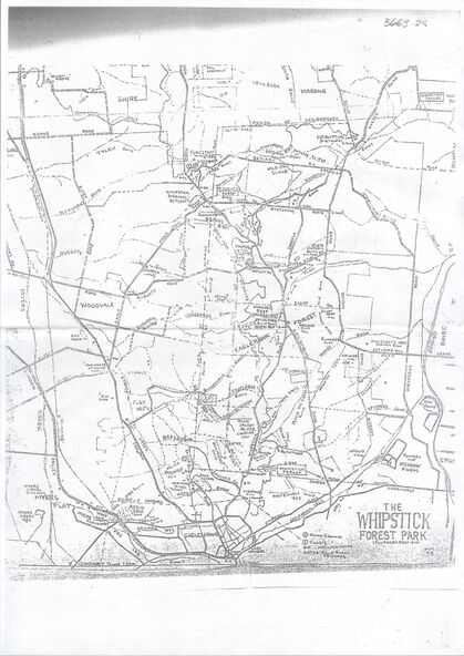
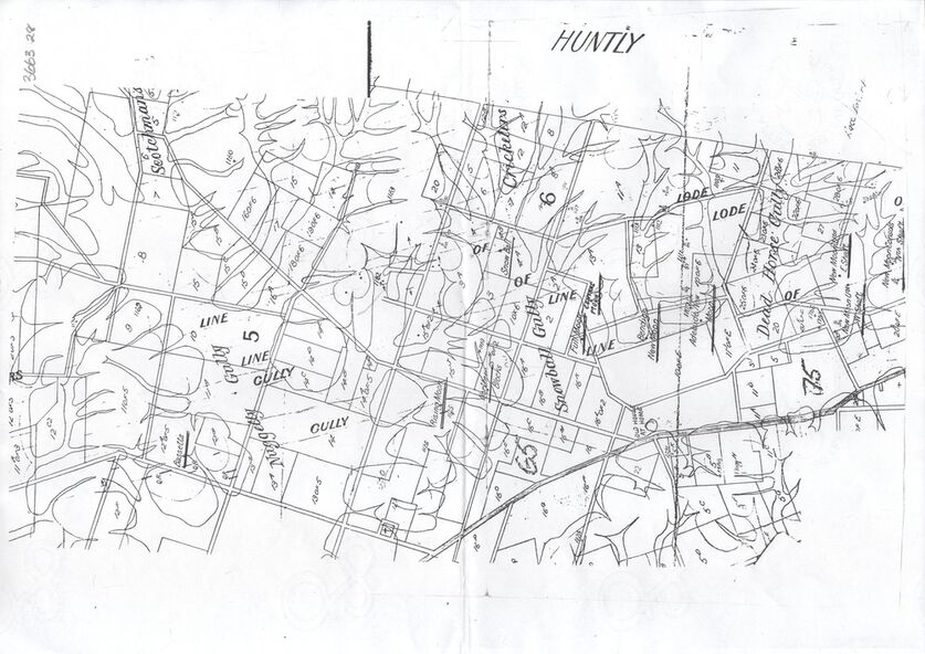
Photocopy of maps:
1. 'The Whipstick Forest Park, southern section'. Map shows gullies - Beezlebub, Napoleon, Whitehorse, Opossum, Wellington, Red Jacket, Blackhorse, and Centipede. Mine sites and other significant features are marked including the Whipstick Diggings Settlement near Shadbolt Reserve. Mine sites are identified.
2. Huntly map showing allotments and gullies - Snowball Gully, Deadhorse Gully Nuggety Gully, and Scotchmans Gully are printed in large text on the map.