Can you reuse this media without permission?No (with exceptions, see below)
Conditions of use
All rights reserved
This media item is licensed under "All rights reserved". You cannot share (i.e. copy, distribute, transmit) or rework (i.e. alter, transform, build upon) this item, or use it for commercial purposes without the permission of the copyright owner. However, an exception can be made if your intended use meets the "fair dealing" criteria. Uses that meet this criteria include research or study; criticism or review; parody or satire; reporting news; enabling a person with a disability to access material; or professional advice by a lawyer, patent attorney, or trademark attorney.
Attribution
Please acknowledge the item’s source, creator and title (where known)
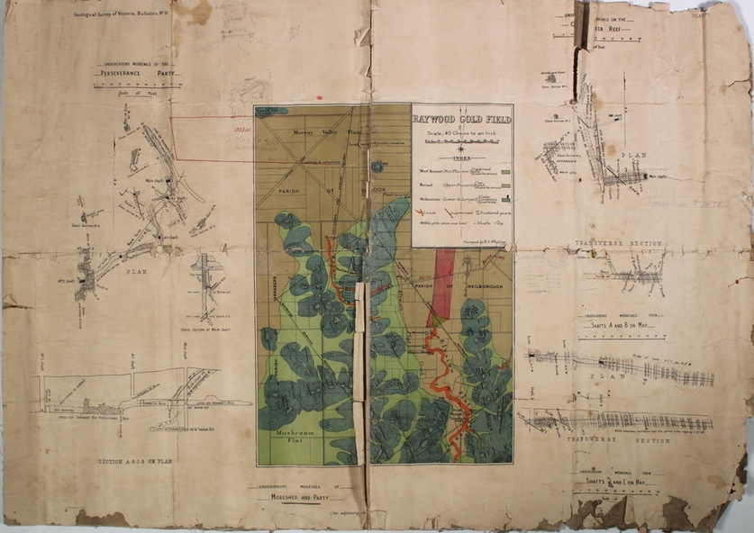
Map, white paper with coloured rectangular insert in centre showing the Raywood field, with Elysian Flat Creek and Mushroom Flat marked. Surrounding the centre piece are plans and descriptions of mining companies, (Perseverance and Party and Moreshead and Party) on the field. 'Geological Survey of Victoria Bulletin No. 12' printed on top left of map. Plan forms part of the Margaret Roberts Collection.