Historical information
Casley's Red White and Blue Gold Mine was located between Burns Street and the Spring Gully Reservoir, Spring Gully. SHEEPSHEAD REEF, DIAMOND HILL, BENDIGO Location BURNS STREET SPRING GULLY, GREATER BENDIGO CITY Municipality GREATER BENDIGO CITY Level of significance Heritage Inventory Site Heritage Inventory (HI) Number H7724-0212 (Heritage Victoria database: chrome-extension://efaidnbmnnnibpcajpcglclefindmkaj/https://vhd.heritagecouncil.vic.gov.au/places/8513/download-report
Bendigo Advertiser, 27 February, 1914: '...the Government made a special grant of £1000 to the Company on conditions that the shaft was sunk 200 ft from the present lowest level of 893ft'
Physical description
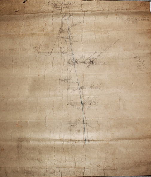
Hand drawn cross section plan of Casley's Red White and Blue Mine.
Forms part of the Margaret Roberts Collection of mining memorabilia.