
Historical information
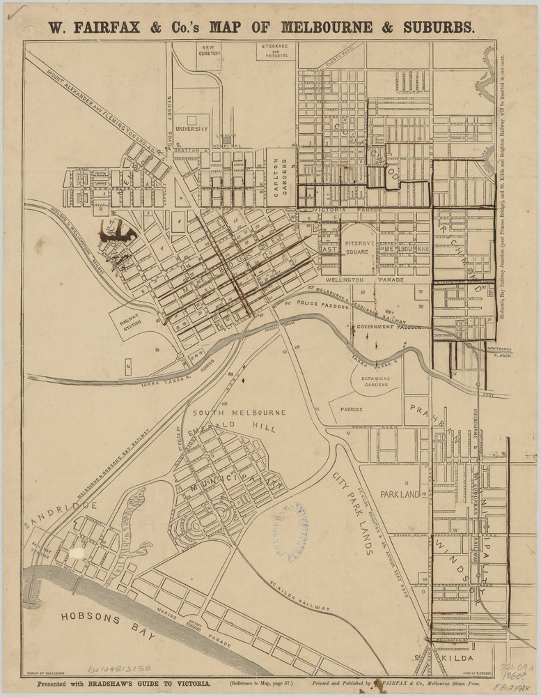
This map was printed and published by W Fairfax & Co and was an inclusion in Bradshaw's Guide to Victoria which was a monthly colonial travel handbook and railway timetable published in Melbourne from 1856 to 1942. A handwritten note at the bottom right of the map suggests it's date as "1860?". This date is likely an approximation, the range being 1855 to 1865.
The map includes Melbourne and surrounding suburbs including Sandridge, Emerald Hill, St Kilda, Windsor, Prahran, Richmond and Collingwood.
Physical description
Photograph in black and white, partly effected by some markings in watercolour.