
Historical information
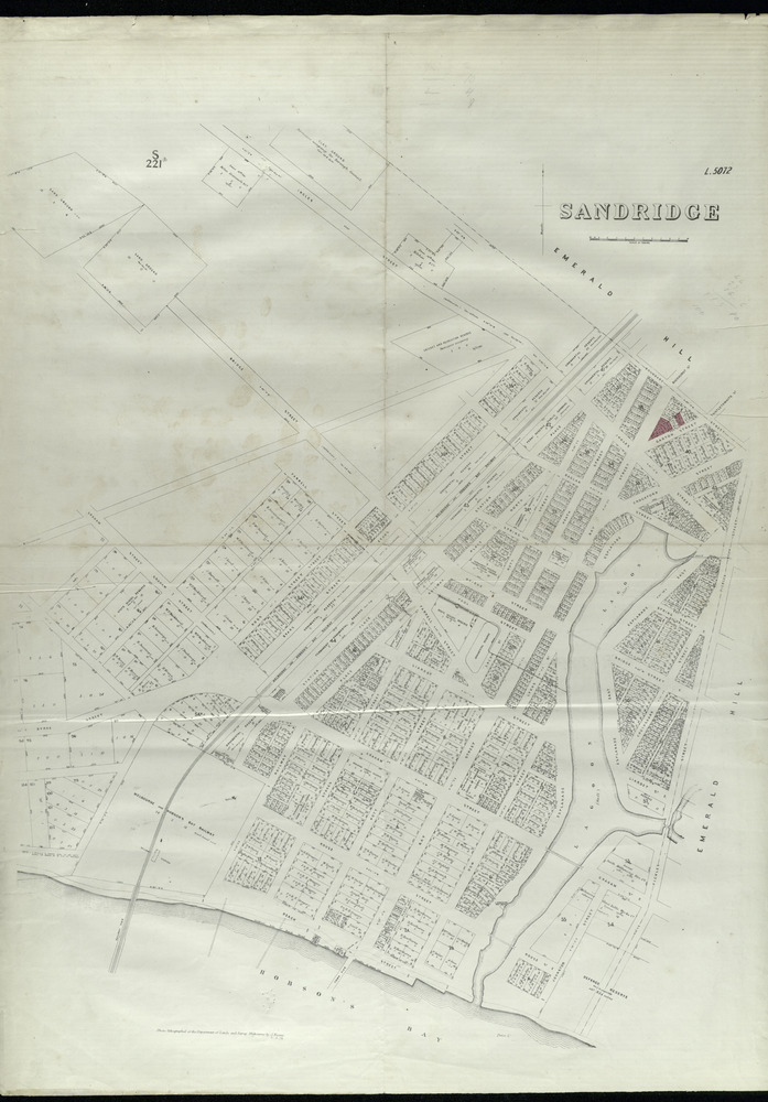
Map of Sandridge which was lithographed by the Department of Lands and Survey Melbourne by J Noone, it is dated 21 May 1878. This map shows property owners and details allotments located on the east side of the Sandridge Lagoon.
Physical description
Digital copy of a map, black and white.