Showing 69 items
matching surveyors report
-
 Eltham District Historical Society Inc
Document - Report, Tract Consultants Australia Pty Ltd, Eltham Cemetery: Towards a Master Plan, Nov 1987
BACKGROUND The Eltham Cemetery is of historic significance to the Eltham area. The Trust was established in 1858 and has administered and maintained the cemetery from that date right up to the present. Among the more noteworthy graves is that of Sir William Irvine, a former State Premier and Chief Justice of Victoria. Eltham Cemetery is surrounded on three sides by urban development. Montsalvat Artists Colony adjoins the remaining (eastern) side. A Joint Select Committee of Parliament called the “Mortuary Industry and Cemeteries Administration Committee" (MICA) enquired into the land requirements at the Eltham Cemetery in 1986. The MICA recommendations contained in its 1986 report are included in the Appendices attached to this report. Although the recommendations have not been adopted by the Government it is interesting to note that the MICA report recommended the use of the bulk of the land for cemetery purpose. In June of 1987, the Cemetery Trust was expanded to include additional members from the Eltham Community by the Minister for Health. At the same time, he instructed the Trust to resolve the land requirement issues. As a result of this Ministerial direction, Tract Consultants has been instructed by the Eltham Cemetery Trust to prepare a report addressing the issues raised in the Minister's letter (see Appendix 1) to the Trust. Principally, the study will examine options available for development of the Cemetery. These options will explore possible boundaries, cemetery design, vegetation, the overall environment, landscaping and financial planning for the Cemetery operations. Appendix 2 details the Cemetery Trusts Terms of Reference for the Study. Before commencing the study in detail, additional basic information was sought; viz: a) sub-soil and rock analysis; and b) feature survey by a Licensed Surveyor. The results from both exercises are included as appendices to this report. Section three includes a summary of the findings along with other analytical results. Also: Eltham Cemetery - planning bewteen 1859 to 1860; research by Alan Sheehan April 2015, collated by Harry Gilham, EDHS, April 2016 (2 pages) PROV Guide 5: Cemetery Records (8 pages), printed 7 May 2014Development of Eltham Cemeteryeltham cemetery trust, master plan, mica, montsalvat, mortuary industry and cemeteries administration committee, tract consultants -
 Ringwood and District Historical Society
Report, Extract from the Victoria Mining Surveyors & Registrars Reports, Quarter ended 31st March, 1883, including activities of The Ringwood Antimony Tribute Company and The Ringwood Consols Company
... Catalogue card reads, "1883 - Reports of the Mining... - Reports of the Mining Surveyors & Registrars. Quarter ended 31st ...Catalogue card reads, "1883 - Reports of the Mining Surveyors & Registrars. Quarter ended 31st March, 1883". -
 Federation University Historical Collection
Document, Zelda Martin, Central Victorian Goldmining towns - Boom Towns or Ghost Towns?, c1996
... 6 tables of data from "Reports of Mining Surveyors Talbot... tables of data from "Reports of Mining Surveyors Talbot (Back ...Zelda Martin was a PhD candidate at the University of Melbourne.[.1] 4th item in light blue display book titled Research Approach/Overview of Chapters/Confirmation of Canditure/Chapters1,2,3&4 of proposed thesis. *Twenty-seven page article on Victorian goldfields towns titled: Central Victorian Goldmining Towns - Boom Towns or Ghost Towns. The article was written during the author's PhD study. It outlines the context methodology, and resources and the chapters of the proposed thesis: (1) Central Victorian Goldmining Towns - The Context (2) Contemporary Views of the Factors Necessary for Town Growth (3) Outward Manifestations of Town Growth (4) The Trappings of Government (5-9) The Main Towns and Their Hinterland. [.2] 5th item in Light Blue display book as above item. *Chapter 1 of proposed thesis titled 'Pick, Shovel and Tin Dish Mining.' Covers in Section A: Central Victoria - Pre 1851: Aborigines in Central Victoria, Squatters, and Government. Section B: The years 1851-1854: The Early Gold Rushes, Government Reaction, Township Surveys, Legislation, Town Development, Local Government and Early Settlement. [.3] 6th item in Light Blue display book as above item. *2A of proposed thesis titled 'Contemporary Views of the Factors Necessary for Town Growth'. Similar information to Chapter 1 plus extra re towns and maps. Sections: Introduction, Context of Place - Geographical Towns Listed, The Context of Time - Pre1851 Aborigines, Governance of Port Phillip, The Squatters, The Villages of Central Victorian Highlands, Conclusion, Condensed Version of Chapter2B. [.4] 7th item in Light Blue display book as above item. *Chapter2B of proposed thesis. Sections: Area of Research, Schools, Banks, Newspapers, Progress Association, Town Development - Sandhurst (Bendigo), Ballarat, Castlemaine,, Maryborough, Ararat and Stawell. [.5] 8th item in Light Blue display book as above item. *Chapter 3 of proposed thesis titled 'Outward Manifestations of Town Growth'. Sections: Introduction, Contemporary Writing, Educationalists, The Bankers, The Townsfolk, Current Theory, General Theories of Urban Development, and Conclusion. [.6] 9th item in Light Blue display book as above item. *Chapter 4 of proposed thesis titled 'Trappings of Government' Sections: Introduction, Early Government Attitudes to Mining and Town Development, Law and Order, Township Surveys, Legislation, Local Government, Transport and Communication, The People and Lobbyists. [.7] 10th item in Light Blue display book as above item. *'The Rise and Fall of Central Victorian Goldmining Towns'. Includes a map showing main Goldfields, a table showing towns and villages at two points in time - 1857 and 1871; a Bibliography of Primary and Secondary Sources. [.8] Resource No1. Black display book titled Local Towns 1 : Alma: *Brief history *Directory *Maps Amphitheatre / Mountain Hut: *Brief History Post Office Directory Ararat: *Brief History *Post Office Directory 1869 - Alphabetical Listing by Occupation *Ararat - Prominent Citizens of 1858 *Langi-Morgala Museum Avoca: *Brief History *Excerpts from 'Avoca The Early Years', Margery and Betty Beavis; pg1 - Beginnings; pg11 - The Midas Touch; pg25 - Local Gold Escorts; pg27 - A Town is Born; pg51- The Administration of Justice; pg53 - The Ways of the Law; pg61 - News of the Day; pg65 - A Time to Play; pg72 - Land Ownership *Post Office Directory (Bailliere's) 1869 *Tourism Map and Information of area *Historic Avoca - A 5.5km Tour *Avoca & the Pyrenees Region - information pamphlet Ballarat: *Early History of Ballarat - Ballarat Historical Society, Publication No.1: origin of the name; Ballaarat - the Beginning; Fabulous Yields from the Ballaarat Goldfield; *Streetscape Lydiard Street. *Hand drawn map showing Leigh River, Old Portland Bay Road, plaque on road to Colac; etc. *Newspaper article re 'The Theatre Royal' ( which stood in the vicinity of the current Owen Williams store) - 'The News'15/04/1998 *Article - 'Ballarat's Mechanics' Institute Lives On' Ballarat Courier, 14/09/1985 *Article - Standing the Test of Time' The News 17/11/1993 re The Mechanics Institute & picture of the Reading Room *'Ballarat a Study of a City, Phyllis Reichl, pub. Nelson, 1968; no.3 place, time and people field studies series *Investigator Vol.33 No.2, 1998 Geelong Historical Society. Article on pg75 describes Ballarat in 1861 *Folded poster - 'Ballarat 100' a history of telegraph communication, pub. Telecom. Beaufort (Fiery Creek): *Brief history *Post Office Directory [.9] Resource No.2 Black Folder Titled Towns cont.No2 Bendigo (Sandhurst): *'Family & Local History at the Bendigo Library - 1851-2001 150 years of gold'. *Bendigo Government Camp in 1853 illustration; key to sketch and names of Government officers stationed there *Excerpts from 'Bendigo and Vicinity' Adolph Haman *The Bendigo Goldfield Registry - pgs 1-7 Introduction *Excerpt: 'Breaking the Grip' *Excerpt: The Most Go-Ahead Place *Excerpts from 'History of Bendigo' - anti license agitation; laying out of town; proposed railway; gold calls and dividends; the Sandhurst Municipality; journalism *Bibliography Blackwood: *Excerpts from 'Aspects of Early Blackwood - The Goldfield, the Landmarks, the Pioneers' Alan J Buckingham and Margaret F Hitchcock, JG Publishing,1980 Buninyong: *A Brief History *Investigator Vol1 No.2 Feb 1966 Geelong Historical Society. Pg3 - Article re gold escort route - Mt Alexander to Adelaide - (see a simple monument on the Western Highway a few miles out of Horsham. Pg 15 - Ballarat Excursion - re the finding of gold. *Three articles published by Buninyong and District Historical Society Inc: (Magpie Exploration; Finding Gold In The Green Hills; Magpie Exploration; Burnt Bridge to Cargarie to Mt Mercer) *Copies of newspaper articles/items *Buninyong Street Directory Carisbrook: *In the Beginning There Was Carisbrook *The History of the Carisbrook Racecourse Carngham / Snake Valley: *Brief History *Directory Castlemaine: *Directory 1865-1866 - Alphabetical and Street *Poster - Castlemaine A Contemporary Guide "The Great Centre" 1866 - A Contemporary Guide to the Fascinating Past *Pamphlet - Castlemaine District Community Hospital *Map - Castlemaine, Maldon & Surrounding Districts *Map and Information - The Dry Diggings Track - a 55kl walk among historic goldfields relics ( Castlemaine Fryerstown Vaughan Mt Franklin Hepburn Daylesford) *Postcard - Former Court House *Directory 1867 - Alphabetical, Trade [.10] Resource No.3 Grey folder Titled Towns 3 Creswick to Maryborough Creswick: *Brief History *Booklet - "Creswick Cemetery Walk" *Booklet - The Buried Rivers of Gold Heritage Trail Creswick *Creswick Historical Museum Information Sheet *Chronological History of Creswick *Alphabetical Directory of the Borough of Creswick *Creswick's Creek Directory 1856 *Historic Creswick Walking Tour *A Brief Account of the Schools of Creswick - Past and Present *100 Years of Railway Travel in Creswick *The Berry Deep Leads *The Spence Home at Jackass Gully in the Creswick State Forest ( William Guthrie Spence - Pioneer) *The New Australian Mine and the 1882 Disaster *Creswick District News, Issue 7, July August 1999 *The Creswick Miners Walk - Information and Map *Maps Chewton: *Brief History *Directory Clunes: *Brief History *Clunes Street Directory Daylesford: *Brief History *Notable Bushfires in Daylesford District Over More Than a Century - "Black Thursday" 1851; 1862; 1899; the Disastrous Hepburn Fire of 1906; 1939; 1944; 1969. *Post Office Directory -Daylesford and Hepburn Dunolly / Inkerman: *Brief History *Directory *Pamphlet - Goldfields Historical Museum *Pamphlet - Historic Dunolly - Victoria's Best Kept Secret *Map of Gold Workings at Dunolly Area - showing where the main gold rushes occurred *Brief History - Inglewood *Directory - Inglewood - Name Occupation, Dwelling Kingower: *Brief History *Directory - Name / Ocupation / Dwelling Linton / Happy Valley / Piggoreet: *Brief History *Directory - Lintons McIvor: *"A History of the Shire and the Township of Heathcote" by J.O. Randell Majorca: *Brief History *Official Post Office Directory 1869 - Name / Occupation/ Address Maldon (Tarrangower): *Brief History Part 1 *Brief History Part 2 *Post Office Directory *List - Alphabetical Order by Names plus Business and Trade (Tarrangower Times Oct/1858) *List - Alphabetical Order by Trade plus Name and Business *Directory - Name / Occupation / Dwelling Maryborough: *Worsley Cottage - built by Arthur Worsley, a contractor in stonework in 1894 [.11] Resource No. 4 Blue Display Book titled Towns 4 Moliagul to Stawell Moliagul: *Brief History *Moligul Legislative Assembly (Voting?) List - Names and Occupations *Moliagul Victorian Post Office Directory 1868 - Name / Ocupation / Address / Comments *"The Welcome Stranger" gold nugget *The Sunday School *The Welcome Stranger Discovery Walk - information and map Moonambel (Mountain Creek) Redbank *Brief History *List of names extracted from advertisments of the Pioneer and Mountain Creek Advertiser 16/02/1861. *Bailliere's Directory 1869 - Alphabetical List of Name / Occupation / Place St Arnaud: *Brief History Sebastapol: *Brief History *Directory 1869 - Alphabetical by Name; plus occupation and address. Browns and Scarsdale: *Brief History *Browns Street Directory - Name and Occupation Smythesdale: *Brief Description *Smythesdale Street Directory -Name and Occupation Stawell (Pleasant Creek) *Brief History *Victorian Official Post Office Directory - Name /Occupation / Dwelling *Chronology - 1841-1920 *Production of gold statistics - 1879 - 1900 *Big Hill *Extracts from "The Golden Years of Stawell". Chapt 1 - Stawell's Coming Out. Capt. 2 - The Gold Rush. Caapt.3 - Cradle of Democracy. Chapt.4 - The Reefs Becomes Stawell. Chapt. 5 - Rushing In. Chapt.6 - The Pioneers. Chapt 7 - The Decade of Optimism. [.12] Resource No. 5: Blue Display Book titled 'Towns Steiglitz to the The Golden Triangle. Steiglitz: Brief History Victorian Post Office Directory 1869 *Map of Steiglitz *List of maps relevant to Steiglitz history *Information 6 tables of data from "Reports of Mining Surveyors Talbot (Back Creek) Brief History Taradale: Post office Directory 1869 - Name/Occupation/Street. Also list in alphabetical order by Occupation Taradale *Chronological Reference to Taradale Mines *Water - The Coliban System of Waterworks *Joseph Brady *The Syphon Tarnagulla (Sandy Creek) *Brief History *Tarnagulla Businessmen Cameos to give depth to advertisments in 'The Tarnagulla Courier' various issues 1864-1871 *Directory - Name/Occupation /Address *List - Name/Business/Trade Wedderburn (Koorong) *Brief History *List - Name/Occupation The Golden Triangle: *The Early Rushes - Wedderburn / Moliagul / Sandy Creek - Tarnagulla / Jones Creek - Waanyarra / Kingower / Dunolly - Goldsborough / Inglweood *Census of 1857 - Population / Occupations *1858-1871 - A Time of Consolidation- Wedderburn / Moliagul / Sandy Creek- Tarnagulla / Arnold *Census 1871 - Population *Information gleaned from the census data - Demographics / Population / Occupations / marital / Birthplace / Religion / Literacy/ Occupation and Housing Cameos *Graphs - Birthplace of settlers /Male-Female Ratio / Married males / Children under 15 as Percentage of Population / Religion *Census 1857 - Statistical data *Maps *Bibliography [.13] Resource No. 6 - Black Display Book Information and Research in Central Victoria including: *Banking - Research from ANZ Bank Archives *Institutions - also includes articles listed from the Ballarat Times Newspaper *Australian mining History Association - A.M.H.A. Bibliography *Australia's Mining History * Bibliography - Land Surveys Victoria - *1853 Administration (Statistics and Other) includes: schools / ministers of religion / police / military / local administration / licences for sale of spirits / distances between various Victorian gold fields. * Victoria Government Gazette (Copy) - N0. 116, 12/12/1854 includes: Gold Felds Commission of Enquiry & No. 85, 15/09/1854 - Addresses presented to the Lieutenant Governor (Sir Charles Hotham) during his tour through the Gold Fields of Victoria,1854. Addresses on behalf of : the people of Bendigo; Members of the Church of England, Bendigo; Members of the Wesleyan Church on the Bendigo Gold Fields; Bendigo Gold District General Hospital; the Bendigo Prospecting Association; Committee of the Bendigo Local Exhibition; Bendigo District Medical Association; Coloured Americans Resident at Bendigo; German Inhabitants of Bendigo; Landowners, Inhabitants, and Miners of Castlemaine; Inhabitants of Forest Creek; Inhabitants of Heathcote and Gold Miners of McIvor; Residents and landholders of the District of Bacchus Marsh; Inhabitants of Kilmore and Vicinity. *Gold Fields Correspondence 1853: letter from Lieutenant Colonel Valiant, (Officer commanding the Troops in Victoria) to the Lieutenant Governor re threatened disturbance at Sandhurst (Bendigo) regarding the Gold License Fee. * Extracts from a book "Victoria" re Gold Fields Commission of Enquiry involving mainly Ballarat and Castlemaine and a chapter titled 'A Tour to the Victorian Gold-Fields' *Lists of central Victorian newspapers - listed by date published 1851to 1874; by first date available to State Library. *A list of cities and towns showing County, population in 1861 &1871, and municipal status. [.14] Resource no.7. Black display book. *Reference: Papers presented to Parliament Victoria - 1859-1860 4 volumes - relevant sections copied. Contains information on Branches of Government. General / Finance / Gold / Gazette / Commission and Warrant / Statistic. *Gold Fields Act. In accordance with the Act the gold fields are divided into six districts - Ballaarat, Castlemaine , Sandhurst, Avoca, Ararat, and Beechworth.. Official staff in each gold district consists of a Resident Warden, Wardens, Wardens' Clerks, Bailiffs, Chinese Protectors, Chinese Interpreters, and Mining Surveyors. *Gold Receiver *Gaols *Police magistrates and Clerks of Petty Sessions, etc. *Field Branch *Immigration and Emigration Overland - Chinese - 1859 *Population on the Goldfields *The Geological Survey - The Government Geologist is assisited by staff from four branches - the office Branch; the Publishing Branch; the Field Branch and the Museum Branch. *Commission to Enquire Into Sludge dated 10/02/1859 (Some sections copied) - Report to the Honorable Chief Commissioner of Public Works, Melbourne re the mode of carrying the sludge from the puddling mills in Sandhurst without interfering with the drainage of the town and the roads in the neighbourhood. [.15] Resource No.8: Camel display book titled Resource No. 8. Aborigines *Lists of book titles - +"Readings in Victorian prehistory" +"The Aborigines of Port Phillip" +Aboriginal languages and clans" +"A History of the Port Phillip District" +"Langi Ghiran 1: Aboriginal Rock...." +"Koorie History: sources for aboriginal studies in the State Library of Victoria", ed. Tom Griffiths, Melb. Friends of the State Library, 1989 +"The Public Lands of Australia Felix"; settlement and land appraisal in Victoria1834-91 with special reference to the Western Plains", J.M.Powell, Melb. Oxford University Press 1970 +*Bibliography of the Victorian Aborigines' from the earliest manuscripts to 31st December 1970, Massoa, Aldo, Melb. Hawthorn Press, 1971 +"Aborigines in Colonial Victoria, 1836-1886", M.F. Christie, Sydney University Press, 1979 +"Urban and Industrial Australia: readings in Human Geography" ed J.M. Powell, Melb. Sorrett Pub. 1974 *Extracts: -Processes of Pioneer Settlement - The Squatting Occupation of Victoria, 1834-60. J.M. Powell -Areal Variations in the Class Structure of the Central-Place Hierarchy. P. Scott - Volume1 and Volume 2: Notes Relating to the Habits of the Natives of Other Parts of Australia and Tasmania. Compiled from various sources for the Government of Victoria by R Brough Smyth. John Curry, O'Neil, Melb. 1st pub. Melb. 1876. p31-45 - Numbers and Distribution of the Aborigines in Victoria -Victorian Aborigines 1835-1901 - A Resource Guide to the Holdings of the Public Record Office, Victoria; published by the Government Information Centre 1984. *History of the Aboriginal Artefacts Displayed in the Daylesford Museum. F. G. Powell (4 page pamphlet) *Letter to Zelda Martin from Peter Lovett, Cultural Officer, Ballarat & District Aboriginal Co- Operative, 05/02/1997 *Map: Ian Clarke Victorian Tribunal Boundary Map - Clans of Central Victoria. *Victorian Rock Art and Mythology - Article about Mount Langhi Ghiran and myths of the Tjapwarong people. *Two Aboriginal myths relating to the Grampians - 'The Monster Emu' / 'The Aquisition of Fire', by the Aborigines in the Grampians Areas *Article titled (chapter 8) Ballarat - information re camping sites in the region. Lake Wendouree / Lake Burrumbeet (includes a myth) / Mt Bunninyong / Lal Lal / Pitfield / Mount Elephant / Mount Egerton / Meredith / Lake Goldsmith / Lake Learmonth / Ercildoune *Notes on the Aborigines of the Wider Ballarat Region plus European names=Aboriginal names. John Morris 26/07/1995 *Role of Aborigines in Town Development in Central Victoria. Mentions Native Police Force est. in Port Phillip 1842 and Central Board for Aborigines est. 1860 *The Grave of King Billy. (Frank Wilson) Pamphlet. *Camping Places in Central and Northern Victoria. Article re Lake Burrumbeet site. *Programme for the Unveiling of Memorial Cairn for Edward Stone Parker 1802-1865. Note portrait not accurate. Accurate portrait is available in the book "A Successful Failure A Trilogy The Aborigines and Early Settlers", Edgar Morrison, Graffiti Publications, 2002. * Large envelope addressed to Mr G Netherway containing newspaper cuttings regarding the life of Edward Stone Parker, the unveiling of the Memorial Cairn as mentioned above, articles titled 'Episodes from Our Early Days' (Edgar Morrison, Yandoit)- The Black's School, A School At Last and The Final years. Also a typed page titled 'Historical Background to E.S.Parker's Career. Includes an interesting tale titled 'When the cat lay doggo' re laying power leads for the unveiling ceremony at the memorial site. [.16] green display folder titled 'Research Aids' *List of references to Commissioners' & W'ardens' Reports (formerly held at La Trobe Library Archives, now at Public Records Office [PRO]). Indicates town referred to / date of report / name of camp if different to town. * Archive information re Anglican Records *Movement around the Goldfields - Miners and Storekeepers - usefulness of newspapers in providing information - areas covered - Castlemaine, Maldon, Ararat, Stawell, Tarnagulla, Dunolly. *Port Phillip /Victoria Directories 1839/1867 - Chronological list of Directories included in this series. *"Notes on the History of Local Government in Victoria" A.W. Greig Melb. University Press 1925 - Photo-copied extract p5-p40. (Source - Deakin University Library) - Introduction by W.Harrison Moore. Section 1 - Development in New South Wales Before Separation. Section 2 - Development in Victoria After Its Separation from New South Wales. Hand written notations: 'roads, markets, and local government 1855 on' ;'opportunity of squatters in parliament' and 'opportunities of matters in parliament p33' * Notes on the Establishment of Surveyor General's Department 1851and Commissioner of Crown Lands and Survey. * Newspaper articles from The Argus, 1849, re the discovery of gold in the Pyrenees region. * Excerpt - a report on schools - A.B.Orlebar, Inspector; re the need for permanent school buildings rather than tents. *Excerpt from - 'Approaches to Urban History', Sean Glynn: The Case for Caution * Except from - 'The Urban Sprinkle', Weston Bate: Country Towns and Australian Regional History *Reference- 'The History of Land Tenure in the Colony of Victoria', John Quick. References the Haines Land Bill, land tenure and Land Leagues. [.17] Light blue envelope folder titled 'Birtchnell's Ballarat, etc. Directory 1862 *Contains various directories for Smythesdale, Buninyong, Clunes, Brown's and Creswick. [.18] Red envelope folder no.2 titled Victorian Gazetteer *Selected pages from 1869 Victorian Gazetteer on A4 paper (with a handwritten note questioning if some pages are from 1868 Victorian Gazetteer as appears to be different sizes - A3 pages.) Information includes locations and descriptions of towns, hotels, banks, communications and populations. (Does not include names, residences and occupations) [.19] Red Envelope folder titled Bailliere's Official Post Office Directory 1868 (or1869 or a mixture of both?) *Preface *Contains a selection of pages of towns highlighted in yellow in the the index *Work on this directory was commenced in 1867. *Information includes: Municipalities - mayors and councilors; lists of towns naming male inhabitants and their occupations. [.20]Yellow manila folder titled Post Grad Seminar Presentation 1996 *Gives some background to Zelda Martin's proposed thesis and why she chose the topic Gold Mining Towns Boom or Bust [.21] A3 display book - No. 1A * A list of 'Relevant Newspapers collected: The Tarrangower Times and Maldon Advertiser (first published 1858) Includes dates 1858-1867. The Mount Alexander Mail. Includes dates 1854-1866 The Tarnagulla Courier. Includes dates from1864-1871 Dunolly and Burnt Creek Express. Includes dates from 1862-1871 * Selection of newspaper pages from The Mount Alexander Mail 1854 to 1856, mostly showing advertisements for businesses and services provided to that community. [.22] A3 display book - No. 1B * Selection of newspaper pages from The Mount Alexander Mail 1857 to 1866, mostly showing advertisements for businesses and services provided to that community. [.23] A3 display book -No. 2 * Selection of newspaper pages from The Tarnagulla Courier 1864 to 1871, mostly showing advertisements for businesses and services provided to that community. [.24] A3 display book - No. 3 *Selection of newspaper pages from The Tarrangower Times (and Maldon and Newstead) Advertiser 1858 to1867, mostly showing advertisements for businesses and services provided to that community. [.25] A3 display book - No.4 * Selection of newspaper pages from The Dunolly and Burnt Creek Express; and The Dunolly and Betbetshire Express 1862 to 1871, mostly showing advertisements for businesses and services provided for that community. [.26] A3 display book - No.5 Includes: * Bryce Ross's Diggings Directory. Includes instructions for using this directory. This directory was used by "all persons having connexion or desiring to communicate with 'working parties, private friends, or Stores at the Diggings." As a directory for each area wwas completed it was published in each month's issue of Bonwick's "Digger's Magazine." Years c1852/1853. This Directory commences first at the head of Forest Creek. Includes a directory for Bendigo and Ballarat. Of interest at the end of the Bendigo and Ballarat directory is a list of the number of storekeepers, butchers, doctors, smiths, eating houses, lemonade sellers and chapels. * The Castlemaine Directory and Book of General Information Comprehending Glass's Model Calendar for the Two Years 1862 and1863. "zelda martin, victorian goldfield towns, bendigo, castlemaine, ballarat, maldon, stawell, ararat, maryborough, creswick, avoca, heathcote, banks, bank of australasia, union bank of australia, government camp, sandhurst, water supply, tarnagulla, talbot, back creek, mountain creek, police court, carisbrook, dunolly, thompson's foundry, charles clacy, anthony trollope, robert cecil, mount alexander, urbanisation, national schools, education, govenrment, industry, railway, transport, settlement, land settlement in central victoria, steiglitz, joseph brady, the new australian mine, berry deep leads, william guthrie spence, creswick state forest, arthur worsley, worsley cottage, the welcome stranger, moliagul, moonambel, redbank, st arnaud, sebastapol, brown's, scarsdale, clunes, chewton, daylesford, bushfires, inkerman, inglewood, kingower, lintons, happy valley, piggoreet, mcivor, majorca, tarrangower, taradale, the coliban system, the syphon, sandy creek, wedderburn, koorong, arnold, jones creek, waanyarra, the golden triangle, census 1857, blackwood, buninyong, durham lead, magpie, carngham, snake valley, alma, amherst, daisy hill, amphitheatre, mountain hut, beaufort, fiery creek, counties, population, gold fields commission of enquiry1854, william westgarth, gold license fee, lieutenant colonel valiant, administration of the victorian gold fields, commission to enquire into sludge 1859, e.s. parker, edward stone parker, edgar morrison, mount franklin protectorate, dja dja wurrung, memorial cairn, franklinford, mt franklin memorial cairn, jajowurrong, dja dja wurung, tjaowarong, wothowurong, assistant protectors, daylesford museum, buluk, rock art - grampians, aboriginal mythology - grampians, aborigines, first nations people, mount franklin, aboriginal artifacts, lake burrumbeet, native police force, central board of aborigines, yandoit, commissioners' reports, wardens' reports, port phillip/victoria directories 1839-1867, local government - victoria 1853/1854, surveyor general's department - 1850's, victorian schools 1850's, a.b.orlebar, haines land bill, william charles haines, wilson gray, land tenure, land leagues, victorian gazetteer, the tarrangower times and maldon advertiser - 1858-1867, the mount alexander mail 1854-1866, the tarnagulla courier 1864, dunolly and burnt creek express 1862-1871, bryce rose's diggings directory, the castlemaine directory 1862-1863 -
 Federation University Historical Collection
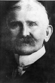
Photograph - Photograph (black & white), Ferdinand Moritz Krause
Civil engineer and geologist Ferdinand Moritz Krause lecturered at the Ballarat School of Mines from 1880 to 1895. He was born at Kassel, Germany on 24 February 1841, the youngest son of Frederich Wilhelm Krause. Ferdinand Krause married Amy Augusta Dimock. He died in South Africa 16 June 1918. In June 1880 Krausé was appointed to the Ballarat School of Mines as lecturer in 'geology, palaeontology, mineralogy, electricity, magnetism, scientific mining, geological and topographical surveying' and as museum curator. In 1881 he was appointed Professor of Geology and in 1892 was elected president of the Staff Association. He was held in high repute by his students and also known as a keen musician. He resigned from the School of Mines to be lecturer in mining at the University of Melbourne from June 1895 to January 1897. Whilst at Ballarat in 1887-90 he had completed geological maps and reports on the parishes of Haddon, Carngham, Scarsdale, Lillerie, Smythesdale and Comeralghip; these were published in 1898. The Institute of Surveyors elected him a member in 1891. His Introduction to the study of Mineralogy for Australian readers was published in Melbourne in 1896. In January 1897 he became manager of the General Gordon mine near Kalgoorlie. In 1900 he contributed an article to the Ballarat School of Mines Students' Magazine on the mining geology of Kalgoorlie. Invited by a former student, George Denny, Krausé left for South Africa in 1901. His last work was a geological map of the Barberton area, Transvaal, published in March 1918. He died on 16 June, survived by his wife, three sons and a daughter. (http://adb.anu.edu.au/biography/krause-ferdinand-moritz-3971, accessed 20 November 2018) Black and White photograph of the head and shoulders of Professor Ferdinand Krause of the Ballarat School of Mines.ballarat school of mines, ferdinand krause, geology, fm krause, krause, ballarat school of mines museum -
 Federation University Historical Collection
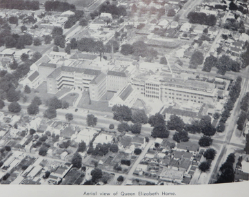
Booklet, City of Ballarat Mayor's Report, 1957-1958, 1958
Ballarat was created a municipality on 17 December 1855, declared a Borough on October 1863, Proclaimed a City on 09 September 1970.Green covered bookcity of ballarat, mayor's report, annual report, jack chisholm, city of ballarat coat of arms, arms of ballarat, john a. chisholm, arthur nicholson, alan pittard, gordon scott, arthur mason, frederick oliver, oscar curnow, frank woodward, william roff, francis cutts, nathaniel callow, kenneth webb, mrs john a. chisholm, queen mother, raaf school of radio, city engineer's department, public health report, finance, mr k. h. mitchell, mr f. j. rogers, building surveyor's department, mr j. b. menhennet, mr r. g. campbell, city health inspector, mr. r. g. biggs, weights and measures inspector, mr. w. mccormack, libraries, mr r. a. mccallum, streets, parks and gardens, water supply and sewerage, ballaarat's voluntary community committees, service clubs, city traffic, mr. j. h. sorrell, sturt street gardens, ballarat base hospital, st john of god hospital, queen elizabeth centre, black hill, black hill reclaimation, ballarat benenevolent asylum -
Federation University Historical Collection
Report, James Stirling, Assistant Geological Surveyor, Report on Rapid Surveys of the Gold-Fields, 1898, 1898
Foolscap report by Ferdinand Krause, issued by James Travis, Acting Secretary for Mines. department of mines, james stirling, a.w. howitt, warrandyte, nillumbik, greensborough, queenstown, a.o.e. whitelaw -
Federation University Historical Collection
Report, James Stirling, Assistant Geological Surveyor, Report on Rapid Surveys of the Gold-Fields, 1895, 1895
Foolscap report by Ernest Lidget, issued by James Travis, Acting Secretary for Mines. department of mines, j. travis, ernest lidgey, mannidar -
Federation University Historical Collection
Book - Report, Reports of the Mining Surveyors and Registrars, 1867, 30/06/1969 - 31/12/1881
... dated 31 December 1881 Reports of the Mining Surveyors ....1) 39 page report dated 30 September 1867 .2) 40 page report dated 31 December 1871 .3) 46 page report dated 30 June 1872 .4) 42 page report dated 31 December 1873 .5) 45 page report dated 30 September 1872 .6) 44 page report dated 31 December 1881gold statistics, mining survey -
 Federation University Historical Collection
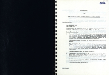
Report, SMB: Review Survey of Buildings and Grounds, July 1985, 1985
Report of the detailed review of The School of Mines and Industries Ballarat Limited undertaken by Alexander & Alexander in 1985. Previous reports were done in 1982 and 1983. The report covers all areas of the school - buildings and grounds. Some sections/buildings are still being completed. Report contains written evaluation, maps/diagrams and photographs.Spiral bound book - dark blue cover. 15 pages of written information plus 3 pages of photographs.Gold lettering on from cover "Alexander & Alexander" Signature "J W Elliott" on page 10 (Loss Control Surveyorballarat school of mines and industries, survey, alexander and alexander, j w elliott, maps, photographs -
 Bendigo Historical Society Inc.
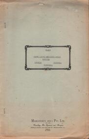
Document - HANRO COLLECTION: PLANS AND REPORT FROM FIRE ENGINEERS AND SURVEYORS, 1954/1960
Plans and Report from Fire Engineers and Surveyors:- Green Card has a rectangular box with an ornate border in the centre of the front page. Inside the border is typed in black *Plans, Hanro (Aust) Knitting Mills Limited, Bendigo Victoria Australia. At the bottom:- Mahlstedt's (Vic) Pty Ltd. (est. 1884). Consulting Fire Engineers and Surveyors. Temple Court, 422 Collins Street., Melbourne C.1. Telephone 673069. Inside the folder is the Key to Detail Block Plans & Fire Surveys. Correspondence from Mahlstedt's Pty Ltd to Edward Lumley and Sons, Insurance Brokers regarding a new survey and the changes to the building with respect to fire hazard. Main report recommendations and general information on the building. Blue print of Shirt Factory, Inglewood Road No. 1061 by Welmar Ltd Bendigo. Small blue print of the main buildings showing different work areas. Blue print No.1119 of John Brown Industries Ltd Alley Street Bendigo showing work areas. Box 116AMahlstedt's (Vic) Pty Ltdhanro, clothing, plans and reports, edward lumley & sons pty ltd. hanro knitting mills. mahlstedt's (vic) pty ltd. welmar ltd bendigo. john brown industries ltd. -
 Bendigo Historical Society Inc.
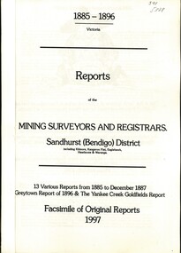
Book - REPORTS OF THE MINING SURVEYORS AND REGISTRARS 1885 - 1896, 1997
... Reports of the Mining Surveyors and Registrars. Sandhurst... GOLDFIELDS mining reports Reports of the Mining Surveyors ...Reports of the Mining Surveyors and Registrars. Sandhurst (Bendigo) District. 13 various Reports from 1885 to December 1887 Greytown Report of 1896 and the Yankee Creek Goldfields Report. Facsimile of Original Reports 1997.goldfields, mining reports -
 Bendigo Historical Society Inc.
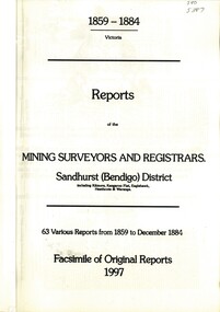
Book - REPORTS OF THE MINING SURVEYORS AND REGISTRARS 1859 - 1884, 1997
... Reports of the Mining Surveyors and Registrars, 1859 - 1884... GOLDFIELDS mining reports Reports of the Mining Surveyors ...Reports of the Mining Surveyors and Registrars, 1859 - 1884. Covering Sandhurst (Bendigo) district, including Kilmore, Kangaroo Flat, Eaglehawk, Heathcote, and Waranga. 63 various reports from 1859 to December 1884. Facsimile of original reports 1997.goldfields, mining reports -
 Bendigo Historical Society Inc.
Document - VICTORIA SURVEY REPORT 1859 TO 60
Four page report presented to both houses of parliament by Surveyor General CH W Ligar dated 1859-60. Object of survey to establish the best method of delineating the boundaries of new allotments in the colony. Geodetic method recommended.bendigo, history, allottment survey -
Port Melbourne Historical & Preservation Society
Map - Survey Map, Captain R Pasley R E, 24 Sep 1855
Survey map to accompany Colonial Engineers Report, September 1855melbourne -
Port Melbourne Historical & Preservation Society
Map - Lagoon between Ingles and Spring Streets, Sandridge, 26 Mar 1872
Prepared by Mr ORME for the Lagoon Committee and presented with a report on 26.3.1872.Map of Lagoon between Ingles Street and Spring Street. 26 March 1872. In brown wooden frameBorough Surveyor's Stamp in bottom right hand corner.sandridge lagoon, mr orme -
 Bendigo Historical Society Inc.
Book - REPORT OF THE MINING SURVEYORS AND REGISTRARS, 31ST. DECEMBER 1881, 1881
... REPORT OF THE MINING SURVEYORS AND REGISTRARS, 31ST...REPORT OF THE MINING SURVEYORS AND REGISTRARS, 31st... registrar's reports Vic. Govt. REPORT OF THE MINING SURVEYORS ...REPORT OF THE MINING SURVEYORS AND REGISTRARS, 31st. December 1881. 44 pagesVic. Govt.gold mining, miners' safety cage, mining surveyors and registrars rep, gold mining, bendigo, goldfields, mining surveyor, mining registrar's reports -
 Bendigo Historical Society Inc.
Book - REPORT OF THE MINING REGISTRAR AND SURVEYORS JUNE 1879, 1879
... gold mining mining registrars mining surveyors REPORT ...REPORT OF THE MINING REGISTRAR AND SURVEYORS JUNE 1879gold mining, miners' safety cage, mining surveyors and registrars, gold, gold mining, mining registrars, mining surveyors -
 Bendigo Historical Society Inc.
Book - REPORTS OF THE MINING SURVEYORS AND REGISTRAR, 1873
... REPORTS OF THE MINING SURVEYORS AND REGISTRAR - June 1873... SURVEYORS AND REGISTRAR - June 1873 Book REPORTS OF THE MINING ...REPORTS OF THE MINING SURVEYORS AND REGISTRAR - June 1873gold mining, miners' safety cage, mining surveyors and registrars rep, gold, gold mining, suvveyors and registrars -
 Bendigo Historical Society Inc.
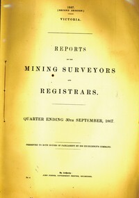
Book - REPORTS OF THE MINING SURVEYORS AND REGISTRARS 30TH. SEPT. 1867, 1867
... REPORTS OF THE MINING SURVEYORS AND REGISTRARS 30TH. SEPT... MINING Miners' Safety Cage surveyors reports gold gold mining ...REPORTS OF THE MINING SURVEYORS AND REGISTRARS 30TH. SEPT. 1867gold mining, miners' safety cage, surveyors reports, gold, gold mining, mining registrars report, mining surveyor -
 Victorian Aboriginal Corporation for Languages
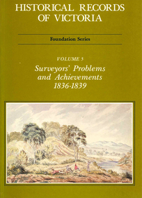
Book, Michael Cannon, Historical records of Victoria : foundation series : volume 5 : surveyors? problems and achievements 1836-1839, 1988
Reproductions of various transactions and reports dealing with the surveying history of Port Phillip, including letters, maps, illustrations, tables, and a detailed history of the surveying of Victoria.maps, b&w illustrations, b&w photographs, tablesvictorian history, port phillip, robert hoddle, monee monee creek, geelong, barwon river, werribee river -
 Victorian Aboriginal Corporation for Languages
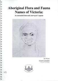
Book, Sue Wesson et al, Aboriginal flora and fauna names of Victoria : as extracted from early surveyors' reports, 2001
... names of Victoria : as extracted from early surveyors' reports ...The Flora and Fauna Names Project is an initiative of the Victorian Aboriginal Corporation for Languages and the Victorian Biodiversity Strategy. The researcher has examined material from the archives of the Department of Natural Resources and Environment (NRE), the State Library of Victoria, the Victorian Public Records Office and the Australian Archives Office. This first stage of the project focussed on the NRE archives, in particular the field notebooks of the earliest surveyors and their maps although other NRE resources, libraries and public records were accessed. A total of 3028 words were found of which a significant proportion have previously been unknown to linguists. It appears that the place names and word lists in early surveyors notebooks, the 1858 surveyors responses to the Surveyor General and an extensive Wiradjuri wordlist by James Baylis have not yet been widely used or published. Fifteen percent of these 3028 words describe flora and fauna and six percent describe habitat. Of particular interest is the evidence provided by these lists of the existence of fauna in the mid nineteenth century in regions where it is now extinct. For example, magpie geese, eastern quolls, bustards and pademelons were assigned names in the Jardwadjali language area of the upper Glenelg and Wimmera Rivers. The outcomes of this project may help to assist in ascertaining the distribution of flora and fauna assets in Victoria.maps, b&w photographs, colour photographs, illustrations, word listswiradjuri, jardwadjali, glenelg river, wimmera river -
 Sunshine and District Historical Society Incorporated
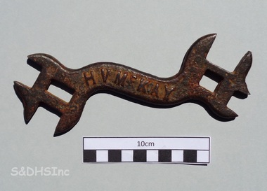
D324 WRENCH - H. V. McKay, H. V. McKay Pty. Ltd, Early 1900's
This type of wrench or spanner was used as a service tool for H. V. McKay Pty. Ltd. manufactured agricultural machinery. This specific tool belonged to Albert (Bert) Montgomery of 11 Kamarooka St, Albion. Bert Montgomery was born in Sunshine and in 1910 was apprenticed as a carpenter with Sunshine Harvester Works, where he worked as a wood machinist. On 19 August 1914, while still an apprentice, he enlisted in the First AIF. He left McKay's and started business as a builder probably just prior to WW2. After the war he joined the Shire of Braybrook as Assistant Building Surveyor until he retired. In 1962 Bert and his friend Jack Causon (proprietor of an Anderson Road second hand store that previously was Les James grocery) were on a fishing trip to Lake Tooliorook (aka Ettrick) near Lismore, Victoria. Their boat capsized and both fishermen were drowned. Bert was a Past President of Sunshine RSL and at that time it was reported that his funeral was the largest that Sunshine had seen. The information about Bert Montgomery was supplied by a Committee member of the Sunshine & District Historical Society Inc. who spoke to Montgomery's daughter, who also donated the tool. This tool serves as a reminder of the large H. V. McKay agricultural manufacturing works that once existed in Sunshine. The tool is associated with the works, and the design is significant enough for images of the tool to be used in an artistic mural, which is painted on the Eastern Pillar of the new H. V. McKay Footbridge in Sunshine, Victoria 3020.Curved double ended rusty cast iron wrench with 4 open slots plus 2 closed slots'H V McKAY' on one side and 'D324' on the reverse sideh. v. mckay pty. ltd, d324, d324 wrench, d324 spanner, agricultural spanner, antique wrench, agricultural tool, albert montgomery, jack causon, lake tooliorook -
Clunes Museum
Document - REPORTS
E J Dunn described the geology of the mining in an around Clunes and a recommendation for re-commencing mining operations in Clunes 1909.1 PHOTOCOPY OF A PAGE SHOWING RETURNS MADE BY MINING SURVEYORS AND REGISTERS TAKEN FOR THE QUARTER ENDED 31ST MARCH 1875 .2 & .3 PHOTOCOPY OF TWO PAGES OF A GEOLOGICAL SURVEY COMPLETED FOR THE GOVERNMENT (SENT IN 17/5/1909)NILlocal history, document, mining -
Koorie Heritage Trust
Book, Bonwick, James, Port Phillip settlement, 1883
... ; The surveyor's note-book and report; Life of Mr. Fawkner before 1835 ...Contents: Discovery; Mr. Grimes round the Bay, 1803; Settlement of 1803; The settlement of 1826; Hume and Hovell's overland journey; The Western Port settlement; Captain Sturt on the Murray; Portland Bay settlement in 1834; Major Mitchell's discoveries in Australia Felix; Life of John Batman; Batman's journal and report; The wild white man; The surveyor's note-book and report; Life of Mr. Fawkner before 1835; Fawkner on the Yarra Yarra; Official correspondence; The Port Phillip Association; Official recognition of trespassers; First Government of Port Phillip; Mr Gellibrand lost in the bush; The Governor's visit to the Yarra; Melbourne and its land sale; The stock question; Mr Mackillop's narrative; Progress of the settlement; The early Melbourne press; Discovery of Gipps Land; The Black Question; Narratives of Old Hands; Causes of emigration in 1835; An Overland journeyx, 537 pages, [36] leaves of plates (some folded.) illustrations (1 colour), facsimiles, portraits ; 23 cm.Contents: Discovery; Mr. Grimes round the Bay, 1803; Settlement of 1803; The settlement of 1826; Hume and Hovell's overland journey; The Western Port settlement; Captain Sturt on the Murray; Portland Bay settlement in 1834; Major Mitchell's discoveries in Australia Felix; Life of John Batman; Batman's journal and report; The wild white man; The surveyor's note-book and report; Life of Mr. Fawkner before 1835; Fawkner on the Yarra Yarra; Official correspondence; The Port Phillip Association; Official recognition of trespassers; First Government of Port Phillip; Mr Gellibrand lost in the bush; The Governor's visit to the Yarra; Melbourne and its land sale; The stock question; Mr Mackillop's narrative; Progress of the settlement; The early Melbourne press; Discovery of Gipps Land; The Black Question; Narratives of Old Hands; Causes of emigration in 1835; An Overland journeymelbourne (vic.) -- history -- to 1834. | melbourne (vic.) -- history -- 1834-1851. | port phillip bay region (vic.) -- history. -
 Whitehorse Historical Society Inc.
Essay - Report, Talk by Keith Patterson, 1/08/1967 12:00:00 AM
Paper delivered to Nunawading Historical SocietyPaper delivered to Nunawading Historical Society on Clement Hodgkinson, surveyor of Nunawading by Keith PattersonPaper delivered to Nunawading Historical Societyhodgkinson, clement, nunawading historical society, patterson, keith arthur, philosophical institute of victoria, surveyors -
 Ballarat Heritage Services
Photograph - Photograph - Colour, Burke and Wills Memorial at Bendigo Cemetery, 2018, 02/09/2018
Robert O'Hara Burke and Thomas Pope Besnard were childhood friends. As sexton of the local Back Creek Cemetery Thomas Besnard organised a subscription to raise the money for a monument to Burke, Wills and Gray. A subscription of one shilling, no more and not less, was asked so all subscribers were equal. The Bendigo monument was designed by Adam Duncan and features a Corinthian column mounted on a foundation stone, topped with a Grecian urn draped with the Union Jack. The stone for the monument was quarried from New Chum Mine. The site in the Bendigo Cemetery was selected by Besnard so the monument was on a grass knoll well clear of any other graves. The design included landscaping with a path and garden beds that provided dignified access. The Burke and Wills Monument in Bendigo has been entered on the Register of the National Estate as being important for its association with historical events and developments associated with exploration in the early days of Colony of Victoria. Two conifers remain from the original group sent by Mueller of the Melbourne Botanical Gardens to develop the garden layout on the knoll. These two trees are listed as Significant Trees by City of Greater Bendigo. The foundation block was laid on 20 August 1862 by Chairman of the Bendigo Municipality, Charles Burrows – exactly two years after the Expedition left Melbourne. A half day holiday was declared by Bendigo Council, and a procession left the Bendigo Town Hall and marched to the cemetery where 8000 people were gathered and another 4000 lined the route. John King was unable to attend due to ill health. Chairman of the Municipality of Bendigo, Charles Burrows, gave a long address, and diaries of members of the expedition, the Sandhurst Almanac, the Bendigo Advertiser, the Bendigo Independent Evening News, photographs of the deceased, photographs of Public Buildings in Bendigo, a Sydney half sovereign and all the silver coins of the Realm were wrapped in a Union Jack and placed in a niche in the foundation stone. Fifteen months later a column was erected on the foundation stone after Besnard openly criticised the Memorial Committee for their lack of action. The Bendigo Advertiser was disappointed at the location of the monument preferring a more central location and in 1893 an attempt was made to move the monument to Rosalind Park. On 19 May 1893, Mr Minto, the City Surveyor of the Bendigo MunicIpality reported it would cost £25, and no other action occurred. In 1940 the land around the memorial was sold off as grave sites and the paths and garden beds disappeared with graves now surrounding the base of the monument. The Burke and Wills Monument in Bendigo Cemetery was entered on the Register of the National Estate for its association with historical events and developments associated with exploration in the early days of Colony of Victoria. Two conifers remain from the original group sent by Mueller of the Melbourne Botanical Gardens to develop the garden layout on the knoll. These two trees are listed as Significant Trees by City of Greater Bendigo.Burke and Wills Memorial at Bendigo Cemetery, 2018Erected by the people of Bendigo in honor of the Victorian Explorers, Burke, Wills, Gray and King who first crossed the continent of Australia. King alone surviving the privation and suffering under which his three brave ill-fated companions sank. A.D. 1862. Robert O'Hara Burke, leader of the Victorian Expedition, left Melbounre 24th August 1860. Reached Carpentaria 12th Feby 1861. Died on his return at Coopers Creek, 30th June 1861. Charles Gray, died also on his return at Polygorum Swamp. 17th April 1861. William John Wills, second in command, died also near Coopers Creek, 29th June 1861. bendigo cemetery, burke and wills, burke and wills memorial, william john wills, john o'hara burke, charles gray, polygonum swamp, coopers creek, victorian expedition, carpentaria, bendigo public cemetery, bendigo remembrance park, thomas pope besnard -
 Bendigo Historical Society Inc.
Administrative record - Order for surveys and reports 1926-1940
Green cover book with brown leather spine. Orders for surveys or reports, under the following headings: nature of instructions, correspondence number, when returned. amount of survey fee, by whom paid, date of account passed, remarks. The following surveyors are used: William Archdall, Castlemaine - Garnet G. Birch, Bendigo - J.H. Brown, St. Arnaud - A.A. Briggs. Echuca - A.D. Thomson, Mildura - Tom Lowndes, Kerang - R.A. Black, Nyah West.survey, land, government -
 Bendigo Historical Society Inc.
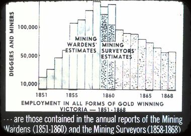
Slide - DIGGERS & MINING: DIGGERS & MINING
Diggers & Mining: Diggers & Mining. Graph depicts employment in all forms of gold winning Victoria (1851-1868) - - - - are these contained in the annual reports of the Mining Wardens (1851-1860 and the Mining Surveyors (1858-1868) Markings: 44/ 994:LIF 1. Used as a teaching aid.hanimounteducation, tertiary, diggers & miners -
![H.H. Harrison, Town Clerk [of Kew] 1901-1938](/media/collectors/550653872162f11fb04854aa/items/5922c035d0cde9131c3555a9/item-media/5c2269b021ea6913f4577219/item-fit-380x285.jpg) Kew Historical Society Inc
Kew Historical Society IncPhotograph, H.H. Harrison, Town Clerk [of Kew] 1901-1938, 1930s
Cr. W.D. Vaughan in his civic history of Kew includes a chapter (XXXII, pages 132-3) to Town Clerks and Surveyors. He states that H.H. Harrison began his career with the Borough of Kew in 1888 as his predecessor's assistant, becoming Town Clerk on the latter's death in 1901. On his retirement, The Herald on 30 Jul 1938 reported that: "H.H. HARRISON, Town Clerk of Kew, was entertained last night by members of the Metropolitan Institute of Town Clerks and presented with a walking stick and case of pipes, on the occasion of his retirement after 50 years' service with Kew City Council. He began his municipal career as a youth with the Bendigo City Council, and in 1888, was appointed Assistant Town Clerk at Kew. Appointed Town Clerk in 1901, he has held the office for 37 years."This portrait is one of a series of mounted and framed photographic portraits of Mayors and Town Clerks of the former Borough, Town and City of Kew, for the period 1863 to 1969. The portraits were transferred by the City of Kew to the Kew Historical Society in March 1989. A Significance Assessment in 2018, funded by the National Library of Australia confirmed the historic, and often artistic significance of the series. Framed portrait of Henry Hirst Harrison, Town Clerk of the City of Kew from 1901 to 1938. The mounting and framing of the photograph follows a typical layout or style in that it each is framed in dark wood, glazed, and laid down on an inscribed board. The inscription identifies the name of the town clerk and the year/s that he served.H.H. Harrison, Town Clerk 1901-1938h.h. harrison, town clerks - kew (vic), kew (vic.) — municipal collection -
Stawell Historical Society Inc
Archive, Mining Surveyor’s and Registrar’s Reports 1859-1871, 1859 - 1871
... grampians Stawell Mining None for year 1867 Mining Surveyor’s ...None for year 1867stawell, mining