Showing 1714 items matching "heritage significance"
-
 Lakes Entrance Historical Society
Book, Commonwealth of Australia for Heritage Collections Council, Victorias Framework of Historical Themes, 2001
... A guide to help assess the significance of heritage objects... the significance of heritage objects and collections in museums, historical ...A guide to help assess the significance of heritage objects and collections in museums, historical societies and similar institutions.reference material -
Glen Eira Historical Society
Document - Hengar, Glen Eira Road, 356, Elsternwick
... features and a statement of its heritage significance. The study... revival architectural features and a statement of its heritage ...A photocopy of a two page Caulfield Conservation Study by Andrew Ward, dated 01/1995, on Hengar at 356 Glen Eira Road, Elsternwick. The study gives a brief history of Hengar’s construction and occupancy, a description of its Gothic revival architectural features and a statement of its heritage significance. The study includes a black and white photograph of the exterior of Hengar.langdon henry, renwick mary, langdon elizabeth, langdon laura, blanche street, glen eira road, kooyong road, langdon estate, elsternwick, caulfield, hengar, beemery park, rosecraddock, tarqua, beemery, happy days kindergarten, architectural styles, architectural features, gothic revival, victorian style, preschools, the contemporary school of art -
 Federation University Art Collection
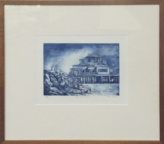
Work on paper - Artwork - printmaking, Tony Irving, "The Old Kiosk, St. Kilda" by Tony Fraser, 1984
... government because of its heritage significance.... heritage significance. artist artwork st kilda churchill ...Tony IRVING (1939- ) Born England Arrived Australia 1942 Tony Irvings work is a snapshot of urban life. In the 1970s, he won the prestigious National Gallery of Victoria's John McCaughey Acquisitive Prize. The St Kilda Kiosk before it was destroyed by fire in 2003, and has since been restored by the state government because of its heritage significance.RealismAn blue etching and aquatint with the St Kilda Kiosk at the subject matter. The St Kilda Kiosk was destroyed by fire in 2003. Donated through the Australian Government Cultural Gifts Programme by Katherine N. Littlewood, 2014artist, artwork, st kilda, churchill, printmaking, st kilda kiosk, tony irving -
Kew Historical Society Inc
Archive (Sub-series) - Subject File, Kew Court House - 2000-2005, 2000
... Information file containing information about the heritage... information about the heritage significance of the Kew Court House ...Various partiesReference, Research, InformationSecondary Values (KHS Imposed Order)Subject file containing information about the heritage significance of the Kew Court House (and Police Station) in High Street, Kew. Most of the file contains correspondence between a number of interested parties including the Kew Historical Society which was leading the campaign to have the building/precinct preserved and used for community purposes. Letters and submissions include those from the Department of Treasury & Finance, Ray Tonkin (Heritage Victoria), Dr. Robert Dean MLA, Judith Voce, Hon David Davis MLC, John Lenders MP, Hon John Thwaites, Andrew McIntosh MLA and officers of the Kew Historical Society. The file also contains records of interview and memos and meeting minutes relating to the campaign.kew - history, kew court house, kew police station, heritage campaigns - kew (vic)kew - history, kew court house, kew police station, heritage campaigns - kew (vic) -
 Wodonga & District Historical Society Inc
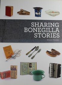
Booklet - Sharing Bonegilla Stories, Bruce J Pennay, 2012
... Bonegilla is of national heritage significance... Bonegilla is of national heritage significance as the largest ...A full-colour catalogue to support the Sharing Bonegilla Stories exhibition at the Albury LibraryMuseum which was curated by Bridget Guthrie in 2009. The exhibition drew from a successful earlier Belongings partnership with the Centre. The catalogue tries to make sense of people’s different memories of, and responses to, Bonegilla.non-fictionA full-colour catalogue to support the Sharing Bonegilla Stories exhibition at the Albury LibraryMuseum which was curated by Bridget Guthrie in 2009. The exhibition drew from a successful earlier Belongings partnership with the Centre. The catalogue tries to make sense of people’s different memories of, and responses to, Bonegilla.bonegilla, migrant experiences, immigration victoria -
Tatura Irrigation & Wartime Camps Museum
Manuscript & Heritage citation report 2011, 117 Hogan Street Early History, 2014
... Heritage citation report 2911. Significance levels... Tatura the-murray Heritage citation report 2911. Significance ...Heritage citation report 2911. Significance levels "contributary "Joyce Crawford is the wife of the late Arch CrawfordA4 1 1/2 pages. Handwritten notes on Gibbs Bakery (Tatura) and some Gibb Family History. Includes a photo of Gibbs house 117 Hogan Street. gibb, tatura history, gibb family history -
 Bendigo Historical Society Inc.
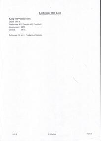
Document - MINING REPORTS - KING OF PRUSSIA MINE
... of significance Heritage Inventory Site Heritage Inventory (HI) Number... of significance Heritage Inventory Site Heritage Inventory (HI) Number ...KING OF PRUSSIA MINE WHIPSTICK ROAD EAGLEHAWK NORTH, GREATER BENDIGO CITY Place ID 8444 Location WHIPSTICK ROAD EAGLEHAWK NORTH, GREATER BENDIGO CITY Municipality GREATER BENDIGO CITY Heritage Listing Victorian Heritage Inventory Level of significance Heritage Inventory Site Heritage Inventory (HI) Number H7724-0141Brief handwritten notes by Albert Richardson, with typed copy of same, on the King of Prussia Mine on the Lightning Hill Line. Notes give the depth, crushings, gold yield, commenced 1876 and closed 1877.gold, mining reports, mining reports, kinf of prussia mine, b m l production statistics -
Glen Eira Historical Society
Document - Heatherbrae
... the house’s architectural features and heritage significance..., describes the house’s architectural features and heritage ...A three page photocopy from a Caulfield Conservation Study by Andrew Ward, on house Heatherbrae located at 73 Neerim Road. The study gives a brief history of the property, describes the house’s architectural features and heritage significance and includes a photograph (100mm x 152mm) of the exterior of the house. The file also includes a page of undated, unattributed, handwritten notes giving a partial list of Heatherbrae’s occupants from 1885 to 1900s and some description of the house. Also included in the file is an undated, unattributed one page handwritten list of the main occupants of Heatherbrae between 1880 and 1970. The file also includes one page of research notes by Dianne Visnovsky, dated 06/11/2009, with details of a publication that describes church fairs held at Heathrbrae circa 1910. These notes are accompanied by a handwritten annotation by Claire Barton dated 05/03/2012.heatherbrae, mansions, neerim road, caulfield conservation study, architectural features, architectural styles, holland john charles, booran road, glenhuntly road, kambrook roads, griffiths george f, vail e l junior, clarke alfred e, clarke margaret h, mcgowan beatrice, mcgowan leslie, macgowan leslie, buildings, caulfield, heatherbrae avenue, clarke street, stoddart j, ross william murray, wright william t, macgowan m h, mcgowan malcom, mcgowan jean, barton claire, visnovsky dianne -
Glen Eira Historical Society
Article - CAULFIELD RAILWAY STATION
... ) relating to the cultural heritage significance of the Caulfield...), with enclosure (4 sheets) relating to the cultural heritage significance ...This file contains four items: 1/Press cutting from Caulfield Contact, November 1991 (brief report, with photograph of Caulfield Station passengers boarding the steam engine K163 bound for Frankston on Public Transport Open Day). 2/Five pages (stapled together) of photo copied recommendations and assessment by Andrew Ward, March 1995, relating to the history, condition and conservation of the Caulfield Railway Station complex (includes four photocopied photographs). 3/Six pages (stapled together) of material from Heritage Victoria, to B. Evans, Environment Offices, Bayside Trains, 05/03/1999 (two sheets), with enclosure (4 sheets) relating to the cultural heritage significance of the Caulfield Railway Station complex (includes one photocopied photograph). 4/Photocopy of postcard (gelatin silver photograph) of ‘Three new railway lines, train going to Oakleigh [at Caulfield Railway Station]’ c1915, from State Library of Victoria (print dated 12/06/2013).caulfield railway station, b. evans, steam engines, railway stations, railway buildings, ray tonkin, heritage victoria, andrew ward -
 Bacchus Marsh & District Historical Society
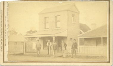
Photograph, Express Office Church Street Bacchus Marsh 1883
... listed as a site of state heritage significance on the Victorian... listed as a site of state heritage significance on the Victorian ...The Express newspaper was founded in Bacchus Marsh in 1866. From 1870 it was produced in this two-storey building in Church Street Bacchus Marsh. The first issue was published on Saturday 7th July 1866. The first issues of the Express were produced in the house of its proprietor George Lane. This house can be seen at the rear of the two-storey building in this image. Around 1889 the size of the building was doubled. The Express was initially started and operated by a syndicate of local businessmen. After only a few months the syndicate ceased and George Lane a printer and his future son-in-law Christopher Crisp took over the ownership and operation of the Express. The Crisp family were associated with the Express for over 100 years. It was both a newspaper and printing business. The Express building was in use as a newspaper and printing business until the early 1980s. Since the 1980s the building has been used for a variety of retail and commercial purposes. The original printing equipment used by the Express is still present in the building and the site has been listed as a site of state heritage significance on the Victorian Heritage Register.Small sepia unframed photograph on card with gold border framing photograph. Housed in the album, 'Photographs of Bacchus Marsh and District in 1883 by Stevenson and McNicoll'. The image depicts the Bacchus Marsh Express building in 1883. It shows a two-storey building with a pitched roof and front verandah. Five men stand in front of the building facing the camera. On the first left is George Lane one of the proprietors. Second from the left is Christopher Crisp, the co-proprietor and editor of the Express. The other three men are unidentified but are possibly employees of the Express. The house on the right belonged to George Lane. The house to the left of the building belonged to Christopher Crisp. All three buildings remain in Bacchus Marsh in 2024.On the front: Stevenson & McNicoll. Photo. 108 Elizabeth St. Melbourne. COPIES CAN BE OBTAINED AT ANY TIME. On the back: LIGHT & TRUTH inscribed on a banner surmounted by a representation of the rising sun. Copies of this Portrait can be had at any time by sending the Name and Post Office Money Order or Stamps for the amount of order to STEVENSON & McNICOLL LATE BENSON & STEVENSON, Photographers. 108 Elizabeth Street, MELBOURNE. newspapers, bacchus marsh express, christopher crisp 1844-1915, printers, george lane 1823-1899 -
 Bendigo Historical Society Inc.
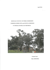
Article - Article for Bendigo East State School Heritage Council Submission
... Gemma Starr Collection: Re: Heritage Council Victoria...Bendigo East State School Anzac Avenue of Honour Heritage ...Gemma Starr Collection: Re: Heritage Council Victoria Submission Former School Site and Avenue of Honour 93 Strickland Road, East Bendigo. Contents: Statement of Cultural Heritage Significance, Overview of Victorian State School's WW1 Efforts, Early History of Bendigo East School and Avenue of Honour, Bendigo East School and Avenue of Honour Site Today, Men Commemorated in Bendigo East's Avenue of Honour, Comparison between Eurak Avenue of Honour Site and Bendigo East School and Avenue of Honour Site, School Avenues Planted before Bendigo East's Avenue, School Avenues Planted on the same Dade as Bendigo East's Avenue, Later School Avenues Mentioned in Heritage Victoria's Report, Final Comments, References, Appendices. Includes copies of original correspondence, newspaper articles and interviews with various people. Avenue of Honour planted 1916, Submission for Heritage Protection prepared 2016. Originally 23 trees planted then additional trees planted to make a total of 31 with plaques honouring 31 soldiers from the district. Brief biographies are listed within the submission for each soldier. The school merged with Weeroona College, and the doors closed on East Bendigo State School December 1998. Names associated with Submission: Gilbert Dyett, John Hampson, Keith Emmonson, Samuel C. Brittingham (Senior Architect). Joseph William Fairbanks (Building Contractor), Randall Jones, Stanley Symes. Jack Whitting, Mr. Phillips (Head Master 1916), Mr. Graham Parker (Last Principal), Mr. Donald Campbell (Principal)bendigo east state school, anzac, avenue of honour, heritage submission -
 Bendigo Historical Society Inc.
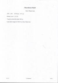
Document - MURCHISON SHAFT
... of significance Heritage Inventory Site Heritage Inventory (HI) Number... of significance Heritage Inventory Site Heritage Inventory (HI) Number ...Victorian Heritage Database Report Report generated 03/03/25 MURCHISON SHAFT Location LESTER STREET SAILORS GULLY, GREATER BENDIGO CITY Municipality GREATER BENDIGO CITY Level of significance Heritage Inventory Site Heritage Inventory (HI) Number H7724-0192 Heritage Listing Victorian Heritage Inventory Other Names NEW CHUM REEF, Hermes Number 8493Handwritten notes with typed copy, on the Murchison Shaft on the New Chum Line. 1870 - 1871. 6,7 tons - 651 ozs. Bottom Level - 2315 ft. Virginia worked this shaft 1883 to -. Lease had a length of 1400 ft. on New Chum Line.document, gold, murchison shaft, virginia -
 Bendigo Historical Society Inc.
Memorabilia - JOHN WILLIAMS COLLECTION: WOODEN MODEL OF BENDIGO HOSPITAL CIRCA 1950'S
... in 1989. Listing and Statement of Significance on Heritage... was demolished in 1989. Listing and Statement of Significance on Heritage ...Wooden model, painted white with brown roof. Model depicts the old Bendigo Hospital, Lucan Street , Bendigo in 1950's. Written on bottom on wooden 'icypole stick' "Bendigo Hospital 1956 era." Model is 2 storey, with central, tall rectangular entry and flagpole on top. Original Hospital was demolished in 1989. Listing and Statement of Significance on Heritage Victoria data base ( see historical details field )bendigo, buildings, old bendigo base hospital, lucan street, heritage victoria database -
 Melton City Libraries
Photograph, Melton Railway Bridge, c.1884
... "The Melton Viaduct, opened in 1886, is of State heritage... "The Melton Viaduct, opened in 1886, is of State heritage significance ..."The Melton Viaduct, opened in 1886, is of State heritage significance as a very large and visually distinctive wrought iron, lattice girder trestle bridge over the Werribee River (now Melton Reservoir). It comprises 18.3 and 9.1 metre spans, in a generally alternate arrangement, of total length 375 metres, and standing 38 metres over the Werribee River. Wrought iron small section iron was used to build tension trussed trestle legs, which supported four lines of rivetted wrought-iron deck-type double lattice trusses. It has bluestone abutments and pier bases of coursed rock-faced bluestone with drafted margins. The larger half-piers, now usually submerged in the Melton Reservoir have sharp tapered cutwaters and curved coping at the tops. While designed to carry two rail tracks it has only ever been used as a single track line. Despite several alterations to its deck structure, it remains an outstanding example of a lighter structural design employing open metal trestle supports and metal truss girders. The direct Melbourne to Ballarat railway link of which the Melton viaduct was the major engineering work contributed significantly to the history and development of Victoria. This new link reflected Ballarat’s diversifying economy as well as the commercial and political influence of the metropolis. Construction of the bridge, and the associated large workers camp, were extensively photographed, documenting an important episode in local history. The railway enabled the development of new industries in the Melton area, notably the timber industry and a chaff industry of national importance, greatly facilitated the later transition of the Shire from a pastoral to a farming economy, and struck a major blow to Melton township’s era as a wayside town servicing Ballarat road (especially coach) traffic". Melton Railway Bridge being built across the Werribee Rivertransport -
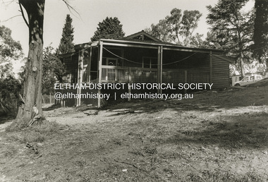
 Eltham District Historical Society Inc
Opening of Meruka Childcare Co-operative, Meruka Park, 5 Meruka Dr, Eltham, April 1994
... to be of local heritage significance and for this reason Meruka Park... to be of local heritage significance and for this reason Meruka Park ...In 1919 J.B. North, a violinist with the then Melbourne Symphonic Orchestra, and Monsieur Leon Lambert, a French architect, who later designed the Glaciarium Ice Skating Rink, purchased three available farms, Looker's, Wright's and Taylor's, approximately 60 acres, the area running along the creek and being bordered by the present day Ryans Road, Karingal Drive and Sherbourne Road. The farms were used for orchards and market gardens. Leon Lambert designed and built two homes on the farm site, one for the North family, ‘Tralford’, and the other, ‘Glen Ellen’, for himself and his wife. The homes were considered as "brother and sister" and they each included in their design an identical bay window in the main living area. "Glen Ellen" originally comprised kitchen, lounge room, inglenook, dining room, bath room and sleepout. Although the home has been extended over the years, much of the original architecture has been retained including timber panelling and three fireplaces. The land was subdivided in approximately 1966 with "Glen Ellen" retaining approximately one half acre of land fronting Meruka Drive. The property then passed from the Charleston family to Gerald and Margaret Sutton in 1976 and again was sold in 1980 and lastly sold again in 1994. The Norths named their house 'Tralford'. According to Marjorie North, the name Meruka was suggested by Alan Gardner and so was apparently not used by the North family. The name appears to be of Indian origin and its connection with the land is not known. ‘Tralford’ stayed in the North family for many years. Eltham Council acquired the house to create Meruka Park. The house was used for some years by the Council as a community arts facility and as emergency accommodation. It fell into disrepair and was demolished about 1990. The Meruka Child Care Centre has been built on the site and incorporates some of the architectural features of the old house. The Co-op was opened in April 1994. The original drive flanked by large old cypress trees remains. These trees are considered to be of local heritage significance and for this reason Meruka Park is covered by a Heritage Overlay under the Nillumbik Planning Scheme. Part of the park has been preserved as habitat for rare local flora. LL's house, named ‘Glen Ellen’, remains in a well-preserved state and fronts Meruka Drive.cr pam sladden, eltham, meruka child care co-operative, meruka house, meruka park -
 Eltham District Historical Society Inc
Opening of Meruka Childcare Co-operative, Meruka Park, 5 Meruka Dr, Eltham, April 1994
... to be of local heritage significance and for this reason Meruka Park... to be of local heritage significance and for this reason Meruka Park ...In 1919 J.B. North, a violinist with the then Melbourne Symphonic Orchestra, and Monsieur Leon Lambert, a French architect, who later designed the Glaciarium Ice Skating Rink, purchased three available farms, Looker's, Wright's and Taylor's, approximately 60 acres, the area running along the creek and being bordered by the present day Ryans Road, Karingal Drive and Sherbourne Road. The farms were used for orchards and market gardens. Leon Lambert designed and built two homes on the farm site, one for the North family, ‘Tralford’, and the other, ‘Glen Ellen’, for himself and his wife. The homes were considered as "brother and sister" and they each included in their design an identical bay window in the main living area. "Glen Ellen" originally comprised kitchen, lounge room, inglenook, dining room, bath room and sleepout. Although the home has been extended over the years, much of the original architecture has been retained including timber panelling and three fireplaces. The land was subdivided in approximately 1966 with "Glen Ellen" retaining approximately one half acre of land fronting Meruka Drive. The property then passed from the Charleston family to Gerald and Margaret Sutton in 1976 and again was sold in 1980 and lastly sold again in 1994. The Norths named their house 'Tralford'. According to Marjorie North, the name Meruka was suggested by Alan Gardner and so was apparently not used by the North family. The name appears to be of Indian origin and its connection with the land is not known. ‘Tralford’ stayed in the North family for many years. Eltham Council acquired the house to create Meruka Park. The house was used for some years by the Council as a community arts facility and as emergency accommodation. It fell into disrepair and was demolished about 1990. The Meruka Child Care Centre has been built on the site and incorporates some of the architectural features of the old house. The Co-op was opened in April 1994. The original drive flanked by large old cypress trees remains. These trees are considered to be of local heritage significance and for this reason Meruka Park is covered by a Heritage Overlay under the Nillumbik Planning Scheme. Part of the park has been preserved as habitat for rare local flora. LL's house, named ‘Glen Ellen’, remains in a well-preserved state and fronts Meruka Drive.eltham, meruka child care co-operative, meruka house, meruka park, cr. peter graham, peter staples, richard allen, sheryl garbutt, bill penrose -
 Eltham District Historical Society Inc
Opening of Meruka Childcare Co-operative, Meruka Park, 5 Meruka Dr, Eltham, April 1994
... to be of local heritage significance and for this reason Meruka Park... to be of local heritage significance and for this reason Meruka Park ...In 1919 J.B. North, a violinist with the then Melbourne Symphonic Orchestra, and Monsieur Leon Lambert, a French architect, who later designed the Glaciarium Ice Skating Rink, purchased three available farms, Looker's, Wright's and Taylor's, approximately 60 acres, the area running along the creek and being bordered by the present day Ryans Road, Karingal Drive and Sherbourne Road. The farms were used for orchards and market gardens. Leon Lambert designed and built two homes on the farm site, one for the North family, ‘Tralford’, and the other, ‘Glen Ellen’, for himself and his wife. The homes were considered as "brother and sister" and they each included in their design an identical bay window in the main living area. "Glen Ellen" originally comprised kitchen, lounge room, inglenook, dining room, bath room and sleepout. Although the home has been extended over the years, much of the original architecture has been retained including timber panelling and three fireplaces. The land was subdivided in approximately 1966 with "Glen Ellen" retaining approximately one half acre of land fronting Meruka Drive. The property then passed from the Charleston family to Gerald and Margaret Sutton in 1976 and again was sold in 1980 and lastly sold again in 1994. The Norths named their house 'Tralford'. According to Marjorie North, the name Meruka was suggested by Alan Gardner and so was apparently not used by the North family. The name appears to be of Indian origin and its connection with the land is not known. ‘Tralford’ stayed in the North family for many years. Eltham Council acquired the house to create Meruka Park. The house was used for some years by the Council as a community arts facility and as emergency accommodation. It fell into disrepair and was demolished about 1990. The Meruka Child Care Centre has been built on the site and incorporates some of the architectural features of the old house. The Co-op was opened in April 1994. The original drive flanked by large old cypress trees remains. These trees are considered to be of local heritage significance and for this reason Meruka Park is covered by a Heritage Overlay under the Nillumbik Planning Scheme. Part of the park has been preserved as habitat for rare local flora. LL's house, named ‘Glen Ellen’, remains in a well-preserved state and fronts Meruka Drive.eltham, meruka child care co-operative, meruka house, meruka park, cr. john cohen -
 Eltham District Historical Society Inc
Opening of Meruka Childcare Co-operative, Meruka Park, 5 Meruka Dr, Eltham, April 1994
... to be of local heritage significance and for this reason Meruka Park... to be of local heritage significance and for this reason Meruka Park ...In 1919 J.B. North, a violinist with the then Melbourne Symphonic Orchestra, and Monsieur Leon Lambert, a French architect, who later designed the Glaciarium Ice Skating Rink, purchased three available farms, Looker's, Wright's and Taylor's, approximately 60 acres, the area running along the creek and being bordered by the present day Ryans Road, Karingal Drive and Sherbourne Road. The farms were used for orchards and market gardens. Leon Lambert designed and built two homes on the farm site, one for the North family, ‘Tralford’, and the other, ‘Glen Ellen’, for himself and his wife. The homes were considered as "brother and sister" and they each included in their design an identical bay window in the main living area. "Glen Ellen" originally comprised kitchen, lounge room, inglenook, dining room, bath room and sleepout. Although the home has been extended over the years, much of the original architecture has been retained including timber panelling and three fireplaces. The land was subdivided in approximately 1966 with "Glen Ellen" retaining approximately one half acre of land fronting Meruka Drive. The property then passed from the Charleston family to Gerald and Margaret Sutton in 1976 and again was sold in 1980 and lastly sold again in 1994. The Norths named their house 'Tralford'. According to Marjorie North, the name Meruka was suggested by Alan Gardner and so was apparently not used by the North family. The name appears to be of Indian origin and its connection with the land is not known. ‘Tralford’ stayed in the North family for many years. Eltham Council acquired the house to create Meruka Park. The house was used for some years by the Council as a community arts facility and as emergency accommodation. It fell into disrepair and was demolished about 1990. The Meruka Child Care Centre has been built on the site and incorporates some of the architectural features of the old house. The Co-op was opened in April 1994. The original drive flanked by large old cypress trees remains. These trees are considered to be of local heritage significance and for this reason Meruka Park is covered by a Heritage Overlay under the Nillumbik Planning Scheme. Part of the park has been preserved as habitat for rare local flora. LL's house, named ‘Glen Ellen’, remains in a well-preserved state and fronts Meruka Drive.eltham, meruka child care co-operative, meruka house, meruka park, rob hauser -
 Eltham District Historical Society Inc
Opening of Meruka Childcare Co-operative, Meruka Park, 5 Meruka Dr, Eltham, April 1994
... to be of local heritage significance and for this reason Meruka Park... to be of local heritage significance and for this reason Meruka Park ...In 1919 J.B. North, a violinist with the then Melbourne Symphonic Orchestra, and Monsieur Leon Lambert, a French architect, who later designed the Glaciarium Ice Skating Rink, purchased three available farms, Looker's, Wright's and Taylor's, approximately 60 acres, the area running along the creek and being bordered by the present day Ryans Road, Karingal Drive and Sherbourne Road. The farms were used for orchards and market gardens. Leon Lambert designed and built two homes on the farm site, one for the North family, ‘Tralford’, and the other, ‘Glen Ellen’, for himself and his wife. The homes were considered as "brother and sister" and they each included in their design an identical bay window in the main living area. "Glen Ellen" originally comprised kitchen, lounge room, inglenook, dining room, bath room and sleepout. Although the home has been extended over the years, much of the original architecture has been retained including timber panelling and three fireplaces. The land was subdivided in approximately 1966 with "Glen Ellen" retaining approximately one half acre of land fronting Meruka Drive. The property then passed from the Charleston family to Gerald and Margaret Sutton in 1976 and again was sold in 1980 and lastly sold again in 1994. The Norths named their house 'Tralford'. According to Marjorie North, the name Meruka was suggested by Alan Gardner and so was apparently not used by the North family. The name appears to be of Indian origin and its connection with the land is not known. ‘Tralford’ stayed in the North family for many years. Eltham Council acquired the house to create Meruka Park. The house was used for some years by the Council as a community arts facility and as emergency accommodation. It fell into disrepair and was demolished about 1990. The Meruka Child Care Centre has been built on the site and incorporates some of the architectural features of the old house. The Co-op was opened in April 1994. The original drive flanked by large old cypress trees remains. These trees are considered to be of local heritage significance and for this reason Meruka Park is covered by a Heritage Overlay under the Nillumbik Planning Scheme. Part of the park has been preserved as habitat for rare local flora. LL's house, named ‘Glen Ellen’, remains in a well-preserved state and fronts Meruka Drive.eltham, meruka child care co-operative, meruka house, meruka park, irene bogle -
 Eltham District Historical Society Inc
Opening of Meruka Childcare Co-operative, Meruka Park, 5 Meruka Dr, Eltham, April 1994
... to be of local heritage significance and for this reason Meruka Park... to be of local heritage significance and for this reason Meruka Park ...In 1919 J.B. North, a violinist with the then Melbourne Symphonic Orchestra, and Monsieur Leon Lambert, a French architect, who later designed the Glaciarium Ice Skating Rink, purchased three available farms, Looker's, Wright's and Taylor's, approximately 60 acres, the area running along the creek and being bordered by the present day Ryans Road, Karingal Drive and Sherbourne Road. The farms were used for orchards and market gardens. Leon Lambert designed and built two homes on the farm site, one for the North family, ‘Tralford’, and the other, ‘Glen Ellen’, for himself and his wife. The homes were considered as "brother and sister" and they each included in their design an identical bay window in the main living area. "Glen Ellen" originally comprised kitchen, lounge room, inglenook, dining room, bath room and sleepout. Although the home has been extended over the years, much of the original architecture has been retained including timber panelling and three fireplaces. The land was subdivided in approximately 1966 with "Glen Ellen" retaining approximately one half acre of land fronting Meruka Drive. The property then passed from the Charleston family to Gerald and Margaret Sutton in 1976 and again was sold in 1980 and lastly sold again in 1994. The Norths named their house 'Tralford'. According to Marjorie North, the name Meruka was suggested by Alan Gardner and so was apparently not used by the North family. The name appears to be of Indian origin and its connection with the land is not known. ‘Tralford’ stayed in the North family for many years. Eltham Council acquired the house to create Meruka Park. The house was used for some years by the Council as a community arts facility and as emergency accommodation. It fell into disrepair and was demolished about 1990. The Meruka Child Care Centre has been built on the site and incorporates some of the architectural features of the old house. The Co-op was opened in April 1994. The original drive flanked by large old cypress trees remains. These trees are considered to be of local heritage significance and for this reason Meruka Park is covered by a Heritage Overlay under the Nillumbik Planning Scheme. Part of the park has been preserved as habitat for rare local flora. LL's house, named ‘Glen Ellen’, remains in a well-preserved state and fronts Meruka Drive.eltham, meruka child care co-operative, meruka house, meruka park, cr bob manuell, matthew rodscholler -
 Eltham District Historical Society Inc
Opening of Meruka Childcare Co-operative, Meruka Park, 5 Meruka Dr, Eltham, April 1994
... to be of local heritage significance and for this reason Meruka Park... to be of local heritage significance and for this reason Meruka Park ...In 1919 J.B. North, a violinist with the then Melbourne Symphonic Orchestra, and Monsieur Leon Lambert, a French architect, who later designed the Glaciarium Ice Skating Rink, purchased three available farms, Looker's, Wright's and Taylor's, approximately 60 acres, the area running along the creek and being bordered by the present day Ryans Road, Karingal Drive and Sherbourne Road. The farms were used for orchards and market gardens. Leon Lambert designed and built two homes on the farm site, one for the North family, ‘Tralford’, and the other, ‘Glen Ellen’, for himself and his wife. The homes were considered as "brother and sister" and they each included in their design an identical bay window in the main living area. "Glen Ellen" originally comprised kitchen, lounge room, inglenook, dining room, bath room and sleepout. Although the home has been extended over the years, much of the original architecture has been retained including timber panelling and three fireplaces. The land was subdivided in approximately 1966 with "Glen Ellen" retaining approximately one half acre of land fronting Meruka Drive. The property then passed from the Charleston family to Gerald and Margaret Sutton in 1976 and again was sold in 1980 and lastly sold again in 1994. The Norths named their house 'Tralford'. According to Marjorie North, the name Meruka was suggested by Alan Gardner and so was apparently not used by the North family. The name appears to be of Indian origin and its connection with the land is not known. ‘Tralford’ stayed in the North family for many years. Eltham Council acquired the house to create Meruka Park. The house was used for some years by the Council as a community arts facility and as emergency accommodation. It fell into disrepair and was demolished about 1990. The Meruka Child Care Centre has been built on the site and incorporates some of the architectural features of the old house. The Co-op was opened in April 1994. The original drive flanked by large old cypress trees remains. These trees are considered to be of local heritage significance and for this reason Meruka Park is covered by a Heritage Overlay under the Nillumbik Planning Scheme. Part of the park has been preserved as habitat for rare local flora. LL's house, named ‘Glen Ellen’, remains in a well-preserved state and fronts Meruka Drive.eltham, meruka child care co-operative, meruka house, meruka park, cr pam sladden, mandy press -
 Eltham District Historical Society Inc
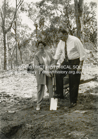
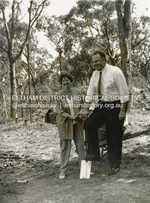
Photograph - Black and White Print, Shire of Eltham, Meruka Child Care Centre, turning the first sod: Cr Pamela Sladden, Peter Staples MHR Jaga Jaga, c.1993
... to be of local heritage significance and for this reason Meruka Park... to be of local heritage significance and for this reason Meruka Park ...In 1919 J.B. North, a violinist with the then Melbourne Symphonic Orchestra, and Monsieur Leon Lambert, a French architect, who later designed the Glaciarium Ice Skating Rink, purchased three available farms, Looker's, Wright's and Taylor's, approximately 60 acres, the area running along the creek and being bordered by the present day Ryans Road, Karingal Drive and Sherbourne Road. The farms were used for orchards and market gardens. Leon Lambert designed and built two homes on the farm site, one for the North family, ‘Tralford’, and the other, ‘Glen Ellen’, for himself and his wife. The homes were considered as "brother and sister" and they each included in their design an identical bay window in the main living area. "Glen Ellen" originally comprised kitchen, lounge room, inglenook, dining room, bath room and sleepout. Although the home has been extended over the years, much of the original architecture has been retained including timber panelling and three fireplaces. The land was subdivided in approximately 1966 with "Glen Ellen" retaining approximately one half acre of land fronting Meruka Drive. The property then passed from the Charleston family to Gerald and Margaret Sutton in 1976 and again was sold in 1980 and lastly sold again in 1994. The Norths named their house 'Tralford'. According to Marjorie North, the name Meruka was suggested by Alan Gardner and so was apparently not used by the North family. The name appears to be of Indian origin and its connection with the land is not known. ‘Tralford’ stayed in the North family for many years. Eltham Council acquired the house to create Meruka Park. The house was used for some years by the Council as a community arts facility and as emergency accommodation. It fell into disrepair and was demolished about 1990. The Meruka Child Care Centre has been built on the site and incorporates some of the architectural features of the old house. The Co-op was opened in April 1994. The original drive flanked by large old cypress trees remains. These trees are considered to be of local heritage significance and for this reason Meruka Park is covered by a Heritage Overlay under the Nillumbik Planning Scheme. Part of the park has been preserved as habitat for rare local flora. LL's house, named ‘Glen Ellen’, remains in a well-preserved state and fronts Meruka Drive.shire of eltham archives, child care centres, health & community services, meruka child care co-operative, peter staples mhr jaga jaga, cr pamela sladden -
 Eltham District Historical Society Inc
Photograph - Black and White Print, Shire of Eltham, Meruka Child Care Centre, Eltham, c.1994
... to be of local heritage significance and for this reason Meruka Park... to be of local heritage significance and for this reason Meruka Park ...In 1919 J.B. North, a violinist with the then Melbourne Symphonic Orchestra, and Monsieur Leon Lambert, a French architect, who later designed the Glaciarium Ice Skating Rink, purchased three available farms, Looker's, Wright's and Taylor's, approximately 60 acres, the area running along the creek and being bordered by the present day Ryans Road, Karingal Drive and Sherbourne Road. The farms were used for orchards and market gardens. Leon Lambert designed and built two homes on the farm site, one for the North family, ‘Tralford’, and the other, ‘Glen Ellen’, for himself and his wife. The homes were considered as "brother and sister" and they each included in their design an identical bay window in the main living area. "Glen Ellen" originally comprised kitchen, lounge room, inglenook, dining room, bath room and sleepout. Although the home has been extended over the years, much of the original architecture has been retained including timber panelling and three fireplaces. The land was subdivided in approximately 1966 with "Glen Ellen" retaining approximately one half acre of land fronting Meruka Drive. The property then passed from the Charleston family to Gerald and Margaret Sutton in 1976 and again was sold in 1980 and lastly sold again in 1994. The Norths named their house 'Tralford'. According to Marjorie North, the name Meruka was suggested by Alan Gardner and so was apparently not used by the North family. The name appears to be of Indian origin and its connection with the land is not known. ‘Tralford’ stayed in the North family for many years. Eltham Council acquired the house to create Meruka Park. The house was used for some years by the Council as a community arts facility and as emergency accommodation. It fell into disrepair and was demolished about 1990. The Meruka Child Care Centre has been built on the site and incorporates some of the architectural features of the old house. The Co-op was opened in April 1994. The original drive flanked by large old cypress trees remains. These trees are considered to be of local heritage significance and for this reason Meruka Park is covered by a Heritage Overlay under the Nillumbik Planning Scheme. Part of the park has been preserved as habitat for rare local flora. LL's house, named ‘Glen Ellen’, remains in a well-preserved state and fronts Meruka Drive.shire of eltham archives, child care centres, health & community services, meruka child care co-operative -
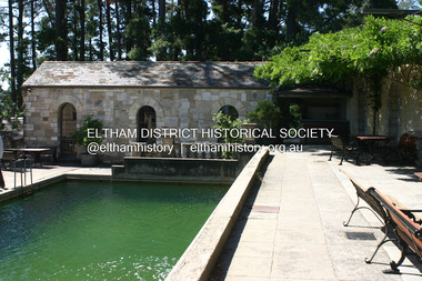 Eltham District Historical Society Inc
Photograph - Digital Photograph, Alan King, Swimming Pool, Montsalvat, 8 January 2008
... Estate, National Trust of Australia (Victoria) State Significance... Estate, National Trust of Australia (Victoria) State Significance ...Re-claimed material were used during the construction of Montsalvat, the artists colony in Eltham. The swimming pool was donated and cubicles were built for the students with their initials marked in tiles on each doorstep. Covered under National Estate, National Trust of Australia (Victoria) State Significance, Victorian Heritage and Heritage Overlay, Nillumbik Planning Scheme. Published: Nillumbik Now and Then / Marguerite Marshall 2008; photographs Alan King with Marguerite Marshall.; p131This collection of almost 130 photos about places and people within the Shire of Nillumbik, an urban and rural municipality in Melbourne's north, contributes to an understanding of the history of the Shire. Published in 2008 immediately prior to the Black Saturday bushfires of February 7, 2009, it documents sites that were impacted, and in some cases destroyed by the fires. It includes photographs taken especially for the publication, creating a unique time capsule representing the Shire in the early 21st century. It remains the most recent comprehenesive publication devoted to the Shire's history connecting local residents to the past. nillumbik now and then (marshall-king) collection, eltham, montsalvat, swimming pool -
 Federation University Historical Collection
Article - Article - Women, Federation University: Women of Note; Anne Beggs-Suntar, Historical Studies, Lecturer and Author
... , to the history of Ballarat and its heritage conservation..., to the history of Ballarat and its heritage conservation ...Dr. Anne Beggs-Sunter is an historian who lectures in the School of Arts at Federation University Ballarat in Wathawurrung country. Her major interests are in Australian social, cultural and political history. Her special interests relate to the colonial era, to the history of Ballarat and its heritage conservation, and the significance and commemoration of the Eureka Stockade. Anne is actively involved with a number of cultural institutions, including the Art Gallery of Ballarat, the Gold Museum and the Buninyong Historical Society, and serves on a number of City of Ballarat committees. She has written a number of books, exhibition catalogues and articles for different audiences ranging from specialised academic journals to newspapers.women of note, dr anne beggs-suntar, historian, school of arts, federation university, social cultural political histories, history of ballarat, heritage conservation, eureka stockade, ballarat art gallery, gold museum, author, books articles, lecturer, historical studies -
Federation University Historical Collection
Booklet, Report on the Viability of Establishing a Post Secondary Education Facility Located at the Aradale Traininf Centre, Ararat, Victoria, 1993, 12/1993
... group of mainly heritage buildings of national significance... heritage buildings of national significance surrounded by open ...Aradale is located 3 km from the centre of Ararat and covers approximately 101 hectares. It consistes of an impresive group of mainly heritage buildings of national significance surrounded by open farmland. Aradale was designed in 1864 in the Victorian Italianate style by John James Clark of the Public Works Department, Victoria. A three storey nurses quarters was built in the 1930s and the Forensic Psychaitry Centre was established in the 1980s. The design of asylums as a specific building type orginated in England in the mddle of the 19th century when it was decided that 'pauper lunatics' would be better cared for in a separate institution rather than being house within the workhouses. Some of the early purpose built asylums were based on the radiating principle of prisons but the arrangement of separat wings at right angles used in hospitals and whorkhouse design soon came to be seen as the most appropriate. The largest 19th century asylum in England was built at Colney Hatch. Kew, Beechworth and Ararat Asylums closely followed the Colney Hatch model. In victoria the population rose due to the gold rushes resulting in severe housing shortages, and additional pressure on asylums. The first asylum in Melbourne was established at Y arra Bend. In 1862 a new asylum was established at Kew. Ararat Asylum and Beechworth Asylum were designed in 1864. Ararat was opened on 19 October 1867, with Beechworth Asylum opening five days later. Soft covered bookletararat regional development board inc., aradale training centre, aradale, grano street ararat, alfred st ararat, ivar nelson, john christie, jon duggan, wes matthews, peter helfer, michael burke, john grant, asylum, lunatic asylum, colney hatch asylum, ararat asylum, fever tents, sunbury asylum, kew asylum, beechworth asylum, wine industry training -
 Eltham District Historical Society Inc
Photograph - Digital Photograph, Alan King, St Margaret's Anglican Church, Pitt Street, Eltham, 30 January 2008
... significance of this place because it is connected to the church... significance of this place because it is connected to the church ...St Margaret’s Church of England was officially opened on December 12, 1861. It is the oldest intact church building in Eltham. At the time it was known as Christ Church until its consecration in 1871, when it was completely free of debt (£1,700 for the church and parsonage) despite the district’s poverty. This was largely due to the free labour and materials, including locally made bricks donated by local artisans and others. The church is historically significant because it is the oldest church in the former Shire of Eltham and has associations with the philanthropist and founder of Brighton, Henry Dendy (who donated the land on which the church is built), the architect Nathaniel Billing and the prominent local builder, George Stebbing. The church is architecturally and aesthetically significant because it is constructed in the Gothic Revival style with several stained-glass windows of various dates and is also a very early use of polychromatic brickwork in Victoria. Billing was one of the first Melbourne architects to employ polychromatic brickwork and an important early architect. The rear wall was intended to be temporary. A major feature of the design is the large buttresses with long, steeply graded upper faces. The overall design is well proportioned with the surface brick patterns relieving an otherwise austere design. The church is spiritually and socially significant because it has been an important place of worship for the people of Eltham for almost 150 years. The land on which the buildings stand was donated by Henry Dendy. Dendy arrived in Melbourne in 1841 after purchasing in England eight square miles at Brighton under the system of "special surveys". After this land passed out of his hands, Dendy moved about Victoria, visited England, then returned to settle in Eltham where he purchased a flour mill. Dendy chaired the meeting held in 1860 “for the purpose of devising such means as may be expedient for the establishment of a Church of England in the township of Eltham”. He became chairman and treasurer of the church committee. Unlike the establishment of many early churches in Victoria where a vicar was appointed to a parish and later a permanent church was constructed, the population at Eltham initiated action to build a church. The nearest church at that time was at Heidelberg and the Eltham settlement was part of the parish of St Johns Heidelberg. Isolation and the tedious, time consuming journey between Heidelberg and Eltham resulted in the Eltham community taking its own action. The original vicarage (Dendy House) at the rear of the church is also an important part of the cultural significance of this place because it is connected to the church and the development of the Eltham area. Together, the church and the vicarage are aesthetically significant because they form a significant streetscape feature. The mud-brick community hall designed by Robert Marshall was added in 1978. In 2014 the original temporary rear wall was removed as part of a modern extension designed by Architects Atelier Wagner and constructed by Conrad Construction and Management. Covered under Heritage Overlay, Nillumbik Planning Scheme. National Trust of Australia (Victoria) State significance Victorian Heritage Published: Nillumbik Now and Then / Marguerite Marshall 2008; photographs Alan King with Marguerite Marshall.; p67This collection of almost 130 photos about places and people within the Shire of Nillumbik, an urban and rural municipality in Melbourne's north, contributes to an understanding of the history of the Shire. Published in 2008 immediately prior to the Black Saturday bushfires of February 7, 2009, it documents sites that were impacted, and in some cases destroyed by the fires. It includes photographs taken especially for the publication, creating a unique time capsule representing the Shire in the early 21st century. It remains the most recent comprehenesive publication devoted to the Shire's history connecting local residents to the past. nillumbik now and then (marshall-king) collection, eltham, st margaret's anglican church, st margaret's church, christ church -
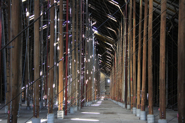 Victorian Interpretive Projects Inc.
Photograph - digital, LJ Gervasoni, Murtoa Stick Shed 00031, 13/08/2011
... From the Victorian Heritage Register statement..., 3350 goldfields From the Victorian Heritage Register statement ...From the Victorian Heritage Register statement of significance H0791 The Marmalake/Murtoa Grain Store, originally the No.1 Murtoa Shed, is located within the Murtoa Grain Terminal, adjacent to the grain elevator tower and railway line. The shed is 280m long, 60m wide and 19m high at the ridge with a capacity of 3.4 million bushels. The hipped corrugated iron roof of the shed is supported on approximately 600 unmilled hardwood poles set in a concrete slab floor and braced with iron tie rods. These poles are the reason for use of the term "stick shed". With its vast gabled interior and the long rows of poles the space has been likened to the nave of a cathedral. An elevator at one end took wheat from railway trucks to ridge level where it was distributed by conveyor along the length of the shed, creating a huge single mound of grain. Braced internal timber bulkheads on either side took the lateral thrust of the wheat, and conveyors at ground level outside the bulkheads took wheat back to the elevator for transport elsewhere. Wheat had been handled in jute bags from the start of the Victorian wheat industry in the mid nineteenth century. Bulk storage had been developed in North America from the early 1900s. NSW began building substantial concrete silos from 1920-21. In Western Australia, farmers' co-operatives, who had to supply their own bulk storage from 1934-5, pioneered the use of low-cost horizontal sheds of timber and corrugated iron for bulk storage. Following its establishment in 1935 the Victorian Grain Elevators Board (GEB) planned a network of 160 concrete silos in country locations, connected by rail to the shipping terminal at Geelong. By the outbreak of the Second World War there was a worldwide glut of wheat, and Australia soon had a massive surplus which it was unable to export. Only 48 silos had been established under the Victorian Silo Scheme so far, and wartime material and labour restrictions prevented progress with this scheme. The storage deficit had become an emergency by 1941 as Britain obtained its imports from North America, rather than over the lengthy and difficult shipping route from Australia. In 1941 the GEB, under chairman and general manager Harold Glowrey, proposed large temporary versions of the horizontal bulk storage sheds already in use in Western Australia. The proposal was approved by the Victorian Wheat and Woolgrowers Association, who considered the use of shed storages as a longer term proposition. After initial resistance from the Australian Wheat Board, some of whose members represented wheat bagging interests, the Commonwealth and Victorian governments agreed to split the costs, and Murtoa was chosen as a suitable site for the first emergency storage. The main contractor, Green Bros, commenced work on the No.1 Murtoa Shed in September 1941, deliveries of bulk wheat began in January 1942, and the store was full by June of the same year. In the following years the Council for Scientific and Industrial Research (later CSIRO) conducted valuable research and experiment on the impacts and control of insect pests at the Murtoa No.1 shed. With these discoveries, and the development of more effective pesticides, use of the No.1 shed and the larger No.2 shed, erected in 1942/43, continued for many years. The No.2 shed was demolished in 1975. By the 1990s, pest resistance to pesticides and requirements for both pest free and insecticide free grain rendered open storage of this type unviable. The No. 1 store was also becoming increasingly expensive to maintain, and its use was phased out from 1989.Image of the Marmalake/Murtoa Grain Store which is of historical, architectural, scientific (technical) and social significance to the State of VictoriaDigital colour image of the interior of the Marmaduke . Murtoa grain storage facility better known as the Stick Shed. The shed was constructed in World War Two to store grain. The supporting columns are trees.marmalake, murtoa grain store, wheat store, stick shed, murtoa