Showing 45 items matching "howitt street"
-
 Victorian Aboriginal Corporation for Languages
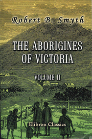
Book, Robert Brough Smyth, The Aborigines of Victoria : volume 2 : with notes relating to the habits of the natives of other parts of Australia and Tasmania : compiled from various sources for the Government of Victoria, 2005
Historical work by the Secretary of the Board for the Protection of the Aborigines. (c.1876) Volume two is devoted to Aboriginal languages, including comparisons of Victorian languages with those from New South Wales, word lists, vocabularies, and native names of trees and plants. Volume two also includes details and customs of the aborigines in Tasmania. Includes interesting observations on the works of William Thomas, Alfred W, Howitt, Philip Chaney, Albert A.C. La Souef, John Moore Davis and Rev. William Ridley.robert brough smyth, philip chauncy, william ridley, albert le souef, a. w. howitt, john moore davis, william locke, a. f. a. greeves, language comparisons, phrenology, aboriginal social life and customs, death and burial customs, weapons, tasmania, lake tyers, lake wellington, gippsland, ballarat, brabrolong, lake hindmarsh, kotoopna -
 Victorian Aboriginal Corporation for Languages
Book, Robert Brough Smyth, The Aborigines of Victoria : with notes relating to the habits of the natives of other parts of Australia and Tasmania : compiled from various sources for the Government of Victoria by R. Brough Smyth : vol. 2, 1878
Produced in two large volumes, Robert Brough Smyth has collected information on various tribes and their customs, as well as their physical and mental character; birth and education of children; marriage; death and burial of the dead; daily lives of the natives; food; diseases; dress and personal ornaments; weapons; implements and manufacturers; nets and fish hooks; methods of producing fire; canoes and myths. Smyth also devotes about two hundred pages to Aboriginal languages, as well as including details and customs of the aborigines in Tasmania. Complete with hundreds of sketches, the work is still a valuable resource not only for those with in an interest in aboriginal culture, but also those wanting to know the early history of Australia.b&w illustrations, word listsrobert brough smyth, philip chauncy, william ridley, albert le souef, a. w. howitt, john moore davis, william locke, a. f. a. greeves, language comparisons, phrenology, aboriginal social life and customs, death and burial customs, weapons, tasmania, lake tyers, lake wellington, gippsland, ballarat, brabrolong, lake hindmarsh, kotoopna -
 Victorian Aboriginal Corporation for Languages
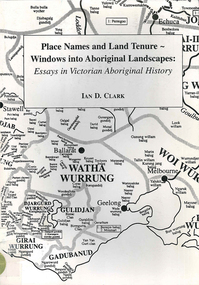
Book, Ian D Clark, Place names and land tenure : windows into Aboriginal landscapes : essays in Victorian Aboriginal history, 1998
This work is a collection of twelve essays that are concerned with place names, clan organisation and local and regional Aboriginal history.maps, document reproductionsdjab wurrung, ngengen wurrung, koroitgundidj, dhauwurud wurrung, djab wurrung, barababaraba, daung wurrung, taungurung, dja dja wurrung, jardwadjali, jodajoda, yorta yorta, nguri-illam wurrung, waywurru, koroit, buangor, mt eccles, mt napier, langi ghiran, grampians national park, massacres, clan organization, land tenure, george augustus robinson, samuel carter, aldo massola, alfred william howitt -
 Victorian Aboriginal Corporation for Languages
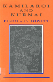
Book, Lorimer Fison et al, Kamilaroi and Kurnai : group-marriage and relationship, and marriage by elopement drawn chiefly from the usage of the Australian Aborigines : also the Kurnai tribe, their customs in peace and war, 1991
Original notes taken by Fison and Howitt into marriage rites and customs in the Kurnai, Kamilaroi and JAMILARAAY people. It looks at kinship terms. Includes maps.tableskurnai, kamilaroi, gournditch mara, gunditjmara, lake condah -
 Victorian Aboriginal Corporation for Languages
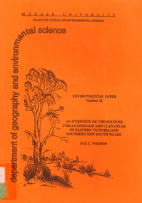
Book, Sue C Wesson, An overview of the sources for a language and clan atlas of Eastern Victoria and Southern New South Wales, 1994
This monograph concerns Eastern Victoria and Southern New South Wales and reviews the ethnographic record available for the study area. A test case is made of one tribe within the study area which requires further research. Overall, the literature review and the case study demonstrate that the ability to undertake detailed reconstructions, as Clark and Barwick have done for the other regions, can be undertaken in Eastern Victoria and Southern New South Wales, and this model will form the basis of future research.maps, b&w illustrations, b&w photographs, document reproductions, tableswoiworung, bunurong, taungurong, ngurai-illam-wurung, bidawal, maap, norman tindale, diane barwick, aldo massola, eve fesl, ian david clark, george augustus robinson, reverend john bulmer, robert brough smyth, alfred william howitt, moieties, clan names -
 Victorian Aboriginal Corporation for Languages
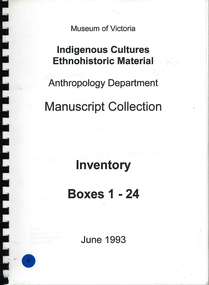
Book, Museum of Victoria, Indigenous cultures ethnohistoric material : Anthropology Department : Manuscript Collection - inventory boxes 1-24, 25-45, 1993
finding aid, howitt, spencer, kenyon, robinson, young, balfour, johns, wright, seeger, wright, cowle, gillen, officer, benporath, croll, mitchell, endacott, cahill -
 Victorian Aboriginal Corporation for Languages
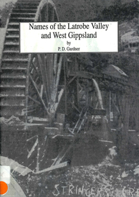
Book, P D Gardner, Names of the Latrobe Valley and West Gippsland : their origins, meanings and history, 1992
An account of the origins and histories of local names from Robin Hood to Kilmany, and from Mirboo North to Mt. Howitt.Maps, b&w illustrations, b&w photographsgunnai, kurnai, braiakaulung, bunerong, wurundjeri, kulin, coranderrk, warragul, morwell, rosedale, governor la trobe, drouin, noojee, darnum, walhalla, strzelecki, heyfield, gormandale -
 National Wool Museum
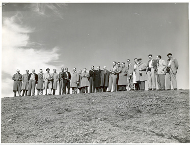
Photograph
One of three photographs of delagates to the 1955 Wool Textile Conference in Australia. Photographed include, W R Lang, F O Howitt, A G Ogston, J B Speakman, H P LundgrenDEPT OF THE INTERIOR - NEWS AND INFORMATION BUREAUwool - research wool - testing wool - measurement, gordon institute of technology, lang, dr w. roy astbury, mr w. t. dillon, mr j h speakman, professor j. b. watt, mr k d lindley, dr hugh, wool - research, wool - testing, wool - measurement -
 Ballarat Tramway Museum
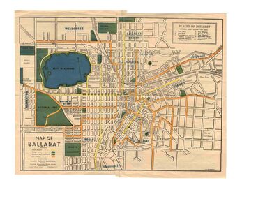
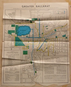
Map, Greater Ballarat Association and George Netherway, "Map of Ballarat", c1945
Yields information about Greater Ballarat, including trams, buses, locations and streets. Has a strong association with George Netherway.Five colour map of Ballarat, showing streets, places of interest, Parks, tram routes, bus routes, railway lines, prepared by G. C. Netherway, Greater Ballarat Association, for the Victorian Government Tourist Bureau, Ballarat Branch, c1945. Shows suburbs names, location of orphanage, the lack of development north of Howitt St, in Wendouree. Map is part diagrammatic and is not entirely to scale. On rear is a road map of the Ballarat area, lists of statistics, beauty spots, look outs, art and culture, points of historical interest, industrial products and recreation. Note: Image 1, assembled from four scans, does not entirely match at edges. See Reg item 2074 for photographic image of another version map. See Reg Item 5613 for another version of this map. trams, tramways, ballarat, tram routes, bus routes, map, lists -
 Ballarat Tramway Museum
Map, Greater Ballarat Association and George Netherway, "Map of Ballarat", c1950
Yields information about Greater Ballarat, including trams, buses, locations and streets. Has a strong association with George Netherway.Four colour map of Ballarat, showing streets, places of interest, Parks, tram routes, bus routes, railway lines, prepared by G. C. Netherway, Greater Ballarat Association. Shows suburbs names, location of places of interest, some development north of Howitt St, in Wendouree. Map is part diagrammatic and is not entirely to scale. Includes the Lake Wendouree Rowing course On rear is a road map of the Ballarat area, lists of statistics, beauty spots, look outs, art and culture, points of historical interest, industrial products and recreation. Printed by Waller & Chester on paper produced by Ballarat Paper Mills Pty Ltd. See Reg item 2074 for photographic image of this version of the map. See Reg Item 2776 for another version of this map. Contained originally within Reg Item 5507 at the back of the binder. For items see btm5507 loose items list.pdf John Whiting in an email of 17-9-2021 noted: The rowing course along Lake Wendouree is noted, so perhaps this map is post 1956? The Mt Pleasant tram line is shown to terminate at Morton St, not Cobden St (which of course is incorrect) Someone's come along and drawn in black ink the branch of the View Point tram line!trams, tramways, ballarat, tram routes, bus routes, map, lists -
 Bendigo Historical Society Inc.
Slide - DIGGERS & MINING. GETTING THE GOLD, c1853
Diggers & Mining. Getting the Gold. Slide: The next four frames contain a description of deep sinking at Ballarat in 1853, taken from William Howitt's book, ''Land, Labour, and Gold'', which was published in 1855. Markings: 32 994.LIF:4. Used as a teaching aid.hanimounteducation, tertiary, goldfields -
 Bendigo Historical Society Inc.
Slide - DIGGERS & MINING: THE DIGGINGS - THE DIGGERS
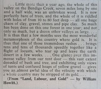
Diggers & Mining: The Digging - The Diggers. Slide: An article from 'Land Labour, and Gold'. By William Howitt. Little more than a year ago the whole of this valley on the Bendigo Creek, seven miles and long by one and a half wide, was an un broken wood. It is now perfectly bare of trees, and the whole of it is riddled of hole 10 to 80 feet deep, on one hugh chaos of clay, gravel, stones and pipe clay. So much has been done on this forest in just one year; and not only one year . . . . . . Markings: 28 994.LIF:6. Used as a teaching aid.hanimounteducation, tertiary, goldfields -
 Bendigo Historical Society Inc.
Slide - DIGGERS & MINING: THE DIGGINGS - THE DIGGERS
Diggers & Mining: The Digging - The Diggers. Slide: The next frame contains a description of Bendigo Creek in 4853. It is taken from the book ''Land, Labour, and Gold'', by William Howitt. (If you can, read this book. Published in 1855, it gives perhaps the best over-all account of the of the Victorian diggings in 1853 and 1854.) Markings: 27 994.LIF:6. Used as a teaching aid.hanimounteducation, tertiary, goldfields -
 Kilmore Historical Society
FREDRIKA BREMER'S WORKS, Fredrika Bremer's works: A diary, the H- family, Axel and Anna, and other tales, 1853
Green cloth cover with embossing detail on cover on the spine 368 pages ; 19cmHandwritten inscription on first page '288' Stamp on various pages 'Kilmore Mechanics Institute'kilmore mechanics institute library. -
Canterbury History Group
Book, Gwen McWilliam, Boroondara Musing
Book one of a collection of articles by Gwen McWilliam published in the Progress Leader from 1990-1993104 pages; includes many colour photosBook one of a collection of articles by Gwen McWilliam published in the Progress Leader from 1990-1993boroondara, schools, churches, howitt> richard, campbell> dame kate, shrublands, mcgregor street, bonwick> james, watson> john middleton, john beswicke, john maling