Showing 1102 items
matching information map
-
 Glenelg Shire Council Cultural Collection
Pamphlet, Portland, Town for all Seasons, 1970s
... Pamphlet, produced for Tourist Information Centre, Portland..., map, information. Portland, Town for all Seasons Pamphlet ...Pamphlet, produced for Tourist Information Centre, Portland 'Portland, Town for all Seasons'. Trifold, coloured photos, map, information.tourism, advertising, portland -
 Marysville & District Historical Society
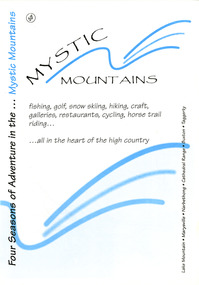
Ephemera (Item) - Visitor information pack, Four Seasons of Adventure in the Mystic Mountains, Unknown
... and the surrounding district. Includes maps and information sheets.... information pack on Marysville and the surrounding district. A visitor ...A visitor information pack on Marysville and the surrounding district.A visitor information pack on Marysville and the surrounding district.marysville, victoria, australia, visitor information pack, lake mountain, narbethong, cathedral range, buxton, taggerty, mystic mountains, beauty spot walk, tree fern gully walk, michaeldene track, keppel track, woods lookout track, lady talbot forest drive, wishing well, taggerty river picnic area, taggerty river, phantom falls, keppel falls, the beeches walking track, mount sugarloaf, department of conservation & environment victoria -
 Bendigo Historical Society Inc.
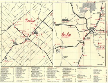
Document - TED BEATIE COLLECTION: MAP, Pre 1980s
... Bendigo tourist map and information guide - printed... Bendigo tourist map and information guide - printed by the Bendigo ...Bendigo tourist map and information guide - printed by the Bendigo and District tourist Association -
 Rutherglen Historical Society
Book, Kath Bentley et al, River of Islands: Charts of the River Murray Yarrawonga Weir to Hume Dam, November 1983
... Book contains information and sketch maps to aid...-country Book contains information and sketch maps to aid ...Book contains information and sketch maps to aid in the navigation of the Murray River, with advice on hazards to look for as these will change over time.74 page A4 book with a drawing of a boat on the Murray River on the coverAutographed on the title page by the authors: "9-1-84 Leon Bentley | Kath Bentley"murray river, boating, river navigation, boating safety -
 Wodonga & District Historical Society Inc
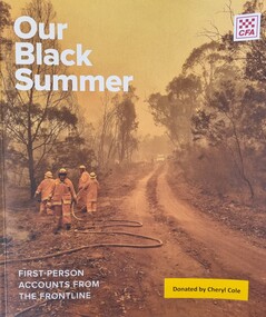
Book - Our Black Summer - First Person Account from the Frontline, Country Fire Authority, 2023
... A publication by the CFA giving detailed information.... A publication by the CFA giving detailed information, images, maps ...The 2019 - 2020 fire season, which became known as "Black SUmmer" was long and difficult for the CFA, emergency services and communities across the eastern seaboard of Australia, especially in northeastern and eastern Victoria. By its conclusion more than 8,200 CFA volunteers had contributed to the fire response in Victoria and another 2,288 CFA volunteers had been deployed interstate. THe bushfires burned 1.5 million hectares, destroyed more than 400 homes, 6,800 livestock and thousands of native animals. Tragically 5 people also lost their lives. The fires took their toll physically and psychologically.This book provides an insight into the challenges faced by so many in their efforts to protect communities and was produced as part of the recovery process from this horrific event.A publication by the CFA giving detailed information, images, maps and photographs about the bush fires which blazed across Victoria and southern New South Wales from November 2019 until brought under control in February 2020.non-fictionThe 2019 - 2020 fire season, which became known as "Black SUmmer" was long and difficult for the CFA, emergency services and communities across the eastern seaboard of Australia, especially in northeastern and eastern Victoria. By its conclusion more than 8,200 CFA volunteers had contributed to the fire response in Victoria and another 2,288 CFA volunteers had been deployed interstate. THe bushfires burned 1.5 million hectares, destroyed more than 400 homes, 6,800 livestock and thousands of native animals. Tragically 5 people also lost their lives. The fires took their toll physically and psychologically.This book provides an insight into the challenges faced by so many in their efforts to protect communities and was produced as part of the recovery process from this horrific event.black summer bushfires, cfa volunteers, bushfires australia -
 Bendigo Military Museum
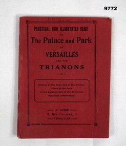
Booklet - VERSAILLES PALACE, A. Crosse, 9 Rue Colbert Versaille, unknown
... Booklet, red covers, 64 pages with photos, maps... pages with photos, maps, and information on places in Versailles ...Item in the collection relating to C.J.C. McQuie MM, refer Cat No 9680P for his service details.Booklet, red covers, 64 pages with photos, maps, and information on places in Versailles and Trianons.On front cover hand written, "J. McQuie 26/9/19". Inside first page, "Lieut J. McQuie 6 Bn AIF Paris 26/9/19"booklet, versaille, mcquie -
 Eltham District Historical Society Inc
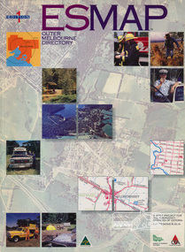
Book, Country Fire Authority Mapping Association Inc, ESMAP - Outer Melbourne Directory, 1991
... Outer Melbourne directory of information for emergencies... melbourne Outer Melbourne directory of information for emergencies ...Outer Melbourne directory of information for emergencies with maps of the state and major towns217 p. : maps ; 30 cm.ISBN 0646065661emergency services victoria -
 Montmorency–Eltham RSL Sub Branch
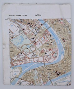
Map, Baghdad
... K941 Sheet 4 Map information as of 2001... 11- NIMA Series K941 Sheet 4 Map information as of 2001 Paper ...Prepared and published by the National Imagery and Mapping Agency Copyright 2003 by the United States GovernmentPaper, coloured The map is of Baghdad Iraq city Graphic 1:25,000. WGS 84 Edition 11- NIMA Series K941 Sheet 4 Map information as of 2001map -
 Williamstown High School
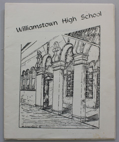
1976 orientation booklet
... information,school rules and map of school.... printed on white paper, 20 p. Includes enrollment information ...Pamphlet printed on white paper, 20 p. Includes enrollment information,school rules and map of school.Some editorial comments included. See the PDF file, attached.williamstown high school, 1976, orientation handbook, school rules -
 Whitehorse Historical Society Inc.
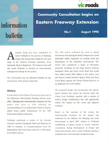
Pamphlet, Eastern Freeway Extension, 1/08/1998 12:00:00 AM
... Information bulletin giving history map showing features... freeway Information bulletin giving history map showing features ...Information bulletin giving history map showing features of extension,Information bulletin giving history map showing features of extension, members of liaison group established for consultation.Information bulletin giving history map showing features of extension,freeways, springvale road, nunawading, mitcham road, mitcham, park road, mullum mullum creek, deep creek road, loughnan road, ringwood, harrison street, acacia court, maroondah highway, city of whitehorse, city of manningham, city of maroondah, melbourne water, victoria. department of natural resources and environment, environment protection authority, victoria, vicroads, eastern freeway -
 Dandenong/Cranbourne RSL Sub Branch
Document - Framed Information Sheet, About The Map, Circa 2000s
... Framed information sheet of the map produced to show...The information sheet belongs with a map showing the Burma ...The information sheet belongs with a map showing the Burma Thailand Railway and it's route with the various camps and P.O.W centres. The map was produced over a period of 15 months and drawn in four stages. Shows Hellfire Pass formerly ( The Konyu Cutting). The 50 Kilo Camp in Burma. There were 56 stations and 87 camps on the route of the map. The map gives due credibility and was released as a limited edition of 1000 copies only. Copies of the map are displayed all over the world including Staffordshire in England, University of Houston, National Guard Museum of Texas and on display at the Australian and New Zealand Embassies in Bangkok.Framed information sheet of the map produced to show the various camps and sights along the Burma Thailand railway. The map was produced using a number of older railway maps, including the Escritt translated map and a local Thai road touring map. -
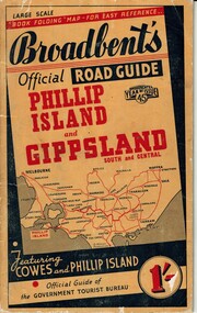 Phillip Island and District Historical Society Inc.
Booklet, Broadbent's Official Roadguide Phillip Island and Gippsland 45, c. 1945
... containing maps and information of accommodation, businesses... booklet with black type containing maps and information ...Broadbent's was the official guide of the Government Tourist Bureau. Mr Roy Bain owned a secondhand shop on corner of Thompson Ave and Chapel Street, Cowes, currently a Japanese restaurant.HistoricalSmall orange, black and red booklet with black type containing maps and information of accommodation, businesses and tourist venues.Broadbent's Official Road Guide Phillip Island and Gippsland South and Central. Broadbent's Year of Issue 45.guesthouses, broadbent's guides, hislop newsagency, underdown strawberry farm, osterlund fishing trips, parry's butcher, athenia cafe, roy bain, broadway bakery, cowes camping ground, cowes main garage, beach park camp -
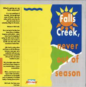 Falls Creek Historical Society
Booklet - Brochure - Falls Creek, Never Out of Season
... with internal pages of yellow and blue with central mud-map of Melbourne... with lines to Falls Creek. Accomodation information surrounding map ...A part of a yearly marketing and information material promoting Falls Creek region for the summer holidays. The slogans incorporated include " Falls Creek, Never Out of Season" and "Falls Creek, your home away from home"This item is important as it documents seasonal activities at Falls Creek Alpine ResortSquare yellow, blue, orange and green brochure titled Falls Creek, Never out of Season. Opens to a larger square program with internal pages of yellow and blue with central mud-map of Melbourne-Sydney with lines to Falls Creek. Accomodation information surrounding map and photographs with text on back pages.falls creek marketing, falls creek activities, falls creek -
 Melbourne Tram Museum
Book, Public Transport Corporation (PTC), "Customer Service Employees", c1995
... information, maps, fares, Met Tickets (3 zones), disabilities, sports... information, maps, fares, Met Tickets (3 zones), disabilities, sports ...Black vinyl covered two ring folder titled "Customer Service Employees", with the Public Transport Corporation Logo printed on dark green paper. Contains approx. 120 sheets with information about Melbourne's public transport including general information, maps, fares, Met Tickets (3 zones), disabilities, sports and entertainment Map, Hospitals, AFL Grounds, Bus & Tram Services, Night Rider Bus Services and basic first aid. The map shows tram line to Bundoora but no services to Docklands, the Altona - Laverton rail line shown. Gives details of Ansett airlines office. Book not dated as such. Estimated date - mid 1990's, prior to Metcards, still using Met tickets.trams, tramways, ptc, the met, tickets, information, melbourne, buses -
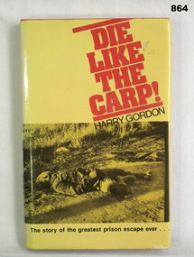 Bendigo Military Museum
Book, Harry Gordon, Die like the Carp!, c.1978
... of Cowra,New South Wales, the other has a map & information about... of Cowra,New South Wales, the other has a map & information about ...Folded page inside front of book. One side has a map of Cowra,New South Wales, the other has a map & information about the Japanese Garden & Cultural Centre, Cowra, New South Wales.Book, 240 pages, orange hard cover with yellow & black dust jacket. Front of dust jacket has photo of the body of a soldier lying on the ground & the back a photo of 2 men & 1 woman looking at photos. Written on 1st page: Nancy Brown Written on back of 2nd page: Alan W Brown Written on title page: Donated by Bgo Y Mens Clubbooks, military, history -
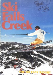 Falls Creek Historical Society
Magazine - Ski Falls Creek - The Ski Easy Resort
... of detailed information and maps describing resort facilities... information and maps describing resort facilities, different runs ...A part of a yearly marketing magazine promoting Falls Creek ski region for the winter holidays. It includes 24 pages of detailed information and maps describing resort facilities, different runs and access to the snow. Available accommodation is explained with the inclusion of tariffs for 25 different venues in both lodges and apartments. Transport, ski hire, other village services and insurance and booking agents are also explained. The brochure was published by Victour.This item is important as it documents seasonal activities at Falls Creek Alpine ResortAn A4 sized magazine titled "Ski Falls Creek - The Ski Easy Resort". It consists of 24 pages of information and images.falls creek 1985, the ski easy resort, falls creek marketing, falls creek maps, falls creek activities -
 Orbost & District Historical Society
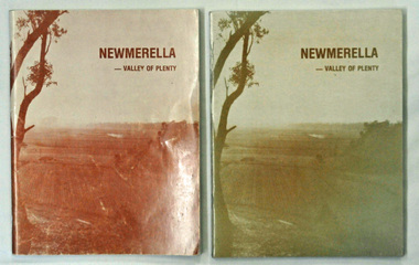
books, Snowy River Mail, Newmerella - Valley of Plenty, March 1978
... . There are black/white photographs, detailed information and maps...., detailed information and maps. Newmerella - Valley of Plenty books ...This book is a useful reference tool on the history of Newmerella.Four copies of a 80 pp soft covered stapled book with a light brown cover with the title, "NEWMERELLA - VALLEY OF PLENTY' in a darker brown print at the top. Below is an illustration of the Snowy River flats. It contains an outline of the history of Newmerella from the beginning of the 19th century until 1978. There are black/white photographs, detailed information and maps.newmerella-history valley-of-plenty -
Glenelg Shire Council Cultural Collection
Flyer - Flyer - Princess Margaret Rose Caves, c. 2009
... of cave formations on front, information about region, plus map... of cave formations on front, information about region, plus map ...Princess Margaret Rose Cave 'flyer'. Light card, photo of cave formations on front, information about region, plus map, on reverse.advertising, tourism, travel -
Glenelg Shire Council Cultural Collection
Souvenir - Brochure - Promotional Material for South West Victoria, n.d
... Full colour fold-out brochure of South-West Victoria, maps... brochure of South-West Victoria, maps, photos, information. Photo ...Full colour fold-out brochure of South-West Victoria, maps, photos, information. Photo of two children, 12 Apostles in background, on front -
Whitehorse Historical Society Inc.
Pamphlet - Periodical, North East Link, 2018
... Map and information regarding the proposed North East Link... and information regarding the proposed North East Link Project. Map ...Map and information regarding the proposed North East Link Project.Map and information regarding the proposed North East Link Project produced by the North East Link Authority. See Series Contents Box for holdings.Map and information regarding the proposed North East Link Project. north east link, map -
 Warrnambool and District Historical Society Inc.
Document - Warrnambool City Council Preliminary Report Industrial Estate West Warrnambool, E Johnson, 9 March 1973
... Two foolscaps size pages of typewritten information... foolscaps size pages of typewritten information. A detailed ...This preliminary report relates to 32½ acres of council owned land in West Warrnambool bounded on the North by McMeekin Road, on the East by Scott Street, on the South by Evans Street and on the West by the rear boundaries of properties facing Landmann and Granter Streets. In 2010, West Warrnambool was the largest of Warrnambool’s existing industrial areas, comprising approximately 109ha of industrial zoned land, the majority of which (101ha) is zoned IN1Z, with the remainder zoned INZ3. The area comprises a mixture of lot sizes supporting a diverse mix of industries. Larger parcels are occupied by the abattoirs, scrap metal industries, freight, the Council Depot and storage. Smaller lots are occupied by smaller manufacturers and wholesalers and service industries. [Ref: Warrnambool Industrial Land Use Review. Mesh Pty Ltd July 2010]This document is a preliminary report prepared by the Warrnambool City Council Engineer in March 1973 and provides an example of the planning process undertaken to develop one of Warrnambool's industrial areas. It contains details and costings of the proposed subdivision. Two foolscaps size pages of typewritten information. A detailed topographical map of the area with areas highlighted in blue, red, green, blue and purple pen.warrnambool city council, west warrnambool, industrial estate -
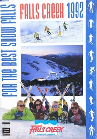 Falls Creek Historical Society
Magazine - Falls Creek 1992 For The Best Snow Falls
... pages of comprehensive information and maps describing resort... of comprehensive information and maps describing resort facilities ...A part of a yearly marketing magazine program promoting Falls Creek ski region for the winter holidays. It includes 28 pages of comprehensive information and maps describing resort facilities, different runs and access to the snow. Available accommodation is explained with the inclusion of tariffs for 25 different venues in both lodges and apartments for 1992. Transport, ski hire, other village services and insurance and booking agents are also explained. This issue was published for the Falls Creek Chamber of Commerce and supported by the Victorian Tourism Commission.This item is important as it documents seasonal activities at Falls Creek Alpine ResortMagazine titled "Falls Creek 1992 For The Best Snow Falls". It is a comprehensive guide to activities, accommodation and services in Falls Creek.falls creek marketing, accommodation falls creek, facilities falls creek, falls creek chamber of commerce -
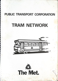 Melbourne Tram Museum
Book, Public Transport Corporation (PTC), "Tram Network", late 1980s
... along with a The Met logo. Provides information in map form... with a The Met logo. Provides information in map form on each tram route ...Titled "Metropolitan Tram Network" published by Public Transport Corporation with a drawing of an A class tram on the cover along with a The Met logo. Provides information in map form on each tram route in a large print format, contact numbers and some general information as a disability service. Gives details of Met customers services, office hours and Legend. See also item 1181 and 6000 for other examples. Possibly late 1980s as the Port Melbourne and St Kilda Light rail lines are detailed.Demonstrates the provision of information about Melbourne's tram routes at the time.Book - wire bound, 34 pages + card covers.tramways, ptc, the met, maps, disability services, tram routes, routes -
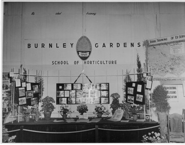 University of Melbourne, Burnley Campus Archives
Photograph - Black and white print, Royal Show 1957, 1957
... information and a map of Victoria locating institutes offering rural..., horticultural information and a map of Victoria locating institutes ...Note by T.H. Kneen 13 May1992, "The Burnley display was part of the Division of Agricultural Education's display covering Dookie, Longerenong and Burnley. Reference to Rural Training in 1957 would have been mainly to the on-farm training phase of the Rural Reconstruction Training Scheme. The Agricultural Collegians Association members had a meeting point at the exhibit. Burnley ex-students were not members of that association."Black and white photograph. Display mounted by Burnley Gardens School of Horticulture at the Royal Agricultural Show 1957. Incorporates photographs of College activities, horticultural information and a map of Victoria locating institutes offering rural training to ex-servicemen.On reverse, "Royal Show 1957."burnley gardens, school of horticulture, royal agricultural show, dookie college, rural training, rural reconstruction training scheme, the agricultural collegians association, horticulture, publicity, dept of agriculture education division, longerenong college -
Clunes Museum
Pamphlet - BROCHURES
... FOR DISTRIBUTION AG INFORMATION CENTRE. MAP OF CLUNES, A TASTY LITTLE... OF CLUNES FOR DISTRIBUTION AG INFORMATION CENTRE. MAP OF CLUNES ...BROCHURES IN ENVELOPE: COLLECTION OF ADVERTISING OF CLUNES FOR DISTRIBUTION AG INFORMATION CENTRE. MAP OF CLUNES, A TASTY LITTLE TOURING MAP CENTRED ON DAYLESFORD AND MT MACEDON, WALKS AND RIDES , CLUNES - SHOWING WALK FRO FRASER STREET AND AROUND CREEK. MENTION OF MT. BECKWORTH, POSTCARD WITH TOWN NAMES, CLUNES BROCHURE DINING AND TAKE AWAY FOR HEPBURN, DAYLSFORD, MACEDON RANGES. VISITOR GUIDEtourist informaion, brochures -
Glenelg Shire Council Cultural Collection
Programme - Programme - Upwelling Festival, 2012, c. 2012
... and green motifs and print, folds out, information one side, map... and green motifs and print, folds out, information one side, map ...Programme for Upwelling Festival 3rd November 2012, at Portland. Presented by Rotary Club of Portland Bay Inc. White, blue and green motifs and print, folds out, information one side, map with programme and location of events/displays on the other.marine ecology, upwelling festival, whales -
 Bendigo Historical Society Inc.
Book - LAND USE STRATEGY PLAN FOR THE BENDIGO SUV-REGION 1990-2020, 1991
... , also a 5 page booklet planning for the future with information..., also a 5 page booklet planning for the future with information ...Land Use Strategy Plan for the Bendigo Sub-Region, 1990 - 2020. Bendigo 2020 Strategy. Prepared by three consulting firms for the Loddon-Campaspe Regional Planning Authority Inside front cover are: 1 Cover sheet, 3 stapled reports covering Bendigo 2020 land use strategy plan, Issues Report, Environment, also a 5 page booklet planning for the future with information and maps.Loddon-Campaspe Regional Planning Authoritybendigo, planning, 2020 strategy. -
 Bendigo Historical Society Inc.
Document - STAFFORD REEF MINE SITE, DIAMOND HILL
... , Diamond Hill, Site 4.11, prepared by David Bannear. Information... Bannear. Information includes the map/grid references of the site ...One page document describing the Stafford Reef Mine Site, Diamond Hill, Site 4.11, prepared by David Bannear. Information includes the map/grid references of the site and an overview of the history of the Stafford Reef Mine. The physical remains of the mine are described..bendigo, mining, stafford reef mine -
Glenelg Shire Council Cultural Collection
Pamphlet, The Holiday Spectacular, c. 1970
... attractions. Multi-fold pamphlet, coloured photos, maps, tourist..., coloured photos, maps, tourist information. The Holiday Spectacular ...Pamphlet. South west Victoria Australia. The Holiday Spectacular produced by Victorian Government to promote tourist attractions. Multi-fold pamphlet, coloured photos, maps, tourist information. -
Clunes Museum
Pamphlet, BUSINESS & TOURISM, BURIED RIVERS OF GOLD, 2021
... AND INFORMATION FOR SELF GUIDED TOUR. MAP OF THE DEEP LEAD MINES, CRESWICK... AND INFORMATION FOR SELF GUIDED TOUR. MAP OF THE DEEP LEAD MINES, CRESWICK ...MAP OF DEEP LEAD MINES, CRESWICK. WALKING TOURCOLOURED PAMPHLET FOLDED TO DL SIZE. INCLUDES MAP AND INFORMATION FOR SELF GUIDED TOUR. MAP OF THE DEEP LEAD MINES, CRESWICK, AND NOTES FOR YOUR SELF-GUIDED TOUR.gold mining, creswick