
Showing 212 items matching "lines plan"
-
 Flagstaff Hill Maritime Museum and Village
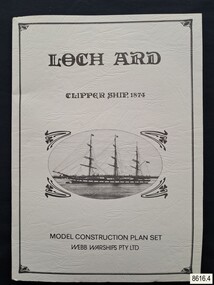
Document - Ship Model Plans, Webb Warships Pty Ltd, Loch Ard Clipper Ship, 1874; Model Construction Plan Set, 1978
... plans are detailed and drawn to scale. They and printed on good quality paper with details, scale and legends. Sheet 1: Sails and Rigging Sheet 2: Lines, Decks and Details Sheet 3: Masts and Spars Details include deck fittings, the wheel, lights and the shipping company’s house flag. ...plans are detailed and drawn to scale. They and printed on good quality paper with details, scale and legends. Sheet 1: Sails and Rigging Sheet 2: Lines, Decks and Details Sheet 3: Masts and Spars Details include deck fittings, the wheel, lights and the shipping company’s house flag. ...The plans are presented in a keepsake folder. They show marks of sections copied and assembled together. Overall, the plans are similar to those drawn by Mr P Webb to the order of the Loch Ard Shipwreck Centenary through Mr P Williams, the organizer of the Centenary competition. “The details were based on all available information which resulted in considerable historical research…and received favourable comment from model makers because of their attention to detail…In excess of 650 sets of plans were sold before entries closed…Many plans were probably purchased by collectors and interested persons for historical reference. An illustrated historical story sheet…was prepared and enclosed with the plans…” (‘Loch Ard Shipwreck Centenary 1878-1978 Report’, November 1978). An example of the attention to historical detail on the plans is the inclusion of the following useful information about the original vessel … Tonnage….1,693 G.R.T., 1,624 N.R.T. Dimensions, Builders….Charles Connell & Co., Ltd., Scotstoun, 1873. Owners….General Shipping Co., Glasgow, (Aitken Lilburn & Co., Ltd.), and the ship’s fate. The plans, in conjunction with the scale Ship Model of the LOCH ARD also on display, are of interpretive significance to Flagstaff Hill Maritime Village. The plans provide historical and technological context to artefacts from the shipwreck, increasing understanding and appreciation of those objects. Flagstaff Hill’s collection of artefacts from LOCH ARD is significant for being one of the largest collections of artefacts from this shipwreck in Victoria. It is significant for its association with the shipwreck, which is on the Victorian Heritage Register (VHR S417). The collection is significant because of the relationship between the objects, as together they have a high potential to interpret the story of the LOCH ARD. The LOCH ARD collection is archaeologically significant as the remains of a large international passenger and cargo ship. The LOCH ARD collection is historically significant for representing aspects of Victoria’s shipping history and its potential to interpret sub-theme 1.5 of Victoria’s Framework of Historical Themes (living with natural processes). The collection is also historically significant for its association with the LOCH ARD, which was one of the worst and best known shipwrecks in Victoria’s history.Model ship plans for building the LOCH ARD. The three sets of plans are presented in a textured cream card folder with the supplier’s details and an oval cameo drawing of the LOCH ARD. The plans are detailed and drawn to scale. They and printed on good quality paper with details, scale and legends. Sheet 1: Sails and Rigging Sheet 2: Lines, Decks and Details Sheet 3: Masts and Spars Details include deck fittings, the wheel, lights and the shipping company’s house flag. The ship model plans are copyrighted in 1977 and 1978 to Webb Warships Pty Ltd. The folder has details of four locations; Australia, USA, UK and New Zealand. Sheet has a handwritten inscription.On Folder: "LOCH ARD CLIPPER SHIP, 1874, MODEL CONSTRUCTION PLAN SET, WEBB WARRIORS PTY LTD." "CONTENTS COPYRIGHT (C) 1978, WEBB WARSHIPS PTY LTD" "WEBB WARSHIPS PTY LTD, PO BOX 50, WILLIAMSTOWN, VICTORIA 3016, AUSTRALIA" Handwritten inscription on sheet 3: "834" "THE FLOATING DRYDOCK, PO BOX 16066, PHILADELPHIA, PENNA. 14114, USA" "SAMBROOK MARINE (PLANS), 84 BROAD ST. TEDDINGTON, MIDDLESEX, UK" "BYMODELS, PO BOX 3037, FORBURY, DUNEDIN, NEW ZEALAND" flagstaff hill, warrnambool, shipwrecked coast, flagstaff hill maritime museum, maritime museum, shipwreck coast, flagstaff hill maritime village, great ocean road, loch line, loch ard, captain gibbs, eva carmichael, tom pearce, glenample station, mutton bird island, loch ard gorge, ship model plans, loch ard model plans, sailing ship, loch ard centenary, webb warriors pty ltd, 1977, 1978, centenary competition -
 Glenelg Shire Council Cultural Collection
Plan - Plans / Line Drawings - Port of Portland Authority Trawling Vessel Sensation, Victoria, n.d
... Document is of poor quality recreation, appears to be a photocopy of the original, drawing and text is faded out and dark copy lines streak the page. Plan Plans / Line Drawings - Port of Portland Authority Trawling Vessel Sensation, Victoria ...PORT OF PORTLAND AUTHORITYFront: '30' - black texta, top right corner -
Glenelg Shire Council Cultural Collection
Plan - Plan - Map Portland Harbour, n.d
... Port of Portland Authority Archives Port of Portland Archives Portland Harbour Black and white photographic copy of a map of the harbour, with lines of longitude marked on it Plan Plan - Map Portland Harbour ...Port of Portland Authority Archivesport of portland archives, portland harbour -
Mission to Seafarers Victoria
Letter - Correspondence, 30/12/1952
... planning to get married in the last week of February. Quinn Collection letters-from-abroad allan quinn alette andersen london 1952 A blue self-folding letter (0909.a1) headed London and dated 30/12/52. Letter is written in green ink. It is addressed to Mrs K Hayes, 14 Fitzroy Street, St Kilda, Victoria, Australia. Postmark is illegible. The return address is Allan Quinn, C/- Australia House, Strand, London. There are four lines ...Allan writes of a lonely Christmas without Alette who is spending it in Norway with her family. They are planning to get married in the last week of February.Quinn CollectionA blue self-folding letter (0909.a1) headed London and dated 30/12/52. Letter is written in green ink. It is addressed to Mrs K Hayes, 14 Fitzroy Street, St Kilda, Victoria, Australia. Postmark is illegible. The return address is Allan Quinn, C/- Australia House, Strand, London. There are four lines of writing at right angles to the return address. letters-from-abroad, allan quinn, alette andersen, london 1952 -
 Greensborough Historical Society
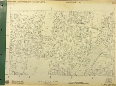
Map, Melbourne and Metropolitan Board of Works. Survey Division, MMBW, Yarra 2500 / 12.21. Watsonia North, 1979_02
... plan numbers, names of prominent features, contour values, creek or river names. Watsonia Railway Station and environs. Prominent streets: Grimshaw Street, William Street and Macorna Street. Includes former Institute of Social Welfare (now Loyola College) Lines...plan numbers, names of prominent features, contour values, creek or river names. Watsonia Railway Station and environs. Prominent streets: Grimshaw Street, William Street and Macorna Street. Includes former Institute of Social Welfare (now Loyola College) Lines ...Melbourne and Metropolitan Board of Works. Yarra 2500 [base map]. 12-22, Parish of Keelbundora 2856, Municipality of Diamond Valley 257. Shows street names, easement sizes, lot numbers, lodged plan numbers, names of prominent features, contour values, creek or river names. Watsonia Railway Station and environs. Prominent streets: Grimshaw Street, William Street and Macorna Street. Includes former Institute of Social Welfare (now Loyola College) Lines Reserve and Binnak Park.MMBW Map in 1:2500 [scale] series. Cream parchment with green tape reinforcing on edges and punched holes on left edge.mmbw, melbourne and metropolitan board of works, shire of diamond valley, watsonia - maps, bundoora - maps -
 Greensborough Historical Society
Book, Nicholas Martin, Dysons - moving with the times: the first 50 years of L. C' Dyson's Bus Services Pty Ltd, 2002
... History of Dyson's bus line to 2002 dyson's bus services pty ltd public transport victoria A history of the early days of Dyson's Bus Lines 112 p., black and white photographs, with gold dust jacket Dysons - moving with the times: the first 50 years of L. C' Dyson's Bus Services Pty Ltd. Book Book Nicholas Martin Martin Strategic Planning ...A history of the early days of Dyson's Bus Lines112 p., black and white photographs, with gold dust jacketnon-fictionA history of the early days of Dyson's Bus Linesdyson's bus services pty ltd, public transport victoria -
 Ringwood and District Historical Society
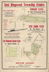
Flyer, Land Sale Advertisement - East Ringwood Township Estates, East Ringwood, Victoria - circa 1920
... Subdivision plans include Mount Dandenong Road, Grey Street, Eastfield Road, King Street, Everard Road, Holland Road, Purser Avenue, and Charles Street. (Agents) Spencer Jackson, Subdivider & Homebuilder, 341 Collins Street, Melbourne, Phones: M2327 (3 lines), also at Dromana, Phone 65....The date of the flyer as circa 1920 can be estimated from the references to the (decision on) "electrification of the Croydon Railway Line" which eventually occurred in 1923, letting of tenders for the state school building which opened in 1924, and the "proposed new railway station" (East Ringwood) which opened in 1925, Subdivision plans include Mount Dandenong Road, Grey Street, Eastfield Road, King Street, Everard Road, Holland Road, Purser Avenue, and Charles Street. (Agents) Spencer Jackson, Subdivider & Homebuilder, 341 Collins Street, Melbourne, Phones: M2327 (3 lines), also at Dromana, Phone 65. ...The date of the flyer as circa 1920 can be estimated from the references to the (decision on) "electrification of the Croydon Railway Line" which eventually occurred in 1923, letting of tenders for the state school building which opened in 1924, and the "proposed new railway station" (East Ringwood) which opened in 1925, Advertisement for three retail and residential allotment land sales in East Ringwood Township including maps showing layout of subdivisions. Township Estate, State School Estate, and East Ringwood Station Estate.Subdivision plans include Mount Dandenong Road, Grey Street, Eastfield Road, King Street, Everard Road, Holland Road, Purser Avenue, and Charles Street. (Agents) Spencer Jackson, Subdivider & Homebuilder, 341 Collins Street, Melbourne, Phones: M2327 (3 lines), also at Dromana, Phone 65. -
 Flagstaff Hill Maritime Museum and Village
Book - Reference, Samuel Taylor Coleridge et al, Coleridge's Rime of the Ancient Mariner, 1863
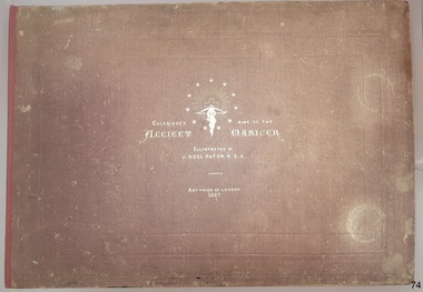
... lines of this stanza, I am indebted to Mr Wordsworth. It was on a delightful walk from Nether Stowey to Dulverton, with him and his sister, in the autumn of 1797, that this poem was planned, and in part composed”. ...lines of this stanza, I am indebted to Mr Wordsworth. It was on a delightful walk from Nether Stowey to Dulverton, with him and his sister, in the autumn of 1797, that this poem was planned, and in part composed”. ...This book includes the classic poem ‘Rime of the Ancient Mariner’ by Samuel Taylor Coleridge, the lines of which are set out in twelve pages of double columns. Each section of the poem is titled, such as 'Part the Sixth'. The twenty lithographed line drawings by J. Noel Paton RSA illustrate major events of the story and repeat the applicable verse below them. Most of the drawings have the initials of the artist and the lithographer on the bottom corners, below which are printed their names. The margins of the poem contain printed author's notes. Interestingly, the printer's name is added as a footnote on page 12, at the end of the poem. The book is included in the Rare Books collection of Flagstaff Hill. Its description closely matches one of two copies of the book held by the British Museum. There have been other publications of Coleridge’s poem over the years, based on various editions of his poem and illustrated by other artists. When this book was first published, Paton’s illustrations were available individually for the public to purchase. The author, Samuel Taylor Coleridge (1772-1834), was a notable late 18th to early 19th century English poet. He was the youngest of fourteen children. His father was a vicar as well as the master of a grammar school, with Samuel attended. Coleridge's longest poem, 'Rime of the Ancient Mariner', was written about 1797-1798 and tells of the experiences and adventures of a sailor. It was included in a collection of poetry titled 'Lyrical Ballads', jointly written with his friend William Wordsworth. The volume is considered the beginning of the Romantic era of British poetry. Coleridge acknowledges William Wordsworth in this poem, in ‘Part the Forth’ with the footnote “For the two left lines of this stanza, I am indebted to Mr Wordsworth. It was on a delightful walk from Nether Stowey to Dulverton, with him and his sister, in the autumn of 1797, that this poem was planned, and in part composed”. Sir Joseph Noel Paton RSA (1821-1901) is a well-known Scottish-born artist and painter of historical artwork, created the line illustrations in 1863, highlighting the main points of the poem. In the same year he also illustrated Charles Kingsley's 'Water Babies'. He was appointed Queen’s Limner for Scotland from 1866. The book was published in 1863 by the Art Union of London, an organisation whose members paid an annual subscription, and who received an annual prize of a work of art. The organisation was established in 1837 and membership quickly grew until the 1870's. Membership then slowly dropped off until the organisation was would up in 1912. Lithographer William Husband McFarlane, of Edinburgh, Scotland, created the black and white lithograph outlines from Paton’s drawings, illustrating many of the lines of the poem. The book of poetry and Illustrations was then printed by Neill & Company, Edinburgh, in 1763. The company was formed by Patrick Neill in 176. The company was known for inventing one of the early mechanical typesetting machines, which was used for the Company's publications as well as sold to other companies even into the early 1900s. The firm continued in business until 1973. This copy of the book was presented to Emily Taylor Smith by her father on September 16, 1867, four years after it was published. There is no further information available about Emily at this point in time.This Victorian era book of poetry with illustrated prints, the 'Rime of the Ancient Mariner' by Samuel Taylor Coleridge, is considered to be a rare book. The British Museum holds two copies, one of which is very similar in description. The book is significant for containing a poem written by the renowned British poet Samuel Coleridge, who acknowledges the contribution of a couple of the lines to his friend William Wordsworth. The book's significance is increased for being included in a collection of poetical works jointly written by Coleridge and his friend William Wordsworth, entitled 'Lyrical Ballads' and published in 1797. The printer of the book, Neill & Company, was known for pioneering an early mechanical typesetting machine. It’s significance also includes the collection of Victorian artwork within. Coleridge's poem is significant for being included in 'Lyrical Ballads', which is considered to signify the beginning of the Romantic era of British poetry. Book: large, burgundy linen covered, hard cover, with gold embossed title and images, landscape orientation. Title: Coleridge's Rime of the Ancient Mariner. Author: Samuel Taylor Coleridge Illustrator: J. Noel Paton, R.S.A. Publisher: Art-Union of London in 1863. Lithographer: W.H. McFarlane in Edinburgh, Scotland, 1863. Printer: Neill & Company, Edinburgh, Scotland Contents include the lines of a poem, with lithograph illustrations above applicable short verse. The cover and fly page have the same emblems. A personal inscription is handwritten in a nib pen inside the book.Printed: "COLERIDGE'S RIME OF THE ANCIENT MARINER" "ILLUSTRATED BY J. NOEL PATON, R.S.A." "ART-UNION OF LONDON, 1863" " W.H. McFARLANE, LITHOGr, EDINBURGH" "Printed by Neill & Company, Edingurgh" Emblems embossed on cover, and a repeat printed on fly page, include stars encircling a crucifix and a snake entwined around a cross bow with a branch in its mouth.flagstaff hill, warrnambool, flagstaff hill maritime museum, maritime museum, shipwreck coast, flagstaff hill maritime village, great ocean road, coleridge's rime of the ancient mariner, rime of the ancient mariner, ancient mariner, samuel coleridge, j. noel paton, art-union of london, 1863, rare book, samuel taylor coleridge, art union of london, w.h. mcfarlane, william husband macfarlane, sir joseph noel paton, poem, emily taylor smith, 1867, romantic period, william wordsworth, lithograph, poetry, lyrical ballads, british romantic movement, literary work, neill & company edinburgh, j. noel paton rsa, mechanical typesetting, alexander neill fraser, mechanical typesetting machine -
 Ringwood and District Historical Society
Flyer - McAlpin's Plan Of Ringwood, Map of Ringwood District promoting J.B. McAlpin - Pioneer Estate Agent & Property Salesman, Main Road, Ringwood. Undated, circa 1910-20s
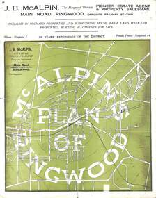
... lines from Ringwood Railway Station with self-promotional advertising, train time table and fares, and a summary of local services, faciities and important dates. Absence of Ringwood East and Heathmont Railway Stations from the undated map suggests earlier than their opening dates,1925 and 1926. Map of Ringwood District promoting J.B. McAlpin - Pioneer Estate Agent & Property Salesman, Main Road, Ringwood. Undated, circa 1910-20s. Flyer McAlpin's Plan ...Multi-fold town map on green background showing 1/4 mile radial lines from Ringwood Railway Station with self-promotional advertising, train time table and fares, and a summary of local services, faciities and important dates. Absence of Ringwood East and Heathmont Railway Stations from the undated map suggests earlier than their opening dates,1925 and 1926. -
 Ringwood and District Historical Society
Drawing - Plan of Subdivision, Part of Crown Portion 29, Parish of Warrandyte, County of Evelyn, Ringwood - Undated, circa 1945
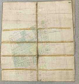
... LP7884 Faded hand-drawn map on cardboard backing with taped repairs along fold lines - numbered allotments on Wonga Road, William Street, Andrew Street, Munro Street and Harrison Street, Ringwood. Part of Crown Portion 29, Parish of Warrandyte, County of Evelyn, Ringwood - Undated, circa 1945. Drawing Plan ...Faded hand-drawn map on cardboard backing with taped repairs along fold lines - numbered allotments on Wonga Road, William Street, Andrew Street, Munro Street and Harrison Street, Ringwood. LP7884 -
 Eltham District Historical Society Inc
Photograph - Newspaper article, Jo Chandler, Call for council to stop 'the chop', 1989
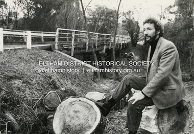
... planned to replant the area around the bridge with suitable native shrubs. Jim Connor was hoping to raise awareness of following a policy of gradual removal of such trees over a period of time that overlapped the establishment of new plantings so that their removal would not be such a sudden change. Jim Connor Shire of Eltham Parks and Environment MMBW Brougham Street Bridge Significant trees John Galea power lines ...Local Eltham resident Jim Connor highlighted the sudden loss of several Willow trees that shrouded the old wooden Brougham Street bridge. These were removed in 1989 by the Shire of Eltham Department of Parks and Environment as part of ensuring clearnce to powerlines. The department manager, John Galea said that cutting down trees ran contrary to the environment unit's philosophy but was necessary where trees interfere with wires. The MMBW also had an ongoing plan to clear willows from waterways. In conjunction with the removal council planned to replant the area around the bridge with suitable native shrubs. Jim Connor was hoping to raise awareness of following a policy of gradual removal of such trees over a period of time that overlapped the establishment of new plantings so that their removal would not be such a sudden change.jim connor, shire of eltham, parks and environment, mmbw, brougham street bridge, significant trees, john galea, power lines, jim connor collection -
 Bendigo Military Museum
Map - RASvy " Map Makers Exhibition 2025 "- Map display, RAN Hydrographic Office, 1972 - 1992
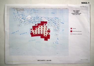
... This series of maps were used for the planning of RAAF flights. Of Particular note these charts were used to plot "Rhumb Lines or loxodromes" where a course crosses all Meridians (Lines of latitude and longitude) at the same angle. ...This series of maps were used for the planning of RAAF flights. Of Particular note these charts were used to plot "Rhumb Lines or loxodromes" where a course crosses all Meridians (Lines of latitude and longitude) at the same angle. ...All of these Charts / Maps were used for the RSL Museum display " The Mapmakers " ( of RASvy. ) 10 Jun - 10 Aug 2025. .1 Catalogue of Tactical Pilotage Charts, 1:500 000 Scale. Digital Data Base available as at 30Jun 92. This catalogue page shows the extent of the Australian area of responsibility for aeronautical charting. .2 RAAF PLOTTING CHART. NP 22-2 (Navigational Plotting) Tasmania. MERCATOR PROJECTION. This series of charts were used for the training of RAAF Navigators. These charts were produced and printed at the Army Survey Regiment, Bendigo. .3 RAAF PLOTTING CHART AUSTRALIA - SOUTHEAST. NP 27 is Based on LAMBERT CONFORMAL CONIC PROJECTION. This series of charts was used by RAAF Navigators for the planning of RAAF flights. These charts were produced and printed at the Army Survey Regiment, Bendigo. .4 RAAF LONG RANGE PLOTTING CHART. NP 43-4 AUSTRALIA WESTERN. MERCATOR PROJECTION. This series of maps were used for the planning of RAAF flights. Of Particular note these charts were used to plot "Rhumb Lines or loxodromes" where a course crosses all Meridians (Lines of latitude and longitude) at the same angle. On Mercator projection charts Rhumb lines are conveniently shown as straight lines and are also lines of constant compass bearing. Rhumb lines are usually longer than the shortest distance between two points. The shortest distance between two points on the earth's surface is called a "Great Circle Route" which is a route on a circular path on the surface of the earth where the centre of that circle is also the centre of the earth. Great Circle Routes on a Mercator Projection are however curves and harder to plot. These charts were produced and printed at the Army Survey Regiment, Bendigo. .5 RAAF LONG RANGE PLOTTING CHART. NP 43-7 SOLOMON ISLANDS. MERCATOR PROJECTION. Used for the planning of RAAF flights. .6 RAAF AIR STAFF PLANNING CHART NS 137-1 DARWIN NORTH WEST. AZIMUTHAL EQUIDISTANT PROJECTION. This series of charts were used for planning by the staff. The whole chart was produced by joining the four quadrant maps together. The charts are based on a single point of tangency (in this case Darwin) and shows radius (distance) in nautical miles to and from that point. A series of charts were produced centred on each of the major airfields in Northern Australia. These charts were produced and printed at the Army Survey Regiment, Bendigo. .7 RAAF AIR STAFF PLANNING CHART NS 137-2 DARWIN NORTH EAST. AZIMUTHAL EQUIDISTANT PROJECTION. Used for the planning by the staff. The charts are based on a point of tangency and show radius in nautical miles. .8 RAAF AIR STAFF PLANNING CHART NS 137-4 DARWIN SOUTH WEST. AZIMUTHAL EQUIDISTANT PROJECTION. Used for the planning by the staff. The charts are based on a point of tangency and show radius in nautical miles. .9 RAAF AIR STAFF PLANNING CHART NS 137-3 DARWIN SOUTH EAST. AZIMUTHAL EQUIDISTANT PROJECTION. Used for the planning by the staff. The charts are based on a point of tangency and show radius in nautical miles. .10 TACTICAL PILOTAGE CHART. TPC R-13B. LAMBERT CONFORMAL PROJECTION. Used by pilots for flight planning and could be used in flight if necessary for visual navigation using major ground features shown on the chart. These charts also contained aeronautical information such as airfields, radio navigation beacons and obstructions. Contours and height information was shown in feet to be compatible with aircraft altimeters. Each graticule square also contained a Maximum Safe Elevation Figure (MEF) also in feet. Coverage of this series over Australia's area of interest were produced and printed at the Army Survey Regiment, Bendigo. .11 HYDROGRAPHIC CHART. AUS 158. PORT PHILLIP SOUTH and WEST CHANNELS. PROJECTION TRANSVERSE MERCATOR. Used by all people needing to navigate a vessel. Hydrographic charts were printed at the Army Survey Regiment, Bendigo. .12 HYDROGRAPHIC CHART. AUS 157. GEELONG HARBOUR and APPROACHES. PROJECTION TRANSVERSE MERCATOR. Used by all people needing to navigate a vessel. .13 EN ROUTE CHART. AUSTRALIA ERC HIGH. H1 and H2. LAMBERT CONFORMAL CONIC PROJECTION. This series of charts were regularly produced by the RAAF Aeronautical Information Service (AIS) and contained current aeronautical information for pilots. These charts were printed at the Army Survey Regiment, Bendigo..1 Tactical Pilotage Chart Series Catalogue. Current as at 30 Jun 92. .2 Extract of Navigational Plotting Chart " NP22-2 Tasmania " .3 Extract of Navigational Plotting Chart " NP 27 RAAF PLOTTING CHART AUSTRALIA - SOUTHEAST " .4 Extract of Navigational Plotting Chart " RAAF LONG RANGE PLOTTING CHART NP43-4 AUSTRALIA WESTERN " .5 Extract of Navigational Plotting Chart " RAAF LONG RANGE PLOTTING CHART NP43-7 SOLOMON ISLANDS " .6 Extract of Navigational Series " RAAF AIR STAFF PLANNING CHART NS 137-2 DARWIN NORTH WEST " .7 Extract of Navigational Series " RAAF AIR STAFF PLANNING CHART NS 137-1 DARWIN NORTH EAST " .8 Extract of Navigational Series " RAAF AIR STAFF PLANNING CHART NS 137-4 DARWIN SOUTH WEST " .9 Extract of Navigational Series " RAAF AIR STAFF PLANNING CHART NS 137-3 DARWIN SOUTH EAST " .10 Extract of Tactical Pilotage Chart " TPC R-13B " .11 Extract of Hydrographic Chart " PORT PHILLIP SOUTH and WEST CHANNELS " .12 Extract of Hydrographic Chart " GEELONG HARBOUR and APPROACHES " .13 Extract of En Route Chart " AUSTRALIA ERC HIGH " " H1 and H2 " royal australian survey corps, rasvy, fortuna, detachment - army survey regiment, army svy regt, asr -
 Bendigo Military Museum
Map - TRENCH MAP, WW1, c. 1918
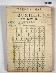
... plan Defence and operations. Part of the collection of V E Giudice 53730. Refer to Cat. No. 10031P for his details. Part of the overall William (Bill) Thomason Collection. V E Giudice Collection of William (Bill) Thomason Trench Map WW1 Signed on front "V E Giudice" and "O/C ACO and something indecipherable. Large white hard paper map of Rumilly Trenches with Town of Rumilly, Masneriei and Crevecoeur and The Canal, St Quentin. Full contour lines ...Detailed trench map of locality to Guide and plan Defence and operations. Part of the collection of V E Giudice 53730. Refer to Cat. No. 10031P for his details. Part of the overall William (Bill) Thomason Collection.Large white hard paper map of Rumilly Trenches with Town of Rumilly, Masneriei and Crevecoeur and The Canal, St Quentin. Full contour lines marked and showing the Beaurevoir Line of Trenches. Is to scale of 1:10,000. Mainly blank on back except a table to index adjoining sheets and a glossary of locations. Translation from French to English.Signed on front "V E Giudice" and "O/C ACO and something indecipherable.v e giudice, collection of william (bill) thomason, trench map, ww1 -
 Eltham District Historical Society Inc
Photograph - Digital Photograph, Marguerite Marshall, Avenue of Honour, Main Road, Eltham, 20 April 2008
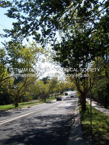
... Nillumbik Shire Council is continuing this process of replanting trees in a new alignment to move them away from overhead power lines and to clear the VicRoads reserve. Covered under Heritage Overlay, Nillumbik Planning Scheme. ...Nillumbik Shire Council is continuing this process of replanting trees in a new alignment to move them away from overhead power lines and to clear the VicRoads reserve. Covered under Heritage Overlay, Nillumbik Planning Scheme. ...The suggestion of an Avenue of Honour may have been originally put forward by Lady Irvine who was a member of the Welcome Home Committee. The Avenue of Honour was established to memorialise all those from Eltham who enlisted (some of whom were still fighting overseas at the time), similarly as the Shire of Eltham (Soldiers) Memorial Park was in tribute to all from the Shire who enlisted. The twenty-seven names of those killed from Eltham were engraved on the Eltham War Memorial Obelisk unveiled in 1919 at the corner of Main Road and Bridge Street. From an article in the Heidelberg News and Greensborough, Eltham and Diamond Creek Chronicle, September 22, 1917, p. 2, it was reported: Some few weeks ago a public meeting was held in the Eltham Rechabite Hall for the purpose of forming a committee to make necessary arrangements for the return of our brave lads from the front, with the result that the following officers were elected, viz., Sir William Irvine. president; Cr. R. D. Taylor, vice-president; Rev. T. W. Sapsford, secretary; Mr R. E. Gilsenan, treasurer; with a very strong committee of local residents. Lady Irvine then suggested that it would be nice to plant an Avenue of Honor, which was carried out in a very cheerful and spirited manner on Saturday afternoon. Cr Taylor and Mr R. E. Gilsenan occupied themselves during the fore-forenoon in getting the lining-out and other preliminaries ready, but shortly after one o'clock the willing workers could be seen wending their way towards the township, with picks, shovels. &c., on their shoulders, and in a very short time the gang at work was in appearance a very lively and pretty sight, the only thing that was missing was the camera, to have had a few snapshots taken. A little after 3 o'clock Sir William and Lady Irvine, and Mr W. Gray and family, arrived by motor. Cr Taylor then explained that their object in gathering together so hurriedly to plant the avenue was on account of the lateness of the season, and being offered 100 trees, free of charge, by Cr. Wm. G. Gray; of Allwood Nursery, Hurst's Bridge (for which the committee are deeply grateful to him and the public highly appreciate his generous offer). Sir Wm. Irvine then spoke at some length on the ravages of this cruel war, and the good that must result therefrom in bringing all closer together; he also referred to our brave lads who were fighting for us, and thought it was for those at home to show their appreciation by planting the Avenue of Honor. Lady Irvine thou proceeded to plant the first tree, which was an English oak: Sir William following by planting a Spanish chestnut; and Mrs W. G. Gray a sycamore. After that the gathering refired to the entrance of Mr R. E. Gilsenan's green paddock to partake of refreshments, which the ladies had kindly provided for the willing band of workers. Work was again taken to in earnest, and the planting finished, all being satisfied that they had done good work. At the Eltham Shire Council’s monthly meeting held May 6, 1918, Cr. Gray promised to give Council £20 to £25 worth of trees if the Council would plant and guard them. His desire was that a tree be planted in the name of every soldier lad who has gone to the front. Each tree was later adorned with a brass plaque with the name of a soldier and a wooden tree guard placed around them. Over the years many trees died, and following roadworks were replanted on a new alignment. Nillumbik Shire Council is continuing this process of replanting trees in a new alignment to move them away from overhead power lines and to clear the VicRoads reserve. Covered under Heritage Overlay, Nillumbik Planning Scheme. Published: Nillumbik Now and Then / Marguerite Marshall 2008; photographs Alan King with Marguerite Marshall.; p119This collection of almost 130 photos about places and people within the Shire of Nillumbik, an urban and rural municipality in Melbourne's north, contributes to an understanding of the history of the Shire. Published in 2008 immediately prior to the Black Saturday bushfires of February 7, 2009, it documents sites that were impacted, and in some cases destroyed by the fires. It includes photographs taken especially for the publication, creating a unique time capsule representing the Shire in the early 21st century. It remains the most recent comprehenesive publication devoted to the Shire's history connecting local residents to the past. nillumbik now and then (marshall-king) collection, avenue of honour, main road, eltham -
 Eltham District Historical Society Inc
Photograph, Peter Pidgeon, Victorian Labor Government Press Release announcing planned upgrades to Hurstbridge line rail services and protection of historic Railway Trestle Bridge, Panther Place, Eltham, 1 August 2018, 1 Aug 2018
... lines connect. Labor will also protect the Eltham Trestle Bridge – the last remaining timber bridge on Melbourne’s electric train network – which has local heritage protection and is an important part of the area’s character. The Liberals will leave this bridge to rot and demolish the nearby childcare centre and football club with their under-cooked and under-costed promise to upgrade the Hurstbridge line. Only Labor will protect this important piece of Melbourne’s history with planning...lines connect. Labor will also protect the Eltham Trestle Bridge – the last remaining timber bridge on Melbourne’s electric train network – which has local heritage protection and is an important part of the area’s character. The Liberals will leave this bridge to rot and demolish the nearby childcare centre and football club with their under-cooked and under-costed promise to upgrade the Hurstbridge line. Only Labor will protect this important piece of Melbourne’s history with planning ...Announcement by Premier Daniel Andrews, Minister for Public Transport, Jacinta Allan and Member for Eltham, Vicki Ward mad alongside the Eltham Railway Trestle Bridge. MEDIA RELEASE "More Trains And Fewer Delays On The Hurstbridge Line" https://www.premier.vic.gov.au/wp-content/uploads/2018/08/180801-More-Trains-And-Fewer-Delays-On-The-Hurstbridge-Line-1.pdf Commuters on the Hurstbridge line will have more trains, more seats and fewer delays with a re-elected Andrews Labor Government to continue its massive upgrade of the Hurstbridge line. The Andrews Labor Government said it would deliver locals in Melbourne’s north-east more peak hour train services and less time stuck at boom gates, and we have. The first stage of the Hurstbridge Line Upgrade has been delivered – six months early and on budget. This includes the new Rosanna Station, duplicated track between Heidelberg and Rosanna and the removal of the dangerous level crossings at Alphington and Rosanna. There’s more to do and only Labor will deliver the next stage of the Hurstbridge Line Upgrade to give local commuters more train services and a more comfortable commute. The $530 million project will include a brand new train station at Greensborough and the duplication of three kilometres of track between Greensborough and Montmorency, and 1.5 kilometres of track between Diamond Creek and Wattle Glen to allow more train services during the morning peak. This will allow trains to run every six and a half minutes at Greensborough, every 10 minutes at Eltham and Montmorency, and every 20 minutes at Hurstbridge, Diamond Creek and Wattle Glen – as well as two extra Hurstbridge express services. Locals on the Labor Government’s new Mernda line will also get five extra train services during the morning peak, with a major upgrade of the Clifton Hill junction where the Mernda and Hurstbridge lines connect. Labor will also protect the Eltham Trestle Bridge – the last remaining timber bridge on Melbourne’s electric train network – which has local heritage protection and is an important part of the area’s character. The Liberals will leave this bridge to rot and demolish the nearby childcare centre and football club with their under-cooked and under-costed promise to upgrade the Hurstbridge line. Only Labor will protect this important piece of Melbourne’s history with planning work to be carried out for a long-term solution as part of the project. Stage two of the Hurstbridge Line Upgrade will create more than 950 jobs, with construction to start in 2020 and finish by 2022. Quotes attributable to Premier Daniel Andrews “We said we’d upgrade the Hurstbridge line and remove dangerous and congested level crossings at Rosanna and Alphington and we did – but there’s more to do.” “Only Labor will deliver the next stage of the Hurstbridge Line Upgrade with a new Greensborough Station and more trains, more often.” Quote attributable to Minister for Public Transport Jacinta Allan “The former Liberal Government promised new train lines but didn’t deliver a single kilometre of track – now they’re promising a half-baked upgrade of the Hurstbridge line with rubbery figures that don’t add up.” Quote attributable to Member for Eltham Vicki Ward “As a fifteen year old hopping on Red Rattlers at Eltham I wanted to do something to make the Hurstbridge line better. It’s taken me a few decades but finally our line will offer the frequency of services that are expected and needed in a 21st century city.”Born digital image (qty 27)jacinta allan, minister for public transport, panther place, premier daniel andrews, press announcement, railway line construction, trestle bridge, vicki ward mp for eltham, victorian parliament -
 Bendigo Military Museum
Document - VIETNAM PAPERS - HERDMAN
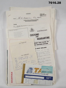
... lines in black. No handwritten details. Title: DAILY MAINT MOVEMENT PLANNING TABLE". ...lines in black. No handwritten details. Title: DAILY MAINT MOVEMENT PLANNING TABLE". ...5. Pocketbook issued to Australian Troops during the Vietnam War. Contents include: The War in South Vietnam, The People, Government Services, Armed Services, Viet Cong, Vietnamese Language, Useful information. 14. Details of Australia V US. Hill climb with program of Events, 22nd February 1970. 15. Details of dog races with fields listed on a six race program - 20th February 1970. 18. Document details departure itinerary (ex SVN) for K.J. HERDMAN. 27. Notebook contains names and addresses of US service personnel. Papers related to "Kevin John Herdman's" visit to South Vietnam from 18th February to 4th March 1970. Part of the Kevin John Herdman, No. 397661 Collection. See Cat. No. 5942P for details of his service. 27. Collection of documents related to K.J. Herdman. 1. Two page TAA flight ticket. Text in blue coloured type. Two baggage tickets stapled to front. 2. Single diary page with torn edge. Handwritten flight itinerary in section dated 16th February. 3. Two page QANTAS flight ticket. Text in red and black type. Flight details printed in purple type. 4. Printed flier outlining Australian Customs and Quarantine regulations. Recipient's name handwritten in black ink. 5. Green coloured soft cover pocketbook. 74 pages with cut edges. Black and white diagrams. Text in black type. 6. Small pamphlet with black type. Written in Vietnamese. 7. Foolscap sized 5 page document stapled on top LHC. Text in black type. Title "VISITS BY CMF OFFICERS TO VIETNAM". 8. A4 sized one page document with text in black type on one side only. Two sided pamphlet on blue paper stapled to top LHC. Black type on pamphlet. Title "NINE RULES FOR AUSTRALIAN ARMY FORCES IN VIETNAM." 9. Two page A4 sized document with text in black type. Text on one side of each page. Title "AUSTRALIAN FORCE VIETNAM, RTA BRIEFING NOTES - QANTAS CHARTER, SAIGON/SYDNEY". 10. Foolscap signed proforma oriented in landscape. Title: AUSTRALIAN MILITARY FORCES, VISITS BY CMF OFFICERS TO SYN". Details of personnel in black type. 11. Quarto sized two page document with printing on one side. Text in black type. Staple in top LHC. Title: "CMF VISITOR - LT. K.J. HERDMAN, (ITINERARY FOR LT. K.J. HERDMAN)". 12. Quarto sized two page document with printing on one side. Text in black type. Staple in top LHC. Title: " CMF VISITOR - LT K.J. HERDMAN (ITINERARY FOR LT. K.J.HERDMAN)" 13. A4 sized document with text in black type. Text on one side only. Title: CMF VISITOR - LT. K.J. HERDMAN". 14. Foolscap sized document with text in black type. Printing on one side. Title: "LONG HI HILL CLIMB". 15. Quarto sized document with text in black type. Printing on one side. Title: "DAT DO DOGS". 16. Foolscap sized 9 page document with text on one side. Printing in black type. Pages stapled together in top LHC. Title: "1 ATF G INSTRUCTIONS 14/69, SUPPLIES, POL AND AMMUNITION HOLDINGS". 17. A4 sized document with text on one side. Printing in black type. TITLE; "AMENDMENT 1 TO Q INSTRUCTION 14/69, DATED 23 OCT 69". 18. A4 SIZED DOCUMENT WITH TEXT ON BOTH SIDES. PRINTING IN BLACK TYPE. 19. Foolscap sized 3 page document with staple in top LHC. Text on page 1 in black type. Text on pages 2 & 3 in purple type. Pages are entitled "TEMA FLYING PROGRAMME - CH 47". 20. Foolscap sized 7 page document with text in black type. Printing on one side. Title: " OPERATIONS BREF - DET 52 SUP PL RAASC, REPUBLIC SOUTH VIETNAM (1967-69)", Dated 20 Sept, 69. 21. Foolscap sized 2 page document with text in black type. Printing on one side. Pages stapled on top LHC. Title: " Q INSTRUCTION 15/69, RETURN OF PRODUCE, " Dated 16 Oct 69. 22. Foolscap sized single page document with text in black type. Printing on one side. Title: " Q INSTRUCTION 19/69, RETURN AND DISPOSAL OF UNSERVICEABLE AMMUNITION" Dated 5 Nov 69. 23. Foolscap sized single page proforma with text and lines in black. No handwritten details. Title: "26 TRANSPORT COY RAASC VEHICLE SERVICEABILITY/AVAILABILITY STATE". 24. Foolscap sized single page proforma with text and lines in black. No handwritten details. Title: "DAILY EMPLOYMENT STATE, 85 TPT PL RAASC". 25. Foolscap sized single page document. Text and lines in purple. Reproduced on a spirit duplicator. Title: "INDENTING PROGRAMME FRESH". 26. Foolscap sized single sheet proforma with text and lines in black. No handwritten details. Title: DAILY MAINT MOVEMENT PLANNING TABLE". Printing on both sides. 27. Red and white covered note book. Title on front and details on back in black type. Lined pages. Handwritten information on most pages. 28. Illustrated Christmas Card. Illustration features an angel and the three Magi. Printing on inside in black. Handwritten message in black ink. 1. Passenger details handwritten in blue, carbon copy. 2. Itinerary notes handwritten in blue ink. 3. Handwritten in black ink: "CAPT K.J. HERDMAN". Flight details printed in purple coloured text. 4. Handwritten in black ink : "KEVIN JOHN HERDMAN". 7. Handwritten in black ink on page 1: LT. K. HERDMAN, 6 Coy RAASC, 17 Feb 70." Handwritten in black ink on last page: "1. Ensure teeth are all O.K., 2. Have you still got your tags Identity? (Signature). 11. Handwritten on top RHC of page 1: "CAPT A". 12. Handwritten on top RHC of page 1: "LT HERDMAN". 27. Handwritten notes in black ink on various pages. 28. Handwritten in black ink on inside of card: "Hello Kevin, Perhaps you remember the 62nd Trans. Company at Long Bing? I completely enjoyed your brief stay. If you are ever in the U.S. do stop by. Have a Merry Christmas to you and yours. Margo and Jack Olsen." vietnam war, army, training notes, kevin john herdman -
 Kiewa Valley Historical Society
Plan Ref. K. 6612 with Letter attached re Public Safety in Kiewa Works Area
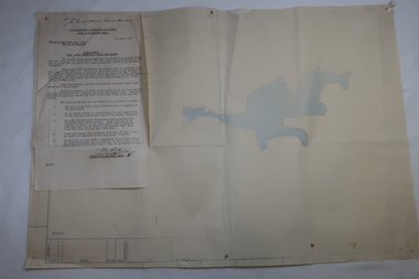
... Plan No. K 6612 of Fall Creek showing Rocky Valley Dam's shape when it is full. Letter dated 6th April 1959 from H.H.C. Williams to Ski Clubs at Falls Creek re public safety as Rocky Valley fills. Refers to roads, transmission lines..., pole lines etc in the Kiewa Works Area. Plan Ref. K. 6612 with Letter attached re Public Safety in Kiewa Works Area ...The SECV constructed the Kiewa Hydro Electric Scheme which included the building of Rocky Valley Dam on the Bogong High Plains near Falls Creek. H.H.C. Williams, construction engineer, Kiewa wrote to the Ski Clubs at Falls Creek outlining the dangers arising with the filling of Rocky Valley Dam. He lists 5 warnings in the interest of safety.The plan and letter provide the dates for the completion of Rocky Valley dam and its effect on the people living and working in the area including miners and ski clubs. It describes some of the features of Kiewa Works Area at the time.Plan No. K 6612 of Fall Creek showing Rocky Valley Dam's shape when it is full. Letter dated 6th April 1959 from H.H.C. Williams to Ski Clubs at Falls Creek re public safety as Rocky Valley fills. Refers to roads, transmission lines, pole lines etc in the Kiewa Works Area.Written in ink at top of letter - "Secretary / Mt Beauty and District Progress Association"rocky valley dam, falls creek ski clubs, h.h.c. williams, khes 1959, safety -
 Kiewa Valley Historical Society
Plans - 2 Southern Hydro - Bogong Power Development and 1 Poster - Hydro-Electricity
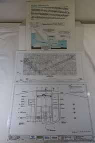
... Waterway Plan & Longsection / with Boreholes & Seismic Lines (Also see KVHS 1438) 3. ...Waterway Plan & Longsection / with Boreholes & Seismic Lines (Also see KVHS 1438) 3. ...Southern Hydro owned the Kiewa Hydro Electric Scheme in 2006. Southern Hydro owned the Kiewa Hydro Electric Scheme in 2006.Laminated A3 sheets The two Southern Hydro Bogong Power Development are black and white. 1. Tunnel and Civil Works / Power Station / Cross Section Sheet 4 of 6 Dated: June 2006 (Also see KVHS 1438) 2. Bogong Power / Development Waterway. Waterway Plan & Longsection / with Boreholes & Seismic Lines (Also see KVHS 1438) 3. Title: Hydro-Electricity in blue at the top and half-way down a blue and brown diagram titled 'Hydro-Electric Power Station'. At the bottom the title 'What is a watt?' southern hydro 2006, bogong power development -
 Kiewa Valley Historical Society
Map - Kiewa on the Map, Guide to Kiewa Hydro-Electric Project
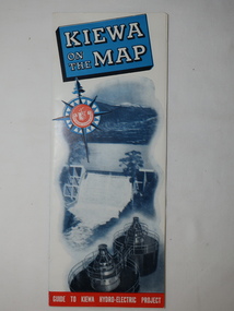
... Lines Pty. Ltd., Albury The SECV constructed the KHES and controlled all roads within the Kiewa works area. Map of Kiewa 1950 KHES Map Large colored map folded in half and then in 3. Front third is mostly blue and white with titles.. When opened the cover has black and white photos beside it with print and 'Please Note'. Also in the other half, a 'Road Map to Kiewa' showing the south eastern side of Australia, mostly yellow (the land) and blue (the sea). Inside the map is a close up map of "Ground Plan ...Published by the SECV in 1950. They controlled the roads from Mt Beauty to the Bogong High Plains and all other roads within the Kiewa works area. The roads are not open to general tourist traffic. Conducted tours of the Kiewa area are operated by Eastern Road Lines Pty. Ltd., AlburyThe SECV constructed the KHES and controlled all roads within the Kiewa works area.Large colored map folded in half and then in 3. Front third is mostly blue and white with titles.. When opened the cover has black and white photos beside it with print and 'Please Note'. Also in the other half, a 'Road Map to Kiewa' showing the south eastern side of Australia, mostly yellow (the land) and blue (the sea). Inside the map is a close up map of "Ground Plan of Kiewa Hydro Electric Project' with a 'Key Map Showing Distances'.map of kiewa 1950, khes map -
 Warrnambool and District Historical Society Inc.
Book, Road register loose binder, 1953
... lines with blue lined margins and headings. The streets in Warrnambool are listed alphabetically and the information in the register contains both typed and handwritten material. There are also printed notices from the Victorian Local Government department, extracts from newspapers, copies of letters and plans of street subdivisions. ...lines with blue lined margins and headings. The streets in Warrnambool are listed alphabetically and the information in the register contains both typed and handwritten material. There are also printed notices from the Victorian Local Government department, extracts from newspapers, copies of letters and plans of street subdivisions. ...This is an Alphabetical Register of the streets in Warrnambool as listed by Warrnambool City Council officers. It appears to have been a working register used in the 1950s, 60s and 70s and information has been added to the entries as it became available and as Council works were carried out in these streets. It contains information on the locality, wards, allotment numbers, lodged plan numbers, footpaths and printed information from the Victorian Local Government Departments. It sometimes gives the origin of the name of the street and some other miscellaneous information is included. It is presumed that the information contained therein has now been stored electronically. This is a most important ledger as it contains much valuable historical information on Warrnambool streets. It will be of great use to researchers. This is a loose leaf binder with a black leather cover and a black metal and cord binding mechanism. The pages are unnumbered but there is provision for insertion or removal of pages and there are leather alphabetical tabs protruding from the pages. The pages have blue ruled lines with blue lined margins and headings. The streets in Warrnambool are listed alphabetically and the information in the register contains both typed and handwritten material. There are also printed notices from the Victorian Local Government department, extracts from newspapers, copies of letters and plans of street subdivisions. There is one loose page.warrnambool city council, warrnmbool streets register -
 Bendigo Historical Society Inc.
Plan - Parish Map of Sydney Flat
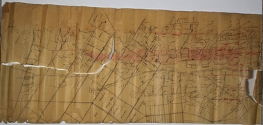
... There is red shading on Gully, Moon and New Chum lines. Plan Parish Map of Sydney Flat ...The New Moon Group of mines were located in the Sailors Gully/ Sydney Flat area. Sydney Flat was originally regard as part of Myers Creek, later Myers Flat it was changed to Sydney Flat when mining was established and was changed to Woodvale in the 1920s Sydney Flat Bushland Reserve is near-by. The area is north of Sailors Gully.Draftsman's drawing on cream coloured waxed paper with black print. SYDNEY FLAT is printed in the centre of a grid of streets with no names divided into sections there are names many of the sections including - J Dolman, G Wills, Gill, J Bayliss, Fracis Webb, T Downie, H Turner, J Hodgson, J Gordon, W Booth, J Shadbolt, J S Pearson, C Maroney, I Quin & Co, W Davey, J Kelly. Printed out of the grid is New Moon U and New Moon Cons. Added red handwriting are reef lines including - Christmas, Thistle, Carshalton, Napoleon, Gr nite, New Chum , Moon, Gully, Derby, Hustlers. There is red shading on Gully, Moon and New Chum lines.bendigo, gold, map, mine, margaret roberts collection, new moon mines, sailors gully, sydney flat -
 Monbulk RSL Sub Branch
Book, Penguin Random House Australia Pty Ltd, Victory at Villers-Bretonneux : why a French town will never forget the Anzacs, 2016
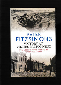
... Across a 45-mile front, no fewer than two million German soldiers hurl themselves at the Allied lines, with the specific intention of driving all the way through to the town of Villers-Bretonneux, where their artillery can rain down shells on the key train hub of Amiens, thus throttling the Allied supply lines. For nigh on two weeks, the plan works brilliantly.The Germans are able to advance without check, as the exhausted British troops flee before them, together with tens of thousands of French refugees. ...It's early 1918, and after four brutal years, the fate of the Great War hangs in the balance. On the morning of 21 March 1918, the Kaiserschlacht (the Kaiser's battle) is launched. The biggest set-piece battle the world has ever seen. Across a 45-mile front, no fewer than two million German soldiers hurl themselves at the Allied lines, with the specific intention of driving all the way through to the town of Villers-Bretonneux, where their artillery can rain down shells on the key train hub of Amiens, thus throttling the Allied supply lines. For nigh on two weeks, the plan works brilliantly.The Germans are able to advance without check, as the exhausted British troops flee before them, together with tens of thousands of French refugees. In desperation, the British commander, General Douglas Haig, calls upon the Australian soldiers to stop the German onslaught and save Villers-Bretonneux. If the Australians can hold the line, the very gate to Amiens, then the Germans will not win the war. Arriving at Villers-Bretonneux just in time, the Australians launch a vicious counter-attack that hurls the enemy back the first time. And then, on Anzac Day 1918, when the town falls after all to the British defenders, it is again the Australians who are called on to save the day, the town, and the entire battle - even the warIndex, ill, bib, maps, p.764.It's early 1918, and after four brutal years, the fate of the Great War hangs in the balance. On the morning of 21 March 1918, the Kaiserschlacht (the Kaiser's battle) is launched. The biggest set-piece battle the world has ever seen. Across a 45-mile front, no fewer than two million German soldiers hurl themselves at the Allied lines, with the specific intention of driving all the way through to the town of Villers-Bretonneux, where their artillery can rain down shells on the key train hub of Amiens, thus throttling the Allied supply lines. For nigh on two weeks, the plan works brilliantly.The Germans are able to advance without check, as the exhausted British troops flee before them, together with tens of thousands of French refugees. In desperation, the British commander, General Douglas Haig, calls upon the Australian soldiers to stop the German onslaught and save Villers-Bretonneux. If the Australians can hold the line, the very gate to Amiens, then the Germans will not win the war. Arriving at Villers-Bretonneux just in time, the Australians launch a vicious counter-attack that hurls the enemy back the first time. And then, on Anzac Day 1918, when the town falls after all to the British defenders, it is again the Australians who are called on to save the day, the town, and the entire battle - even the war -
 Bendigo Historical Society Inc.
Plan - MARKS COLLECTION: PLAN OF UNDERGROUND SURVEY G. DENNIS MINE
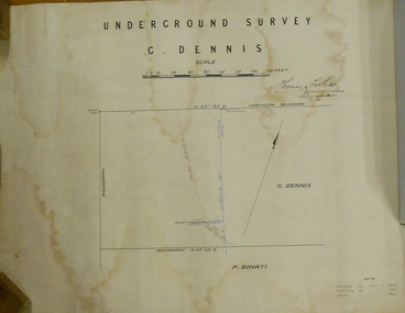
... Dennis' printed on top of plan. Plan shows boundary lines and peg site. P. Bonati claim marked on bottom of plan. ...Dennis' printed on top of plan. Plan shows boundary lines and peg site. P. Bonati claim marked on bottom of plan. ...Plan drawn on heavy parchment 'underground survey G. Dennis' printed on top of plan. Plan shows boundary lines and peg site. P. Bonati claim marked on bottom of plan. B. Letter with plan on letterhead 'City of Sandhurst, Town Hall, July 2nd. 1873' Addressed to Mr. George Dennis, Sir, In reply to your letter of the 19th. ulto I am empowered to state that subject to the formation of the road referred to, your existing rights are conserved, and the council will undertake not to object to the renewal of your lease. The only conditions being that you shall not sink a shaft in the street or attempt to obstruct it when formed. I have the honor to be, Sir, your obedient servant, Geo Fletcher, Town Clerk.bendigo, mining, g. dennis claim -
Port Melbourne Historical & Preservation Society
Pamphlet - Accomodation, MS Achille Lauro and Flotta Lauro, Feb 1970
... Passenger accommodation plan for MS Achille Lauro, Flotta Lauro (Lauro Lines). Blue on white....transport - shipping ms achille lauro flotto lauro (lauro lines) Passenger accommodation plan for MS Achille Lauro, Flotta Lauro (Lauro Lines). ...Passenger accommodation plan for MS Achille Lauro, Flotta Lauro (Lauro Lines). Blue on white.transport - shipping, ms achille lauro, flotto lauro (lauro lines) -
Port Melbourne Historical & Preservation Society
Pamphlet - Brochure, cabin plan, P&O Orient Lines - SS Canberra, Sep 1964
... Probably with materials from Station Pier kiosk, donated by Ted Rohan transport - shipping canberra p&o lines Plan of first class accommodation on the P&O Orient liner Canberra P&O Orient Lines - SS Canberra Pamphlet Brochure, cabin plan ...Probably with materials from Station Pier kiosk, donated by Ted RohanPlan of first class accommodation on the P&O Orient liner Canberratransport - shipping, canberra, p&o lines -
 Bendigo Historical Society Inc.
Newspaper - Kangaroo Flat Gold Mine Collection: Bendigo Mining N.L, Bendigo Advertiser, 9.1. 2007, 10.1.2007
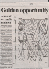
... On right hand side of article: plan of Deborah and Sheepshead reef lines showing Swan decline. ...On right hand side of article: plan of Deborah and Sheepshead reef lines showing Swan decline. ...Two newspaper articles: 1. 'Golden Opportunity' Bendigo Advertiser, January 23, 2001. Article describes progress of the Swan Decline which is now 3.5 km under the City of Bendigo, at a depth of 500 metres under Hargreaves Street. On right hand side of article: plan of Deborah and Sheepshead reef lines showing Swan decline. Written underneath plan: ' The Ribbons: the Swan decline is now under Hargreaves Street. Deposits are in black'. Mr. Doug Buerger is quoted in the article. 2. '300 New Jobs', Bendigo Advertiser May 28, 2002. Photo of Euan McGowan, Bendigo Mining heavy plant fitter and Mr. Doug Buerger, on right hand side of article. Article discusses the Bendigo Mining N.L. project and Mr. Buerger predicts that between '200 and 300 full-time jobs will become available in Bendigo'. bendigo mining n.l., bendigo, mining, gold, douglas buerger, swan decline, euan mcgowan, production -
 Bendigo Historical Society Inc.
Plan - Part of Napoleon and Nell Gwynne Reefs
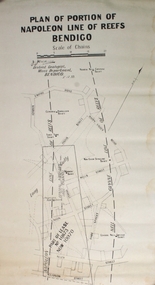
... Black printing on off white colored paper- PLAN OF PORTION OF NAPOLEON LINE OF REEFS BENDIGO, Scale of Chains, a signature, District Geologist Mines Department BENDIGO. 5/12/39 Two vertical broken lines are labeled NAPOLEON LINE OF REEFS, NELL GYWNNE LINE OF REEFS and CENTRAL NAPOLEON LODE CHANNEL and mine shafts CENTRAL NAPOLEON, MOONTA, PTOPOSED NEW SHAFT, NORTH NEW GWYNNE, THREE TOMS, NEW CHUM SYNCLINE and CENTRAL NELL GWYNNE are drawn over a street map of the Long Gully area. ...Caldwell Black printing on off white colored paper- PLAN OF PORTION OF NAPOLEON LINE OF REEFS BENDIGO, Scale of Chains, a signature, District Geologist Mines Department BENDIGO. 5/12/39 Two vertical broken lines are labeled NAPOLEON LINE OF REEFS, NELL GYWNNE LINE OF REEFS and CENTRAL NAPOLEON LODE CHANNEL and mine shafts CENTRAL NAPOLEON, MOONTA, PTOPOSED NEW SHAFT, NORTH NEW GWYNNE, THREE TOMS, NEW CHUM SYNCLINE and CENTRAL NELL GWYNNE are drawn over a street map of the Long Gully area. ...Mr. J. J. Caldwell, Officer in charge of the Bendigo Geological branch of the Victorian Mines Department, received his early training in the Castlemaine and Bendigo Schools of Mines and later at the Melbourne Technical CollegeBlack printing on off white colored paper- PLAN OF PORTION OF NAPOLEON LINE OF REEFS BENDIGO, Scale of Chains, a signature, District Geologist Mines Department BENDIGO. 5/12/39 Two vertical broken lines are labeled NAPOLEON LINE OF REEFS, NELL GYWNNE LINE OF REEFS and CENTRAL NAPOLEON LODE CHANNEL and mine shafts CENTRAL NAPOLEON, MOONTA, PTOPOSED NEW SHAFT, NORTH NEW GWYNNE, THREE TOMS, NEW CHUM SYNCLINE and CENTRAL NELL GWYNNE are drawn over a street map of the Long Gully area. The streets shown are; Empire Rd, Harvey St, Inglis St, Wells St, Union St, Alley St (now Marong Rd) and Curnow St. Forms part of the Margaret Roberts Collection bendigo, margaret roberts, gold, map, mine, long gully, j.j. caldwell -
 Bendigo Historical Society Inc.
Plan - Section of Levels S.B.G.M.Co
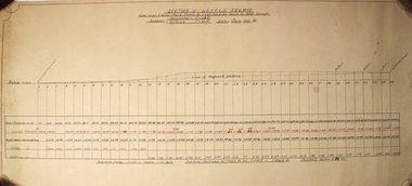
... Underneath there is a data chart with 29 columns with horizontal lines labeled- Datum Line, Total Distances in ft, Levels Reduced, Height above+ below Datum, Filling ft, Cutting ft Forms part of the Margaret Roberts Collection. Plan ...A t draftsman's drawing. Written at the top - SECTION of LEVELS S.B.G.M. Co From X cut 5 level Main Shaft to cut leading back to Old Shaft Scales Horizontal 1"=20ft Vertical 1'=10ft Date 6th July 1935 J.B. Underneath there is a data chart with 29 columns with horizontal lines labeled- Datum Line, Total Distances in ft, Levels Reduced, Height above+ below Datum, Filling ft, Cutting ft Forms part of the Margaret Roberts Collection.bendigo, margaret roberts, gold, mine -
 Bendigo Historical Society Inc.
Plan - Napoleon, Nell Gwynne Transverse Section, 14.1.1946
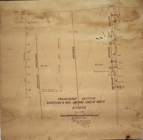
... Printed on bottom of plan" Transverse Section Napoleon and Nell Gwynne Lines of Reef' and 'J.J. ...Printed on bottom of plan" Transverse Section Napoleon and Nell Gwynne Lines of Reef' and 'J.J. ...Napoleon Lease no.11111 is situated immediately south from the Golden Square railway station. It embraces an approx length of 36 chains of the Napoleon Anticline. The old Napoleon shaft, the depth of which is 1020 ft, occupies a central position in the area of about 43 acres. The accompanying sections, which are prepared from mine Managers plans, illustrate the extent of previous underground operations and indicate points at which future prospecting may be advantageously continued. The no.10 (920 ft) south level connects with the main Napoleon shaft no.5 level (479 ft) appears to present the best opportunity for testing the prospects that are believed to have been inadequately investigated by the Bendigo Mines Limited in recent years.Map drawn on heavy paper. Printed on bottom of plan" Transverse Section Napoleon and Nell Gwynne Lines of Reef' and 'J.J. Caldwell, District Field Geologist, Mines Department, Bendigo. 14.1.46'. Napoleon anticline and Central Nell Gwynne anticline marked on map. Map is part of the Margaret Roberts Collection of mining documents. gold mining, bendigo, napoleon gold mine, nell gwynne, reef lines, j.j. caldwell, 1946 -
 Bendigo Historical Society Inc.
Plan - Whip and Jersey Gold Mine, 19th December, 1917
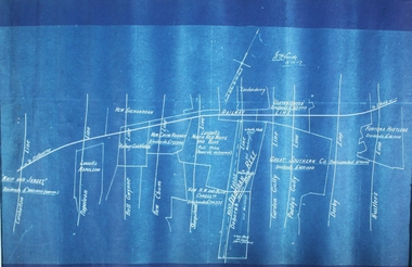
... Blue wax paper plan with white inscriptions, titled 'Whip and Jersey'. Plan shows reef lines: Carshalton, Napoleon, Nell Gwynne, New Chum, Sheepshead, Garden Gully, Paddy Gully, Derby, Hustlers. ...Cundy, 19.12.17 Blue wax paper plan with white inscriptions, titled 'Whip and Jersey'. Plan shows reef lines: Carshalton, Napoleon, Nell Gwynne, New Chum, Sheepshead, Garden Gully, Paddy Gully, Derby, Hustlers. ...The Whip and Jersey Mine was located south of Hunter Street, Golden Square.Blue wax paper plan with white inscriptions, titled 'Whip and Jersey'. Plan shows reef lines: Carshalton, Napoleon, Nell Gwynne, New Chum, Sheepshead, Garden Gully, Paddy Gully, Derby, Hustlers. Deborah Reef marked in bold text. Bendigo to Melbourne railway line at top of plan. 'Whip and Jersey, £200,000', written in white on left hand side of plan. Plan forms part of the Margaret Roberts Collection.N. Cundy, 19.12.17gold mining, gold, bendigo, whip and jersey, carshalton, napoleon, nell gwynne, new chum, sheepshead, garden gully, paddy gully, derby, hustlers., deborah, railway line
