Showing 540 items matching "open house melbourne"
-
 Warrnambool and District Historical Society Inc.
Medal, Jubilee of Canberra 1913-1963
This medal was made by W.J.Amor Mint, a medal making company from New South Wales. It was made to commemorate both the 50th anniversary of the establishment of Canberra in 1963 and the Royal Visit of 1963. Because of the rivalry between the two major Australian cities, Melbourne and Sydney, it was decided to establish a new capital city somewhere between the two cities. The Australian capital Territory was established in 1913 and the American architect, Walter Burley Griffin, in association with his wife, Marion Mahony Griffin, was chosen to design the new city of Canberra. The first Parliament House was opened in 1927 and Melbourne ceased to be the location of the Federal Parliament meetings.This medal is of interest, mainly because it commemorates the 50th anniversary of the first Parliament House in Canberra and the establishment of Canberra as Australia's capital city.Circular brass medal with ring attached at the top and a split ring through the ring. The obverse features a raised profile of Queen Elizabeth 11 wearing a crown and text. The reverse depicts old Parliament House, decorative leaves and text.THE ROYAL VISIT OF HM. QUEEN ELIZABETH 11. 1963. JUBILEE OF CANBERRA 1913-1963 AUSTRALIA 1788-1963 australian capital territory, canberra australia, walter burley griffin, queen elizabeth 11 -
 Warrnambool and District Historical Society Inc.
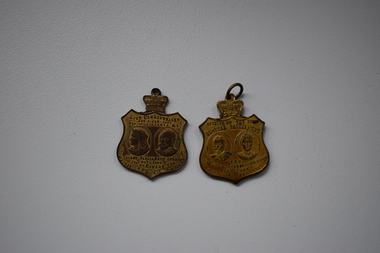
Medals, Opening of First Australian Parliament 1901, 1901
These medals were issued to commemorate the opening of the first Parliament in Australia in Melbourne in May 1901. The Federation of the Australian States and Territories took place in January 1901. The Federal Parliament met in Melbourne until Canberra was established and a new Parliament House was opened in 1927. The fist Parliament in Australia was opened by the Duke and Duchess of Cornwall and York. These medals have no known local provenance and are retained for display purposes..1 This is a shield-shaped metal medal with a crown on the top. Obverse: Images of the Duke and Duchess of Cornwall and York and printing. Reverse: Images of Queen Victoria and Edward V11 and printing. .2 as above Opening of the First Federal Parliament T.R.H The Duke & Duchess of Cornwall and York Melbourne, May 1901 Aust. Commonwealth Est. 1 Jan. 1901 First Parliament opened May 1901 63rd of Victoria R.I. 1st of Edward V11 W.A. Tas. N.S.W. Vic. S.A. Qld. -
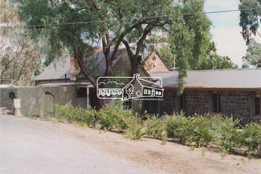
 Eltham District Historical Society Inc
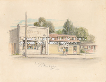
Artwork, other - Sketch, E. Foreman, Old property at Eltham Station, c.1980
Situated at 965 Main Road adjacent to the Eltham Railway Station, the Country Art Store was originally a hairdresser and Tattersalls agency In 1968 Pam Robinson and Caroline Shenton opened a small shop on the corner of Main Road and Napoleon Street. Four months later a damaged fire hyrdant flooded the store and ruined all their stock. The pair moved to the former hardresser shop at 965 Main Road, adjacent to the Eltham Railway Station, opposite the Stationmaster's house and opened the Country Art Store and adjacent gallery. At the time the only other shop selling pottery was the Potters Cottage in Warrandyte. During the 1970s the gallery was the Wiregrass Gallery. In 1993, after 25 years operating the Country Art Store, the pair decided to sell up and move to warmer climates. During the course of their business a number of craft shops and galleries opened and closed in Eltham. One such shop was Bimbadeen, next to Ansell and Muir's chicken shop opposite Eltham Lower Park. That business run by Don Brown, then a local artist was taken over as River Clay run by Leo Haanappel and Coeny Dommers but ultimately sat in a flood plain and was demolished. When the Country Art Store became available in 1993, Leo Haanappel and Coeny Dommers took it over. The premises became Platform 3095 cafe around 2015.Old Property at Eltha Station E. Foremanart store, country art store, country art store (eltham), eltham railway station, platform 3095, restaurants, shops, wiregrass gallery -
 Eltham District Historical Society Inc
Document - Folder, Macklin, Jenny
Jenny Maclin, was Member for JagaJaga, House of Representatives Contents Newspaper advertisement: Nillumbik Mail, 6 September 2000, Jenny Macklin's office open every Friday. Newspaper advertisement: Diamond Valley Leader, 22 February 2006, Jenny Maclin photographed at opening of new Town and Country Hearing Centre, Greensborough. Letter Jenny Maclin to Eltham District Historical Society, 28 November 2014, seeking donations to Diamond Valley Foodshare. Flier for Jenny Maclin constituents event, 17 February 2015. Letter Jenny Maclin to Eltham District Historical Society, reporting Federal Liberal Government's defunding of Trove. Letter Jenny Maclin to Eltham District Historical Society, seeking donations to 3081 Angels collection of children's books. Newspaper article, "Thwaites is Labor's pick", Diamond Valley Leader, 1 August 2018, details of Jenny Macklin's political career and background of new Labor candidate Kate Thwaites. Letter Jenny Mackin to JagaJaga residents, September 2018, announcing her retirement and introducing Kate Thwaites. Flier, lecture by Jenny Macklin, for Banyule U3A, 28 October 2018.Newspaper clippings, A4 photocopies, etcjenny maclin, town and country hearing centre greensborough, 3081 angels, diamond valley foodshare, kate thwaites, jagajaga electorate -
 Eltham District Historical Society Inc
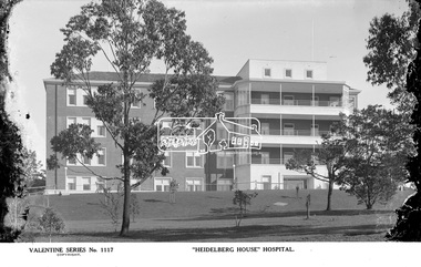
Photograph, The Rose Stereograph Company, "Heidelberg House" Hospital, c.1938
View looking across a treed landscape lawn towards the new 'Heidelberg House' at the Austin Hospital, which was opened in 1939. This glass plate negative was used to manufacture postcards (1:1 printing) for commercial sale by the Rose Sterograph Company and its subsidiaries. George Rose founded the Rose Stereograph Company in 1880 and was joined by Herbert (Bert) Cutts in the early 20th Century. The pair formed a lifetime working partnership and strong personal friendship. Assisted by George’s two sons, Herbert George and Walter, and later by Neil Cutts, the Rose Stereograph Company continued its operations for more than 140 years. The company was initially built on stereographs, but as cinema took over and stereographs fell out of fashion, the Rose Stereograph Company developed Australia’s first commercially viable photographic postcard business. Specialising in postcards of iconic historical moments and significant landmarks, The Rose Stereograph Company became a staple of the Australian travel industry.This remarkable collection of glass plate negatives, transparencies, and postcards – arguably Australia’s most significant photography collection outside of public hands – has been passed down through the generations, surviving war, relocation, and the harsh Victorian climate. The historic Rose Stereograph collection is the culmination of George Rose’s dream of capturing and preserving precious moments in time and remains the legacy of the Rose and Cutts families. It is with great sadness that the Cutts family says goodbye to a collection that spans five generations and 140 years. The Cutts family understands that for these historically important pieces to rest with one family is to deny others the pleasure of their custodianship.Glass Plate Negative Size: 9 x 14 cm"Heidelberg House" Hospital, Velentine Series No. 1117, Copyrightpostcard, travel, rose stereograph company, glass plate negative, ray trinham, austin hospital, heidelberg house, valentine series postcard, heidelberg, peter and elizabeth pidgeon collection -
 Eltham District Historical Society Inc
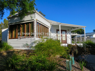
Photograph - Digital Photograph, Jim Connor, The Pavillion, Eltham Living and Learning Centre, 739 Main Road, Eltham, 29 November 2016
The Pavillion was an extension to the Eltham Living and Learning Centre which was opened 8 October, 1994 In 1857, tanner John Pearson purchased three and a half acres of land in Little Eltham, at the western end of Pitt Street, with a 70-foot frontage to Maria Street (Main Road) and stretching down to the Diamond Creek for £100. He contracted Benjamin Oliver Wallis to build house for him. Wallis, a mason by trade who originated from the Cornish village of Newlyn, migrated to Melbourne in 1853 and was shortly engaged by Richard Warren to build the Eltham Hotel, which opened in 1854. When Warren fell into financial difficulty in 1858, Wallis purchased the hotel. That same year, Pearson constructed a tannery below the house with access to the water in the Diamond Creek. When Pearson became bankrupt in 1867, Wallis similarly acquired the house from Pearson’s creditors in 1868 and lived there until his death in 1896. For some of this time the house was in the name of Wallis’s son Richard but following his death in 1888, ownership reverted to his father. It was purchased by retired teacher Richard Gilsenen in 1899. Gilsenen was made acting head teacher at the Eltham State School in 1906 following the sudden death of head teacher John Brown. In the 1950s the house was bought by retired engineer Dr Alfred Fitzpatrick and his wife Claire who made various modifications to house goats and poultry as well as structural modifications to the house. In the early 1970s, Eltham Shire Councillors Frank Maas and Don Maling proposed an extended communities’ activities program be set up and the Commonwealth Grants Commission was approached for financial assistance. In 1974 a $50,000 Commonwealth Grant was received by the Shire Council to acquire the Fitzpatrick property as part of the planning to establish an extended communities’ activities program. The Fitzpatricks moved next door and Claire taught at the new Living and Learning Centre, which began in 1975, one of the first community education centres in Victoria.jim connor collection, eltham, eltham living and learning centre, living and learning centre, pavilion -
 Eltham District Historical Society Inc
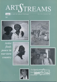
Journal, Peter Doughtery, ArtStreams: News in arts and cultural heritage; Vol. 2, No. 5, Oct-Nov 1997, 1997
Vol. 2, No. 5, Oct-Nov 1997 CONTENTS ART BRIDGES GAP IN WAR-TORN NATION Painter Piers Batman captures life in Eritrea 3 TENACITY OF THE HUMAN SPIRIT A teacher's road back from road trauma 7 EXHIBITIONS 10 POETRY Ray Liversidge 11 STUDIO WALKABOUT Artists open studios for Eltham Festival 12 ART FROM THE HEART Interview with Herman Pekel 14 ERITREAN JOURNEY Bill Moseley's camera in Eritrea 16 ART AND THE INTERNET Two Kangaroo Ground women bring art to a wider audience 18 HOUSE AND GARDEN IN SUBURBIA Exhibition of sculpture at Austin and Repatriation Medical Centre 20 THEATRE New Playbox - powerful advocate of Australian theatre 21 SHORT STORY Goodbye Dave, by Sherry Clarke 22 BOOK REVIEW 27 POETRY READING 28 BOOK REVIEW 29 EXPATRIATES COME HOME Former Nillumbik artists exhibit works 30 "Peter Dougherty has been involved in the local art scene for many years. As publisher and editor of the arts magazine Artstreams, his comments on the various branches of the arts are widely respected. His "The Arts" column in the Diamond Valley Leader presents a brief summary for a much wider cross section of the local community. Peter also operates his own gallery and the Artstreams Cafe at the St Andrews market. Peter has a wealth of knowledge about present day and historical aspects of local art and artists." - Eltham District Historical Society Newsletter No. 161, March 2005Colour front and back cover with feature articles and literary pieces with photographs and advertisements printed in black and white. 36 pages, 30 cm. Vol. 1, no. 1 (Nov. 1996) - Vol. 10, no. 5 (summer ed. 2005/06) art streams, thornton mccamish, bill moseley, eritrea, darebin festival, christine durham, michele lonsdale, ray liversidge, ona henderson, syd tunn, eltham festival, artists open studios program, nillumbik artists' open studios, david armfield, janet boddy, jules christian burns, wendy donald, jill forest, annie keil-taggart, ming bellamy mackay, jenni mitchell, grace mitchell, mervyn hannan, mary lou pittard, chris pittard, maureen runge, herman pekel, austin and repatriation medical centre, carolyn pickett, sherry clarke, manningham artspace, alan marshall short story award, eltham arts council inc., eltham library community gallery, harriot dance, chapman & bailey artists' stretchers and furniture, eltham high school -
 Eltham District Historical Society Inc
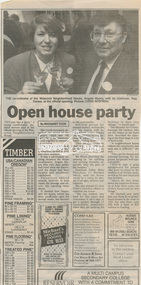
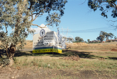
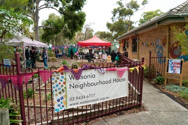
Newspaper clipping, Open house party by Margaret Cook, Diamond Valley News, 12 November 1991, 1991
Opening of Watsonia Neighbourhood House Photo of Co-ordinator Angela Myers and Chairman, Reg DaviesNewsprint1991, angela myers, diana and peter bassett-smith collection, eltham festival, opening, reg davies, watson neighbourhood house -
 Eltham District Historical Society Inc
Photograph (item), J.H. Clark, View of Eltham from Main Road, c.1907
An F-class 2-4-0 steam locomotive and tender hauls a train of two open wagons, a guards van and a single Tait passenger car over the Eltham Railway Trestle Bridge, heading for Melbourne. This type of steam locomotive was replaced by the F-Class 2-4-2. The house on the right, originally known as 'Derril' was purchased in the early 1920s by Walter Ernest and Alice Miriam Gahan. On the western side of Main Road near the present-day site of Shillinglaw Cottage, they remained till about 1960 when Walter died. The house was demolished in 1968 during the widening of Main Road. In the distance beyond the trestle bridge on what would become Central Park appears to be an orchard of fruit trees. A young man with waist coat, jacket and hat stands beside an older man wearing suspenders without jacket and bare headed, sitting on the post fence. Photographer: J.H. Clark John Henry Clark was the youngest of three boys born to William Henry Clark (1823-1877) and Maria White (1843-1914). He and his brothers, William Charles Clark (1872-1945), Clement Kent Clark (1874-1912) operated a photography business (Clark Bros.) from 25 Thomas Street, Windsor near Prahran during the period c.1894 to 1914. Following death of Clement in September 1912 and their mother in 1914, the Clark Bros business appears to have dissolved, the premises demolished, and a new house was under construction in 1915. John set up business independently in 1914 operating out of 29 Moor Street, Fitzroy where he is registered in the 1914 and 1915 Electoral Rolls. By 1916 John had relocated to Eltham where he continued his practice as a photographer and took many of the early images around the district of Little Eltham. Around 1930 John changed professions and opened a small cobbler's shop in 1931 near the pond opposite Dalton Street adjacent to the Jarrold family cottage. He never married and continued his profession as a bootmaker from this little shop, maintaining a close relationship with Mrs Jarrold for the rest of their lives. His bootmaker shop remains today beside the Whitecloud cottage and is one of only three remaining shops in the area from the early 20th century. There are a couple of images of Eltham taken by Clark Bros. in the Eltham District Historical Society collection, one such example being Hunniford’s Post Office with Miss Anne Hunniford out front (EDHS_00140 - marked on the back of the print, Clark Bros., 25 Thomas St. Windsor), which would date this image between c.1894 and 1914. Other early images of Eltham taken by John Henry Clark are marked on the face “J. H. Clark Photo” and it is assumed these are dated between 1914 and 1930. It is noted that the Grant of Probate for John H Clark of Eltham South dated 5 April !957 (513/387) records his occupation as "X Photographer".derril, eltham railway trestle bridge, f-class 2-4-0 steam locomotive, gahan house, j.h. clark photo, main road, orchards, postcards, steam train, tait train, victorian railways -
 Eltham District Historical Society Inc
Photograph, Jim Connor, Main Road, Eltham, 14 Jan 2017
The Eltham Hotel is the oldest continually operating hotel in the Eltham district. Initially referred to as the Little Eltham Hotel, it has been known as the Eltham Hotel since the 1850s through to present time with a very brief period as the Eltham Tavern in the late 1980s. Benjamin Oliver Wallis was a prominent Eltham resident, publican and Councillor during the second half of the nineteenth century. He owned the house that is now the Nillumbik Living and Learning Centre at 739 Main Road Eltham and one stage the Eltham Hotel. Wallis migrated to Melbourne in 1853 but his wife and children remained in Cornwall for a further 10 years. Later in 1853 Richard Warren engaged Wallis to build the Eltham Hotel and it opened in 1854. The hotel was constructed of hard basaltic blue stone quarried in the Eltham district and cemented together with mud, and partly of bricks made at Eltham. The Fountain of Friendship Hotel on the opposite side of Maria Street (Main Road) opened shortly after. The hotel was a well-known resting place for gold diggers during the gold rush at Woods’ Point and Warren would buy the gold from the diggers. In 1858 Warren fell into financial difficulties and had to sell the hotel. Wallis bought the hotel and obtained a publican’s licence in 1861. In the 1850s the Fountain had been the more popular hotel but after that the Eltham Hotel became more popular. It is understood that in about 1857 Wallis probably built the “Living and Learning house” for tanner John Pearson. In 1868 Pearson became bankrupt and Wallis acquired the house and he lived there until his death in 1896. For some of this time the house was in the name of Benjamin’s son Richard but he died in 1888 and ownership reverted to his father. Wallis was a member of the Eltham Jockey Club and in 1867 his wife Anna rode her horse Charlotte in the Annual Races. Anna was also an angler and is reported to have caught a large perch in the Yarra River. She died in 1887. On 16th September 1886 Wallis sold the hotel to Christopher Watson (Snr). Watson died in 1887 and the hotel passed to his son Christopher Watson (Jr) who owned it until his death in 1909 at which time his wife Emily took over the license. Upon her death, their son Herbert applied for the license in January 1915. In July 1925, Herbert Watson demolished the original building and, in its place, erected a modern hotel which remains the foundation of the present Eltham Hotel. The contractors at the time commented on how well the original building had been constructed. A description of the new building was detailed in the Advertiser newspaper of January 8, 1926: “The new building consists of. two stories. designed in English tavern style, and contains-all told, 24 rooms. On the second floor, in front uninviting the two gables is a deep balcony, which will be much appreciated by visitors. The lower story is wholly of brick, and the upper one of wood and fibrous cement plaster. The rooms are spacious and lofty, and the windows are large and of latest style, and light the rooms splendidly. The entrance hall is 8 feet wide. The bar is a very commodious room and is furnished in the most up-to-date and convenient manner. The dining room, a very attractive apartment, is 30 feet by 15 feet 6 inches, and the bar parlor is also a large and well furnished room. A large cellar, an indispensable adjunct to an hotel, has been excavated beneath the bar. On the upper story are 12 bedrooms, and among other conveniences are two bath rooms in which hot and cold water can be used. All the rooms have been supplied with the necessary appliances for electric lighting, which will be one of the progressive evidences which Eltham will shortly enjoy.” “In the yard a brick garage to accommodate three cars at once, has been erected. This, as well as the hotel, is roofed with tiles.” “From the front of the hotel (especially the balcony) a lovely view of the country west and, north may be obtained.” “It may be added that it Is intended to have an ornamental garden, a tennis court. and a kiosk in connection with the hotel, and the property will have a rustic fence round it.” The hotel has since undergone several modifications and extensionsTomorrow's history documented todayeltham, jim connor collection, main road, eltham gateway, eltham hotel, pitt street -
 Eltham District Historical Society Inc
Slide - Photograph, Woodhaven Estate off Reynolds Road, Eltham, c.May 1988
The Age, Saturday, April 15, 1989, Page 72 OPEN SAT SUN 2-4 WOODHAVEN ESTATE A sample of house and land packages for your consideration: 3 br Ige rumpus $159,950 4 br tri level $169.9S0 4 br split level $169,500 Colonial with verandahs $199,950 Big 4 br dble garage $235,000 Huge exec 5 br S266.000 Meet our representative on site 2-4pm Sat and Sun in Booth Court, Eltham. off Reynolds Rd. Melway ref 22.E.335mm colour positive transparency (1 of 23) Mount - Kodak EktachromeProcess Date MAY 88Mmain road, eltham, housing estate, nicholas lauder real estate, woodhaven estate -
 Eltham District Historical Society Inc
Slide - Photograph, Incident Control Centre, Kangaroo Ground, Ness Lane and Kangaroo Ground-St Andrews Road, c.May 1988
The Age, Saturday, April 15, 1989, Page 72 OPEN SAT SUN 2-4 WOODHAVEN ESTATE A sample of house and land packages for your consideration: 3 br Ige rumpus $159,950 4 br tri level $169.9S0 4 br split level $169,500 Colonial with verandahs $199,950 Big 4 br dble garage $235,000 Huge exec 5 br S266.000 Meet our representative on site 2-4pm Sat and Sun in Booth Court, Eltham. off Reynolds Rd. Melway ref 22.E.335mm colour positive transparency (1 of 23) Mount - Kodak EktachromeProcess Date MAY 88Mincident control centre, kangaroo ground, kangaroo ground-st andrews road, ness lane -
 Eltham District Historical Society Inc
Photograph, Harry Gilham, Shoestring, Metery Road, Eltham, March 2004, 2004
Built in the 1860s by David Clark, Head Teacher of Eltham State School No. 209. David Clark was the foundation Head Teacher of Eltham primary School which was opened in 1856 and situated on the current site since 1857.Colour printdavid clark, eltham primary school, eltham state school, houses, metery road, shoestring, streets -
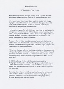 Mission to Seafarers Victoria
Archive (Collection) - Correspondence, Barbara Quinn, Allan Charles Quinn, 2011
Allan Charles Quinn and his motherAllan Charles Quinn letters and photographs to his mother during his seafaring life.ChronologicalLetters, enveloppes and photographsallan charles quinn (1928-1990), barbara quinn, asbetos, seaman, photographer, gary wright, asbestos, seafaring, travelsallan charles quinn (1928-1990), barbara quinn, asbetos, seaman, photographer, gary wright, asbestos, seafaring, travels -
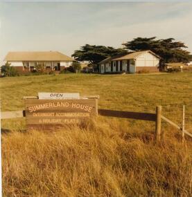 Phillip Island and District Historical Society Inc.
Photograph, John Cook, 1978-79
In 1927 Mr A. K. T. Sambell built a pier, planned and subdivided a residential estate, designed and built Summerland House, where ardent golfers after an enjoyable day on the course, could relax. Summerland House was built by local builder Mr Vic McRae. It attracted large numbers of professional people from Melbourne.Three photographs of Summerland Guesthouse, one of the first Guesthouses on the Island, situated above the site of the Penguin Parade. 81-87 Note sign: Open - overnight accommodation and holiday flats. 81-88 View of Summerland Guesthouse. Probably back view. Note elevated water tank. Car parked behind. 81-89 Another view of Summerland Guesthouse.coloured photograph, summerland guesthouse phillip island, akt sambell -
 Greensborough Historical Society
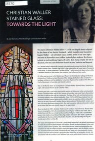
Article - Article, Newsletter, Christian Waller stained glass: towards the light
Article on female stained glass artist Christian Waller, published in the National Trust of Victoria newsletter. Ms Waller's Ivanhoe home "Waller House" is operated by the National Trust open, but not to the public in 2024 while undertaking restoration.2 p., text and colour imageschristian waller, stained glass, artists, ivanhoe, national trust of australia (victoria) -
 Greensborough Historical Society
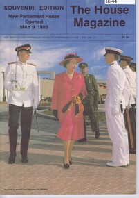
Magazine, Australia. Parliament, The House Magazine: Souvenir edition: New Parliament House opened May 9 1988, 1988
The House Magazine, Souvenir Edition, New Parliament House Opened May 9 1988. This magazine is published for senators and members of the House of Representatives. This edition contains information on the politicians who influenced the design and development of new Parliament House.59 pages , illustrations. (some colour)australia. parliament, australia. parliament house -
 Greensborough Historical Society
Slide - Photograph, John Ramsdale, Rural panorama: Slide 14
Photograph shows view across a road and open land to large house in a rural setting. At the time of the photograph was named 'Odyssey House' at Lower Plenty, Pre 1976 it was known as the Blessed Sacrament Fathers Seminary.Part of the John Ramsdale collection of slides and audio visual material.Colour photograph scanned from slide.No maker's marks. No caption on slide.rural landscape -
 Greensborough Historical Society
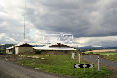
Photograph - Digital Image, Marilyn Smith, Watsonia Neighbourhood House, 15/06/2019
Watsonia Neighbourhood House, 47 Lambourn Road Watsonia. Provides adult education classes and workshops, as well as social and mutual-support activities. This photogrsph was taken at the Sustainable Watsonia Open Day 2019.Digital copy of colour photographwatsonia neighbourhood house, lambourn road watsonia, neighbourhood houses -
 Mission to Seafarers Victoria
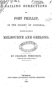
Booklet - Manual, Sailing directions for Port Phillip, in the colony of Victoria including the ports of Melbourne and Geelong, 1854
Captain Charles Ferguson was born in Scotland in 1813. He was the Master of the "Rajah" from 1838 to 1850 on voyages from England to Australia and vice versa. He became the First Chief Harbour Master for the port of Melbourne in 1852 after being the first Harbour Master and Water Police Officer in Geelong for 12 months. On the 5th of April 1841, the Rajah sailed with James Donovan M.D. as Surgeon Superintendent, and the Rajah sailed from Woolwich with 180 female convicts. The Rajah arrived on the 19th of July in Hobart, with 179 females (one died during the voyage) and 10 children. Miss Kezia Elizabeth Hayter was the matron on board. On page 28 of the "Sailing directions for Port Phillip, in the colony of Victoria including the ports of Melbourne and Geelong", a mention is made of the Mariner's Hospital and Floating Church soon to be established. There were discussions to built the hospital in Williamstown but instead the Government decided to build it in Melbourne. The Harbour Master and a commiittee decided to use the water police hulk, Emily, left unsold in 1856, to create a floating church: the Bethel was open in July 1857 with Reverend Kerr Johnston as Chaplain. Latrobe wrote a letter to Captain Cole in 1869, a few months after learning his death : "To Captain George Ward Cole † [from a draft in another’s hand] Clapham House, Lewes, Sussex, January 28th, 1869. My dear Captain Cole, Last mail will have taken out the sad intelligence of the death of our excellent old friend, Captain Ferguson. This will have been a terrible blow to his children and to his friends in the colony, who may have held reason to expect his early return to his home, with a not unreasonable prospect of ultimate restoration to health and activity. In the course of last October I went up to town with one of my children, mainly with the purpose of finding my way to Pinner, where he and Mrs. Ferguson were staying with an intimate friend. I found him in excellent health and spirits, and enjoying the prospect of a speeding resumption of the service to which he had devoted his best days, and upon the furtherance of which his entire energy was still directed. A week or two later Captain and Mrs. Ferguson went to Dover for change of air, and being still under the impression received from the advisers by whom they had been guided during their residence at a hydropathic establishment at Matlock, felt encouraged to plan almost immediate return to the colony by the Jerusalem early in December. However, certain misgivings in the mind of a medical gentleman, then in England, under whose care Captain Ferguson had at one time placed himself in Williamtown, led them to consider it judicious before departure to take the advice of some surgeon of eminence in London. Accordingly they came up to town at the close of November. The first London practitioners they consulted shook their heads, and advised consultation with Sir Wm. Ferguson. The result was that amputation, without loss of time, was pronounced necessary. The rest is soon told. He received the painful intelligence with calmness and full resignation to God's will, and underwent the operation at King's College Hospital with exemplary firmness and Courage on the 28th of November. Perfect success seemingly attended it, and there seemed, humanly speaking, to be every prospect of a prompt cure and early convalescence; everything seemed in his favour. A few days later, however, all was clouded by symptoms of hospital fever (pyoe æm ia). This resisted all control, and finally carried him off on the 27th of December, just one month after the operation. He had lived a Christian life, and his death was the peaceful and resigned death of a Christian. It was a melancholy satisfaction to me to be able to join a few friends in following his remains to their resting place in one of the outlying London cemeteries on the last day of the year. You know Mrs Ferguson well, and will be prepared to hear me say that her whole conduct and demeanour throughout this period of suspense and bitter trial has been worthy of her high character and steadfast principle. Come what will, and happen what may, I have the fullest conviction that neither the widow nor the children will be forsaken, however doubtful and clouded the future may appear, in consequence of the irreparable loss which, they have sustained. And now, dear Captain Cole, it is possible that you may already have heard all this from other sources, but I have dictated it to you under strong impulse, for I feel assured that there is no member of the community in which you live who will more sincerely deplore the loss of Captain Ferguson on private grounds; at the same time that there is no one who, from long acquaintance with his official character and services, will be in a better position to estimate their real value or the loss which the colony has sustained. The circumstances in which Captain Ferguson's family are left not only demands the utmost display of sympathy and interest on the part of friends, but may call for decided and prompt action; therefore I cannot rest satisfied without discharging what I consider my duty, and seeking to strengthen your hands as far as I may in bringing the character of his long services before the existing colonial authorities. Of his private career previous to his entering the service of the Colonial Government in 1851 nothing need be said. Captain Ferguson was appointed as the Harbour Master at Geelong in April, 1851 – a few months before the separation of the colony from New South Wales. He there did excellent service in a variety of ways calculated to advance the interests of the port, and to introduce www.latrobesociety.org.au 27 order, where, from circumstances, but little order had hitherto prevailed. His was the first appointment of this class in that locality. The separation of the colony from New South Wales took place in the month of July following. Shortly after, the late Captain Bunbury resigned the Harbour Mastership of Port Phillip. Captain Ferguson was at once (February, 1852) appointed to succeed him, and from that time performed all duties of Chief Harbour Master of the colony. The previous year (May 1851) the first gold discoveries in New South Wales had taken place, and in the month of August those of our colony followed. At the time of Captain Ferguson’s taking charge of the Port of Melbourne their influence had begun to be fully felt, and in no department more seriously than in that of the Harbour Master. This is no place for statistical details, but they must bear me out in reminding you of a few facts connected with our late friend’s career. At the time of separation that department comprised only 30 individuals of all ranks, and when he took charge the number was much reduced. There were at that time, according to the returns, no fewer than 54 vessels, registering 26,785 tons, in Hobson’s Bay alone. The crews on arrival numbered 1,235 men. Of this number only 463 remained on board, 500 having deserted, and the rest having been discharged by arrangement or pure necessity. For the first six months after Captain Ferguson’s assumption of office as Harbour Master the duties of Police Magistrate and Chief of the Water Police were superadded, and how much labour they involved may be surmised from the fact that from 1st of April to the 31st July, 1852, four months only, no less than 236 marine cases were brought before the bench at Williamstown - sometimes as many as 30 in a day. A year later (March 1853) the returns show that the number of vessels in the harbour in Hobson’s Bay alone were 91, tonnage 43,754; and passing on to the still later returns of May, 1853, two years after Captain Ferguson’s assumption of office, we find from the records that the number of ships in port had increased to 129; tonnage, 63,292; crew on board on arrival, 2872, and at the date of report, 1628; the amount of desertions at that time having, however, proportionally diminished, in consequence of the abatement of the gold fever, caused by the non-success attendant upon the labours of thousands at the goldfields. The above numbers take no account of the large number of vessels and amount of tonnage lying at the wharves at Melbourne or elsewhere. From these figures alone it may be judged what must have been a struggle in which the Chief Harbour Master was engaged from the very outset to secure order, and answer the innumerable calls on every branch of his department, at the same time that there was for many months an almost complete impossibility of securing subordinate agency, such as boatmen, pilots, and police, at any price. But I may bear witness to the untiring diligence, energy, and self-devotion with which Captain Ferguson grappled with the difficulties of his position, and the seemingly insurmountable obstacles which stood in his way. Ashore and afloat he was always ready, showing the same directness of purpose, intelligence, and forgetfulness of self. He shunned no responsibility, and turned his hand from no work, whether within or beyond the ordinary scope of his duty, which the hard necessity of the times forced the Government to bring under his notice. Already in 1852, when the overflowing of our gaol and stockade rendered the adoption of other methods of restraint absolutely necessary, and addition to the existing buildings could not be thought of, it was Captain Ferguson who first suggested the employment of hulks; and it was with his personal assistance and supervision, and under his unflagging energy, that the three first of these – the Success, the President, and the Sacramento – were purchased, fitted up, and made available for the purpose in view, and the rules and regulations for the employment and safety of the men afloat and ashore prescribed and carried out. He carried the same energy into every branch of his department, and his influence was soon apparent. His subordinates of every class became actuated by his spirit. As time moved on, the range of his duties, both ordinary and extraordinary, increased. In the formation of the quarantine station at the heads, in the management if not the erection of lighthouses, sailing directions, port and wharf regulations, buoys, signal stations, www.latrobesociety.org.au 28 steam dredging &c., he was the main and most active agent. The whole pilot establishment and regulations, men, and vessels, were under his charge; and when I left the colony in May, 1854, the entire range of ports outside Port Phillip Heads from Point Lonsdale to Portland, as well as that of Geelong had felt the influence of his intelligent supervision and care. The entire department of Chief Harbour Master, which I have numbered at the period of separation about thirty individuals, then numbered 230. The character of Captain Ferguson’s unbroken service during the fourteen years which have elapsed since I left the colony must be well known to the Government and the people he has served so long and so faithfully. I confine myself to recalling to mind those earlier, and what must have been the hardest and most difficult, period – none can know how difficult but those who were in that fierce struggle for the maintenance of order under so many disadvantages; and on this subject I have spoken advisedly and with reason, for I may truly say he worked under my own eye. I had sincere regard for the man, and just pride in the qualities of his heart, head, and hand. Whatever mistakes may have been made by the Government of the colony in those hard and difficult times (and I am quite ready to admit that there were many, especially if the past is to be judged by the light of the present), I never have hesitated in believing that, in appointing Captain Ferguson to the office he has so long filled, it was the right man in the right place. I shall be heartily rejoiced to find that the Government and inhabitants of the colony admit that this has been the case, and to learn that they have not forgotten the strong claims of one who has served them so long and so faithfully, and who, removed by God’s providence, so to say, in the maturity of his powers, has left a widow and young family behind him. I have done, I leave you to make use of this communication, or any portion of it, which you may think judicious and called for. There may be among Ferguson’s friends those who may not be sorry to be reminded of facts. By-the-bye, I may mention as a proof how completely Captain Ferguson’s mind was engrossed by devotion to his public duty, that while in Dover, only ten days before the operation, he took an opportunity to drag himself up into the lantern of the S. Foreland Lighthouse, and made a most careful scrutiny of the whole apparatus and arrangement, with a view of the adoption of any hint for the perfection of those under his charge in the colony. And now, goodbye. I trust this will find you in good health, and in comparative vigour. Believe me ever, dear Captain Cole, Yours very truly, C. J. La Trobe"The attempt for a floating church was made as early as 1853 following similar examples in London like the Seamen's Hospital. Captain Ferguson was instrumental in the foundation of the Bethel Church.Digital copies of the 37 pages ; 22 cm.1854, hobsons bay, geelong, melbourne, williamstown, sandridge, mariner's hospital, floating church, seamen's hospital, captain charles ferguson (1813-1868), kezia elizabeth hayter (1818-1885), rajah quilt, prison hulks, water police, harbour master, harbor master, gaols -
 Mission to Seafarers Victoria
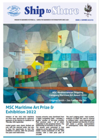
Magazine (item) - Newsletter, Mission to Seafarers Victoria, Ship to Shore , Issue 3 2022, November 2022
Ship to Shore was first printed in 1997. Inspired by the Jottings From Our Log, this modern version is generally published quarterly (Summer, Autumn, Winter, Spring) Articles are written by the mission's staff and give updates about shipping and seafaring news, staff, events, board Committee, heritage. It is sent by post or email to supporters, members, volunteers and friends of the mission. It is also available to the public in the Flying Angel club and online on the website.Ship to Shore is a valable source of informationship to shore, mission to seamen, mission to seafarers, flinders street, melbourne, victoria, news, events, art prize, exhibitions, concerts, open house, seafaring life, shipping, sailors, seamen, sponsors, marketing, festival, flying angel, staff, chaplains, heritage, collection, archives, sue dight, 2022, maritime art prize, williamstown historical society, phillip cornish, amaga, victorian collections, vc day -
 Mission to Seafarers Victoria
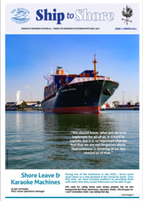
Magazine (item) - Newsletter, Mission to Seafarers Victoria, Ship to Shore , Issue 2 2022, November 2022
Ship to Shore was first printed in 1997. Inspired by the Jottings From Our Log, this modern version is generally published quarterly (Summer, Autumn, Winter, Spring) Articles are written by the mission's staff and give updates about shipping and seafaring news, staff, events, board Committee, heritage. It is sent by post or email to supporters, members, volunteers and friends of the mission. It is also available to the public in the Flying Angel club and online on the website.Ship to Shore is a valable source of informationship to shore, mission to seamen, mission to seafarers, flinders street, melbourne, victoria, news, events, art prize, exhibitions, concerts, open house, seafaring life, shipping, sailors, seamen, sponsors, marketing, festival, flying angel, staff, chaplains, heritage, collection, archives, 2022, maritime art prize, phillip cornish, weathervane, walter richmond butler (1864–1949) -
 Mission to Seafarers Victoria
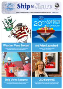
Magazine (item) - Newsletter, Mission to Seafarers Victoria, Ship to Shore , Issue 1 2022, November 2022
Ship to Shore was first printed in 1997. Inspired by the Jottings From Our Log, this modern version is generally published quarterly (Summer, Autumn, Winter, Spring) Articles are written by the mission's staff and give updates about shipping and seafaring news, staff, events, board Committee, heritage. It is sent by post or email to supporters, members, volunteers and friends of the mission. It is also available to the public in the Flying Angel club and online on the website.Ship to Shore is a valable source of informationship to shore, mission to seamen, mission to seafarers, flinders street, melbourne, victoria, news, events, art prize, exhibitions, concerts, open house, seafaring life, shipping, sailors, seamen, sponsors, marketing, festival, flying angel, staff, chaplains, heritage, collection, archives, 2022, maritime art prize, phillip cornish, weathervane, walter richmond butler (1864–1949), sue dight, theft -
 Mission to Seafarers Victoria
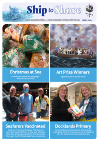
Magazine (item) - Newsletter, Mission to Seafarers Victoria, Ship to Shore , Issue 3 2021, November 2022
Ship to Shore was first printed in 1997. Inspired by the Jottings From Our Log, this modern version is generally published quarterly (Summer, Autumn, Winter, Spring) Articles are written by the mission's staff and give updates about shipping and seafaring news, staff, events, board Committee, heritage. It is sent by post or email to supporters, members, volunteers and friends of the mission. It is also available to the public in the Flying Angel club and online on the website.Ship to Shore is a valable source of informationship to shore, mission to seamen, mission to seafarers, flinders street, melbourne, victoria, news, events, art prize, exhibitions, concerts, open house, seafaring life, shipping, sailors, seamen, sponsors, marketing, festival, flying angel, staff, chaplains, heritage, collection, archives, maritime art prize, sue dight, 2021, docklands primary school, community, docklands, covid 19, vaccination, covid vaccine, xmas, christmas, pandemic -
 Mission to Seafarers Victoria
Magazine (item) - Newsletter, Mission to Seafarers Victoria, Ship to Shore , Issue 2 2021, November 2022
Ship to Shore was first printed in 1997. Inspired by the Jottings From Our Log, this modern version is generally published quarterly (Summer, Autumn, Winter, Spring) Articles are written by the mission's staff and give updates about shipping and seafaring news, staff, events, board Committee, heritage. It is sent by post or email to supporters, members, volunteers and friends of the mission. It is also available to the public in the Flying Angel club and online on the website.Ship to Shore is a valable source of informationship to shore, mission to seamen, mission to seafarers, flinders street, melbourne, victoria, news, events, art prize, exhibitions, concerts, open house, seafaring life, shipping, sailors, seamen, sponsors, marketing, festival, flying angel, staff, chaplains, heritage, collection, archives, maritime art prize, sue dight, 2021, community, docklands, covid 19, vaccination, covid vaccine, xmas, christmas, pandemic, simon burton, welfare, postcards, glass slides, nigel porteous, catherine aviss (nee frampton), herbert aviss, heritage tours, vera moore foundation, board members -
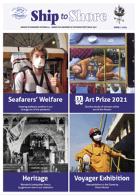
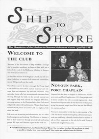 Mission to Seafarers Victoria
Magazine (item) - Newsletter, Mission to Seafarers Victoria, Ship to Shore , Issue 1 1997, January/February 1997
... news events open house seafaring life shipping sailors seamen ...Ship to Shore was first printed in 1997. Inspired by the Jottings From Our Log, this modern version is generally published quarterly (Summer, Autumn, Winter, Spring) Articles are written by the mission's staff and give updates about shipping and seafaring news, staff, events, board Committee, heritage. It is sent by post or email to supporters, members, volunteers and friends of the mission. It is also available to the public in the Flying Angel club and online on the website. This is the first Ship to Shore; the first year it was a bi-monthly newsletter.Ship to Shore is a valable source of informationship to shore, mission to seamen, mission to seafarers, flinders street, melbourne, victoria, news, events, open house, seafaring life, shipping, sailors, seamen, sponsors, marketing, flying angel, staff, chaplains, heritage, community, xmas, christmas, welfare, board members, rodney oliver, noyoun park, korean, bryce amner, sally cloke, cottage -
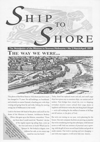 Mission to Seafarers Victoria
Magazine (item) - Newsletter, Mission to Seafarers Victoria, Ship to Shore , Issue 2 1997, March/April 1997
... to seafarers flinders street melbourne victoria news events open house ...Ship to Shore was first printed in 1997. Inspired by the Jottings From Our Log, this modern version is generally published quarterly (Summer, Autumn, Winter, Spring) Articles are written by the mission's staff and give updates about shipping and seafaring news, staff, events, board Committee, heritage. It is sent by post or email to supporters, members, volunteers and friends of the mission. It is also available to the public in the Flying Angel club and online on the website.Ship to Shore is a valable source of informationship to shore, mission to seamen, mission to seafarers, flinders street, melbourne, victoria, news, events, open house, seafaring life, shipping, sailors, seamen, sponsors, marketing, flying angel, staff, chaplains, heritage, community, xmas, christmas, welfare, board members, rodney oliver, bill romney, geelong mission, barque shandon, yarra river, southbank, casino, sea sunday, 1997