Showing 342 items
matching economic history
-
 Kew Historical Society Inc
Plan - Subdivision Plan, J R Mathers & McMillan, Clutha Subdivision, 1940
Pru Sanderson, in her groundbreaking ‘City of Kew Urban Conservation Study : Volume 2 - Development History’ (1988), summarised the periods of urban development and subdivisions of land in Kew. The periods that she identified included 1845-1880, 1880-1893, 1893-1921, 1921-1933, 1933-1943, and Post-War Development. These periods were selected as they represented periods of rapid growth or decline in urban development. An obvious starting point for Sanderson’s groupings involved population growth and the associated economic cycles. These cycles also highlighted urban expansion onto land that was predominantly rural, although in other cases it represented the decline and breakup of large estates. A number of the plans in the Kew Historical Society’s collection can also be found in other collections, such as those of the State Library of Victoria and the Boroondara Library Service. A number are however unique to the collection.The Kew Historical Society collection includes almost 100 subdivision plans pertaining to suburbs of the City of Melbourne. Most of these are of Kew, Kew East or Studley Park, although a smaller number are plans of Camberwell, Deepdene, Balwyn and Hawthorn. It is believed that the majority of the plans were gifted to the Society by persons connected with the real estate firm - J. R. Mathers and McMillan, 136 Cotham Road, Kew. The Plans in the collection are rarely in pristine form, being working plans on which the agent would write notes and record lots sold and the prices of these. The subdivision plans are historically significant examples of the growth of urban Melbourne from the beginning of the 20th Century up until the 1980s. A number of the plans are double-sided and often include a photograph on the reverse. A number of the latter are by noted photographers such as J.E. Barnes.The subdivision plan for the Clutha Subdivision is one of the largest in the Society’s collection. The plan includes a map of the proposed allotments, photographic views to the north and south, and information about the kinds of buildings that could be constructed on the allotments. The subdivision was bounded by Studley Park Road, and Carson, Stevenson and Edgecombe Streets. Two new streets, Mackie Court and Younger Street were created as part of the subdivision. The subdivision took its name from ‘Clutha’, the home of John Carson, who was to become Mayor of Kew in 1863. A Report to the City of Boroondara outlined how: ‘The Clutha estate was progressively developed from 1940, with new houses under construction on the Studley Park Road, Carson and Edgecombe Street frontages by 1941. By 1943, directory listings were available for all addresses with the exception of Mackie Court. Building ceased after the government’s prohibition on civilian building was enforced from 1942, with little change in listings until the 1950s when the remainder of the subdivision was developed’."H"subdivisions - kew - studley park, clutha subdivision, studley park road -
 Kew Historical Society Inc
Plan - Subdivision Plan, Jas R Mathers Son & McMillan, Macartney Estate, East Kew, c. 1925
Pru Sanderson, in her groundbreaking ‘City of Kew Urban Conservation Study : Volume 2 - Development History’ (1988), summarised the periods of urban development and subdivisions of land in Kew. The periods that she identified included 1845-1880, 1880-1893, 1893-1921, 1921-1933, 1933-1943, and Post-War Development. These periods were selected as they represented periods of rapid growth or decline in urban development. An obvious starting point for Sanderson’s groupings involved population growth and the associated economic cycles. These cycles also highlighted urban expansion onto land that was predominantly rural, although in other cases it represented the decline and breakup of large estates. A number of the plans in the Kew Historical Society’s collection can also be found in other collections, such as those of the State Library of Victoria and the Boroondara Library Service. A number are however unique to the collection.Subdivision plans are historically important documents used as evidence of the growth of suburbs in Australia. They frequently provide information about when the land was sold on which a built structure was subsequently constructed as well as evidence relating to surveyors and real estate and financial agents. The numerous subdivision plans in the Kew Historical Society's collection represent working documents, ranging from the initial sketches made in planning a subdivision to printed plans on which auctioneers or agents listed the prices for which individual lots were sold. In a number of cases, the reverse of a subdivision plan in the collection includes a photograph of a house that was also for sale by the agent. These photographs provide significant heritage information relating house design and decoration, fencing and household gardens.The Macartney Estate subdivision advertised 21 lots for sale on either side of Macartney Street (now Macartney Avenue) and Evans Road in what was then designated as East Kew. Most of the houses shown on the south side of Macartney Street then, as now, have rear entrances on Mount Street, however a number of these blocks have since been further subdivided to allow for the building of new houses on the rear of a block. Brougham Place is marked on the plan but is now called Daniell Place."C"subdivision plans - east kew, macartney estate, macartney street, mount street, evans road, brougham place -
 Kew Historical Society Inc
Plan - Subdivision Plan, J R Mathers & McMillan, Glenarbor Estate, 1934
Pru Sanderson, in her groundbreaking ‘City of Kew Urban Conservation Study : Volume 2 - Development History’ (1988), summarised the periods of urban development and subdivisions of land in Kew. The periods that she identified included 1845-1880, 1880-1893, 1893-1921, 1921-1933, 1933-1943, and Post-War Development. These periods were selected as they represented periods of rapid growth or decline in urban development. An obvious starting point for Sanderson’s groupings involved population growth and the associated economic cycles. These cycles also highlighted urban expansion onto land that was predominantly rural, although in other cases it represented the decline and breakup of large estates. A number of the plans in the Kew Historical Society’s collection can also be found in other collections, such as those of the State Library of Victoria and the Boroondara Library Service. A number are however unique to the collection.The Kew Historical Society collection includes almost 100 subdivision plans pertaining to suburbs of the City of Melbourne. Most of these are of Kew, Kew East or Studley Park, although a smaller number are plans of Camberwell, Deepdene, Balwyn and Hawthorn. It is believed that the majority of the plans were gifted to the Society by persons connected with the real estate firm - J. R. Mathers and McMillan, 136 Cotham Road, Kew. The Plans in the collection are rarely in pristine form, being working plans on which the agent would write notes and record lots sold and the prices of these. The subdivision plans are historically significant examples of the growth of urban Melbourne from the beginning of the 20th Century up until the 1980s. A number of the plans are double-sided and often include a photograph on the reverse. A number of the latter are by noted photographers such as J.E. Barnes.The little-known Glenarbor Estate comprised 23 allotments bordering Wellington and Denmark Streets and Fenton Avenue. The auction of the allotments in the Estate was held in the Kew Recreation Hall. The purported advantages to Kew are identified on the plan, such as the close proximity of the entrance to the Kew Railway Station and access to shops in Denmark Street. Due to its location, the subdivision was pitched at commercial as well as residential purchasers. The Estate was to cause a crisis in the Kew Council as a majority of councillors voted on 29 May to acquire the entire Estate as the location of a new Town Hall. The Estate was said to be valued at £50,000. A later meeting was to rescind the vote, instead opting for the compulsory acquisition of South Esk on the corner of Charles Street and Cotham Road. That acquisition was to be overturned by the State Government. The debate about the purchase of the Glenarbor Estate by Council coincided with the decision to widen High Street on the South side between Cotham Road and the Junction."D"subdivision plans - kew, glenarbor estate, wellington street, denmark street -
 Kew Historical Society Inc
Plan - Subdivision Plan, Jas R Mathers Son & McMillan, The Dale Estate, Deepdene, 1918
Pru Sanderson, in her groundbreaking ‘City of Kew Urban Conservation Study : Volume 2 - Development History’ (1988), summarised the periods of urban development and subdivisions of land in Kew. The periods that she identified included 1845-1880, 1880-1893, 1893-1921, 1921-1933, 1933-1943, and Post-War Development. These periods were selected as they represented periods of rapid growth or decline in urban development. An obvious starting point for Sanderson’s groupings involved population growth and the associated economic cycles. These cycles also highlighted urban expansion onto land that was predominantly rural, although in other cases it represented the decline and breakup of large estates. A number of the plans in the Kew Historical Society’s collection can also be found in other collections, such as those of the State Library of Victoria and the Boroondara Library Service. A number are however unique to the collection.The Kew Historical Society collection includes almost 100 subdivision plans pertaining to suburbs of the City of Melbourne. Most of these are of Kew, Kew East or Studley Park, although a smaller number are plans of Camberwell, Deepdene, Balwyn and Hawthorn. It is believed that the majority of the plans were gifted to the Society by persons connected with the real estate firm - J. R. Mathers and McMillan, 136 Cotham Road, Kew. The Plans in the collection are rarely in pristine form, being working plans on which the agent would write notes and record lots sold and the prices of these. The subdivision plans are historically significant examples of the growth of urban Melbourne from the beginning of the 20th Century up until the 1980s. A number of the plans are double-sided and often include a photograph on the reverse. A number of the latter are by noted photographers such as J.E. Barnes.The Dale Estate in Deepdene was made possible by the death of Robert Sparrow Smythe, Australian journalist, newspaper editor/owner and theatrical manager. Smythe lived in his residence ‘Highate’, Deepdene until his death in 1917. In the subdivision proposed one year later, before the end of the First World War, 18 allotments were to be created. The very fragmentary plan in the Society’s collection notes that a large weatherboard [house] will need to be removed. This may be Smythe’s own home. The proposed subdivision included allotments facing Burke and Whitehorse Roads and Dale Street. Bordering the subdivision is the Deepdene Station and the Outer Circle Railway Line. The clear directions on the plan indicate that in 1918 it was possible to travel by train from Deepdene to East Camberwell and Ashburtonsubdivision plans - deepdene, the dale estate -
 Kew Historical Society Inc
Plan - Subdivision Plan, Jas R Mathers Son & McMillan, Clifton Estate, Kew, c. 1916
Pru Sanderson, in her groundbreaking ‘City of Kew Urban Conservation Study : Volume 2 - Development History’ (1988), summarised the periods of urban development and subdivisions of land in Kew. The periods that she identified included 1845-1880, 1880-1893, 1893-1921, 1921-1933, 1933-1943, and Post-War Development. These periods were selected as they represented periods of rapid growth or decline in urban development. An obvious starting point for Sanderson’s groupings involved population growth and the associated economic cycles. These cycles also highlighted urban expansion onto land that was predominantly rural, although in other cases it represented the decline and breakup of large estates. A number of the plans in the Kew Historical Society’s collection can also be found in other collections, such as those of the State Library of Victoria and the Boroondara Library Service. A number are however unique to the collection.The Kew Historical Society collection includes almost 100 subdivision plans pertaining to suburbs of the City of Melbourne. Most of these are of Kew, Kew East or Studley Park, although a smaller number are plans of Camberwell, Deepdene, Balwyn and Hawthorn. It is believed that the majority of the plans were gifted to the Society by persons connected with the real estate firm - J. R. Mathers and McMillan, 136 Cotham Road, Kew. The Plans in the collection are rarely in pristine form, being working plans on which the agent would write notes and record lots sold and the prices of these. The subdivision plans are historically significant examples of the growth of urban Melbourne from the beginning of the 20th Century up until the 1980s. A number of the plans are double-sided and often include a photograph on the reverse. A number of the latter are by noted photographers such as J.E. Barnes.The Clifton Estate was an ambitious subdivision. It included 61 allotments bordering Cotham and Park Hill Roads, and Florence and Adeney Avenues. It is difficult to ascertain the exact year when the ‘Clifton Estate’ was surveyed, subdivided and first auctioned. The uncertainty may be due to allotments being released during the First World War. The subdivision took its name from the house ‘Clifton’ (lot 5) on the corner of Adeney Avenue and Cotham Road. The outline of Clifton (since demolished) and the extent of its land following the subdivision are represented on the plan. The auctioneers have also shown ‘Maryfield’ and ‘Wimba’, the neighbouring properties in Cotham Road, on the plan."B"subdivision plans - kew, clifton estate, cotham road, adeney avenue, florence avenue, park hill road -
 Kew Historical Society Inc
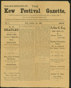
Newspaper, Kew Festival Gazette, No.1, October 5th 1895, 1895
The first known use of the term 'Kew Festival'.The Kew Festival Gazette, 5 October 1895 is a four-page mock-up newspaper, published from the Boroondara Standard office to advertise and publicise a Kew Festival. The Festival was not associated with the current Kew Festival, which was founded in 1974, but was principally a bazaar held in the Kew Recreation Hall to raise money for the Kew Catholic Church Building Fund which was associated with the Jesuit Mission. Perhaps because of the recent economic depression, the Mission was in financial difficulties and it was hoped that the bazaar would raise enough money to ease the situation. According to the Gazette, ‘All Kew has been in a gentle simmer of excitement for some time past over the coming Sacred Heart Bazaar in aid of the Jesuit Mission funds. Wherever one goes the talk is of the bazaar, and whoever one meets is either a stallholder, an assistant or an intending purchaser.’ There are a few items in the Gazette about other local events, including a cake fair and sale of works, and a history of bazaars that traces them from the Middle East via Britain to Kew. One article contains some examples of nineteenth century humour, including ‘the lady stallholders will not have to pay income tax on their takings’. The advertisements reflect the goods and services available to Kew residents in 1895 – groceries, wine & spirits, hay, corn, chaff, ironmongery, timber, drapery, millinery, gas cookers, and an undertaker and embalmer. kew festival gazette, kew catholic church, boroondara standard -
 Kew Historical Society Inc
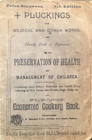
Book, T M Donaldson & Co, Pluckings from medical and other works and handy book of reference for the preservation of health and management of children, 1890-99
A booklet produced for families advising about simple remedies and useful hints referring to the Sick Room, also Horses, Dogs, Birds etc. Included in the book is the Melbourne Economic Cookery Book. Amongst cures is advice on the treatment of Diphtheria which is to drink olive oil freely.non-fictionpluckings, cookery book -
 Kew Historical Society Inc
Plan - Subdivision Plan, Plan of Subdivision of Part of Crown Portion 84 / Parish of Boroondara / County of Bourke / Lodged Plan No. 2217, Twentieth Century
Pru Sanderson, in her groundbreaking ‘City of Kew Urban Conservation Study : Volume 2 - Development History’ (1988), summarised the periods of urban development and subdivisions of land in Kew. The periods that she identified included 1845-1880, 1880-1893, 1893-1921, 1921-1933, 1933-1943, and Post-War Development. These periods were selected as they represented periods of rapid growth or decline in urban development. An obvious starting point for Sanderson’s groupings involved population growth and the associated economic cycles. These cycles also highlighted urban expansion onto land that was predominantly rural, although in other cases it represented the decline and breakup of large estates. A number of the plans in the Kew Historical Society’s collection can also be found in other collections, such as those of the State Library of Victoria and the Boroondara Library Service. A number are however unique to the collection.The Kew Historical Society collection includes almost 100 subdivision plans pertaining to suburbs of the City of Melbourne. Most of these are of Kew, Kew East or Studley Park, although a smaller number are plans of Camberwell, Deepdene, Balwyn and Hawthorn. It is believed that the majority of the plans were gifted to the Society by persons connected with the real estate firm - J. R. Mathers and McMillan, 136 Cotham Road, Kew. The Plans in the collection are rarely in pristine form, being working plans on which the agent would write notes and record lots sold and the prices of these. The subdivision plans are historically significant examples of the growth of urban Melbourne from the beginning of the 20th Century up until the 1980s. A number of the plans are double-sided and often include a photograph on the reverse. A number of the latter are by noted photographers such as J.E. Barnes.Undated Plan of Subdivision of Crown Portion 84 in what is now Kew. The area shown is bordered by Burke Road, Harp Road, Arglye Road and Normanby Road.subdivision plans -- kew (vic), harp road, burke road, normanby road, lady loch's drive, gladstone street, second avenue, first avenue -
 Kew Historical Society Inc
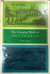
Book, Franklin Watts, The Changing World of Australia, 1963
General history with very brief mention of Aborigines.New York : Franklin Watts, 1963 vii, 253 p. ; 25 cm. non-fictionGeneral history with very brief mention of Aborigines.settlement and contacts - colonisation., settlement and contacts - ancient and early historical., politics and government - sovereignty, economic sectors - agriculture and horticulture - pastoral industry., settlement and contacts - government settlements, history - political. | settlement and contacts - settlers., australia -- history. -
 Surrey Hills Historical Society Collection
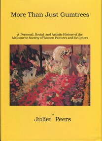
Book, More than just gumtrees: a personal, social and artistic history of the Melbourne Society of Women Painters and Sculptors, 1993
Joan Richard was a speaker at the Surrey Hills Historical Society meeting in November 2013. A watercolourist, she has been a long standing member of MSWPS, Past and Recent President in 2017 and a Life Member. The Melbourne Society of Women Painters and Sculptors was founded in 1902 by women who had been students at the Art School of the National Gallery of Victoria, to provide a forum for artistic discussion and an opportunity to view and comment on each other's work. Originally named the Students' Art Club, it became "Woomballana" (meaning either 'everlasting beauty' or 'search for beauty') Art Club, The Women's Art Club, the Melbourne Society of Women Painters and finally, in 1954, the present title was adopted. The history of the MSWPS and its members’ achievements, issues of the workplace, family and art commitments, the economic survival of artists, migrant artists and prejudice against women are also explored. Much of the information in “More Than Just Gumtrees” has not been available in previous publications; it includes hitherto unpublished sources - oral history interviews, minute books, reviews, letters, early photographs. There are includes biographies of over 300 artists, with individual exhibition lists, representation in public collections etc REF: MSWPS website. Artist Mabel Pye, who lived in Surrey Hills, is one of the featured artists.A history of the Melbourne Society of Women Painters and Sculptors and of the women who have belonged since 1902. Some of these women have become well-known to the art world, other have slipped by un-noticed. Incl. index, bibliography.To the Surrey Hills/Historical Society/Presented by/Joan Richard/19th November/2013melbourne society of women painters and sculptors, women painters, women sculptors, mabel pye, joan richard -
 Mrs Aeneas Gunn Memorial Library
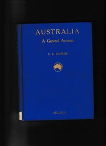
Book, T. Nelson and sons, Australia : a general account - history, resources, production, social conditions, 1929
Outline of geography, European exploration and settlement, economic development, social condition, flora and fauna; includes a brief general account of Aboriginal culture.Index, Ill, maps, p.272.non-fictionOutline of geography, European exploration and settlement, economic development, social condition, flora and fauna; includes a brief general account of Aboriginal culture.australia - social life and customs, australia - history -
 Mrs Aeneas Gunn Memorial Library
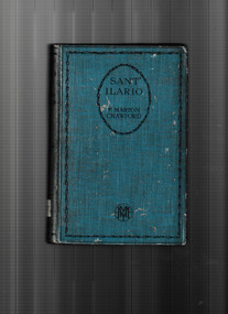
Book, Francis Marion Crawford, Sant' Ilario, 1926
Sant' Ilario is an absorbing story depicting the impact of social change on an Italian family during the late 1800s. Set mostly in Rome, it tells the fascinating tale of Sant' Ilario, A Lady of Rome, and Giovanni Saracinesca. The novel presents an interesting picture of the period, describing the spiritual and economic concerns of the aristocracy at a time when its power and position were under attack from the emerging forces of modernity.P.443.fictionSant' Ilario is an absorbing story depicting the impact of social change on an Italian family during the late 1800s. Set mostly in Rome, it tells the fascinating tale of Sant' Ilario, A Lady of Rome, and Giovanni Saracinesca. The novel presents an interesting picture of the period, describing the spiritual and economic concerns of the aristocracy at a time when its power and position were under attack from the emerging forces of modernity.england - fiction, italy - history -
 Mrs Aeneas Gunn Memorial Library
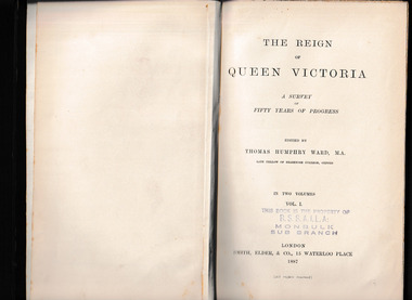
Book, Smith Elder and Co, The reign of Queen Victoria : a survey of fifty years of progress v.1, 1887
A study of the history of Great Britain during the reign of Queen VictoriaMap, p.594.non-fictionA study of the history of Great Britain during the reign of Queen Victoriagreat britain - social conditions - 19th century, great britain - economic conditions - 19th century -
 Mrs Aeneas Gunn Memorial Library
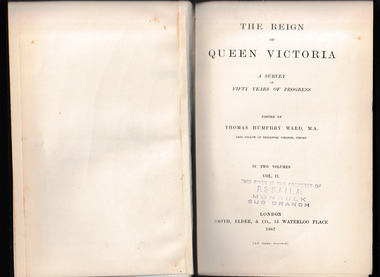
Book, Smith Elder and Co, The reign of Queen Victoria : a survey of fifty years of progress v.2, 1887
A study of the history of Great Britain during the reign of Queen VictoriaMap, p.620.non-fictionA study of the history of Great Britain during the reign of Queen Victoriagreat britain - social conditions - 19th century, great britain - economic conditions - 19th century -
 Friends of Ballarat Botanical Gardens History Group
Work on paper - "The Cultural and Economic Impact of the Begonia Festival on Ballarat and its District". Reverend W.W. Devonshire, A Perspective on the Begonia Festival
john garner collection, ballarat botanical gardens, gardens, ballarat, devonshire, begonia festival -
 Bacchus Marsh & District Historical Society
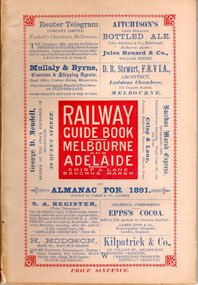
Book, Railway guide book and time table for Melbourne, Ballarat, Adelaide and all intermediate stations, also gazette for Bacchus Marsh, Ballan, Melton, &c., and almanac for 1891
Publication details: 'Railway guide book and time table for Melbourne, Ballarat, Adelaide and all intermediate stations, also gazette for Bacchus Marsh, Ballan, Melton, &c., and almanac for 1891', compiled by Christopher Crisp. Printed and published by Crisp and Lane, Bacchus Marsh, Vic., 1891. SUMMARY OF CONTENT: Includes detailed timetables and schedule of fares, descriptions of stations and refreshment facilities pp.6-26; overviews of Shires of Bacchus Marsh, Ballan and Melton, pp.27-30; historical, geographic, and economic background notes about places on the Melbourne to Adelaide route, pages 31-64, including descriptions of Bacchus Marsh, pp.34-42 and briefer notes on Ballan, pp.42-43 and Melton, pp.32-33. Almanac section is pp.65-95 (not numbered), containing common information in nineteenth century almanacs such as a calendar of the days, weeks, and months of the year; a record of various astronomical phenomena, climate information and seasonal suggestions for farmers, the rising and setting times of the Sun and Moon, dates of eclipses, hours of high and low tides, and religious festivals. A brief history of Irrigation in Mildura is on pages 1 and 112 (first and last pages). Advertisements, mostly for Bacchus Marsh businesses are on pp.96-111. The Almanac section is illustrated with drawings of scenic views of various places in Australia, but none of the Bacchus Marsh region. Online access is available on Trove at: http://nla.gov.au/nla.obj-392504046Printed book. 112 pages in total. Pages 13 -64 numbered.non-fictionPublication details: 'Railway guide book and time table for Melbourne, Ballarat, Adelaide and all intermediate stations, also gazette for Bacchus Marsh, Ballan, Melton, &c., and almanac for 1891', compiled by Christopher Crisp. Printed and published by Crisp and Lane, Bacchus Marsh, Vic., 1891. SUMMARY OF CONTENT: Includes detailed timetables and schedule of fares, descriptions of stations and refreshment facilities pp.6-26; overviews of Shires of Bacchus Marsh, Ballan and Melton, pp.27-30; historical, geographic, and economic background notes about places on the Melbourne to Adelaide route, pages 31-64, including descriptions of Bacchus Marsh, pp.34-42 and briefer notes on Ballan, pp.42-43 and Melton, pp.32-33. Almanac section is pp.65-95 (not numbered), containing common information in nineteenth century almanacs such as a calendar of the days, weeks, and months of the year; a record of various astronomical phenomena, climate information and seasonal suggestions for farmers, the rising and setting times of the Sun and Moon, dates of eclipses, hours of high and low tides, and religious festivals. A brief history of Irrigation in Mildura is on pages 1 and 112 (first and last pages). Advertisements, mostly for Bacchus Marsh businesses are on pp.96-111. The Almanac section is illustrated with drawings of scenic views of various places in Australia, but none of the Bacchus Marsh region. Online access is available on Trove at: http://nla.gov.au/nla.obj-392504046railways, railway lines, almanacs, railway lines timetables -
 Bacchus Marsh & District Historical Society
Book, John Lloyd, The Road District Years, 1853-1871: Local Government in Bacchus Marsh
This work describes the early evolution and history of local government in the Bacchus Marsh area. Local government bodies in Victoria and in other places had their origins in committees and local boards which were established to regulate over pressing local issues, raise revenue, and expend it in a limited range of social and economic ways. The early areas of responsibility were dominated by the need for local roads and this book primarily looks at this period of local government history in the Bacchus Marsh area. Overtime the range of areas local government bodies took responsibility for expanded and this work begins to trace this transformation in its earliest stages. It is a fascinating and detailed account of the early history of local government in Bacchus Marsh containing many amusing anecdotes among the wealth of administrative historical data. The author who was at one time an employee of the Shire of Bacchus Marsh has drawn directly from the early local records such as minutes of meetings, records of expenditure, newspaper reports and notices in the Victoria Government Gazette.Soft cover foolscap size book. 128 pages with b & w illustrations, maps and plans. No publisher is indicated in the work but it is likely to have been privately published by the author John Lloyd. Year and place of publication is 1986, Bacchus Marsh, Victoria.non-fictionThis work describes the early evolution and history of local government in the Bacchus Marsh area. Local government bodies in Victoria and in other places had their origins in committees and local boards which were established to regulate over pressing local issues, raise revenue, and expend it in a limited range of social and economic ways. The early areas of responsibility were dominated by the need for local roads and this book primarily looks at this period of local government history in the Bacchus Marsh area. Overtime the range of areas local government bodies took responsibility for expanded and this work begins to trace this transformation in its earliest stages. It is a fascinating and detailed account of the early history of local government in Bacchus Marsh containing many amusing anecdotes among the wealth of administrative historical data. The author who was at one time an employee of the Shire of Bacchus Marsh has drawn directly from the early local records such as minutes of meetings, records of expenditure, newspaper reports and notices in the Victoria Government Gazette.bacchus marsh shire council, local government bacchus marsh history -
 The Celtic Club
Book, Heather Radi, Jack Lang, 1977
The book is the result of the Society of Labour History's commitment to collect and publish the achievements and impact of labour social and economic policies and their impact on Australian society.Index, bib, ill, p.282.The book is the result of the Society of Labour History's commitment to collect and publish the achievements and impact of labour social and economic policies and their impact on Australian society.australia - politics and government, jack lang - biography -
 Wodonga & District Historical Society Inc
Domestic object - Haeusler Collection Teapot
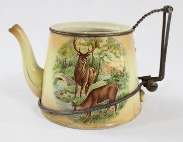
The Wodonga Historical Society Haeusler Collection provides invaluable insight into life in late nineteenth and early twentieth century north east Victoria. The collection comprises manuscripts, personal artefacts used by the Haeusler family on their farm in Wodonga, and a set of glass negatives which offer a unique visual snapshot of the domestic and social lives of the Haeusler family and local Wodonga community. The Haeusler family migrated from Prussia (Germany) to South Australia in the 1840s and 1850s, before purchasing 100 acres of Crown Land made available under the Victorian Lands Act 1862 (also known as ‘Duffy’s Land Act’) in 1866 in what is now Wodonga West. The Haeusler family were one of several German families to migrate from South Australia to Wodonga in the 1860s. This teapot is one of the many domestic objects in the Haeusler Collection that represent family and home life in early twentieth century Wodonga. The ingenious repair to the teapot's handle reflects the resourcefulness and thriftiness of the Haeusler family during the economic hardships of the 1930s Great Depression. The teapot was manufactured in England, likely dating from the early twentieth-century. This item has well documented provenance and a known owner. It forms part of a significant and representative historical collection which reflects the local history of Wodonga. It contributes to our understanding of domestic and family life in early twentieth century Wodonga, as well as providing interpretative capacity for themes including local history, social history, and women’s history. A glazed ceramic teapot with a printed design depicting two deer and a hunter in a woodland on one side, and two deer by a stream in a woodland on the other. The broken handle of the teapot has been replaced with wire. The teapot handle was repaired by Alfred Haeusler (b.1922, d.1997) and holds remarkable balance, perfectly retaining its function. Faded, circular makers mark on the base of teapot, illegible/"ENGLAND"teapot, teaware, tableware, ceramic, domestic, social history -
 Melbourne Legacy
Document, Resume of history of formation of W.D. Joynt & Company Pty. Ltd
Detailed account of the business history of Legatee W.D.Joynt VC prepared by Mrs Beryl Luff. Joynt was the seventh member of the newly formed Legacy in 1923 and became a member of the Board of Management in 1924 and worked closely with Stan Savige. He was also instrumental in gaining the support of both General Sir John Monash and the R.S.L. to build the Shrine of Remembrance, as well as ensuring media backing and thus public support for the project. He worked tirelessly for Legacy for 38 years until he retired at the age of 84, and entered fully into comradeship activities throughout his involvement. He won his VC in 1917 at Chuignes during one of the last battles on the Somme. The Victoria Cross is the highest award for acts of bravery in wartime and was instituted in 1856 by Queen Victoria. See also Cat No 01303. Mrs Luff wrote extensively about Joynt's business career and the challenges he faced throughout the Great Depression and the Second World War. Despite initially losing his farm and then a colour printing business he went on to form W.D. Joynt & Co which began by printing advertising and moved on to general printing, ultimately becoming one of the three largest paperback printers in Australia. in 1976, due to the then economic difficulties in Australia, the company went into receivership, but managed to trade its way out and eventually printed most of Mills & Boon's popular romance series. In 1981 the company became part of the McPherson Group of Companies and Joynt retired. His qualities of leadership, persistence and business acumen were of great benefit to Melbourne Legacy. Illustrates some of the difficulties faced by early Legatees throughout their working lives as a result of global economic crises.5 x typed sheets black on whiteBox 16 L14 in black biro on first pagedonovan joynt, founding legatee -
 Melbourne Legacy
Book, Carry On. A History of Carry On (Victoria) 1932 - 1998, 1998
The book is about the history of the Carry On Club which was set up in 1932 along similar lines to Legacy. Their main focus is to help with the care for veterans and their dependents. The founder was WL Hawkins (1861-1969), who served in the First AIF in 1915 and saw active service in France. He attained the rank of Lieutenant. With the economic collapse of 1929 he saw a need to help the many unemployed ex-servicemen. He discussed his ideas with Stan Savige of Legacy. Liaison between Carry On and the other ex-service organisations continues to the present day.A record of the founding of the Carry On Club and its history to 1998.Green cloth hardcover book x 80 pages about the history of Carry On, with a white paper dustcover with flags.Flyleaf is inscribed as a gift to Melbourne Legacy from the president and members of the Carry On Club in 1999.carry on club, history, hawkins -
 Bendigo Military Museum
Photograph - Army Survey Regiment Open Day - Briefings and Tours, Fortuna, Bendigo, 1990
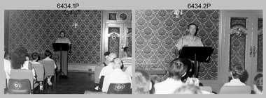
These 27 photographs were taken at an Army Survey Regiment Open Day at Fortuna Villa, Bendigo on the 24th of February 1990. This occasion was one of several events held to commemorate the 75th anniversary of the formation of the Royal Australian Survey Corps. Although historical tours of Fortuna occurred on a regular basis, this was the first technical open day since 1972. The Royal Australian Survey Corps recognised that an Open Day was the best way for the local community in Bendigo to gain an insight into the unit’s important role as Defence’s map production agency, its technical equipment, and its economic importance to Bendigo. It also gave them an opportunity to tour through historic Fortuna Villa. This occasion is covered in more detail in page 143 of Valerie Lovejoy’s book 'Mapmakers of Fortuna – A history of the Army Survey Regiment’ ISBN: 0-646-42120-4. Refer to items 6435.35P and 6436.18P for more photos of the Open Day taken in the Map Production areas of Air Survey and Cartographic Squadron, and production areas of Lithographic Squadron. Photo prints of some of these photos were scanned and catalogued in items 6247.30P and 6291.6P.These 27 photographs were taken at an Army Survey Regiment Open Day held at Fortuna, Bendigo on the 24th of February 1990. The 35mm colour and black & white negatives photographs were scanned at 96 dpi and are part of the Army Survey Regiment’s Collection. .1) & .2) - Photo, black & white, 1990. Ballroom - Visitor briefings by CO LTCOL Rene van den Tol. .3) - Photo, colour, 1990. Ballroom - Visitor briefings by MAJ Ray Redman. .4) - Photo, colour, 1990. Ballroom - Visitor briefings by unidentified UK Exchange officer. .5) - Photo, black & white, 1990. Music Room - Visitor briefings by MAJ Bob Williams. .6) - Photo, black & white, 1990. Orderly Room - ADJT CAPT Peter Parkes. .7) - Photo, colour, 1990. Music Room - ADJT CAPT Peter Parkes with civilian visitors. .8) - Photo, colour, 1990. Music Room - Visitor briefings by CPL Le-Anne (Smallshaw) Shirley. .9) - Photo, colour, 1990. Entrance Foyer - Visitor briefings. .10) - Photo, colour, 1990. CO’s Office - Visitor briefings by CPL Raelene (Munting) Brodie. .11) - Photo, colour, 1990. Mr Pat Thwaites outlining utilisation of satellite imagery to civilian visitors. .12) - Photo, black & white, 1990. Mr Pat Thwaites outlining utilisation of satellite imagery to civilian visitors. .13) - Photo, colour, 1990. Staircase leading up to the top floor - Visitor briefings by CPL Ian Nelson. .14) - Photo, colour, 1990. Building 16 - Visitor briefings by RSM WO1 Neville Stone. .15) - Photo, colour, 1990. Civilian visitors enjoying views of the garden from Fortuna Villa’s rooftop. .16) - Photo, black & white, 1990. Visitor briefings at Fortuna’s rear steps. .17) - Photo, black & white, 1990. Outside Building 16 - Visitor briefings by WO1 Gary Warnest. .18) - Photo, colour, 1990. Outside Building 16 - Visitor briefings by WO2 Adrian ‘Charlie’ Creedy. .19) - Photo, colour, 1990. Outside Building 16 - L to R: SPR Sue (Foote) Bourne, LCPL Sandy Winn, WO2 Adrian ‘Charlie’ Creedy. .20) - Photo, colour, 1990. Outside Building 16 - SGT Greg Byers. .21) - Photo, colour, 1990. Visitors enjoying Devonshire Tea in the gardens next to the Tavern. .22) - Photo, colour, 1990. RSM WO1 Neville Stone and family enjoying Devonshire Tea in the gardens next to the Tavern. .23) - Photo, colour, 1990. Visitors relaxing in the garden next to Fortuna’s lake. .24) - Photo, black & white, 1990. CPL Trevor Poll and others serve up BBQ lunch next to the tennis courts. .25) to .27) - Photo, colour, 1990. Parking at a premium inside the Army Survey Regiment and Chum Street..1P to .27P – no annotationsroyal australian survey corps, rasvy, army survey regiment, army svy regt, fortuna, asr -
 Victorian Railway History Library
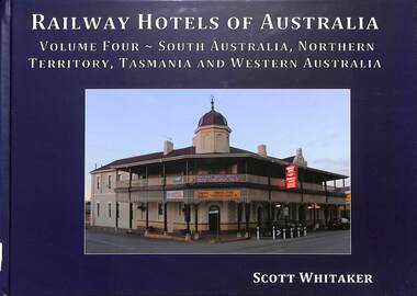
Book, Whitaker, Scott, Railway Hotels of Australia Volume Four - South Australia, Northern Territory, Tasmania and Western Australia, 2019
The coming of the railway was a major event in the history of many towns and cities across Australia. This is the story behind every Railway Hotel; and the social, economic and political themes that have shaped society over the last 150 years.index, ill, maps, p.312.non-fictionThe coming of the railway was a major event in the history of many towns and cities across Australia. This is the story behind every Railway Hotel; and the social, economic and political themes that have shaped society over the last 150 years.australia -- buildings, structures, etc -- history, bars (drinking establishments) -- australia -- history -
 Victorian Railway History Library
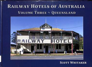
Book, Whitaker, Scott, Railway Hotels of Australia Volume Three - Queensland, 2017
The coming of the railway was a major event in the history of many towns and cities across Australia. This is the story behind every Railway Hotel; and the social, economic and political themes that have shaped society over the last 150 years.index, ill, maps, p.276.non-fictionThe coming of the railway was a major event in the history of many towns and cities across Australia. This is the story behind every Railway Hotel; and the social, economic and political themes that have shaped society over the last 150 years.australia -- buildings, structures, etc -- history, bars (drinking establishments) -- australia -- history -
 Victorian Railway History Library
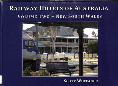
Book, Whitaker, Scott, Railway Hotels of Australia Volume Two - New South Wales, 2016
The coming of the railway was a major event in the history of many towns and cities across Australia. This is the story behind every Railway Hotel; and the social, economic and political themes that have shaped society over the last 150 years.index, ill, maps, p.296.non-fictionThe coming of the railway was a major event in the history of many towns and cities across Australia. This is the story behind every Railway Hotel; and the social, economic and political themes that have shaped society over the last 150 years.australia -- buildings, structures, etc -- history, bars (drinking establishments) -- australia -- history -
 Victorian Railway History Library
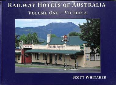
Book, Whitaker, Scott, Railway Hotels of Australia Volume One - Victoria, 2015
The coming of the railway was a major event in the history of many towns and cities across Australia. This is the story behind every Railway Hotel; and the social, economic and political themes that have shaped society over the last 150 years.index, ill, maps, p.260.non-fictionThe coming of the railway was a major event in the history of many towns and cities across Australia. This is the story behind every Railway Hotel; and the social, economic and political themes that have shaped society over the last 150 years.australia -- buildings, structures, etc -- history, bars (drinking establishments) -- australia -- history -
 Victorian Railway History Library
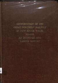
Book, Rowe, Denis, John, Construction of the Great Northern Railway in New South Wales 1854-1889, 1986
... Victorian Railway History Library 39 St Edmonds Rd Prahran ...A thesis for a Masters of Arts degree on the construction of the Great Northern Railway in New South Wales from Sydney to Wallangarra 1854-1889: An economic and labour history.ill, maps, p.226.non-fictionA thesis for a Masters of Arts degree on the construction of the Great Northern Railway in New South Wales from Sydney to Wallangarra 1854-1889: An economic and labour history.railroad construction - new south wales - history, railroad construction - australia - history -
 Warrnambool and District Historical Society Inc.
Functional object - Cloth Chart, A.E. Putnam Co. Iowa, U.S.A, c. 1896
... in local social and economic history. The possible connection ...This item was used to measure accurately the length of cloth on a bolt of material without unwinding it. It also measured lace, all types of textiles and spools of ribbon. It is surmised it would have been used in general stores or department stores in the late 19th and early 20th centuries. This item was discovered in the late 1980s behind an old safe at Swintons Stores in Timor Street in Warrnambool. The item appears to have been used extensively and would have been very useful during a stocktake. It may have been used in the Swinton Stores which were first established in Timor Street in 1865 with one section of the stores selling furnishings, furniture, clothing and clothing materials. The item was manufactured by A.E. Putnam of Iowa, U.S.A. There was a patent registered in 1896 and a later 'improved' model with a patent date of 1907. This item is of considerable interest because of its rarity and survival, its connection to Warrnambool General Stores in the past and its value as a research tool in local social and economic history. The possible connection to Swintons Stores is important as this business operated from 1865 to 2024 and was one of the longest-surviving family businesses in Australia. This is a rectangular-shaped wooden pole with one slightly flattened side and numbers marked on each side in patterns resembling brick walls. At the top of the pole are two wooden pieces attached to the pole by metal clips held by screws. The two wooden pieces are attached at a slight angle to the pole. The lower wooden piece is movable along the pole and has incised numbers. The wooden pieces are rectangular in shape with a large curved piece cut out to form the shape of a pennant. The maker's name is incised into the metal on the top attached wooden piece. Putnam's Cloth Chart Copyrighted 1896 Patent Pend'ggeneral stores in warrnambool, swintons stores in warrnambool, vintage measuring instrument for cloth -
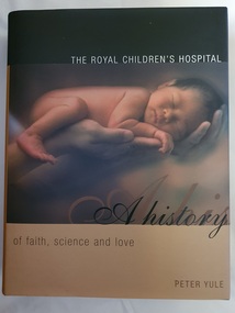 Alfred Hospital Nurses League - Nursing Archive
Book - Illustrated book, Peter Yule, The Royal Children's Hospital: a history of faith science and love, 1999
An insight into the origins and development of the Royal Children's Hospital, Melbourne. Opening in 1870 with six rooms as "the Melbourne Free Hospital for Sick Children, it has grown into a major paediatric institution. As well as the hospitals history, the book provides insisight into the soacial and economic conditions in Victoria in the late 19th and early 20th centuryIllustrated book with dust jacket. Book is bound in dark green material, with title authors name and publishers mark print ed in gilt on spine. Dust jacket is black and gold in colour, with a coloured photo of newborn baby lying on adult hand on front cover. Title and author's name on front cover, also on spine with the addition of the publisher's mark. On the back cover is the RCH coat of armsnon-fictionAn insight into the origins and development of the Royal Children's Hospital, Melbourne. Opening in 1870 with six rooms as "the Melbourne Free Hospital for Sick Children, it has grown into a major paediatric institution. As well as the hospitals history, the book provides insisight into the soacial and economic conditions in Victoria in the late 19th and early 20th centuryroyal children's hospital (melbourne), paediatrics-victoria-history -
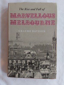 Mont De Lancey
Book, Graeme Davidson, The Rise and Fall of Marvellous Melbourne, 1978
... -century cities. History Melbourne Australian history Melbourne ...This book looks beyond public events to discover how the experience of boom and depression touched the lives of ordinary Melburnians at work and at home and reshaped their society and their sense of urban identity.A red hardcover book, The Rise and Fall of Marvellous Melbourne by Graeme Davidson. The red cover has large flourished gold embossed letters MM on the front cover with the title and publisher symbol at the bottom of the spine. It has a grey dust jacket with the title printed in black and red letters at the top front and the author written in white letters below. A full page grey and white cityscape of Melbourne wraps around the jacket. On the inside of the jacket there is a blurb explaining briefly the book's contents. There is a Contents, list of Illustrations, Acknowledgements, Notes and Abbreviations pages. On the back inside jacket are details of the author. Tables, black and white illustrations and photographs are included.non-fictionThis book looks beyond public events to discover how the experience of boom and depression touched the lives of ordinary Melburnians at work and at home and reshaped their society and their sense of urban identity.history melbourne, australian history, melbourne - economic conditions - 1880-1890