Showing 1339 items
matching growth
-
 Kew Historical Society Inc
Plan - Subdivision Plan, Jas R Mathers Son & McMillan, East Kew Tramway Estate, 1915
Pru Sanderson, in her groundbreaking ‘City of Kew Urban Conservation Study : Volume 2 - Development History’ (1988), summarised the periods of urban development and subdivisions of land in Kew. The periods that she identified included 1845-1880, 1880-1893, 1893-1921, 1921-1933, 1933-1943, and Post-War Development. These periods were selected as they represented periods of rapid growth or decline in urban development. An obvious starting point for Sanderson’s groupings involved population growth and the associated economic cycles. These cycles also highlighted urban expansion onto land that was predominantly rural, although in other cases it represented the decline and breakup of large estates. A number of the plans in the Kew Historical Society’s collection can also be found in other collections, such as those of the State Library of Victoria and the Boroondara Library Service. A number are however unique to the collection.The Kew Historical Society collection includes almost 100 subdivision plans pertaining to suburbs of the City of Melbourne. Most of these are of Kew, Kew East or Studley Park, although a smaller number are plans of Camberwell, Deepdene, Balwyn and Hawthorn. It is believed that the majority of the plans were gifted to the Society by persons connected with the real estate firm - J. R. Mathers and McMillan, 136 Cotham Road, Kew. The Plans in the collection are rarely in pristine form, being working plans on which the agent would write notes and record lots sold and the prices of these. The subdivision plans are historically significant examples of the growth of urban Melbourne from the beginning of the 20th Century up until the 1980s. A number of the plans are double-sided and often include a photograph on the reverse. A number of the latter are by noted photographers such as J.E. Barnes.The East Kew Tramway Estate was a subdivision of two separate parcels of land between Adeney Avenue and Normanby Road. The larger section included 54 lots facing Adeney Avenue, Argyle Road, and Campbell, Hunter and Wishart Streets. [Hunter and Wishart Streets were created as part of the subdivision.] A further 17 allotments faced Normanby Road, Hubert and Campbell Streets. [The name of Hubert Street was later to be changed to Cecil Street.] The promotion of the sale referred to the advantages of living between two tram routes, in High Street and Cotham Road. On the plan, quaintly drawn trams mark these routes. Also on the plan is the route of part of the Outer Circle [Railway] Line.east kew tramway estate, subdivision plans - east kew -
 Kew Historical Society Inc
Plan - Subdivision Plan, J R Mathers & McMillan, Clutha Subdivision, 1940
Pru Sanderson, in her groundbreaking ‘City of Kew Urban Conservation Study : Volume 2 - Development History’ (1988), summarised the periods of urban development and subdivisions of land in Kew. The periods that she identified included 1845-1880, 1880-1893, 1893-1921, 1921-1933, 1933-1943, and Post-War Development. These periods were selected as they represented periods of rapid growth or decline in urban development. An obvious starting point for Sanderson’s groupings involved population growth and the associated economic cycles. These cycles also highlighted urban expansion onto land that was predominantly rural, although in other cases it represented the decline and breakup of large estates. A number of the plans in the Kew Historical Society’s collection can also be found in other collections, such as those of the State Library of Victoria and the Boroondara Library Service. A number are however unique to the collection.The Kew Historical Society collection includes almost 100 subdivision plans pertaining to suburbs of the City of Melbourne. Most of these are of Kew, Kew East or Studley Park, although a smaller number are plans of Camberwell, Deepdene, Balwyn and Hawthorn. It is believed that the majority of the plans were gifted to the Society by persons connected with the real estate firm - J. R. Mathers and McMillan, 136 Cotham Road, Kew. The Plans in the collection are rarely in pristine form, being working plans on which the agent would write notes and record lots sold and the prices of these. The subdivision plans are historically significant examples of the growth of urban Melbourne from the beginning of the 20th Century up until the 1980s. A number of the plans are double-sided and often include a photograph on the reverse. A number of the latter are by noted photographers such as J.E. Barnes.The subdivision plan for the Clutha Subdivision is one of the largest in the Society’s collection. The plan includes a map of the proposed allotments, photographic views to the north and south, and information about the kinds of buildings that could be constructed on the allotments. The subdivision was bounded by Studley Park Road, and Carson, Stevenson and Edgecombe Streets. Two new streets, Mackie Court and Younger Street were created as part of the subdivision. The subdivision took its name from ‘Clutha’, the home of John Carson, who was to become Mayor of Kew in 1863. A Report to the City of Boroondara outlined how: ‘The Clutha estate was progressively developed from 1940, with new houses under construction on the Studley Park Road, Carson and Edgecombe Street frontages by 1941. By 1943, directory listings were available for all addresses with the exception of Mackie Court. Building ceased after the government’s prohibition on civilian building was enforced from 1942, with little change in listings until the 1950s when the remainder of the subdivision was developed’."H"subdivisions - kew - studley park, clutha subdivision, studley park road -
 Kew Historical Society Inc
Plan - Subdivision Plan, Jas R Mathers Son & McMillan, Macartney Estate, East Kew, c. 1925
Pru Sanderson, in her groundbreaking ‘City of Kew Urban Conservation Study : Volume 2 - Development History’ (1988), summarised the periods of urban development and subdivisions of land in Kew. The periods that she identified included 1845-1880, 1880-1893, 1893-1921, 1921-1933, 1933-1943, and Post-War Development. These periods were selected as they represented periods of rapid growth or decline in urban development. An obvious starting point for Sanderson’s groupings involved population growth and the associated economic cycles. These cycles also highlighted urban expansion onto land that was predominantly rural, although in other cases it represented the decline and breakup of large estates. A number of the plans in the Kew Historical Society’s collection can also be found in other collections, such as those of the State Library of Victoria and the Boroondara Library Service. A number are however unique to the collection.Subdivision plans are historically important documents used as evidence of the growth of suburbs in Australia. They frequently provide information about when the land was sold on which a built structure was subsequently constructed as well as evidence relating to surveyors and real estate and financial agents. The numerous subdivision plans in the Kew Historical Society's collection represent working documents, ranging from the initial sketches made in planning a subdivision to printed plans on which auctioneers or agents listed the prices for which individual lots were sold. In a number of cases, the reverse of a subdivision plan in the collection includes a photograph of a house that was also for sale by the agent. These photographs provide significant heritage information relating house design and decoration, fencing and household gardens.The Macartney Estate subdivision advertised 21 lots for sale on either side of Macartney Street (now Macartney Avenue) and Evans Road in what was then designated as East Kew. Most of the houses shown on the south side of Macartney Street then, as now, have rear entrances on Mount Street, however a number of these blocks have since been further subdivided to allow for the building of new houses on the rear of a block. Brougham Place is marked on the plan but is now called Daniell Place."C"subdivision plans - east kew, macartney estate, macartney street, mount street, evans road, brougham place -
 Kew Historical Society Inc
Plan - Subdivision Plan, J R Mathers & McMillan, Glenarbor Estate, 1934
Pru Sanderson, in her groundbreaking ‘City of Kew Urban Conservation Study : Volume 2 - Development History’ (1988), summarised the periods of urban development and subdivisions of land in Kew. The periods that she identified included 1845-1880, 1880-1893, 1893-1921, 1921-1933, 1933-1943, and Post-War Development. These periods were selected as they represented periods of rapid growth or decline in urban development. An obvious starting point for Sanderson’s groupings involved population growth and the associated economic cycles. These cycles also highlighted urban expansion onto land that was predominantly rural, although in other cases it represented the decline and breakup of large estates. A number of the plans in the Kew Historical Society’s collection can also be found in other collections, such as those of the State Library of Victoria and the Boroondara Library Service. A number are however unique to the collection.The Kew Historical Society collection includes almost 100 subdivision plans pertaining to suburbs of the City of Melbourne. Most of these are of Kew, Kew East or Studley Park, although a smaller number are plans of Camberwell, Deepdene, Balwyn and Hawthorn. It is believed that the majority of the plans were gifted to the Society by persons connected with the real estate firm - J. R. Mathers and McMillan, 136 Cotham Road, Kew. The Plans in the collection are rarely in pristine form, being working plans on which the agent would write notes and record lots sold and the prices of these. The subdivision plans are historically significant examples of the growth of urban Melbourne from the beginning of the 20th Century up until the 1980s. A number of the plans are double-sided and often include a photograph on the reverse. A number of the latter are by noted photographers such as J.E. Barnes.The little-known Glenarbor Estate comprised 23 allotments bordering Wellington and Denmark Streets and Fenton Avenue. The auction of the allotments in the Estate was held in the Kew Recreation Hall. The purported advantages to Kew are identified on the plan, such as the close proximity of the entrance to the Kew Railway Station and access to shops in Denmark Street. Due to its location, the subdivision was pitched at commercial as well as residential purchasers. The Estate was to cause a crisis in the Kew Council as a majority of councillors voted on 29 May to acquire the entire Estate as the location of a new Town Hall. The Estate was said to be valued at £50,000. A later meeting was to rescind the vote, instead opting for the compulsory acquisition of South Esk on the corner of Charles Street and Cotham Road. That acquisition was to be overturned by the State Government. The debate about the purchase of the Glenarbor Estate by Council coincided with the decision to widen High Street on the South side between Cotham Road and the Junction."D"subdivision plans - kew, glenarbor estate, wellington street, denmark street -
 Kew Historical Society Inc
Plan - Subdivision Plan, Jas R Mathers Son & McMillan, The Dale Estate, Deepdene, 1918
Pru Sanderson, in her groundbreaking ‘City of Kew Urban Conservation Study : Volume 2 - Development History’ (1988), summarised the periods of urban development and subdivisions of land in Kew. The periods that she identified included 1845-1880, 1880-1893, 1893-1921, 1921-1933, 1933-1943, and Post-War Development. These periods were selected as they represented periods of rapid growth or decline in urban development. An obvious starting point for Sanderson’s groupings involved population growth and the associated economic cycles. These cycles also highlighted urban expansion onto land that was predominantly rural, although in other cases it represented the decline and breakup of large estates. A number of the plans in the Kew Historical Society’s collection can also be found in other collections, such as those of the State Library of Victoria and the Boroondara Library Service. A number are however unique to the collection.The Kew Historical Society collection includes almost 100 subdivision plans pertaining to suburbs of the City of Melbourne. Most of these are of Kew, Kew East or Studley Park, although a smaller number are plans of Camberwell, Deepdene, Balwyn and Hawthorn. It is believed that the majority of the plans were gifted to the Society by persons connected with the real estate firm - J. R. Mathers and McMillan, 136 Cotham Road, Kew. The Plans in the collection are rarely in pristine form, being working plans on which the agent would write notes and record lots sold and the prices of these. The subdivision plans are historically significant examples of the growth of urban Melbourne from the beginning of the 20th Century up until the 1980s. A number of the plans are double-sided and often include a photograph on the reverse. A number of the latter are by noted photographers such as J.E. Barnes.The Dale Estate in Deepdene was made possible by the death of Robert Sparrow Smythe, Australian journalist, newspaper editor/owner and theatrical manager. Smythe lived in his residence ‘Highate’, Deepdene until his death in 1917. In the subdivision proposed one year later, before the end of the First World War, 18 allotments were to be created. The very fragmentary plan in the Society’s collection notes that a large weatherboard [house] will need to be removed. This may be Smythe’s own home. The proposed subdivision included allotments facing Burke and Whitehorse Roads and Dale Street. Bordering the subdivision is the Deepdene Station and the Outer Circle Railway Line. The clear directions on the plan indicate that in 1918 it was possible to travel by train from Deepdene to East Camberwell and Ashburtonsubdivision plans - deepdene, the dale estate -
 Kew Historical Society Inc
Plan - Subdivision Plan, Jas R Mathers Son & McMillan, Clifton Estate, Kew, c. 1916
Pru Sanderson, in her groundbreaking ‘City of Kew Urban Conservation Study : Volume 2 - Development History’ (1988), summarised the periods of urban development and subdivisions of land in Kew. The periods that she identified included 1845-1880, 1880-1893, 1893-1921, 1921-1933, 1933-1943, and Post-War Development. These periods were selected as they represented periods of rapid growth or decline in urban development. An obvious starting point for Sanderson’s groupings involved population growth and the associated economic cycles. These cycles also highlighted urban expansion onto land that was predominantly rural, although in other cases it represented the decline and breakup of large estates. A number of the plans in the Kew Historical Society’s collection can also be found in other collections, such as those of the State Library of Victoria and the Boroondara Library Service. A number are however unique to the collection.The Kew Historical Society collection includes almost 100 subdivision plans pertaining to suburbs of the City of Melbourne. Most of these are of Kew, Kew East or Studley Park, although a smaller number are plans of Camberwell, Deepdene, Balwyn and Hawthorn. It is believed that the majority of the plans were gifted to the Society by persons connected with the real estate firm - J. R. Mathers and McMillan, 136 Cotham Road, Kew. The Plans in the collection are rarely in pristine form, being working plans on which the agent would write notes and record lots sold and the prices of these. The subdivision plans are historically significant examples of the growth of urban Melbourne from the beginning of the 20th Century up until the 1980s. A number of the plans are double-sided and often include a photograph on the reverse. A number of the latter are by noted photographers such as J.E. Barnes.The Clifton Estate was an ambitious subdivision. It included 61 allotments bordering Cotham and Park Hill Roads, and Florence and Adeney Avenues. It is difficult to ascertain the exact year when the ‘Clifton Estate’ was surveyed, subdivided and first auctioned. The uncertainty may be due to allotments being released during the First World War. The subdivision took its name from the house ‘Clifton’ (lot 5) on the corner of Adeney Avenue and Cotham Road. The outline of Clifton (since demolished) and the extent of its land following the subdivision are represented on the plan. The auctioneers have also shown ‘Maryfield’ and ‘Wimba’, the neighbouring properties in Cotham Road, on the plan."B"subdivision plans - kew, clifton estate, cotham road, adeney avenue, florence avenue, park hill road -
 Kew Historical Society Inc
Plan - Subdivision Plan, Plan of Subdivision of Part of Crown Portion 84 / Parish of Boroondara / County of Bourke / Lodged Plan No. 2217, Twentieth Century
Pru Sanderson, in her groundbreaking ‘City of Kew Urban Conservation Study : Volume 2 - Development History’ (1988), summarised the periods of urban development and subdivisions of land in Kew. The periods that she identified included 1845-1880, 1880-1893, 1893-1921, 1921-1933, 1933-1943, and Post-War Development. These periods were selected as they represented periods of rapid growth or decline in urban development. An obvious starting point for Sanderson’s groupings involved population growth and the associated economic cycles. These cycles also highlighted urban expansion onto land that was predominantly rural, although in other cases it represented the decline and breakup of large estates. A number of the plans in the Kew Historical Society’s collection can also be found in other collections, such as those of the State Library of Victoria and the Boroondara Library Service. A number are however unique to the collection.The Kew Historical Society collection includes almost 100 subdivision plans pertaining to suburbs of the City of Melbourne. Most of these are of Kew, Kew East or Studley Park, although a smaller number are plans of Camberwell, Deepdene, Balwyn and Hawthorn. It is believed that the majority of the plans were gifted to the Society by persons connected with the real estate firm - J. R. Mathers and McMillan, 136 Cotham Road, Kew. The Plans in the collection are rarely in pristine form, being working plans on which the agent would write notes and record lots sold and the prices of these. The subdivision plans are historically significant examples of the growth of urban Melbourne from the beginning of the 20th Century up until the 1980s. A number of the plans are double-sided and often include a photograph on the reverse. A number of the latter are by noted photographers such as J.E. Barnes.Undated Plan of Subdivision of Crown Portion 84 in what is now Kew. The area shown is bordered by Burke Road, Harp Road, Arglye Road and Normanby Road.subdivision plans -- kew (vic), harp road, burke road, normanby road, lady loch's drive, gladstone street, second avenue, first avenue -
![Giant fern trees: Splitters' Track, Black Spur / [by] Nicholas Caire, circa 1876](/media/collectors/550653872162f11fb04854aa/items/57774978d0cdd10a5c123cdb/item-media/57774a0fd0cdd10a5c1297aa/item-fit-380x285.jpg) Kew Historical Society Inc
Kew Historical Society IncPhotograph, Anglo-Australasian Photographic Company, Giant fern trees: Splitters' Track, Black Spur, c. 1876
Nicholas Caire was born on Guernsey in the Channel Islands in 1837. He arrived in Adelaide with his parents in about 1860. In 1867, following photographic journeys in Gippsland, he opened a studio in Adelaide. From 1870 to 1876 he lived and worked in Talbot in Central Victoria. In 1876 he purchased T. F. Chuck's studios in the Royal Arcade Melbourne. In 1885, following the introduction of dry plate photography, he began a series of landscape series, which were commercially successful. As a photographer, he travelled extensively through Victoria, photographing places few of his contemporaries had previously seen. He died in 1918. Reference: Jack Cato, 'Caire, Nicholas John (1837–1918)', Australian Dictionary of Biography.An original, rare photograph from the series 'Views of Victoria: General Series' by the photographer, Nicholas Caire (1837-1918). The series of 60 photographs that comprise the series was issued c. 1876 and reinforced a neo-Romantic view of the Australian landscape to which a growing nationalist movement would respond. Nicholas Caire was active as a photographer in Australia from 1858 until his death in 1918. His vision of the Australian bush and pioneer life had a counterpart in the works of Henry Lawson and other nationalist poets, authors and painters.Albumen silver photograph mounted on boardprinted in ink on support l.c.: GIANT FERN TREES: SPLITTERS' TRACK, BLACK SPUR. / COPYRIGHT REGISTERED. printed in ink (vertically) on support reverse u.c.l.: J.W. FORBES, Agent, printed in ink (vertically) on support reverse c.l.: ANGLO-AUSTRALASIAN PHOTOGRAPHIC COMPANY, MELBOURNE. printed in ink (vertically) on support reverse c.: VIEWS OF VICTORIA. / (GENERAL SERIES.) / No. 8. / GIANT FERN TREES: SPLITTERS' TRACK, BLACK SPUR. / The scene which this illustration represents is situated on Morley's Creek, at the foot of the Black Spur, and is / about a mile and a half from the Township of Fernshawe. The Fern Trees in this locality are of gigantic growth, / measuring 50 feet in height, the fronds of which are from 12 to 15 feet long. This excessive growth is attributable / to the great number of springs flowing into the creek, thereby causing the surrounding soil to be in a continual / state of moisture. printed in ink (vertically) on support reverse l.c.l.: 10 Temple Court, Collins Street West.landscape photography, nicholas caire, black spur - victoria -
 City of Moorabbin Historical Society (Operating the Box Cottage Museum)
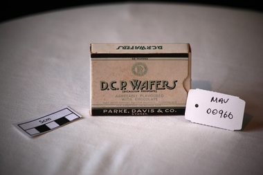
Containers, cardboard box 'D.C.P. WAFERS', mid 20thC
‘D.C.P WAFERS’ made by Parke, Davis & Co Pty Ltd Sydney, that contained Calcium and Phosphorous. The wafers ‘could be chewed or allowed to dissolve in the mouth’ and ‘ were agreeably flavoured with Chocolate’An empty cardboard box, with a sliding inset, for ‘D.C.P WAFERS’ that contained Calcium and Phosphorous. The wafers ‘could be chewed or allowed to dissolve in the mouth’ and ‘ were agreeably flavoured with Chocolate’Top: 36 WAFERS / MEDICAMENTE VERA encircling PDCo. / D.C.P. WAFERS / (DICALCIUM PHOSPHATE) / AGREEABLY FLAVOURED / WITH CHOCOLATE / EACH WAFER CONTAINS DICALCIUM PHOSPHATE 15 GRAINS / FOR DIRECTIONS SEE REVERSE SIDE / PARKE, DAVIS & CO. / SYDNEY . Left and Right Sides: D.C.P. WAFERS. Base: D.C.P. WAFERS …… same ratio as … milk … soluble … Indicated during periods of growth …../ DIRECTIONS / ….. They may be chewed or allowed to disintegrate in the mouth….pharmacy, parke-davis pty.ltd, moorabbin, cheltenham, bentleigh, disease, bone disease, osteoporosis, calcium -
 Ararat & District Historical Society (operating the Langi Morgala Museum)
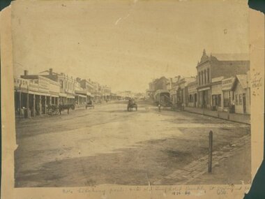
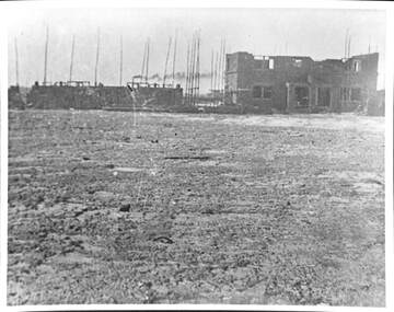
Barkly Street, Ararat, perhaps 1870s
This is one of a dozen or so pictures of very early Ararat held by Langi Morgala Museum, and can be compared to a succession of later photographs to illustrate the growth of the town of Ararat. The date suggested by the inscription on the front is probably a reference to some other occurrence, since the street seems far to built-up for 1856-1860. The date is more likely the 1870s, or even the 1880sThis photograph, though not in good condition, is one of the few in the possession of Langi Morgala Museum that shows very early Ararat. It is of regional significance, which would be enhanced if a firmer date could be established. This cardboard-mounted large photograph is not in very good condition, but some parts of the image are still clear. There are permanent inscriptions on both front and back, not done in sympathy with the age and importance of the item.On front: "Note hitching posts and the old Turf Hotel, Barkly Street cont[illegible] / 1856-60". On back: museum stamp and photo numbers.barkly-street, ararat, horse, horse-driven, early-ararat, business, commercial -
 Vision Australia
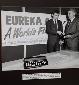
Photograph - Image, David Blyth and Milan Hudecek
The Eureka A4 was a Melbourne invention, designed to capitalise on the growth of IBM PCs. It attached to the PC and allowed blind and vision impaired people to utilise screen orientated programs. The Royal Victorian Institute for the Blind supported the project and in this image, David Blyth and the managing director of Robotron Milan Hudecek, pose for a publicity shot at the launch of the Eureka A4 Notetaker in July 1997. Black and white photograph of two men at the Eureka A4 computer standDavid Blyth, Director of Community Services at the Royal Victorian Institute for the Blind, carrying a Eureka A4, while Milan Hudecek, Managing Director of Robotron Pty Ltd looks on.royal victorian institute for the blind, braille equipment, david blyth, milan hudecek -
 City of Greater Geelong
Painting - Tempera, Robert Ingpen, Geelong Character Mural, c.1960
Robert Ingpen, illustrator, designer, writer and consultant, was born in Geelong in 1936. He was educated in Geelong before studying art and illustration under Harold Freedman at the Royal Melbourne Institute of Technology, 1955-58. Early in his career he specialised in relating design to scientific research, and this included work as a graphic design artist for the CSIRO, 1958-67, commissions for designing pamphlets on fisheries for the United Nations in Mexico and Peru, and involvement in a number of Australian conservation and environmental projects. He launched into freelance work in 1968. Ingpen's work has focused on environmental and heritage issues and his exploration of fantasy and imagination. He is best known as an illustrator, and as an author of children's books, and historical books and pamphlets for adults. He has painted murals on public buildings, designed the flag and coat of arms for the Northern Territory, and designed postage stamps, including stamps for the Captain Cook Bicentenary and the 50th anniversary of CSIRO. He has been involved in a number of conservation and environmental projects, including the establishment of the Swan Hill Pioneer Settlement as consultant/designer. He was one of the founders of the Australian Conservation Foundation. Ingpen rose to prominence with his illustrations for Colin Thiele's classic children's story Storm Boy, winning for him the first Visual Arts Board award for children's book illustration. He won the international Hans Christian Anderson Medal for children's literature in 1986, and the Dromkeen Medal in 1989.Robert Ingpen, celebrated Geelong artist, was commissioned to paint a mural to be located above the entrance of the new west wing. The mural was designed to represent the objects and systems that characterise Geelong and its district and that played a major role in the city’s growth and development. The three systems comprise: the natural (producing) system; the man-made or technological system, and the natural (trading) system.ingpen, mural, city hall geelong, james harrison -
 Melbourne Tram Museum
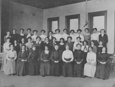
Photograph - Melbourne Tramway and Omnibus Company Female Staff Head Office c1914, c1914
Photograph of 36 female administrative staff of the cable tram company (MT&OC), taken in an upper room of the company's head office at 669-675 Bourke Street, Melbourne. From the company's beginning, very few females were employed. The rapid growth in female employees may have coincided with the introduction of typewriters into Melbourne offices after 1900. Yields information about administration of MT&OC Sepia toned black and white photograph glued to cardboard with staff names on rearFemale Staff, Head Office about 1914, MT&O Co. (Only five of the 36 women shown are named. No occupations included.)melbourne tramway and omnibus company, mt&oc, mtoc, cable tram, female staff, typewriter -
 Bendigo Historical Society Inc.
Document - BENDIGO TOTAL ABSTINENCE SOCIETY COLLECTION: TEMPERANCE WALL SHEET NO 1, EXAMINATION PAPER
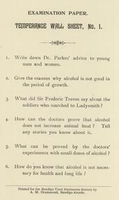
Document. Examination paper, Temperance Wall Sheet, No.1. 1. Write down Dr. Parkes' advice to young men and women. 2. Give reasone why alcohol is not good in the period of growth. 3. What did Sir Frederic Treves say about the soldiers who marched to Ladysmith?. 4. How can the doctors prove that alcohol does not increase animal heat? Tell any stories you know about it. 5. What can be proved by the doctor' experiments with small doses of alcohol?. 6. How do you know that alcohol is not necessary for health and long life? Six copies.Printed for the Bendigo Total Anstinence Society by A.M.Drummond, Bendigo Arcade.organisation, community, abstinence society -
 Melbourne Tram Museum
Book, Friends of the Earth, "Getting on the Right Track - The public transport crisis in Australia", mid to late 1970's
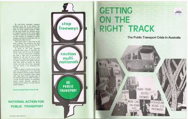
Book - 104 pages printed on newsprint, stapled with two colour light card cover, titled "Getting on the Right Track - The public transport crisis in Australia". Produced by the National Action for Public Transport, largely transport union based (see page 104 for contacts), looking at the lack of investment into public transport and the construction of freeways, roads and the growth of motor cars. Has a table of contents and many sketches, cartoons and tables. See inside front cover for sources, names and who produced the document, Friends of the Earth. Appears to have been produced mid to late 1970's. Two copies held.Has a "$1.50" Angus and Robertson price sticker on the front cover, top right hand corner.trams, tramways, public transport, unions, motor vehicles, road transport -
 Royal Australian and New Zealand College of Obstetricians & Gynaecologists (RANZCOG)
Print - Reproduction print of plate from 'Birth atlas', Maternity Center Association, 1943, Robert Latou Dickinson et al, Plate 9. Labor cervix dilating & bag of waters, 1943
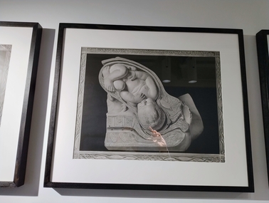
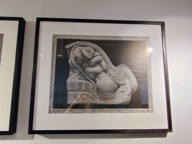
A series of six prints showing various stages of labour, donated to the College in 2000.Black and white reproduction print of a plate from a book, enclosed in a wooden frame. Text at the top of the print reads 'LABOR CERVIX DILATING & BAG OF WATERS PLATE 9'. The plate depicts a detailed cross section image of a baby in the womb. Label attached to back of work reads: 'Robert Latou DICKINSON and Abram BELSKI/ Plate 9. Labor cervix dilating & bag of waters/From: Birth atlas: reproduction of twenty-four life size sculptures of fertilization, growth,/stages of labour and involution./New York: Maternity Center Association, 1943. 6th ed./Gift of St Georges Hospital, Kew, 2000'.LABOR CERVIX DILATING & BAG OF WATERS PLATE 9obstetric delivery -
 The Beechworth Burke Museum
Geological specimen - Spotted Slate, Unknown
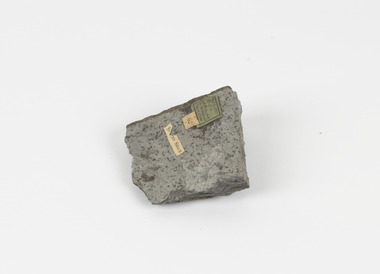
This specimen was recovered from Sedgwick, VIC. Spotted slate is a fine-grained porphyroblastic metamorphic rock with a number of compounds including muscovite, quartz, graphite with cordierite poikiloblasts and more. The cordierite poikiloblasts are rounded crystals that size up to 2.5 mm. the growth of these crystals is in response to metamorphism of low to medium intensity. The town Sedgwick was named after British geologist Adam Sedgwick This specimen is part of a larger collection of geological and mineral specimens collected from around Australia (and some parts of the world) and donated to the Burke Museum between 1868-1880. A large percentage of these specimens were collected in Victoria as part of the Geological Survey of Victoria that begun in 1852 (in response to the Gold Rush) to study and map the geology of Victoria. Collecting geological specimens was an important part of mapping and understanding the scientific makeup of the earth. Many of these specimens were sent to research and collecting organisations across Australia, including the Burke Museum, to educate and encourage further study.A solid rectangular hand-sized spotted slate specimen in a shade of light grey with darker flecks throughout Spotted Slate / Locality: Sedgwick Victoria | This is an early specimen / from the Quarter sheet / map. See sample 62 / page 18. Described as 'Spotted Slate' but these / days we would call it spotted hornfels / C. William 15/4/21 slate, spotted slate, victoria, beechworth, burke museum, geological specimen, mineralogy, sedgwick, sedgwick victoria, spotted slate specimen -
 Rutherglen Historical Society
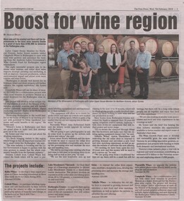
Newspaper - Newspaper article, Boost for wine region, 7/02/2018
Newspaper article from the Corowa Free Press, Wednesday 7th February 2018, page 3, by Sarah Dean. Article refers to grants from the Victorian Government's Wine Growth Fund to a number of wineries in the Rutherglen region. Recipients include Buller Wines, Cofield Wines, Lake Moodemere Vineyards, Rutherglen Estates, Scion, Valhalla Wines, Warrabilla Wines and Campbells Wines.Newspaper article about the Rutherglen wine region, with a coloured photograph of a group of people in front of stacked wine barrels.government grants, wine industry, tourism, wine growth fund, buller wines, cofield wines, lake moodemere wines, rutherglen estates, scion, valhalla wines, warrabilla wines, campbells wines -
 Hymettus Cottage & Garden Ballarat
Photograph, Church group, 14/06/2020
This group of buildings all of which served as churches at different periods is one of the best visual demonstrations of the rapid growth of Ballarat caused by the boom years of the gold rush following the initial alluvial diggings of the 1850s. The smallest church was built in 1861 followed by the next built in 1867 and finally the construction of the grand church on the corner of Neil and Macarthur streets Soldiers' Hill in the 1890s.methodist church, uniting church, soldiers hill, ballarat. -
 Merbein District Historical Society
Tool - Aggie pipe
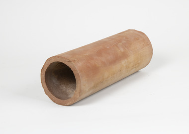
with early in precise furrow irrigation ground water mounds developed on blocks which were detrimental to vine growth Aggie pipes were laid on grade on the clay layer of soil 4 to 5 foot deep or every 4th row of vines (forty four feet apart) to drain the perched water table and the accumulated salts from the vines root zone with early in precise furrow irrigation ground water mounds developed on blocks which were detrimental to vine growth Aggie pipes were laid on grade on the clay layer of soil 4 to 5 foot deep or every 4th row of vines (forty four feet apart) to drain the perched water table and the accumulated salts from the vines root zone Long clay cylinder horticulture, merbein, irrigation, pipes, furrow irrigation -
 Flagstaff Hill Maritime Museum and Village
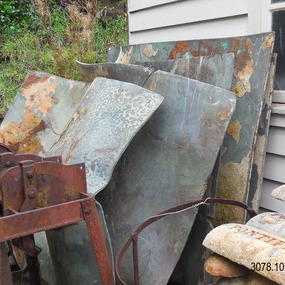
Functional object - Copper Sheet, circa 1878
In 1984 the Commonwealth Government made available to Flagstaff Hill a collection of lead ingots and copper sheets recovered from the wreck-site of the LOCH ARD. They were presented to the Warrnambool City Council by the Hon. Tom Uren MHR, Minister for Territories and Local Government: “The Commonwealth recognises that shipwrecks like the LOCH ARD are our national heritage with important educational, recreational and tourist applications” (The Standard, Tuesday 8 May 1984). The LOCH ARD was wrecked in 1878. Unsuccessful salvage operations were then undertaken with the 90 ton paddle steamer NAPIER. In sudden bad weather this vessel too was sunk. The precise position of the LOCH ARD in the exposed and dangerous waters off Mutton Bird Island became lost to memory. The underwater location of the LOCH ARD was rediscovered in 1967 by a Warrnambool skindiver, Stan McPhee. In the two years following his find, the vessel was systematically pillaged by unauthorised salvagers. This led to the State and Federal Governments’ intervention in 1969. A roundup and seizure of recovered lead ingots and copper sheets was conducted by Commonwealth and Victorian Police. Offenders were charged and convicted. The “repossessed loot of the Tassie Boys” was placed into secure storage (Jack Loney, 1978, Wrecks & Reputations). The LOCH ARD manifest of cargo lists “Pig lead 50 tons, 994 pig & 37 rolls” and “Copper 33 plates, 53 bolts”. While the lead ingots have been subsequently described as “ballast”, the copper sheets are unlikely to have been associated with the ship’s normal complement in that way. Similar product lines in the cargo manifest are “Bar and rod iron 102 tons”, “Plate iron 3 tons” and “Zinc 12 tons”. These raw materials were used by colonial artisans such as blacksmiths and metal smelters to fashion, and repair, agricultural implements and industrial machinery. Copper was valued for its non-corrosive properties and its malleability, or ease of working. Both these qualities were useful, for example, in laying underground gas pipes that supplied lighting to residences, businesses and streetscapes in the mid-nineteenth century. As the nineteenth century progressed, the metal was also increasingly valued for its conductivity, with copper wiring linking colonial communities to each other, and the wider world, via the Telegraph system. The average weight of the copper sheets is 216 kilograms, calculated by "volume 0.1936m³ X Cu density 8930kgs/m³".The shipwreck of the Loch Ard is of significance for Victoria and is registered on the Victorian Heritage Register ( S 417). Flagstaff Hill has a varied collection of artefacts from Loch Ard and its collection is significant for being one of the largest accumulation of artefacts from this notable Victorian shipwreck. The collections object is to also give us a snapshot into history so we can interpret the story of this tragic event. The collection is also archaeologically significant as it represents aspects of Victoria's shipping history that allows us to interpret Victoria's social and historical themes of the time. The collections historically significance is that it is associated unfortunately with the worst and best-known shipwreck in Victoria's history. Large heavy sheets or panels of copper metal raised from the wreck of the LOCH ARD. The 10 sheets are of roughly similar dimensions and rectangular shape. They bear signs of prolonged submersion in seawater, with various degrees of limestone accretion, adhered marine growth, and green oxidisation. Three of the sheets are severely buckled, demonstrating the force of underwater explosives used in their salvage. One sheet appears cut or severed in a diagonal line downwards from its top left hand corner. One sheet has a 10cm X 10cm square cut out of its top right hand corner. All sheets are in sturdy, stable condition. No maker’s marks are visible.flagstaff hill, warrnambool, shipwrecked coast, flagstaff hill maritime museum, flagstaff hill maritime village, great ocean road, loch line, loch ard, captain gibbs, eva carmichael, tom pearce, glenample station, mutton bird island, loch ard gorge, sailing ship, copper sheet, manutacturing materials, metal imports, muntz -
 Falls Creek Historical Society
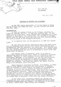
Document - Circular to Licensees and Lessees
Bob (Herman) Hymans (a former member of the Royal Netherlands Navy) was born in Bloemendaal, Holland on 30th September 1922. During World War II he fought against the Japanese in the Dutch East Indies (now Indonesia) and was imprisoned in Changi and on the Burma Railway. After gaining qualifications as a Ski Instructor, Bob arrived in Falls Creek in July 1950. Working as an Instructor and Supervisor at Bogong Lodge, Bob decided his future was in accommodation. He was successful in negotiating an indenture for land from the State Electricity Commission (SEC). It took Bob two years to build his Grand Coeur Chalet but, tragically, it was burned down in August 1961. Bob also built the first Chairlift in Australia. This was a single chairlift and the structure was built from wooden electricity poles. He was constantly full of new ideas and proposals for the village. Bob Hymans died on 7th July 2007. This Collection of documents and letters tells the story of Bob's endeavours to develop Falls Creek into the ski village it is today.This item is significant because it documents the wide range of actions and responsibilities undertaken by the Falls Creek Tourist Area Management Committee.A Circular from the Management Committee prior to the 1967 season. It includes a wide range of topics including; the growth of accommodation capacity at Falls Creek; slope improvements; parking and improved road access; Tows and Ski School; garbage collection and suitable containers; tender called for a new hotel; Medical Service arrangements for 1967; Sewerage System reminders; new arrangements for Oversnow Transport; composition of the Committee; a tobogganing franchise; the Ross Milne Memorial Ski Jump; careful use of the Water Supply; Finances and appointment of an Advisor from the SEC to plan for the future; Price Structure for 1967; a request for more involvement in publicity of the Resort and a tribute to R. T. (Bob) Scott.falls creek tourist area management committee, falls creek administration, r.t. (bob) scott, ross milne memorial ski jump -
 Royal Australian and New Zealand College of Obstetricians & Gynaecologists (RANZCOG)
Print - Reproduction print of plate from 'Birth atlas', Maternity Center Association, 1943, Robert Latou Dickinson et al, Plate 10. Full dilation cervix high head deep in pelvis, 1943
A series of six prints showing various stages of labour, donated to the College in 2000.Black and white reproduction print of a plate from a book, enclosed in a wooden frame. Text at the top of the print reads 'FULL DILATION CERVIX HIGH HEAD DEEP IN PELVIS PLATE 10'. The plate depicts a detailed cross section image of a baby in the womb. Label attached to back of work reads: 'Robert Latou DICKINSON and Abram BELSKI/ Plate 10. Full dilation cervix high head deep in pelvis/From: Birth atlas: reproduction of twenty-four life size sculptures of fertilization, growth,/stages of labour and involution./New York: Maternity Center Association, 1943. 6th ed./Gift of St Georges Hospital, Kew, 2000'.FULL DILATION CERVIX HIGH HEAD DEEP IN PELVIS PLATE 10obstetric delivery -
 Royal Australian and New Zealand College of Obstetricians & Gynaecologists (RANZCOG)
Print - Reproduction print of plate from 'Birth atlas', Maternity Center Association, 1943, Robert Latou Dickinson et al, Plate 11. Abdominal muscle drive pelvic floor thin, 1943
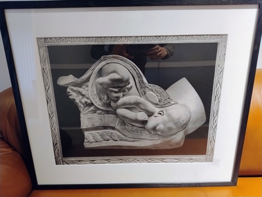
A series of six prints showing various stages of labour, donated to the College in 2000.Black and white reproduction print of a plate from a book, enclosed in a wooden frame. Text at the top of the print reads 'ABDOMINAL MUSCLE DRIVE PELVIC FLOOR THIN PLATE 11'. The plate depicts a detailed cross section image of a baby in the womb. Label attached to back of work reads: 'Robert Latou DICKINSON and Abram BELSKI/ Plate 11. Abdominal muscle drive pelvic floor thin/From: Birth atlas: reproduction of twenty-four life size sculptures of fertilization, growth,/stages of labour and involution./New York: Maternity Center Association, 1943. 6th ed./Gift of St Georges Hospital, Kew, 2000'.ABDOMINAL MUSCLE DRIVE PELVIC FLOOR THIN PLATE 11obstetric delivery -
 Royal Australian and New Zealand College of Obstetricians & Gynaecologists (RANZCOG)
Print - Reproduction print of plate from 'Birth atlas', Maternity Center Association, 1943, Robert Latou Dickinson et al, Plate 12. Head turns upward pelvic floor retreats, 1943
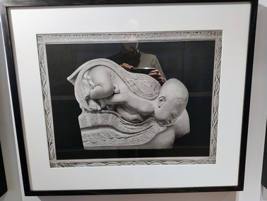
A series of six prints showing various stages of labour, donated to the College in 2000.Black and white reproduction print of a plate from a book, enclosed in a wooden frame. Text at the top of the print reads 'HEAD TURNS UPWARD PELVIC FLOOR RETREATS PLATE 12'. The plate depicts a detailed cross section image of a baby in the womb. Label attached to back of work reads: 'Robert Latou DICKINSON and Abram BELSKI/ Plate 12. Head turns upward pelvic floor retreats/From: Birth atlas: reproduction of twenty-four life size sculptures of fertilization, growth,/stages of labour and involution./New York: Maternity Center Association, 1943. 6th ed./Gift of St Georges Hospital, Kew, 2000'.HEAD TURNS UPWARD PELVIC FLOOR RETREATS PLATE 12obstetric delivery -
 Eltham District Historical Society Inc
Document - Folder, Census information, 1983
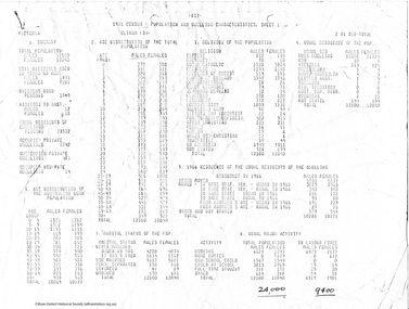
Report of population and dwelling characteristics from the 1971 Census relating to the Shire of Eltham. Comparative population statistics about the Shire of Eltham, August 1983. Historical population growth for the Shire of Eltham 1871-1981 Comparison of 1976 and 1981 populations by age group, population by urban area, age structure, number of dwellings, family type, households and more Part of Folder 75 from Harry Gilham Collection 4 A4 pages (photocopies), 2 printed A4 pages and 2 printed maps (A3) folded. 5 pages headed September, 1983population, statistics, census, shire of eltham -
 Port Melbourne Historical & Preservation Society
Photograph - Construction of Bank Houses, Jack GOULD
From a box of photographs in Nancy U'REN's papers used during research for her thesis, The Early Growth and Development of Sandridge (1976) and/or her book with Noel TURNBULL, A History of Port Melbourne (1983). Comparing the form and location of the doors and windows with plans for the various types of Bank Houses, the semi-detached building on the right appears to be Type 5. Jack GOULD probably created this from an earlier photograph.Black and white photograph across vacant ground to the construction of some Bank Houses.bank houses, garden city, nancy u'ren nee morris -
 Flagstaff Hill Maritime Museum and Village
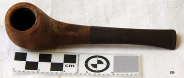
Leisure object - Tobacco Pipe, Early 20th century
People in ancient civilisations smoked pipes during various healing and religious ceremonies. By the end of the 15th century, after tobacco was discovered in America, smoking had become a common pastime for everyday people. From that time, tobacco pipes were fashioned from many materials ranging from gold and silver to corn cobs and clay. A popular material was meerschaum, an expensive, soft, white stone from Turkey. In the 1820s, French craftsmen carved pipes out of the wood from the growth on the root of a Mediterranean White Heath. This material became increasingly popular due to its durable, heat-resistant qualities. The growth was called ‘bruyere’, now anglicised to ‘briar’ wood. Bakelite was the first plastic made from synthetic components. It was developed by Leo Baekeland of New York in 1907. The material was heat-resistant and could be moulded into any shape and hardened to keep its shape. This invention greatly impacted the industrial world and the products available to the domestic market, making more objects available at reduced cost.This smoker's tobacco pipe symbolises one of the leisure activities of the early 20th century that has continued into modern times. The shape and materials of the pipe represent a point in time in the evolution of tobacco pipes, including the revolutionary impact that the 1900s invention of Bakelite had on objects available in the domestic and industrial markets.Smoker's tobacco pipe; a round brown wooden pipe bowl joined to a dark brown mouthpiece. The French pipe's bowl is made from briar wood, and its mouthpiece is Bakelite. There is an inscription on the pipe."French Briar Pipe"warrnambool, shipwreck coast, flagstaff hill, flagstaff hill maritime museum, flagstaff hill maritime village, smoker's pipe, tobacco pipe, briar wood pipe, wooden pipe, smoking, french pipe, bakelite, smoker's equipment -
 Port Melbourne Historical & Preservation Society
Photograph - Steam Sloop Victoria, Jack GOULD
From a box of photographs in Nancy U'REN's papers used during research for her thesis, The Early Growth and Development of Sandridge (1976) and/or her book with Noel TURNBULL, A History of Port Melbourne (1983). Jack GOULD probably created this from a version of the photograph held by the Australian War Museum. This version is cropped a bit tighter than the version held at the Australian War Museum (AWM 300060) and does not include the caption.Black and white photograph of the steam sloop, Victoria, at Sandridge, decorated to welcome Prince Alfred, Duke of Edinburgh, November 1867.transport - shipping, steam sloop victoria, royal visits and occasions, prince alfred, nancy u'ren nee morris -
 Ballarat Tramway Museum
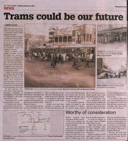
Newspaper, The Courier Ballarat, "Trams could be our future", 21/1/2017
Article by Michael Pollock reporting on a letter to the City of Ballarat about a proposal by Mr Jeff Moran of AWTY Transort Consultants about building a light rail system to serve Ballarat growth areas. Outlines possible routes. Was supported by Mr Bob Lever of the local PTUA. Has photos of a large crowd joining bogie trams outside the Provincial Hotel and two photos of tram accidents. along with a map of the SEC System.Yields information about a proposal to provide light rail to Ballarat.Newspaper cutting from The Courier, Ballarat, 21/1/2017 titled "Trams could be our future".trams, tramways, tram revival, light rail, ballarat, tramway proposals