Showing 920 items matching "land subdivision"
-
 Glen Eira Historical Society
Photograph, Beauville Avenue, 2, Murrumbeena, 2001
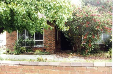
... land subdivision... architectural features jennings group limited land subdivision gardens ...Originally labelled "Beauville Estate, Established 1936, Still Thriving 65 years on, 10th March 2001", the Beauville Estate Album contains colour photographs of houses in the Estate. They were taken around the time of the Beauville Estate’s 65th Heritage Celebration held on 10/03/2001 and donated to the Caulfield Historical Society shortly afterwards. Photographer Bev Baxter. City of Glen Eira’s Heritage Management Plan Vol 2 p79 (this is p84 of the pdf version) – HO12 Beauville Estate and environs, Murrumbeena: The Beauville Historic Area is important at the State level as the first large housing estate undertaken by the AV Jennings Construction Co, later Jennings Group Limited, Victoria’s largest home builder. It is important also as a very early estate development incorporating a range of features other than houses and including made roads, shops and recreation facilities. In this respect it was the forerunner of the comprehensively planned housing estate of the post war era. The estate is distinguished by its aesthetic values, as is the earlier and comparable Hillcrest Estate, which are formed by a combination of restrained diversity in house styles, with the exception of no. 30 in the emerging International style, and by a landscaped garden environment. Colour photograph of an unpainted brick house. Other features include a central porch, tiled roof, square paned windows and a low unpainted brick fence in the foreground.murrumbeena, beauville avenue, architectural styles, 1930's, inter war style, a.v. jennings, av jennings, jennings, brick houses, beauville estate, porches, sir albert victor jennings, a v jennings construction co, beauville estate heritage area, glen eira city council, architectural features, jennings group limited, land subdivision, gardens, beauville historic area -
 Glen Eira Historical Society
Photograph, Beauville Avenue, 10, Murrumbeena, 2001
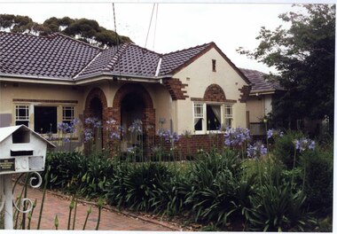
... land subdivision... limited land subdivision gardens beauville historic area brick ...Originally labelled "Beauville Estate, Established 1936, Still Thriving 65 years on, 10th March 2001", the Beauville Estate Album contains colour photographs of houses in the Estate. They were taken around the time of the Beauville Estate’s 65th Heritage Celebration held on 10/03/2001 and donated to the Caulfield Historical Society shortly afterwards. Photographer Bev Baxter. From Glen Eira’s Heritage Management Plan by Andrew Ward (1996) Vol 2 p63: The inclusion of shops in Murrumbeena Road and a common parkland developed at the rear of the properties were complemented by the construction of a gas display home at No. 10 Beauville Avenue.City of Glen Eira’s Heritage Management Plan Vol 2 p79 (this is p84 of the pdf version) – HO12 Beauville Estate and environs, Murrumbeena: The Beauville Historic Area is important at the State level as the first large housing estate undertaken by the AV Jennings Construction Co, later Jennings Group Limited, Victoria’s largest home builder. It is important also as a very early estate development incorporating a range of features other than houses and including made roads, shops and recreation facilities. In this respect it was the forerunner of the comprehensively planned housing estate of the post war era. The estate is distinguished by its aesthetic values, as is the earlier and comparable Hillcrest Estate, which are formed by a combination of restrained diversity in house styles, with the exception of no. 30 in the emerging International style, and by a landscaped garden environment. Colour photograph of cream rendered house with decorative unpainted brown brick features. Other features include a porch with two decorative open arches, tiled roof, 2 sets of matching double sashed windows with large square pane within each set, agapanthus lining the brick paved driveway and a cast iron work metal letterbox with number "10" on it. murrumbeena, houses, beauville avenue, architectural styles, 1930's, inter war style, a.v. jennings, av jennings, jennings, brick houses, beauville estate, porches, arches, sir albert victor jennings, a v jennings construction co, beauville estate heritage area, glen eira city council, architectural features, jennings group limited, land subdivision, gardens, beauville historic area, brick features, sash windows, paved drives, cast iron work, letter boxes, gas display houses -
 Glen Eira Historical Society
Photograph, Beauville Avenue, 13, Murrumbeena, 2001
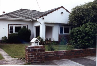
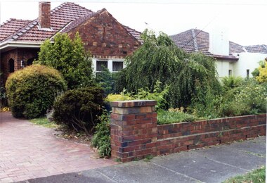
... land subdivision... features jennings group limited land subdivision gardens beauville ...Originally labelled "Beauville Estate, Established 1936, Still Thriving 65 years on, 10th March 2001", the Beauville Estate Album contains colour photographs of houses in the Estate. They were taken around the time of the Beauville Estate’s 65th Heritage Celebration held on 10/03/2001 and donated to the Caulfield Historical Society shortly afterwards. Photographer Bev Baxter. City of Glen Eira’s Heritage Management Plan Vol 2 p79 (this is p84 of the pdf version) – HO12 Beauville Estate and environs, Murrumbeena: The Beauville Historic Area is important at the State level as the first large housing estate undertaken by the AV Jennings Construction Co, later Jennings Group Limited, Victoria’s largest home builder. It is important also as a very early estate development incorporating a range of features other than houses and including made roads, shops and recreation facilities. In this respect it was the forerunner of the comprehensively planned housing estate of the post war era. The estate is distinguished by its aesthetic values, as is the earlier and comparable Hillcrest Estate, which are formed by a combination of restrained diversity in house styles, with the exception of no. 30 in the emerging International style, and by a landscaped garden environment. See Significance Statement in Glen Eira’s Heritage Management Plan by Andrew Ward (1996) Vol 2 p.79. Available from https://www.gleneira.vic.gov.au/media/4779/heritage_management_plan_volume_2.pdf (Note see p.84 of pdf)Colour photograph of white rendered house with unpainted brick features including on chimney. Other features include a semi enclosed porch, tiled roof, sash windows and low unpainted brick fence in the foreground with "13" on the white letterbox above the brick pillar beside the driveway and also on the front wall to the left. Garden beds and fence surround the lawn with drive to the left.murrumbeena, houses, beauville avenue, architectural styles, 1930's, inter war style, a.v. jennings, av jennings, jennings, brick houses, beauville estate, porches, sir albert victor jennings, a v jennings construction co, beauville estate heritage area, glen eira city council, architectural features, jennings group limited, land subdivision, gardens, beauville historic area, brick features, brick fences, letterboxes, chimneys -
 Glen Eira Historical Society
Photograph, Beauville Avenue, 9, Murrumbeena, 2001
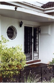
... land subdivision... group limited land subdivision gardens beauville historic area ...Originally labelled "Beauville Estate, Established 1936, Still Thriving 65 years on, 10th March 2001", the Beauville Estate Album contains colour photographs of houses in the Estate. They were taken around the time of the Beauville Estate’s 65th Heritage Celebration held on 10/03/2001 and donated to the Caulfield Historical Society shortly afterwards. Photographer Bev Baxter. See also 2104A-11 and 2104A-12.City of Glen Eira’s Heritage Management Plan Vol 2 p79 (this is p84 of the pdf version) – HO12 Beauville Estate and environs, Murrumbeena: The Beauville Historic Area is important at the State level as the first large housing estate undertaken by the AV Jennings Construction Co, later Jennings Group Limited, Victoria’s largest home builder. It is important also as a very early estate development incorporating a range of features other than houses and including made roads, shops and recreation facilities. In this respect it was the forerunner of the comprehensively planned housing estate of the post war era. The estate is distinguished by its aesthetic values, as is the earlier and comparable Hillcrest Estate, which are formed by a combination of restrained diversity in house styles, with the exception of no. 30 in the emerging International style, and by a landscaped garden environment. Colour photograph of the front entrance to a white rendered house featuring a porthole style window with a decorative cast iron work grid, a wall light, double cast iron work doors in front of the double glass doors and a meter box. Wrought iron balustrading can also be seen edging the porch in the foreground. murrumbeena, houses, beauville avenue, architectural styles, 1930's, inter war style, a.v. jennings, av jennings, jennings, brick houses, beauville estate, porches, sir albert victor jennings, a v jennings construction co, beauville estate heritage area, glen eira city council, architectural features, jennings group limited, land subdivision, gardens, beauville historic area, porthole windows, double doors, cast iron work, lights, glass doors -
 Glen Eira Historical Society
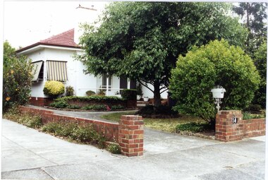
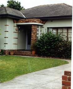
Photograph, Beauville Avenue, 14, Murrumbeena, 2001
... land subdivision... group limited land subdivision gardens beauville historic area ...Originally labelled "Beauville Estate, Established 1936, Still Thriving 65 years on, 10th March 2001", the Beauville Estate Album contains colour photographs of houses in the Estate. They were taken around the time of the Beauville Estate’s 65th Heritage Celebration held on 10/03/2001 and donated to the Caulfield Historical Society shortly afterwards. Photographer Bev Baxter.City of Glen Eira’s Heritage Management Plan Vol 2 p79 (this is p84 of the pdf version) – HO12 Beauville Estate and environs, Murrumbeena: The Beauville Historic Area is important at the State level as the first large housing estate undertaken by the AV Jennings Construction Co, later Jennings Group Limited, Victoria’s largest home builder. It is important also as a very early estate development incorporating a range of features other than houses and including made roads, shops and recreation facilities. In this respect it was the forerunner of the comprehensively planned housing estate of the post war era. The estate is distinguished by its aesthetic values, as is the earlier and comparable Hillcrest Estate, which are formed by a combination of restrained diversity in house styles, with the exception of no. 30 in the emerging International style, and by a landscaped garden environment. Colour photograph of white rendered house with brown brick features, a porch, striped awnings, tiled roof and low unpainted brick fences to the side and front of the house. A white cast iron letterbox and the number "14" on the brick pillar beside the driveway can be seen in the foreground along with a number of garden beds. murrumbeena, houses, beauville avenue, architectural styles, 1930's, inter war style, a.v. jennings, av jennings, jennings, brick houses, beauville estate, porches, letterboxes, sir albert victor jennings, a v jennings construction co, beauville estate heritage area, glen eira city council, architectural features, jennings group limited, land subdivision, gardens, beauville historic area, brick features, glass doors, striped awnings, brick fences -
 Glen Eira Historical Society
Photograph, Beauville Avenue, 16, Murrumbeena, 2001
... land subdivision... city council architectural features jennings group limited land ...Originally labelled "Beauville Estate, Established 1936, Still Thriving 65 years on, 10th March 2001", the Beauville Estate Album contains colour photographs of houses in the Estate. They were taken around the time of the Beauville Estate’s 65th Heritage Celebration held on 10/03/2001 and donated to the Caulfield Historical Society shortly afterwards. Photographer Bev Baxter. See also 2104A-19 which seems to be same property but with different colour and different larger plants in the right garden bed.City of Glen Eira’s Heritage Management Plan Vol 2 p79 (this is p84 of the pdf version) – HO12 Beauville Estate and environs, Murrumbeena: The Beauville Historic Area is important at the State level as the first large housing estate undertaken by the AV Jennings Construction Co, later Jennings Group Limited, Victoria’s largest home builder. It is important also as a very early estate development incorporating a range of features other than houses and including made roads, shops and recreation facilities. In this respect it was the forerunner of the comprehensively planned housing estate of the post war era. The estate is distinguished by its aesthetic values, as is the earlier and comparable Hillcrest Estate, which are formed by a combination of restrained diversity in house styles, with the exception of no. 30 in the emerging International style, and by a landscaped garden environment. Colour photograph of light brown coloured rendered house with unpainted brick features. Other features include a curved wall porch, tiled roof, and concrete driveway and path leading to the front porch. murrumbeena, houses, beauville avenue, architectural styles, 1930's, inter war style, a.v. jennings, av jennings, jennings, brick houses, beauville estate, porches, sir albert victor jennings, a v jennings construction co, beauville estate heritage area, glen eira city council, architectural features, jennings group limited, land subdivision, gardens, beauville historic area, brick features, chimneys -
 Glen Eira Historical Society
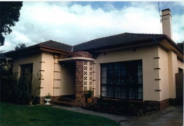
Photograph, Beauville Avenue, 16, Murrumbeena, 2001
... land subdivision... city council architectural features jennings group limited land ...Originally labelled "Beauville Estate, Established 1936, Still Thriving 65 years on, 10th March 2001", the Beauville Estate Album contains colour photographs of houses in the Estate. They were taken around the time of the Beauville Estate’s 65th Heritage Celebration held on 10/03/2001 and donated to the Caulfield Historical Society shortly afterwards. Photographer Bev Baxter. See also 2104A-18 which seems to be same property but with different colour and different smaller plants in the garden bed.City of Glen Eira’s Heritage Management Plan Vol 2 p79 (this is p84 of the pdf version) – HO12 Beauville Estate and environs, Murrumbeena: The Beauville Historic Area is important at the State level as the first large housing estate undertaken by the AV Jennings Construction Co, later Jennings Group Limited, Victoria’s largest home builder. It is important also as a very early estate development incorporating a range of features other than houses and including made roads, shops and recreation facilities. In this respect it was the forerunner of the comprehensively planned housing estate of the post war era. The estate is distinguished by its aesthetic values, as is the earlier and comparable Hillcrest Estate, which are formed by a combination of restrained diversity in house styles, with the exception of no. 30 in the emerging International style, and by a landscaped garden environment. Colour photograph of light green rendered house with unpainted variegated brown brick features. Other features include a curved porch, tiled roof and concrete driveway and path to the porch.murrumbeena, houses, beauville avenue, architectural styles, 1930's, inter war style, a.v. jennings, av jennings, jennings, brick houses, beauville estate, porches, sir albert victor jennings, a v jennings construction co, beauville estate heritage area, glen eira city council, architectural features, jennings group limited, land subdivision, gardens, beauville historic area, brick features, chimneys -
 Glen Eira Historical Society
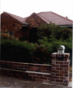
Photograph, Beauville Avenue, 15, Murrumbeena, 2001
... land subdivision... limited land subdivision gardens beauville historic area brick ...Originally labelled "Beauville Estate, Established 1936, Still Thriving 65 years on, 10th March 2001", the Beauville Estate Album contains colour photographs of houses in the Estate. They were taken around the time of the Beauville Estate’s 65th Heritage Celebration held on 10/03/2001 and donated to the Caulfield Historical Society shortly afterwards. Photographer Bev Baxter.City of Glen Eira’s Heritage Management Plan Vol 2 p79 (this is p84 of the pdf version) – HO12 Beauville Estate and environs, Murrumbeena: The Beauville Historic Area is important at the State level as the first large housing estate undertaken by the AV Jennings Construction Co, later Jennings Group Limited, Victoria’s largest home builder. It is important also as a very early estate development incorporating a range of features other than houses and including made roads, shops and recreation facilities. In this respect it was the forerunner of the comprehensively planned housing estate of the post war era. The estate is distinguished by its aesthetic values, as is the earlier and comparable Hillcrest Estate, which are formed by a combination of restrained diversity in house styles, with the exception of no. 30 in the emerging International style, and by a landscaped garden environment. Colour photograph of a house with decorative brickwork. Other features include a pitched roof porch with an arched entrance, tiled roof, and low unpainted brick fence in the foreground with "15" on the mailbox on top of the brick pillar beside the driveway.murrumbeena, houses, beauville avenue, architectural styles, 1930's, inter war style, a.v. jennings, av jennings, jennings, brick houses, beauville estate, porches, arches, sir albert victor jennings, a v jennings construction co, beauville estate heritage area, glen eira city council, architectural features, jennings group limited, land subdivision, gardens, beauville historic area, brick features, brick fences -
 Glen Eira Historical Society
Photograph, Beauville Avenue, 17, Murrumbeena, 2001
... land subdivision... group limited land subdivision gardens beauville historic area ...Originally labelled "Beauville Estate, Established 1936, Still Thriving 65 years on, 10th March 2001", the Beauville Estate Album contains colour photographs of houses in the Estate. They were taken around the time of the Beauville Estate’s 65th Heritage Celebration held on 10/03/2001 and donated to the Caulfield Historical Society shortly afterwards. Photographer Bev Baxter. City of Glen Eira’s Heritage Management Plan Vol 2 p79 (this is p84 of the pdf version) – HO12 Beauville Estate and environs, Murrumbeena: The Beauville Historic Area is important at the State level as the first large housing estate undertaken by the AV Jennings Construction Co, later Jennings Group Limited, Victoria’s largest home builder. It is important also as a very early estate development incorporating a range of features other than houses and including made roads, shops and recreation facilities. In this respect it was the forerunner of the comprehensively planned housing estate of the post war era. The estate is distinguished by its aesthetic values, as is the earlier and comparable Hillcrest Estate, which are formed by a combination of restrained diversity in house styles, with the exception of no. 30 in the emerging International style, and by a landscaped garden environment. Colour photograph of an unpainted brown brick house with decorative brickwork. Other features include a porch with 2 arched entrances, tiled roof and low unpainted brick fence in the foreground with "17" on the brick pillar beside the driveway.murrumbeena, houses, beauville avenue, architectural styles, 1930's, inter war style, a.v. jennings, av jennings, jennings, brick houses, beauville estate, porches, arches, sir albert victor jennings, a v jennings construction co, beauville estate heritage area, glen eira city council, architectural features, plans, jennings group limited, land subdivision, gardens, beauville historic area, brick features, brick fences -
 Whitehorse Historical Society Inc.
Article, Seeking a world of your own, 12/02/1969 12:00:00 AM
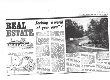
... land subdivision...williams jessie trove park drive estate vermont land ...Article on Council decision to demolish Moreton Park Hall (used as Regal Theatre) in order to build a branch library (ca 1965).Copy from Mrs Jessie Williams scrapbook of article from Nunawading Gazette 12 February 1969 about the subdivision of Trove Park Drive Estate by Mr Hilary Watson.Article on Council decision to demolish Moreton Park Hall (used as Regal Theatre) in order to build a branch library (ca 1965). williams, jessie, trove park drive estate, vermont, land subdivision, watson, hilary, cantley lane, brentford square shopping centre, forest hill, nunawading swimming pool, nunawading memorial swimming pool, nunawading pool, aqualink nunawading -
 Whitehorse Historical Society Inc.
Document, Walker Estate, 1/10/1938
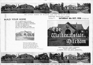
... land subdivision...land subdivision walker estate walker edgar edwardes ...Brochure for auction, 8 October 1938 of Walker Estate, Mitcham. 9 room brick residence and 11/2 acres of grounds, subdivided into 12 building sites for brick residences. House built for E.E. Walker by Louis Hatherley. Auctioneers: Edward Haughton Pty Ltd and Drake & Co.land subdivision, walker estate, walker, edgar edwardes, hatherley, louis, meerut street, mitcham, mitcham road, agra street, simla street -
 Whitehorse Historical Society Inc.
Document, Information Night, 10/08/1994 12:00:00 AM
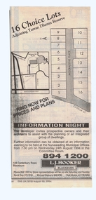
... land subdivision...casella street mitcham yarran dheran moorakyne place land ...advertisement for the sale of 16 lots'Information Night' about development and advertisement for the sale of 16 lots adjoining Yarran Dheran Reserve [access from Casella Street, Mitcham] Agent: L.J. Hooker, Blackburn. In the Nunawading Gazette.advertisement for the sale of 16 lots casella street, mitcham, yarran dheran, moorakyne place, land subdivision -
 Glen Eira Historical Society
Book - O’Neill College, Nagle Avenue, 2, Elsternwick
... Land subdivision... schools Secondary schools Land subdivision Richard O'Neill ...A commemorative history titled "O’Neill College 1908 – 1981" published at the time of the amalgamation of O’Neill College with star of the Sea, 1982 (2 copies). The book (64 pages) includes a short history of O’Neill college, reports from Monsignor Lyons, Principal's report and reports from various other sisters from 1930’s, 40’s, 50’s, 60’s and 70’s. Reminiscences from students activities in the 80’s. Many school photographs of staff, class photos, school outings, sporting events and year 9 camp. Date and author unknown.o’ neill college, sister margaret canoll, presentation secondary, nagle avenue, sister mary kavanagh, education committee, sister christine walsh, elsternwick, sister francis muirhead, peart leanne, sister marie therese harold, star of the sea college, collina filomena, gammaldi tony, mcwilliam lorraine, o'neill college mothers auxillary, mcwilliam barry, st. jospeh's school, sister mary claver stone, sister mary de sales mckenna, sister angela johnston, sister bonaventure harrington, cooper sheila, cooper robert, harnett eileen, harnett desmond, beldart dorothy, catholic schools, primary schools, secondary schools, land subdivision, richard o'neill ecclesiastical college, romanesque style, schreiber r.a., architects, diocesan teacher training college, registers, lists, diaries and journals, halls, kindergartens, school concerts, basketball, choirs, festivals and celebrations, fundraising events, sport, harrison bessie, lynch eileen, murray veronica, mullamby kathleen, mullamby mary, mullamby eileen, miller joseph, strachan barry, webster mary, waldam geoffrey, checchi norman, delaney ella, hooper george, cahill john, cooper john, doyle albert, sister catherine walsh, carr archbishop, mother mary peter fitzgerald, couch mary, couch ambrose, checchi thomas, cahill francis, cooper robert, cooper sheila, castieau margot, castieau john, collinson eileen, collinson john, carolan veronica, carolan james, coates emily, coates henry, cato helena, cato herbert, cato yootha, cahill vincent, cleverley ernest, cleverley francis, cleverley maisie, collins dorothy, collins alfred, clark madge, clark william, gough father, ryan father, morris father, sister benedicta, sister anglea, brennan father, o'neill sarah, riddell parade, mother peter fitzgerald, mother mary bernard justice, sister marie bernade, sister kath coury, hoy hubert mrs, dowling mr, dowling mrs, mclaughlin mr, mclaughlin mrs, collis-brown mr, collis-brown mrs, keane tom, smith coral-anne, dwyer coral, lyons monsignor, miller collin henry, sister catherine curtin, sister peter, sister laserian, sister clare, sister fintan, sister cyril, domec-carre inez, murphy eileen, miller joy, guiney leo, tennis, wood joyce, toomey marie, hayes teresa, sister mary chanel, cobern wanda, sister mary gabriel, jeffrey lorna, sister mary genevieve, pitt jean, clark veronica, phipps sheila, sister sheila, youngberry kathleen, sister benedict, lowday dulcie, sister anne-marie, keary brenda, briglia rita, sister immaculata, burns n., brennan b., wright s., baker e., brdawshaw billy, barnes joan, mason patricia, roberts connie, shelton june, murray betty, keane peggy, taylor audrey, feiss margaret, hoy rosemary, sans lydia, smythe victor, hoy agatha, souter bobbie, brennan kathleen, shelton moira, wallman vera, cox s., rogers s., brennan b., wright s., mckeeran k., power e., maloney j., fyfe p., wright e., chambers f., baker e., keary d., lynch maeve, mcilroy j., corrigan p., harris p., gill p., keogh k., hennessy d., garrett j., feiss j., deverall j., langley j., griffin moya, ashton norma, hull fay, linehan mary, murphy eileen, odgers shirley, brennan jean, mahony denise, meyer margaret, mornament ina, cox s., wright s., borelli marie, flanagan c., smythe p., whelan mary, hawkridge v., johnson v., filippina contessa, rawlings a.b., beer letty, sister mary joseph, eisma joan, langley joan, sister raymond, sister aloysius, garrett betty, sister gertrude, sister elizabeth, sister mary hilary, sister marie louis, stratford c., sister james cantwell, dance mrs., mcnamara colleen, share kath, sister adrian, sister patricia carroll, sister rose, sister pius, dunne patricia, sister james, sister sheila, sister jude, dawes pat, sister beatrice, mason june-maree, sister domenica, guatta win, sister marie cline, sister marie de lourdes, hale mrs, sister robert, sister merle, sister philomena, sister francis xavier, sister frances borgia, sister margaret bullock, sister bruna, mother peter, sister genevieve, kendall vern, collette leonie, sister philomena consedine, ashton francine, maher frank, mcgrath brian, van heeswick julie, west liz, ferrier fran, molloy miss, cooney jenny, tkalcevic josephine, sirianni lena, danielis simonetta, simmonds louis, richardson sharon, giannelli irene, carter louise, ettia gie, williamson helene, galli mrs, meagher mrs, fitzgibbon mrs, beveridge cathy, cocciardi bernadette, emmett mr, emmett mrs, brother moore, farrow sandra, warren angela, peters kim, tarcasio rina, tuohy helen, massey jayne, o'sullivan kerrie, killingsworth miss, conheady mrs, gray mrs, clark fiona, ferrier margaret, dotter andrea, muller mary, young samantha, aquilina tania, baker patricia, bean dianne, bouchereau brenda, brohier audrey, curtis debbie, ferrier frances, hynes nerida, jones leanne, krelle brenda, lamanna ann, loiacono chris, morin jackie, musster judy, renshaw susan, stratford margaret, hoareau marlene, clark nicole, o'neill college, williamson helen, victorian congregation of presentation sisters, sister margaret walsh, archbishop carr -
Canterbury History Group
Ephemera - Frognall Place, 1994
... Land Subdivision... Mont Albert Road Land Subdivision Sinclair & Co Ephemera ...Auction notice 20 August 1994 Frognall Place. Allotments to Torrington Street and Frognall Place. plan of allotmentscanterbury, city of boroondara, torrington street, frognall place, frognall, mont albert road, land subdivision, sinclair & co -
 Ringwood and District Historical Society
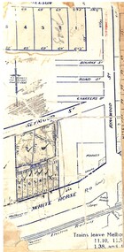
Map, Partially trimmed copy of a retail and residential auction advertisement, Ringwood, Vic. - 1926
... One of 3 unrelated land subdivision maps on cardboard... unrelated land subdivision maps on cardboard backing. Numbered ...One of 3 unrelated land subdivision maps on cardboard backing. Numbered allotments on Nelson Street, Seymour Street and Whitehorse Road, Ringwood.W.J. Bonwick, Licensed Surveyor, Phone WU4830. Location map also includes Bourke Street, Bond Street, Charter Street, Ringwood Street, and Shops and Market sites in Ringwood. -
 Ringwood and District Historical Society
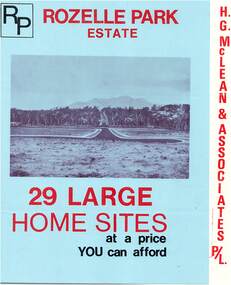
Flyer, Subdivisional Land Sale Brochure, Rozelle Park Estate, Ringwood East, Vic. - circa 1968
... Folded land subdivision sale advertisement for 29 home...Subdivision includes Wingate Avenue and Rozelle Avenue ...Folded land subdivision sale advertisement for 29 home sites, with location map and summary of local facilities and services. Separate price list leaflet enclosed with terms of sale.Subdivision includes Wingate Avenue and Rozelle Avenue, Ringwood East. Agent - H.G. McLean & Associates Pty. Ltd., 166 Canterbury Road, Heathmont. Phone 870 3422 A/H 870 5879. -
 Ballan Shire Historical Society
Map - Map. Korweinguboora, Department of Lands and Survey, Korweinguboora. Counties of Talbot and Grant
... A map of the Korweinguboora area showing land subdivisions... of the Korweinguboora area showing land subdivisions and names of owners ...A map of the Korweinguboora area showing roads, forests, railway lines and properties with the owners names.The inclusion of the names of landowners is of significance and value to historians.A map of the Korweinguboora area showing land subdivisions and names of owners and other physical features. There is a scale in chains. No date is certain but it could be 1902. The map has been repaired with sellotape.There are various pencil annotations but the are difficult to read.talbot, moorarbool west, wombat, bullarto, korweinguboora, moorarbool east, dean, wombat state forest, barkstead -
 Ringwood and District Historical Society
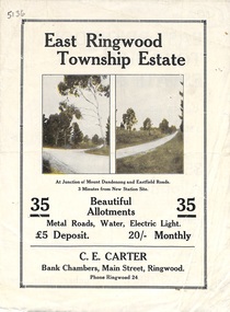
Flyer, Subdivisional Land Sale Brochure, East Ringwood Township Estate, Vic. - 1923
... Bi-folded double sided land subdivision sale advertisement...-folded double sided land subdivision sale advertisement ...Bi-folded double sided land subdivision sale advertisement with location map and summary of local facilities and services. Includes two additional images of allotment plan with subsequent handwritten notations.Subdivision includes Mount Dandenong Road, Grey Street, and Eastfield Road. Agent - C.E. Carter, Bank Chambers, Main Street, Ringwood. Phone Ringwood 24. -
 Ballan Shire Historical Society
Map - Map. Shire of Ballan, Shire of Ballan
... and land subdivisions. It appears to be a copy of the original..., towns, settlements, State parks and forests and land ...This is a fairly comprehensive map of the former Shire of Ballan which is now amalgamated into the Shire of Moorabool.A black and white map of the Shire of Ballan showing major roads, rivers, towns, settlements, State parks and forests and land subdivisions. It appears to be a copy of the original as no dates or maker or printer appear on the map. There is a scale of 2 miles to 1 inch.gordon, ballan, bungal, kerrit bareet, borhoneyghurk, bungeeltap, ballark, yaloak, gorong, beremboke, wallace, ingliston, hunterston, millbrook, bradshaw, myrniong, blackwood, moorarbool, greendale, bayup, trentham, bullarto, korweinguboora, glenlyon, bolwarra -
 Ringwood and District Historical Society
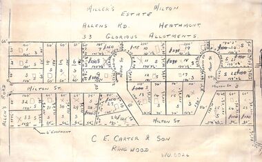
Pamphlet - Land Sales Brochure, Miller's Estate , Heathmont - circa 1950s
... Hand-drawn land subdivision map with 33 allotments...LP28038 P/R 1954 Hand-drawn land subdivision map with 33 ...Hand-drawn land subdivision map with 33 allotments of the Miller's Estate on Allens Road, Milton Street, Heath Court and Mont Court, Heathmont. Sold by CE Carter & Son, Ringwood WU6024. (2 copies, one on blue cardboard backing.)LP28038 P/R 1954 -
 Greensborough Historical Society
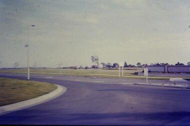
Slide - Photograph, John Ramsdale, Riverside: Slide 1, 1990s
... Photograph shows a new land subdivision, with the name... Plenty Lower Plenty melbourne Photograph shows a new land ...Photograph shows a new land subdivision, with the name "Riverside" on a wall.Part of the John Ramsdale collection of slides and audio visual material.Colour photograph scanned from slide.No maker's marks or captions -
Canterbury History Group
Map - Canterbury Subdivisions
... and dates of land subdivision in Canterbury and surrounding suburbs.... and dates of land subdivision in Canterbury and surrounding suburbs ...A collection of 6 maps with notations showing the names and dates of land subdivision in Canterbury and surrounding suburbs.canterbury, logans estate, shrublands estate, claremount park estate, arklow hill estate, griffin estate, monomeath estate, mont albert park estate, great railway estate, grange estate -
Glen Eira Historical Society
Document - Orrong Estate
... Subdivision Land titles Auctions Auctioneers Buildings by condition ...Photocopy of the contract and conditions of sale of Orrong Estate to Ernest Melbourne Boyle, dated 12/01/1916. Includes a hand drawn plan of the area. Photocopied receipt for payment by Ernest Melbourne Boyle, dated 13/01/1916.orrong estate, orrong road, inkerman road, caulfield, labassa grove, pearson grove, sydney arnold best and co, yeo crosthwaite and co, east st kilda sand proprietary limited, east saint kilda sand proprietary limited, seton williams and heathfield, estate agents, legal documents, receipts, real estate agents, financial documents, lawyers, subdivision, land titles, auctions, auctioneers, buildings by condition, land sales, land values, boyle ernest melbourne -
Glen Eira Historical Society
Map - CAPLES PLACE SUBDIVISION
... and others written directly onto the copy. Land Subdivisions ...This file contains a copy of a map of the CAPLES PLACE SUBDIVISION, undated and author unknown. The map provides the dimensions of roads and allotments in the area, including also handwritten notes from the original document and others written directly onto the copy.land subdivisions, documents, maps, glen eira, caples place, caples place subdivision, land surveys, orrong road, mulgrave road, prahran grove, somerset road, prahran grove, prahran grove, east walk, land allotments, town planning, garden road -
Southern Sherbrooke Historical Society Inc.
Map - photocopy
... (in 2 land sales advertisements subdivision "Villette Estate ...A photocopy taken from the original land sale map provided to the society through Karel Coxell of Stockdale & Leggo. The original maps are stored in large bound account books and were originally the propert of McNally Real Estate. The books are held (in 2A3 photocopy of plan of survey of part of Crown Allotments 20 & 21, section C, parish of Narre Worran, County of Mornington. Clements Ave and environs in Belgrave Heights"Villette Estate" in top LH corner, "Locality Plan" in bottom LH corner, "Not in sale" written on one block and crossed out. All handwritten in pencil on original. "Colby Drive " and "Verona Street" added in pencil to copy.land sales, advertisements, subdivision -
Ringwood and District Historical Society
Memoirs, McKellar, Margaret et al, Text of talk to Ringwood Historical Society by Margaret and Ian McKellar - history of "Reaghill" and Davies Family. 2005, 24-Sep-05
... The two articles give the history of the land subdivisions... of the land subdivisions over the years, of "Reaghill", a house owned ...The two articles give the history of the land subdivisions over the years, of "Reaghill", a house owned by the Davies family. The history of the land and family was given in a talk to Ringwood Historical Society by the McKellars in 2005.9 type-written pages. Pages 1-4 talk given by Margaret and Ian McKellar to the Ringwood Historical Society and a map. Pages 5-9 history of Reaghill and the Davies Family. +Additional Keywords: McKellar, Margaret / McKellar, Ian / Davies, George / Davies, Dora -
Whitehorse Historical Society Inc.
Legal record - Land Title, Certificate of Title, 19/06/1911
... Certificate of Title of land at Lot 6 Subdivision 404.... Certificate of Title of land at Lot 6 Subdivision 404 Blackburn ...Certificate of Title of land at Lot 6 Subdivision 404 Blackburn on Whitehorse Road.Certificate of Title of land at Lot 6 Subdivision 404 Blackburn on Whitehorse Road.Certificate of Title of land at Lot 6 Subdivision 404 Blackburn on Whitehorse Road.goodwin, william, whitehorse road, blackburn, williams road, blackburn, certificates -
 Surrey Hills Historical Society Collection
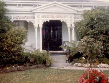
Photograph, 101 Guildford Road, Surrey Hills
... development of housing on the first urban land subdivision in Surrey... to encourage development of housing on the first urban land subdivision ...The house was built in 1883, possibly to encourage development of housing on the first urban land subdivision in Surrey Hills, the Windsor Park Estate (in the Windsor Crescent area). This coincided with the opening of the Surrey Hills Railway station. The first occupant was John Brown Nicholson, police magistrate. In 1884 the foundation meeting of the Wyclif Congregational Church was held in the house.Colour photo of the front door and verandah of 101 Guildford Road taken from the street. The house is Victorian in style with ornate lacework along the verandah. It is painted white and has a slate roof. There is a well-maintained garden with flower beds and shrubs, which partially obscure the house.victorian style, wyclif church, houses, guildford road, john brown nicholson -
 Kew Historical Society Inc
Book, Plan of General Development, Melbourne : Report of the Metropolitan Town Planning Commission
... Housing and Land Subdivision Part VIII Civic Art and Amenities... Part VI Public Utilities Part VII Housing and Land Subdivision ...The 1929 report of the Metropolitan Town Planning Commission covering Melbourne and its suburbs. Includes photographs and 15 folding maps (some in rear pocket) This was a planning scheme to prevent 'misuse' of land and protect property values. It highlighted traffic congestion, the distribution of recreational open space and haphazard intermingling of land uses. The plan identified a number of problems, such as the congestion at St Kilda Junction, that were not addressed until decades later. The plan also recognised the value of Melbourne's waterways as an open space network.xii, 308 p., [25] leaves of plates (24 folded) : ill., maps (some col.), ports., plans ; 34 cm. CONTENTS Part 1 Surveys and studies Part II Communications Part III The execution of improvement schemes - a programme of urgent works Part IV Zoning Part V Public Recreation Part VI Public Utilities Part VII Housing and Land Subdivision Part VIII Civic Art and Amenities Part IX Miscellaneous Part X Legislation Part XI Conclusionnon-fictionThe 1929 report of the Metropolitan Town Planning Commission covering Melbourne and its suburbs. Includes photographs and 15 folding maps (some in rear pocket) This was a planning scheme to prevent 'misuse' of land and protect property values. It highlighted traffic congestion, the distribution of recreational open space and haphazard intermingling of land uses. The plan identified a number of problems, such as the congestion at St Kilda Junction, that were not addressed until decades later. The plan also recognised the value of Melbourne's waterways as an open space network.city planning -- victoria. -- maps, city planning -- victoria -- melbourne, city planning -- victoria, civic improvement -- victoria -- melbourne, melbourne -- (vic.), cartography -
 Ringwood and District Historical Society
Document - Correspondence, REIV Proposal - History of Land Subidivision in Melbourne 1880-1960
... to commission a history of land subdivisions around Melbourne from circa..., with attachment: Proposal for The REIV to commission a history of land ...Email from Marie Wallington via Richard Carter (Carter Real Estate, Ringwood, Victoria) to G. Bruno (Real Estate Institute of Victoria), 31 October, 2008, with attachment: Proposal for The REIV to commission a history of land subdivisions around Melbourne from circa 1890s to circa 1960s. Subsequent Report to Past Presidents' Council dated 10th March 2009 including submission of proposed printing costs by Bounce Books, Rosanna, Victoria. Email from Allan Lord sent Monday, 4 April 2011 to Richard Carter, Subject: Wednesday Meeting, with list of names (for discussion?).