Physical description
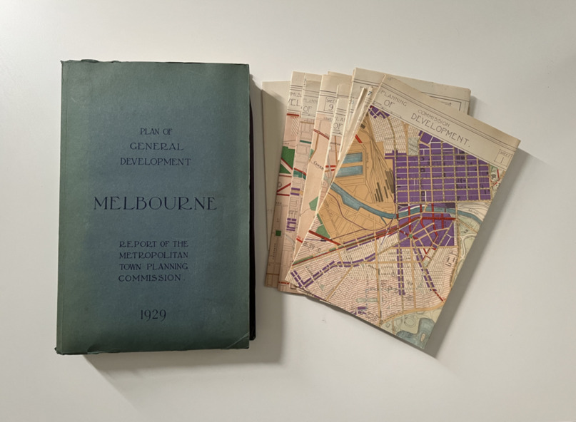
xii, 308 p., [25] leaves of plates (24 folded) : ill., maps (some col.), ports., plans ; 34 cm.
CONTENTS
Part 1 Surveys and studies
Part II Communications
Part III The execution of improvement schemes - a programme of urgent works
Part IV Zoning
Part V Public Recreation
Part VI Public Utilities
Part VII Housing and Land Subdivision
Part VIII Civic Art and Amenities
Part IX Miscellaneous
Part X Legislation
Part XI Conclusion
Publication type
non-fiction
Summary
The 1929 report of the Metropolitan Town Planning Commission covering Melbourne and its suburbs. Includes photographs and 15 folding maps (some in rear pocket) This was a planning scheme to prevent 'misuse' of land and protect property values. It highlighted traffic congestion, the distribution of recreational open space and haphazard intermingling of land uses. The plan identified a number of problems, such as the congestion at St Kilda Junction, that were not addressed until decades later. The plan also recognised the value of Melbourne's waterways as an open space network.
Keywords
References
- Melbourne's strategic planning history Department of Environment, Land, Water and Planning (2022)
- Digitised copy of the Report Department of Environment, Land, Water and Planning (2022)