Showing 420 items
matching quartz gold
-
 Bendigo Historical Society Inc.
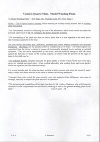
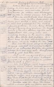
Document - VICTORIA QUARTZ - MODEL WINDING PLANT AT THE VICTORIA QUARTZ MINE
... DOCUMENT Gold victoria quartz Victoria Quartz Model Winding ...Handwritten copy of an article titled 'A Model Winding Plant' which appeared in the Bendigo Advertiser Thursday June 30, 1910 on Page 5. Article describes the winding plant and mentions the remodelling of the plant supervised by Mr W Abraham. The designing and remodelling of the plant was done by Mr Andrew Harkness.document, gold, victoria quartz, victoria quartz, model winding plant at the victoria quartz mine, bendigo advertiser june 30 1910, the victoria quartz company, mr w abraham, mr andrew harkness -
 Bendigo Historical Society Inc.
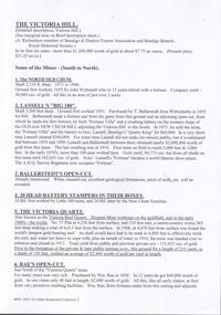
Document - BENDIGO ADVERTISER - NOTES ON VICTORIA QUARTZ
... DOCUMENT Gold victoria quartz Victoria Quartz Notes ...One typed and one handwritten copy of articles from the Bendigo Advertiser. Items mentioned are a man killed in an explosion at the mine, yields of gold at various depths, ventilation at the mine and a new discovery.document, gold, victoria quartz, victoria quartz, notes on victoria quartz, victoria quartz mine explosion, bendigo advertiser 11/7/1905, lansell's 180 tribute, bendigo advertiser mining intelligence 3/8/1908, crushings - bendigo advertiser17/8/1908, ventilation at the victoria quartz - bendigo advertiser 17/9/1908, victoria quartz - a reef at 4504 feet - bendigo advertiser mining intelligence 29/8/1908 -
 Bendigo Historical Society Inc.
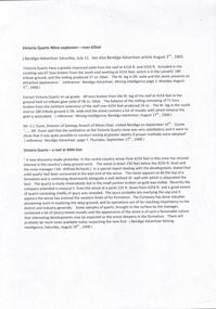
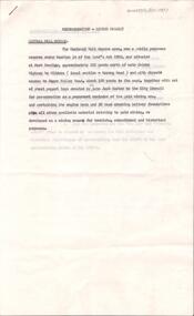
Document - VICTORIA QUARTZ - EXTRACT FROM OUR 'MINES' NEW CHUM & DEVONSHIRE LINE
... DOCUMENT Gold victoria quartz Victoria Quartz Extract from ...Handwritten extract from Our Mines New Chum & Devonshire Line. Written on the paper is: Miner Killed Sth Belle Vue 19/2/1894. Great Central Victoria - Adv 3/7/1899 Page 3. Has worked steadily to get down to the Victoria Quartz formation; but progress has been slow on account of hand labour being in vogue on the mine. Extract from Our'Mines' New Chum & Devonshire Line.document, gold, victoria quartz, victoria quartz, extract from our 'mines' new chum & devonshire line, sth belle vue, great central victoria, our 'mines' new chum & devonshire line -
 Bendigo Historical Society Inc.
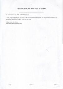
Document - VICTORIA QUARTZ - VICTORIA QUARTZ MACHINERY
... DOCUMENT Gold victoria quartz Victoria Quartz Victoria ...Handwritten notes describing the machinery at the Victoria Quartz Mine. Items mentioned are: Poppet Legs, Pithead Pulleys, Braces, Boilers, Winding Engines, Platform, Air Compressor, Boiler Feed Pump and a Feed-water Heater which was attached to the main exhaust pipe of the winding engines.document, gold, victoria quartz, victoria quartz, victoria quartz machinery, bendigo advertiser1/2/1897 & 4/9/1896 & 10/2/1897, roberts & sons, mr w foote, mr ennor -
 Bendigo Historical Society Inc.
Document - VICTORIA QUARTZ - VICTORIA REEF QUARTZ MINE MANAGER'S REPORT
... DOCUMENT Gold victoria quartz Victoria Quartz Victoria Reef ...Two copies of the Victoria Reef Quartz Mine Managers report. The report mentions putting up the poppet heads, drainage assessment, water level and two men offered 50/- per week. Dates 14/6/1861, 22/6/1861, 18/10/1861 and 13/12/1861.document, gold, victoria quartz, victoria quartz, victoria reef quartz mine manager's report, victoria reef gold mines, gerraws, mr cook, mr sterry, mr mollison, endeavour coy, the victoria reef gold mines coy, ironbark co, endeavour, chenoweth, mr hoskins -
 Bendigo Historical Society Inc.
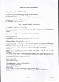
Document - VICTORIA QUARTZ - FROM THE VICTORIA QUARTZ MINE MANAGER'S REPORT
... DOCUMENT Gold victoria quartz Victoria Quartz From ...Handwritten ona piece of paper, from the Bendigo Advertiser 1/1/1900. 'Victoria Quartz. Winze below 2,606 ft. 104 tons for 850 ozs 3 dwt. Gold. From Mine Manager's Report. Per Bgo. Adv. On the back is written: fortitude Club. Any money rec'd. Victoria Quartz. 'Leader' at Museum.document, gold, victoria quartz, victoria quartz, from the victoria quartz mine manager's report, bendigo advertiser 1/1/1900, fortutude club -
 Bendigo Historical Society Inc.
Document - VICTORIA QUARTZ - NOTES ON THE VICTORIA QUARTZ 1910
... DOCUMENT Gold victoria quartz Victoria Quartz Notes ...Handwritten notes on the Victoria Reef Quartz Half Yearly Meeting, Cost of Shaft Sinking and striking water at the Victoria Quartz Mine. Includes detailed expenditure of wages, Firewood, explosives, etc.document, gold, victoria quartz, victoria quartz, notes on the victoria quartz 1910, victoria reef quartz, j h craig, h harkness & co, bendigo advertiser 1/2/1910 - 2/2/1910 - 30/6/1910, mr h mcgowan -
 Bendigo Historical Society Inc.
Document - VICTORIA QUARTZ - MINE MANAGER'S REPORTS 1886-87 YIELDS
... DOCUMENT Gold victoria quartz Victoria Quartz Victoria ...Typed copy and a handwritten copy of the Victoria Quartz Manager's Reports, 1886-87 Yields. Items mentioned are: depth from the surface, type of stone, crushings and depth of Plat Nos 1 to 13 from the surface.document, gold, victoria quartz, victoria quartz, victoria quartz mine manager's reports 1886-87 yields, samuel renfrey, 180 boundary -
 Bendigo Historical Society Inc.
Document - VICTORIA QUARTZ - NOTES ON THE VICTORIA QUARTZ MINE
... DOCUMENT Gold victoria quartz Victoria Quartz Notes ...Three typed and one handwritten copies of notes on the Victoria Quartz Mine. Notes include Size of Lease, Depth of Shaft, Locality, P;lant, Early History, Leading & Prominent, Best Gold and Gold Yield.document, gold, victoria quartz, victoria quartz, notes on the victoria quartz mine, goldmines hotel, mr william rae, lansell's 180, mr e j dunn, geological branch of the mines department, new chum railway mine, new chum drainage association, mines dept special edition australian mining standard 1/6/1899, mines dept booklet 'bendigo goldfield' 1936, mines dept annual and quarterly reports, annals of bendigo, a richardson -
 Bendigo Historical Society Inc.
Document - VICTORIA QUARTZ - NOTES ON VICTORIA QUARTZ
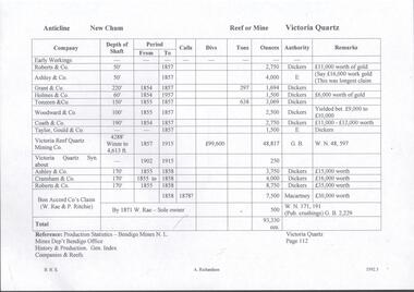
... DOCUMENT Gold victoria quartz Victoria Quartz Notes ...Handwritten page of notes listing Company, Depth of Shaft, Years and Ounces of Gold, Names of Companies listed: Roberts & Co, Ashley & Co, Grant & Co, Holmes & Co,Touzeau & Co, Woodward & Co, Coath & CO, Taylor Gould & Co, Victoria Reef Quartz Mining Co, Victoria Quartz Syn, Cranshaw & Co and Bon Accord Co.document, gold, victoria quartz, victoria quartz, notes on victoria quartz, roberts & co, ashley & co, grant & co, holmes & co, touzeau & co, woodward & co, coath & co, taylor gould & co, victoria reef quartz mining co, victoria quartz syn, cranshaw & co and bon accord co, dickers, macartney, w rae, p ritchie, production statistics - bendigo mines n l, mines dept bendigo, history & production gen index of companies & reefs -
 Bendigo Historical Society Inc.
Document - VICTORIA QUARTZ - NOTES ON THE VICTORIA QUARTZ & RAE'S OPEN CUT
... DOCUMENT Gold victoria quartz Victoria Quartz Notes ...Handwritten page and carbon copy of notes on the Victoria Quartz Mine and Rae's Open Cut.document, gold, victoria quartz, victoria quartz, notes on the victoria quartz & rae's open cut, victoria reef company, wm rae, eastern victoria reef -
 Bendigo Historical Society Inc.
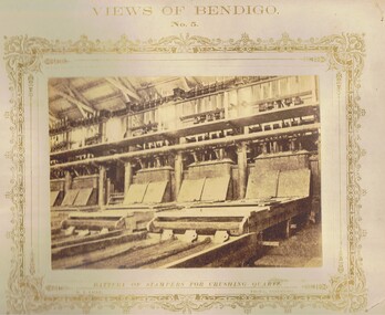
Photograph - VIEWS OF BENDIGO: BATTERY OF STAMPERS, c. 1870's
BHS CollectionSepia toned photograph. Photograph No. 5 - Battery of Stampers for crushing quartz. Printed on front of mount - 'The reduction of Quartz by means of Stampers, adopted on the Gold Fields of Bendigo. The most extensive Plants, being those at Koch's Pioneer Claim, Long Gully; The Great Extended Hustler's; also the Garden Gully United; and the Crushing Plant, New Chum Gully. Nicholas CaireN.J. Cairetopic, mining, battery -
 Bendigo Historical Society Inc.
Document - MINING REPORTS - FAMOUS GOLD MINES OF BENDIGO AND EAGLEHAWK
Handwritten notes by Albert Richardson, titled 'Famous Gold Mines of Bendigo and Eaglehawk'. Notes include gold yields, deep shafts in 1904 and 1911, shafts of more than 4,000 feet, shafts between 3.020 and 3,682 feet and the reef line they were on, wages for different mine workers and a reference to winding engines and air compressors. Miner's mentioned: Ballerstadt, Wittscheibe, Lufffmans, Burrows, Sterry, Lazarus, Koch, Hidebrandt, Watson and George Lansell.gold, mining reports, mining reports, famous gold mines of bendigo and eaglehawk, the victoria quartz, new chum railway, miners wages, albert richardson -
Bendigo Historical Society Inc.
Document - Return of Gold Mines 1859, 1876
Four page photocopy document 'Legislative Assembly 1859, Return of gold mine leases'. Information detailed includes: lessee; name of company; gold field; mining district; description of lease (alluvial/quartz) area; term; annual rent; capital, machinery value; minimum number of men to be employed. Example: Union Co., Sheepshead Gully, quartz mine, area 3 roods, and 22 perches, term 10 years, amount of rent 4 pounds 8 shillings and ninepence, capital 4,000 pounds, machinery 3,000 pounds, minimum amount of men to be employed - 2. Names of mine lessees: W. Tongue, R. Lysle, G. Nevison, T. Porter, J. Griston. mining, sandhurst, mining leases, labour convenant, union co., sheepshead gully, quartz mine, legislative assembly, return of gold mines, -
 Bendigo Historical Society Inc.
Document - LANSELL'S BIG 180 MINE - CONDENSED HISTORICAL RECORD OF LANSELL'S BIG 180 MINE
Two handwritten and three typed copies of a Condensed Historical Record of Lansell's Big 180 Mine on the New Chum Line of Reef. Notes include location, shaft, first worked, size of lease, plant, engine house, boiler rooms, mullock heap, early history, Prominent, best gold, underground connections, pressurised hot water, diamond drill bores and a table with depths and the increase in temperature with the depth (in Fahr). Albert Richardson Collection. document, gold, lansell's big 180 mine, lansell's big 180 mine, condensed historical record of lansell's big 180 mine, wittscheibe, ballerstadt, ernst mueller, theodore ballerstadt, george lansell, north old chum, victoria quartz, mines dept special edition 'australian mining standard' 1/6/1899, mines dept booklet 'bendigo goldfield' 1936, quarterly reports, lansell's 180 mine 'transverse sections, annals of bendigo mining sections, a richardson's observations from old photographs and measurements of mining plans, measurements taked from caleb thomas' report mines dept 1875, 'report on observation of underground temperature at bendigo' james stirling government geologist 1899, a richardson -
 Bendigo Historical Society Inc.
Document - LANSELL'S BIG 180 MINE - ROBBERY AT THE 180 MINE
Handwritten notes and typed copy of same, on a gold robbery at the 180 Mine. One man was arrested and two escaped. The engine driver was also arrested as an accessory to the crime. The underground manager, Mr John Baxter decided to set a watch and the men were caught red-handed. The Det-Sgt was reduced in rank and transferred to Melbourne. He knew the men would be coming up at a certain time. He didn't have sufficient police to surround the mine and he did not take any lanterns. Albert Richardson Collection. document, gold, lansell's big 180 mine, lansell's big 180 mine, robbery at the 180 mine, bendigo advertiser mon jan 11th 1897 page 3, mr lansell, john baxter, edward west, mr northcott, det-sgt griffin, const. davidson, const. mallon, mr edwards, mr grenfell, long gully fire brigade, victoria quartz mine, bendigo advertiser tues jan 12th 1897, mr thomas, bendigo advertiser mon jan 18th 1897 page 3, alfred rogers, mr pellow, james trahair, bendigo advertiser fri jan 22nd 1897, bendigo advertiser fri feb 26th 1897, bendigo advertiser fri april 2nd 1897 -
Bendigo Historical Society Inc.
Book - AUCTION SALES: MINING CATALOGUE AUCTION SALES
Blue, black & white Woolstar exercise book with black & white check pattern to the left and a world globe over the top. Name on the front: A Richardson. Written on the front: Mining Catalogue Auction Sales. Book contains Lot numbers and description for auction sales at various mines. Mines mentioned are: Central Blue Gold Mine 19/2/42, Big Blue 23/11/1938, South Blue, Hercules Consols 19/2/1942, South Virginia 19/2/42, New Prince of Wales 5/2/48, Golden Carshalton G M 19/12/1957, North Virginia 3/5/57, North Nell Gwynne 25/2/53, South Shaft Diamond Hill, New Don 21/10/48, Sheepshead Battery Site 21/10/48, Forbes Carshalton 9/7/47, South Virginia 9/7/47, East Clarence 31/8/49?, Deborah Surplus Equipment 31/8/49, Deborah No 2 Shaft, North Deborah 31/8/49, Hercules Main Shaft 19/6/1950, Stanfield Shaft 20/6/1950, United Crushing Coy Battery (Unity Carlisle) 20/6/1950, Toolleen Gold Mine 23/2/1950, Ironbark Gold Mine 6/10/49, Ironbark South 1/12/49, Hercules New Chum 1/12/49, Great Southern Gold Mine 10/4/47, New Chum Syncline 2/3/1950, Deborah Associated 19/4/195? And the Deborah Consolidated 19/4/1950. Further information of Bendigo Mines from The Gold Mining Registry Guide to Bendigo Mines by H Kirkwood, Eaglehawk. Published by W. Welch. Mines include Lazarus New Chum Reg'd & Lazarus New Chum No 1, Princess Alexandra, Ellenborough, Trio-Hauling Coy, South Catherine Reef G. M. C., Princess Alice, Central Catherine Co,Cravens New Chum Co N. L., Garibaldi Mining and Crushing Co, Williams United, Catherine Reef Claimholders G. M. N. L., New Chum & Victoria Reef, Johnsons (Garden Gully) Line, United Ulster, Garden Gully Rly Reserve, South Ulster, Ulster and Cosmopolitan Coys, Golden Gate and Lansell'sBig 180. Some information on the Moon Mines 24/6/67 South New Moon, New Moon, Nth New Moon and New Moon Consolidated.In the reverseof the book is some information on the Lazarus New Chum Mine, Lazarus No 1 and Lazarus Mines. Also mentioned are New Chum Rly and Victoria Quartz. In 1895 a large gold bearing reef in Lazarus at 3000 feet. Also Some extracts from E. C. Dunn's Report 13/8/92 on the Lazarus Mine Old Shaft and Lazarus Main Shaft at various depths. Book not located on 6.3.25. Typed notes from book are in folder.book, bendigo, mining auction sales, auction sales, mining catalogue auction sales, a richardson, central blue g m, big blue, south blue, hercules consols, south virginia, new prince of wales, golden carshalton g m, north virginia, north nell gwynne, south shaft diamond hill, new don, sheepshead battery site, forbes carshalton, south virginia, east clarence, deborah, deborah no 2 shaft, north deborah, hercules main shaft, stanfield shaft, united crushing coy battery (unity carlisle), toolleen gold mine - toolleen, ironbark gold mine, ironbark south, hercules new chum, great southern gold mine, new chum syncline, deborah associated, deborah consolidated, j h curnow, miss kirkwood, the gold mining registry guide to bendigo mines, h kirkwood, w welch, lazarus new chum no 1, mr g armstrong, princess alexandra, h hectmann, ellenborough, amos arblaster, trio hauling coy, catherine reef g m c, w burnside, st mungo reef, princess alice, central catherine co, big catherine, belmont, cravens new chum co n l, wm w barker, c edwards, ellesmere, garibaldi mining and crushing co, henry von der heyde, w martin, williams united, wm cook, john chynowth, catherine reef claimholders g m n l, churchill davidson, edgar l rosman, new chum and victoria reef, johnsons (garden gully) line, united ulster, james mccoll, james quick, garden gully reserve, south ulster, ulster and cosmopolitan coys, golden gate, geo lansell's big 180, signal of a mine, mr langridge, e clarke, j hattam, a llewelly, n murray, a richardson, new moon, nth new moon, new moon consolidated, lazarus new chum, lazarus no 1, new chum rly, victoria quartz, lazarus, e c dunn -
 Bendigo Historical Society Inc.
Document - NEW CHUM CONSOLIDATED MINE - NOTES ON THE NEW CHUM CONSOLIDATED MINE
Handwritten notes of an article in the Bendigo Advertiser 1/1/1881. Notes include production, water in the North Old Chum, New Chum & Victoria shafts and it's consequences on employment and amalgamation of companies. Taken from Bendigo Advertiser Leader - 'Our Mines'. Albert Richardson Collection. document, gold, new chum consolidated mine, new chum consolidated mine, notes on the new chum consolidated mine, ellesmere, consolidated reef, new chum united, lazarus, lazarus no 1, old chum, new chum & victoria, north old chum, lansell's 180, victoria quartz, mr lansell, bendigo advertiser 1/1/1881, bendigo advertiser leader - our mines -
 Bendigo Historical Society Inc.
Document - RAE'S CRUSHING BATTERY - THE RICH VICTORIA HILL & ITS HISTORICAL ASSOCIATIONS
The first five pages are photocopies of photos:- 2 of Rae's Crushing Works; Victoria Quartz on Victoria Hill, Ironbark; Looking North from Old Chum Hill to the Victoria Hill; Victoria Hill - from Rae's Open Cut. Introduction covers location of buildings and mines. Mentioned are:- North Old Chum Mine, Ballerstedt's First Open-cut, Quartz Veins (Spurs), rock formations pitching North, Prospecting shafts 1929, Concrete dam, Engine beds of Lansells Big 180 Mine, Lansells Big 180 Shaft, twenty stampers crushing battery, Lansell's Cleopatra Needle type chimney, Victoria Quartz Mine, Victoria Quartz dams, Rae's Open-cut, Quartz once roasted here to an intense heat, Anticlinal Arch New Chum Line, small primitive tunnels, Prospecting tunnels, Floyd's small 5 head crushing battery, Great Central Victoria (Midway) Shaft, Great Central Victoria engine-bed, Ballerstedt's small 24 yard claim, The Humboldt, Adventure ground, The Advance, Luffsman & Sterry's Claim, A round shaft. Small piece of paper with 'Notes on Victoria Hill complete. Notes prepared by Albert Richardson.document, gold, rae's crushing battery, rae's crushing battery, rae's crushing works, victoria quartz mine, from old chum hill, victoria hill from rae's open cut, ironbark, hercules & energetic, midway, wittscheibe, great central victoria, mr & mrs conroy, central nell gwynne, gold mines hotel, john brown knitwear factory, new chum & victoria, rotary club of bendigo south, north old chum, ballerstedt's first open-cut, lansell's big 180 shaft, cleopatra needle type chimney, a roberts & sons, mr e j dunn, h harkness & sons, eureka extd, new chum railway, pearl, inrush of water at victoria quartz, floyd's small 5 head crushing battery, great central victoria (midway), ballertedt's small 24 yard claim, humboldt, humboldt, great central victoria, victoria hill, bendigo & vicinity 1895 p51, j n macartney 1st edition 1871, bendigo goldfield registry 1871, plan of new chum line, mr rae anderson, annals of bendigo obituary 1904, bendigo advertiser, b m l records mines dept, patterson's goldfields of victoria, dickers mining record 23/11/1861, australian mining standard special edition 1/6/1899 p40, bendigo mines ltd, chinese joss house, fortuna, the victoria goldfield 1851 to 1954, the victoria hill 1854 to 1949 -
 Bendigo Historical Society Inc.
Document - RAE'S CRUSHING BATTERY - THE RICH VICTORIA HILL
Eleven pages including four pages of photocopied photos, They are:- Wm Rae's Crushing Works, The Victoria Quartz Mine, Looking North from Old Chum Hill to the Victoria Hill early 1870's, Victoria Hill from Rae's Open Cut. Notes begin at page 4, there are two page 6 and no page 7, otherwise same notes as 3573.1. Small note with 'Notes on Victoria Hill - incomplete. Notes prepared by Albert Richardson.document, gold, rae's crushing battery, rae's crushing battery, wm rae's crushing works, victoria quartz mine, view from old chum hill to the victoria hill, victoria hill from rae's open cut, ballerstedt, lansell's bit 180, dickers mining record 23/11/1861, j n macartney bendigo goldfields registry 1871, new chum syncline, cleopatra needle type chimney, victoria quartz coy, annals of bendigo, australian mining standard special edition 1/6/1899, bendigo advertiser, bendigo & vicinity 1895, h harkness & sons, new chum drainage scheme, eureka extd, new chum railway, pearl, inrush of water at victoria quartz mine, floyd's small 5 head crushing battery, great central victoria (midway), midway, midway no 2, midway north, ballerstedt's small 24 yard claim, the humboldt, wittscheibe, the adventure, bendigo mines ltd, luffsman & sterry's claim, round shaft, chinese joss house, fortuna -
 Bendigo Historical Society Inc.
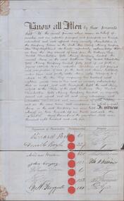
Document - THE SOUTH STAR QUARTZ MINING COY - ACCEPTANCE OF SHARES IN Catherine Reef United Claimholders Co, 1865
... DOCUMENT Gold the south star quartz mining coy The South ...Handwritten 'Receipt for, and acceptance of share' in the Catherine Reef United Claimholders Gold Mining Company, limited dated 6th November 1865. List of shareholders, their seals, the number of shares they have and witnesses. Note attached to the back: Edward Hunt, surgeon, appointing Thomas Kaye of Sailors Gully the lawful attorney to sign the rules of The Catherine Reef United Claimholders. Some of the signatures on the document are unreadable. Bottom quarter of the page is detached. document, gold, the south star quartz mining coy, the south star quartz mining coy, catherine reef united claimholders gold mining company limited, richard bell, ? boyle, andrew brown, john cargeeg, william dis?, ? froggatt, ? burrows, ? williams, james hart, john hart, ? kaye, edward hunt, george loudow, william nichols, john nichols, joseph taylor, robert thornton, ? williams, william winles, thomas kaye -
 Bendigo Historical Society Inc.
Document - VICTORIA HILL - THE RICH VICTORIA HILL AND IT'S HISTORICAL ASSOCIATION
Two copies of document : nineteen handwritten pages of notes on 'The Rich Victoria Hill and Its Historical Association' Signed by A Richardson and dated 30 - 8 - 1971. and a typed copy of same. Notes include: Introduction, Hotels, Mines, Mining History and descriptions of features where the signposts are. Mines mentioned in the text are: North Old Chum. Ballerstedt's first open cut, Lansell's Big 180. 20 head stamper, Lansell's Cleopatra Needle, Victoria Quartz Mine. Cleopatra's Needle was a square sectioned brick chimney with this four sided pyramidal chimney top with four vents to allow the smoke to escape whatever the direction of the wind. It was demolished in the 1950's as it had a bend in it and it was considered unsafe. Lansell had two other mines with similar chimneys, the '222' in Chum Street and his 'Sandhurst' or 'Needle' mine near the Bendigo, Eaglehawk boundary. Notes prepared by Albert Richardson.mine, gold, victoria hill, victoria hill, the rich victoria hill and it's historical association, j. n. macartney, quartz miner's arms hotel, ironbark methodist church, greek orthodox church, john brown knitwear factory, little 180 mine, geo lansell, conrad heinz, british & american hotel, victoria reef gold mining coy, manchester arms hotel, housing commission homes, ironbark (victoria reef gold mines, hercules and energetic, midway, wittscheibe, gt central victoria, wm rae, mr & mrs conroy, wm rae jr, central nell gwynne, moorhead's shop, gill family, gold mines hotel, david chaplin sterry, pioneer, new chum and victoria, burrowes and sterry, new chum and victoria tribute, rotary club of bendigo south, big 180, victoria quartz mines, jeweller's shop, bendigo and district tourist association, north old chum mine, john wybrandt, ballerstedt's first open-cut, j c t christopher ballerstedt, ballerstedt's mine, bendigo cemetry, lansell's 'cleopatra nedle' type chimney, 222 mine, sandhurst or 'needle' mine, victoria quartz mine, victoria reef quartz company, mr e j dunn, eureka ext'd, new chum railway, pearl, bendigo advertiser 16 june 1910, victoria consols, shamrock, shenandoah, victoria quartz dams, rae's open cut, prospecting tunnels, floyd's small 5 head crushing battery, gt central victoria (midway) shaft, midway no 2, midway north, ballerstedt's small 24 yard claim, the humboldt, the tribute coy, advance, luffsman and sterry's claim, a round shaft, chinese joss house, lansell's fortuna, p m g repeater station, a richardson -
 Bendigo Historical Society Inc.
Document - VICTORIA HILL - KEY TO SIGN POSTS ON AREA MAP
Three page hand written carbon copy of Sign numbers at Victoria Hill. No 1 North Old Chum Shaft, No 2 Ballerstedt's First Open - Cut. Special Sign Post, No 2 C Rock Formations Pitching North, No 2 B Rich shallow shafts, No 2 A Quartz veins, No 4 A Concrete Dams, No 3 Engine Beds - Lansell's 'Big 180' Mine, No 3 B Lansell's 'Big 180' Shaft, No 4 Twenty Stampers Crushing Battery, No 3 C Foundations - 'Cleopatra Needle' type Chimney for Lansell's 'big 180' Mine, No 5 Victoria Quartz Mine, No 5 A Fou;ndations Victoria Quartz Poppet Legs, No 5 C Foundations Victoria Quartz Winding Plant, No 5 B Victoria Quartz Dams, No 6 Rae's Open - Cut, No 9 Quartz Once Roasted Here, No 12 Anticlinal Arch, No 15 primitive Tunnels, No 14 Beautifully Coloured Rock Formations, No 16 Adit, Graded Bedding, Oblique Fault, Spurry Quartz Veins, No 17 Prospecting Tunnels, No 18 Floyd's Small Crushing Battery, No 19 Gt Central Victoria (Midway) Shaft, No 20 Great Central Victoria (Midway) Engine Bed, No 21 ballerstedt's Small 24 Yard Claim, No 22 Humboldt Shaft, No 23 Wittscheibe's 'Jeweller's Shop', No 24 The 'Adventure' ground, Large Open - Cut, No 26 Luffsman and Sterry's Ground, NO 27 A Round Shaft, Notes prepared by Albert Richardson.mine, gold, victoria hill, victoria hill, victoria hill key to sign posts on area map, north old chum shaft, ballerstedt's first open cut, lansell's big 180 shaft, 'cleopatra needle' type chimney, victoria quartz mine, rae's open cut, prospecting tunnels, floyd's small crushing battery, gt central victoria (midway) shaft, ballerstedt's small 245 yard claim, humboldt shaft, wittscheibe's 'jeweller's shop', adventure, luffsman and sterry's ground, david sterry, sterry's 'gold mines' hotel, round shaft -
 Bendigo Historical Society Inc.
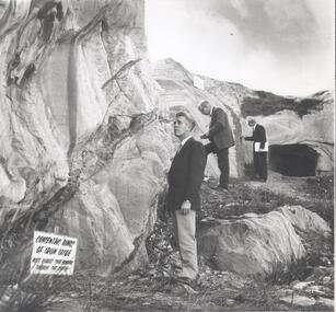
Photograph - VICTORIA HILL - PHOTOGRAPH WITH CONCENTRIC RINGS OF IRON OXIDE
Black and white photograph of three men dressed in suits looking at some rocks. The tall rock on the left has darker markings on it. In the background is a rectangular tunnel ? Opening. Sign at the foot of the rock reads: Concentric rings of iron oxide. Note quartz spur running throught the centre. A. E. Richardson written on the back. Some other indecipherable writing on the back.mine, gold, victoria hill, victoria hill, photograph with concentric rings of iron oxide, a e richardson -
 Bendigo Historical Society Inc.
Document - VICTORIA HILL - CONDENSED HISTORY OF VICTORIA HILL
Handwritten carbon copy of a short history of Victoria Hill. Date on top of page is 13/10/69. Notes mention claims and who bought them and the value of the gold. Notes prepared by Albert Richardson.mine, gold, victoria hill, victoria hill, condensed history of victoria hill, theodore ballerstedt, george lansell, touzeau and co., wm rae, bon accord, victoria quartz, wittscheibe's jeweller's shop, luffsman and sterry, adventure, advance, cinderella, j n macartney, bendigo goldfield registry, the backbone of sandhurst -
 Bendigo Historical Society Inc.
Document - VICTORIA HILL - VICTORIA HILL HISTORY
Hand written notes and typed copy of the history of Victoria Hill area. Some of the mines from South to North: North Old Chum, Lansell's 'Big 180', Ballerstedt's Open - Cut, 20 Head Battery Stampers, The Victoria Quartz, Rae's Open - Cut, which has some colourful geographical features, Central Victoria (also known as the 'Midway'), Wittshiebe's 'Jeweller's Shop', Boldt's 5 Head Crushing Battery (site only), Advance Shaft, Hercules & Energetic. Notes prepared by Albert Richardson.mine, gold, victoria hill, victoria hill, victoria hill history, north old chum, john wybrandt, lansell's 'bit 180', t ballerstedt, wittschiebe, fortuna villa, geo lansell, a h q survey regiment, ballerstedt's open cut, victoria quartz (victoria reef quartz), rae's open cut, wm rae, gt central victoria (midway), adventure, wittshiebe's 'jeweller's shop', boldt's 5 head crushing battery, advance, cinderella, hercules & energetic, john brown knitwear factory, a richardson -
 Bendigo Historical Society Inc.
Document - VICTORIA HILL - RECOMMENDATION - MINING PROJECT
Two (a & b) typed copy of a recommendation for mining project, accepted Nov. 1967. Recommendation for Central Nell Gwynne area, now a public purposes reserve for preservation as a permanent reminder of the gold mining era. Victoria Hill Area mentioned for it's geographical and historical significance. The New Chum Hill area rich in historical and mining. Notes on development of the Central Nell Gwynne, Victoria Hill and New or Old Chum Hill areas. Notes prepared by Albert Richardson.mine, gold, victoria hill, victoria hill, recommendation - mining project, central nell gwynne, jack barker, victoria hill area, big 180, victoria quartz, new chum hill (old chum hill), p. m. g. repeater station, mine's department, land's department, lansell, fortuna, a h q survey regiment, lazarus mine, b c v 8 television studio -
 Bendigo Historical Society Inc.
Document - VICTORIA HILL - THE BENDIGO DIGGINGS, PRELIMINARY DRAFT FOR BROCHURE
BHS CollectionNine typed pages of notes on a preliminary draft for a brochure on the Bendigo Diggings. First part is the objective which is to preserve the mining history and to have exhibits in the places they were used, e.g. quartz mining machinery exhibited in a quartz mining area, not on an alluvial field. Part B is historical notes on the area. Part C is the Site - Victoria Hill area. Part D is Stage One which consists of carpark area, technological museum, restaurant, mineral haulage line, picnic ground, earthworks and planting over the area. Part E is Stage Two which will consist of the open-air exhibits, in the area surrounded by the mineral haulage line, and the Central Nell Gwynne mine on the west side of the site. Part F is Stage Three which will consist of the winery, the steam tram track, the lake, the wildlife sanctuary and various buildings associated with gold mining. Part G is Costing with the prices to be filled in. Parts H and I are the Appeal and the Committee. Details to be filled in. Notes prepared by Albert Richardson.mining, marketing, victoria hill, victoria hill, the bendigo diggings - preliminary draft for brochure, aust national travel association, tullamarine jetport, emu bottom homestead, kyneton historical museum, chinese joss house, eaglehawk museum, whipstick scrub, cairn curran reservoir, castelmaine historical museum and market hall, national trust, ballarat hiatorical park, echuca's hopwood gardens, swan hill folk museum, gibson's mount alexander no 2 squatting run, captain brown, chief commissioner wright, hustler's reef, thomas hustler, mining board, drainage of reefs act 1862, first world war, bendigo amalgamated goldfields, second world war, sandhurst, w c vahland, battery trams, horse trams, steam trams, electric trams, central nell gwynne mine, theodore ballerstadt, george lansell, new chum hill, ballerstadt's open cut, 180 mine, new chum syncline battery, william rae, victoria quartz, wittscheibe's 'jeweller's shop', luffsman and sterry, gold mines hotel, adventure, bendigo and district tourist association, bendigo city council, bendigo branch of the royal historical society of victoria, professor brian lewis, school of architecture and building at the university of melbourne, taylor horsfield, lord robert cecil, south australian gold commissioner -
 Bendigo Historical Society Inc.
Document - VICTORIA HILL - MINES SITUATED ON VICTORIA HILL
Three pages of typed notes on creamy paper. Notes mention the mines on Victoria Hill and gives some information about them such as depth, ounces of gold extracted and who owned them. Mines mentioned are: The North Old Chum, Lansell's Big 180, Ballerstedt's Open-Cut, Little 180 Crushing Battery, the Victoria Quartz, Rae's Open-Cut, Great Central Victoria, Wittshiebe's 'Jeweller's Shop', Boldt's 5 Head Crushing Battery, Northern Slope and the Advance Shaft. Written in pencil at the top: Copy of material sent to Herald Reporter by R. Aulsbrook 30/7/68. Copied from my material and initialled AR. Notes prepared by Albert Richardson.mine, gold, victoria hill, victoria hill, mines situated on victoria hill, john wybrandt, wittscheibe, t ballerstedt, fortuna villa, george lansell, a h q survey regiment, ballerstedt's open-cut, little 180 crushing battery, little 180 mine, new chum syncline, victoria quartz (victoria reef quartz), rae's open-cut, william rae, great central victoria (midway), adventurer, wittshiebe's 'jeweller's shop', boldt's 5 head crushing battery, northern slope, the advance shaft, cinderella, hercules and energetic, john brown knitwear factory, r aulsbrook, the herald -
 Bendigo Historical Society Inc.
Document - VICTORIA HILL - SPECIAL FEATURES
Four hand written pages and typed copy, titled The Victoria Hill - Special Features. Notes mention the Victoria Hill, the deepest workings on the field,the first mine on the field to 2,000 and 3,000 feet in depth, Ballerstedt's Open-Cut, Rae;s Open-Cut, Wittscheibe's Jeweller's Shop, the Adventure, the richest cross-section of the whole of the Bendigo Goldfield, the first mine to pay dividends from ore mined below 1,000 feet to 1,500 feet from the surface, the tallest poppet legs on the field, Lazarus Mine, Barnet Lazarus, Mt Alvernia Hospital, Central Red White & Blue. Notes prepared by Albert Richardson.document, gold, victoria hill, victoria hill, victoria hill - special features, john neill macartney, the argus, the australasian, bendigo goldfields registry, victoria reef quartz mine, the deepest workings on the field, the first mine on the field to reach 2, 000 and 3, 000 feet in depth, lansell's 'big 180' mine, hot water, george lansell, theodore ballerstedt, fortuna, ballerstedt's open-cut, rae's open-cut, wittscheibe's jeweller's shop, adventure, advance, cinderella, the private pioneer coy, new chum & victoria mine, a h q survey regiment, tallest poppet legs, lazarus mine, barnet lazarus, mt alvernia hospital, central redwhite and blue, hudson's, burrowes & sterry, b c v 8 television station, swan hill's channel 11