Showing 369 items
matching city planning -- victoria -- melbourne
-
 Kew Historical Society Inc
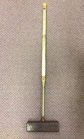
Equipment - Sports Equipment, Auburn Heights Recreation Club, Wooden Croquet Mallet, Twentieth Century
Sports Clubs in Kew in the final decades of the 19th century and in the early 20th century were often umbrella organisations with facilities for a number of sports. Typically in Kew, this included teams in lawn bowls, tennis and croquet. The Kew Bowling Club was formed in 1880 while the privately owned Auburn Heights Recreation Club was opened in 1904. The croquet courts at the Kew Recreation Club were opened in 1906, two years after the Club's formation. By 1998, the two Clubs decided to amalgamate at the Auburn Heights site in Barkers Road, forming the Kew Heights Sports Club. The combined club was itself taken over by the Melbourne Cricket Club in 2012 becoming MCC Kew Sports Club. In 2017 MCC Kew closed and its landholding was subsequently sold to Carey Baptist Grammar School. Both the Kew and Auburn Heights Clubs assembled important collections. These historically significant and large collections were donated to the Society in 2020. The collections include manuscripts, pictures, trophies, plans, honour boards etc. References Barnard FGA 1910, 'Sports and Pastimes' in Jubilee History of Kew Victoria: Its origin & progress 1803-1910. Chapman J & C 1999, The history of the Auburn Heights Recreation Club, 1904 to 1908. Reeve S 2012, City of Boroondara: Thematic Environmental History, p.216.The combined collections of the four sporting clubs making up the collection number hundreds of items that are historically significant locally. They are also significant to the sporting history of the greater Melbourne area and to the sports of lawn bowls and tennis in Australia in the 19th and 20th centuries. The collection illuminates two of the Victorian historic themes - 'Building community life' through forming community organisations and 'Shaping cultural and creative life' by participating in sport and recreation.Croquet mallet, Shaft made of a number of separate rectangular sections of pale wood, mostly wrapped with cotton cord and strips of leather. The rectangular head is made of a darker heavier wood and it is banded with a strip of lighter wood.croquet -- mallets, croquet -- equipment, auburn heights croquet club, auburn heights recreation club -
 Kew Historical Society Inc
Map, MMBW, MMBW Town of Kew, 1910-21
The Melbourne and Metropolitan Board of Works (MMBW) was established by an act of the Victorian Parliament in 1890 to prepare for and to implement a sewerage and water reticulation system across what was then inner Melbourne, its surrounding and middle distance suburbs, including Kew. The MMBW was disbanded in 1991.The map collection of the Kew Historical Society has at its core the historic maps assembled and originally stored in the City Engineer's Department of the City of Kew. These include maps in a number of scales. The vast majority of maps were produced by the MMBW in the first two decades of the twentieth century, and are solid working maps, backed by linen for durability. These maps are historically significant to Kew, the City of Boroondara and to the history of the development of state utilities in Victoria. A number of the Kew maps have additional details added by former municipal officers, including the levels reached by various floods. As these were working documents, information was added to them long after the period of their initial production and distribution.Early map of the Town of Kew, created after 1910, at a scale 440 ft to 1 inch. The 'assembled' map by the City of Kew Engineer's Department includes scaled down copies of The Melbourne and Metropolitan Board of Works maps, Nos. 39, 40, 64, 65, 66, 67, 68, and 117. The map covers the entirety of the Town of Kew, bordered on its north and west by the River Yarra, by Burke Road in the East and Barkers Road in the south. The map shows the extent of urban development by that time, prominent institutions and the outlines of built structures in the municipality. TOWN OF KEW / SCALE 400 FEET TO 1 INCHmelbourne & metropolitan board of works, mmbw maps, mmbw plans, town of kew, cartography -
 Kew Historical Society Inc
Map, MMBW, MMBW Plan No.39 Kew & Heidelberg, 1900-1910
The Melbourne and Metropolitan Board of Works (MMBW) was established by an act of the Victorian Parliament in 1890 to prepare for and to implement a sewerage and water reticulation system across what was then inner Melbourne, its surrounding and middle distance suburbs, including Kew. The MMBW was disbanded in 1991.The map collection of the Kew Historical Society has at its core the historic maps assembled and originally stored in the City Engineer's Department of the City of Kew. These include maps in a number of scales. The vast majority of maps were produced by the MMBW in the first two decades of the twentieth century, and are solid working maps, backed by linen for durability. These maps are historically significant to Kew, the City of Boroondara and to the history of the development of state utilities in Victoria. A number of the Kew maps have additional details added by former municipal officers, including the levels reached by various floods. As these were working documents, information was added to them long after the period of their initial production and distribution.Early map of part of the Borough of Kew, created in the first decade of the twentieth century, at a scale 160 ft to 1 inch. The map covers what was then the north western section of Kew, bordered on its north by Wills Street and the Kew Lunatic Asylum, in the west by the River Yarra [and the later added Yarra Boulevard] , by Princess Street in the East and Holroyd Street in the south. The map shows the extent of urban development by that time, prominent institutions and the outlines of built structures in the municipality. Contour lines were added in ink to the map at a later stage.MELBOURNE AND METROPOLITAN BOARD OF WORKS / PLAN NO. 39 / KEW & HEIDELBERGmelbourne & metropolitan board of works, mmbw maps, mmbw plans, borough of kew, cartography -
 Kew Historical Society Inc
Map, MMBW, MMBW Plan No.40 Collingwood & Kew, 1900-1910
The Melbourne and Metropolitan Board of Works (MMBW) was established by an act of the Victorian Parliament in 1890 to prepare for and to implement a sewerage and water reticulation system across what was then inner Melbourne, its surrounding and middle distance suburbs, including Kew. The MMBW was disbanded in 1991.The map collection of the Kew Historical Society has at its core the historic maps assembled and originally stored in the City Engineer's Department of the City of Kew. These include maps in a number of scales. The vast majority of maps were produced by the MMBW in the first two decades of the twentieth century, and are solid working maps, backed by linen for durability. These maps are historically significant to Kew, the City of Boroondara and to the history of the development of state utilities in Victoria. A number of the Kew maps have additional details added by former municipal officers, including the levels reached by various floods. As these were working documents, information was added to them long after the period of their initial production and distribution.Early map of part of the Borough of Kew, created in the first decade of the twentieth century, at a scale 160 ft to 1 inch. The map covers what was then the south western section of Kew, bordered on its north by Studley Park Road, in the west by Walmer Street and the River Yarra, by High Street South and Princess Street in the East and Barkers Road in the south. The map shows the extent of urban development by that time, prominent institutions and the outlines of built structures in the municipality. Contour lines and historic flood levels were added in ink to the map at a later stage.MELBOURNE AND METROPOLITAN BOARD OF WORKS / PLAN NO. 40 / COLLINGWOOD & KEWmelbourne & metropolitan board of works, mmbw maps, mmbw plans, borough of kew, cartography -
 Kew Historical Society Inc
Map, MMBW, MMBW Plan No.64 Kew & Heidelberg, 1900-1910
The Melbourne and Metropolitan Board of Works (MMBW) was established by an act of the Victorian Parliament in 1890 to prepare for and to implement a sewerage and water reticulation system across what was then inner Melbourne, its surrounding and middle distance suburbs, including Kew. The MMBW was disbanded in 1991.The map collection of the Kew Historical Society has at its core the historic maps assembled and originally stored in the City Engineer's Department of the City of Kew. These include maps in a number of scales. The vast majority of maps were produced by the MMBW in the first two decades of the twentieth century, and are solid working maps, backed by linen for durability. These maps are historically significant to Kew, the City of Boroondara and to the history of the development of state utilities in Victoria. A number of the Kew maps have additional details added by former municipal officers, including the levels reached by various floods. As these were working documents, information was added to them long after the period of their initial production and distribution.Early map of part of the Borough of Kew, created in the first decade of the twentieth century, at a scale 160 ft to 1 inch. The map covers what was then the northern most part of Kew, bordered on its north and west by the Yarra River, in the East by Connor's Creek and by the Asylum in the south. The map shows the extent of urban development by that time, prominent institutions and the outlines of built structures in the municipality. Contour lines and historic flood levels were added in ink to the map at a later stage.MELBOURNE AND METROPOLITAN BOARD OF WORKS / PLAN NO. 64 / KEW & HEIDELBERGmelbourne & metropolitan board of works, mmbw maps, mmbw plans, borough of kew, cartography -
 Kew Historical Society Inc
Map, MMBW, MMBW Plan No.65 Kew & Heidelberg, 1900-1910
The Melbourne and Metropolitan Board of Works (MMBW) was established by an act of the Victorian Parliament in 1890 to prepare for and to implement a sewerage and water reticulation system across what was then inner Melbourne, its surrounding and middle distance suburbs, including Kew. The MMBW was disbanded in 1991.The map collection of the Kew Historical Society has at its core the historic maps assembled and originally stored in the City Engineer's Department of the City of Kew. These include maps in a number of scales. The vast majority of maps were produced by the MMBW in the first two decades of the twentieth century, and are solid working maps, backed by linen for durability. These maps are historically significant to Kew, the City of Boroondara and to the history of the development of state utilities in Victoria. A number of the Kew maps have additional details added by former municipal officers, including the levels reached by various floods. As these were working documents, information was added to them long after the period of their initial production and distribution.Early map of part of the Borough of Kew, created in the first decade of the twentieth century, at a scale 160 ft to 1 inch. The map covers what was then the south central part of Kew, bordered on its north by Malmsbury Street, in the west by Florence Avenue, in the south by Barkers Road, and in the east by Princess Street. The map shows the extent of urban development by that time, prominent institutions and the outlines of built structures in the municipality. Contour lines were added in ink to the map at a later stage.MELBOURNE AND METROPOLITAN BOARD OF WORKS / PLAN NO. 65 / KEW & HEIDELBERGmelbourne & metropolitan board of works, mmbw maps, mmbw plans, borough of kew, cartography -
 Kew Historical Society Inc
Map, MMBW, MMBW Plan No.66 Kew, 1900-1910
The Melbourne and Metropolitan Board of Works (MMBW) was established by an act of the Victorian Parliament in 1890 to prepare for and to implement a sewerage and water reticulation system across what was then inner Melbourne, its surrounding and middle distance suburbs, including Kew. The MMBW was disbanded in 1991.The map collection of the Kew Historical Society has at its core the historic maps assembled and originally stored in the City Engineer's Department of the City of Kew. These include maps in a number of scales. The vast majority of maps were produced by the MMBW in the first two decades of the twentieth century, and are solid working maps, backed by linen for durability. These maps are historically significant to Kew, the City of Boroondara and to the history of the development of state utilities in Victoria. A number of the Kew maps have additional details added by former municipal officers, including the levels reached by various floods. As these were working documents, information was added to them long after the period of their initial production and distribution.Early map of part of the Borough of Kew, created in the first decade of the twentieth century, at a scale 160 ft to 1 inch. The map covers what was then the south eastern part of Kew, bordered on its north by Adeney Avenue, in the west by Sackville Street, in the south by Barkers Road, and in the east by Burke Road. The map shows the extent of urban development by that time, prominent institutions and the outlines of built structures in the municipality. Contour lines were added in ink to the map at a later stage.MELBOURNE AND METROPOLITAN BOARD OF WORKS / PLAN NO. 66 / KEW melbourne & metropolitan board of works, mmbw maps, mmbw plans, borough of kew, cartography -
 Kew Historical Society Inc
Map, MMBW, MMBW Plan No.67 Kew, 1900-1910
The Melbourne and Metropolitan Board of Works (MMBW) was established by an act of the Victorian Parliament in 1890 to prepare for and to implement a sewerage and water reticulation system across what was then inner Melbourne, its surrounding and middle distance suburbs, including Kew. The MMBW was disbanded in 1991.The map collection of the Kew Historical Society has at its core the historic maps assembled and originally stored in the City Engineer's Department of the City of Kew. These include maps in a number of scales. The vast majority of maps were produced by the MMBW in the first two decades of the twentieth century, and are solid working maps, backed by linen for durability. These maps are historically significant to Kew, the City of Boroondara and to the history of the development of state utilities in Victoria. A number of the Kew maps have additional details added by former municipal officers, including the levels reached by various floods. As these were working documents, information was added to them long after the period of their initial production and distribution.Early map of part of the Borough of Kew, created in the first decade of the twentieth century, at a scale 160 ft to 1 inch. The map covers what was then the north central part of Kew, bordered on its north by the Outer Circle Railway Spruzen and Beresford Avenues, in the west by Princess Street, in the south by High Street, and in the east by (about) Belford Road. The map shows the extent of urban development by that time, prominent institutions and the outlines of built structures in the municipality. Contour lines were added in ink to the map at a later stage.MELBOURNE AND METROPOLITAN BOARD OF WORKS / PLAN NO. 67 / KEW melbourne & metropolitan board of works, mmbw maps, mmbw plans, borough of kew, cartography -
 Kew Historical Society Inc
Map, MMBW, MMBW Plan No.68 Kew, 1900-1910
The Melbourne and Metropolitan Board of Works (MMBW) was established by an act of the Victorian Parliament in 1890 to prepare for and to implement a sewerage and water reticulation system across what was then inner Melbourne, its surrounding and middle distance suburbs, including Kew. The MMBW was disbanded in 1991.The map collection of the Kew Historical Society has at its core the historic maps assembled and originally stored in the City Engineer's Department of the City of Kew. These include maps in a number of scales. The vast majority of maps were produced by the MMBW in the first two decades of the twentieth century, and are solid working maps, backed by linen for durability. These maps are historically significant to Kew, the City of Boroondara and to the history of the development of state utilities in Victoria. A number of the Kew maps have additional details added by former municipal officers, including the levels reached by various floods. As these were working documents, information was added to them long after the period of their initial production and distribution.Early map of part of the Borough of Kew, created in the first decade of the twentieth century, at a scale 160 ft to 1 inch. The map covers what was then the north central part of Kew, bordered in the north by Oak Avenue, in the west by the Yarra River and Connor's Creek, in the south by Beresford and Carnegie Avenues, and in the east by Glass's Creek and Burke Road. The map shows the extent of urban development by that time, prominent institutions and the outlines of built structures in the municipality. Contour lines and the levels of historic floods were added in ink to the map at a later stage.MELBOURNE AND METROPOLITAN BOARD OF WORKS / PLAN NO. 68 / KEW melbourne & metropolitan board of works, mmbw maps, mmbw plans, borough of kew, cartography -
 Kew Historical Society Inc
Map, MMBW, MMBW Plan No.117 Heidelberg & Kew, 1900-1910
The Melbourne and Metropolitan Board of Works (MMBW) was established by an act of the Victorian Parliament in 1890 to prepare for and to implement a sewerage and water reticulation system across what was then inner Melbourne, its surrounding and middle distance suburbs, including Kew. The MMBW was disbanded in 1991.The map collection of the Kew Historical Society has at its core the historic maps assembled and originally stored in the City Engineer's Department of the City of Kew. These include maps in a number of scales. The vast majority of maps were produced by the MMBW in the first two decades of the twentieth century, and are solid working maps, backed by linen for durability. These maps are historically significant to Kew, the City of Boroondara and to the history of the development of state utilities in Victoria. A number of the Kew maps have additional details added by former municipal officers, including the levels reached by various floods. As these were working documents, information was added to them long after the period of their initial production and distribution.Early map of part of the Borough of Kew, created in the early twentieth century, at a scale 160 ft to 1 inch. The map covers what was then the north eastern part of Kew showing the natural landscape and limited development on the south side of the Yarra River. In the Kew section, south of the river, the land is occupied currently by the Greenacres and Kew Golf Clubs. The map shows the extent of urban development by that time and the outlines of the few built structures in the municipality. The height above sea level of all parts of the landscape are indicated numerically in feet. Contour lines and the levels of historic floods were added in ink to the map at a later stage. MELBOURNE AND METROPOLITAN BOARD OF WORKS / PLAN NO. 117 / HEIDELBERG & KEW melbourne & metropolitan board of works, mmbw maps, borough of kew, cartography, mmbw plan no. 117, kew (vic.) -- maps, heidelberg (vic.) -- maps -
 Kew Historical Society Inc
Map, MMBW, River Yarra Beautification Schemes, c.1913
The Melbourne and Metropolitan Board of Works (MMBW) was established by an act of the Victorian Parliament in 1890 to prepare for and to implement a sewerage and water reticulation system across what was then inner Melbourne, its surrounding and middle distance suburbs, including Kew. The MMBW was disbanded in 1991.The map collection of the Kew Historical Society has at its core the historic maps assembled and originally stored in the City Engineer's Department of the City of Kew. These include maps in a number of scales. The vast majority of maps were produced by the MMBW in the first two decades of the twentieth century, and are solid working maps, backed by linen for durability. These maps are historically significant to Kew, the City of Boroondara and to the history of the development of state utilities in Victoria. A number of the Kew maps have additional details added by former municipal officers, including the levels reached by various floods. As these were working documents, information was added to them long after the period of their initial production and distribution.Map of the City of Kew showing part of the River Yarra Beautification Schemes. The map shows development to date and the flood levels reached in 1923 and 1924. This map may have been adapted from an earlier map, as most development in central Kew and Studley Park had occurred by this date yet numerous streets are not represented. Public buildings and institutions are clearly represented and named on the map as are significant public transport infrastructure (eg the Outer Circle railway).MELBOURNE AND METROPOLITAN BOARD OF WORKS / RIVER YARRA BEAUTIFICATION SCHEMES / SCHEME / SCALE 10 CHAINS TO AN INCHmelbourne & metropolitan board of works, mmbw maps, mmbw plans, city of kew, flood levels -- kew (vic.), cartography -
 Maryborough Midlands Historical Society operating the Worsley Cottage Museum
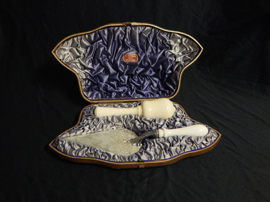
Trowel and mallet, Circa 1890
The trowel and mallet set was purchased by Mr Swanson, the builder of the Maryborough (Victoria) Railway Station prior to the planned ceremony for the laying of the foundation stone. Duncan Gillies. the Victorian Premier, was to lay the foundation stone, but his government was defeated in the week before the scheduled ceremony. The trowel and mallet set was never used. This set was held by the Maryborough Borough (later City) Council and lay unidentified for almost 120 years until a receipt from the jeweller was discovered. The set was donated to the Maryborough Midlands Historical Society in 2010.Ceremonial trowel and mallet set in brown leather covered presentation case with blue satin lining. Trowel has silver blade with cream handle possibly bone. Mallet cream, possibly bone. H. NEWMAN/Jeweller/MELBOURNE -
 Surrey Hills Historical Society Collection
Book, City of Boroondara Civic Collection: (City Art and Memorabilia Collections) Cultural Heritage Review and Straegic Plan, 1996
This publication explains an approach to manage the collection and develop a strategic plan for its exposure to the public through community participation and access, interpretations and exhibitions.This publication explains an approach to manage the collection and develop a strategic plan for its exposure to the public through community participation and access, interpretations and exhibitions.boroondara council - art collections, art ad state, cultural policy, boroondara history -
 University of Melbourne, Burnley Campus Archives
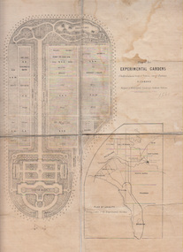
Plan, Alfred Lynch, Plan of the Experimental Gardens of the Horticultural Society of Victoria. Survey Paddock. Richmond, 1861
Subsequently the area was not fully developed in this manner following flooding in 1863. Some remnants remain.Plan on paper with cloth backing. Inscription, "Designed by Alfred Lynch. Landscape Gardener, Prahran. Printed by De Guchy & Leigh." An inset plan shows position of Experimental Gardens related to the City of Melbourne and Bay. Plan shows layout and plantings of the designated area - fruit, vegetables: the conservatory, nursery, exhibition buildings. This plan was owned by E.E. Pescott. Inscription on cover, "Burnley. E.E.P.." "Ed. E. Pescott." Subsequently the area was not developed in this manner. See inscription on copy made for Centenary Exhibition B92.633. Other copies given to College by N. Lothian (graduated 1934). Jim Sanders, a friend of his, gave them to Dr. G. Moore in 1991. A larger copy, inscribed on reverse, '1861', 'Early proposals for Horticultural Gardens for Horticultural Society of Victoria (now Royal). The lithograph was included as an insert in the Farmers Journal and Gardeners Chronicle 21 June, 1862. It is only in one of the copies held by the State Library of Victoria. 1 large and 1 small photographs of plan. Several photocopies of the plan.Inscription, "Designed by Alfred Lynch. Landscape Gardener, Prahran. Printed by De Gruchy & Leigh." / Inscription on cover, "Burnley. E.E.P.." "Ed. E. Pescott."alfred lynch, experimental gardens, conservatory, nursery, e.e. pescott, n. lothian, jim sanders, dr. g. moore, horticultural socoety of victoria -
 City of Greater Bendigo - Civic Collection
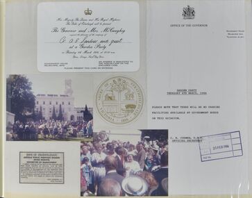
Album - Collection of memorabilia from Alec Sandner's time as President of Strathfieldsaye Shire, Alec and Helen Sandner, 1986
Alec Sandner was a Strathfieldsaye Shire Councillor from 1982 -1987, Strathfieldsaye Shire President from 1985 – 86 and Mayor of Bendigo 2011 - 2012. This album provides at in depth understanding of the many responsibilities of a Shire President and partners. The newspaper articles, mostly collected from the Bendigo Advertiser, provides commentary on the key issues of the times. Fifty page photo album containing invitations, photographs, newspaper cuttings and event memorabilia dating from 6th March - 6th August 1986, documenting events attended by Alec and Helen Sandner during Alec's time as Strathfieldsaye Shire President. Contents are arranged chronologically and provides an extensive overview of the breadth of events and activities a role such as Shire President and Lady are involved in. Highlights include Invitation to Government House Melbourne to meet Queen Elizabeth and the Duke of Edinburgh ( 6th March, 1986) and initial plans to amalgamate Shire's across Victoria including Strathfieldsaye Shire with the City of Bendigo.sandner collection, helen sandner, eugene sandner, mollie sandner, shire of strathfieldsaye, president of strathfieldsaye shire, strathfieldsaye shire council, city of greater bendigo events, city of greater bendigo community groups -
 Melton City Libraries
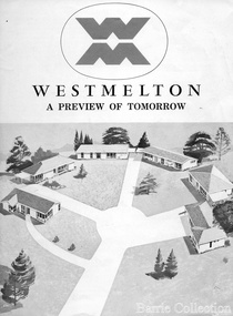
Document, West Melton: A preview of tomorrow, c.1969
"In April 1969, the first major residential development in Melton began with the release of 148 homes for purchase. This was the first stage of a staggered release of a planned 30,000 homes for 100,000 people by 1990. The development, called Westmelton Satellite City, was described as ‘a preview of tomorrow’.101 It was the first estate built in a ‘modern’ style, with curved streets, and dozens of culs de sac. Westmelton was also the first major development in Victoria to build all the supply lines to the houses – including electricity and telephone lines – underground. The six different home designs in Westmelton were ‘specially designed for the future’, and with allotments ten feet wider than regulations required, there was plenty of ‘space for gracious living’ and for a family swimming pool. The developers of this new estate were active in promoting Westmelton as a new community within the Shire of Melton. By 1971, the Westmelton City News reported that Ian McIntosh, General Manager of Westmelton, had given away $100,000 on behalf of the company ‘to aid community projects’. This included a $72,000 donation towards building a community centre in Westmelton, and $25,000 for the shire’s Olympic-sized swimming pool. Ian McIntosh and his family moved to Melton and Ian said he was ‘very much aware of the needs of [the] Westmelton community’. By the end of 1971, Westmelton was home to 100 new families. The modern residences were obviously an appealing drawcard, but so was the country feel that characterised Melton. Mrs C. Allen, described as a ‘housewife’, said she and her husband chose to move to Westmelton because of ‘the quality homes ... and we both love the clean, fresh, natural environment that surrounds us’. Similarly, Mr W. Coxhead, insurance consultant, moved to Westmelton because of the ‘clean, fresh country air’. Accountant Mr B. Swanton echoed their sentiments, describing Westmelton as ‘far enough away from the industrial pollution carried over Melbourne suburbs by prevailing westerly winds’. The new development attracted an increasing number of young, professional couples and families, representing the beginning of a significant shift from the predominantly rural and farming community of the district’s past. The Westmelton development had four different ‘neighbourhoods’ designed to cater to a variety of different lifestyle needs. Westmelton was the first to be established, followed by Brookfield, which offered ‘superb land in a rustic setting’. Brookfield Acres offered ‘wide open spaces with lots of room for a pool and even a tennis court’ on huge one-acre blocks, while Westlake was an innovative development with ‘different sized homesites’ and ‘lakeside living’.Westmelton was the first of many residential developments that would come to play a huge role in shaping the shire in the decades to follow".A marketing brochure for the Westmelton Satellite City developmentlocal significant events, council -
!['Save Fairfield Hospital' badge, [1990s]](/media/collectors/5bb42dc221eaf31100db1d3b/items/5c9af03221ea720f88da88fb/item-media/5c9af03f21ea720f88daaa65/item-fit-380x285.jpg) Australian Nursing & Midwifery Federation
Australian Nursing & Midwifery Federation'Save Fairfield Hospital' badge, [1990s]
Fairfield Hospital opened in 1904 as the Queen's Memorial Infectious Diseases Hospital, the first purpose-built isolation hospital for infectious diseases in Victoria. Its 22-acre site was located on a bank of the Yarra River. It was renamed Fairfield Hospital in 1948. In its later years, the hospital was a centre for AIDS treatment in Victoria, and a passionate campaign fought against its planned closure in the 1990s. Fairfield Hospital finally closed in June 1996. One section of the site was gazetted as a Public Park and Memorial Garden (containing an AIDS Garden).Circular white and red plastic badge. Silver metal, plastic-coated, with safety pin fastener adhered to back. Badge printed with the red text 'SAVE FAIRFIELD HOSPITAL'. Silver metal, plastic-coated, with safety pin fastener adhered to back.medicine, health, public institutions, fairfield, victoria, city of darebin, melbourne, politics, political protest, public protest, campaigning, badges, buttons, pins, public health, infectious diseases, aids -
 Canterbury History Group
Document - The stained glass windows by Christain Waller at St Paul's Anglican Church, Canterbury, National Trust of Australia (Victoria), 2005
Classification Report on the Christian Waller windows. Lists assessment criteria, plan of the interior of the church, photocopies of the design of the windows and exterior of the church, and a list of some of Christain Waller's windows together with their location.canterbury, margaret street, church street, st paul's anglican church, boroondara city council, national trust of australia (victoria), waller> christian, stained glass, windows, redman family, churches -
 Melbourne Legacy
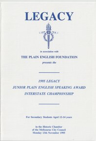
Programme, Legacy Junior Plain English Speaking Competition 1995, 1995
From 1988 to 2021, Legacy held a public speaking contest for young secondary school students. It was initially called the Junior Plain English Speaking Award (JPESA) and later called Legacy Junior Public Speaking Award (LJPSA). Schools were eligible to send along up to 4 representatives to compete in a preliminary round. Participants gave a four minute prepared speech and a two minute impromptu response to a topic. This programme was from the first interstate final, it was held at the Historic Chamber of the Melbourne City Council. 1995 was the first year it became in interstate event with 411 entrants in NSW, 360 in Victoria, plus 4 schools in Brisbane, ending with this Interstate Championship. The plan was for a National Final in 1996. The following was taken from a programme in 1996: "The Award aim is to promote enhanced oral communication skills for 12-14 year old students and to help young people appreciate the ideals of Legacy - voluntary service, caring and comradeship - and the need for remembrance. It began in 1988 in the Melbourne area with the support of the Ministry of Education and The Plain English Foundation. Entries have grown from 24 in the 1988 competition to over 300 in schools across the State, plus greater numbers participating in the process of selecting four contestants from each school. In 1995, a successful Interstate Championship was held with contestants from Victoria, New South Wales and Queensland. On 11 November 1996 the first National final was held with contestants from six states."A programme of finalists and presenters from the Junior Plain Speaking contest that has been run by Legacy since 1988.White A4 card with blue printing as a programme of the interstate speaking contest in 1995. legacy promotion, speaking contest, jpesa -
 Working Heritage Crown Land Collection
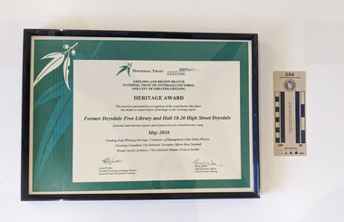
Award - former Drysdale Free Library Heritage Award, Former Drysdale Free Library and Hall 18-20 High Street Drysdale
Framed AwardNational Trust, City of Greater Geelong, Geelong and Regional Branch National Trust of Australia (Victoria) and City of Greater Geelong, Heritage Award, This award is presented in recognition of the contribution this place has made to conservation of heritage in the Geelong region, Former Drysdale Free Library and Hall 18-20 High Street Drysdale, External and internal repairs and construction of a disabled entry ramp, May 2016m Funding body Working Heritage, Committee of Management Chair Helen Weston, Planning Construction Consultant Tim Hubbard, Executive Officer Ross Turnbull, Wendy Jacobs Architect, Chris Mantello Mantec Projects builder -
 Hymettus Cottage & Garden Ballarat
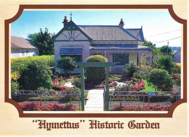
Postcard, Nu-Color-Vue Productions Pty Ltd, Hymettus Historic Garden, 1986
Hymettus Historic Garden and its cottage museum were opened to the public in 1985 after two years of garden restoration work. The interpretive work was undertaken by Mr and a team from Melbourne's Royal Botanical Gardens and the Taffe family. Plans were drawn up by Peter Lumley and Michael Looker of the Royal Botanical Gardens and the work of restoration undertaken by the family with financial assistance from Heritage Victoria and The City of Ballaarat. historic garden, ballarat, hymettus, postcard, royal botanical gardens melbourne, restoration, city of ballaarat. -
 Kew Historical Society Inc
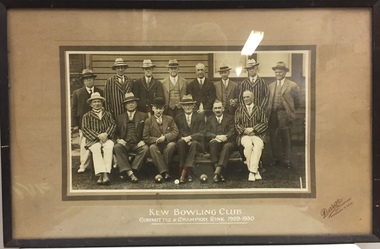
Photograph, Kew Bowling Club, Kew Bowling Club Committee and Champion Rink, 1929-30
Sports Clubs in Kew in the final decades of the 19th century and in the early 20th century were often umbrella organisations with facilities for a number of sports. Typically in Kew, this included teams in lawn bowls, tennis and croquet. The Kew Bowling Club was formed in 1880 while the privately owned Auburn Heights Recreation Club was opened in 1904. By 1998, the two Clubs decided to amalgamate at the Auburn Heights site in Barkers Road, forming the Kew Heights Sports Club. The combined club was itself taken over by the Melbourne Cricket Club in 2012 becoming MCC Kew Sports Club. In 2017 MCC Kew closed and its landholding was subsequently sold to Carey Baptist Grammar School. Both the Kew and Auburn Heights Clubs assembled important collections. These historically significant and large collections were donated to the Society in 2020. The collections include manuscripts, pictures, trophies, plans, honour boards etc. References Barnard FGA 1910, 'Sports and Pastimes' in Jubilee History of Kew Victoria: Its origin & progress 1803-1910. Nixon NV 1980, The History of the Kew Bowling Club 1880-1980. Reeve S 2012, City of Boroondara: Thematic Environmental History, p.216.The combined collections of the four sporting clubs making up the collection number hundreds of items that are historically significant locally. They are also significant to the sporting history of the greater Melbourne area and to the sports of lawn bowls and tennis in Australia in the 19th and 20th centuries. The collection illuminates two of the Victorian historic themes - 'Building community life' through forming community organisations and 'Shaping cultural and creative life' by participating in sport and recreation.Framed and glazed original photograph of the Kew Bowling Club's Committee and Champion Rink 1929-30. [The item is part of the historic Kew Bowling Club collection (1880-1988) gifted to the Kew Historical Society in 2020].KEW BOWLING CLUB / COMMITTEE & CHAMPION RINK1929-30kew bowling club - wellington street - kew (vic), clubs - lawn bowls - kew (vic) -
 Kew Historical Society Inc
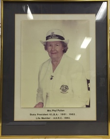
Photograph - Framed Portrait, Mrs. Phyl Pullen, State President VLBA 1981-83, Life Member AHRC 1983, 1983
Sports Clubs in Kew in the final decades of the 19th century and in the early 20th century were often umbrella organisations with facilities for a number of sports. Typically in Kew, this included teams in lawn bowls, tennis and croquet. The Kew Bowling Club was formed in 1880 while the privately owned Auburn Heights Recreation Club was opened in 1904. By 1998, the two Clubs decided to amalgamate at the Auburn Heights site in Barkers Road, forming the Kew Heights Sports Club. The combined club was itself taken over by the Melbourne Cricket Club in 2012 becoming MCC Kew Sports Club. In 2017 MCC Kew closed and its landholding was subsequently sold to Carey Baptist Grammar School. Both the Kew and Auburn Heights Clubs assembled important collections. These historically significant and large collections were donated to the Society in 2020. The collections include manuscripts, pictures, trophies, plans, honour boards etc. References Barnard FGA 1910, 'Sports and Pastimes' in Jubilee History of Kew Victoria: Its origin & progress 1803-1910. Nixon NV 1980, The History of the Kew Bowling Club 1880-1980. Reeve S 2012, City of Boroondara: Thematic Environmental History, p.216.The combined collections of the four sporting clubs making up the collection number hundreds of items that are historically significant locally. They are also significant to the sporting history of the greater Melbourne area and to the sports of lawn bowls and tennis in Australia in the 19th and 20th centuries. The collection illuminates two of the Victorian historic themes - 'Building community life' through forming community organisations and 'Shaping cultural and creative life' by participating in sport and recreation.Framed and glazed photographic portrait of Mrs. Phyl Pullen, State President VLBA 1981-83; a life member of Auburn Heights Recreation ClubMRS PHYL PULLEN / STATE PRESIDENT VLBA 1981-83 / LIFE MEMBER AHRC 1983kew bowling club - wellington street - kew (vic), clubs - lawn bowls - kew (vic), vlba, phyllis pullen -
 Kew Historical Society Inc
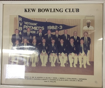
Photograph - Framed Photograph, Kew Bowling Club RVBA “Hotham Premiers Division 2, 1982-3, 1982-1983
Sports Clubs in Kew in the final decades of the 19th century and in the early 20th century were often umbrella organisations with facilities for a number of sports. Typically in Kew, this included teams in lawn bowls, tennis and croquet. The Kew Bowling Club was formed in 1880 while the privately owned Auburn Heights Recreation Club was opened in 1904. By 1998, the two Clubs decided to amalgamate at the Auburn Heights site in Barkers Road, forming the Kew Heights Sports Club. The combined club was itself taken over by the Melbourne Cricket Club in 2012 becoming MCC Kew Sports Club. In 2017 MCC Kew closed and its landholding was subsequently sold to Carey Baptist Grammar School. Both the Kew and Auburn Heights Clubs assembled important collections. These historically significant and large collections were donated to the Society in 2020. The collections include manuscripts, pictures, trophies, plans, honour boards etc. References Barnard FGA 1910, 'Sports and Pastimes' in Jubilee History of Kew Victoria: Its origin & progress 1803-1910. Nixon NV 1980, The History of the Kew Bowling Club 1880-1980. Reeve S 2012, City of Boroondara: Thematic Environmental History, p.216.The combined collections of the four sporting clubs making up the collection number hundreds of items that are historically significant locally. They are also significant to the sporting history of the greater Melbourne area and to the sports of lawn bowls and tennis in Australia in the 19th and 20th centuries. The collection illuminates two of the Victorian historic themes - 'Building community life' through forming community organisations and 'Shaping cultural and creative life' by participating in sport and recreation.Framed and glazed photograph of Kew Bowling Club, “Hotham Premiers Division 2, 1982-3. [The item is part of the large historic Kew Bowling Club collection (1880-1988) gifted to the Kew Historical Society in 2020].kew bowling club - wellington street - kew (vic), clubs - lawn bowls - kew (vic), kew bowling club - rvba pennants -
 Kew Historical Society Inc
Legal record - Framed Document, Kew Bowling Club Certificate of Incorporation, 1986, 1880
Sports Clubs in Kew in the final decades of the 19th century and in the early 20th century were often umbrella organisations with facilities for a number of sports. Typically in Kew, this included teams in lawn bowls, tennis and croquet. The Kew Bowling Club was formed in 1880 while the privately owned Auburn Heights Recreation Club was opened in 1904. By 1998, the two Clubs decided to amalgamate at the Auburn Heights site in Barkers Road, forming the Kew Heights Sports Club. The combined club was itself taken over by the Melbourne Cricket Club in 2012 becoming MCC Kew Sports Club. In 2017 MCC Kew closed and its landholding was subsequently sold to Carey Baptist Grammar School. Both the Kew and Auburn Heights Clubs assembled important collections. These historically significant and large collections were donated to the Society in 2020. The collections include manuscripts, pictures, trophies, plans, honour boards etc. References Barnard FGA 1910, 'Sports and Pastimes' in Jubilee History of Kew Victoria: Its origin & progress 1803-1910. Nixon NV 1980, The History of the Kew Bowling Club 1880-1980. Reeve S 2012, City of Boroondara: Thematic Environmental History, p.216.The combined collections of the four sporting clubs making up the collection number hundreds of items that are historically significant locally. They are also significant to the sporting history of the greater Melbourne area and to the sports of lawn bowls and tennis in Australia in the 19th and 20th centuries. The collection illuminates two of the Victorian historic themes - 'Building community life' through forming community organisations and 'Shaping cultural and creative life' by participating in sport and recreation.Framed and glazed Certificate of Incorporation of Kew Bowling Club, 1986. [The item is part of the large historic Kew Bowling Club collection (1880-1988) gifted to the Kew Historical Society in 2020].kew bowling club - wellington street - kew (vic), clubs - lawn bowls - kew (vic) -
 Kew Historical Society Inc
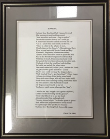
Document - Framed Document, Dr David Pitt, Kew Bowling Club, 'Bowling' / by David Pitt, 1984, 1984
Sports Clubs in Kew in the final decades of the 19th century and in the early 20th century were often umbrella organisations with facilities for a number of sports. Typically in Kew, this included teams in lawn bowls, tennis and croquet. The Kew Bowling Club was formed in 1880 while the privately owned Auburn Heights Recreation Club was opened in 1904. By 1998, the two Clubs decided to amalgamate at the Auburn Heights site in Barkers Road, forming the Kew Heights Sports Club. The combined club was itself taken over by the Melbourne Cricket Club in 2012 becoming MCC Kew Sports Club. In 2017 MCC Kew closed and its landholding was subsequently sold to Carey Baptist Grammar School. Both the Kew and Auburn Heights Clubs assembled important collections. These historically significant and large collections were donated to the Society in 2020. The collections include manuscripts, pictures, trophies, plans, honour boards etc. References Barnard FGA 1910, 'Sports and Pastimes' in Jubilee History of Kew Victoria: Its origin & progress 1803-1910. Nixon NV 1980, The History of the Kew Bowling Club 1880-1980. Reeve S 2012, City of Boroondara: Thematic Environmental History, p.216.The combined collections of the four sporting clubs making up the collection number hundreds of items that are historically significant locally. They are also significant to the sporting history of the greater Melbourne area and to the sports of lawn bowls and tennis in Australia in the 19th and 20th centuries. The collection illuminates two of the Victorian historic themes - 'Building community life' through forming community organisations and 'Shaping cultural and creative life' by participating in sport and recreation.Framed and glazed poem ‘Bowling’ by David Pitt, 1984. [The item is part of the large historic Kew Bowling Club collection (1880-1988) gifted to the Kew Historical Society in 2020].kew bowling club - wellington street - kew (vic), clubs - lawn bowls - kew (vic), sports - lawn bowling - poems -
 Kew Historical Society Inc
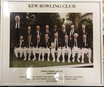
Photograph - Framed Photograph, Kew Bowling Club Division 3 Premiers (Second Side), 1991-92, 1991-1992
Sports Clubs in Kew in the final decades of the 19th century and in the early 20th century were often umbrella organisations with facilities for a number of sports. Typically in Kew, this included teams in lawn bowls, tennis and croquet. The Kew Bowling Club was formed in 1880 while the privately owned Auburn Heights Recreation Club was opened in 1904. By 1998, the two Clubs decided to amalgamate at the Auburn Heights site in Barkers Road, forming the Kew Heights Sports Club. The combined club was itself taken over by the Melbourne Cricket Club in 2012 becoming MCC Kew Sports Club. In 2017 MCC Kew closed and its landholding was subsequently sold to Carey Baptist Grammar School. Both the Kew and Auburn Heights Clubs assembled important collections. These historically significant and large collections were donated to the Society in 2020. The collections include manuscripts, pictures, trophies, plans, honour boards etc. References Barnard FGA 1910, 'Sports and Pastimes' in Jubilee History of Kew Victoria: Its origin & progress 1803-1910. Nixon NV 1980, The History of the Kew Bowling Club 1880-1980. Reeve S 2012, City of Boroondara: Thematic Environmental History, p.216.The combined collections of the four sporting clubs making up the collection number hundreds of items that are historically significant locally. They are also significant to the sporting history of the greater Melbourne area and to the sports of lawn bowls and tennis in Australia in the 19th and 20th centuries. The collection illuminates two of the Victorian historic themes - 'Building community life' through forming community organisations and 'Shaping cultural and creative life' by participating in sport and recreation.Framed and glazed photograph of Division 3 Premiers (Second Side), 1991-92. [The item is part of the large historic Kew Bowling Club collection (1880-1988) gifted to the Kew Historical Society in 2020].kew bowling club - wellington street - kew (vic), clubs - lawn bowls - kew (vic) -
 Melbourne Tram Museum
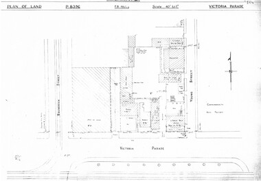
Drawing, Melbourne & Metropolitan Tramways Board (MMTB), "Victoria Parade", "Rae St Fitzroy", c1938
Set of three photocopied plans or drawings on A3 sheet of the "Victoria Parade" and "Rae St Fitzroy", c/1938. .1 - sheet 1 - P8396 - showing layout of buildings, adjacent properties at the intersection of Victoria Parade and Young Street - includes the offices, sub-station and shedding and location of No. 95 Victoria Parade - sheet 2 - P8397 - shows details of No. 95 Victoria Parade and the Two story Traffic offices at the corner of Young and Victoria Parade. .2 - P8405 - Plan of property - block and buildings of No. 449 Rae St Fitzroy. A web search shows that an advertisement was placed for the Carowindra Private Hospital at this location - advertised in the Fitzroy City Press - 14/2/1920 - Trove - access 12-9-2016. This became part of the Central Bus Garage property - see Reg Item 1745.trams, tramways, drawings, depots, property, victoria parade, young st, substation, hospital -
 Melbourne Tram Museum
Newspaper, The Age, Progress Press, "Tram theme to stay at apartment complex", 2000
Set of 6 newspaper cuttings about the redevelopment of the site to apartments and the Hawthorn Tram Museum Depot. .1 - The Age - 8 Jan. 2000 - "Tram theme to stay at apartment complex" - announcing the redevelopment and plans for the redevelopment of Hawthorn tram depot. Includes architects impressions. Article by Victoria Gurvich. .2 -The Age - 14/1/2000 - letter to the Editor by Peter Moon - "Tram plan: too big and too ugly". .3 - Press - 21/2/2000 - "Trams on track for 498 years, Depot housing in line with history" - with photo of Mike Ryan and Matt Faubel (old photo) - article by Laeta Antonysen. .4 - ditto - "Outcry over historic site" and "Developers asked for another aspect" .5 - Progress Press - 6/3/2000 - letter re the redevelopment from John Santoro or Power St Hawthorn. .6 - Progress Press - 7/8/2000 - "Green light for tram depot apartments" - about the City of Boroondara issuing the planning permit.trams, tramways, hawthorn tram depot, tram museum, museums, minister for transport, city of boroondara -
 Melbourne Tram Museum
Pamphlet, Dept of Planning and Development, "Catch the City Circle", 1994
Pamphlet - DL 6 fold from A3 sheet, full colour titled "Catch the City Circle", detailing the City Circle tram, 1994 - has the original route by Spencer St - map shows various points and details the various locations.. Has contact details but no web site. Has the Victoria government, Better Cities and Public Transport Corporation Logos. See Reg Item 866, 2703 and 1337 for other versions. Second copy added 24-04-2019 from Bob Prentice Collection.trams, tramways, city circle, yarra trams, ptc