Showing 1088 items matching "geology"
-
 Federation University Historical Collection
Booklet, The New South Wales Educational Gazette, 01 February 1896, 01/02/1896
Booklet published for New South Wales teachers. Articles include: * A Comparison of the Classical and Shakespean Dramas. * Geology for Australian Students by Rev. J. Miln Curran * From the Atlantic to the Pacific: Niagara to Minneapolis * G.A. Henty * The Study of Entomology by Walter W. Froggatt molong, anticline, syncline, jenolan, education gazette, educational gazette -
 Bendigo Historical Society Inc.
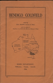
Book - BENDIGO GOLDFIELD
booklet, 51 pages. 'Bendigo Goldfield' issued by Geo Brown, Secretary for Mines. Mines Department 1936. Contains information on the geology of the Bendigo goldfield and major lines of reef and mines. Map of goldfield showing reef lines and mines attached to back cover.bendigo, mining, bendigo goldfield -
 Eltham District Historical Society Inc
Book, Jenny Brown et al, Out of the Mist; Osborne Peninsula, 2024
The Osborne Peninsula on the Yarra River at Warrandyte accommodates a limited number of properties and residents (70 households). The area is rich in geology and ecology, and an unusually rich endowment of human, built and creative history. Contents: Welcome: The landform: The River: Aboriginal occupation: The Miners: North Warrandyte :The Subdivision: The Lowes: The Osbornes: The Last Osborne: The Elders: The Relics: Dray Track: Water Wheel"Kauri Plaque: River track: Pines: Windmill Creek Bridge: The Koornong School: The Houses" Man Cave: MidCentury Classic: Enduring Original" Masterwork: The Muddies: The State Park: The Saving of Koornong Reserve: The Landcare Story: Flora and Fauna: The Vulnerable, Endangered and threatened: Birds: Mammals: "Waring" the wombat: Reptiles: Fish: Invertebrates: Flora: Fire. Published by the North Warrandyte (Osborne Peninsula) Landcare Group. Includes photos from EDHS collection.64 p. : ill., map ; 29.7 x 21 cm. (2 copies)yarra river, birrarung, dray track, fauna, geology, houses, indigenous history, koornong reserve, koornong school, lowe family, mining, mudbrick houses, north warrandyte, osborne family, warrandyte state park, water wheel, north warrandyte (osborne peninsula) landcare group, osborne peninsula -
 Federation University Historical Collection
Book, Victorian Government Legislative Assembly, The Select Committee on Castlemaine and Sandhurst water supply, Report from the Select Committee on Castlemaine and Sandhurst Water Supply, together with the proceedings of the Committee, minutes of evidence and appendices, 19/5/1865 (exact)
This book contains the report from the select committee on Castlemaine and Sandhurst water supply; with the proceedings of the committee, minutes of evidence and appendices. It also contains the report Of the Engineer-In-Chief of Railways, and reply of the Chief Engineer of Water Supply on the works constructed by the Victorian Water Supply Department, presented to both houses of parliament by His Excellency’s command. Ferdinand M. Krause, was a lecturer at the Ballarat School of Mines in Geology Mineralogy Mining Engineering and Surveying. He was a Fellow of the Geological Society and a Fellow of the Linnian Society. He was assistant engineer for the Ballaarat and Ballarat East Water Supply Committee and helped plan local reservoirs.A brown cloth hard cover, foolscap book with leather spine. Title is written in black on the title page. "Water Supply Reports" is engraved in gold on spine. It includes a table showing the monthly and yearly rainfall and shade temperature at Ballarat, 2nd February, 1885. It also includes two reports and two replies, a map No.7082.2 of Victorian Water Supply, Castlemaine and Sandhurst district general plan including lines of Aqueduct, Reservoirs. No. 7082.3 of Victorian Mining districts, Mining Divisions and The Gold Fields in 1866 - includes districts to be supplied under the Waterworks Act, 1965. It also includes: *Report of the Engineer-in-chief of Railways and Reply of the Chief Engineer of Water Supply on the works constructed by the Victorian Water Supply Department, 1869. * Coliban Water Scheme, 1864 * Ballarat and Ballarat East Water Supply (1869) including the Ballarat Water Supply List containing names of occupiers and nature of improvements on lands comprised within the proposed reserve of Gong Gong Reservoir, Ballaarat. At Warrenheip the names included: Honora McCallin, William Honan, C. McMahon, Patrick McMahon, J.P. Beach, J.H. Smith, Michael Nestor, Martin Quinn, Martin McIntyre, Robert Higgins, Coleman Kane, Robert Bond. At Ballarat: William Clarke, Richard White, John Hosking, Wesleyan Chapel, J. Hewitt, Robert McRobinson. At Bungaree: John Pullin, John Llewellyn. William Daw, Smith and Wynne, William Brough, A. Alexander. * Ballarat and Ballaarat East Water Supply report upon the advisability, or otherwise, of constructing a reservoir at the junction of the Yarrowee Creek and Gile's Creek, upon a site known as Gile's Reservoir (printed by Frank Pinkerton). This report has numerous notes written on it (most probably by Krause) and includes the capacity of Harry Beale's Reservoir, Pimcott's Reservoir and the Proposed Gong Gong Reservoir. * Statement as to the position of the Ballaarat and Ballaarat East Borough Councils in Connection with Water Supply, September 1869. * Ballarat and Ballaarat East Water Supply - General Statement upon the Ballaarat and Ballaarat east Scheme of Water Supply. Includes information on Moorabool reservoir, Harry Beale's Reservoir, Lal Lal Creek, Two Mile Creek, Beale's Dam, Yarrowee Creek, Gong Gong Reservoir, Kirk's Dam, Devil's Creek, Moorabool Creek. Additional handwritten notes (probably by Krause) * Engineer's Report on the resolution of the COmmittee of Water Supply, of the 7th July 1868. The report refers to the Country around Mount Warrenheip. Names mentioned are L. Abraham, Great North-West Gold Mining Company, Border Sawmills, Ferdinand Krause, Ohlfsen Bagge, W.H. Shaw, A signature by "Ferdinand M. Krause" at the top corner of the title page. A few pages have handwriting on the margins, it is believed to be his handwriting. water supply victoria, castlemaine directories, sandhurst directories, ballarat directories, james blackburn, edward wardle, daylesford water race, c j taylor, george avery fletcher, bagge, ohlfsen bagge, george foote, john h reilly, ambrose johnson, george francis, timber preservation, james forbes, alfred surplice, malcolm carmichael, robert adams, frederick hugh thomas, h o christerpherson, william downe, thomas lawrence brown, francis hadgson nixon, strangways, guildford, maldon, muckleford, lauriston, malmesbury, franklinford, walmer, strathloddon, downe, ferdinand krause, m7082, trentham, castlemaine, drummond, metcalfe, sutton grange, lockwood, ravenswood, mandurang, yandoit, c.h. ohlfsen bagge, moorabool reservoir, gong gong reservoir, harry beale's reservoir, pincott reservoir, frank pinkerton, water -
 Bendigo Historical Society Inc.
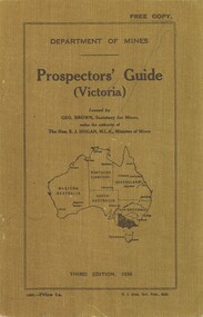
Book - DEPARTMENT OF MINES - PROSPECTORS GUIDE (VICTORIA), 1936
Department of Mines - Prospectors Guide (Victoria), Third Edition, 1936. Booklet has a brown coloured cover with a cost of 1/-, (one shilling). Marked 'Free Copy'Department of Mines H. J. Green Government Printer.victoria, history, gold mining, geology, and gold pros, gold mining, geology, and gold prospecting. -
 Bendigo Historical Society Inc.
Book - 'BULLETINS OF THE GEOLOGICAL SURVEY OF VICTORIA NO. 30'. THE PEARL AND HERCULES AND ENERGETIC MINES, BENDIGO, 1914
Bulletins of the Geological Survey of Victoria No. 30. The Pearl and Hercules and Energetic Mines, Bendigo, with plans and sections. By W. Baraganath Underground maps of the 4 (four) mines referred to in this book. Priced six pence Inscribed on the front cover: A. Richardson, 29 Harrison Street, Bendigo.Department of Mines. By W. Baraganathbendigo, mining, early history., mining, pearl, hercules and energetic mines. -
 Bendigo Historical Society Inc.
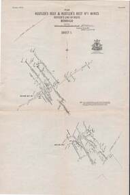
Map - STRUGNELL COLLECTION: HUSTLER'S LINE OF REEFS, September 1913
Map, Hustler's Line of Reefs, Hustler's Reef & Hustler's Reef No.1 Mines, Plan view . Plate No. XV (15).Sheet 1 Bulletin No. 33. Included is the emblem of the Geological Survey of Victoria. Signed by H.A.Whitelaw Underground Survey Office, Bendigo, Septembe ,1913.Underground Survey Office, Bendigo.map, bendigo, hustler's reef & hustler's reef 1 -
 Bendigo Historical Society Inc.
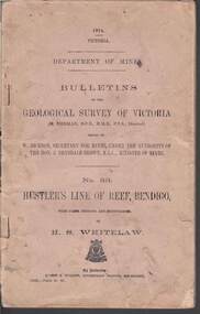
Book - STRUGNELL COLLECTION: DEPARTMENT OF MINES: 1914 GEOLOGICAL SURVEY OF VICTORIA. HUSTLERS LINE OF REEF, 1914
Book, Department of Mines, Bulletins of the Geological Survey of Victoria, No.33, Hustler's Line Of Reef, Bendigo, with plans,sections, and photographs, by H.S.Whitelaw. 13833, Price 2s.6d.`Back cover shows J.A. and J.A Strugnell , 12 Mulbar St Swan Hill 3585 .Albert J. Mullett, Government Printer, Melbourne.book, bendigo, hustler's line of reef -
 Federation University Historical Collection
Booklet, Luplau, Hewood & Riderm Printers, The School of Mines Ballaarat Annual Report 1883, 1883
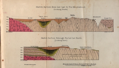
The School of Mines Ballaarat. Annual Report 1883. Statement of Receipts and expenditure, general balance sheet, and list of subscriptions donations 1882. Sketch of School of Mines. Sketch Section from Lal Lal to the Moorabool (looking north) Geological map of Lal Lal. In the County of Grant. Annual Report, Balance Sheet, Certificates granted by the Council, Examination Papers - Elementary Science Classes (Appendix), Extracts from Visitors' Book, Fees, Form of Bequest, Honorary Correspondents. Life Governors, Museum - open to visitors, Notes on the Geology of Lal Lal (with Geological Plan & Sections), Obituary, Office Bearers, Paper of Particulars, Rules of the Ballaarat Field Club and Science Society (Appendix), Report of the Curator of the Museum and Library, Report of the Superintendent of Laboratories, Report of the Lecturer in Mathematics, Report of the Lecturer in Mechanical Engineering, Report of the Lecturer in Telegraphy, Report of the Lecturer in Materia Medica, Statement of Receipts and Expenditure for the year 1882, Subjects and Lectures, Subjects and Examiners, Subscriptions and Donations, from 1st January to 31st December 1882.Ballaarat School of Mines annual Report. Hard cover red book of 101 pages. Includes plans on Lal Lal and surrounds. ballarat school of mines, annual report, balance sheet, certificates granted by the council, examination papers, extracts from the visitors' book, fees, form of bequest, honorary correspondents, life governors, museum, notes on the geology of lal lal, obituary: charles william thomas. one of the examiners in mining and surveying, office bearers, paper of particulars, rules of the ballaarat field club and science society, report of the curator of the museum and library, report of the superintendent of laboratories, report of the lecturer in mathematics, report of the lecturer in mechanical engineering, report of the lecturer in telegraphy, report of the lecturer in materia medica, statement of receipts and expenditure for the year 1882, subjects and lectures, subjects and examiners, subcriptions and donations, from 1st january to 31st december 1882, alf. mica smith, professor of chemistry, alf. mica smith, metallurgy, f. m. krause - professor of geology, mineralogy, scientific mining, t. h. thompson, practical mining, w. h. shaw mechanical engineering, h. reid, mechanical enginnering, phoenix foundry company (limited), a. a. buley, mathematics, f. m. krause, land, mining and engineering surveying, w. d. campbell, telegraphy, james oddie, vice-president, alf. mica smith, natural philosophy (elementary mechanics and hydrostatics, magnetism and electricty, sound, light and heat), j. f. usher, materia medica, pharmacy and physiology, examiner, professor h. m. andrew, m. a., examiner, h. d. de la poer wall, m. a, c. e., examiner, thomas mann, b. a., examiner, p. c. fitzpatrick, c. s., examiner, h. rosale, j.p., f.g.s, m.e. and m, examiner, john lewis, examiner, w. c. kernot, m.a., c.e., examiner, professor mccoy, examiner, j. cosmo newbery, c.m.g., b. sc., examiner, baron von mueller, k.c.m.g., m. et ph. d., f. r.s., examiner, sam. w. macgowan, examiner, w. p. bechervaise, examiner, r. l. j. ellery, f.r.s. govt. astronomer, examiner, f. m. krause, c.e., examiner, j. m. bickett, examiner, n. kent, examiner, a. martin, examiner, r. s. mitchell, examiner, w. h. keast, examiner, p. matthews, examiner, d. milliken, examiner, j. t. richards, examiner, jonathan robinson, examiner, t. h. thompson, examiner, h. brookes allen, m.d., examiner, joseph bosisto, examiner, c. r. blackett, m.l.a., examiner, wm. johnson, analyst to the government of victoria, ferdinand krause, ballarat field naturalists club, ferdinand von mueller, thomas mann, a.a. buley, ferrdinand krause, alfred mica smith, james oddie, william johnson, jonathan robinson, james bickett, r.l.j. ellery, cosmo newbery, ballarat field naturalists -
 Bendigo Historical Society Inc.
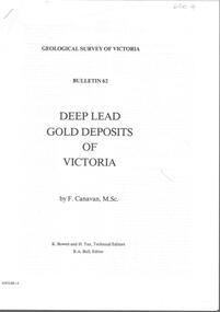
Document - CAROL HOLSWORTH COLLECTION: DEEP LEAD GOLD DEPOSITS OF VICTORIA
Bulletin 62 from the Geological Survey of Victoria, titled ' Derep Lead Gold Deposits of Victoria' by F. Canavan, M Sc. K. Bowen and H. Tan, Technical Editors, R.A. Bull, Editor. Bendigo and Sebastian District and the Huntly Telegraph Lead, are discussed in the paper.bendigo, mining, geological survey bulletin 62, bendigo, sebastian, geological survey. -
 Ballarat Heritage Services
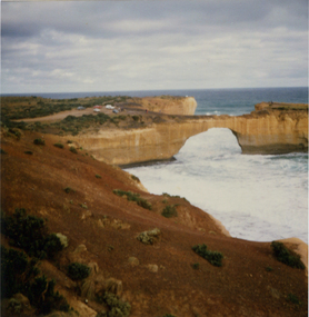
Photograph, London Bridge, Great Ocean Road, 01/1990
London Bridge, pre 1990 was a double-spanning bridge connected to the mainland. The stack was created over hundreds of years, with the weaker layers toward the base being eroded away by wind and water to form the two bridges. The span closer to the shoreline collapsed unexpectedly on 15 January 1990, leaving two visitors, whilst uninjured, stranded on the outer span before being rescued by helicopter. Two coloured photographs of the London Bridge, on the Great Ocean Road. This photo was taken days before the collapse of the geological feature. The photographer walked across the bridge to the warning of her mother "if you go over there and it collapses you will be stuck. After the collapse it was renamed London Arch. london bridge, great ocean road, london bridge, peterborough, london arch, shipwreck coast, 12 apostles -
 The Beechworth Burke Museum
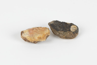
Geological specimen - Basalt (igneous-volcanic) containing Olivine, unknown
This particular geological specimen was found in Mount Franklin or Lalgambook in Djadjawurrung, located between Daylesford and Newstead, approximately ninety minutes drive from Melbourne. The mountain is an example of a breached scoria cone (a steep conical hill of loose pyroclastic fragments) which was created by a volcanic eruption about 470,000 years ago, a date which may indicate the age of this geological specimen. The volcanic eruptions of Mount Franklin were most likely witnessed by members of the Dja Dja Wurrung Aboriginal tribe, who referred to this country as the 'smoking grounds'. Mount Franklin and the surrounding area appears to have been a place of considerable religious significance to Aboriginal people, there is evidence which indicates that frequent large ceremonial gatherings took place in the area. Basalt is the most common rock on Earth’s surface, more than 90% of all volcanic rock on Earth is basalt. Basalt is an aphanitic extrusive igneous rock formed from the rapid cooling of low-viscosity lava exposed at or very near the surface of a rocky planet or moon. Specimens are black in colour and weather to dark green or brown. Basalt is rich in iron and magnesium and is mainly composed of olivine, pyroxene, and plagioclase. Olivine is the name of a group of rock-forming silicate minerals with compositions ranging between Mg2SiO4 and Fe2SiO4. Unlike other minerals, Olivine has a very high crystallisation temperature which makes it the first of the minerals to crystallise from magma. As magma cools, the crystals begin to form and settle on the bottom of the lava and form basalts that are abnormally enriched in olivine in the lower part of lava flows. According to H. M. King (on geology.com) "Olivine is thought to be an important mineral in Earth's mantle. Its presence as a mantle mineral has been inferred by a change in the behaviour of seismic waves as they cross the boundary between Earth's crust and mantle". Lava from Mount Franklin and other volcanoes in the area filled valleys and buried the gold bearing streams that became the renowned ‘deep leads’ of the gold mining era. In 1852, as part of the Victorian gold rush, gold was discovered in the immediate area, this gold was created by lava flows during the Newer Volcanic period, which were mined intensively during the nineteenth century. Around 1865 the presence of a deep lead in Mount Franklin was established. Deep lead mining was initially unsuccessful, and it was not until the late 1870s that the Franklinford Gold Mining Company mined at Mount Franklin on a significant scale. A few years later the Mount Franklin Estate Gold Mining Company also struck gold, followed by the Shakespeare and Great Western companies in the mid-1880s. By the late 1880s, however, deep lead mining had ceased in the area. Soon after gold was discovered in 1851, Victoria’s Governor La Trobe wrote to the Colonial Office in London, urging ‘the propriety of selecting and appointing as Mineral Surveyor for this Colony a gentleman possessed of the requisite qualifications and acquaintance with geological science and phenomena’. Alfred Selwyn was appointed geological surveyor in Australia in 1852 which began the Geological Survey of Victoria. In 1853-69 the Geological Survey issued under Selwyn's direction sixty-one geological maps and numerous reports; they were of such high standard that a writer in the Quarterly Journal of the Geological Society of London bracketed the survey with that of the United States of America as the best in the world. During his years spent in Australia, Selwyn collected numerous significant geological specimens, examples of which are held in collections such as the Burke Museum.This geological specimen is an example of basalt and olivine which shows the volcanic lava activity and geographical specific nature of Mt Franklin as a significant volcanic site. According to Agriculture Victoria 'The crater is one of the deepest in the Central Highlands area. It is a major megacryst site with some of the largest known Victorian examples of megacrysts of augite and an orthoclase. The small parasitic mound of Lady Franklin on the western flanks adds to the geological interest of the site'. This specimen also highlights the locality as a significant place for both indigenous activity and Victorian gold rush era mining practices. This specimen is part of a larger collection of geological and mineral specimens collected from around Australia (and some parts of the world) and donated to the Burke Museum between 1868-1880. A large percentage of these specimens were collected in Victoria as part of the Geological Survey of Victoria that begun in 1852 (in response to the Gold Rush) to study and map the geology of Victoria. Collecting geological specimens was an important part of mapping and understanding the scientific makeup of the earth. Many of these specimens were sent to research and collecting organisations across Australia, including the Burke Museum, to educate and encourage further study.An angular, solid hand-sized piece of grey volcanic Basalt with green/brown Olivine phenocrysts along one flat edge.Olivine in basalt / - label is probably / correct. / C. Willman / 15/4/21burke museum, beechworth, indigo shire, beechworth museum, geological, geological specimen, mineralogy, basalt, igneous rock, igneous-volcanic, volcanic geology, volcanic, olivine, olivine specimen, basaltoid -
 Federation University Historical Collection
Book, Henry Louis et al, Handbook of Gold Milling, 1902, 1902
Henry Louis, M.A. was an Associate of the Royal School of miens, Fellow of the Geological Society; Fellow of the Institute of Chemistry of Great Britain; Member of the Institution of Mining Engineers; Member of the American Institute of Mining Engineers and Professor of Mining in the Durham College of Science. Green hardcovered book of 599 pages including index and illustrations. Contents include: Mode of occurance of gold; physical and chemical properties of gold; physical and chemical properties of mercury; Primitive Methods or ore-breaking; The stamp; Hoisting gear; Water Supply; Ore-Feeders; Crushing Machinery; amalgamation; concentration; Spitzkasten; Amalgam; Milling; Cam Curve; sampling and assaying; horse-power developed by fall of water; value of gold according to its fineness; conversionInside front cover in pencil "Rhys Brook" -
 Federation University Historical Collection
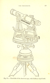
Book, Bennett H. Brough, A treatise on Mine-Surveying, 1904
The author, Bennett H. Brough was an associate of theRoyal School of Mines, a member of the COuncil of the Institution of Mining Engineers, a fellow of the geological society and of the Institute of Chemistry, a member of the Mining Institute of Cornwall, and a former instructor of mine-surveying at the Royal School of MinesRed had covered book 372 pages - part of Griffin's Mining Series. Contents include general explanatinos of surveying, an historical sketch, mineral deposits, mining terms, measures of length, measurement distances, the chain, rods, steel bands, measuring wheel, Miner's Dial, Magnetic needle, Fixed needle, German Dial, theodolite, traversing underground. Surface-surveys. plotting the survey, calculation of area, leveling, Telescope, Setting out, Mine-Surveying Problems, Mine Plans, Photographic Surveying, examination Surveying. Illustrations include: Whitelaw's Dial (Fig 22), Theodolite of the American Type with Hoffman tripod head, (fig 37a)mining, surveying, miner's dial, chain, survey, theodolite, scientific instruments -
 Bendigo Historical Society Inc.
Book - MINING & GEOLOGICAL JOURNAL. VOL,4. NO,4, 1951
Mining and Geological Journal, Volume 4, No.4. September 1951. Published by Department of Mines Victoria with 65 pages of articles on gold, coal & oil mining, Illustrations, maps, photographs including photographs of Bendigo mines. Name noted on front A.E.Richardson 29 Harrison St Bendigo.Dept of Mines Victoriamagazine, organization, mining, mining - mines - mining equipment, bendigo mines. -
 Bendigo Historical Society Inc.
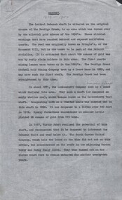
Document - CENTRAL DEBORAH GOLD MINE - HISTORY OF CENTRAL DEBORAH GOLD MINE 1939 - 1954
4 typed pages of the history of the Central Deborah Gold Mine from 1939 to 1954. Mentions the start of mining at this site and Victor Pabst, who in 1917 recommended that the shaft be deepened. His advice was not acted on for another twenty-two years. Also mentioned is the geology and Method of Mining.mine, gold, central deborah gold mine, central deborah gold mine, history of central deborah gold mine, geology of the central deborah gold mine, method of mining -
 Bendigo Historical Society Inc.
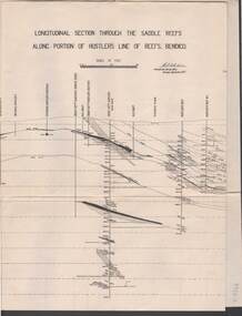
Map - STRUGNELL COLLECTION: HUSTLER'S LINE OF REEF, September 1913
Map, Longitudinal section through the Saddle Reefs along portion of Hustler's Line of Reefs, Bendigo. Plate No. XXX1V(34). Underground Survey Office,Bendigo, September 1913. Geological Society of Victoria.//Signed H.A.Whitelaw. Drawing shows the vertical shaft descending to over 3454 ftUnderground Survey Office, Bendigomap, bendigo, hustler's line of reefs -
 Whitehorse Historical Society Inc.
Document - Speech, Gerry Robinson, Heathmont History Group, The Histories of Heathmont by Gerry Robinson, August 2023
A talk on the "Histories of Heathmont" given by Gerry Robinson of the Heathmont History Group at the 2023 AGM of the Whitehorse Historical Society, Mitcham.A talk on the "Histories of Heathmont" given by Gerry Robinson of the Heathmont History Group at the 2023 AGM of the Whitehorse Historical Society, Mitcham.non-fictionA talk on the "Histories of Heathmont" given by Gerry Robinson of the Heathmont History Group at the 2023 AGM of the Whitehorse Historical Society, Mitcham.heathmont, gerry robinson, urbanisation -
 The Beechworth Burke Museum
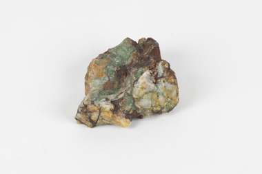
Geological specimen - Malachite in Conglomerate, Unknown
Malachite is a green copper carbonate hydroxide mineral and was one of the first ores used to make copper metal. Malachite has been utilised as a gemstone and sculptural material in the past as its distinctive green color does not fade when exposed to light or after long periods of time. Malachite is formed at shallow depths in the ground, in the oxidizing zone above copper deposits. The material has also been used as a pigment for painting throughout history. Malachite is considered a rare gemstone in that the original deposits for the stones have been depleted leaving behind very few sources. In addition, the use of Malachite as gemstones and sculptural materials remains just as popular today as they were throughout history. It is quite common to cut the stone into beads for jewellery. The fact that Malachite has such a rich colour and one that does not fade with time or when exposed to light makes it particularly rare. Although there is no indication available of the locality from which the specimen was sourced, it is likely that the specimen was collected either in South Australia in the vicinity of the Burra Burra mines or in Victoria as part of programs of geological surveying undertaken in the Nineteenth and Twentieth centuries. This specimen is part of a larger collection of geological and mineral specimens collected from around Australia (and some parts of the world) and donated to the Burke Museum between 1868-1880. A large percentage of these specimens were collected in Victoria as part of the Geological Survey of Victoria that begun in 1852 (in response to the Gold Rush) to study and map the geology of Victoria. Collecting geological specimens was an important part of mapping and understanding the scientific makeup of the earth. Many of these specimens were sent to research and collecting organisations across Australia, including the Burke Museum, to educate and encourage further study.A solid hand-sized copper carbonate hydroxide mineral with quartz pebbles in red conglomorate matrix presenting shades of cream, brown and green.Existing label: Malachite / (green) in / conglomerate / (white quartz / pebbles / in red matrix /geological specimen, geology, geology collection, burke museum, beechworth, geological, indigo shire, malachite, malachite specimen, australian mines, mines, geological survey, conglomorate, matrix -
 The Beechworth Burke Museum
Geological specimen - Dolomite
Dolomite is a mineral, calcium magnesium carbonate, with the chemical formula CaMg(CO3)2. It is a principle component of various rock types sometimes also referred to as dolomite, including dolostone, dolomitic marble and dolomitic limestone (according to the composition of each type). Dolomite rock is found in sedimentary basins throughout the world, comprising approximately 2% of the Earth's crust. It is formed when lime mud or limestone encounters groundwater containing magnesium. Dolomite can contain elements such as lead, zinc and copper. Dolomite and limestone are used in various construction, landscaping and agricultural processes. This specimen was donated to the Burke Museum in 1868 by Alfred Selwyn as part of the Geological Survey of Victoria. It was donated to the Museum in 1868. Victoria and other regions of Australia were surveyed for sites of potential mineral wealth throughout the 19th Century. The identification of sites containing valuable commodities such as gold, iron ore and gemstones in a locality had the potential to shape the development and history of communities and industries in the area. The discovery of gold in Victoria, for instance, had a significant influence on the development of the area now known as 'the goldfields', including Beechworth; the city of Melbourne and Victoria as a whole. Dolomite and limestone are mined at several locations in Victoria, including sites in the North-East of the state in Bindi and Limestone Creek. There are notable dolomite deposits in most Australian states. The dolomitised form of the mineral tends to come from older limestone deposits, formed during the palaeozoic era in marine settings, so this specimen may have come from a deposit located along a coastline in Victoria or another state. The specimen is significant as an example of surveying activity undertaken to assess and direct the development of the mineral resource industries in Victoria and Australia, as well as the movement to expand human knowledge of earth sciences such as mineralogy and geology in the nineteenth century. This specimen is part of a larger collection of geological and mineral specimens collected from around Australia (and some parts of the world) and donated to the Burke Museum between 1868-1880. A large percentage of these specimens were collected in Victoria as part of the Geological Survey of Victoria that begun in 1852 (in response to the Gold Rush) to study and map the geology of Victoria. Collecting geological specimens was an important part of mapping and understanding the scientific makeup of the earth. Many of these specimens were sent to research and collecting organisations across Australia, including the Burke Museum, to educate and encourage further study.Hand-sized piece of pale pink dolomite (calcium magnesium carbonate) with dark grey rim and hollowed centre. geological specimen, geology, geology collection, burke museum, beechworth, dolomite, mineralogy, geological survey, alfred selwyn, limestone, calcium magnesium carbonate -
 The Beechworth Burke Museum
Geological specimen - North Queensland Agates, Unknown
Agate occurs when amygdales (gas pockets) form in the upper levels of basaltic lava flows. If these pockets or bubbles are iniltrated by water bearing silica in solution, the fluid dries and hardens in layers, forming round or egg shaped nodules or geodes within the rocky matrix. Agate is formed of a silica mineral chalcedony similar to quartz. Although relatively common and semi-precious, agate has been prized since at least 1450 BC - an intricately carved agate seal was found in the 2015 excavation of a grave belonging to a Mycenaeum priest or warrior near Pylos in Greece. Agate is also used in jewellery and other decorative or ritual purposes due to its often striking appearance. These specimens originated in North Queensland, which contains noted agate-fossicking regions such as in the area surrounding Forsayth. They were collected in approximately 1852 as an adjunct to the Geological Survey of Victoria. It was donated to the Museum in 1868. Victoria and other regions of Australia were surveyed for sites of potential mineral wealth throughout the 19th Century. The identification of sites containing valuable commodities such as gold, iron ore and gemstones in a locality had the potential to shape the development and history of communities and industries in the area. The discovery of gold in Victoria, for instance, had a significant influence on the development of the area now known as 'the goldfields', including Beechworth; the city of Melbourne and Victoria as a whole. The specimens are significant as examples of surveying activity undertaken to assess and direct the development of the mineral resource industries in Victoria and Australia, as well as the movement to expand human knowledge of earth sciences such as mineralogy and geology in the nineteenth century. Two solid egg-sized pieces of peach/orange toned agate (a common semi-precious chalcedony, similar to quartz) with a striped pattern, embedded in a light and dark brown matrix. geological specimen, geology, geology collection, burke museum, beechworth, agate, north queensland agate, 1852 geological survey of victoria, l. hufer - donor, mineralogy, agate specimen, indigo shire -
Federation University Historical Collection
Book, American Institute of Mining Engineers, Transactions of the American Institute of Mining Engineers, Vol 1, 1871-1873
Meetings of the institute were held in Wilkes-Barre, Bethlehem, Troy, Philadelphia, New York, Pittsburgh and Boston.Red hard covered book. Contents include: * List of members * Geological Distribution of MIning Districts in the United States (R.W. Raymond) * The Relation between the Speed and Effectiveness of Stamps (R.W. Raymond) * Remarks on the Waste in Coal-Mining (R. P Rothwell) * An Eccentric Theodolite (Francis Vinton) * The Use ad Advantages of the Prop Srew-Jack (E. Gaijot) * The Manufacture of Iron and Steel Rails ( John B. Pearse) * The importance of Surveying in Geology (Benjamin Smith Lyman) * Use of Blast-Furnace Slag (T. Egleston) * The Geonostical History of Metals (T. Sterry Hunt) * The Mining and Metallurgical Laboratories of the Massachusetts Institute of Technology (Robert H. Richards) Stamped "Department of Mining University of Melbourne"american institute of mining engineers, mining engineering, prop screw jack, mining districts in the united states of america, waste inn coal mining, lehigh zinc company, lake superior copper districtblast furnace, rolling versus hammering ingots, indianablack coal, pig-iron, longwall system of mining, wickersham process, midlothian colliary, virginia, plummet lamp, diamond drills -
 Kiewa Valley Historical Society
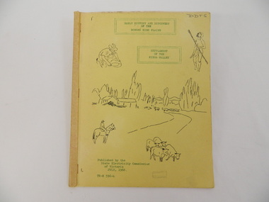
Book - Bogong High Plains x2, Early History and Discovery of the Bogong High Plains, 1968
The State Electricity Commission of Victoria constructed the Kiewa Hydro Electric Scheme in the north east of Victoria. Mr R.M. Duncan prepared the notes. He was a member of the S.E.C. Kiewa Branch from 1949 - 1966. This book was commissioned by the State Electricity Commission of Victoria. It consists of the early history of the Bogong High Plains and the origin of names of places and creeks in the area.This book was researched in 1968 by Mr R.M. Duncan who worked for the S.E.C. on the Kiewa Hydro Electric Scheme from 1949 to 1966. His sources were the Melbourne Public Library, the Victorian Historical Society, the North Eastern Victorian Historical Society and the Dept. of Crown Lands & Survey, Melbourne. The book is an accurate history of the Bogong High Plains given the available records at the time. Yellow cardboard covered book with black sketches and green print. 9 one-sided pages held together by 3 staples and taped over the staples. One - has sheets enclosed "The Three Floras of Bogong" and "General Geology of the Kiewa Area". 6 copies including 1 that is a photocopyDDTS hand written on front cover "Early History and Discovery / of the / Bogong High Plains" on cover top centre. "Settlement / of the / Kiewa-Valley" on cover towards the top slightly to the right. "Published by the / State Electricity Commission / of Victoria / July, 1968" on cover bottom left. "TR-K 596-4" on cover bottom left.bogong high plains. state electricity commission of victoria. kiewa. aborigines. kiewa valley. mullindollingong pastoral run. flora. geology -
 Federation University Historical Collection
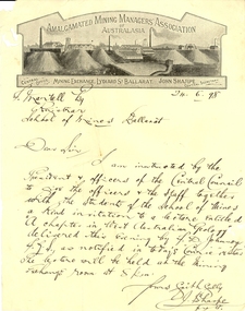
Letter - Letterhead, J. Sharpe, Amalgamated Mining Managers' Association of Australasia Letterhead, 1898, 24/06/1898
Handwritten letter on Amalgamated Mining Managers' Association of Australasia letterhead inviting students of the Ballarat School of Mines to attend the lecture on 'A Chapter in West Australian Geology' delivered by F.G. Johnson, F.G.S. at the Ballarat Mining Exchange. The artwork on this letterhead may have been executed by Henry James Hall.amalgamated mining managers' association of australasia, letterhead, j. sharpe, ballarat mining exchange, f.d. johnson, west australian geology, henry hall -
 Kiewa Valley Historical Society
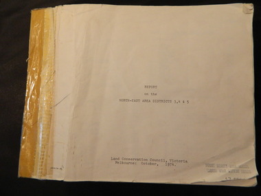
Report - Land Conservation Council x2, Land Conservation Council, Victoria Melbourne, April 1978, October 1974
Land Conservation Act 1970 established the Land Conservation Council to investigate and recommend to the Minister use of public land in Victoria. It describes and assesses the natural resources:-Physiography, Geology, Topography, Land Systems, Outdoor Recreation, Public land and blocks. Primary Production. Vegetation.North East Victoria includes the Kiewa Valley. This report gives an understanding of the development of the area.Thick heavy book with 312 pages with black and white photos. Back half has a folder with heavy cardboard attached to thick cardboard back cover. Inside folder are 9 maps with color each with a different title.Stamped on Front Cover: "Mount Beauty High School" Has a library borrowing slip at the back of the last page.land conservation council, environment, public land, kiewa valley, planning -
 Federation University Historical Collection
Map, Ballaarat Gold Field, 1861, 1861
A party of surveyors camped by Yuille's Swamp (later Lake Wendouree) and surveyed the countryside for a map to be produced by the Geological Survey of Victoria. In November 2004 the Central Highlands Regional Library presented a special edition of 200 copies of the 1861 map reproduced from a copy in their collection. Original 1861 map of Ballarat showing streets and leads. Blue dots indicate gold leads, and red lines indicate auriferous quartz reef and outcrops of quartz veins."Compiled & Drawn from the Survey of Mining Surveyors Davidson, Fitzpatrick and Cowan & the Plans in the Surveyor General's Office by J. Brahe, 21st October 1861. R. Brough Smyth, Secretary for Mines. The Honourable J.B. Humffray, M.L.A. Commr of Mines.”ballarat, map, ballarat east, lake wendouree, survey, mines, robert davidson, ballarat gold field 1861, yuille's swamp, wendouree swamp, little bendigo diggings, gold leads, old post office hill, specimen hill, bakery hill, black hill, dead horse creek, brown hill, pennyweight hill, clayton hill, soldiers hill, golden point, gum tree flat, white flat, poverty hill, chinese village, robert brough smyth, ballarat map 1861, ballaarat vineyard, dead horse gully, deadhorse creek, invermay, black hill flat, gaelic church, police reserve, magpie range, dalton's flat, caadian lead, rifle butts, powder magazine, bathing house, government camp, gold office, chinese, llanberrris, victoria theatre, charlie napier hotel, united states hotel, grape's hoel, clayton's hill, cattleyard hill, free trade hotel, esmond lead, bakery hill, black hill lead, juvenile reformatory, ballarat orphanage, lady barkly lead, triffet's slaughter yard, little bendigo, melbourne road, t. cowan, thomas cowan -
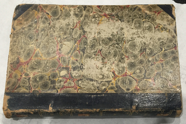 Federation University Historical Collection
Book, Selection of Geological Publications, 09/1866
This book was owned and used by Professor Ferdinand M. Krause of the Ballarat School of Mines.Ferdinand Krause was a renowned teacher at the Ballarat School of Mines. He also produced many important Geological Maps. This book has seven reports that Krause had bound together for his own use. Half black leather bound book with hand marbled paper cover. Marbling on cover is grey, maroon and darker grey with gold bands on black leather spine. The book contains 7 papers on various subjects associated with ores. The book includes: 1. Auriferous, Leads, & Silver Ores at Upper Hungary - G.H.F. Ulrich, 1868 2. Nuggetty Reef, Maldon, Victoria - G.H.F. Ulrich, 1866 3. Internal Communication - Lieut. Amsinck, 1856 4. Roads for Victoria - William Macredie, 1856 5. Mining & Mineral Statistics of Victoria - Robert Brough Smyth, 1866 6. Physical Geography & Geology of Victoria - R.C. Selwyn, 1866 7. Mineralogy of Victoria - G.H.F. Ulrich, 1866 Leather component is black with gold bands on spine with "Silver Ores etc" written on spine. 'G" on square cream paper at top of spine; "2" on square cream paper on middle of spine; and "3" on square cream paper on bottom of spine. Inside front cover on red paper rectangle near spine "bound by W. PAUL 17 Lydiard St BALLARAT" "Ferdinand M Krause C E" handwritten in black ink on title page of first paper (right hand side)treatment, auriferous, lead, silver ores, nuggetty reef, maldon, victoria, internal communication, roads for victoria, mining, mineral statistics, geography, geology, mineralogy, ulrich, amsinck, selwyn, ferdinand krause, macredie -
 Clunes Museum
Photograph, ca1861
When Richard Daintree rejoined the Victorian Geological Survey as a field surveyor in January 1859, he pioneered the use of photography in field-work. The glass plates attributed to him by the State Library of Victoria show four images of the mines in Clunes, Victoria, Australia in the 1860'sBlack and white reproduction of Port Phillip Colonial & Gold Mining Co., Clunes, Victoria, Australia in a light wood timber frameOn Reverse: Handwritten in pencil Port Phillip Co. 1860's Nettleton Photography glass plate Latrobe Libraryport phillip and colonial gold mining co., richard daintree -
 Bendigo Historical Society Inc.
Document - BENDIGO STATE FORESTS - FORESTS NOTES
Forests Notes: Bendigo State forests newsletter published May 2006 by the State of Victoria, Department of sustainability and Environment. Getting there - indigenous culture - Bendigo's golden past - Geology and geomorphology - Discover nature treasures - Bendigo State forests - Activities to enjoy in State forests. Map of Bendigo State forests.government, state, department of sustainability -
 Bendigo Historical Society Inc.
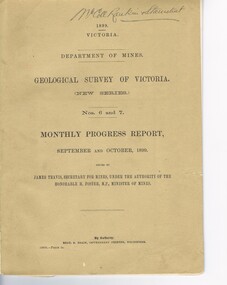
Document - MCCOLL, RANKIN AND STANISTREET COLLECTION: GEOLOGICAL SURVEY OF VICTORIA 1899, 1899
Booklet: 1899 Victoria Department of Mines Geological survey of Victoria (new series Nos. 6 &7. Monthly progress report, September, October issued by James Travis secretary for mines, under the Authority of the Hon. H. Foster M.P. Minister of Mines. McColl Rankin & Stanistreet, 1899 Victoria.MCCOLL RANKIN & STANISTREETorganization, business, industrial - mining, mccoll rankin & stanistreet