Showing 811 items
matching maps and sections
-
 Eltham District Historical Society Inc
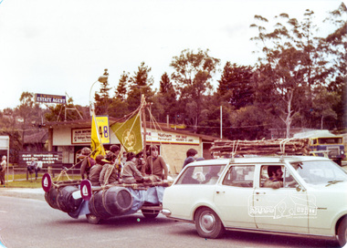
Photograph, !st Eltham Scouts and Cubs, Eltham Community Festival Parade, Main Road opposite Wingrove Park, 4 August 1978, 04/08/1978
Eltham Community Festival, 4-13 August 1978 Newsletter No. 3 September 1978 Eltham Community Festival. This year’s Eltham Community Festival was held from August 4th to 13th. The society was involved with the Warrandyte Historical Society in arranging an exhibition at the Community Centre and also provided notes and a map for a self-guided walking tour of historic buildings and locations around Eltham. Copies of notes will continue to be available from the Eltham Shire Offices and the tour may be under-taken at any time. The exhibition was divided into two sections. The Eltham Society displayed early photographs associated with the walking tour, whilst the Warrandyte Society showed their photographs and artefacts of the Warrandyte gold era. An outstanding feature was the large "blow-up" photos of early Warrandyte. Colour photographeltham, main road, eltham festival, alan whitmore estate agents, shell service station, mount pleasant road, parade, parade float, wingrove park, !st eltham scouts -
 Eltham District Historical Society Inc
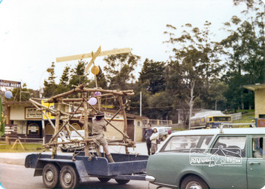
Photograph, Montmorency Scouts, Eltham Community Festival Parade, Main Road opposite Wingrove Park, 4 August 1978, 04/08/1978
Eltham Community Festival, 4-13 August 1978 Newsletter No. 3 September 1978 Eltham Community Festival. This year’s Eltham Community Festival was held from August 4th to 13th. The society was involved with the Warrandyte Historical Society in arranging an exhibition at the Community Centre and also provided notes and a map for a self-guided walking tour of historic buildings and locations around Eltham. Copies of notes will continue to be available from the Eltham Shire Offices and the tour may be under-taken at any time. The exhibition was divided into two sections. The Eltham Society displayed early photographs associated with the walking tour, whilst the Warrandyte Society showed their photographs and artefacts of the Warrandyte gold era. An outstanding feature was the large "blow-up" photos of early Warrandyte. Colour photographeltham, main road, eltham festival, alan whitmore estate agents, shell service station, mount pleasant road, parade, parade float, wingrove park -
 Eltham District Historical Society Inc
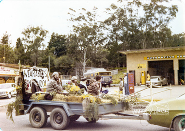
Photograph, Wearables Yarn Wool, Eltham Community Festival Parade, Main Road opposite Wingrove Park, 4 August 1978, 04/08/1978
Eltham Community Festival, 4-13 August 1978 Newsletter No. 3 September 1978 Eltham Community Festival. This year’s Eltham Community Festival was held from August 4th to 13th. The society was involved with the Warrandyte Historical Society in arranging an exhibition at the Community Centre and also provided notes and a map for a self-guided walking tour of historic buildings and locations around Eltham. Copies of notes will continue to be available from the Eltham Shire Offices and the tour may be under-taken at any time. The exhibition was divided into two sections. The Eltham Society displayed early photographs associated with the walking tour, whilst the Warrandyte Society showed their photographs and artefacts of the Warrandyte gold era. An outstanding feature was the large "blow-up" photos of early Warrandyte. Colour photographeltham, main road, eltham festival, alan whitmore estate agents, shell service station, mount pleasant road, parade, parade float, wingrove park -
 Eltham District Historical Society Inc
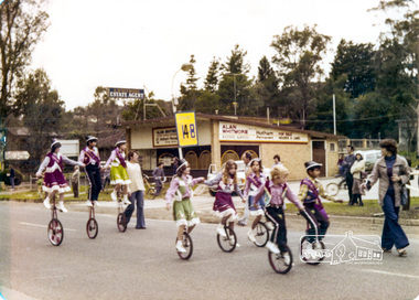
Photograph, Mono cyclists, Eltham Parade, Eltham Community Festival Parade, Main Road opposite Wingrove Park, 4 August 1978, 04/08/1978
Eltham Community Festival, 4-13 August 1978 Newsletter No. 3 September 1978 Eltham Community Festival. This year’s Eltham Community Festival was held from August 4th to 13th. The society was involved with the Warrandyte Historical Society in arranging an exhibition at the Community Centre and also provided notes and a map for a self-guided walking tour of historic buildings and locations around Eltham. Copies of notes will continue to be available from the Eltham Shire Offices and the tour may be under-taken at any time. The exhibition was divided into two sections. The Eltham Society displayed early photographs associated with the walking tour, whilst the Warrandyte Society showed their photographs and artefacts of the Warrandyte gold era. An outstanding feature was the large "blow-up" photos of early Warrandyte. Colour photographeltham, main road, eltham festival, alan whitmore estate agents, shell service station, mount pleasant road, parade, parade float, wingrove park -
 Stawell Historical Society Inc
Photograph, Sister Rocks Title Documents c 1867
Photographs of title documents related to the Sister’s Rocks. c 1867. In 1866 a photographer Mr. O.G. Armstrong feared the Sister's Rock's would be used for building material. Mr. Armstrong and Samuel John Davidson squatter of Great Western leased the ground around the Rock's under the 42nd section of then existing "Land Act" enclosing the rocks with a rough fence. Davidson's lease application was dated 30th Jan 1867. The area applied for was 10 acres and issued 2nd July 1867. The fee paid 2 pound 10 shillings annually till July 1871 when an application to purchase was lodged. Two years later the land was transferred to the Borough of Stawell. Photographs also show maps of the areas. Information also includes 3 typed pages copied from the documents photographs. Documents relating to the Sister Rock's c 1867.documents relating to sister's rock's -
 Bendigo Historical Society Inc.
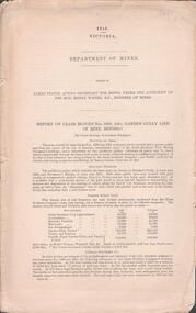
Document - GARDEN GULLY LINE OF REEF, LEASE BLOCKS 5360 AND 5361
Two page document titled ' Report on lease blocks Nos. 5360 and 5361 Garden Gully line of reef, Bendigo. Produced by the Department of Mines 1899. The area described is about 'one mile and a quarter southeast from the centre of the city of Bendigo, immediately south of the Great Southern Gold Mining Company's workings and is intersected by two auriferous gullies ... Salomon's Gully and Derwenter's Gully'. The alluvial deposits, the Garden Gully line, the Great Souther Co.and old workings are discussed in the paper. A map of the Garden Gully line of reef is attached to the report, showing claimholders and mine names along that section of the reef. Mines named on the map: Great Southern Garden Gully United Ulster Londonderry Burrows Horwoods Sea Amalgamated Garden Gully United Victory and Pandora Unity Carlisle and Garden Gully and Passbye United Cornish United Koch's PioneerJames Stirling, Government Geologistbendigo, mining, garden gully line of reef mines -
 Bendigo Historical Society Inc.
Map - HUSTLERS LINE OF REEFS - LONGITUDINAL SECTION THROUGH THE SADDLE REEFS
Drawing with Longitudinal Section through the Saddle Reefs along portion of Hustler's Line of Reefs, Bendigo. Map shows the depth of the mines, reef numbers and Datum 700 ft above sea level. North and South is also noted on the map. Map signed by H. S, Whitelaw, Underground Survey Office, Bendigo, September 1913. Bulletin No 33, Plate No XXXIV. Bendigo Creek, Ironbark Creek and Long Gully are also noted. Mines are: Fortuna Hustlers, Hustler's Royal Reserve No 2 Main Shaft, Hustler's Royal Reserve No 2 Park Shaft, Royal Hustler's, Imperial Hustler's, Extended Hustler's Freehold, Great Extended Hustler's Tribute (Pups), Old Shaft, Great Extended Hustler's Reef No 2, Great Extended Hustler's Main Shaft, Old Shaft, Hustler's Reef, Hustler's Reef No 1, Comet, K. K., United Hustler's & Redan, Old Shaft and Hustler's Consols. Has Geological Survey of Victoria Crest and underneath is: H. Herman, Director, W. Dickson, Secretary for Mines, The Hon. J Drysdale Brown M L C. Minister of Mines.Geological Survey of Victoria Crestmining, hustler's reef maps, hustlers line of reefs, bendigo creek, royal hustler's, imperial hustler's, extended hustler's freehold, great extended hustler's tribute (pups), great extended hustler's reef no 2, great extended hustler's main shaft, hustler's reef, hustler's reef no 1, united hustler's & redan, old shaft and hustler's consols.h s whitelaw, underground survey office bendigo september 1913 -
 Kew Historical Society Inc
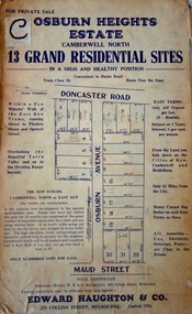
Plan - Subdivision Plan, Osburn Heights Estate, 1938
Edward Haughton & Co, in promoting the Osburn Heights Estate in what is now Balwyn North, attempted to capitalize on the subdivision’s proximity to East Kew. One section of the plan is includes the text: ‘The New Suburb: Camberwell North or East Kew (the names are synonymous)’. The Osburn Heights subdivision was part of a series of subdivisions running between Doncaster Road and Maud Street, including the ‘Pointed Firs Estate’ (MAP.0010). This subdivision included 13 ‘grand residential sites’ for sale in Doncaster Road, Maud Street and Osburn Avenue.subdivision plans - camberwell north, osburn heights estate -
 Bendigo Military Museum
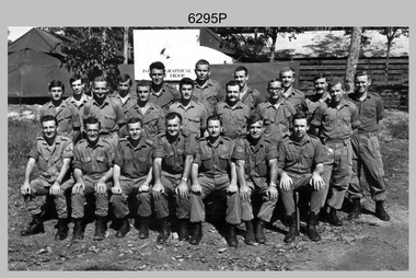
Photograph - A Section, 1st Topographic Survey Troop, Nui Dat, Vietnam, 1969
This is a photograph of A Section, 1st Topographic Survey Troop taken at Nui Dat, Vietnam in 1969. A nominal roll of personnel and their trade as of the 30th of September 1969, accompanies this photo. Their trades in this photo were as follows - Surveyors Topographic: WO1 Darby Munro, SGT Paddy Strunks, SGT Graeme Birrell, CPL Brian Knight, CPL Colin Laybutt, SPR Roderick Gilbert and SPR Rodney Offer. Draughtsmen Topographic: SGT Terrance Linz, CPL Robert Kay, SPR Peter Aukstinaitis, SPR Lloyd Patterson and SPR Ian Wark. Photographer Cartographic: CPL George Graham. Clerk Admin: CPL Oreste Biziak. Helioworker: CPL Geoffrey White, SPR Lance Percey. Cook AACC: PTE R. Johnston. The first Royal Australian Survey Corps troops arrived in South Vietnam on the 10th of June 1966. This was a detachment from 1st Topographic Survey Troop, which was to give cartographic support to the Australian Task Force. Their main tasks were to establish a Theatre Grid, map compilation and map revision. Engineer Survey Support in the camp and to the civil community and give assistance to the Cordon Search Missions by producing large scale plots from aerial photos with every house and fence etc plotted and then reproduce these by silk screening usually, within a 24-hour period. This support concluded with the withdrawal of Australian troops from Vietnam in 1972. For more information on the career of A Section’s OC MAJ Peter Constantine AM, refer to item 6159P or 6092P. He was the CO of the Army Survey Regiment from 1975 to 1976 and CO of the School of Military Survey (SMS) from 1976 to his retirement in January 1982. His memoirs of active duty in Vietnam ‘Surveyor - Printer Behind the Lines’ was published in 2022. 2IC CAPT Frank Thorogood SB St J’s career culminated at the rank of LTCOL as the CO Army Survey Regiment from 1980 to 1981. More information on the A Section, 1st Topographic Survey Troop and the Army Survey Regiment’s supporting role is provided in pages 89 to 94 of Valerie Lovejoy’s book 'Mapmakers of Fortuna – A history of the Army Survey Regiment’ ISBN: 0-646-42120-4.This is a photograph of A Section, 1st Topographic Survey Troop taken at Nui Dat, Vietnam in 1969. The black and white photograph was printed on photographic paper and is part of the Army Survey Regiment’s Collection. The photograph was scanned at 300 dpi. .1) - Photo, black & white, 1969. Back row L to R: SPR Lance Percey, SPR Bruce Grisdale, SPR Rodney Offer, SPR Roderick Gilbert, CPL Geoffrey White, PTE R. Johnston, CPL Colin Laybutt, SPR Lloyd Patterson. Centre row L to R: SPR Peter Aukstinaitis, SPR Ian Hanna, SPR Ian Wark, CPL Robert Kay, CPL George Graham, CPL Oreste Biziak, CPL Brian Knight. Front row L to R: SGT Terrance Linz, SSGT Gordon Haswell, 2IC CAPT Frank Thorogood SB St J, OC MAJ Peter Constantine AM, WO1 Darby Munro, SGT Paddy Strunks, SGT Graeme Birrell.An A4 nominal roll of personnel and their trade accompanies the photo, as of the 30th of September 1969. A torn paper identifies the personnel in the photo. Annotated on back of photo – ‘Unit Photo – 1 Topo Svy Tp 30 Sept 69’royal australian survey corps, rasvy, army survey regiment, army svy regt, fortuna, asr -
 Melbourne Tram Museum
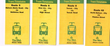
Ephemera - Timetable/s, The Met, "The Met Tram Timetable", 1987 and 1988
Set of 9 The Met Tram timetables, folded sheets, 8 -10 sections, providing timetables for specific routes, day of week giving information on tram times at specific time points, route map, sections and fares and phone contact numbers. Route 5 - Malvern (Burke Road) - City via Wattletree Road - June 1988 Route 6 - Glen Iris - City via High St - June 1988 Route 8 - Toorak - City - June 1988 Route 48 - North Balwyn - City via Flinders St - Oct. 1988 Route 67 - Carnegie - City - Sept. 1987 Route 86 - Bundoora - City via Preston - Aug. 1988 Route 72 - Camberwell - City via Malvern Road - June 1988 Route 75 - East Burwood - City via Flinders St - Feb. 1988 Route 96 - East Brunswick - St Kilda Beach (Light Rail) - Oct 1988trams, tramways, the met, timetables, melbourne, fares, route 5, route 6, route 8, route 48, route 67, route 86, route 72, route 75, route 96 -
 Bendigo Military Museum
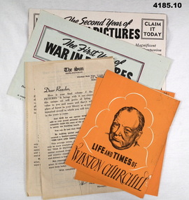
Literary work - ADVERTISING LEAFLETS, 9) 5.8.1944. .10) 23.6.1945
This collection of leaflets were enclosed in various Volumes of the First to the Sixth years of the war in pictures. Refer Cat No 4184.6.1)- .2) Leaflet, Life and times of Winston Churchill, folded, exterior orange colour, B & W print, interior white with black & orange print with white photo. .3) .4) Leaflet, The Sun News Pictorial, folded, white paper with black print. .5) - .6) Leaflet, The first year, the second year of the war in pictures, .5) cream colour, .6) green colour both B & W print. .7) - .8) Envelopes, paper, beige colour stamped “Inscriptions”. .9 - .10) War map Section. Page of a newspaper, folded, beige colour black print. .7) & .8) Hand written on both slightly different, “Reg RUNCIMAN Rutherford St Swanhill”, .8) has “8 JL 42”leaflets, advertising -
 Ringwood and District Historical Society
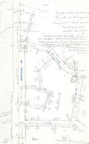
Document - Copy of Lands Department Field Notes - Parish of Ringwood, Victoria, Field Notes - 1928/453 - Part of OP R72C Surveyed on 17.11.1928
5616b Foolscap size photocopy of survey map with handwritten notations. References include Whitehorse Road, Mines Road, Wilson Street, Rupert Street, New Road (Braeside Avenue), Section E, Allot 31 sold, Allot 32 sold, Recreation Reserve, Allot 25 sold, Allot 29 sold, hedge, spikes, links on line from each corner, I hereby certify that these field notes were prepared from actual observations and measurements made by me or under my supervision on the ground and in accord with regulations (signed) Authorised Surveyor 17/11/28. -
 Bendigo Historical Society Inc.
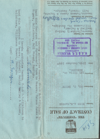
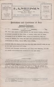
Document - H.A. & S.R. WILKINSON COLLECTION: CONTRACT OF SALE
Contract of sale dated 19th October, 1957 between Miss A.M. Sanger (seller) and Mr. C. Smith (buyer). Solicitor for vendor: Messrs. Tatchell, Dunlop, Smalley & Balmer, Williamson Street, Bendigo. Solicitor for purchaser: Messrs. Watson, James & Rogers, Bull Street, Bendigo. For property No.121 Wills Street, Bendigo being part of Crown allotments 2 and 3 section 116C together with a right of carriage way over the road colored brown on the map on the title, being land described in certificate of title volume 8149 folio 666. Price 1,500 poundsorganization, business, h.a. & s.r wilkinson real estate -
 Bendigo Historical Society Inc.
Book - BOOKLET: THE RUSKIN ALL-ABOUT
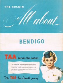
40 paged booklet - ''The Ruskin All-about'' (covering the Municipality of Bendigo facilities and activities), printed by The Ruskin Press, 1955. ''assisted by the Municipal Council and its officers and office-bearers of other organizations and associations''. Contents: Abbreviations; Baby Health Centres; Bus services; By-laws and regulations; Churches; Classified advertisers; Community activities; Doctors and surgery hours; Facts on the city; Friendly Societies; Hospitals; Magazine section; Maps; Message from the Mayor; Miscellaneous; Municipal services; The Municipality; Public and semi-public utilities; Schools and kindergartens; Sporting and recreation. Information on the forthcoming Olympic Games.Ruskin Publishing Pty. Ltd., 37 Swanston Street Melbourne.bendigo, tourism, guide -
 Bendigo Historical Society Inc.
Document - H. A. & S. R. WILKINSON COLLECTION: CONTRACT OF SALE
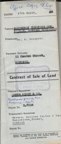
Contract of sale of land dated 17th March, 1966 between Sandhurst and Northern District Trustees Executors for C. L. H. Seymour-Deceased (vendor) and Mr. A. Scinetti (purchaser). Solicitor for vendor: Cohen Kirby & Co. Solicitor for purchaser: Messrs. Macaboy Taylor & Taylor, Hargreaves Street, Bendigo. Property 11 Condon Street, Bendigo being part of Crown allotment 250 section H land comprised in certificate of title volume 5433 folio 443 together with a right to drainage over the land coloured yellow on the map endorsed on the said title. Price 5,000 dollars.organization, business, h.a. & s.r wilkinson real estate -
 Ballarat Tramway Museum
Poster, Transport Regulation Board, "Geelong Bus Services", late 1955
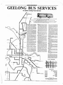
Yields information about the closure of the Geelong Tramway system and the bus replacements made by the Transport Regulation Board, can be compared to that for Ballarat.Poster printed on off white paper with a gloss finish on the printed side - Produced shortly before the closure of the State Electricity Commission of Victoria operated Geelong Tramway system. Gives details of the replacement bus services as well as the existing bus services and other changes planned. Provides notes on the operator, timetables, fares, vehicle standards and dates when the services would be changed. Map shows Operator, section points, rail lies and service levels. Authorised by the Secretary of the Transport Regulation Board E V N Field. pdf file has to be opened outside dbTextWorks.trams, tramways, geelong, closure, map, buses -
 Ballarat Tramway Museum
Poster, Transport Regulation Board, Ballarat Bus Services", Aug. 1971
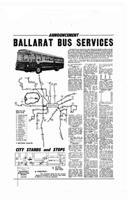
Yields information about the closure of the Ballarat Tramway system and the bus replacements made by the Transport Regulation Board, can be compared to that for Bendigo and Geelong.Poster, titled "Ballarat Bus Services" printed on off white gloss paper. Produced shortly before the closure of the State Electricity Commission of Victoria operated Ballarat Tramway system. Gives details of the replacement bus services as well as the existing bus services and other changes planned. Provides notes on the operator, timetables, fares, route numbers and dates when the services would be changed. Map shows the bus routes, route numbers, section points and City stands and stops. Authorised by the Secretary of the Transport Regulation Board B. P. Kay. pdf file has to be opened outside dbTextWorks.trams, tramways, ballarat, map, closure, buses -
 Ballarat Tramway Museum
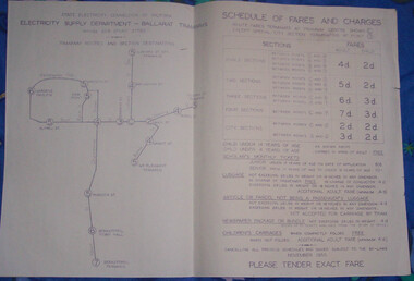
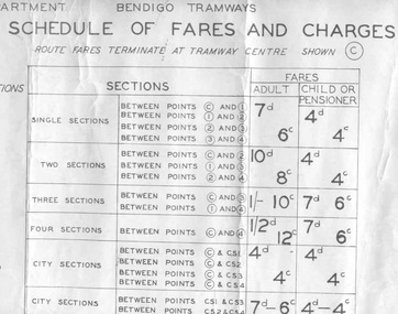
Poster, State Electricity Commission of Victoria (SECV), "Schedule of Fares and Charges - November 1955", Nov. 1955
... Sections ...Demonstrates the way the SEC advised passengers in Ballarat and Bendigo how the fare and charges systems worked and yielded information about the fare charges in force at the time. A copy was provided in each tram behind framed glass.Dyeline print of a drawing showing Ballarat Tramway (SEC) Fares, Charges, and Section Map. Also gives charges for Scholar's Monthly tickets, Luggage, Parcels, Newspapers and Chartered trams. Originally dated November 1955. All fares in shillings and pence. Titled - "Schedule of Fares and Charges - November 1955" See Reg Item 1731 and 4135 for the following versions. Note May have not been made in November 1955, some printed versions have been seen. Two additional copies found in depot collection 1/2011, added 5/1/2011. trams, tramways, ballarat, fares, sections, map -
 Ballarat Tramway Museum
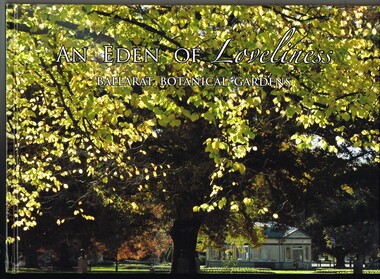
Book, Friends of the Botanical Gardens, "An Eden of Loveliness - Ballarat Botanical Gardens", 2012
Book - 6 sections, sewn hard cover with glued face sheets, 122 pages, full colour printing, art paper with table of contents, index, sources and maps, titled "An Eden of Leveliness - Ballarat Botanical Gardens". Provides a detailed illustrated history of the Ballarat Botanical Gardens. Looks at the creation of the gardens, the north and south foreshores, Lake Wendouree, Friends of the Botanical Gardens, Begonias, the Heritage trees and provides a timeline of development. Has some notes on the Ballarat Tramway Museum, fish hatchery and other features of the area. Published by the Friends of the Ballarat Botanical Gardens, 2012.On inside of the front cover "To the Ballarat Tramway Museum, Enjoy, from the Friends of the Botanical Gardens June 2016"trams, tramways, lake wendouree, botanical gardens, btm, gardens, begonia festival, local history -
 Melbourne Tram Museum
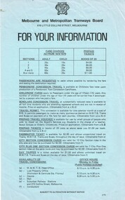
Document - Notice, Melbourne & Metropolitan Tramways Board (MMTB), "For Your Information", 9/1979 and 8/1980
Set of two foolscap notices regarding fares, travel cards, concession cards, day trippers, and general information. .1 - Blue foolscap sheet - titled "For your Information", for fares changes from 16/9/1979, gives details of fares and prepaid tickets in books of 20, also vintage tram trips, tram and bus charter rates, maps, timetables and contact details. .2 - pink foolscap sheet - titled "Information Guide for passengers:, as above, applicable from 3/8/1980, has details on section savers, day trippers, metro cards, etc.trams, tramways, notices and information, mmtb, fares, tickets, charters, information -
 Melbourne Tram Museum
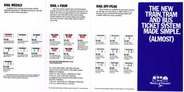
Pamphlet, Minister of Transport, "The new Train, Tram and Bus Ticket system made Simple (Almost)", Sep. 1981
Fold out pamphlet - 8 sections, titled "The new Train, Tram and Bus Ticket system made Simple (Almost)", explaining the new fare zone system - Central, Zones 1 to 3, with maps, explanations how it works, and the various travel cards issued by the Tramways Board and private buses and Vic Rail. Provides fare details of Travelcards, with pictures of them, rail singles, tram concessions, and rail weekly. Dated for introduction on 4/10, does not provide a year - see Reg Item 1645 for year - 1981. 2nd copy added 16-6-2015.trams, tramways, map, mmtb, vicrail, tickets, fares -
 Bendigo Military Museum
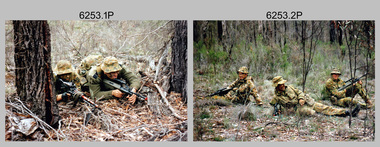
Photograph - Army Survey Regiment - Regimental Training Field Phase, 1995
This is a set of twenty photographs of the Army Survey Regiment undertaking regimental training in state forest north of Costerfield, Victoria, 1995. The state forest is now part of the Heathcote-Graytown National Park. The aim of the training was to provide personnel practical revision of infantry and minor tactics at the section level, navigation and map reading, RATEL and Survival in the Field. This was the Army Survey Regiment’s last military skills field training exercise before disbandment of RA Svy and the weather on the last day was wet and cold. It provided soldiers who decided to continue their military service essential military skills revision and for those who chose to discharge from the Army, it reinforced their decision to leave. LTCOL Duncan Burns was the last CO of the Army Survey Regiment from 1994 to 1996 and WO1 Ken Johnston OAM MM from RA Inf was the RSM for one year in 1995.This is a set of twenty photographs of the Army Survey Regiment undertaking regimental training in state forest north of Costerfield, Victoria, 1995. The photographs were printed on photographic paper and are part of the Army Survey Regiment’s Collection. The photographs were scanned at 300 dpi. .1) - Photo, colour, 1995, unidentified personnel. .2) - Photo, colour, 1995, L to R: Derek Percival, Damien Cole, unidentified. .3) - Photo, colour, 1995, L to R: unidentified, Chris ‘Charlie’ Brown, unidentified (x2). .4) - Photo, colour, 1995, unidentified personnel. .5) - Photo, colour, 1995, unidentified. .6) - Photo, colour, 1995, unidentified personnel. .7) - Photo, colour, 1995, unidentified personnel. .8) - Photo, colour, 1995, L to R: Jim Ash, Syd Anstee, unidentified, Rob Bogumil. .9) & 10) - Photo, colour, 1995, L to R: Steve Hill OAM CSM, Rob Bogumil, Brian Paul, Jim Ash, Syd Anstee, Colin Davidson. .11) - Photo, colour, 1995, L to R: Paul ‘Hutch’ Hunter, Stu Ridge, Chris ‘Charlie’ Brown. .12) - Photo, colour, 1995, RSM WO1 Ken Johnston OAM MM. .13) - Photo, colour, 1995, Peter Imeson. .14) - Photo, colour, 1995, L to R: Stu Ridge, Alan Virtue. .15) - Photo, colour, 1995, CO LTCOL Duncan Burns. .16) - Photo, colour, 1995, unidentified personnel. .17) - Photo, colour, 1995, L to R: Tony Harder, CAPT Sutiman (Indonesian Exchange Officer), Kasey ‘Tiges’ Northausen, unidentified (x2), Mick Duggan. .18) - Photo, colour, 1995, CAPT Sutiman (Indonesian Exchange Officer). .19) & 20) - Photo, colour, 1995, unidentified personnel..1P to .20P – No personnel are identified.royal australian survey corps, rasvy, army survey regiment, army svy regt, fortuna, asr -
 Ballarat Tramway Museum
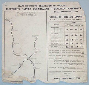
Poster, State Electricity Commission of Victoria (SECV), "Schedule of Fares and Charges - 11 August 1965", Aug. 1966
... Sections ...Dye line print of a drawing showing Bendigo Tramways (SEC) Fares, Charges, and Section Map. Also gives charges for Scholar's Monthly tickets, Luggage, Parcels, Newspapers and Chartered trams. Dated 11 August 1965. Fares in shillings and pence and decimal currency. Titled - "Schedule of Fares and Charges - 11August 1965". Shows offices as Hargreaves St. For map - see bgofsmap.jpg and for actual fare tables, btm1732i1.jpg and btm1732i2.jpg. .1 - Second copy from Ron Fluck, added 26/9/2008. Note: 1732 - first copy stored rolled, 1732 - 2nd copy stored flat in box at bottom of rolls. .2 - as above but mounted onto a heavy card sheet with wear marks along the bottom edge - see image i3. Stored as for the 2nd copy. Note: 1732 - first copy stored rolled, 1732 - 2nd copy stored flat in box at bottom of rolls, .3 dittotrams, tramways, bendigo, fares, sections, map -
 Melbourne Tram Museum
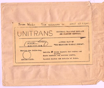
Map, Russell J. Nowell, "The Melbourne Tramway System", mid 1960's
Printed map (dye line process) on a large sheet of paper contained within an envelope. .1 - Brown paper envelope with a printed sheet glued to the envelope - giving title "The Melbourne Tramway System", publisher ("Unitrans - Universal Transport Research and Planning Services" - with a space for the retail price. .2 - Map printed on paper and folded into 16 parts - details the track layouts for routes and depot, route numbers, sections, Latrobe and William St services and details of fares. Has a sketch of tram 980 in the top right hand corner along with details of the tram system. Also includes depot locations, reserved tracks and derails at level crossings, though railway level crossings are not shown. Produced by Russell J. Nowell - gives address and phone number along with the "UniTrans" logo. Advised by other members, he was a Tasmanian. Not dated, but appears to be mid 1960's. Plan scanned 1-3-2016 as a tiff file.Envelope has the name and address of the donor "Brian Weedon 5/124 Alexandra St East St Kilda"trams, tramways, map, mmtb, depots, tram routes, trackwork -
 Melbourne Tram Museum
Ephemera - Timetable, Hawthorn Tramways Trust (HTT), "Directory and Tramway Guide issued by the Hawthorn Tramways Trust", 1918
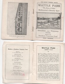
Booklet - 38 pages, printed on off white page, centre stapled, titled "Directory and Tramway Guide issued by the Hawthorn Tramways Trust", specifically advertising Wattle Park and showing Princes Bridge and the Yarra on the front cover and a photo of Hawthorn depot on the rear cover. Gives details of Wattle Park, its opening, many photos, members of the Trust, Engineer and Manager and Acting Secretary, Stopping points for the round and fares to Wattle Park, section fares, maps of the tram routes and connections with other tramways and railway stations. Has timetables for Burnley and other major points, special and emergency services, the coloured lights used on the trams, and a map for land sales at Riversdale Heights estate. Advertisements for Mutual stores, Melbourne Electric Supply Co., Moule, Hamilton and Kindle for the sale of land at Riversdale Heights and a map showing the estate location. Both copies have alterations or corrections to the route signage letters - marked in red - from the Minutes of the HTT Board meetings, the Trust were not happy with the finished product and was reluctant to pay for them - see Minutes of Meeting No. 99 of 5-7-1918. Two copies held - one with red marks on the front cover.trams, tramways, htt, wattle park, princes bridge, hawthorn depot, timetables, mesco, real estate -
 Glen Eira Historical Society
Article - OUTER CIRCLE RAILWAY
This file contains five items: 1/Two copies of a document titled THE OUTER CIRCLE RAILWAY by the Royal Historical Society of Victoria and the Australian Railway Historical Society, Vic div. It details the history of the construction of the Outer Circle Railway and discussed expenses and other factors affecting the construction of the line. Notes compiled by R.K Whitehead, Research and Archives Officer Australian Railway Historical Society Victoria Division. The document includes three maps of the outer circle railway line. 2/Four newspaper articles detailing the history of the Outer Circle Railway Line. They include ten black and white images of various aspects of the railway and three line maps. The first article is titled ‘Rail Link with the Past’. In the COLLINGWOOD COURIER dated 07/10/1970, author unknown. The second article titled ‘Ghost trains of the Outer’ by Kenneth Joachim in the HERALD dated 18/04/1975. The third article is titled ‘Tracks in Time’ by Norman Thompson from NEWS, dated 13/02/1973. The fourth article is titled ‘Our Ghost Railway’ by John Townsley from the HERALD, dated 06/11/1974. 3/A letter from Victorian Railways Chief Estate Officer N.A Wigmore to the Honorary Secretary of the Caulfield Historical Society, dated 19/11/1975 regarding the leasing of land along the Outer Circle Railway Reserve from Dandenong Road to the Hughesdale Station. 4/Two copies of an article titled ‘Outer Circle Railway’ in the CAULFIELD HISTORICAL SOCIETY NEWSLETTER undated detailing the history of the outer circle line. The article includes a map of the section of the line in Caulfield. 5/A Photocopy of two images of train line locations on the Outer Circle Line. One on Warrigal Road, looking south from Ashburton dated 1936. The second is of the Black Bridge over Gardiners Creek dated 1935.outer circle railway, normanby road, caulfield station, outer circle line, rosstown junction railway, monash john, caulfield historical society, poath road, deepdene dasher, ashby dasher, dandenong road, gippsy goods, mallee root mercury, outer circle railway reserve, railway lines, railway stations, steam trains -
 Bendigo Historical Society Inc.
Document - H. A. & S. R. WILKINSON COLLECTION: CONTRACT OF SALE
Conditions of sale by private contract dated 14th December, 1946 between Mr. J. R. Shields (vendor) and Mr. L. J. Trigg (purchaser). Property: land situate No. 110 Garsed Street, Bendigo at present occupied by Mrs. Cook as tenant, being part of Crown allotment 5 and 6 section 116C Parish of Sandhurst city of Bendigo described in certificate of title volume 1397 folio 279304, together with the right of carriage way over land coloured brown on map on certificate of title, together with 5 roomed weatherboard and rough cast dwelling and sundry outbuildings. Price: 1,020 pounds.organization, business, h.a. & s.r wilkinson real estate -
 Bendigo Historical Society Inc.
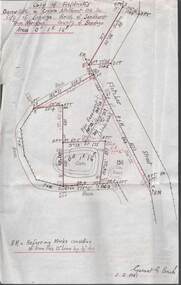
Plan - MCCOLL, RANKIN AND STANISTREET COLLECTION: PLAN OF SURVEY OF DAM SITE, 1941
McColl Rankin & Stanistreet, Plan of Survey of Dam site, Part of Crown Allotment 98 Section C, City of Bendigo, Parish of Sandhurst, County of Bendigo. Signed by Garnet G Birch 1 Feb 1941. 33.5 x 43. Attached is a Copy of Field notes, Dam Site in Crown Allotment 198 Sec. City of Bendigo, Parish of Sandhurst. True Meridian, County of Bendigo, Area 0A 1R 16P. Signed Garnet G Birch, 1/2/1941. Drawn in red and black pen. 20.8 x 33. Both maps are for Deborah Extended Gold Mining Co. No Liabilityorganization, mining, deborah extended gold mining co nl, mccoll rankin & stanistreet, plan of survey of dam site -
 Victorian Aboriginal Corporation for Languages
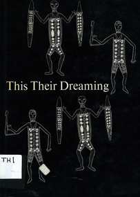
Book, Ann E Wells, This their dreaming : legends of the panels of Aboriginal art in the Yirrkala Church, 1971
Some time before the end of the year 1962, two great panels of Aboriginal art were begun. They were painted for part of a screen placed behind the Communion table in the Yirrkala church, and represented the two main, creative legends governing the lives, the behaviour and the ritual of the Aborigines belonging to a wide area of northeast Arnhem Land. Gives a brief outline of circumstances surrounding the panels. Lists the artists for each moiety. Maps show the territory of the people mentioned in the text. For each panel, there is a description of each section and an explanation of associated myths. Dua panel - the Djankawu journeys. Yiritja panel - legend of Banaitja. Glossary of terms.b&w art reproductionsyirrkala, yirrkala church, arnhem land -
 Ballarat Tramway Museum
Poster, State Electricity Commission of Victoria (SECV), "Schedule of Fares and Charges - July 1951", Jul.1951
... Sections ...Demonstrates the way the SEC advised passengers in Ballarat and Bendigo how the fare and charges systems worked and yielded information about the fare charges in force at the time. A copy was provided in each tram behind framed glass.Printed sheet and mounted onto at least two other sheets of heavy blank paper to form a poster of a drawing showing Bendigo Tramways (SEC) Fares, Charges, and Section Map. Also gives charges for Scholar's Monthly tickets, Luggage, Parcels, Newspapers and Chartered trams. Fares in shillings and pence and decimal currency. Titled - "Schedule of Fares and Charges - July 1951". Shows offices as Hargreaves St. Has details of designer/draftsman and date "AVM/MM / 14/5/51" in top left hand corner. See images for digital photographs of the poster. Stored within a purpose made folder. In very poor order.trams, tramways, bendigo, fares, sections, map