Showing 450 items
matching arthur and son
-
 Eltham District Historical Society Inc
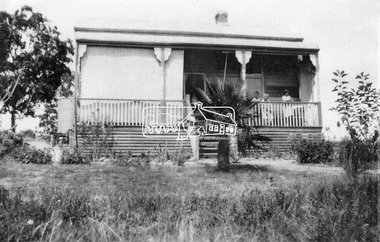
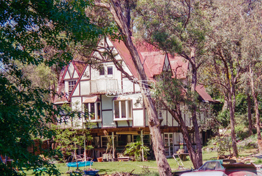
Photograph, Castledine family home, 226 Old Eltham Road, Lower Plenty
This is the home of Annie Castledine and her children, widow of Arthur Frederick Castledine. The property is now the present day site of Araluen. Araluen provides quality supports for adults with intellectual disabilities throughout Melbourne’s north-east suburbs.Son George, Sapper George Ernest Castledine VX10044 was the first soldier from the Eltham District to be killed in the Second World War, an event that ultimately resulted in the women and men of the district raising funds to create the Eltham War Memorial to benefit the children of the district as a living memorial in memory of the fallen soldiers of the district in that war.Digital file only created from scan of print on loanannie castledine, araluen, arthur frederick castledine, castledine family home, eltham war memorial, george ernest castledine, lower plenty, old eltham road, sidney castledine -
 Bendigo Military Museum
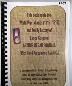
Literary work - DIARY, TRANSCRIPT, Frank Pownall, A R POWNALL'S SON, Post 2000
Arthur Reagan POWNALL No 5345 enlisted in the AIF on 16.6.1915 in reinforcements for Convalescent Depot in London age 23 years 7 months. Embark for England 22.7.1915, promoted L/Cpl 6.10.1916, embark for France 5.3.1917, transfer to 5th Div AMC 23.3.1917, transfer to 15th Field Ambulance 25.3.1917, WIA 8.5.1917 GSW’s to legs, rejoin unit 26.6.17, awarded the Military Medal (MM) near Perrone 2.9.18 as a stretcher bearer, awarded a bar to the Military Medal 29/30.9.1918 over 36 hours as a stretcher bearer at Bellicourt, hospital 24.10.1918 accidental injury bayonet wound left thigh, embark for Australia transport duty as N/Staff Masseur 19.4.1919, discharged from the AIF 23.9.1919. A bar to the Military Medal means he has actually won two MM’s. Plastic covered folder with black binding containing typed diary of A R POWNALL 22.7.15 to 9.6.19, 120 pages. Also copies of Service Records, Awards. The rear has folded sheets with photostats of photos & newspaper articles.documents - diaries - transcripts, military history -
 Federation University Historical Collection
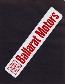
Album - Album - Sample Stickers, ZILLES COLLECTION: Album, Sample Stickers produced by Jeff Zilles
Zilles Printers was begun by Lewis Zilles in the early 1930s. It was in McKenzie Street Ballarat. His son Jeffrey also became a printer - letterpress, offset and screen printer. The business became Zilles Printers/Graphics and was in Armstrong Street and later Bell Street Ballarat. A form of sticker began in 1839 when Sir Rowland Hill invented adhesive paper. The first self-adhesive label was invented in 1935 by Stanton Avery - Avery Labels. In the 1940s "bumper strips"were created. Now referred to as bumper stickers. The stickers shown are for car dealerships, motor bike, tractor and agricultural equipment and entertainment. They are for places in Ballarat, Bendigo, Geelong and Wonthaggi, indicating that Zilles were well known for the quality of their products. These stickers were possibly produced in the 1960s, 1970s and early 1980s. The Swinger was a local dance that ran at the Ballarat Civic Hall between 1972-1975. Dress was neat casual and men were required to wear a tie. The average age of attendees was 18-25.Dark green vinyl cover, three bolts holding it together. Thirteen pages - black cover paperSticker on each pagezilles printers, stickers, bumper stickers, self-adhesive label, santo avery, sir rowland hill, car dealers, motor cycles, farm equipment, ballarat, bendigo, geelong, wonthaggi, ballarat motors, rambler, triumph, toyota, brown murphy geelong, leyland australia, berko datsun geelong, mental ballarat, sound conditioned bendigo, col hawkins, frank faulkner car sales, patron products ballarat, mil haven tractor cab ballarat, john basin ballarat, swinger, b & g myers pty ltd ballarat, arthur shultz, don mullin motors wonthaggi -
 Flagstaff Hill Maritime Museum and Village
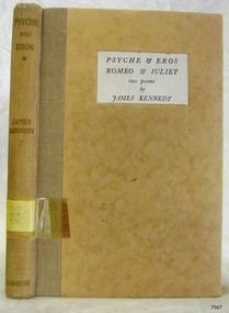
Book, Psyche & Eros Romeo & Juliet
This item is from the ‘Pattison Collection’, a collection of books and records that was originally owned by the Warrnambool Mechanics’ Institute, which was founded in Warrnambool in 1853. By 1886 the Warrnambool Mechanics’ Institute (WMI) had grown to have a Library, Museum and Fine Arts Gallery, with a collection of “… choice productions of art, and valuable specimens in almost every branch and many wonderful national curiosities are now to be seen there, including historic relics of the town and district.” It later included a School of Design. Although it was very well patronised, the lack of financial support led the WMI in 1911 to ask the City Council to take it over. In 1935 Ralph Pattison was appointed as City Librarian to establish and organise the Warrnambool Library as it was then called. When the WMI building was pulled down in 1963 a new civic building was erected on the site and the new Warrnambool Library, on behalf of the City Council, took over all the holdings of the WMI. At this time some of the items were separated and identified as the ‘Pattison Collection’, named after Ralph Pattison. Eventually the components of the WMI were distributed from the Warrnambool Library to various places, including the Art Gallery, Historical Society and Flagstaff Hill. Later some were even distributed to other regional branches of Corangamite Regional Library and passed to and fro. It is difficult now to trace just where all of the items have ended up. The books at Flagstaff Hill Maritime Village generally display stamps and markings from Pattison as well as a variety of other institutions including the Mechanics’ Institute itself. RALPH ERIC PATTISON Ralph Eric Pattison was born in Rockhampton, Queensland, in 1891. He married Maude Swan from Warrnambool in 1920 and they set up home in Warrnambool. In 1935 Pattison accepted a position as City Librarian for the Warrnambool City Council. His huge challenge was to make a functional library within two rooms of the Mechanics’ Institute. He tirelessly cleaned, cleared and sorted a disarrayed collection of old books, jars of preserved specimens and other items reserved for exhibition in the city’s museum. He developed and updated the library with a wide variety of books for all tastes, including reference books for students; a difficult task to fulfil during the years following the Depression. He converted all of the lower area of the building into a library, reference room and reading room for members and the public. The books were sorted and stored using a cataloguing and card index system that he had developed himself. He also prepared the upper floor of the building and established the Art Gallery and later the Museum, a place to exhibit the many old relics that had been stored for years for this purpose. One of the treasures he found was a beautiful ancient clock, which he repaired, restored and enjoyed using in his office during the years of his service there. Ralph Pattison was described as “a meticulous gentleman whose punctuality, floorless courtesy and distinctive neat dress were hallmarks of his character, and ‘his’ clock controlled his daily routine, and his opening and closing of the library’s large heavy doors to the minute.” Pattison took leave during 1942 to 1942 to serve in the Royal Australian Navy, Volunteer Reserve as Lieutenant. A few years later he converted one of the Museum’s rooms into a Children’s Library, stocking it with suitable books for the younger generation. This was an instant success. In the 1950’s he had the honour of being appointed to the Victorian Library Board and received more inspiration from the monthly conferences in Melbourne. He was sadly retired in 1959 after over 23 years of service, due to the fact that he had gone over the working age of council officers. However he continued to take a very keen interest in the continual development of the Library until his death in 1969. WARRNAMBOOL PUBLIC LIBRARY The Warrnambool Mechanics’ Institute (WMI) was formed by a voluntary community group in 1863, within six years of Warrnambool’s beginnings, and its Reading Room opened in 1854. The WMI operated until 1963, at which time it was one of the oldest Mechanics’ Institutes in Victoria. Mechanics’ Institutes offered important services to the public including libraries, reading rooms and places to display and store collections of all sorts such as curiosities and local historical relics. In 1886 a Museum and Fine Arts Gallery were added to the WMI and by the beginning of the 20th century there was also a billiards room and a School of Art. By this time all Mechanics’ Institutes in country Victoria had museums attached. Over the years the Warrnambool Mechanics’ Institute Library was also known as the Warrnambool Public Library the Warrnambool Library and the Free Library. Early funding from the government was for the “Free Library”. The inscription in a book “Science of Man” was for the “Warrnambool Public Library”, donated by Joseph Archibald in 1899. Another inscription in the book “Catalogue of Plants Under Cultivation in the Melbourne Botanic Gardens 1 & 2, 1883” was presented to the “Warrnambool Library” and signed by the author W.R. Guilfoyle. In 1903 the Warrnambool Public Library decided to add a Juvenile Department to library and stock it with hundreds of books suitable for youth. In 1905 the Public Library committee decided to update the collection of books and added 100 new novels plus arrangements for the latest novels to be included as soon as they were available in Victoria. In July 1911 the Warrnambool Council took over the management of the Public Library, Art Gallery, Museum and Mechanics’ Institute and planned to double the size of the then-current building. In 1953, when Mr. R. Pattison was Public Librarian, the Warrnambool Public Library’s senior section 10,000 of the 13,000 books were fiction. The children’s section offered an additional 3,400 books. The library had the equivalent of one book per head of population and served around 33 percent of the reading population. The collection of books was made up of around 60 percent reference and 40 percent fiction. The library was lending 400 books per day. In 1963 the Warrnambool City Council allocated the site of the Mechanics’ Institute building, which included the Public Library, Museum and Art Gallery, for the new Municipal Offices and the Collections were dispersed until 1971. The Warrnambool Library took over the Mechanics’ Institute Library’s holdings on behalf of the Warrnambool City Council. Since the closure of the Warrnambool Mechanics’ Institute the exact location and composition of the original WMI books and items has become unclear. Other materials have been added to the collection, including items from Terang MI, Warrnambool Court House and Customs House. Many of the books have been identified as the Pattison Collection, named after the Librarian who catalogued and numbered the books during his time as Warrnambool Public Librarian in the time before the Mechanics’ Institute closed. It seems that when Warrnambool became part of the Corangamite Regional Library some of the books and materials went to its head office in Colac and then back to Warrnambool where they were stored at the Art Gallery for quite some time. Some then went to the Warrnambool Historical Society, some stayed at the Art Gallery and some were moved to Flagstaff Hill Maritime Village. The various stamps and labels on the books held at Flagstaff Hill show the variety of the collection’s distribution and origin. The books in the collection at Flagstaff Hill Maritime Village date from the 1850’s to the late 1950’s and include rare and valuable volumes. Many of the books are part of the “Pattison Collection” after the Warrnambool’s Public Librarian, Mr. R. Pattison The Pattison Collection, along with other items at Flagstaff Hill Maritime Village, was originally part of the Warrnambool Mechanics' Institute’s collection. The Warrnambool Mechanics’ Institute Collection is primarily significant in its totality, rather than for the individual objects it contains. Its contents are highly representative of the development of Mechanics' Institute libraries across Australia, particularly Victoria. A diversity of publications and themes has been amassed, and these provide clues to our understanding of the nature of and changes in the reading habits of Victorians from the 1850s to the middle of the 20th century. The collection also highlights the Warrnambool community’s commitment to the Mechanics’ Institute, reading, literacy and learning in the regions, and proves that access to knowledge was not impeded by distance. These items help to provide a more complete picture of our community’s ideals and aspirations. The Warrnambool Mechanics Institute book collection has historical and social significance for its strong association with the Mechanics Institute movement and the important role it played in the intellectual, cultural and social development of people throughout the latter part of the nineteenth century and the early twentieth century. The collection of books is a rare example of an early lending library and its significance is enhanced by the survival of an original collection of many volumes. The Warrnambool Mechanics' Institute’s publication collection is of both local and state significance. The Warrnambool Mechanics' Institute Collection is primarily significant in its totality, rather than for the individual objects it contains. Its contents are highly representative of the development of Mechanics' Institute libraries across Australia, particularly Victoria. A diversity of publications and themes has been amassed, and these provide clues to our understanding of the nature of and changes in the reading habits of Victorians from the 1850s to the middle of the 20th century. The collection also highlights the Warrnambool community’s commitment to the Mechanics’ Institute, and to reading, literacy and learning in the regions, and proves that access to knowledge was not impeded by distance. These items help to provide a more complete picture of our community’s ideals and aspirations. As with many Mechanics' Institutes in Australia, the one which operated in Warrnambool was established and overseen for many years by key individuals associated with the development of the city itself. The WMI publication collection is historically significant because of its association with local people, places and the key historical themes in the development of Warrnambool of rural development, industry, farming, education, and community. The collection documents and illustrates the changing interests, focus and tastes of Victorians, especially those in regional cities. Generally the individual items in the collection are not particularly rare, as examples of all probably exist in other public collections in Victoria. It is primarily because there are so very few surviving Mechanics' Institute collections in Victoria, which lends this overall collection its significance. Many items in the WMI Collection have the potential to support further research, both as individual objects and through the collection in its entirety. This material is significant for its ability to assist in the interpretation of the history of the area and adds to the general understanding of the development of the township. Many components of the WMI publication collection complement and reinforce the Flagstaff Hill Maritime Museum Collection, the Warrnambool Art Gallery Collection, and that in the Warrnambool Historical Society, and also contribute to a clearer understanding of the original Warrnambool Mechanics' Institute collections. This will greatly enhance the appreciation of the few surviving Mechanics' Institute collections across Victoria, and also in New South Wales. The similarities and differences between the small number of collections that have survived can provide further insights into how the people of Victoria in general, and Warrnambool in particular, constructed a civic culture of adult learning to foster an informed citizenry. The Warrnambool Mechanics' Institute publication collection is of both local and state significance. (This Statement of Significance is quoted from the Significance Assessment : Warrnambool Mechanics’ Institute Book Collection at Flagstaff Hill Maritime Museum, February 2009, by Annette Welkamp, Cultural Connections, for Delise Oldfied, FHMV) References Juvenile Department in Warrnambool Public Library In August 1903 The Age newspaper reported in its Warrnambool news section that “With the object of discouraging boys from reading literature of the “penny dreadful” class, the committee of the local public library has decided to open a juvenile department and to stock it with hundreds of suitable books attractive to the youthful mind.” 100 new novels added to Warrnambool Public Library Shelves In November 1905 The Argue newspaper’s Warrnambool news section announced “The committee of the Public Library is bringing the collection of books more up to date. It has recently added 100 new novels to the shelves, and arrangements have been made for a supply of the latest novels immediately they arrive in the state.” Warrnambool Town Council takes over Mechanics’ Institute, Art Gallery, Public Library, Museum – and will double the building’s size In 1912 The Age reported in its Warrnambool news section “Considerable improvements are being effected by the town council in the most picturesque part of Liebig Street. Between the fire brigade station and the mechanics’ institute and art gallery a vacant block of land is being transformed a garden for carpet bedding and flowering plants. The council, which recently took over the control of the art gallery, public library, museum and mechanics’ institute, is doubling the size of the substantial stone building containing these institutions. The new building will contain a supper room for use in conjunction with functions in the town hall, adjoining, and a new reading room.” Mr Pattison, Public Librarian, says Library has a book per head of population In 1953 The Age reported an interview with the Public Librarian, Mr. R. Pattison, who said “Warrnambool has an insatiable thirst for reading. And its reading recipe contains a strong dash of fiction – 73 percent of it. Fiction makes up 10,000 of the 13,000 books in the senior section of the public library. That works out at a book per head of population. Warrnambool today is really book minded. This city has an almost insatiable thirst for knowledge as well as fiction. We’re lending 400 books a day. We supply 33 percent of the reading population of Warrnambool.” The reporter goes on to say “Warrnambool Public Library also has an ultra-modern children’s section of 3,400 books, open to every boy and girl attending school in Warrnambool. Mr Pattison hopes to show travel-talk films and install a radiogram in the children’s section “later on”. But it won’t disturb adult reading next door because the junior section is sound proof. “ Mechanics’ Institutes and Museums Mechanics’ Institutes were important sites for collecting in country Victoria … Warrnambool … all had museums attached to Mechanics’ Institutes before the end of the twentieth century” Warrnambool Mechanics’ Institute Ms Tierney said FHMV holds the collection of the Warrnambool Mechanics’ Institute in three different locations on its site. “The Mechanics’ Institute opened in 1871, was demolished in the 1960s and was one of the oldest in Victoria. “FHMV intends to create a new storage area and bring the collection together in one place which will greatly facilitate access and research. “The collection consists of books and archives dating from the 1850s to 1959s. “Some of the books are rare and valuable but it is unclear as to their relevance to the history of Warrnambool or Victoria,” Ms Tierney said. Warrnambool TAFE History South West TAFE has a long and proud history of providing technical and specialist education, with links back to the formation of the Mechanic’s Institute in 1853. Warrnambool Art Gallery’s History The Warrnambool Art Gallery began in 1886 when retired police officer Joseph Archibald opened its doors in a building behind the mechanics institute in Liebig Street. The Gallery began with an eclectic mix of artworks and museum curios. Before long Archibald mobilised public support and paid for a new gallery annex. Loans and grants allowed the Gallery collection to grow with significant early acquisitions by French, German, and Belgian artists, which were less expensive than British works. Despite its enthusiastic start the economic downturn of the 1890s brought the Collection to a halt. In 1910 the Council took control of the Mechanics Institute and ran the Gallery there until 1963 when the building was allocated for municipal offices. The Collection was dispersed on loan to galleries in Shepparton and Hamilton and not reunited until 1971. In 1986 the Gallery’s Centenary year, a permanent home was built next to the ‘Civic Green’ and named in memory of one its champions Sir Fletcher Jones O.B.E. 2016 Warrnibald Entries Joseph Archibald established the Warrnambool Museum and Art Gallery in 1886 while his son Jules Francois Archibald founded the Archibald Prize through his bequest of 1919. His aim was to foster portraiture, as well as support artists, and perpetuate the memory of great Australians. Psyche & Eros Romeo & Juliet two peoms Author: James Kennedy Publisher: Arthur Barron Date: 1935 Label on spine has typed text PAT 821 KEN Pastedown front endpaper has sticker from Warrnambool Public Library covered by a sticker from Corangamite Regional Library Service Front loose endpaper has a stamp from Corangamite Regional Library Service warrnambool, shipwrecked-coast, flagstaff-hill, flagstaff-hill-maritime-museum, maritime-museum, shipwreck-coast, flagstaff-hill-maritime-village, shipwrecked-artefact, book, warrnambool mechanics’ institute, pattison collection, warrnambool library, ralph eric pattison, warrnambool city librarian, mechanics’ institute library, victorian library board, warrnambool books and records, warrnambool children’s library, psyche & eros romeo & juliet, james kennedy -
 Flagstaff Hill Maritime Museum and Village
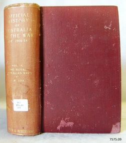
Book, Official History of Australia In The War of 1914-18 Vol 9
This item is from the ‘Pattison Collection’, a collection of books and records that was originally owned by the Warrnambool Mechanics’ Institute, which was founded in Warrnambool in 1853. By 1886 the Warrnambool Mechanics’ Institute (WMI) had grown to have a Library, Museum and Fine Arts Gallery, with a collection of “… choice productions of art, and valuable specimens in almost every branch and many wonderful national curiosities are now to be seen there, including historic relics of the town and district.” It later included a School of Design. Although it was very well patronised, the lack of financial support led the WMI in 1911 to ask the City Council to take it over. In 1935 Ralph Pattison was appointed as City Librarian to establish and organise the Warrnambool Library as it was then called. When the WMI building was pulled down in 1963 a new civic building was erected on the site and the new Warrnambool Library, on behalf of the City Council, took over all the holdings of the WMI. At this time some of the items were separated and identified as the ‘Pattison Collection’, named after Ralph Pattison. Eventually the components of the WMI were distributed from the Warrnambool Library to various places, including the Art Gallery, Historical Society and Flagstaff Hill. Later some were even distributed to other regional branches of Corangamite Regional Library and passed to and fro. It is difficult now to trace just where all of the items have ended up. The books at Flagstaff Hill Maritime Village generally display stamps and markings from Pattison as well as a variety of other institutions including the Mechanics’ Institute itself. RALPH ERIC PATTISON Ralph Eric Pattison was born in Rockhampton, Queensland, in 1891. He married Maude Swan from Warrnambool in 1920 and they set up home in Warrnambool. In 1935 Pattison accepted a position as City Librarian for the Warrnambool City Council. His huge challenge was to make a functional library within two rooms of the Mechanics’ Institute. He tirelessly cleaned, cleared and sorted a disarrayed collection of old books, jars of preserved specimens and other items reserved for exhibition in the city’s museum. He developed and updated the library with a wide variety of books for all tastes, including reference books for students; a difficult task to fulfil during the years following the Depression. He converted all of the lower area of the building into a library, reference room and reading room for members and the public. The books were sorted and stored using a cataloguing and card index system that he had developed himself. He also prepared the upper floor of the building and established the Art Gallery and later the Museum, a place to exhibit the many old relics that had been stored for years for this purpose. One of the treasures he found was a beautiful ancient clock, which he repaired, restored and enjoyed using in his office during the years of his service there. Ralph Pattison was described as “a meticulous gentleman whose punctuality, floorless courtesy and distinctive neat dress were hallmarks of his character, and ‘his’ clock controlled his daily routine, and his opening and closing of the library’s large heavy doors to the minute.” Pattison took leave during 1942 to 1942 to serve in the Royal Australian Navy, Volunteer Reserve as Lieutenant. A few years later he converted one of the Museum’s rooms into a Children’s Library, stocking it with suitable books for the younger generation. This was an instant success. In the 1950’s he had the honour of being appointed to the Victorian Library Board and received more inspiration from the monthly conferences in Melbourne. He was sadly retired in 1959 after over 23 years of service, due to the fact that he had gone over the working age of council officers. However he continued to take a very keen interest in the continual development of the Library until his death in 1969. WARRNAMBOOL PUBLIC LIBRARY The Warrnambool Mechanics’ Institute (WMI) was formed by a voluntary community group in 1863, within six years of Warrnambool’s beginnings, and its Reading Room opened in 1854. The WMI operated until 1963, at which time it was one of the oldest Mechanics’ Institutes in Victoria. Mechanics’ Institutes offered important services to the public including libraries, reading rooms and places to display and store collections of all sorts such as curiosities and local historical relics. In 1886 a Museum and Fine Arts Gallery were added to the WMI and by the beginning of the 20th century there was also a billiards room and a School of Art. By this time all Mechanics’ Institutes in country Victoria had museums attached. Over the years the Warrnambool Mechanics’ Institute Library was also known as the Warrnambool Public Library the Warrnambool Library and the Free Library. Early funding from the government was for the “Free Library”. The inscription in a book “Science of Man” was for the “Warrnambool Public Library”, donated by Joseph Archibald in 1899. Another inscription in the book “Catalogue of Plants Under Cultivation in the Melbourne Botanic Gardens 1 & 2, 1883” was presented to the “Warrnambool Library” and signed by the author W.R. Guilfoyle. In 1903 the Warrnambool Public Library decided to add a Juvenile Department to library and stock it with hundreds of books suitable for youth. In 1905 the Public Library committee decided to update the collection of books and added 100 new novels plus arrangements for the latest novels to be included as soon as they were available in Victoria. In July 1911 the Warrnambool Council took over the management of the Public Library, Art Gallery, Museum and Mechanics’ Institute and planned to double the size of the then-current building. In 1953, when Mr. R. Pattison was Public Librarian, the Warrnambool Public Library’s senior section 10,000 of the 13,000 books were fiction. The children’s section offered an additional 3,400 books. The library had the equivalent of one book per head of population and served around 33 percent of the reading population. The collection of books was made up of around 60 percent reference and 40 percent fiction. The library was lending 400 books per day. In 1963 the Warrnambool City Council allocated the site of the Mechanics’ Institute building, which included the Public Library, Museum and Art Gallery, for the new Municipal Offices and the Collections were dispersed until 1971. The Warrnambool Library took over the Mechanics’ Institute Library’s holdings on behalf of the Warrnambool City Council. Since the closure of the Warrnambool Mechanics’ Institute the exact location and composition of the original WMI books and items has become unclear. Other materials have been added to the collection, including items from Terang MI, Warrnambool Court House and Customs House. Many of the books have been identified as the Pattison Collection, named after the Librarian who catalogued and numbered the books during his time as Warrnambool Public Librarian in the time before the Mechanics’ Institute closed. It seems that when Warrnambool became part of the Corangamite Regional Library some of the books and materials went to its head office in Colac and then back to Warrnambool where they were stored at the Art Gallery for quite some time. Some then went to the Warrnambool Historical Society, some stayed at the Art Gallery and some were moved to Flagstaff Hill Maritime Village. The various stamps and labels on the books held at Flagstaff Hill show the variety of the collection’s distribution and origin. The books in the collection at Flagstaff Hill Maritime Village date from the 1850’s to the late 1950’s and include rare and valuable volumes. Many of the books are part of the “Pattison Collection” after the Warrnambool’s Public Librarian, Mr. R. Pattison. The Pattison Collection, along with other items at Flagstaff Hill Maritime Village, was originally part of the Warrnambool Mechanics' Institute’s collection. The Warrnambool Mechanics’ Institute Collection is primarily significant in its totality, rather than for the individual objects it contains. Its contents are highly representative of the development of Mechanics' Institute libraries across Australia, particularly Victoria. A diversity of publications and themes has been amassed, and these provide clues to our understanding of the nature of and changes in the reading habits of Victorians from the 1850s to the middle of the 20th century. The collection also highlights the Warrnambool community’s commitment to the Mechanics’ Institute, reading, literacy and learning in the regions, and proves that access to knowledge was not impeded by distance. These items help to provide a more complete picture of our community’s ideals and aspirations. The Warrnambool Mechanics Institute book collection has historical and social significance for its strong association with the Mechanics Institute movement and the important role it played in the intellectual, cultural and social development of people throughout the latter part of the nineteenth century and the early twentieth century. The collection of books is a rare example of an early lending library and its significance is enhanced by the survival of an original collection of many volumes. The Warrnambool Mechanics' Institute’s publication collection is of both local and state significance. The Warrnambool Mechanics' Institute Collection is primarily significant in its totality, rather than for the individual objects it contains. Its contents are highly representative of the development of Mechanics' Institute libraries across Australia, particularly Victoria. A diversity of publications and themes has been amassed, and these provide clues to our understanding of the nature of and changes in the reading habits of Victorians from the 1850s to the middle of the 20th century. The collection also highlights the Warrnambool community’s commitment to the Mechanics’ Institute, and to reading, literacy and learning in the regions, and proves that access to knowledge was not impeded by distance. These items help to provide a more complete picture of our community’s ideals and aspirations. As with many Mechanics' Institutes in Australia, the one which operated in Warrnambool was established and overseen for many years by key individuals associated with the development of the city itself. The WMI publication collection is historically significant because of its association with local people, places and the key historical themes in the development of Warrnambool of rural development, industry, farming, education, and community. The collection documents and illustrates the changing interests, focus and tastes of Victorians, especially those in regional cities. Generally the individual items in the collection are not particularly rare, as examples of all probably exist in other public collections in Victoria. It is primarily because there are so very few surviving Mechanics' Institute collections in Victoria, which lends this overall collection its significance. Many items in the WMI Collection have the potential to support further research, both as individual objects and through the collection in its entirety. This material is significant for its ability to assist in the interpretation of the history of the area and adds to the general understanding of the development of the township. Many components of the WMI publication collection complement and reinforce the Flagstaff Hill Maritime Museum Collection, the Warrnambool Art Gallery Collection, and that in the Warrnambool Historical Society, and also contribute to a clearer understanding of the original Warrnambool Mechanics' Institute collections. This will greatly enhance the appreciation of the few surviving Mechanics' Institute collections across Victoria, and also in New South Wales. The similarities and differences between the small number of collections that have survived can provide further insights into how the people of Victoria in general, and Warrnambool in particular, constructed a civic culture of adult learning to foster an informed citizenry. The Warrnambool Mechanics' Institute publication collection is of both local and state significance. (This Statement of Significance is quoted from the Significance Assessment : Warrnambool Mechanics’ Institute Book Collection at Flagstaff Hill Maritime Museum, February 2009, by Annette Welkamp, Cultural Connections, for Delise Oldfied, FHMV) References Juvenile Department in Warrnambool Public Library In August 1903 The Age newspaper reported in its Warrnambool news section that “With the object of discouraging boys from reading literature of the “penny dreadful” class, the committee of the local public library has decided to open a juvenile department and to stock it with hundreds of suitable books attractive to the youthful mind.” 100 new novels added to Warrnambool Public Library Shelves In November 1905 The Argue newspaper’s Warrnambool news section announced “The committee of the Public Library is bringing the collection of books more up to date. It has recently added 100 new novels to the shelves, and arrangements have been made for a supply of the latest novels immediately they arrive in the state.” Warrnambool Town Council takes over Mechanics’ Institute, Art Gallery, Public Library, Museum – and will double the building’s size In 1912 The Age reported in its Warrnambool news section “Considerable improvements are being effected by the town council in the most picturesque part of Liebig Street. Between the fire brigade station and the mechanics’ institute and art gallery a vacant block of land is being transformed a garden for carpet bedding and flowering plants. The council, which recently took over the control of the art gallery, public library, museum and mechanics’ institute, is doubling the size of the substantial stone building containing these institutions. The new building will contain a supper room for use in conjunction with functions in the town hall, adjoining, and a new reading room.” Mr Pattison, Public Librarian, says Library has a book per head of population In 1953 The Age reported an interview with the Public Librarian, Mr. R. Pattison, who said “Warrnambool has an insatiable thirst for reading. And its reading recipe contains a strong dash of fiction – 73 percent of it. Fiction makes up 10,000 of the 13,000 books in the senior section of the public library. That works out at a book per head of population. Warrnambool today is really book minded. This city has an almost insatiable thirst for knowledge as well as fiction. We’re lending 400 books a day. We supply 33 percent of the reading population of Warrnambool.” The reporter goes on to say “Warrnambool Public Library also has an ultra-modern children’s section of 3,400 books, open to every boy and girl attending school in Warrnambool. Mr Pattison hopes to show travel-talk films and install a radiogram in the children’s section “later on”. But it won’t disturb adult reading next door because the junior section is sound proof. “ Mechanics’ Institutes and Museums Mechanics’ Institutes were important sites for collecting in country Victoria … Warrnambool … all had museums attached to Mechanics’ Institutes before the end of the twentieth century” Warrnambool Mechanics’ Institute Ms Tierney said FHMV holds the collection of the Warrnambool Mechanics’ Institute in three different locations on its site. “The Mechanics’ Institute opened in 1871, was demolished in the 1960s and was one of the oldest in Victoria. “FHMV intends to create a new storage area and bring the collection together in one place which will greatly facilitate access and research. “The collection consists of books and archives dating from the 1850s to 1959s. “Some of the books are rare and valuable but it is unclear as to their relevance to the history of Warrnambool or Victoria,” Ms Tierney said. Warrnambool TAFE History South West TAFE has a long and proud history of providing technical and specialist education, with links back to the formation of the Mechanic’s Institute in 1853. Warrnambool Art Gallery’s History The Warrnambool Art Gallery began in 1886 when retired police officer Joseph Archibald opened its doors in a building behind the mechanics institute in Liebig Street. The Gallery began with an eclectic mix of artworks and museum curios. Before long Archibald mobilised public support and paid for a new gallery annex. Loans and grants allowed the Gallery collection to grow with significant early acquisitions by French, German, and Belgian artists, which were less expensive than British works. Despite its enthusiastic start the economic downturn of the 1890s brought the Collection to a halt. In 1910 the Council took control of the Mechanics Institute and ran the Gallery there until 1963 when the building was allocated for municipal offices. The Collection was dispersed on loan to galleries in Shepparton and Hamilton and not reunited until 1971. In 1986 the Gallery’s Centenary year, a permanent home was built next to the ‘Civic Green’ and named in memory of one its champions Sir Fletcher Jones O.B.E. 2016 Warrnibald Entries Joseph Archibald established the Warrnambool Museum and Art Gallery in 1886 while his son Jules Francois Archibald founded the Archibald Prize through his bequest of 1919. His aim was to foster portraiture, as well as support artists, and perpetuate the memory of great Australians. Official History of Australia In The War of 1914-18 Vol 9. The Australian Navy 1914-1917 Author: Arthur W Jose Publisher: Angus & Robertson Date: 1937Label on spine cover with typed text PATT 994.04 OFF Front pastedown endpaper has sticker from Warrnambool Public Library Front loose endpaper has a sticker from Corangamite Regional Library Service warrnambool, shipwrecked-coast, flagstaff-hill, flagstaff-hill-maritime-museum, maritime-museum, shipwreck-coast, flagstaff-hill-maritime-village, shipwrecked-artefact, book, warrnambool mechanics’ institute, pattison collection, warrnambool library, ralph eric pattison, warrnambool city librarian, mechanics’ institute library, victorian library board, warrnambool books and records, official history of australia in the war of 1914-18 vol 9., official history of australia in the war of 1914-18, the australian navy 1914-1917, the australian navy, arthur w jose -
 Mission to Seafarers Victoria
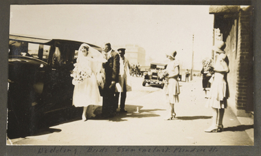
Photograph - Photograph, Sepia, Dora Walker bride to be and Father , 1928, 14 February 1928
This photograph shows one of the many weddings held at the Mission to Seafarers over the years and provides an overview of wedding fashion of the late 1920s. The bridesmaids were Ella Kendall and Molly Walker. In this image a horse and cart can be seen in the background on Flinders St and a Telegraph pole. Dora would continue association with the Mission and as president of the Flying angels in the 1960s-70s she would be awarded the MBE for services to Community presented by the State Governor of Victoria. This photograph shows one of the many weddings performed at the Mission to Seafarers over the years. Cross referencing with the marriage registers, also held in the collection, reveals that this photograph is Amy Dora Walker (known as Dora) of East Malvern marrying Harold Priestley Simpson of Surrey Hills / Mornington on 14 February 1928. Dora's son David Simpson, a former architect still volunteers for the Mission in 2018. Dora is listed on the Women of achievement listing.Sepia toned photograph of bride and attendants in the courtyard of the Mission to Seafarers. The bride's dress is calf length and she has just stepped out of a large car assisted by her Father Mr Walker. The Bride is holding a large bouquet. There are two attendants or Bridesmaids to the right of the photograph, wearing layered calf length dresses, cloche hats and holding a small bouquet. Both are standing outside the Mission to Seamen on Flinders St waiting to assist the bride. small circular Blue ink stamp on rear of photograph: PRINTED BY HARRINGTONS. numerals stamped on the back 3 and 8 hat, flowers, veil, wedding, dress, shoes, motorcar, bridesmaids, dora walker, dora simpson, harry simpson, flinders street, 1928, david simpson, fan album, john reginald weller (1880-1969), arthur walker, molly walker, ella kendall -
 Greensborough Historical Society
Article, R. A. Marsh: Church Street Greensborough, by Faye Fort and June Hall, 1919_
A brief history of Richard Marsh and family and his house on the corner of Hailes and Church Street Greensborough. This story by Faye Fort and June Hall was updated in 2016 by Marilyn Smith and Sue Ballantyne from material generously supplied by Mrs Madge Marsh, widow of Richard's son Gordon.Story of a pioneer family and a significant house in Greensborough.One page of text.richard arthur marsh, teresa bautista, hailes street, marsh family -
Glenelg Shire Council Cultural Collection
Book, Gordon Browne ' illustrator et al, 'In the King's Name', c. 1885
Children's book, hard cover. Front cover burgundy with green print and maritime and military illustrations. Gold section with 2 sailors in green. Back cover green. Spine green with gold print; burgundy with green and gold sailor carrying a barrel.henty -
Glenelg Shire Council Cultural Collection
Book - Book - The White Company, Sir Arthur Conan Doyle, c. 1914
Novel, 'The White Company' by Sir Arthur Conan Doyle. hard cover, brown, black print. Black and white illustrations -
 Glenelg Shire Council Cultural Collection
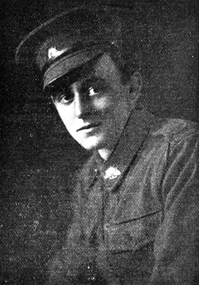
Photograph - Photograph - J. Edward C. Henry, Arthur & Sons, Mt. Gambier, c. 1938
Portland Town CouncilBlack and white photograph of a man with white hair parted on left and a moustache. He is wearing round glasses and a dark suit with white shirt (peaked collar) and dark tie. Mounted in grey matt, under glass in wooden frame.Front: J. Edward C. Henry, Town Clerk and Surveyor Appointed 20th November 1888, over 50 years an officer of the Council (white paint, lower centre). -
 Greensborough Historical Society
Genealogical document, John James Jeffery, 1957o
Details the life and family history of John James Jeffery, his English roots and his time in Greensborough as a poultry farmer. Prepared by his son John Jefferey in 2008.Gives the origin of Jeffery Court, (off Nepean St).2 x A4 pages.Family history of John James Jeffery, john james jeffrey, poultry farm, nepean street, greensborough, arthur street greensborough. -
 Eltham District Historical Society Inc
Negative - Photograph, Ross house, 50 Arthur Street, Eltham, 1998c
This house was built by Jack Ross and his son Phillip in the early 1960s. They lived in the adjacent house. The main building was made from old WW2 ammunition boxes held together with their leather strapping. Originally it was going to have an elevator in the middle of the house.Roll of 35mm colour negative film, 8 strips and associated 10 x 15 cm colour printKodak Gold 100-5arthur street, eltham, ross house, tudor house, houses -
Glen Eira Historical Society
Article - ELSTER AVENUE, 20, ELSTERNWICK
This file contains 5 items: 1/Handwritten notes of title search details compiled by Peta Darke, dated 25/07/2014. From 1909 to 1936. 2/Photocopy of six pages of handwritten details from title searches compiled by Peta Darke, dated 24/10/2014. From 1871 to 1920. 3/Handwritten list of Sands and McDougal entries from 1915 to 1970 and additional notes up to 2014, compiled by Peta Darke, dated 28/07/2014. 4/Photocopies of four advertisements concerning the property from The Argus as follows: 26/04/1919 page 17: property for sale; 10/05/1919 page 14: property for sale; 01/09/1917 page 13: a son born to Mrs. W. Robertson of ‘Struan’; 09/06/1928 page 2: mortgagee’s auction to be held. 5/Photocopy of colour photography of 20 Elster Avenue taken by R. Darke, approx. 1998.elsternwick, gardenvale, elster avenue, struan, kooyong road, parnell street, college street, lempriere john thompson, hawker lilian margaret, taylor mary maud, davison lily ann, pretty ralph, robinson charles, robinson william henry, robinson george augustus, inglis robert, davies matthew henry, ross william murray, calder william anderson, watson john, rosstown junction railway and property company, muntz street (now parnell street), rupert street, oswald street, peile edgar stoddart, robertson walter, davison walter, bays arthur, gluth william, petersen o. c., farnell thomas h., bennett william, mcdonald michael, donaldson william, ryan james s., diamond g., nirens george, nirens pamela, nirens paul, nirens linda, coburn helen, coburn graham, coburn laura, coburn george, architectural styles, edwardian style, brick houses -
Glen Eira Historical Society
Article - ELSTER AVENUE, 16, ELSTERNWICK
This file contains 6 items: 1/Handwritten notes by Peta Darke dated 25/07/2014 listing title details for 16 Elster Avenue from 1909 to 2009 – two pages. 2/Handwritten list of Sands and McDougall entries for the property from 1915 to 1940 dated 25/07/2014 compiled by Peta Darke. 3/A photocopy of a Biggin Scott Real Estate Agents flyer advertising the recent sale of the property in 2009. 4/Print out from ‘The Argus’ of 04/12/1917, Page 6, from the Trove website of a brief article concerning the wounding of S.P.Jones, son of Stephen Jones of ‘Mons’, Elster Avenue in November 1917. 5/A photocopy of colour photograph of exterior of 16 Elster Avenue Circa 1998 taken by R.Darke. 6/Article from ‘Caulfield Glen Eira Leader’ of 25/03/2014, Page 3, concerning Oscar Jones, 14 year old son of present owners, who is an excellent surf life saver. Includes colour photograph of Oscar.elster avenue, college street, bowood, elsternwick, bowden arthur william, mons, hartington street, parnell street, jones stephen alma, kooyong road, kendall ann bell, kendall james william, kendall harold duncan, morrison harold lindsay, morrison rhonda may, cook jean isobel, golding ida curnow, perrett craig stuart, perrett eileen mary, perrett edward, perrett anthea, perrett catherine, lewis kay margaret, swain anthony barry gilles, swain darcy, swain mitchell, jones adrian, jones karine stehman, jones oscar, jones patrick, thomas lloyd, rickman jacob, lee james t, nidschelm harold, regan francis, jones douglas, laughton martin, biggin and scott, ashton daniel, jones stephen percy douglas, architectural styles, edwardian style, timber houses, gardenvale, collinson william morris, thomson william hamilton, lempriere john thompson -
 Federation University Historical Collection
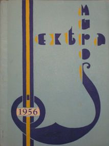
Book, Extra Muros 1956, Teachers' College Ballarat, 1956
Editorial, Our Principal, Second Year Staff and Students', First Year Students', Main Events of '56, Hostel Highlights, Sporting World, Sports Awards. December 1955 Ballarat Teachers’ College held its first Graduation Ceremony. The words of the Graduation Hymn were written by Mavis Canty. (BTC Handbook 1965) July 1956 Tenders were called for the first section of the new Ballarat Teachers’ College to be built in Gillies St. (BTC Handbook 1965)Light blue cover (cream inside cover) with dark blue and yellow titles. Soft covered magazine of the Ballarat Teachers College. Title page states Vol. 2. No. 3.btc, ballarat teachers college, n. l. harvey, t. w. h. turner, john pianta, d. stanley, b. parker, j. hutchings, n. ruddick, b. poole, r. arthur, e. w. doney, f. golding, a. hutchings, j. hammet, d. wyley, m. hutchinson, i. burt, y. davey, p. mcconville, m. ryan, h. miller, p. wiltshire, d. wright, m. hyndman, v. goodwin, k. reither, h. weeks, r. delbridge, n. freeman, b. pointer, w. taylor, g. mcrae, l. dugdale, b. robson, e. o. walpole, r. j. croft, e. constable, j. brown, j. dugdale, ian burt, heather sparkes, g. whitelaw, e. major, ruth ray, ron bunn, w. j. taylor, shirley a. mclay, d. henderson, a. gleeson, p. utber, a. rutter, i. erdmanis, e. phillips, i. mckinley, a. stalker, m. spencer, c. rodger, r. ross, l. jenkins, j. m. blair, j. kirk, m. odd, b. dahlenburg, m. cattanach -
 Flagstaff Hill Maritime Museum and Village
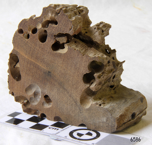
Memorabilia - Wood Sample, about 1871
The American wooden ship Eric the Red was named after the Icelandic Viking Eric 'the Red-Haired' Thorvaldsson, who was the first European to reach the shores of North America in 980 A.D. The ship Eric the Red was owned by the Sewall family of Bath, Maine, between 1873 and 1877 it operated in the coal trade between Britain and America. It then operated on the South American guano/ nitrates trade, before again trading between Europe and New York. On this voyage the Eric the Red had been chartered to carry a full cargo of American merchandise including many exhibits bound for the international exhibition to be held in Melbourne in 1880. Eighty-five days out from New York with 23 crew and two passengers, the Eric the Red approached Cape Otway nearing the end of its long voyage. At 1 am on 4 September the weather was hazy with a moderate north-westerly wind, Captain Jacques Allen had all sail set except for the mizzen-royal and the cross jack sails doing 8 knots, and was steering by the light to keep 5-6 miles offshore and clear of Otway Reef. Returning to the deck after consulting his charts the ship bumped as it ran onto the Otway Reef. It struck a second time and then a heavy sea carried away the wheel ropes and the man at the wheel. A third bump carried away the rudder, and shortly after this the ship completely broke up - within twelve minutes it had disappeared but for floating wreckage and cargo. Captain Jacques Allen recounted that: "The mizzen topmast fell with all the rigging, but strange to say, not a man was hurt by it, although they were all standing about. As soon as I found out there was no hope I said to Ned Sewell, the owner's son, and the third mate on board "Stick to me, and hang on to this mizzen mast". I peeled off everything I had on except my drawers thinking I would be able to swim better without my clothes; and Sewell and myself, clinging to the mast, were washed overboard...It was a fearful sea; I have never seen anything like it". Attempting to swim to a more substantial raft of wreckage, and losing touch with young Sewell in the process, Captain Allen struck out: " Just as I left the spar my drawers got down my legs, and entangled them, and down I went. I managed to clear one of my legs and on coming up I managed to get hold of some floating timber. There was a clear space of water between this timber and the deck, except for the spare royal yard, and I again started, but the surf struck me and I went over and over. I managed to get hold of the spare yard, and after holding on to it for some time I managed to get to the deck. When I was pulled on to it I could not move, being so numb and cramped with the cold. The men had some blankets and other things which they had got from the passengers' room in the deck house, and they wrapped me in these. Shortly after I got onto the wreck we made out the steamer's lights, and as soon as she was within hearing distance the men haled. This must have been about half-past four the Captain of the Dawn sent two of his boats to cruise about, and at daylight, they picked us up off the wreck. We had drifted about four miles from the reef where the ship struck, all those who were rescued were more or less bruised. One man had two or three ribs broken, and another had some fingers crushed off. My left foot is very much hurt, and I am black and blue from head to foot. I never knew such ten minutes as that of the wreck, and I thought the time had come for me to 'hand in my checks'. The ship was worth about £15,000, and neither it nor the freight was insured one dollar". (Argus 14/9/1880). Three of the crew and one of the passengers had been swept away and drowned. Fortunately for those clinging to the remains of the shattered hull and floating wreckage, the steamer SS Dawn passed close by and the crew heard the distressed cries of the survivors. Boats were lowered and the survivors were rescued. The Dawn stayed in the area for several hours searching for more survivors. One body was found washed up at Cape Otway and was buried in the lighthouse cemetery. The captain and crew of the Dawn later received rewards and thanks from the United States consul for their efforts. The hull and cargo were sold for £410, and large rafts of floating wreckage and cargo washed up all over the Victorian coast. A section of the hull lies buried in the sand at the Parker River beach, an anchor is on the rocks at Point Franklin, a second anchor is on display at the Cape Otway lighthouse and parts of the ship are on display at Bimbi Park and the Apollo Bay museum. Various wreckage is located in a concentration off Point Franklin, but suitable diving conditions are rare due to waves and strong currents. At the time of the wreck parts of its were salvaged and used in the construction of houses and sheds around Apollo Bay, including Milford House (since burnt down in bush fires), which had furniture and fittings from the ship, and the dining room floor made out of its timbers. A ketch the Apollo was also built from its timbers and subsequently used in Tasmanian waters.The Eric the Red is historically significant as one of Victoria's major 19th-century shipwrecks. The wreck led to the provision of an additional warning light placed below the Cape Otway lighthouse to alert mariners to the location of Otway Reef. The site is archaeologically significant for its remains of a large and varied cargo and ship's fittings being scattered over a wide area. The site is recreationally and aesthetically significant as it is one of the few sites along this coast where tourists can visit identifiable remains of a large wooden shipwreck and for its location set against the background of Cape Otway, Bass Strait, and the Cape Otway lighthouse. (Victorian Heritage Database Registration Number S 239, Official Number 8745 USA) Wood sample from the wreck of the ship Eric the Red the wood is dark in colour and is very light in weight. Noneflagstaff hill, warrnambool, shipwrecked-coast, flagstaff-hill, flagstaff-hill-maritime-museum, maritime-museum, shipwreck-coast, flagstaff-hill-maritime-village, shipwreck-artefact, eric-the-red, zaccheus-allen, sewall, 1880, melbourne-exhibition, cape-otway, otway-reef, wood-sample, s.s.-dawn -
 Federation University Historical Collection
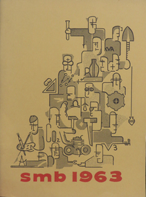
Booklet, Ballarat School of Mines Students' Magazine, 1963, 1963
The editor of the Ballarat School of Mines Students' Magazine for 1963 was T. Brauer. The President of the SRC was R. Coutts. The Eric McGrath Award is given to the student who distinguishes themselves in extra-curricular activities, with special emphais on work concerned with the Revue and School Magazine. The winner was selected by the executive of the Students' Representative Council.Orange soft covered booklet of 104 pages. Articles include: King Island, Look Back in Wonder, Journey into Darkness, The Sensible Enemy, Strictly for Girls, The pH Factor, Diploma Conferring Ceremony, Diplomas Conferred, Personality Tests and the Individual, Poison to Poison SMB Students' Revue, In Search of Truth, Gliding With the Birds, Income Tax, Newtonian Observations Extended, Friends, The Idealist View of Life, Rustling Rags, Where Mankind Has Failed, Sports report, School Council and Members of Staff listing, Roll Call, Images Include: Bob Coutts, Paul Pusari, Tony Brauer, Jemi Milbourne, Kerry Penna, Brian McLennan, Bob Grubb, John Davis, Netta Walta, Kevin Brady, Oscar Rogers, Kuo Yiew See, S. White, Anne Morrehouse, Gerry Liston, Bob Coutts, Gary Robert, Ray Megee, Pater Smith, Daila Berzins, Tony Brauer, Bob Grubb, Peter Donaldson, Don Yates Snippets include: Tony Brauer won the Eric McGrath Award; The R.W. Richards Medal was won by K.A Sculley in 1962.ballarat school of mines, kelvin whitford, greg hunter, ray megee, daila berzins, bob grubb, gary roberts, stephen drew, david bell, bob coutts, gerry liston, michael moissinac, neil mudge, arthur patterson, edward scull, eric mcgrath award, bobby ong, paul pusari, toby brauer, jeni melbourne, kerry penna, brian mclennan, john davis, netta walta, kevin crady, oscar rogers, kuo view see, anne moorehouse, robert grubb, peter donaldson, peter smith, geoogy demonstration, lake relay -
 Federation University Historical Collection
Magazine - Photograph - Black and White, Ballarat School of Mines Students' Magazine, 1916-1923, 1916-1924
The Ballarat School of Mines Magazine does not appear to have been publishing in 1914, 1915, 1917, 1918, and 1919.A red bound copy of the Ballarat School of Mines Students' Magazine, holding copies for years 1916 to 1923. 1916 The 1916 Students' Magazine features many references to World War One, including an image of Ted Cannon, a gifted artist attending the Ballarat Technical Art School (part of the Ballarat School of Mines [SMB] campus) from 1912. After completing his art course Ted was employed as an assistant teacher at the Art School, before taking a position as cartoonist with the Ballarat Star newspaper at the end of 1914. In 1915 Ted was awarded the prestigious Victorian Education Department Senior Technical School Scholarship. Only months into his scholarship, Ted volunteered for the AIF. He was killed in action on 14 September 1916 in France. 1917 Editorial staff, Natural Colour Motion Pictures, Chemistry, Caricatures, Old Art School Students, Old Science School Students, Broken Hill, Lal Lal Deposits, SMB Athletic Team, SMB Roll of Honor, Junior Technical School Senior Cadet Team, Ballarat, Junior Technical School; Ballarat Junior Technical School Bugle Band, A visit to Ronaldson's Workshop 1920 Historical Sketch of the Ballarat School of Mines, War Service, Editorial Staff, Maurice Copland Obituary, The Chemist, Separation of Lead and Zinc Sulphides, Explosives, Werribee Gorge Visit, Daylesford Visit, Sports Ground, Indian Art, Dressmaking, Herbert H. Smith, Drawing From the Antique, Caricatures, Ballarat School of Mines Football Team. 1921 A.F. Hesiltine, Editorial Staff, Feathertop and Mt Buffalo trip, Plumbing, frequency changer, Melbourne excursion, Melbourne Electric Railways, Dawn of Modern Art, Moorabool Trip, Guy Fawkes, Bush Camp, Caricatures, manual art, past students, SMB Athletic Team, Cadet camp at Broadmeadows, Ballarat Junior Technical School Athletics Team. 1922 Editorial Staff, Assaying, Plasticity of Clay, Lal Lal V Morwell, Cheap Electricity, Clyde Lukeis Obituary, Ken Moss Obituary, Past Students, Old Boy's Association, Reunion, SMB Athletic Team, Military News, Athletics 1923 Editorial Staff, Alfred Mica Smith Biography, caricature, Robert James Dowling Obituary, Chemistry, America, SM Football Team, Ballarat Junior Technical School, Wireless Telegraphy, Caricatures, ballarat school of mines, motion picture photography, the chemlab, ballarat school of mines students' excursion to the lead and copper mining centres, sport, military notes, ballarat junior technical school, henry j. hall, arthur m. lilburne, ballarat school of mines history, maurice copland, maurice copland obituary, l.h. archibald, g. baragwanath, r.w. richards, c.a. schache, cadets, a.w. steane, elsie j. mckissock, coliseim theatre, advertisements, mcdorney's, w. dick, t. kift and son, f. narrow, stansfield and smith, clay, reginald calister, clyde lukeisr, w.k. moss, ken moss, robert james dowling, e.j. mcconnon, raymond fricke -
 Federation University Historical Collection
Booklet, City of Ballarat Mayor's Report, 1957-1958, 1958
Ballarat was created a municipality on 17 December 1855, declared a Borough on October 1863, Proclaimed a City on 09 September 1970.Green covered bookcity of ballarat, mayor's report, annual report, jack chisholm, city of ballarat coat of arms, arms of ballarat, john a. chisholm, arthur nicholson, alan pittard, gordon scott, arthur mason, frederick oliver, oscar curnow, frank woodward, william roff, francis cutts, nathaniel callow, kenneth webb, mrs john a. chisholm, queen mother, raaf school of radio, city engineer's department, public health report, finance, mr k. h. mitchell, mr f. j. rogers, building surveyor's department, mr j. b. menhennet, mr r. g. campbell, city health inspector, mr. r. g. biggs, weights and measures inspector, mr. w. mccormack, libraries, mr r. a. mccallum, streets, parks and gardens, water supply and sewerage, ballaarat's voluntary community committees, service clubs, city traffic, mr. j. h. sorrell, sturt street gardens, ballarat base hospital, st john of god hospital, queen elizabeth centre, black hill, black hill reclaimation, ballarat benenevolent asylum -
Federation University Historical Collection
Book, J. Lloyd Bullock et al, A System of Instruction in Quantitative Chemical Analysis, 1865, 1865
Alfred Mica Smith was a professor at the Ballarat School of MinesBook with brown half leather cover, and gold lettering on the spine. Signed on title page and preface page "Alfred Mica Smith"ballarat school of mines, alfred mica smith, chemistry -
Federation University Historical Collection
Magazine - Booklet, J.A. Hoskin & Son, Ballarat School of Mines Students' Magazine, 1953. Coronation Number, 1953
Editorial, Principal's Page, Literary Society, News and Notes, Prominent Personalities, Science School, Boys Sport, Baseball, Athletics, Football, Cricket, Tennis, The Art School, The Apprentices, Commercial Notes, Junior School, House Notes, With the Cricketers, School Council 1953, Roll Call - Diploma Students 1953, Junior Technical School students White soft covered magazine with red titlesballarat school of mines, magazine, w. h. corbould, mr hillman, mr gillespie, i. burger, n. leckie, b. singleton, mr treadwell, mr fairbank, j. mcneil, b. smith, ann mitchell, janice wilton, eleanor tozer, j. beattie, b. macdougall, mr bryan, a. e. ferguson, jim tinney, arthur faneco, jean dean, jim john, neville spiers, barbara ngip, barrie smith, stewart rowe, elaine walton, max stevens, jim sawyer, bruce flavel, ron ingleton, john bethune, john blackburn, john boag, jim brokenshire, john carmichael, ray kibby, alec kinnane, norm. ludbrook, noel meagher, graham searle, rod sheppard, d. halliwell, g. searle, b. tozer, murray gillin, g. keyes, r. archer, b. taylor, g. ditchfield, j. watts, j. sawyer, a. johnson, w. saggers, j. barnes, j. john, g. willey, d. schmidt, l. matthews, b. schreenan, s. kisler, d. stevens, j. tinney, i. schunke, j. murray, w. maxwell, n. andrews, g. habel, r. furlong, a. mills, l. doull, a. day, f. benjamin, w. maddox, ryrie mccallum, t. seabrook, i. shunke, robert a. cross, joan taylor, diana. mainwaring, m. stafford, d. lavery, c. borrack, l. cutter, j. saunders, margaret paine, robyn day, j. fletcher, geo. shuttleworth, k. douglas, p. henson, tony sykes, d. martin, m. hall, e. courtney, b. murnane, b. donald, b. mackie, d. quilliam, k. hocking, k. jenkin, h. lockett, n. dixon, n. hodder, n. sutherlland, n. brogden, m. drabsch, b. mcknight, b. baldock, r. gilbert, j. hovey, l. willis, l. robson, j. mills, j. cunningham, c. veale, b. salter, i. jolly, j. rogers, d. beaumont, a. minotti, m. eggleton, m. wunhyn, b. cody, l. edwards, d. lang, m. marshall, j. schrader, dawn lang, barbara o'connell, b. wilson, m. thorpe, m. volk, r. wells, j. thompson, j. taylor, helen ross, desmond winberg, r. cutter, d. gallagher, p. cahill, a. cassells, l. johns, k. norman, g. wilson, p. collier, t. lugg, g. shuttleworth, n. nunn, g. van berkel, r. lazarus, c. bilney, m. drabsh, b. bellingham, g. douglas, c. grose, r. stewart, w. edmonds, g. gilmer, l. furlong, l. copeman, j. lloyd, n. twaits, l. willison, j. squire, e. kinnane, g. boyach, e. leishman, b. mclennan, n. cartledge, w. cowan, b. swan, b. trezie, w. etty, i. mchenry, b. parker, w. g. cowan, don whitefield, p. agrums, l. pike, d. baldock, n. richards, a. kilfoyle, c. mckinnon, g. henderson, d. roberston, j. strickland, m. walsh, b. blee, f. nicol, g. sonsie, g. swanson, g. e. timmins, n. g. cowan, m. wunhym, g. templeton, d. new, v. vincent, m. ritchie, j. schroeder, d. parkes, i. hosking, n. rimmington, h. mcgregor, g. sleeth, a. mitchell, v. jolly, n. c. leckie, b. trotter, i. t. macklin -
 Federation University Historical Collection
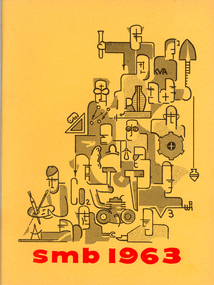
Booklet, Ballarat School of Mines Students' Magazine, 1963, 1963
Ballarat School of Mines Students' Magazine, 1963. Editorial, Prominent Personalities, King Island - Vacation Wonderland, Look back in Wonder, The Sensible Enemy, Diploma Conferring Ceremony, R. W. Richards Medal, Diplomas Conferred, Personality Tests and the Individual, Poison to Poison - Students' Revue for 1963, Malaya, Income Tax, Rustling Rags, Where Mankind has Failed, Sports Awards 1963, Sports, School Council, Members of Staff, Roll Call Yellow soft cover with red inscriptions and black figures on front cover, 104 pages including advertisements.ballarat school of mines students' magazine 1963, staff, sports, tony brauer, bob coutts, paul pusari, jeni milbourne, kerry penna brian mclennan, bob grub, john davis, netta walta, kevin brady, oscar rogers, kuo yiew see, h. e. arblaster, stanley white, quentin reynolds smyth, l. p. coombes - chief superintendent aeronautical research laboratories melbourne, graeme george redman, robert skewes, chookiat tanaksaranond, alan james bethune, lachlan stewart campbell, graham william hall, john rash, alan kenneth webb, peter agrums, sr. mary chanel fitzsimmons, david ewan clarke kirton, william joseph lannen, neil frances menz, keith houston alexander, john alexander pollock, john peter russell, francis william hunting, chookiate sirivongse, chong thung tay, keith stanley waller, bryan magson, anne moorehouse, stephen drew, gerry liston, gary roberts, ray megee, peter smith, daila berzins, don yates, kelvin whitford, greg hunter, david bell, michael moissinac, neil mudge, arthur patterson, edward scull, joseph heller, g. roberts, j. humphreys, bobby ong, alan cox, p. l. day, r. coutts, wayne johnson, prasert mahattanakul, l. t. negri, ooi kok hai, photography -
Federation University Historical Collection
Booklet, J. A. Hoskin & Son, Ballarat School of Mines Students' Magazine, 1964, 1964
Ballarat School of Mines Students' Magazine, 1964. Editorial - Education or Indocrination, The Principal's Page, "The Happiest Days of your Life", From Mr. Arblaster, Ceremony to Stand On, The Creative Personality, Are we Overworked?, Folksinging by the Miners, S.M.B. Silent Movies Inc, Students' Representative Committee (S.R.C.), Presidential Report, Red Roar or the Commie Threat, Conventional Wisdom, The Malaysian Student in Australia, Conferring of Diplomas 1964, Prizes Presented, Sports, The Past and the Future, The possibility of Fusion Power, School Council, Members of staff, Full Time Diploma Students 1964Yellow soft cover with black inscriptions and black images on front cover, 96 pages including advertisements.ballarat school of mines students' magazine 1964, staff, sports, kelvin whitford, armand krastins, c. w. valentine, ray windmill, jennifer boyd, malcolm park, mg. b. mck. henry, jutta bacsak, noel brady, gloria medlyn, ken felstead, jan butterworth, wayne collins, diane berry, lora richter, mr arblaster, eric fromm, john costa, stephen drew, judi woodward, michael moissinac, e. r. mcgrath, geoff. pepperell, marilyn barclay, gary roberts, jon mcdonald, ratnam nachiappan, jeni milbourne, dalia berzins, bernard livingston, ken ogden, g. n. hart, k. g. whitford, e. j. barker, h. j. trudinger, margaret leong, yew har ong, william cheng, ellen leong, joan wright, poh teck shen, kristine goodier, kok fong ho, kenneth laurence blee, jillian margaret norton, francis john pomeroy, graeme reginald williams, robert christopher blayney, alan joseph horne, anthony chai shing yeung, matthew john zeegars, peter william dalton, donald francis holmes, francis yung hei kwong, william lawrence moore, david sydney perry, vincent william quinn, graeme arthur waller, alan desmond bellingham, george ikstrums, george lauchlan nevet leishman, barry john lonsdale, malcolm john peel, harold matthew everett, bruce hugh flavel, chin kee hung, barry james patterson, willem roodenburg, raymond john benn, lloyd john menz, ian boyd beaumont, victor raymond wilson, norman kenneth hullick, philip clive lockyer, peter grantley prest, robert michael norton, chermsak tanskul, kenneth james mciver, neil albert bromley, robert james chapman, norman lindsay nash, joe hart, john thorne, greg. hunter, wayne johnson, robert e. grubb, tan joo lim, l. t. negri, p. h. malins, ruth russell, colin jellet, ken delany, roger lonsdale, bobby ong gim sen, ooi kok hai -
 Federation University Historical Collection
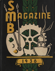
Magazine - Booklet, Ballarat School of Mines Students' Magazine, 1938, 1938
School Council, Members of Staff, Magazine Committee, List of Full Course Students 1938, Full Course Commercial Students, Editorial, Personal Column, Obituary - Roy S. Hall - F. J. Martell, S.M.B Old Boys' Association, The Literary Society, Centenary Jottings, Fumes from the Lab, Broken Hill, News from Papua, Sidelights on the B.H.P. Cadet Training Scheme, Arts & Crafts Gossip, Sport, Commercial Notes, The Junior Techs, Junior Technical SportingBlack soft covered magazine with yellow font, green and white images. 64 pages including advertisements. Artworks * Lino cut - By Maureen McRae * Lino Cut - By B. Delima * Lino Cut - By Bessie Martin * The dog you's like to kick - By Gordon Yorke * Harry - By Ernest Gribble * Digger - By Ernest Gribble * Lino cut - By Gordon Yorke * Our little girl - By Dorothy Woolcock * Miss W - By Ernest Gribble * Joan - By Ernest Gribble * Roma - By Gladys Bilney * Doing art for t'arts sake - By Gilda Gude * Una - By Dorothy Woolcock * My Bill - By Dorothy Woolcock * The Sec. - By Ernest Gribble * Hassell - By Dorothy Woolcock * Chief Engineer - By Dorothy Woolcock * Rusty - By Ernest Gribble * Lino Cut - By Jeff Wilkinson * Dick - By Dorothy Woolcock * Goosey - By Ernest Gribble * Pen Drawing - By Dorothy Woolcock * Parking 1 - By Max Coward * Miss King - By Dorothy Woolcock * Goal Umpire - By Ernest Gribble * To Prep Girls - Joe - By Ernest Gribble * Dreamy Dolan - By Ernest Gribble * Lino Cut - By Max Coward * Norma - By Dorothy Woolcock * Lino Cut - By A. Janetski * Dorothy - By Patsy Walsh * Jean - By Dorothy Woolcock * Lino Cut - By Joy Martin * Lino Cut - By Max Coward and A.2., * Ben - By Bob McHutchison * Polly - By Ernest Gribble * Dobber - By Ernest Gribble * Francies - By Ernest Gribble * Ad a line not a bite - By Dorothy Woolcock * Dulcie - By Dorothy Woolcock * Joan - By Ernest Gribble * Kitty - By Bob McHutchison * Stumpy - By Elva Brimacombe * Pegleg - By Dorothy Woolcock * Fat - By Gladys Bilney * Dawn - By Dorothy Woolcock * Joy - By Ernest Gribble * Nipper - By Ernest Gribble * Mac - By Ernest Gribble * Puss - By Bob McHutchison * Tinted Lino Cut - By W. Edward * Lino Cut by G.Day ballarat school of mines, magazine, maureen mcrae, b. delima, j. woolcock, herbert j. trevenan, n. palmer, olwyn williams, gordon yorke, bob mchutchinson, w. edward, keith heriot, sylvia wyres, jeff wilkinson, peter richards, d. gordon, f. morris, mr proctor, ernest gribble, dr. j. r. pound, muriel boyd, george downing, roy s. hall, f. j. martell, d. v. shore, ken wilkie, eoin macdonald, g. berriman, dorothy woolcock, russell h. s. ewins, v. e. greenhalgh, max coward, shelia moss, frank t. jelbart, neil crouch, graham white, mr cornell, francis hollioke, k. vaughan, david j. jelbart, arthur g. veale, bill walters, richard menhennett, james redford, w. monteith, mr hillman, john t. graham, james w. thomas, keith. walter, james m. martin, lyle s. dimsey, jean birch, margaret turner, lesley stapleton, marjorie day, una kersey, jean lonie, coral robertson, norma rowe, jean bridges, jean cox, a. janetski, d. ditchfield, j. harrison, gladys james, j. brimacombe, sheila moss, r. mathews, joy martin, joan ellsworth, e. salter, a. spence, m. may, f. coulson, i. clow, h. tonkin, l. taylor, s. harris, k. gingell, g. jones, william t. paterson, f. harland, w. harrison, j. pike, a. mcmillan, m. lee, e. mccann, j. harris, a. clack, f. osborne, e. stephens, s. nicol, d. eltringham, j. hosie, v. burt, w. rowe, wm. c. edward, j. donald, m. cox, n. dalton, gladys bilney, gilda gude, patsy walsh, elva brimacombe, g. day, francis hollyoake, centenary, betty brown, alan nye, victor greenhalgh, alan gilpin, george edward, e.h. schache, john dulfer, max bayley, eric rumpff, henry kum yuen, fred j. martell, old boys' association, literary society, j.a. wilkie, cyril callister, g. yorke, broken hill, papua, e. macdonald, j. wilkinson, bhp cadet training scheme, g.r. crouch, salt lake city, utah, photography, photographic class, r.h.e. ewins, f. jelbart, n. crouch, g. white, f. hollioake, p. richards, d. jelbart, a. veale, w. walters, e. gribble, r. mchutchison, r. menhennett, i. redford, k. heriot, j. graham, j. thomas, r. ewins, k. waller, j. martin, j. king, bena lamb, j. birch, m. turner, l. stapleton, m. day, u. kersey, j. lonie, c. robertson, n. rowe, j. bridges, m. mcrae, o. williams, j. cox, g. james, s. moss, b. martin, junior technical school old boys' association, des marks, cornell's little liver pills, ballarat wattle tea rooms, the modern dairy -
Federation University Historical Collection
Magazine - Booklet, S. L. Vale, Printer, Ballarat School of Mines Students' Magazine, 1927, 1927
Editorial, Fumes from the lab, A trip to Geelong, Arts & Crafts gossip, The Duke and Duchess visit the school, Echoes of the past, A brief description of the rubber industry, Sport, The Junior Techs, A Brief Description of the Rubber Industry, The Troubles of a Wireman, Herald ShieldGreen soft covered magazine. Articles include J.N Rowell, Procession, Rare Metals, Excursion to Geelong, The Duke and Duchess Visit the School, A glimpse of Rabaul. Advertisements include: Maclurkin Motors (Morris) T.J. Haymes, C. Marks & Co., Ballarat Gas Company, Fred. A. Reed (Tobacconist), Wallace Butter Factory, Richards & Co. Studio, Neptune Radio Co, Golden City Vulcanising Co., H. Wardle and Son, J.A. Holland Cycles, Ballarat Radio Co, Drew & Wood, Isaac Abraham, Stansfield and Smith, C.P.A. Taylor, Thornton Studios, Wattle Tea Rooms, Black Cat Tea Rooms. Images include: John N. Rowell, Ballarat School of Mines Procession, sketcj of the Ballarat School of Mines Gardens by Graham Hopwood)Signed on first page by " Harold Jolly".ballarat school of mines, magazine, j. n. rowell, w. g. mchutchison, colin hunt, f. waistcoates, f. v. middleton, c. a. schache, ernest h. schache., rowell, mchutchison, c.a. schache, erenst schache, harold jolly, j.r. pound, n. nicholls, rabaul, new guinea, mica smith scholarship, past students' association, port arthur, mount lyell, queenstown, paper-making, rubber industry, wireman, ernest schache, e. van beek, australian football, thompson shield, graham hopwood, a. t. morrison, e. van beck, g. dimsey, g. inglis, l. hillman, j. nuir, j. johnson, b. saunders, dr. j. r. pound, h. jolly, a. proctor, j. walters, h. wardle and son, john rowell, j.n. rowell, w.g. mchutchison, colin hunt, f. waistcoates, f.v. middleton, ernest h. schache -
 Federation University Historical Collection
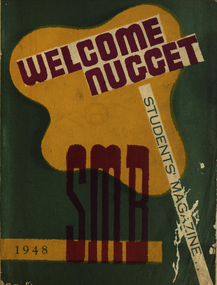
Magazine - Booklet, Ballarat School of Mines Students' Magazine, Welcome Nugget,1948, 1948
Ballarat School of Mines Students' Magazine, 1948, List of Full Course Students', Editorial, Principal's Page, Photographic Competition, News and Notes, Editor's Notes, Obituary - S. H. Mayo, Farewells to Staff Members, Alterations in Staff, Science Section. The Literary Society, S.M.B. Yesterday and Today, R.A.A.F. Story, Art Section, Escape from Nazi Europe, Short Story Competition, Senior Sport, The Junior Techs, Students' doing Trade Apprenticeship Courses Green front page soft cover of 53 pages with burgundy and green inscriptions on front coverballarat school of mines students' magazine, staff, sports, h. tozer, v. lancaster, g. murdoch, m. greenwood, a. fenton, c. rook, b. bryan, c. g. fairbank, r. p. flower, c. sanos, d. munro, e. marshman, r. w. richards, dr. j. r. pound, m. k. ashton, w. k. l. murray, s. h. mayo, john c. collins, don johnston, f. g. procter, l. j. hillman, n. d. gardner, arthur c. burrow, p. richards, h. darby, lewis huisman, betty freeth, j. williams, m. treganowan, g. williams, w. archibald, m. callahan, m. ryan, t. downes, d. anderson, m. rowbottom, b. lette, l. greenbank, v. ritchie, b. hutchings, p. reidy, b. tantau, w. brown, w. wilson, d. durant, g. hetherington, j. wilson, m. murray, r. cairns, g. edmonds, j. ballinger, n. edwards, r. rosser, h. graham, k. treloar, j. boag, l. veal, h. fumberger, j. jopling, w. wray, j. dunstan, j. willis, r. davis, g. coward, j. scala, g. searle, n. ludbrook, r. u'ren, r. hollioake, a. vinegrad, h. mcwilliam, b. tippett, j. brokenshire, f. savage, r. spence, j. sawyer, t. lannen, e. lloyd, d. brayshaw, r. b. williams, beryl hutchings, heather coad, margaret ryan, s. shillington, b. duffer, m. mclean, j. catherall, c. beeston, e. shaw, n. silvey, d. stevens, k. adams, t. hewitt, i. lepp, j. mccormack, a. young, l. george, j. terrill, k. spalding, j. watts, w. clarke, g. hindson, d. gilbert, a. hewitt, r. plover, g. murrowood, r. cochrane, j. bethune, j. walton, r. ward, j. blain, r. luke, j. daly, k. ward, i. mcconchie, p. hewitt, j. skilbeck, e. jones, c. hoffman, w. mckenzie, r. phillips, g. allen, k. george, h. saw, c. mayne, b. graham, m. tweedale, d. alexander, r. gluyas, w. rodgers, r. norman, m. horwood, p. hains, m. coleman, g. hannah, r. smith, r. bawden, r. simpson, d. ditchfield, w. d. ditchfield, r.a.a.f. story, avro anson, escape from nazi europe -
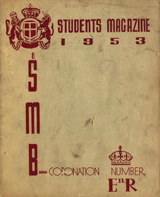 Federation University Historical Collection
Booklet, J. A. Hoskin & Son, Ballarat School of Mines Students' Magazine, 1953, 1953
Ballarat School of Mines Students' Magazine, 1953White front page soft cover with burgundy inscriptions on front cover. This magazine recognised the coronation of Queen Elizabeth II, and reproduced a portrait of the Queen.staff, sports, her majesty queen elizabeth ii, mr hillman, mr gillespie, i. burger, n. leckie, b. singleton, mr treadwell, mr fairbank, j. mcneil, b. smith, ann mitchell, janice wilton, eleanor tozer, j. beattie, b. macdougall, mr bryan, mrs alf. watson, mr hans fumberger, mr w. r. richards, cliff restarick, russell ewins, kevin whiter, mr w. carlyon, mr k. treloar, mr c. livitsamos, arthur faneco, jim john, barbara ngip, jim tinney, jean dean, neville spiers, stewart rowe, max stevens, barrie smith, elaine walton, jim sawyer, bruce flavel, ron ingleton, john bethune, john blackburn, john boag, jim brokenshire, john carmichael, ray kibby, alec kinnane, noel meagher, norm ludbrook, graham searle, ron sheppard, ryrie mccallum, queen elizabeth ii, coronation -
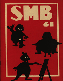 Federation University Historical Collection
Booklet, Ballarat School of Mines Students' Magazine, 1961, 1961
Ballarat School of Mines Students' Magazine, 1961. Editorial, Prominent Personalities, The Principal's Pages, The Richard W. Richards Medal, Loyalty, Arts v. Science, Hong Kong Today, Conferring of Diplomas, Bath Push, Intellectual Pursuit, Never be a Woman, Man and Morality, The Old and the New, A Gentlemen's Excursion to Beaufort House, Awards 1961, Sports, The History of Electricity, School Council, Members of Staff, Roll Call Red front page soft cover with white inscriptions and black figures on front cover, 72 pagesballarat school of mines students' magazine, staff, sports, john w. boarmans, noel delosa, noel whitcher, bob coutts, noel kelly, les dobie, noel murphy, malcolm peel, peter agrums, ian weir, sue mole, val baker, neil bromley, kevin oscar rogers, h. e. arblaster, richard w. richards, daniel yung, m. b. john, morgan bevan john, sir william hudson, brian arthur bellingham, francis david benjamin, neil albert brogden, geoffrey angus chritian, william davison, brian harold duthie, thomas bernard gallagher, john robert gowan, william john spencer, lawrence grenville trevan, douglas james vendy, michael villani, walter john wynd, graeme robert bromley, david william brown, leonard ernest fox, ralph james hepburn, john gribble holloway, peter john matthews, peter mervyn robinson, chris peter livitsanos, david yan kai chung, thomas henry john coad, john neil mcarthur, john andrew watts, d. pollard, n. r. whitcher, peter agrumsk., e. ooi, t. smith, c. naylor, p. terry, gerald brenan, e. r. mcgrath, j. kavangh, a. bitans -
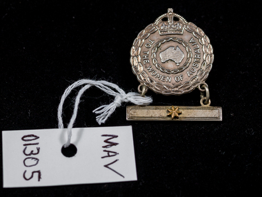 City of Moorabbin Historical Society (Operating the Box Cottage Museum)
WW2 Medal for Women relatives of serving soldiers, 1942
Female Relative Badges were issued to the nearest female relative (usually wives or mothers) of those who engaged in active service overseas during the First and Second World Wars. For active service abroad during the Second World War, a single badge was issued to the nearest female relative of members of the RAN, the Australian Imperial Force (including members of the Australian Army Nursing Service), and the Royal Australian Air Force. Stars displayed on a bar suspended below the badge represented the number of relatives involved in the war effort. Authority for the issue of the badge was given under AIF Order 200,14 February 1941. This medal was given to Veronica ( White ) Roper in 1942 because her husband Alfred William Roper was a member of the Australian Army Signals Corp serving in New Guinea. Emma Olymphia Roper of Balaclava/ Ripponlea would also have received a medal like this with 4 four stars because her 4 sons were serving in the Australian Army 1939-45 This Military Medal was given to the wives and mothers of Australian Soldiers serving during World War 2 1939-1945Silver medal, engraved wreath of leaves, crown and map of Australia and pin clasp on back . A bar with one star is suspendedAround medal : For the Women of Australia Back : Issued by the / C'wealth Govt. / A 135699 / Angus & Coote / 1942 Bar : star/ asteriskworld war 1939-1945, military medals, roper alfred william , roper veronica, moore joan catherine, roper arthur leopold, roper emma olymphia, war memorials, bentleigh, city of moorabbin, totally and permanently invalid, returned service league, victoria barracks, department of defence australia, -
 City of Moorabbin Historical Society (Operating the Box Cottage Museum)
Flyer - Killearnan Estate, Bentleigh, 1930
The train line from the city to Frankston was electrified which intensified the sale in the municipality of Moorabbin, particularly land which was in the vicinity of the railway stations.Example of the progress of the Municipality of MoorabbinAdvertising flyer for auction of real estate sales - plan of building blocks for saleKillearnan Estate - 70 Homes Sites - Auction Saturday 10 May 1930thomas street, yawla street, huntley road, whitmuir road, bentleigh, whitmuir, killearnan, robert gray ford, mrs betsy armstrong, arthur crozier, real estate, auction, a. f. always & son, wilson bros., moorabbin, bentleigh club