Showing 632 items
matching river st
-
 Queenscliffe Maritime Museum
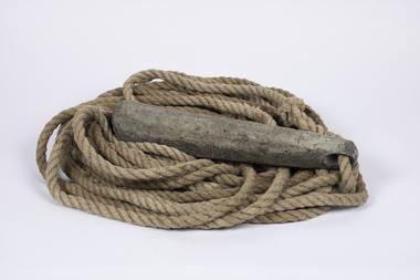
Equipment - Sounding lead line
Although the provenance cannot be confirmed it is believed that this lead possibly originated from the SS Time.Since at least the sixth century B.C. the sounding lead or sounding weight was in use in the Mediterranean area for maritime navigation. It is the oldest known marine navigational instrument and it remained a primary navigational aid in coastal waters and rivers well into the twentieth century.A sounding lead with rope line attached. One surviving leather fathom depth marker is spliced into the rope.sound lead, navigation -
 Bendigo Historical Society Inc.
Document - General Receipts for Government Departs within the City of Bendigo, 1968
Parry CollectionGeneral Receipts for Government Departs within the City of Bendigo 1. State Rivers and Water Supply Commission - Golden Square Office 2. Bendigo Sewerage Authority, 1967-68 Installments 3. City of Bendigo rates 1967-68 for 3 Yandoit St - John S. Parry 4. City of Bendigo 30/5/69 Part Payment of rates receipt 5. City of Bendigo Receipt of $1 for black and white labrador cross.history, bendigo, j s parry collection, city of bendigo council rates -
 Ballarat Tramway Museum
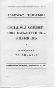
Ephemera - Timetable, Dept of Government Transport - NSW, Sydney Tramway Timetable - 1953 Sydney, 1953 and 1954
Paper - black and white. Alterations on separate pieces of paper in the book - 5 pages. 120.1 - Tramway timetable for Circular Quay - Canterbury - Cooks Rivers - Dulwich Hill - Earlwood lines, 1953. 120.2 - Altered journey for route, Circular Quay - Cooks River line - 1954 120.3 - Altered journey - Dulwich Hill, Glebe Point, Balmain, Lilyfield and Darling St. wharf - Canterbury lines - 1954. 120.4 - Altered journey (on trail) Circular Quay and Darling St. wharf and Canterbury lines - 1954. 120.5 - Additional and altered journeys - Circular Quay and Darling St. wharf lines - 1954 120.6 - Tram time table for Circular Quay - North Bondi line (via Bellevue Hill) including running times, sections and fares - July 26 1954.sydney, timetables -
Kew Historical Society Inc
Book, Book Collectors' Society of Australia, Batman & Fawkner: Discovery of the River Yarra; an episode, 1965
Originally printed by H. Cordell, 59 Queen St., 1881. Limited edition of 250 copies11 p. 2 facsims. 23 cm. non-fictionOriginally printed by H. Cordell, 59 Queen St., 1881. Limited edition of 250 copiesbatman john -- 1801-1839, fawkner john pascoe -- 1792-1869, melbourne (vic.) - history - 1834-1851. -
Kew Historical Society Inc
Journal, Kewriosity : March 1991
Kew Festival 10th March to 24th March - Kew is for living / artwork Heike Effler / p1. Dates for March [1991] / p2. Easter hours [Council Offices] / 2. 10th April [Rates and dog registrations due] / p2. Voters' Roll / p2. [Kew] Community House events / p2. Commentary / Cr Daryl Oldaker p3. Council's casino letter [Willsmere] / p3. Later to the editor [Casino] / E Stanley Meyer p3. Information: your view [Council survey] / p2. Cotham Road rebuilt [reconstruction] / p4. Anybody home? [1991 Census] / p4. Valley views protected [development along the Yarra River] / p4. Reaching the tram [upgrades] / p5. Traffic management update [Area 4, Area 5, Area 6, Area 7, Area 10] / p5. 7,000 more Kewites [projected population growth] / p5. New school buildings [Ruyton Girls' School; Methodist Ladies' College; Trinity Grammar; Xavier College; Genazzano College; Carey Grammar School; Preshil] / p5. High St [Pedestrian] Crossing / p5. St George's amalgamated [with Victoria Parade Geriatric Centre, Henry Pride Unit, Hawthorn Day Hospital] / p6. Youth co-ordination [Youth Workers' Forum] / p6. Bowling vacancies [East Kew Bowling Club] / p6. Driver wanted [for Henry Pride Geriatric Centre] / p6. On World's rooftop [Trinity Grammar students and teachers in Nepal] / p6. Trinity Day / p6. Clergy move / p6. Bus volunteers [needed for Kew Community Bus] / p6. Festival artist [Heike Effler] / p7. Citizens honoured [Australia Day honours] / p7. Medallion award [Royal Guide Dogs Association] / p7. Will bunny arrive? [Three and Fours Kindergarten] / p8. Fun with your children [Highbury Grove Playgroup] / p8. 2nd birthday celebrations [Kew Recreation Centre] / p8. Free electrolysis / p8. Empress of Britain [1938 voyage] / p8. Japanese woodblocks [exhibition at East West Art] / p8. Join the cast [Viola Musical Comedy Society]Kewriosity was a local newsletter combining Kew Council and community news. It was published between November 1983 and June 1994, replacing an earlier Kewriosity [broad] Sheet (1979-84). In producing Kewriosity, Council aimed to provide a range of interesting and informative articles covering its deliberations and decision making, together with items of general interest and importance to the Kew community and information not generally available through daily media outlets.non-fictionKew Festival 10th March to 24th March - Kew is for living / artwork Heike Effler / p1. Dates for March [1991] / p2. Easter hours [Council Offices] / 2. 10th April [Rates and dog registrations due] / p2. Voters' Roll / p2. [Kew] Community House events / p2. Commentary / Cr Daryl Oldaker p3. Council's casino letter [Willsmere] / p3. Later to the editor [Casino] / E Stanley Meyer p3. Information: your view [Council survey] / p2. Cotham Road rebuilt [reconstruction] / p4. Anybody home? [1991 Census] / p4. Valley views protected [development along the Yarra River] / p4. Reaching the tram [upgrades] / p5. Traffic management update [Area 4, Area 5, Area 6, Area 7, Area 10] / p5. 7,000 more Kewites [projected population growth] / p5. New school buildings [Ruyton Girls' School; Methodist Ladies' College; Trinity Grammar; Xavier College; Genazzano College; Carey Grammar School; Preshil] / p5. High St [Pedestrian] Crossing / p5. St George's amalgamated [with Victoria Parade Geriatric Centre, Henry Pride Unit, Hawthorn Day Hospital] / p6. Youth co-ordination [Youth Workers' Forum] / p6. Bowling vacancies [East Kew Bowling Club] / p6. Driver wanted [for Henry Pride Geriatric Centre] / p6. On World's rooftop [Trinity Grammar students and teachers in Nepal] / p6. Trinity Day / p6. Clergy move / p6. Bus volunteers [needed for Kew Community Bus] / p6. Festival artist [Heike Effler] / p7. Citizens honoured [Australia Day honours] / p7. Medallion award [Royal Guide Dogs Association] / p7. Will bunny arrive? [Three and Fours Kindergarten] / p8. Fun with your children [Highbury Grove Playgroup] / p8. 2nd birthday celebrations [Kew Recreation Centre] / p8. Free electrolysis / p8. Empress of Britain [1938 voyage] / p8. Japanese woodblocks [exhibition at East West Art] / p8. Join the cast [Viola Musical Comedy Society]publications -- city of kew (vic.), kewriosity, council newsletters, community newsletters -
 Kew Historical Society Inc
Photograph - Second Johnston Street Bridge in Flood, 1934
Original, small black and white print photograph of crowds lining the Johnston Street Bridge watching the flood waters below. The annotation on the reverse clarifies that Kew is in the distance.Annotated on reverse: "Gift of G.S. Beard / 2nd bridge / Johnston St. Studly Park Rd. Bridge looking towards Kew / 1st bridge 1858–1876, 2nd bridge built (bad bend), 1876–1958, 3rd bridge 1958, lined up Johnston St and Studley Park Rd."johnston street bridge, bridges - yarra river -- kew (vic.), flood -- 1934 -
 Kew Historical Society Inc
Print - Walmer Street Foot Bridge, 1901
Photographic print of the Walmer Street Bridge. The view of the Bridge is from the Abbotsford side of the Yarra. A section of pipe on the near side of the bridge is a remnant of the irrigation pipes that carried water from above Dight's falls to the Melbourne Botanic Gardens. The former bridge, constructed in 1896 was swept away in the 1901 Flood. It has two major brick piers while the remainder of the trestle supports are metal. The original photograph from which this copy was made was taken after 1901 as it shows the second bridge under construction. Houses in Young Street, Kew, can be seen on the far side of the river.Reverse: " Walmer St footbridge 1901 being repaired after flood / Constructed 1892 substantially renewed in 1901 and in 1928 / Rebuilt in 1977 by Kew Council aided by State funding. Won for designer Martin Aylard a New Zealand award presented by the timber Research & Development Assoc / Site of Simpsons Road passenger foot ferry". bridges - yarra river -- kew (vic.), walmer street bridge -- kew (vic.) -
Kew Historical Society Inc
Journal, The Kewriosity Sheet Vol.2 No.3 : August 1980
What's doing in Kew for August / p1. Kew Historical Society [George Allan WW2 memorial; Kew Library] / Mavis Rolley p1. St Anne's School - East Kew [50th anniversary of laying of foundation stone] / p1. Epilepsy month / p1. Studley Park Progress Association [Yarra River, Environmental conservation] / Marshall Slattery p2. Greenacres Golf Club / p1. St Hilary's Youth Club / p1. Kintore Social Club / p2. Early landmark of Kew [Kew Court House; Kew Post Office] / Elizabeth Mackie p2. Kew Garden Club / p2. Bowling Club nears century [Kew Bowling Club] / p2.Council News [Kindergarten enrolments; Funds available for local groups; Promoting Kew; Entertainment in Parks; What is R.A.A.V? (Rheumatism and Arthritis Association of Victoria)] / p2. Where have all the people gone? / Rev Stan Simmons p2. Scrabble [Kew Scrabble Club] / p2. Kew & Hawthorn Citizens' Advice Bureau / p2.The Kewriosity Sheet (1979-83) was first published in the City of Kew (Victoria) in June 1979 as a two-sided 'community newssheet'. It aimed to: 'share news about Kew happenings and Kew people, and to exchange ideas about living in Kew'. Later issues gradually evolved into a 4-page, quarto sized publication. The Kewriosity Sheet was superseded by the Kew Council publication 'Kewriosity' (1983-1994).non-fictionWhat's doing in Kew for August / p1. Kew Historical Society [George Allan WW2 memorial; Kew Library] / Mavis Rolley p1. St Anne's School - East Kew [50th anniversary of laying of foundation stone] / p1. Epilepsy month / p1. Studley Park Progress Association [Yarra River, Environmental conservation] / Marshall Slattery p2. Greenacres Golf Club / p1. St Hilary's Youth Club / p1. Kintore Social Club / p2. Early landmark of Kew [Kew Court House; Kew Post Office] / Elizabeth Mackie p2. Kew Garden Club / p2. Bowling Club nears century [Kew Bowling Club] / p2.Council News [Kindergarten enrolments; Funds available for local groups; Promoting Kew; Entertainment in Parks; What is R.A.A.V? (Rheumatism and Arthritis Association of Victoria)] / p2. Where have all the people gone? / Rev Stan Simmons p2. Scrabble [Kew Scrabble Club] / p2. Kew & Hawthorn Citizens' Advice Bureau / p2. community publications --- kew (vic.), the kewriosity sheet, newsletters - kew (vic.) -
![Scene on the Yarra, near Rourke's Bridge / [by] Nicholas Caire, circa 1876](/media/collectors/550653872162f11fb04854aa/items/5777571cd0cdd10a5c191a9c/item-media/57775788d0cdd10a5c193e0d/item-fit-380x285.jpg) Kew Historical Society Inc
Kew Historical Society IncPhotograph, Anglo-Australasian Photographic Company, Scene on the Yarra, near Rourke's Bridge, c. 1876
Nicholas Caire was born on Guernsey in the Channel Islands in 1837. He arrived in Adelaide with his parents in about 1860. In 1867, following photographic journeys in Gippsland, he opened a studio in Adelaide. From 1870 to 1876 he lived and worked in Talbot in Central Victoria. In 1876 he purchased T. F. Chuck's studios in the Royal Arcade Melbourne. In 1885, following the introduction of dry plate photography, he began a series of landscape series, which were commercially successful. As a photographer, he travelled extensively through Victoria, photographing places few of his contemporaries had previously seen. He died in 1918. Reference: Jack Cato, 'Caire, Nicholas John (1837–1918)', Australian Dictionary of BiographyAn original, rare photograph from the series 'Views of Victoria: General Series' by the photographer, Nicholas Caire (1837-1918). The series of 60 photographs that comprise the series was issued c. 1876 and reinforced a neo-Romantic view of the Australian landscape to which a growing nationalist movement would respond. Nicholas Caire was active as a photographer in Australia from 1858 until his death in 1918. His vision of the Australian bush and pioneer life had a counterpart in the works of Henry Lawson and other nationalist poets, authors and painters.Albumen silver photograph mounted on boardprinted in ink on support l.c.: SCENE ON THE YARRA, NEAR ROURKE'S BRIDGE. / COPYRIGHT REGISTERED. printed in ink on support reverse c.: VIEWS OF VICTORIA. / (GENERAL SERIES.) / No. 16. / SCENE ON THE YARRA, NEAR ROURKE'S BRIDGE. / The subject of the present illustration represents the New Bridge crossing the River Yarra on the road from / St. Huberts to the Native Station at Corranderrk, and to the township at Healesville. The river at this place abounds / with fish of a large description, which are caught by the Natives, frequently in considerable quantitities. printed in ink on support reverse l.c.l.: J.W. FORBES, Agent, printed in ink on support reverse l.c.: ANGLO-AUSTRALASIAN PHOTOGRAPHIC COMPANY, MELBOURNE. printed in ink on support reverse l.c.r.: 10 Temple Court, Collins Street West.nicholas caire (1837-1918), landscape photography - victoria -
 Kew Historical Society Inc
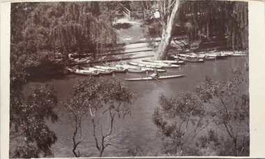
Postcard, Macauleys' Boat Shed on the River Yarra at Kew, 1907-1915
The Kew Historical Society's postcard collection includes views of Kew, Melbourne and Greater Melbourne as well as those including overseas scenes sent or received from Europe or the Middle East. They date from the 1890s to the 2000s. These postcards may or may not include the name of the publisher or printer. A number of the cards were published as parts of popular series. A way of dating early postcards is to identify whether the reverse was divided by a central line which became the norm after 1902 in the United Kingdom. However, other postcards produced after this date do not always conform to this print layout.The item forms part of the Laurie Bennett collection of thirty-six postcards and photographs of Kew and early Melbourne, donated to the Kew Historical Society in 1980. The postcards in the Bennett collection, like other images in the Society's holdings date from the 1890s to the present and comprehensively indicate points-of-view or scenes considered historically, aesthetically or socially significant in the period in which they were produced.Monochrome photo postcard of Macauleys' Boat Shed in Kew and its position on the Yarra at the end of Molesworth Street."KH-393. Macauley's Boat Shed, Kew. Lower Molesworth St, Donated by L. Bennett"boat sheds - kew (vic), river yarra - kew (vic), macaulay's boat shed - kew (vic), recreation - yarra river - kew (vic) -
 Kew Historical Society Inc
Postcard, Victoria Street Bridge, Collingwood, 1905-1913
Victoria Bridge is a riveted and welded steel Warren truss bridge over the Yarra River completed in 1884 to a design by Fraser & Chase following a controversial design competition held in 1880. Funds for the bridge's construction were provided by the councils of Collingwood, Hawthorn, Kew and Richmond. The contract was awarded to Mr P. Platt. Charles Rowand was officially appointed Supervising Engineer in 1883. The winning design was based on the theoretical work of William Charles Kernot (1845-1909) who campaigned for economy in public works design and the application of scientific principles in engineering. ... The bridge was widened in 1890 by the addition of a third line of truss on new piers on the up stream side to carry horse trams. Work commenced in 1914 to convert the horse tramway to an electric tramway by the Prahran & Malvern Tramways Trust, part of the Trust's extension of its tramway into the eastern suburbs between 1913-18. In 1915 the bridge was further strengthened to accommodate the extra weight of electric trams and widened by the addition of two six feet cantilever footpaths. During this period the Prahran & Malvern Tramways Trust erected two ornamental gantries over the roadway to support overhead wires for the electric tramway. Further widening and reconditioning of the bridge took place in 1933, including the addition of four new welded trusses, two intermediate and two on the outside. The latter were supported on new cantilevered truss cross beams attached to the top of the piers. (Source: Heritage Victoria)Early and rare postcard of the Victoria Street Bridge linking Victoria Street and Barkers Road.Polychrome postcard of the Victoria Street Bridge which links Richmond and Abbotsford with Kew and Hawthorn.View from Harrison Cres embankment / former Xavier College boatshed on site of tree in foreground. / Chimney left corner - Wool Scoring Mils in Victoria St. / On horizon - Studley Villa, Studley House circa 1880s, Studley Hall / Chinese gardens to be seen behind three set of columns / M.J. Slatterypostcards -- yarra river, postcards -- bridges. -- greater melbourne (vic.), victoria street bridge -
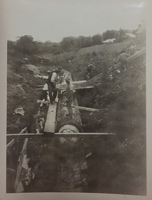
 Kew Historical Society Inc
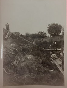
Photograph, City of Kew, City of Kew, Cecil Street Drain, 1936
An original photograph donated to the Kew Historical Society by the City's Engineering Department preceding the amalgamation of Kew into the City of Boroondara. While not all of the photographs are of Studley Park, Kew or East Kew, each photo provides a fine snapshot of the work of local government engineering departments of the period. They reveal they types of labour conducted, the techniques used and the equipment and machinery in the possession of the local government authority. Historic and rare photograph of major public works in Kew in the 1930sPublic works. Men at work in the creek bed of Connor's Creek in Kew, while constructing the underground barrel drain. Connors Creek was one of the two main tributaries of the Yarra River in Kew. It originated somewhere near the grounds of Genazzano FCJ College. The barrel drain was finally completed in 1941 at a cost of £14,000. Inscription on reverse: "City of Kew / Cecil st drain / November 1936". public works (kew), roadmaking, engineering, city of kew (engineering department), connor's creek (kew), cecil street drain -
 Kew Historical Society Inc
Photograph, City of Kew, City of Kew, Cecil Street Drain, 1936
An original photograph donated to the Kew Historical Society by the City's Engineering Department following the amalgamation of Kew into the City of Boroondara. While not all of the photographs are of Studley Park, Kew or East Kew, each photo provides a fine snapshot of the work of local government engineering departments of the period. They reveal they types of labour conducted, the techniques used and the equipment and machinery in the possession of the local government authority. Historic and rare photograph of major public works in Kew in the 1930s.Public works. Men at work in the creek bed of Connor's Creek in Kew, while constructing the underground drain. Connor's Creek was one of the two main tributaries of the Yarra River in Kew. It originated somewhere near the grounds of Genazzano FCJ College. The barrel drain was finally completed in 1941 at a cost of £14,000. Inscription on reverse: "City of Kew / Cecil st drain / November 1936". city of kew, city of kew (engineering department), engineering, connor's creek (kew) -
 Kew Historical Society Inc
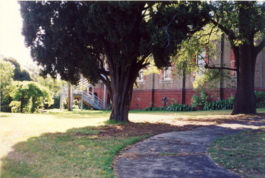
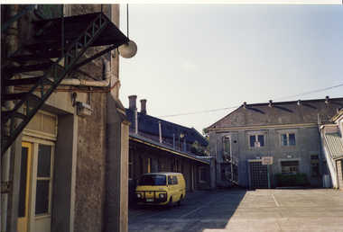
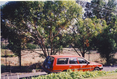
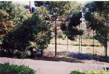
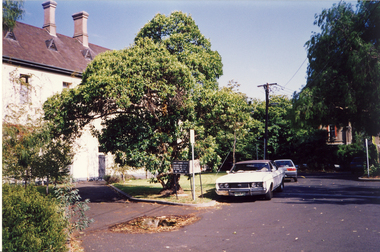
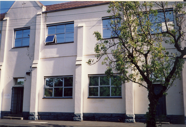
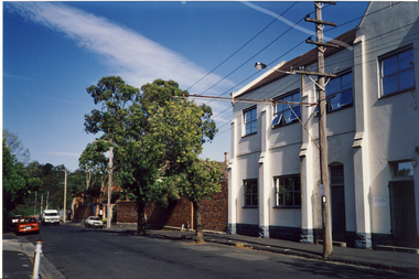
Photograph, Former Convent of the Good Shepherd, Abbotsford
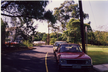
The former Convent of the Good Shepherd at Abbotsford includes ecclesiastical, residential, educational and utility buildings constructed during the late nineteenth and twentieth centuries on a bend of the Yarra River. In 1975 the site was purchased by the Victorian Government as a higher education campus. A proposed redevelopment of the site in the late 1990s led to a community-based heritage battle which resulted in 2004 in the transfer of the convent site south of St Heliers Street to the Abbotsford Convent Foundation for community use. (Source: Heritage Victoria)This photograph is part of a series taken c.1990 by the photographer Rick Lowell. It was taken before the heritage campaign to preserve the site for community use.Colour snapshot of a part or section of the Former Convent of the Good Shepherd, Abbotsfordconvent of the good shepherd, abbotsford -
 Kew Historical Society Inc
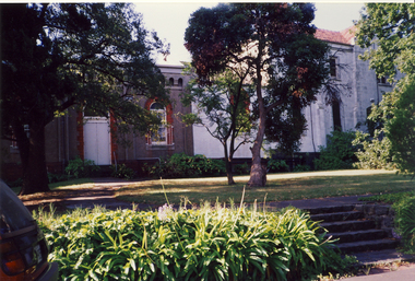
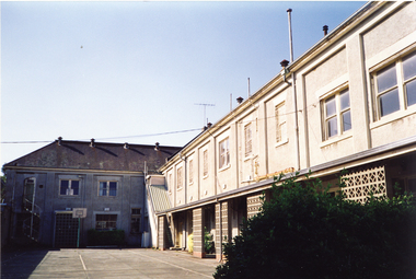
Photograph, Former Convent of the Good Shepherd, Abbotsford
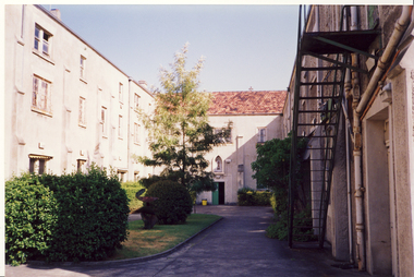
The former Convent of the Good Shepherd at Abbotsford includes ecclesiastical, residential, educational and utility buildings constructed during the late nineteenth and twentieth centuries on a bend of the Yarra River. In 1975 the site was purchased by the Victorian Government as a higher education campus. A proposed redevelopment of the site in the late 1990s led to a community-based heritage battle which resulted in 2004 in the transfer of the convent site south of St Heliers Street to the Abbotsford Convent Foundation for community use. (Source: Heritage Victoria)This photograph is part of a series taken c.1990 by the photographer Rick Lowell. It was taken before the heritage campaign to preserve the site for community use.Colour snapshot of a part or section of the Former Convent of the Good Shepherd, Abbotsford by Rick Lovell.abbotsford convent -
 Kew Historical Society Inc
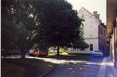
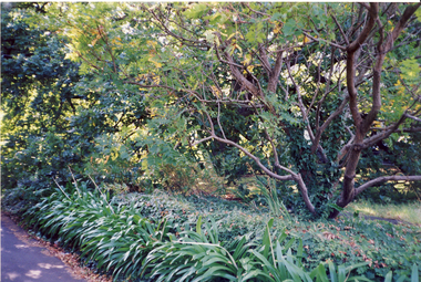
Photograph, Former Convent of the Good Shepherd, Abbotsford
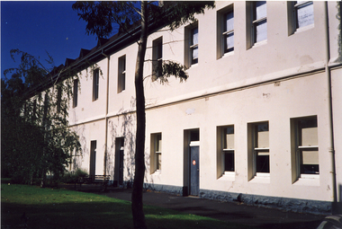
The former Convent of the Good Shepherd at Abbotsford includes ecclesiastical, residential, educational and utility buildings constructed during the late nineteenth and twentieth centuries on a bend of the Yarra River. In 1975 the site was purchased by the Victorian Government as a higher education campus. A proposed redevelopment of the site in the late 1990s led to a community-based heritage battle which resulted in 2004 in the transfer of the convent site south of St Heliers Street to the Abbotsford Convent Foundation for community use. (Source: Heritage Victoria)This photograph is part of a series taken c.1990 by the photographer Rick Lowell. It was taken before the heritage campaign to preserve the site for community use.Colour snapshot of a part or section of the Former Convent of the Good Shepherd, Abbotsford by the photographer Rick Lowell.abbotsford convent -
 Kew Historical Society Inc
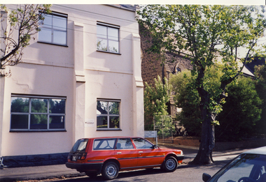
Photograph, Former Convent of the Good Shepherd, Abbotsford
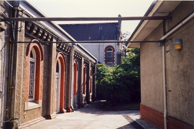
The former Convent of the Good Shepherd at Abbotsford includes ecclesiastical, residential, educational and utility buildings constructed during the late nineteenth and twentieth centuries on a bend of the Yarra River. In 1975 the site was purchased by the Victorian Government as a higher education campus. A proposed redevelopment of the site in the late 1990s led to a community-based heritage battle which resulted in 2004 in the transfer of the convent site south of St Heliers Street to the Abbotsford Convent Foundation for community use. (Source: Heritage Victoria)This photograph is part of a series taken c.1990 by the photographer Rick Lowell. It was taken before the heritage campaign to preserve the site for community use.Colour snapshot of a part or section of the Former Convent of the Good Shepherd, Abbotsfordabbotsford convent -
 Kew Historical Society Inc
Photograph, Former Convent of the Good Shepherd, Abbotsford
The former Convent of the Good Shepherd at Abbotsford includes ecclesiastical, residential, educational and utility buildings constructed during the late nineteenth and twentieth centuries on a bend of the Yarra River. In 1975 the site was purchased by the Victorian Government as a higher education campus. A proposed redevelopment of the site in the late 1990s led to a community-based heritage battle which resulted in 2004 in the transfer of the convent site south of St Heliers Street to the Abbotsford Convent Foundation for community use. (Source: Heritage Victoria)This photograph is part of a series taken c.1990 by the photographer Rick Lowell. It was taken before the heritage campaign to preserve the site for community use.Colour snapshot of a part or section of the Former Convent of the Good Shepherd, Abbotsfordabbotsford convent, convent of the good shepherd, abbotsford (vic.) -
 Kew Historical Society Inc
Photograph, Former Convent of the Good Shepherd, Abbotsford
The former Convent of the Good Shepherd at Abbotsford includes ecclesiastical, residential, educational and utility buildings constructed during the late nineteenth and twentieth centuries on a bend of the Yarra River. In 1975 the site was purchased by the Victorian Government as a higher education campus. A proposed redevelopment of the site in the late 1990s led to a community-based heritage battle which resulted in 2004 in the transfer of the convent site south of St Heliers Street to the Abbotsford Convent Foundation for community use. (Source: Heritage Victoria)This photograph is part of a series taken c.1990 by the photographer Rick Lowell. It was taken before the heritage campaign to preserve the site for community use.Colour snapshot of a part or section of the Former Convent of the Good Shepherd, Abbotsfordabbotsford convent, convent of the good shepherd, abbotsford (vic.)