Showing 636 items matching "st andrew's"
-
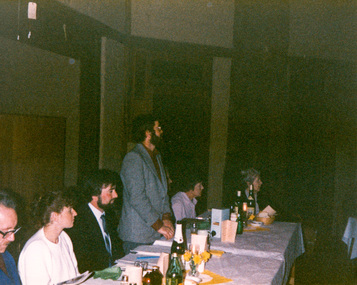
 Mission to Seafarers Victoria
legal record (item) - Register Receipts, Circa 1965
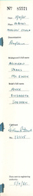
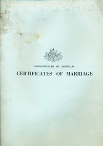
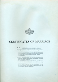
... st andrew chapel... chapel st andrew chapel marriages dio-marriages mission ...The receipts are dated from the 3rd of April 1965 to the 29th of November 1966. They document some of the information needed on the actual marriage certificate, such as the date and location, bride, bridegroom and celebrant's names, as well as the date the each certificate was sent to registering authority.Part of the record of weddings performed at the Mission to Seafarers between 1965 to 1966.Printed on the front cover: COMMONWEALTH OF AUSTRALIA / CERTIFICATES OF MARRIAGE.receipt, register, 1965-1966, st peter chapel, st andrew chapel, marriages, dio-marriages, mission to seafarers, seamen's mission -
 Mission to Seafarers Victoria
legal record (item) - Register Receipts, Circa 1972
... st andrew chapel...-marriages st peter chapel st andrew chapel Printed on front cover ...The receipts are dated from the 26th of August 1972 to the 1st of February 1975. They document some of the information needed on the actual marriage certificate, such as the date and location, bride, bridegroom and celebrant's names, as well as the date the each certificate was sent to registering authority.Part of the record of weddings performed at the Mission to Seafarers between 1972 to 1975.Printed on front cover: COMMONWEALTH OF AUSTRALIA / CERTIFICATE OF MARRIAGE. The Australian crest is printed above this.marriage, wedding, register, receipt, 1972-1975, mission-to-seafarers, port-melbourne, marriages, dio-marriages, st peter chapel, st andrew chapel -
 Mission to Seafarers Victoria
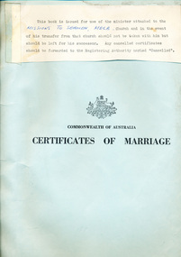
legal record (item) - Register Receipts, Circa 1977
... st andrew chapel... marriages dio-marriages st peter chapel st andrew chapel A typed ...The receipts are dated from the 17th of December 1977 to the 2nd of October 1982. The last receipt has been cancelled. They document some of the information needed on the actual marriage certificate, such as the date and location, bride, bridegroom and celebrant's names, as well as the date the each certificate was sent to registering authority.Part of the record of weddings performed at the Mission to Seafarers between 1977 to 1982.A typed note taped to the front cover: THIS BOOK IS ISSUED FOR USE OF THE MINISTER ATTACHED TO THE / (handwritten) MISSION TO SEAMEN, MELB, (typed) CHURCH AND IN THE EVENT OF HIS TRANSFER FROM THAT CHURCH NOT BY TAKEN WITH HIM BUT / SHOULD BE LEFT FOR HIS SUCCESSOR. ANY CANCELLED CERTIFICATES / SHOULD BE FORWARDED TO THE REGISTERING AUTHORITY MARKED "CANCELLED". Printed under this is the Australian crest. Printed under this: COMMONWEALTH OF AUSTRALIA / CERTIFICATES OF MARRIAGE.marriage, wedding, register, receipt, 1977-1982, mission-to-seafarers, port-melbourne, marriages, dio-marriages, st peter chapel, st andrew chapel -
 Mission to Seafarers Victoria
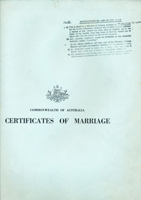
legal record (item) - Register Receipts, Circa 1982
... st andrew chapel... marriages dio-marriages st peter chapel st andrew chapel Stamped ...The receipts are dated from the 20th of November 1982 to the 8th of July 1989. The last receipt has been crossed out, possibly cancelled. The is a handwritten note within the register. They document some of the information needed on the actual marriage certificate, such as the date and location, bride, bridegroom and celebrant's names, as well as the date the each certificate was sent to registering authority.Part of the record of weddings performed at the Mission to Seafarers between 1982 to 1989.Stamped in black ink on the front cover: N.B INSTRUCTIONS RE: USE OF THIS BOOK (underlined), followed by the instructions. Under this is printed the Australian crest. Under this is printed : COMMONWEALTH OF AUSTRALIA / CERTIFICATES OF MARRIAGE.marriage, wedding, register, receipt, 1982-1989, mission-to-seafarers, port-melbourne, marriages, dio-marriages, st peter chapel, st andrew chapel -
 Mission to Seafarers Victoria
legal record (item) - Register Receipts, Circa 1989
... st andrew chapel... st andrew chapel st peter chapel mission to seafarers ...The receipts are dated from the 22nd of October 1989 to the11th of May 1993. The ninth receipt has been cancelled. They document some of the information needed on the actual marriage certificate, such as the date and location, bride, bridegroom and celebrant's names, as well as the date the each certificate was sent to registering authority.Part of the record of weddings performed at the Mission to Seafarers between 1989 to 1993.The Australian crest is printed on the front cover. Under this is printed: CERTIFICATES OF MARRIAGE / N.B. INSTRUCTIONS RE: USE OF THIS BOOK, followed by the instructions.marriage, wedding, register, receipt, 1989-1993, marriages, dio-marriages, port melbourne, st andrew chapel, st peter chapel, mission to seafarers -
 Greensborough Historical Society
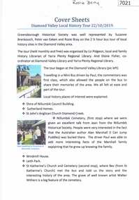
Booklet and article, Diamond Valley Local History Tour 2019, by Yarra Plenty Regional Library, 22/10/2019
... library sutherland homes st katherines church st helena andrew ...Cover article written by Rosie Bray. In addition to YPRL booklets which have a brief history of each site visited, there are leaflets on Anglican parish of Diamond Creek; Nillumbik Cemetery; Ellis Cottage; Greensborough Cemetery and Sutherland Homes for ChildrenBooklet (2 copies) containing a brief history of sites visited on the Library's Diamond Valley Tour 2019, with 21 p. of supplementary information by various writers and 6 photographs taken on the tour.diamond valley, yarra plenty regional library, sutherland homes, st katherines church st helena, andrew yandell reserve, greensborough rsl, greensborough war memorial park, greensborough cemetery -
 Greensborough Historical Society
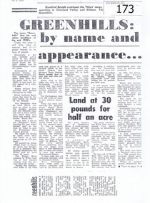
Newspaper clipping, Greenhills: by name and appearance, 04/07/1978
The article was written by Rosalind Resigh as part of a series on the origins and history of local communities.Gives the historical details of Greenhills and adjoining areas of Greensborough.A photocopy of a newspaper article on the history of Greenhills.Nilgreenhillls, andrew yandall reserve, a k lines, cecil jessop, partington, sutherland homes, st helena -
 Glenelg Shire Council Cultural Collection
Book - Bible and Prayer Book, George Eyre and Andrew Strahan, London, The Book of Common Prayer, 1821
Burgundy leather-bound text with board covers and gilt edged pages. Title on spine in gold lettering. Eight horizontal lines in gold on spine and thin gold line borders on covers. Gold decorative edge on internal leather of covers.religious book -
Glenelg Shire Council Cultural Collection
Photograph - Photograph - Andrew Bryant and Darryl Morrison, Portland, c. 1992
Black and white photo. Andrew Bryant, signwriter, and Darryl Morrison, 'Observer' reporter, standing on footpath outside Observer office, Percy St Portland. Large decorative sign on window commemorating 150 years of Portland Observer & Guardian publishingBack: Sticker - 'COPYRIGHT PORTLAND OBSERVER'portland observer 150th anniversary, newspaper, media, celebration -
 Eltham District Historical Society Inc
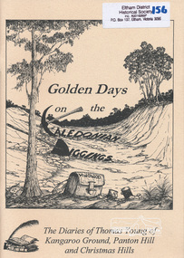
Book, Golden Days on the Caledonian Diggings: the diaries of Thomas Young of Kangaroo Ground, Panton Hill and Christmas Hills, compiled by Mick Woiwod, 2005
The original diaries, (1859-1866,1895-1900) of Thomas Young discovered by a Young descendant have been transcribed with the author adding his own research and historical photographs. The diary sheds light on the lives of prospectors who worked the Caledonian goldfields in the 1860s, including St Andrews and Smiths Gully. Thomas Young, migrated from Scotland and moved to the goldfields in 1858. He carted ore by horse and dray from mines around St Andrews to crushers in Panton Hill and Smiths Gully. He later became a baker. He and his wife Bridget had eleven children. He later settled at Christmas Hills establishing the local store and school. See also: "Old Diary Strikes Old" by Natalie Birch, Diamond Valley Leader August 17 2005The diary provides a rare first-hand account of life on the Caledonian goldfields.v. : ill. 69 p 30 cm[written inside front cover] To my very good friend Harry Gilham - Mick Woiwod 25th August 2005thomas young, caledonian gold fields, kangaroo ground, christmas hills, panton hill, smiths gully, st andrews, diary, gold mining -
 Eltham District Historical Society Inc
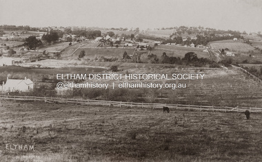
Photograph - Photograph postcard, J.H. Clark, Eltham (from Bolton Street), c.1915
... Police Station Post Office St Margaret’s Church W.B. Andrew Corn ...Original sepia photo postcard of early view of Eltham looking east from Bolton Street between Bridge Street and Brougham Street (Wellington). Fenced road reserve on right is Brougham Street. Originally dated as pre-1877 introduction of the Telegraph (the Telegraph was connected to the Post Office on Thursday, June 7, 1877) given the lack of poles and wires visible, a more recent higher resolution scan has revealed more detail highlighting the presence of several Telegraph poles: one about half way between Brougham Street and Dalton Street, one opposite the Police Residence, another opposite W.B Andrew’s Corn Store (Zen Den site), one possibly near the Fountain/Evelyn Hotel. Also, given the photo was originally marked “J. H. Clark Photo” it is safer to assume the image is dated circa 1915 until dates of further image details can be confirmed. Photographer: J.H. Clark John Henry Clark was the youngest of three boys born to William Henry Clark (1823-1877) and Maria White (1843-1914). He and his brothers, William Charles Clark (1872-1945), Clement Kent Clark (1874-1912) operated a photography business (Clark Bros.) from 25 Thomas Street, Windsor near Prahran during the period c.1894 to 1914. Following death of Clement in September 1912 and their mother in 1914, the Clark Bros business appears to have dissolved, the premises demolished, and a new house was under construction in 1915. John set up business independently in 1914 operating out of 29 Moor Street, Fitzroy where he is registered in the 1914 and 1915 Electoral Rolls. By 1916 John had relocated to Eltham where he continued his practice as a photographer and took many of the early images around the district of Little Eltham. Around 1930 John changed professions and opened a small cobbler's shop in 1931 near the pond opposite Dalton Street adjacent to the Jarrold family cottage. He never married and continued his profession as a bootmaker from this little shop, maintaining a close relationship with Mrs Jarrold for the rest of their lives. His bootmaker shop remains today beside the Whitecloud cottage and is one of only three remaining shops in the area from the early 20th century. There are a couple of images of Eltham taken by Clark Bros. in the Eltham District Historical Society collection, one such example being Hunniford’s Post Office with Miss Anne Hunniford out front (EDHS_00140 - marked on the back of the print, Clark Bros., 25 Thomas St. Windsor), which would date this image between c.1894 and 1914. Other early images of Eltham taken by John Henry Clark are marked on the face “J. H. Clark Photo” and it is assumed these are dated between 1914 and 1930. It is noted that the Grant of Probate for John H Clark of Eltham South dated 5 April 1957 (513/387) records his occupation as "X Photographer".1. Original sepia postcard - water damaged lower left corner over approximate 30mm diameter destroying image and photohgrapher's markings (same as EDHS_00533 and EDHS_00535 - all from same donor collection) 2. A second black and white print copy of the same image from a different unknown source (of lower resolution quality) is also held. 3. A digital enhanced version has been created using the lower quality black and white print as a donor source for the damaged section of the postcard.In pencil on back of postcard: A. Petrie Verandah on Andrews shop Pearsons house (Living and Learning Centre)bolton street, brougham street, cafe zen den, courthouse, eltham courthouse, eltham hotel, eltham living and learning centre, eltham living and learning, eltham, fountain hotel, j.h. clark photo, knapmans forge, main road, maria street, pitt street, police residence, police station, post office, st margaret’s church, w.b. andrew corn store, wellington street, early eltham, little eltham -
 Warrnambool and District Historical Society Inc.
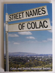
Book, Streets of Colac, 2008
This is a book giving information on the streets of Colac and the origins of the names. Colac is a city 150 kilometres south west of Melbourne and is a commercial centre for a major agricultural area. It is situated near the 3rd largest volcanic plain in the world and European settlement began in 1837. The book was commenced by Ian McIntosh in the 1970s and in 2005 the Colac and District Historical Society took on the project again with the major editors being Ida and Andrew McIntosh. This book is of interest, particularly those in the Western District of Victoria, as it contains information on Colac streets, many of which were named after pioneers of the district. The book will be useful for research. This is a soft cover book of 60 pages. The cover has a blue background and features a colour photograph (mainly in green, blue and white tonings) of a panorama of the Colac district. The photograph extends over the front and back covers. The book contains the names and name origins of Colac streets in alphabetical order and many black and white photographs. The pages have a glued binding. Front Cover: ‘Street Names of Colac’ ‘Colac and District Historical Society’ history of colac, colac and district historical society, street names of colac, ian mcintosh -
 Warrnambool and District Historical Society Inc.
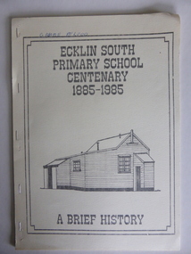
Booklet, Ecklin South Primary School 1885-1985, 1985
This is a short history of the Ecklin South Primary School from 1885 to 1985. Ecklin South is 37 kilometres from Warrnambool and 25 kilometres from Port Campbell. The school was established on a five acre site in 1885 with the first teacher, Andrew Harkness. A new building was erected in 1937.This booklet is of interest because it gives the history of a school in Ecklin South, a district not far from Warrnambool. It will be useful for research. This is a soft cover booklet of 28 pages produced in-house by Ecklin South Primary School Centenary Committee members.. The cover is a buff colour with a black, grey and white sketch of the school on the front. The history of the school is type-written and there are several black and white photographs reproduced by photocopying. The booklet includes a poem, ‘Ecklin School’ by Iris Wormald and a list of the teachers from 1885 to 1985. The booklet has been stapled. Some of the pages are difficult to read. Front cover: ‘Ecklin South Primary School Centenary 1885-1985 A Brief History’ecklin south, ecklin south primary school, warrnambool -
 Warrnambool and District Historical Society Inc.
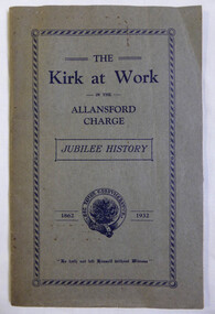
Booklet, The Kirk at Work in the Allansford Charge Jubilee 1862-1932, Circa 1932
This booklet tells the story of the establishment of the Allansford Presbyterian church. First services were held in a Mr. Irvine’s barn at Wangoom by Rev Andrew Begg. The first church was built shortly afterwards towards the end of 1861. The first minister was Rev Robert Sutherland (1862-1876). The booklet gives a brief outline of history of the ministers who followed. Foreign missionaries are mentioned as are the men of the Kirk session. It also gives a brief history of the congregations at Wangoom, Mepunga and Nirranda.A worthwhile record of the people associated with the Presbyterian Church in the areas of Allansford, Wangoom, Mepunga and Nirranda.Khaki covered soft card cover with dark blue text. 48 pages approximately with collated black and white photographs of ministers and members of the congregation at the time. Red circular logo inside front cover.The foreward is written by W M Chapman.allansford presbyterian church, the kirk at work, wangoom, mepunga, rev andrew begg, rev robert sutherland 1862-1876 -
 Eltham District Historical Society Inc
Photograph, Russell Yeoman, Andrew McKenzie, 08/07/1987
Shire of Eltham Historical Society 20th Anniversary dinner, St Margaret's Hall, 8 July 1987Colour photograph20th anniversary, shire of eltham historical society, st margaret's church hall, russell yeoman, andrew mckenzie -
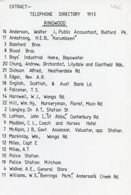 Ringwood and District Historical Society
Document, 1913 Ringwood Telephone Directory
One A4 sheetTELEPHONE DIRECTORY 1913 RINGWOOD 16 Anderson, Walter J, Public Accountant, Belford Pk. 17 Armstrong, H.E.B., 'Korumbeen'' 3 Bamford Bros. 8 Blood Bros. 1 Boys' Industrial Home, Bayswater. 20 Chung, Andrew, Orchardist, Lilydale and Eastfield Rds, 21 Dickson Alfred, Heatherdale Rd. 5 Edgar, Rev. A.R. 18 English. Scottish, & Aust. Bank Ld. 6 Falconer, T. S. 14 Harnwell, W.J., Wonga Rd. 22 Hill, Wm.Hy, Nurseryman, Florist, Main Rd. 2 Langley, Or A.T. Station St. 15 Lothian, John I, "St Abbs" Canterbury Rd. 9 Madden, C. L., Coach and Horses Hotel. 7 McAlpin, J. B., Govt. Assessor, Valuator, opp. Station. 13 Mackinlay, Wm., Wonga Rd. 12 Miles, Capt. E. 12 Miles, A.T. 10 Police Station. 19 Police Station. Mitcham. 4 Walker, A.E., General Store. 11 Williams, W.S., 'Berringa Park,' Andersons Creek Rd. -
 Glen Eira Historical Society
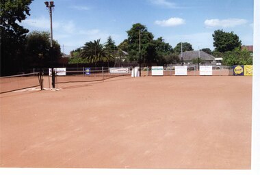
Photograph, Dalny Road, 5-17 Rear, Murrumbeena, 2001
Originally labelled "Beauville Estate, Established 1936, Still Thriving 65 years on, 10th March 2001", the Beauville Estate Album contains colour photographs of houses in the Estate. They were taken around the time of the Beauville Estate’s 65th Heritage Celebration held on 10/03/2001 and donated to the Caulfield Historical Society shortly afterwards. Photographer unknown. From Glen Eira’s Heritage Management Plan by Andrew Ward (1996) Vol 2 p78: "Beauville Avenue is unusual in that it is terminated in a cul-de-sac (see Section 3.9.2) whilst the design of the estate may well be unique for its time in that the houses back onto 6 tennis courts for public use. St. Patrick's Church, which adjoins the estate is a comparatively recent structure whilst the school has one building erected in 1930 and prior to the release of the Beauville lots." It also notes that St.Patrick's Church and School now run the tennis courts. The Beauville Historic Area is important at the State level as the first large housing estate undertaken by the AV Jennings Construction Co, later Jennings Group Limited, Victoria’s largest home builder. It is important also as a very early estate development incorporating a range of features other than houses and including made roads, shops and recreation facilities. In this respect it was the forerunner of the comprehensively planned housing estate of the post war era. The estate is distinguished by its aesthetic values, as is the earlier and comparable Hillcrest Estate, which are formed by a combination of restrained diversity in house styles, with the exception of no. 30 in the emerging International style, and by a landscaped garden environment. See Significance Statement in Glen Eira’s Heritage Management Plan by Andrew Ward (1996) Vol 2 p.79. Available from https://www.gleneira.vic.gov.au/media/4779/heritage_management_plan_volume_2.pdf (Note see p.84 of pdf)Colour photograph of a playground on the Beauville Estate. murrumbeena, houses, 1930's, a.v. jennings, av jennings, jennings, beauville estate, playgrounds, parks and reserves, sir albert victor jennings, a v jennings construction co, beauville estate heritage area, glen eira city council, jennings group limited, land subdivision, gardens, beauville historic area, st patrick's church, st patrick's school, dalny road -
 Glen Eira Historical Society
Photograph, Dalny Road, 5-17 Rear, Murrumbeena, 2001
Originally labelled "Beauville Estate, Established 1936, Still Thriving 65 years on, 10th March 2001", the Beauville Estate Album contains colour photographs of houses in the Estate. They were taken around the time of the Beauville Estate’s 65th Heritage Celebration held on 10/03/2001 and donated to the Caulfield Historical Society shortly afterwards. Photographer unknown. From Glen Eira’s Heritage Management Plan by Andrew Ward (1996) Vol 2 p78: "Beauville Avenue is unusual in that it is terminated in a cul-de-sac (see Section 3.9.2) whilst the design of the estate may well be unique for its time in that the houses back onto 6 tennis courts for public use. St. Patrick's Church, which adjoins the estate is a comparatively recent structure whilst the school has one building erected in 1930 and prior to the release of the Beauville lots." It also notes that St.Patrick's Church and School now run the tennis courts.City of Glen Eira’s Heritage Management Plan Vol 2 p79 (this is p84 of the pdf version) – HO12 Beauville Estate and environs, Murrumbeena: The Beauville Historic Area is important at the State level as the first large housing estate undertaken by the AV Jennings Construction Co, later Jennings Group Limited, Victoria’s largest home builder. It is important also as a very early estate development incorporating a range of features other than houses and including made roads, shops and recreation facilities. In this respect it was the forerunner of the comprehensively planned housing estate of the post war era. The estate is distinguished by its aesthetic values, as is the earlier and comparable Hillcrest Estate, which are formed by a combination of restrained diversity in house styles, with the exception of no. 30 in the emerging International style, and by a landscaped garden environment. Colour photograph of a tennis club house and a park on the Beauville Estate. murrumbeena, houses, 1930's, a.v. jennings, av jennings, jennings, beauville estate, jennings albert victor, parks and reserves, sports and recreations establishments, clubhouses, tennis clubs, beauville tennis courts, st patrick's tennis club, sir albert victor jennings, a v jennings construction co, beauville estate heritage area, glen eira city council, architectural features, jennings group limited, land subdivision, gardens, beauville historic area, dalny road -
 Glen Eira Historical Society
Photograph, Dalny Road, 5-17 Rear, Murrumbeena, 2001
Originally labelled "Beauville Estate, Established 1936, Still Thriving 65 years on, 10th March 2001", the Beauville Estate Album contains colour photographs of houses in the Estate. They were taken around the time of the Beauville Estate’s 65th Heritage Celebration held on 10/03/2001 and donated to the Caulfield Historical Society shortly afterwards. Photographer unknown. From Glen Eira’s Heritage Management Plan by Andrew Ward (1996) Vol 2 p78: "Beauville Avenue is unusual in that it is terminated in a cul-de-sac (see Section 3.9.2) whilst the design of the estate may well be unique for its time in that the houses back onto 6 tennis courts for public use. St. Patrick's Church, which adjoins the estate is a comparatively recent structure whilst the school has one building erected in 1930 and prior to the release of the Beauville lots." It also notes that St.Patrick's Church and School now run the tennis courts.City of Glen Eira’s Heritage Management Plan Vol 2 p79 (this is p84 of the pdf version) – HO12 Beauville Estate and environs, Murrumbeena: The Beauville Historic Area is important at the State level as the first large housing estate undertaken by the AV Jennings Construction Co, later Jennings Group Limited, Victoria’s largest home builder. It is important also as a very early estate development incorporating a range of features other than houses and including made roads, shops and recreation facilities. In this respect it was the forerunner of the comprehensively planned housing estate of the post war era. The estate is distinguished by its aesthetic values, as is the earlier and comparable Hillcrest Estate, which are formed by a combination of restrained diversity in house styles, with the exception of no. 30 in the emerging International style, and by a landscaped garden environment. Colour photograph of tennis courts and surrounding mesh fencing on the Beauville Estate. murrumbeena, houses, 1930's, a.v. jennings, av jennings, jennings, beauville estate, parks and reserves, sports and recreations establishments, tennis courts, sportsgrounds, sir albert victor jennings, a v jennings construction co, beauville estate heritage area, glen eira city council, architectural features, jennings group limited, land subdivision, gardens, beauville historic area, tennis clubs, beauville tennis courts, st patrick's tennis club, dalny road -
 Glen Eira Historical Society
Photograph, Dalny Road, 5-17 Rear, Murrumbeena, 2001
Originally labelled "Beauville Estate, Established 1936, Still Thriving 65 years on, 10th March 2001", the Beauville Estate Album contains colour photographs of houses in the Estate. They were taken around the time of the Beauville Estate’s 65th Heritage Celebration held on 10/03/2001 and donated to the Caulfield Historical Society shortly afterwards. Photographer unknown. From Glen Eira’s Heritage Management Plan by Andrew Ward (1996) Vol 2 p78: "Beauville Avenue is unusual in that it is terminated in a cul-de-sac (see Section 3.9.2) whilst the design of the estate may well be unique for its time in that the houses back onto 6 tennis courts for public use. St. Patrick's Church, which adjoins the estate is a comparatively recent structure whilst the school has one building erected in 1930 and prior to the release of the Beauville lots." It also notes that St.Patrick's Church and School now run the tennis courts. City of Glen Eira’s Heritage Management Plan Vol 2 p79 (this is p84 of the pdf version) – HO12 Beauville Estate and environs, Murrumbeena: The Beauville Historic Area is important at the State level as the first large housing estate undertaken by the AV Jennings Construction Co, later Jennings Group Limited, Victoria’s largest home builder. It is important also as a very early estate development incorporating a range of features other than houses and including made roads, shops and recreation facilities. In this respect it was the forerunner of the comprehensively planned housing estate of the post war era. The estate is distinguished by its aesthetic values, as is the earlier and comparable Hillcrest Estate, which are formed by a combination of restrained diversity in house styles, with the exception of no. 30 in the emerging International style, and by a landscaped garden environment. Colour photograph of tennis courts with lights on the Beauville Estate. murrumbeena, houses, 1930's, a.v. jennings, av jennings, jennings, beauville estate, parks and reserves, sports and recreations establishments, tennis courts, sportsgrounds, sir albert victor jennings, a v jennings construction co, beauville estate heritage area, glen eira city council, architectural features, jennings group limited, land subdivision, gardens, beauville historic area, tennis clubs, beauville tennis courts, st patrick's tennis club, dalny road -
Glen Eira Historical Society
Ephemera - ROSENEATH, NEPEAN HIGHWAY, 31, ELSTERNWICK
This file contains 8 pages and one property notice. The file contains: 1/descriptions from Andrew Ward’s Heritage Planning Report. Notes on residents of ‘Roseneath’ from 1866 to 1963. Articles include household goods sale, public notices, wills and estate notices from Trove and census record. Details from Ancestry.com 2016. 2/Property sale notice of ‘Roseneath’ dated 04/03/2016 from Leader newspaper.‘roseneath’, house names, point nepean road, elsternwick, bogle andrew esq., auctions, wragge william, wragge mary, wragge william charles, miller william, councillors, rusden street, mcmillan street, subdivision, boyle andrew, merchants, shire of caulfield, east st kilda riding, breckinhill lodge, bogle andrew mrs., wragge w mrs, st kilda cemetery, cemeteries, kirkham councillor, long councillor, riddell councillor, lempriere councillor, ilberry concillor, worthington george, judges, tulloch annie, st kilda ladies benevolent society, worthington mrs, wheeldon isaac, tulloch w.g., breweries, elsternwick, madame berry west company, tulloch and son, mccracken’s brewery, elsternwick station, ‘elderslie’, glenhuntly road, wheeldon sarah, cross anastacia, brick houses, meek alexander charles, meek una eveline, meek david, meek jane, meek james, meek alexander, meek kathleen, meek william, lloyd i. captain, lloyd mary, lloyd nova, lloyd eileen, meek anastasia mary, meek william john, meek monica venus, engineers, marine surveyors, social events and activities, wills and estates, real estate, advertisements -
Glen Eira Historical Society
Document - CAULFIELD COMMUNITY THEATRE
This file contains a three page typed and handwritten program for CHASE ME COMRADE by the Caulfield Community Theatre, undated. The program names the author, director, cost and crew of the play, as well as providing acknowledgements to groups outside the theatre who assisted in the production.theatre, plays, entertainment, caulfield, cooney ray, authors, lee lillian, gould marcia, cranston georgia, dermer tamara, slattery mark, boral mark, collins george, ohlson steve, sheppard noel, dawes russel, taylor michael, guthrie andrew, lee don, chester winifred, brennan patricia, documents, community groups, danvers carrol, payne norman, woolf diana, woolf ernie, clarke joyce, godfrey’s appliances of caulfield, guyatt billy, carnegie, st. anthony’s parish, glenhuntly, glen huntly, st. patrick’s parish, murrumbeena, mccoll bros. of hughesdale, hughesdale, leb paul, programs, theatre companies, groups people, casts performers -
Glen Eira Historical Society
Document - History of the City of Caulfield
This file contains 4 items: 1/Typewritten document titled ‘The City of Caulfield’. Author and date unknown. 1 page (back and front), 2 copies. Document covers topics such as origins of the name ‘Caulfield’, early settlement and the Caulfield Cup. 2/Typewritten document titled ‘History of Caulfield Council’. Author and date unknown. 6 pages, 3 copies. Document covers subjects such as early settlement, Aboriginal influence, Caulfield Road Board, Shire of Caulfield, Borough and town boundaries, coat of arms, and Freedom of Entry to the City. 3/Typewritten document (undated + author unknown) titled ‘The Structure of Local Government in Victoria with a history of the City of Caulfield’. 13 pages. Covers the following subjects: Powers, Planning, Public Works, Trading Undertakings, Health Services, Municipalities, Wards Electors or Ratepayers, Voters Roll, Councillors, Officers, Finance, Nature of Soil and Vegetation, Parks and Gardens and Reserves, Coat of Arms, Boundaries, How Did Caulfield get its Name, Aboriginal Influence, Caulfield Road Board, Shire of Caulfield, Borough and Town and the City of Caulfield. Also covered is early settlement. Note at the end of the document mentions that the historical content contained in the last section was based upon a thesis for the Department of Town and Regional Planning, University of Melbourne, 1968 by L. Alwis, P. Rowe, N. Wootten. Melbourne, ‘City of Caulfield: An Illustrated City Report’. 4/Typewritten document (undated) titled ‘The Structure of Local Government in Victoria with notes on the history of the City of Caulfield’. 8 pages, 2 copies. This document also includes a map/diagram of the city with boundaries and wards showing locations of railway stations and parks. Document covers the structure of local government and its functions then goes on to focus on City of Caulfield with subjects similar to those covered in item 3. Document signed off by Deputy Town Clerk.city of caulfield, caulfield john, caulfield baron, caulfield racecourse, elsternwick, ripponlea, st. mary’s church, caulfield council, kooyong road, neerim road, bambra road, greenmeadows house, caulfield park, paddy’s swamp, dandenong road, caulfield grammar school, chisholm institute of technology, murrumbeena, glen eira road, alma road, orrong road, balaclava road, inkerman road, ‘grosmont’, caulfield school room, caulfield road board, caulfield road district, crimean war, victorian amateur turf club, caulfield cup, glenhuntly road, north road, glenhuntly station, ormond station, outer circle railway, local government, gardenvale, carnegie, rosstown, poath road, nepean highway, hotham street, ormond park, princes park, ross william murray, caulfield institute of technology, ‘ross’ folly’, hawthorn road, glenhuntly, ormond, morris t. w., lloyd charles du plan, meals on wheels, shire of caulfield, caulfield railway station, caulfield rsl, bouran road, murrum murrumbeen, kooyong road, great dandenong road, neerim road, trams, prahran and malvern tramways trust, fisher andrew, mackinnon reserve, dover street, ‘glen eira’, blair max cr., insignia, third ordnance services unit, schools, street lighting, lampriere, mr. bevan, the caulfield leader, davies j. henry, curraweena road, st. georges road, o’neill college, hope george, market gardens, koornang reserve, packer reserve, murrumbeena reserve, hopetoun gardens, greenmeadows gardens, mirambeena, caulfield technical college, hart john, langdon h. j., ‘rosecraddock’, judge webb, ‘crotonhurst’, service james, ‘kilwinning’, ricketson henry, grimwade frederick sheppard, airdrie, jenner, st. aubin’s, caulfield john p. t., harlston, lempriere, lord reserve, ‘cantala’ -
Glen Eira Historical Society
Document - LEMPRIERE AVENUE
1/A newspaper cutting from The Argus 12/07/1927 (a print-out of same from Trove), praising the virtues of demolishing former mansion ‘Rozelle’ and erecting a ‘score’ of pretty modern villas from Balaclava Road directly into Green Meadows Gardens, a public reserve. Article describes modernity of homes in great details and the streetscape vistas (1 photo included) including road and pathways. 2/A Caulfield St Kilda Leader, dated 25/08/1993, article with Caulfield residents George and Edna McKaige wanting a planning amendment ‘with teeth’ to protect their Lempriere Ave streetscape. Andrew Ward, Heritage Architect, identified Lempriere Ave as one of Caulfield’s significant areas, because of its Interwar streetscape.east st kilda, ‘rozelle’ mansions, balaclava, land subdivision, balaclava road, georgian style, spanish mission style, orrong road, greenmeadows gardens, lempriere avenue, leadlight, mckaige george, power and telegraph lines, triple-fronted style, interwar streetscape, mckaige edna, ward andrew, caulfield council, elsternwick, welsh heather (councillor), councillors, akehurst jeff, caulfield heritage watch, spencer david, johnson john dr., ‘kilwinning’, george h., peterson william mrs., ‘melby’, ‘springfield’, rose-watt miss, ‘rozelle’, ‘cressy house’, meadow street, smith wallace m., heron herbert l., ‘goathland’, ‘melbe’, wright james, marsh malcolm reginald, house names, melby avenue, springfield avenue, goathlands street, kilwinning court, heritage studies, town planning -
Glen Eira Historical Society
Plan - LEMPRIERE AVENUE
One item about this location 1/Excerpts (5 pages) from Andrew Wards Heritage Study vol 2, 3.6 on Lempriere Avenue and ‘Greenmeadows Gardens’ Historic Area include street plan and general view of Roselle Estate’, Greenmeadows Garden. Included in his description is mention of a large eucalypt in ‘Greenmeadows Gardens’ which pre-dates European settlement.streetscape, lempriere avenue, ‘greenmeadows gardens’, meadow street, alston grove, californian bungalow style, fences, spanish mission style, ‘greenmeadows house, lempriere w. g., meadow street, clarke william senior, ‘greenmeadows’, trees, balaclava road, orrong road, allan road, meadow street, lempriere john, kirton mr, dickson and yorston (pty ltd), lempriere ruby l mrs, dickson g c, yorston j c, st kilda east, east st kilda, roselle estate, east st kilda, east st kilda riding -
 Glen Eira Historical Society
Album - Album page, Avoca Grove, 12, Circa 1972
This photograph is part of the Caulfield Historical Album 1972. This album was created in approximately 1972 as part of a project by the Caulfield Historical Society to assist in identifying buildings worthy of preservation. The album is related to a Survey the Caulfield Historical Society developed in collaboration with the National Trust of Australia (Victoria) and Caulfield City Council to identify historic buildings within the City of Caulfield that warranted the protection of a National Trust Classification. Principal photographer thought to be Trevor Hart, member of Caulfield Historical Society. Most photographs were taken between 1966-1972 with a small number of photographs being older and from unknown sources. All photographs are black and white except where stated, with 386 photographs over 198 pages.From Glen Eira Heritage Management Plan (1996) by Andrew Ward and Associates: The house at 12 Avoca Grove, part of "Merton", now demolished, is understood to have been built for and occupied by James Wilberforce Stephens from c.1865. It has aesthetic and historical significance. The building's aesthetic value is derived from the manner in which it demonstrates aspects of the Cottage Orne style, popular among Melboume's gentry during the mid Victorian period. Its historical value is derived from its association with J. W. Stephens, MLA, for East St Kilda and a prominent Caulfield resident.Page 20 of Photograph Album - two black and white exterior photographs of a house with both photographs on the right hand side of the page, the top in landscape mode and the bottom portrait. Hand written: 12 Avoca Grove [top right of page] / 20 [bottom right]trevor hart, avoca grove, church, caulfield north, merton, james wilberforce stephens, cottage orne style, j w stephens (mla) -
 Glen Eira Historical Society
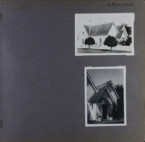
Album - Album page, St Aloysius Roman Catholic Church (Balaclava Road), Circa 1972
... ) by Andrew Ward and Associates St Aloysius is architecturally ...This photograph is part of the Caulfield Historical Album 1972. This album was created in approximately 1972 as part of a project by the Caulfield Historical Society to assist in identifying buildings worthy of preservation. The album is related to a Survey the Caulfield Historical Society developed in collaboration with the National Trust of Australia (Victoria) and Caulfield City Council to identify historic buildings within the City of Caulfield that warranted the protection of a National Trust Classification. Principal photographer thought to be Trevor Hart, member of Caulfield Historical Society. Most photographs were taken between 1966-1972 with a small number of photographs being older and from unknown sources. All photographs are black and white except where stated, with 386 photographs over 198 pages.From: Glen Eira Heritage Management Plan (1996) by Andrew Ward and Associates St Aloysius is architecturally important as an exceptionally imposing red brick church in the Early English Gothic Style from the inter-war period. Its significance, however, is compromised by the recent removal of its Pyrmont stone spire. It is locally important as a focus of Catholic worship in Caulfield.Page 23 of Photograph Album with two black and white photographs of front views of a church. There is also a photo missing on the bottom left. Hand written: 233 [above top right photo] / St Aloysius R C Church [under top right photo] / 23[bottom left]trevor hart, caulfield north, balaclava road, st aloysius, early english gothic, inter-war period, catholic church, towers, red brick -
 Glen Eira Historical Society
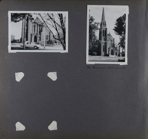
Album - Album page, St Stephen's Presbyterian Church, Balaclava Road, Circa 1972
... was £5,100. Glen Eira Heritage Management Plan 1996 by Andrew Ward St ...This photograph is part of the Caulfield Historical Album 1972. This album was created in approximately 1972 as part of a project by the Caulfield Historical Society to assist in identifying buildings worthy of preservation. The album is related to a Survey the Caulfield Historical Society developed in collaboration with the National Trust of Australia (Victoria) and Caulfield City Council to identify historic buildings within the City of Caulfield that warranted the protection of a National Trust Classification. Principal photographer thought to be Trevor Hart, member of Caulfield Historical Society. Most photographs were taken between 1966-1972 with a small number of photographs being older and from unknown sources. All photographs are black and white except where stated, with 386 photographs over 198 pages. From: Glen Eira Heritage Management Plan (1996) by Andrew Ward and Associates: In 1905, the land was vacant in Balaclava Road, north side, from Kooyong Road east to the right of way, except for one house. A block of this land was acquired by the Presbyterian community and a timber church erected there in 1910. In time, a larger church was required. After several years of fund raising led by George Kinross, a new red brick St Stephen's church was built in 1926 to the design of architects Haddon and Henderson. George Currie was the builder and the cost of construction was £5,100.Glen Eira Heritage Management Plan 1996 by Andrew Ward St Stephens has architectural importance as a noteworthy example of a Gothic Transitional design in the Arts and Crafts eclectic manner (see Stylistic Typology in National Trust's Historic Church's Study}. The facade treatment successfully combines Christian symbols with Gothic forms in the Arts and Crafts mode (comparable with Haddon's Presbyterian Church, Malvern (1906) and Haddon and Henderson's Oakleigh Church (1928). It is locally important as an example of Robert Haddon's work in Caulfield, where he also lived (4 Glenferrie St q.v.).Page 24 of Photograph Album with four black and white photographs of St Stephen's Presbyterian Church, with Balaclava Road written on the top right hand side. Three photos are of the exterior and one is a wide view of the inside towards the altar.Hand written: St Stephen's Presbyterian Church Balaclava Road [top right of page] / 24 [bottom right]trevor hart, caulfield north, balaclava road, george kinross, haddon and henderson, george currie, st stephen's, 1900's, 1920's, gothic transitional, christian symbols, arts and crafts, robert haddon, stylistic typology, gothic, presbyterian church, architects, red bricks, entrances -
 Glen Eira Historical Society
Album - Album page, St Stephen's Presbyterian Church, Balaclava Road, Circa 1972
... ) by Andrew Ward and Associates In 1905, the land was vacant ...This photograph is part of the Caulfield Historical Album 1972. This album was created in approximately 1972 as part of a project by the Caulfield Historical Society to assist in identifying buildings worthy of preservation. The album is related to a Survey the Caulfield Historical Society developed in collaboration with the National Trust of Australia (Victoria) and Caulfield City Council to identify historic buildings within the City of Caulfield that warranted the protection of a National Trust Classification. Principal photographer thought to be Trevor Hart, member of Caulfield Historical Society. Most photographs were taken between 1966-1972 with a small number of photographs being older and from unknown sources. All photographs are black and white except where stated, with 386 photographs over 198 pages. From: Glen Eira Heritage Management Plan (1996) by Andrew Ward and Associates In 1905, the land was vacant in Balaclava Road, north side, from Kooyong Road east to the right of way, except for one house. A block of this land was acquired by the Presbyterian community and a timber church erected there in 1910. In time, a larger church was required. After several years of fund raising led by George Kinross, a new red brick St Stephen's church was built in 1926 to the design of architects Haddon and Henderson. George Currie was the builder and the cost of construction was £5,100.From: Glen Eira Heritage Management Plan (1996) by Andrew Ward and Associates: St Stephens has architectural importance as a noteworthy example of a Gothic Transitional design in the Arts and Crafts eclectic manner (see Stylistic Typology in National Trust's Historic Church's Study}. The facade treatment successfully combines Christian symbols with Gothic forms in the Arts and Crafts mode (comparable with Haddon's Presbyterian Church, Malvern (1906) and Haddon and Henderson's Oakleigh Church (1928). It is locally important as an example of Robert Haddon's work in Caulfield, where he also lived (4 Glenferrie St q.v.).Page 25 of Photograph Album - four black and white photographs of St Stephen's Presbyterian Church, with two photographs in landscape mode across the top showing information about who designed the building in one and showing the church name and year founded in the other; and two in portrait mode in the bottom section showing 2 different heavy wooden doors.Hand written: 25 [bottom left]trevor hart, caulfield north, balaclava road, george kinross, haddon and henderson, george currie, st stephen's, 1900's, 1920's, gothic transitional, christian symbols, arts and crafts, robert haddon, stylistic typology, gothic, presbyterian church, architects, red brick, doors, memorials -
 Glen Eira Historical Society
Album - Album page, St Stephen's Presbyterian Church, Balaclava Road, Circa 1972
... ) by Andrew Ward and Associates In 1905, the land was vacant ...This photograph is part of the Caulfield Historical Album 1972. This album was created in approximately 1972 as part of a project by the Caulfield Historical Society to assist in identifying buildings worthy of preservation. The album is related to a Survey the Caulfield Historical Society developed in collaboration with the National Trust of Australia (Victoria) and Caulfield City Council to identify historic buildings within the City of Caulfield that warranted the protection of a National Trust Classification. Principal photographer thought to be Trevor Hart, member of Caulfield Historical Society. Most photographs were taken between 1966-1972 with a small number of photographs being older and from unknown sources. All photographs are black and white except where stated, with 386 photographs over 198 pages. From: Glen Eira Heritage Management Plan (1996) by Andrew Ward and Associates In 1905, the land was vacant in Balaclava Road, north side, from Kooyong Road east to the right of way, except for one house. A block of this land was acquired by the Presbyterian community and a timber church erected there in 1910. In time, a larger church was required. After several years of fund raising led by George Kinross, a new red brick St Stephen's church was built in 1926 to the design of architects Haddon and Henderson. George Currie was the builder and the cost of construction was £5,100.From: Glen Eira Heritage Management Plan (1996) by Andrew Ward and Associates: St Stephens has architectural importance as a noteworthy example of a Gothic Transitional design in the Arts and Crafts eclectic manner (see Stylistic Typology in National Trust's Historic Church's Study}. The facade treatment successfully combines Christian symbols with Gothic forms in the Arts and Crafts mode (comparable with Haddon's Presbyterian Church, Malvern (1906) and Haddon and Henderson's Oakleigh Church (1928). It is locally important as an example of Robert Haddon's work in Caulfield, where he also lived (4 Glenferrie St q.v.).Page 26 of Photograph Album including three black and white photographs of St Stephen's Presbyterian Church, with two photographs in portrait mode across the top showing 2 different stained glass windows from the inside; and one in landscape mode in the bottom section which appears to be a photograph of a framed photograph or drawing of the church.Hand written: St Stephen's Presbyterian Church Balaclava Road [top right] / 26 [bottom right]trevor hart, caulfield north, balaclava road, george kinross, haddon and henderson, george currie, st stephen's, 1900's, 1920's, gothic transitional, christian symbols, arts and crafts, robert haddon, stylistic typology, gothic, drawings, presbyterian church, architects, lead lights, stained glass windows