Historical information
This is a book giving information on the streets of Colac and the origins of the names. Colac is a city 150 kilometres south west of Melbourne and is a commercial centre for a major agricultural area. It is situated near the 3rd largest volcanic plain in the world and European settlement began in 1837. The book was commenced by Ian McIntosh in the 1970s and in 2005 the Colac and District Historical Society took on the project again with the major editors being Ida and Andrew McIntosh.
Significance
This book is of interest, particularly those in the Western District of Victoria, as it contains information on Colac streets, many of which were named after pioneers of the district. The book will be useful for research.
Physical description
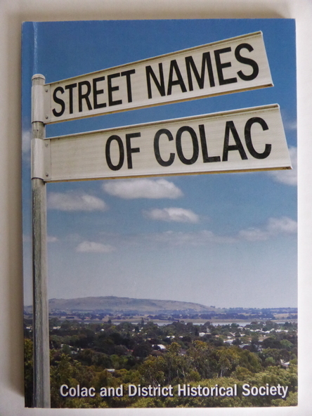
This is a soft cover book of 60 pages. The cover has a blue background and features a colour photograph (mainly in green, blue and white tonings) of a panorama of the Colac district. The photograph extends over the front and back covers. The book contains the names and name origins of Colac streets in alphabetical order and many black and white photographs. The pages have a glued binding.
Inscriptions & markings
Front Cover: ‘Street Names of Colac’
‘Colac and District Historical Society’