Showing 937 items matching " reservoir"
-
 Clunes Museum
Domestic object - GAS IRON
.1 PACKAGING. GREEN AND YELLOW CARDBOARD BOX .2 PUMPLESS AIR GAS IRON WITH METAL RESERVOIR ATTACHED AND A WOODEN HANDLE .3 SMALL METAL FUNNEL WITH WIRE MESH FILTER. .4 SMALL METAL TRIVET - TRIANGULAR SHAPE .5 SMALL METAL TIN WITH LID.5 ON BASE OF CONTAINER - BE 11domestic item, gas iron -
Tatura Irrigation & Wartime Camps Museum
Photograph, 29/10/1925
Taken by photographer for State Rivers and Water Supply Commission.Medium sized black and white photograph. Sugarloaf Reservoir / Early construction work 29/10/1925 / Horse and dray carrying bags of cement / workmen building timber frames supervised by dark suited person / Huts right of middle / Heaps of wood for use in traction engine.victorian state rivers and supply commission, sugarloaf reservoir -
Tatura Irrigation & Wartime Camps Museum
Photograph, 1910
Taken by photographer for State Rivers and Water Supply Commission.Small black and white photograph. Waranga Reservoir embankment (north end) man left of picture, looking towards narrow gauge railway line along which the beaching material is transparent from a nearby hill. Windmill left of centre and small boat and house right corner.goulburn weir, victorian state rivers and supply commission -
 Bendigo Historical Society Inc.
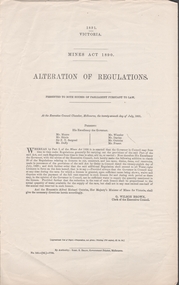
Document - MINING REPORTS - MINES ACT 1890, ALTERATION OF REGULATIONS
Printed document Mines Act 1890, Alteration of Regulations. Refers to an addition to clause 20 of the Regulations relating to licenses to cut, construct, and use races, drains, dams, and reservoirs. The additional Regulations shall extend to all Water-right Licenses. Document is part of the Albert Richardson Collection. document, gold, mining reports, mines act 1890 alteration of regulations, mr munro, mr shiels, sir f t sargood, mr duffy, mr wheeler, mr davies, mr outtrim, mr fraser, g wilson brown, robt s brain -
Tatura Irrigation & Wartime Camps Museum
Book, Water Ledger, 1928
Ledger used at State Rivers & Water Supply Commission - Rodney District, showing water discharges from Waranga and Goulburn Reservoir and Weir and channels. Also rainfall. 1928 to 1950Large book.Green cardboard cover. suede leather spine and cornersirrigation, rural, industries, irrigaiton -
 Whitehorse Historical Society Inc.
Document, David Boyle, 2024
David Boyle purchased land in Nunawading which he occupied in 1868non-fictionDavid Boyle purchased land in Nunawading which he occupied in 1868boyle david, nunawading, pioneers, horticulture -
 Federation University Historical Collection
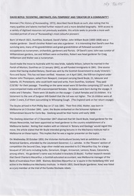
Plan, Creswick Water Supply from Bullarook to Creswick, 02/10/1869
Probably gazetted on 12 April 1872 (pg 737)Large horizontal paper plan glued in three sections to a linen backing. Coloured plan shows pipe and rack track from the Bullarook Reservoir to Albert Street, Creswick. Attached with ribbon top left are twelve pages giving bearing and lengths / descriptions of pipe and rack track. Five information boxes drawn along the bottom of plan gives extra information where pipe passes through private properties. Main heading 'Plan of Creswick Water Supply / scale eight chains to an inch / County of Talbot / Parish of Creswick'. Calculations and hand written notes in ink and pencil also on plan. Verso 'Dean Reservoir'. Signed and dated.creswick, water supply, bullurook reservoir, dean, bush inn, hesken, rivers, warner, taylor, gillard, mccormack, mcdonald, brown, naples, humbug hill sluicing co, frank rivers, w.r. taylor, j. and m. mccormack, j. mcdonald, richard brown, c. naples -
Bendigo Historical Society Inc.
Map - CAMPBELL COLLECTION: BENDIGO AND DISTRICT MAPS, 22-3-29
Map. Marong, Parishes of Marong, Lockwood and Mandurang, Scale 20 chains to 1 inch, Total area 5106 acres. Crusoe Reservoir & Viaduct and water race. Compiled in W.P.B. fro Field Survey and Parish Plans. B.W.L.22-3-29 (number 389 in map cupboard 1)B.W.L.map, bendigo, allotments -
Tatura Irrigation & Wartime Camps Museum
Photograph, Stuart Murray Canal Sign, 1890s
Taken by photographer for State Rivers and Water Supply Commission.Medium sized black and white photograph. Sign:-"STATE RIVERS AND WATER SUPPLY COMMISSION/GOULBURN IRRIGATION SYSTEM/STUART MURRAY CANAL/CONVEYS WATER FROM GOULBURN WEIR TO WARANGA RESERVOIR/DESIGNED AND CONSTRUCTED BY VICTORIAN WATER SUPPLY DEPARTMENT - 1981./STUART MURRAY M.I.C.E CHIEF ENGINEER."goulburn weir, victorian state rivers and supply commission -
Stawell Historical Society Inc
Map, Easton Johnstone, Map of Stawell Surveyed by Easton Johnstone 1872, 1872
Victoria Co Crushing Machine. St Georges Co Crushing machine. Wimmera Co Crushing Machine. Government Reservoir and Drainage. Sloan Street, Skene Street Mines. old Mine WorkingsA2 map of Stawell Reefs Area. Showing Crushing Machines & Title InfoSurveyed by Easton Johnstone Contract Surveyor. Photo-Lithographed at the Department of Lands & Survey. Melbourne By J Noone 9th May 1872mining -
 Eltham District Historical Society Inc
Document - Series Listing, Fraser Faithfull et al, Series 48: Aerial Views of Shire & Newly Completed Library, May 1994, 23 colour photographs, 2000
Series consists of colour prints measuring from 215mm x 150mm up to 255mm x 200mm. Includes views of Sugarloaf Reservoir, Petty's Orchard, Residential Areas, Shire Offices and New Library.shire of eltham archives, series listing -
 Eltham District Historical Society Inc
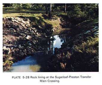
Work on paper (Sub-Item) - Photograph, Rock lining at the Sugarloaf-Preston transfer main crossing, 1976
Colour photograph of rock lining at the Sugarloaf-Preston transfer main crossing. The Sugarloaf Reservoir and the Winneke Water Treatment Plant (Winneke) are located 32 km north-east of Melbourne, near Christmas Hills. rock lining, water supply -
 Stawell Historical Society Inc
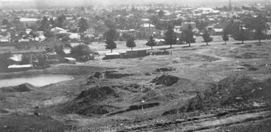
Photograph, Panorama of Stawell from Big Hill with the Stawell Water Supply Dam -- 3 Photos
Three views from Big Hill December 9th 1928 Davis Open Cut in foreground Black Range at Back. Stawell Court House with mining holes in foreground. Water Reservoir between trees. 3 Black & White photos of Stawell water supply dam taken from Big Hill.(29.11). Stawell from Big Hill Dec 9th 1928. - (29.11a) Nov 1928. L.C. Langford. - (29.11b). Stawell from Big Hill Dec 9th 1928. stawell -
 Kiewa Valley Historical Society
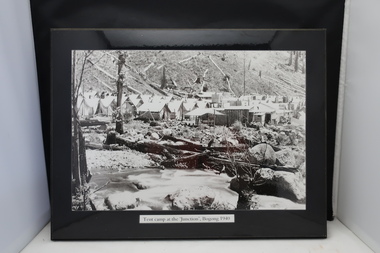
4 Photos framed - Kiewa Hydro Electric Scheme 1940s
These 4 black and white photos are very clear and are of Bogong in the 1940s when the Kiewa Hydro electric Scheme was being constructed. Bogong was the first construction site. Bogong was a township and construction site for the Kiewa Hydro Electric Scheme built by the State Electricity Commission of Victoria. These photos in the early 1940s (during WW2) tell the story of fire, flood and living conditions with the inference of transport being horses in 1940 compared with its development in 1944.1. Tent camp at the 'Junction', Bogong 1940 2. Junction Dam September 1940: floodwaters over coffer dam 3. 'Reservoir' Camp with Bogong Stables in foreground, 1940 4. Junction Dam and Bogong village in August 1944 Each photo has string attached on the back with tape - for hangingSticker on the back of each photo: 'Framing/ Colour Magic / Shop 7, Lismore Central / Carrington Street, Lismore / Phone (02) 6621 3289'bogong township 1940, junction dam 1944, reservoir camp 1940, bogong stables 1940, tent camp at bogong -
 Southern Sherbrooke Historical Society Inc.
Photograph - Puffing Billy line near The Tanks
B&W photo of the Puffing Billy line near The Tanks below Glen Park Farm. On the left is the house of the Dunham family, with shedding in the background. The land slopes down to the track then falls quite steeply away to a treed area. In the distance can be seen land which is now part of Cardinia Reservoir. -
 Bendigo Historical Society Inc.
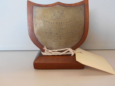
Ceremonial object - CEREMONIAL SPADE
Small wooden stand with metal plaque attached. The plaque reads: Crusoe Reservoir Sandhurst Water Works. The first sod was laid in the foundation with this spade on the 17th August 1872 by Mrs MacDougall wife of the right Worshipful the Mayor of the city of Sandhurst. Contractors: Messrs. Fishburn, Morton and Kennedy. Engineer T. Bradycivil engineering, water supply, crusoe reservoir -
 Greensborough Historical Society
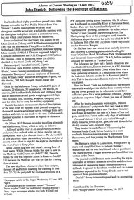
Article, John Daniels: following the footsteps of Batman, by Jan Hanslow, 11/07/2014
Discussion of John Daniels' theory that "Batman's Treaty" was signed on the southern bank of the Merri Creek in Reservoir. It follows Batman up the Maribyrnong River and his meeting with 'a native family' who took him to the Merri Creek.1 p. reprint of address at general Meeting [of Port Phillip Pioneers Group?] 11 July 2014, by Jan Hanslowbatmans treaty, john daniels, john batman, merri creek -
 Halls Gap & Grampians Historical Society
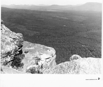
Photograph - B/W
Photo is of the "Victoria Valley" taken from around the area of Reed's Lookout. The body of water is Moora Moora Reservoir. The background range is Victoria Range. Photo is typical of promotional photos taken by Forests Commission VictoriaRocky outcrop in foreground and a large, thick tree covered valley, with mountain ranges in the background. A body of water (near top, middle) and some roads can be seen c1960sscenery, grampians ranges -
 Halls Gap & Grampians Historical Society
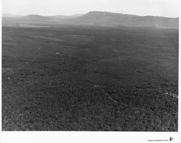
Photograph - B/W
Photo is of Victoria Valley with Moora Moora Reservoir and the Victoria Range in the background. Photo would have been taken from around Reed's lookout area. Photo typical of promotional photos of the time by Forests CommissionLarge, densely treed valley with a body of water in background. Some roads can be seen particularly right foreground. There is a mountain range in the background. c1960sscenery, grampians ranges -
 Bendigo Historical Society Inc.
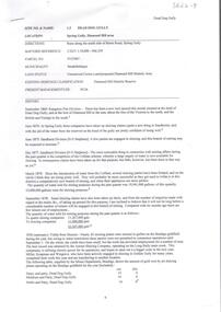
Document - DEAD DOG GULLY DIAMOND HILL
Description of the Dead Dog Gully (1.2) area on Diamond Hill, researched and described by David Bannear, two page document. Dead Dog Gully runs alongside Burns Road, Spring Gully. History of the area is given from 1860 onwards. Reference to Spring Gully Reservoir and water availability for mining in the area.bendigo, mining, dead dog gully -
Clunes Museum
Newspaper - NEWSPAPER CUTTING, THE ILLUSTRATED AUSTRALIAN NEWS
THE ABOVE PHOTOGRAPHS WERE TAKEN BY JOHN UNDERWOODPHOTOSTAT COPIES OF NEWS PAPER COLLECTION CUTTINGS FROM ILLUSTRATED AUSRALIAN NEWS. JUNE 17 th.1873. PHOTOSTAT COPY 1;RESERVOIR AND DAM OF CLUNES WATER SUPPLY. 2;SHAFT & SURFACE OF NEW NORTH CLUNES MINING CO. 3;UNDERGROUND WORKINGS OF NEW NORTH CLUNES MINING CO.17 JUNE 1878local history, document, newspaper cutting, mining -
Southern Sherbrooke Historical Society Inc.
Photograph - Set of photos of official opening of works at Cardinia Reservoir, May 1970
A set of four black and white photos of the official opening of works at Cardinia Reservoir, Narre Warren East, May 1970. The photos were taken by Edna or Mick Boothroyd of Wellington Rd, Narre Warren East and were brought by Edna to the first display of the Southern Sherbrooke Historical Society on 20th June 1993. -
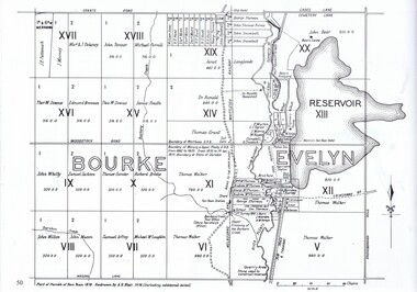 Greensborough Historical Society
Map, Dianne Edwards, Part of Parish of Yan Yean 1878, 1978
Map includes Crown Portions V - XVII, showing Yan Yean Reservoir, Melbourne-Whittlesea Railway route, names of landowners, roads and various other features west of Greensborough Road. Redrawn by A. R. Blair in 1978.1 p. black and white photocopy of mapyan yean reservoir, yan yean -
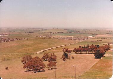 Hume City Civic Collection
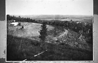
Photograph, 1980s
The photograph was taken above Reservoir Road on the lower slopes of Mt. Holden. It is looking south down Wilson's Lane towards some of the early Sunbury developments which grew around the Gap Road area in the early 1980s.A landscape coloured photograph with rounded corners. It is a panoramic view of Sunbury taken from the southern slopes of Mt. Holden. In the foreground there is a small cluster of trees and in the middle distance there is some evidence of housing development. Bald Hill can be seen on the skyline.wilson's lane, mt. holden, bald hill, sunbury, george evans collection -
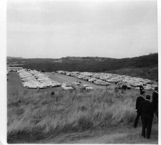 Southern Sherbrooke Historical Society Inc.
Photograph - Carpark at Cardinia Reservoir's official works opening ceremony 1970
Black and white photo showing the carpark at the Cardinia Reservoir site on the day of the official ceremony for the start of works in May 1970. Several dozen cars and one bus can be seen in the carpark, and groups of people are gathered there. In the foreground members of the official party can be seen. Between them and the carpark is a wide strip of long grass. -
 Bendigo Historical Society Inc.
Document - Digital, JOSEPH BRADY COLLECTION: CD J M BRADY BENDIGO WATER WKS CRUSOE RES CONTRACT BOOK 1870 TO 1975
EMTEC 80 min/700MB CD-R recordable disc with 'J. M. Brady Bendigo Water Wks Crusoe Res Contract Book 1870 - 75 handwritten on the front. Contained in an orange plastic cover. See also 8137.1 - Joseph Brady's notebook on the construction of the Crusoe Reservoir, Bendigo, stored in Box 690.civil engineering, water supply, cd - j m brady - bendigo water wks crusoe res contract book 1870 - 75, emtec 80 min/700mb cd-r recordable -
 Greensborough Historical Society
Document - Report, Rhys Coleman, The Health of the Plenty River Catchment 1999, 1999_09
Report prepared by Rhys Coleman for Waterways and Drainage, Melbourne Water Corporation, discusses the health of the Plenty River catchment from upstream of Toorourrong Reservoir, through Whittlesea and Mernda, South Morang and Plenty to Greensborough and confluence with the Yarra River.31 p., tables.plenty river, melbourne water corporation -
 Flagstaff Hill Maritime Museum and Village
Pen Nibs, 1920's
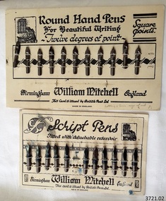
The two cards of nibs are retail display cards of the dip pen nibs that William Mitchell Calligraphy produced, dating back to around the 1920’s, which was the time of the Great Exhibition in the UK. At that time dip pens with steel nibs were the main writing instruments. British Pens Ltd. had recently formed as a company and its subsidiaries included the the company William Mitchell, which is why British Pens Ltd. is named on the cards as well. One card (1) has the Round Hand nib, which is widely used today for calligraphy scripts. The other card (2) has the Script nib that has round upturned points for monocline or unshaded lettering that is also used for calligraphy. The nibs also have a detachable reservoir. The pen nibs are shaped to fit into a slot in the base of a wooden or Bakelite pen holder. The hole at the front of the nib is for collecting ink from a well, which is then stored in a reservoir at the back of the nib. The nibsare stamped with their nib size and Pedigree (what type of nib it is) and maker’s details. William Mitchell Calligraphy still makes these nibs today with a slightly difference finish. (ref: Sales and Marketing Director of William Mitchell Calligraphy in 2016). HISTORY of the Ink Pen Quills and ink were common writing tools until the early 19th century when the pen trade began mass producing steel nibs and pens. The steel nibs each have a hole in the middle that acts like a well for the ink. When the nib is dipped into the ink well the writer needs to ensure that it is dipped to only just past that well. India Ink was one of the most popular inks used with the nib pens, notable for its satin-like smooth flow. This ink is composed of a particularly fine carbon mixed with water; it can also be obtained as a dry stick that is then crushed and mixed with water as required. The Jewellery Quarter of Birmingham had the largest concentration of independent jewellers in Europe. Birmingham became the centre of the world’s pen trade for many years -, during the 1800’s over 100 factories, employing 1000s of skilled workers, manufactured the ‘Birmingham Pen’. ABOUT WILLIAM MITCHELL CALLIGRAPHY LTD.* (*The following text is quoted from the William Mitchell Calligraphy website) British based William Mitchell Calligraphy has been designing and manufacturing exceptional pens for almost 200 years. The William Mitchell heritage in making pen nibs began whilst working with his brother John Mitchell in the early 1820s. William Mitchell established his own business in 1825 to become one of the leading nib manufacturers and famous for lettering pens. Almost 100 years later William Mitchell merged with Hinks, Wells & Co, another pen manufacturer, to form British Pens, employing around 1000 people in the Bearwood Road area of Birmingham. During the early 1960s British Pens acquired the pen business of other pen manufacturers Perry & Co and John Mitchell, once again reuniting the two brothers. Joseph Gillott, who were famous for their artist drawing and mapping nibs, amalgamated with British pens in 1969. William Mitchell and Joseph Gillott established in Birmingham during the early part of the nineteenth century and [their products] are still proudly made here. British Pens were subsequently purchased by its current owner Byron Head, the owner of William Mitchell (Sinkers) in 1982, and was subsequently renamed William Mitchell (calligraphy) Ltd. Established in 1827 Joseph Gillott was one of the pioneers of mass steel pen nib manufacturing. The company was particularly strong in the American market, prompting Elihu Burrit, the American consul, to write “In ten thousand school houses across the American continent between two oceans, a million children are as familiarly acquainted with Joseph Gillott as with Noah Webster” (The compiler of the famous American dictionary). The company consequently received visits from many notable Americans, including president Ulysses S Grant. The early 19th century invention and mass production of pen nibs such these in our collection had a large impact on education and literacy because the nibs could be produced in great numbers and affordable prices.Pen nibs; 2 cards of steel dip pen nibs from the 1920’s. The steel nibs are attached to cards by 2 rows of entwined cotton cord. Reverse sides of cards have some hand written marks. Manufacturer; William Mitchell, Birmingham, England. Card issued by British Pens Ltd. Nibs have shaped ends, a hole in the centre with a well on the underside, and the tops are shaped approximately quarter circle. Inscriptions are pressed into each nib. The script pens have detachable reservoirs made of a metal different to the nib. (Card 1) Round Hand Pens, 11 nibs remain from card of 12. Printed on card “Round Hand Pens for Beautiful Writing, Twelve degrees of point, Square points. William Mitchell, Birmingham, England. This card is issued by British Pens Ltd. MADE IN ENGLAND” Also printed on top left of card is a pen drawing of a person writing at a desk, background of decorative 3-paned window in brick wall. (Card 2) Script Pens; 11 nibs remain from card of 12. “Script pens fitted with detachable reservoir. William Mitchell, Birmingham, England. This card is issued by British Pens Ltd. MADE IN ENGLAND” Also printed on top right of card is a pen drawing of a person writing at a desk, background of decorative 3-paned window in brick wall. On Card 1, - each nib is stamped with its size, and “Wm MITCHELLS / PEDIGREE / ROUND HAND / ENGLAND” - hand written on front bottom of card in ball point pen “Lettering 5 times size of nib” - hand drawn on back of card in red and blue ball point pen are scribbled lines On Card 2 - each nib is stamped with its size, and “WILLIAM / MITCHELLS / SCRIPT PEN / ENGLAND” - a black circle corresponding to the nib is printed on the card above each nib. - hand written on back of card in black felt tip pen are numerals - hand drawn on back, 4 parallel lines in red ball point pen with the numbers “10” between 2 of the lines flagstaff hill, warrnambool, shipwrecked coast, flagstaff hill maritime museum, maritime museum, shipwreck coast, great ocean road, william mitchell calligraphy ltd, british pens ltd., pen nib, writing implement, dip pen, round hand nib, script nib, birmingham manufacturer, communication in writing, mass produced pen nibs -
 Bendigo Historical Society Inc.
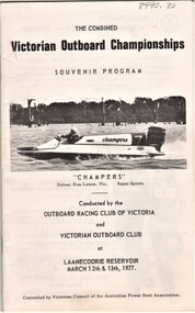
Document - AULSEBROOK COLLECTION: VICTORIAN OUTBOARD CHAMPIONSHIPS 1977 PROGRAM, 1977
Aulsebrook Collection: The Combined Victorian Outboard Championships -Conducted by the Outboard racing Club of Victoria and Victorian Outboard Club at Laanecoorie Reservoir: March 12th - 13th, 1977 -Extensive booklet for a racing program: ads, information for event, lists of drivers and events taking place and images of drivers. -A5 booklet, 14 pages, typed and photorgaphs -
Tatura Irrigation & Wartime Camps Museum
Photograph, 24/3/1917
Taken by photographer for State Rivers and Water Supply Commission.Medium sized black and white photograph. Sugarloaf Reservoir construction of core wall and tower / Rail trucks on single line bottom centre / Traction engine and pump in timber shed lower right / Horses and carts on bank beside upper dams/ words printed:"Upper Dam Core Wall , Bed Rock, Lower Dam."victorian state rivers and supply commission, sugarloaf reservoir