Showing 560 items matching " northcote"
-
 Melbourne Tram Museum
Photograph - Set of 11 Black and White photograph, Ken Flood, 18/04/1974 12:00:00 AM
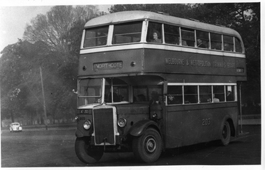
... Set of 11 black and white photographs sent to Keith Kings received from Ken Flood 4/6/1975. .1 - Bus No 203 1940 Leyland TD5c - Turning from Nicholson Street into Gertrude Street. - bound for Northcote. .2 - Bus No 201 1940 Leyland TD5c - In Nicholson Street at Albert Street - Photo. bound for Northcote .3.- Bus No 492 1943 Ford Austerity - at Queens Pde Clifton Hill - Note the Pram and Passenger bus sign by the front doorway. ...Melbourne Tram Museum 8 Wallen Road Hawthorn melbourne Trams tramways Buses Double Deck Buses Prams MMTB Buses Austerity buses W2 class tram 305 Bus 203 bus 201 bus 492 bus 365 bus 500 bus 19 bus 143 bus 9 bus 4 bus 150 Leyland Ford Motor Company TD5c class OPS1 class OPS4 class TS8c class Cub class TS11c class On rear of the photos in ink; .1 - MMTB 203 9/6/49 - K Flood .2 - MMTB 201 - 9/6/49 - K Flood .3 - MMTB Ford #492 - K Flood .4 - MMTB #365 - K Flood .5 - MMTB #325 - K Flood .6 - MMTB #500 Pt Ormond 6/6/49 - K Flood .7 - MMTB #19 9/6/49 - K Flood .8 - MMTB #143 - K Flood .9 - MMTB #4 9/6/49, K Flood .10 - MMTB #4 9/6/49, K Flood .11 - MMTB #150 - K Flood Set of 11 black and white photographs sent to Keith Kings received from Ken Flood 4/6/1975. .1 - Bus No 203 1940 Leyland TD5c - Turning from Nicholson Street into Gertrude Street. - bound for Northcote. .2 - Bus No 201 1940 Leyland TD5c - In Nicholson Street at Albert Street - Photo. bound for Northcote .3.- Bus No 492 1943 Ford Austerity - at Queens Pde Clifton Hill - Note the Pram and Passenger bus sign by the front doorway. ...Set of 11 black and white photographs sent to Keith Kings received from Ken Flood 4/6/1975. .1 - Bus No 203 1940 Leyland TD5c - Turning from Nicholson Street into Gertrude Street. - bound for Northcote. .2 - Bus No 201 1940 Leyland TD5c - In Nicholson Street at Albert Street - Photo. bound for Northcote .3.- Bus No 492 1943 Ford Austerity - at Queens Pde Clifton Hill - Note the Pram and Passenger bus sign by the front doorway. Photo not dated. .4 - Bus No 365 1948 OPS1 - Nicholson Street at Victoria Pde. bound for East Brunswick. Photo not dated. .5 - Bus No 325 1950 OPS4 - Nicholson Street at Victoria Pde. bound for East Brunswick. Photo not dated. Bus did not enter service until 1950. .6 - Bus No 500 1943 Ford Austerity - Marine Pde. Point Ormond. Note the Pram bus sign by the front door. .7 - Bus No 19 1938 Leyland Cub (diesel) with Preston Workshops body. - Lonsdale Street at William Street. W2 No 305 passes behind the bus. Late 1940's photo. .8 - Bus No 143 1940 Leyland TS8c drop enter - in Russell Street at LaTrobe Street bound for North Kew. (Belford Road via Collingwood). Photo not dated. .9 - Bus No 9 1938 Leyland Cub (diesel) with Preston Workshops body. - in Russell Street at LaTrobe Street bound for North Carlton .10 - Bus No 4 1938 Leyland Cub (Diesel) with Preston Workshops body - in Lonsdale Street at William Street. note destination not reset for the return trip. .11 - Bus No 150 1940 Leyland TS11c Drop enter - Nicholson Street at Victoria Pde. Photo not dated. Most of the photos dated 9/6/1949 unless noted otherwise. Notes on photos provided by Rod Atkins - see htd5860doc.pdfOn rear of the photos in ink; .1 - MMTB 203 9/6/49 - K Flood .2 - MMTB 201 - 9/6/49 - K Flood .3 - MMTB Ford #492 - K Flood .4 - MMTB #365 - K Flood .5 - MMTB #325 - K Flood .6 - MMTB #500 Pt Ormond 6/6/49 - K Flood .7 - MMTB #19 9/6/49 - K Flood .8 - MMTB #143 - K Flood .9 - MMTB #4 9/6/49, K Flood .10 - MMTB #4 9/6/49, K Flood .11 - MMTB #150 - K Floodtrams, tramways, buses, double deck buses, prams, mmtb buses, austerity buses, w2 class, tram 305, bus 203, bus 201, bus 492, bus 365, bus 500, bus 19, bus 143, bus 9, bus 4, bus 150, leyland, ford motor company, td5c class, ops1 class, ops4 class, ts8c class, cub class, ts11c class -
 Melbourne Tram Museum
Pamphlet, Yarra Trams, Buses Replace Trams - Routes 58, 59, 86 and 96, 2022
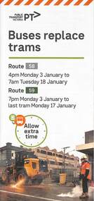
... ...Northcote...Mt Alexander Road tram works track work Route 58 Route 59 Yarra Trams PTV Essendon Tram Depot route 86 route 96 nicholson st Merri Creek Bridges Carlton super stops trams tramways Northcote .1 - Pamphlet - DL, four fold printed on off white paper titled - Buses Replace Trams - Route 58 and Route 59 - Jan 2022 .2 - Project sheet - 3 A4 sheets, titled "Renewal works: Essendon Depot and Mt Alexander Road - 3.1 to 18.1.2022. .3 - Pamphlet - DL 3 fold, Buses Replace Trams, route 86, November 2021 - Merrit Creek Bridge works .4 - Pamphlet - DL - 4 fold, Buses Replace Trams, route 96, January 2020 - Nicholson St works for tram super stops. ....1 - pamphlet provided at tram stops giving details of the works and bus services for routes 58 and 59 .2 - Project document describing the work and dates - downloaded from the Yarra Trams website after buses were used to replace route 58 from the Royal Children's Hospital rather than from Royal Park Station as originally planned. .3 - as for .1 - for the upgrading of the Merri Creek Bridge - route 86 - see also Reg Item 6066 .4 - as for .1 - for the installation of superstops in Nicholson St between Elgin St and Holden St - route 96Shows the methods that Yarra Trams customers are advised of changes due to track replacement works..1 - Pamphlet - DL, four fold printed on off white paper titled - Buses Replace Trams - Route 58 and Route 59 - Jan 2022 .2 - Project sheet - 3 A4 sheets, titled "Renewal works: Essendon Depot and Mt Alexander Road - 3.1 to 18.1.2022. .3 - Pamphlet - DL 3 fold, Buses Replace Trams, route 86, November 2021 - Merrit Creek Bridge works .4 - Pamphlet - DL - 4 fold, Buses Replace Trams, route 96, January 2020 - Nicholson St works for tram super stops.mt alexander road, tram works, track work, route 58, route 59, yarra trams, ptv, essendon tram depot, route 86, route 96, nicholson st, merri creek, bridges, carlton, super stops, trams, tramways, northcote -
 Melbourne Tram Museum
Document - Research Notes, H. S. McComb, "Orders in Council - Relating to Bridges", c1930
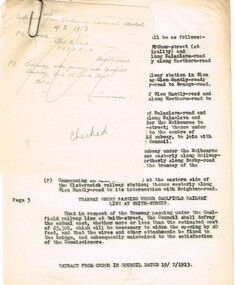
... Type and hand written notes, on quarto or scrap paper about Orders in councils relating to Melbourne Tramway bridges - 17 sets of notes, each retained by a paper clip. 1 - Caulfield line at Smith St 2 - Church St Bridge Act 3 - Spencer St Bridge Act 4 - Melbourne to Burwood Tramways Act 5 - Footscray Tramway Act 6 - Fitzroy Northcote and Preston Tramways Act 7 - Hawthorn - Under line at Burwood and over line at Burnley 8 - Burke Road Camberwell 9 - St Kilda rail line at Kerford Road 10 - High St Deepdene - Fairfield to Deepdene line. 11 - Glenferrie - Glenferrie Road 12 - Prahran and Malvern Act 13 - Brunswick and Coburg Tramways Act 14 - PMTT - Caulfield and Sandringham rail lines 15 - Glenferrie and Wattletree road and rail lines 16 - Commercial Road and rail crossings 17 - MMTB Act 1928 - various provisions...Melbourne Tram Museum 8 Wallen Road Hawthorn melbourne Trams tramways Bridges PMTT MMTB Glenferrie Rd Camberwell HTT MBCTT FTT FNPTT Railways Type and hand written notes, on quarto or scrap paper about Orders in councils relating to Melbourne Tramway bridges - 17 sets of notes, each retained by a paper clip. 1 - Caulfield line at Smith St 2 - Church St Bridge Act 3 - Spencer St Bridge Act 4 - Melbourne to Burwood Tramways Act 5 - Footscray Tramway Act 6 - Fitzroy Northcote and Preston Tramways Act 7 - Hawthorn - Under line at Burwood and over line at Burnley 8 - Burke Road Camberwell 9 - St Kilda rail line at Kerford Road 10 - High St Deepdene - Fairfield to Deepdene line. 11 - Glenferrie - Glenferrie Road 12 - Prahran and Malvern Act 13 - Brunswick and Coburg Tramways Act 14 - PMTT - Caulfield and Sandringham rail lines 15 - Glenferrie and Wattletree road and rail lines 16 - Commercial Road and rail crossings 17 - MMTB Act 1928 - various provisions "Orders in Council - Relating to Bridges" Document Research Notes H. ...Type and hand written notes, on quarto or scrap paper about Orders in councils relating to Melbourne Tramway bridges - 17 sets of notes, each retained by a paper clip. 1 - Caulfield line at Smith St 2 - Church St Bridge Act 3 - Spencer St Bridge Act 4 - Melbourne to Burwood Tramways Act 5 - Footscray Tramway Act 6 - Fitzroy Northcote and Preston Tramways Act 7 - Hawthorn - Under line at Burwood and over line at Burnley 8 - Burke Road Camberwell 9 - St Kilda rail line at Kerford Road 10 - High St Deepdene - Fairfield to Deepdene line. 11 - Glenferrie - Glenferrie Road 12 - Prahran and Malvern Act 13 - Brunswick and Coburg Tramways Act 14 - PMTT - Caulfield and Sandringham rail lines 15 - Glenferrie and Wattletree road and rail lines 16 - Commercial Road and rail crossings 17 - MMTB Act 1928 - various provisionstrams, tramways, bridges, pmtt, mmtb, glenferrie rd, camberwell, htt, mbctt, ftt, fnptt, railways -
 Marysville & District Historical Society
Book, James Semple, The Self-Interpreting Family Bible, 1800's
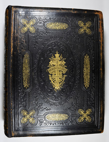
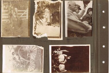
... ./ Station Victoria 3rd June 1870 Florence Victoria Beaver,/ born at Northcote, Melbourne/ Victoria, 24th May, 1871 Gertrude Mary Beaver./ born at Carlton, Melbourne/ Victoria. 8th June 1873 Walter Benjamin Beaver,/ born at Northcote/ Melbourne, Victoria, 7th Feby 1876 Clara Margaret Beaver/ born at Northcote, Melb/ Victoria, 4th April 1877 Herbert William Beaver/ born at Yarraville Refy. ..../ Station Victoria 3rd June 1870 Florence Victoria Beaver,/ born at Northcote, Melbourne/ Victoria, 24th May, 1871 Gertrude Mary Beaver./ born at Carlton, Melbourne/ Victoria. 8th June 1873 Walter Benjamin Beaver,/ born at Northcote/ Melbourne, Victoria, 7th Feby 1876 Clara Margaret Beaver/ born at Northcote, Melb/ Victoria, 4th April 1877 Herbert William Beaver/ born at Yarraville Refy. ...The Batchelor family Bible. The Batchelor Family were early residents of Taggerty.Leather bound with decorative embossing with some in gold on covers and spine.non-fictionThe Batchelor family Bible. The Batchelor Family were early residents of Taggerty.bible, batchelor family, taggerty -
 Federation University Historical Collection
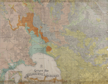
Map, Geological Map of Ascot, 1937, 1937
... ...northcote...Barker Library (top floor) Mount Helen goldfields melbourne geological geology caulfield brighton box hill camberwell richmond prahran st kilda brunswick coburg keilor braybrook kew hawthorn northcote williamstown south melbourne Coloured plan of Melbourne and suburbs. ...Coloured plan of Melbourne and suburbs.melbourne, geological, geology, caulfield, brighton, box hill, camberwell, richmond, prahran, st kilda, brunswick, coburg, keilor, braybrook, kew, hawthorn, northcote, williamstown, south melbourne -
 Eltham District Historical Society Inc
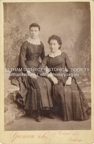
Photograph, Possibly Caroline Shillinglaw on left and sister Margaret Shillinglaw, c.1884
... She was born at Northcote March 3, 1856 and died at North Fitzroy September 7, 1933. ...She was born at Northcote March 3, 1856 and died at North Fitzroy September 7, 1933. ...Caroline Shillinglaw was born at Plenty, October 6, 1863. She died at the Shillinglaw family cottage 'Wattle Brae' in Eltham April 11, 1947. Caroline never married and was the youngest of Phillip Shillinglaw's siblings. Margaret Shillinglaw was William and Jean Shillinglaw's ninth child. She was born at Northcote March 3, 1856 and died at North Fitzroy September 7, 1933. She never married. Yeoman & Co operated at 47 Chapel St., Prahran from 1883 to 1889. The fashion depicted is typical of mid 1880s. CABINET 1866-1905 The Cabinet photo was introduced in 1866 in answer to a demand for a larger format photograph which could be mounted for a cabinet or on the wall. They were 4.5 inches by 6.5 inches (11.5 x 16.5 cm), more than twice the size of the cdv. They cost about twice as much as a cdv but eventually displaced them. They were not extensively produced until 1880 and had ceased by 1905. Coloured mounts, especially maroon or green, indicate a date between 1880 and 1890. - Frost, Lenore; Dating Family Photos 1850-1920; Valiant Press Pty. Ltd., Berwick, Victoria 1991cabinet photo, marg ball collection, shillinglaw family photo album 3, 1883-1889, 1884, caroline shillinglaw (1863-1947), margaret shillinglaw (1856-1933), unknown, yeoman & co photographer 47 chapel st prahran -
 Melbourne Tram Museum
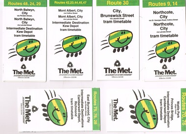
Ephemera - Timetable, The Met, Set of 7 Tram Timetables - The Met, 1986
... Provides a map, description of route, time points, timetable, ticketing information (Travel cards and Neighbourhood tickets). .1 - Routes 9 and 14 - Northcote City both via Collins St and Latrobe St. - 13/4/1986 .2 - Route 30 - City - Brunswick St via Latrobe St - 24/3/1986. .3 - Routes 42, 23, 33, 45 and 47 - Mont Albert both via Collins St and Latrobe St. and Kew Depot - 12/2/1986 .4 - Routes 48, 24 and 29 North Balwyn both via Collins St and Latrobe St. and Kew Depot - 24/3/1986 .5 - Routes 70 and 76 - Wattle Park and Camberwell Depot - 24/3/1986. .6 - Route 76, 76 and 28 - East Burwood - City, Camberwell Depot and Richmond - 24/3/1986 .7 - Route 96, 97 and 95 - East Brunswick - 24/3/1986...Provides a map, description of route, time points, timetable, ticketing information (Travel cards and Neighbourhood tickets). .1 - Routes 9 and 14 - Northcote City both via Collins St and Latrobe St. - 13/4/1986 .2 - Route 30 - City - Brunswick St via Latrobe St - 24/3/1986. .3 - Routes 42, 23, 33, 45 and 47 - Mont Albert both via Collins St and Latrobe St. and Kew Depot - 12/2/1986 .4 - Routes 48, 24 and 29 North Balwyn both via Collins St and Latrobe St. and Kew Depot - 24/3/1986 .5 - Routes 70 and 76 - Wattle Park and Camberwell Depot - 24/3/1986. .6 - Route 76, 76 and 28 - East Burwood - City, Camberwell Depot and Richmond - 24/3/1986 .7 - Route 96, 97 and 95 - East Brunswick - 24/3/1986 Set of 7 Tram Timetables - The Met Ephemera Timetable The Met ...Set of 7 Tram Timetables, Printed fold out timetable for various tram routes, published by The Met. Provides a map, description of route, time points, timetable, ticketing information (Travel cards and Neighbourhood tickets). .1 - Routes 9 and 14 - Northcote City both via Collins St and Latrobe St. - 13/4/1986 .2 - Route 30 - City - Brunswick St via Latrobe St - 24/3/1986. .3 - Routes 42, 23, 33, 45 and 47 - Mont Albert both via Collins St and Latrobe St. and Kew Depot - 12/2/1986 .4 - Routes 48, 24 and 29 North Balwyn both via Collins St and Latrobe St. and Kew Depot - 24/3/1986 .5 - Routes 70 and 76 - Wattle Park and Camberwell Depot - 24/3/1986. .6 - Route 76, 76 and 28 - East Burwood - City, Camberwell Depot and Richmond - 24/3/1986 .7 - Route 96, 97 and 95 - East Brunswick - 24/3/1986trams, tramways, timetables, tickets, tram services, route 9, route 14, latrobe st, la trobe st, kew depot, route 30, route 42, route 23, route 44, route 45, route 47, route 48, route 24, route 29, route 70, route 76, route 75, route 28, route 96, route 97, route 95, camberwell depot -
 Eltham District Historical Society Inc
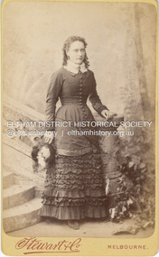
Photograph, Stewart & Co, Possibly Margaret Shillinglaw, c.1882
... She was born at Northcote March 3, 1856 and died at North Fitzroy September 7, 1933. ...She was born at Northcote March 3, 1856 and died at North Fitzroy September 7, 1933. ...Margaret Shillinglaw was William and Jean Shillinglaw's ninth child. She was born at Northcote March 3, 1856 and died at North Fitzroy September 7, 1933. She never married. Stewart & Co operated from 217 Bourke St., East from 1871 to 1876 and from 217-219 from 1877 to 1889. Other locations included 42, 284 and 286. Overall, they operated in Melbourne from 1871 through at least 1910 though Carte-de-Visite photos were superseded by 1890. According to Lenore Frost's book, Dating Family Photos 1850-1920, the swathes of contrasting fabric across her abdomen is a peculiarity of 1882. CARTE-DE-VISITE (cdv) 1857-1890 Cartes-de-visite (cdv's) are the most common form of photograph from the nineteenth century, generally measuring two and a half inches by four and an eighth inches (6.3 x 10.5 cm) when mounted, sepia toned, mounted on a card which was generally printed with the photographer's name and address on the back or beneath the portrait. - Frost, Lenore; Dating Family Photos 1850-1920; Valiant Press Pty. Ltd., Berwick, Victoria 1991marg ball collection, shillinglaw family photo album 1, 1871-1890, 1882, margaret shillinglaw (1856-1933), stewart & co photographers melbourne, unknown -
 University of Melbourne, Burnley Campus Archives
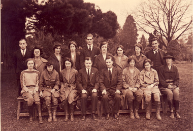
Photograph - Black and white and sepia prints and negatives, C.J. Frazer, Students and Staff. Mr. Rae on the Long Border, 1922-1923
... , Violet Warren?, Miss Northcote, Mr. Rae, ?, Kathie Clark (Tas), Dorothy Allender, Mrs Hedges (Kathleen Curry married Charles Fryer ex-Longerenong student. ..., Violet Warren?, Miss Northcote, Mr. Rae, ?, Kathie Clark (Tas), Dorothy Allender, Mrs Hedges (Kathleen Curry married Charles Fryer ex-Longerenong student. ...1 copy used in a display in Burnley Library Nov 1995. Note by T.H. Kneen 4 December 1991, "1922 or 3 Back Row (L to R): Fred Sala, Kath Keynes, Miss Pye (Parttime), ?,Fred Gillespie, Clara Broadhurst, Jean Borrett, Kathleen Curry, Alex Jessep. Front Row: Joan Anderson?, Violet Warren?, Miss Northcote, Mr. Rae, ?, Kathie Clark (Tas), Dorothy Allender, Mrs Hedges (Kathleen Curry married Charles Fryer ex-Longerenong student. Together they established Fryer's Nursery in Glenferrie Rd., Hawthorn." (4) 2 copies of photograph, 1 on reverse, "1922 Mr Rae Principal c.1923." Stamp, "Burnley Horticultural College Swan Street, Richmond, Victoria. Photographer was C.J. Frazer, Melbourne (embossed). This photograph appears as an illustration in, "Green Grows Our Garden," A.P. Winzenried, p68. The caption states, "Alex Jessep (sic) admiring an Umbrella Palm from Lord Howe Island near the herbaceous border along the orchard fence." Note by T.H. Kneen 11 December 1991, "Location is the pathway along the Long Border adjoining the Orchard fence. "(1) 2 black and white negatives joined. (2) The 2 negatives developed. (3) 3 copies Group photograph of Students and Staff some seated on a bench and some standing behind.. (4) 2 copies sepia photograph Mr Rae , Principal, on the Long Border (looks like the Orchard Border).On reverse of 1 copy, "1922 Mr Rae Principal, c.1923 Mr. Alex Jessep Lecturer in Botany & Chemistry."Stamp" Burnley Horticultural College Swan Street, Richmond, Victoria."students, staff, mr rae, principal, a.w jessep, lecturer, botany, chemistry, burnley horticultural college, fred sala, kath keynes, miss pye, clara broadhurst, jean borrett, kathleen curry, joan anderson, violet warren, kathie clark, dorothy allender, mrs hedges, charles fryer, fryer's nursery, hawthorn, mr rae principal, c.j. frazer, umbrella palm, lord howe island, herbaceous border, r. fred gillespie, miss northcote, orchard border -
 Melbourne Tram Museum
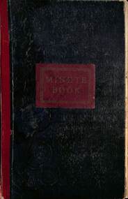
Document - Minute book - Cable tram operational history notes and records, Melbourne & Metropolitan Tramways Board (MMTB), up to 1930
... Richmond Fitzroy Fitzroy and South Melbourne line Victoria St Clifton Hill Nicholson St Exhibition (route or line) Brunswick Royal Park Carlton Prahran Toorak' Queensberry St North Carlton Esplanade with details on bus services Windsor St Kilda (Brighton Road) North Melbourne West Melbourne' South Melbourne Port Melbourne' Northcote Kew (horse) Elsternwick (electric) At rear of book is four page document that gives information on the electric tram system, routes, cable. fares and first and last services for each line. ...Richmond Fitzroy Fitzroy and South Melbourne line Victoria St Clifton Hill Nicholson St Exhibition (route or line) Brunswick Royal Park Carlton Prahran Toorak' Queensberry St North Carlton Esplanade with details on bus services Windsor St Kilda (Brighton Road) North Melbourne West Melbourne' South Melbourne Port Melbourne' Northcote Kew (horse) Elsternwick (electric) At rear of book is four page document that gives information on the electric tram system, routes, cable. fares and first and last services for each line. ...Compiled by an unknown person as a record book of cable tram operational tickets or fare history for each location with general notes and some notes on electric trams. Pages 1 to 23 and pages 123 and 124 - General history of cable and electric trams with notes on tickets, trams, buses, events, and operational management. Compiled through to 26/10/1930, with some loose notes about the final closure of the cable tram system. For each cable tram car house (depot), Power House or Winding house, or route, notes on tickets, dates, rope speed, fares, replacement electric services or buses. Richmond Fitzroy Fitzroy and South Melbourne line Victoria St Clifton Hill Nicholson St Exhibition (route or line) Brunswick Royal Park Carlton Prahran Toorak' Queensberry St North Carlton Esplanade with details on bus services Windsor St Kilda (Brighton Road) North Melbourne West Melbourne' South Melbourne Port Melbourne' Northcote Kew (horse) Elsternwick (electric) At rear of book is four page document that gives information on the electric tram system, routes, cable. fares and first and last services for each line. Mid 1920s as the West Coburg service noted. Yields information Melbourne cable tram fares, ticket issuing and general history of the MMTB.Book - heavy card covers with paper imitation leather finish with red tape on left hand side and labelled "Minute Book", bound with 8 sewn sections, approx 200 foolscap pages, ruled sheets, numbered in pencil from 1 to 124 used to record information in ink.tramways, cable trams, fares, tickets, electric trams, melbourne, mmtb -
 Uniting Church Archives - Synod of Victoria
B&W photo of another photo or newspaper photograph of Pastor Sir Douglas Nicholls, Undated
... He signed with the Northcote Victorian Football Association team, despite his nervousness about his Aboriginality, and was given a job with Northcote City Council. ...He signed with the Northcote Victorian Football Association team, despite his nervousness about his Aboriginality, and was given a job with Northcote City Council. ...Sir Douglas Ralph Nicholls (1906-1988), footballer, pastor, activist and governor, was born on 9 December 1906 at Cummeragunja Aboriginal mission, New South Wales, fifth child of Herbert Nicholls, seasonal worker, and his wife Florence, née Atkinson. Doug grew up at Cummeragunja, on the Murray River near Barmah, in its golden years of Aboriginal autonomy. Thomas Shadrach James gave him and other Yorta Yorta children a sound primary education, reinforcing the pride and self-assurance gained from their parents. As Doug grew, so too did the powers of the State’s Aboriginal Protection Board. Doug’s elder sister Hilda was removed about 1915. When Doug reached 14, he was moved off under the Aborigines Protection Act (1909) to find work. He took a job with dredging teams constructing levees on the Murray. Like other youths in the region Nicholls played Australian rules football, emulating kinsmen who had won local premierships since the 1890s. Doug and his brother Herbert (‘Dowie’) played with Tongala in the mid-1920s. Melbourne football beckoned, Doug trying out unsuccessfully for Carlton in 1927. He signed with the Northcote Victorian Football Association team, despite his nervousness about his Aboriginality, and was given a job with Northcote City Council. ‘Dowie’ joined him for a season. Doug was short at 5 ft 2 ins (158 cm), but muscular and lightning fast. He competed regularly during a boom in professional running, winning many heat and place prizes. In 1929 he won the Nyah and Warracknabeal gifts, earning a sash and £100 in each, together with a case of cutlery in the latter. Using his speed on the wing for Northcote, he produced great spring and agility from his compact body. The Sporting Globe reported in 1929 that ‘he flashes through packs of big men, whisks around small men . . . and attempts marks at the back of any six-footer’. In front-on clashes he was flattened only to rise again. The sole Aborigine in the VFA, he was known affectionately as the ‘flying Abo’ but called worse by his opponents’ barrackers. He competed for five seasons, being named ‘best and fairest’ twice, appearing in three association grand finals and winning in 1929. Keen to earn more than a seasonal wage, in 1931 Nicholls accepted a three-year contract with Jimmy Sharman’s travelling boxing show. The bouts matched opposites, local against tent boxer, white against black, and sometimes men of different sizes. He faced stiff competition from those who wanted to best the noted Melbourne black footballer, the crowd adding racial abuse. A far better footballer than boxer, he copped some punishment. Fighting in the Melbourne Stadium in December 1931, he was described by Truth as ‘slow and awkward’, but packing a ‘good wallop’. In 1932 Sharman, who treated his boxers fairly, released Nicholls to join the Fitzroy Victorian Football League team, which agreed to employ him as its groundsman. He played fifty-four games for Fitzroy over six seasons until knee trouble forced him out in 1937. Winning cups in 1934 and 1935, he played alongside Haydn Bunton and Wilfred (‘Chicken’) Smallhorn. Grand finals eluded him but he represented Victoria twice. Following his mother’s death, Nicholls revisited the Church of Christ chapel in Northcote, where they had worshipped together. On 17 July 1932 he experienced a conversion. He was soon baptised and witnessed openly, leading his fellow footballers to occasional church parades. Nicholls exhibited leadership qualities. William Cooper, founder of the Australian Aborigines’ League and Nicholls’ Yorta Yorta kinsman and fellow Christian, encouraged the young footballer. In February 1935 Cooper, Nicholls and others lobbied Thomas Paterson, the Commonwealth minister for the interior, over the need for Federal control of Aboriginal affairs. Nicholls attended the Day of Mourning protest for Aborigines held in Sydney on 26 January 1938, declaring: ‘after 150 years our people are still influenced and bossed by white people. I know we can proudly hold our own with others if given the chance’. When Cooper retired in November 1940 Nicholls became secretary of the AAL. On 2 June 1941 Nicholls enlisted in the Citizen Military Forces. He trained at Seymour and Bonegilla before being posted to the 29th Battalion. As Major Frank Corr’s batman, he was popular with other soldiers who tolerated his preaching and Bible reading. His army service was brief, however, and he was discharged in Melbourne on compassionate grounds on 22 January 1942. His biographer claimed that the Fitzroy police requested his return to mediate in the racial tensions developing between servicemen and the mostly respectable Aboriginal families living in crowded and dilapidated Fitzroy housing; Aboriginal people maintain that they requested his release. Nicholls began welfare work and religious services from an Aboriginal home in Gertrude Street, Fitzroy. In April 1942, ‘Dowie’ died of road accident trauma, leaving his wife, Gladys, née Bux, and three children. On 26 December 1942 at Moama Methodist Church, New South Wales, Nicholls married her, a caring gesture which developed into a loving partnership. In January 1943 he initiated ‘Aboriginal Sunday’, featuring a gum leaf orchestra and choir. By 1955 this service had moved to July and later evolved into National Aborigines and Islanders Day Observance Committee (NAIDOC) week. Ordained a Churches of Christ pastor in 1945, Nicholls conducted a vigorous ministry from a chapel in Gore Street, Fitzroy. His work survived on donations, a small honorarium, and his employment as team coach (1947) and curator at the Northcote Football Ground. In the 1950s Gladys established grocery and opportunity shops to earn income and provide services. Their house soon overflowed with people in need or visitors to Melbourne. Nicholls also hosted inspiring African American visitors such as the pianist Winifred Attwell and the singer Harry Belafonte. His ministry extended to Aboriginal country communities. Gladys taught Sunday school, undertook endless fund-raising and welfare work beside her husband, and became his greatest supporter and financial manager. They formed an Aboriginal Girls’ Hostel in 1956, for which they acted as house parents, and bought holiday units for Aborigines at Queenscliff. Persistently advocating Aboriginal rights, Nicholls protested about the impact of the Woomera rocket range on the people of the Warburton Ranges, co-ordinated the production of a concert, Out of the Dark, scripted by Jean Campbell, to rectify the omission of Aborigines from Victoria’s Commonwealth jubilee celebrations, and criticised the Victorian Aboriginal Protection Board. In 1957 when the board was transformed into the Aborigines’ Welfare Board, he and Harold Blair were appointed as Aboriginal representatives. Maintaining the stance of a political moderate, he did not bear grudges and sought to build bridges between black and white. He co-operated with any group that aided the cause, including the Council of Aboriginal Rights, whose executive were members of the Communist Party of Australia. This association attracted the attention of the Australian Security Intelligence Organization, which in 1957 began to keep a file on Nicholls. In May 1957 Nicholls formed the Victorian Aborigines Advancement League with Doris Blackburn and Gordon Bryant, a Federal parliamentarian. As its paid field officer and spokesman, Nicholls contested assimilation policies and used film to raise awareness of issues. When the Welfare Board attempted to close Lake Tyers reserve, Gippsland, he resigned in disgust and led a protest march on parliament in May 1963. The AAL also petitioned the United Nations on land rights in June, perhaps the first indigenous body to do so. He argued for new premises at 58 Cunningham Street, Northcote, opened in 1966 as the ‘Doug Nicholls Centre’. In 1958 Nicholls was a foundation member of the Federal Council for Aboriginal Advancement (Federal Council for the Advancement of Aboriginal and Torres Strait Islanders after 1964), which he served as national field officer (1961) and Victorian secretary (1962-63). While an innovator in tactics, he was alarmed by the influence of confrontational ‘black power’ politics in the AAL and resigned as a director amid turmoil on this issue in 1969, claiming the concept was a ‘bitter word’, not needed in Australia. Similar tensions in FCAATSI led him to join with Kath Walker (Oodgeroo Noonuccal) in establishing the short-lived National Tribal Council as an alternative forum. As the AAL leadership moderated their stance, he returned as president (1969-74) of the new all-Aboriginal organisation. He was also a keen patron of the National Aboriginal Sports Foundation, founded in 1969. Many honours were conferred on Nicholls: he was appointed MBE (1957) and OBE (1968) and knighted (1972). In 1962 he was named Victorian ‘Father of the Year’ and the State’s second Aboriginal justice of the peace. Crowned Melbourne’s 1973 King of Moomba, he was declared Bapu Mamus (a Torres Strait term for ‘headman’) by the NTC. On 1 December 1976 Sir Douglas was appointed Governor of South Australia, but his health deteriorated within weeks, making it difficult for him to perform his official duties. In March 1977 he hosted Queen Elizabeth during her royal tour and was appointed KCVO. He relinquished his governorship on 30 April 1977 following a stroke. Ill health continued to dog him during retirement, but he played his Nelson Eddy records, enjoyed his expanding family, and when able, ministered to the Aboriginal Church at the League’s premises. Sir Douglas Nicholls died on 4 June 1988 at Mooroopna, predeceased (1981) by his wife and survived by his five children. He was given a state funeral and buried in tribal ground at Cummeragunja cemetery. Among the many tributes to him are an oval at Northcote, handed to the AAL in 1982, a Canberra suburb gazetted in 1991, and a fellowship for Indigenous leadership established in 2003, all in his name, and a statue of Sir Doug and Lady Nicholls by Louis Laumen, unveiled in 2007 in Parliament Gardens, Melbourne. Sir Douglas Nicholls is shown speaking at a microphone; head and shoulders; dressed in a suit.Pastor Douglas Nicholls -
 Kew Historical Society Inc
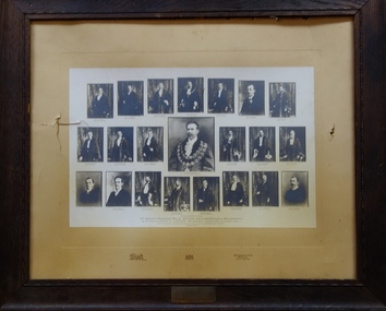
Print, Cr Henry Weedon MLA, & Suburban Mayors, 1907
... Mercy (Camberwell), Cr. T. L. Taylor (Northcote), Cr. Thos. Smith (Port Melbourne), Cr. ...Mercy (Camberwell), Cr. T. L. Taylor (Northcote), Cr. Thos. Smith (Port Melbourne), Cr. ...An article in the Box Hill 'Reporter' (11 October 1907, p.2) refers to the presentation of the artefact to the Kew Town Hall. The report records: 'Presentation to Kew's Ex-Mayor In the mayor's room at Kew on Tuesday evening, Ex-Mayor Cr Wishart was made the recipient of a handsomely-illuminated and exquisitely-framed testimonial as a mark of appreciation by his colleagues of the highly satisfactory manner in which he had discharged the duties appertaining to the mayoral office. .... A framed group of the metropolitan mayors was subsequently presented by Cr Wishart as an addition to the pictures hung in the mayor's room.'The newspaper report in the Box Hill Reporter positively identifies the artefact and how it was placed in the Mayor's Room in the Walpole Street Town Hall. The collage is historically significant as it may include the only photograph of a mayor of a city at this period of time.A large framed photographic collage of Henry Weedon surrounded by the Mayors of Greater Melbourne (holding office for the year 1906-07). The photograph was assembled in recognition of the ‘slight favours to them’ showed by the Lord Mayor. The photograph is dated August 1907. Surrounding the central medallion is, from left to right: Cr. C. C. Mercy (Camberwell), Cr. T. L. Taylor (Northcote), Cr. Thos. Smith (Port Melbourne), Cr. W. Flintoft (Prahran), Cr. W. Collings (Fitzroy), Cr. C. D. Lloyd (Caulfield), Cr. W. Wishart (Kew). Cr. Eli Williams (Coburg), Cr. C. Pattison (Essendon), Cr. A. E. Wells (South Melbourne), Cr. H. B. Gibbs (St Kilda), Cr. J. F. Hamilton (Brighton), Cr. C. Dalley (Hawthorn), Cr. C. L. Davey (?), Cr. J. C. Hill (Heidelberg), Cr. D. Phillips (Brunswick), Cr. M. Alexander (Richmond), Cr. W. Johns (Collingwood), Cr. W. H. Edgar MLC (Malvern), Cr. T. P. Hannah (Williamstown) and Cr. A. A. Harris (Footscray). henry wheedon, c. c. mercy, t. l. taylor (northcote),thomas smith, w. flintoft, w. collings, c. d. lloyd), w. wishart, eli williams, c. pattison, a. e. wells, h. b. gibbs, j. f. hamilton, c. dalley, c. l. davey, j. c. hill, d. phillips, m. alexander, w. johns,w. h. edgar, t. p. hannah, a. a. harris, mayors, kew, henry weedon -
 Melbourne Tram Museum
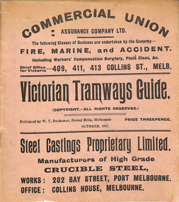
Ephemera, "Victorian Tramways Guide - October 1917", Oct. 1917
... Details the timetables for the Tramway Board, Northcote Council, PMTT, NMETL, HTT, MBCTT and the VR Brighton line. ...Details the timetables for the Tramway Board, Northcote Council, PMTT, NMETL, HTT, MBCTT and the VR Brighton line. ...Timetable - 36 pages, printed on off-white paper, cover printed on pink paper, centre stapled titled "Victorian Tramways Guide" for October 1917. Details the timetables for the Tramway Board, Northcote Council, PMTT, NMETL, HTT, MBCTT and the VR Brighton line. Gives details of fares, routes, signs, first and last cars. Middle page - has a map and details of a Round trip and shows other lines and change points. Foldout map included on the inside rear cover, showing tramways, railways and rivers. Has many advertisements for the re-election of Sir Frank Madden (he was not re-elected - see http://www.parliament.vic.gov.au/re-member/details/569-madden-frank - accessed 30-12-2016). Polling day 15/11/1917. Has adverts for: Commercial Union Steel Castings Proprietary Limited Myer's Country of Bourke Permanent Building and Investment Society Prohibition - Canada, USA Royal Insurance Company Australian Ladies Commercial College Incley Frederick Collis Tramways Advertising Co. Stott's Business College Chambers and Seymour W. M Richards Huttons Ham Sterling Preparationstrams, tramways, timetables, melbourne, nmetl, vr, cable trams, htt, pmtt, map, advertising -
 Port Melbourne Historical & Preservation Society
Photograph - Port Melbourne Railway United Football Club, Premiers 1925-26, 1926
... In the challenge match for the John Wren Shield played at the Motordrome, 3 Oct 1925, Yarraville 10.15.75 def Port Melbourne 5.10.40. 1926: Port Melbourne 12.11.83 def Northcote 6.12.48 at the Motordrome on 18 Sep 1926 to claim the VJFA VFA Section premiership. ...In the challenge match for the John Wren Shield played at the Motordrome, 3 Oct 1925, Yarraville 10.15.75 def Port Melbourne 5.10.40. 1926: Port Melbourne 12.11.83 def Northcote 6.12.48 at the Motordrome on 18 Sep 1926 to claim the VJFA VFA Section premiership. ...From William Hegarty's collection, donated by daughter Barbara Hegarty Gardiner. By 1925 Railway United were effectively the PMFC Seconds and were referred to in the media as Port Melbourne Junior Football Club although the Railway United name remained in use locally for many years. The Victorian Junior Football Association (VJFA) had been split into two sections. Section B consisted of teams associated with senior clubs playing in the Victorian Football Association (VFA) with unaligned teams making up Section A. Finals were played between the top teams in each section and then the two winners (premiers) played off in a final match to determine which club won the John Wren Shield as premier of the VJFA. 1925: Port Melbourne 12.11.83 def Williamstown 6.12.48 at Yarraville on 5 Sep 1925 to claim the B Section premiership. In the challenge match for the John Wren Shield played at the Motordrome, 3 Oct 1925, Yarraville 10.15.75 def Port Melbourne 5.10.40. 1926: Port Melbourne 12.11.83 def Northcote 6.12.48 at the Motordrome on 18 Sep 1926 to claim the VJFA VFA Section premiership. Again Port 11.11.77 lost to Yarraville 15.16.106 in the challenge match for the John Wren Shield played at the Motordrome, 2 Oct 1926. Yarraville were then able to claim the John Wren Shield outright and hold it permanently as a result of winning it on three occasions.Photograph of Railway United Football Team Premiers 1925-26sport - australian rules football, jim hall, bill wilson, ern atkinson, george murphy, bert roune (?), mick bragg, alby keogh, william (bill) hegarty, tom davis, bill johnson, archibald (arch) todd, port melbourne railway united football club, port melbourne junior football club, alby mowlam -
 Melbourne Tram Museum
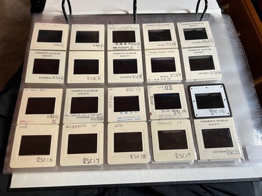
Album - Robert Thomson Slide Collection, AETA Convention 1971
... Number Brief Description RT123 1971 Convention - 9.4.71 - tram 610 - "Special" - Wattle park terminus RT124 Mt Alexander Road - 980 - "Special" RT125 St Kilda Jct - 7.4.71 - "St Kilda Beach" - route 16 RT126 North Balwyn Terminus - 9.4.71 - tram 840 - "Nth Balwyn" route 79 RT127 Preston - tram 980 - "City - Spencer St" - route 9A RT128 St Kilda Jct - "E Brighton Malv Burke Rd" - route 64 RT129 St Kilda Park St Terminus 12.4.71 - tram 394 - "Special" & tram 1017 - "West Preston - Northcote" - route 10 RT130 Carnegie 9.4.71 - tram 106 - "St Kilda Jun" - route 17 RT131 High St - tram 980 - "East Preston" - route 98 RT132 St Kilda Park St Terminus 12.4.71 - tram 894 - "West Preston" - route 10 RT133 St Kilda Park St Terminus 12.4.71 - tram 894 - "West Preston" - route 10 RT134 Wattle Park - 9.4.71 - tram 610 - "City" - route 70 RT135 Wellington Parade - 9.4.71 - tram 840 - "City - Flinders & Spencer St Cnr" - route 23 RT136 Melville Rd West Coburg 12.4.71 - tram 787 - route 55 ...Number Brief Description RT123 1971 Convention - 9.4.71 - tram 610 - "Special" - Wattle park terminus RT124 Mt Alexander Road - 980 - "Special" RT125 St Kilda Jct - 7.4.71 - "St Kilda Beach" - route 16 RT126 North Balwyn Terminus - 9.4.71 - tram 840 - "Nth Balwyn" route 79 RT127 Preston - tram 980 - "City - Spencer St" - route 9A RT128 St Kilda Jct - "E Brighton Malv Burke Rd" - route 64 RT129 St Kilda Park St Terminus 12.4.71 - tram 394 - "Special" & tram 1017 - "West Preston - Northcote" - route 10 RT130 Carnegie 9.4.71 - tram 106 - "St Kilda Jun" - route 17 RT131 High St - tram 980 - "East Preston" - route 98 RT132 St Kilda Park St Terminus 12.4.71 - tram 894 - "West Preston" - route 10 RT133 St Kilda Park St Terminus 12.4.71 - tram 894 - "West Preston" - route 10 RT134 Wattle Park - 9.4.71 - tram 610 - "City" - route 70 RT135 Wellington Parade - 9.4.71 - tram 840 - "City - Flinders & Spencer St Cnr" - route 23 RT136 Melville Rd West Coburg 12.4.71 - tram 787 - route 55 Demonstrates the work of Robert Thomson in photography, collection and/or production of slides Melbourne tramways trams Assembled album in a black presentation folder of 14 colour slides, collected or produced by Robert Thomson. ...Photo - see pdf file for further information. Number Brief Description RT123 1971 Convention - 9.4.71 - tram 610 - "Special" - Wattle park terminus RT124 Mt Alexander Road - 980 - "Special" RT125 St Kilda Jct - 7.4.71 - "St Kilda Beach" - route 16 RT126 North Balwyn Terminus - 9.4.71 - tram 840 - "Nth Balwyn" route 79 RT127 Preston - tram 980 - "City - Spencer St" - route 9A RT128 St Kilda Jct - "E Brighton Malv Burke Rd" - route 64 RT129 St Kilda Park St Terminus 12.4.71 - tram 394 - "Special" & tram 1017 - "West Preston - Northcote" - route 10 RT130 Carnegie 9.4.71 - tram 106 - "St Kilda Jun" - route 17 RT131 High St - tram 980 - "East Preston" - route 98 RT132 St Kilda Park St Terminus 12.4.71 - tram 894 - "West Preston" - route 10 RT133 St Kilda Park St Terminus 12.4.71 - tram 894 - "West Preston" - route 10 RT134 Wattle Park - 9.4.71 - tram 610 - "City" - route 70 RT135 Wellington Parade - 9.4.71 - tram 840 - "City - Flinders & Spencer St Cnr" - route 23 RT136 Melville Rd West Coburg 12.4.71 - tram 787 - route 55 Demonstrates the work of Robert Thomson in photography, collection and/or production of slidesAssembled album in a black presentation folder of 14 colour slides, collected or produced by Robert Thomson. All photographs have been scanned and placed on the Museum's G drive. A list of all photographs with details has been compiled. melbourne, tramways, trams -
 Ballarat Tramway Museum
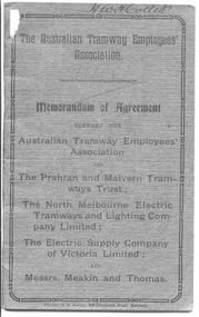
Book, Australian Tramway Employees Association (ATEA), "Memorandum of Agreement - ATEA with PMTT, NMETL, ESCo & Meakin & Thomas", 1913
... Pages 33 - 42 - ditto with Messrs Meakin and Thomas, Lessees of the Northcote Cable Tramways. Dated 14/1/1913, applied from 1/12/1912 to 30/6/1916. ...Pages 33 - 42 - ditto with Messrs Meakin and Thomas, Lessees of the Northcote Cable Tramways. Dated 14/1/1913, applied from 1/12/1912 to 30/6/1916. ...Four separate agreements, one for each organisation. All details wages and conditions of work and disputes, grievances, and discipline, leave etc. Pages 1 - 10 - agreement with the PMTT - dated 14/1/1913, applied from 1/10/1912 to 1/6/1916. Signed for PMTT by Alex Cameron Chairman; Thomas King Member; and Thomas King Secretary and for Union by Lionel L. Hill President and A. C. Warton General Secretary. Pages 12 - 20 - ditto with NMELTL - dated 14/1/1913, applied from 1/1/1913 to 30/6/1916. Signed for NMETL by L. Voight, A.D. Murdoch and for Union by A. C. Warton General Secretary. Pages 21 - 32 - ditto with ESCo - dated 14/1/1913, applied from 1/12/1912 to 30/6/1916, includes rosters for Ballarat and Bendigo. Signed by William J Home for P. J. Pringle for ESCo and for Union by Lionel L. Hill President and A. C. Warton General Secretary. Pages 33 - 42 - ditto with Messrs Meakin and Thomas, Lessees of the Northcote Cable Tramways. Dated 14/1/1913, applied from 1/12/1912 to 30/6/1916. Signed by F.W. Meakin and Lena Thomas in front of Louis Waxman Solicitor and A. C. Warton, General Secretary.Yields information about the industrial agreements with Tramway operators in Victoria, except for MTOCo.Forty-Four page booklet, off-white paper, saddle-stapled, with additional dark grey colour paper cover. titled "The Australian Tramway Employees' Association with the The Prahran & Malvern Tramways Trust / The North Melbourne Electric Tramways and Lighting Company Limited/ The Electric Supply Company of Victoria Limited and Messrs. Meakin and Thomas". Three copies held. "Ballarat Tramway Preservation Society Catalogue No. 213" in ink on top of first page, inside cover on both copies. Copy 1 - has name of "H.W.H.Collett" and "1913" on front cover, and pencil or red pencil notes against various rules in the ESCo section. Copy 2 - some minor pencil marks.trams, tramways, bendigo, ballarat, atea, unions, agreements, esco, nmetl, pmtt, northcote cable trams, meakin & thomas -
 Melbourne Tram Museum
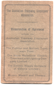
Book, Australian Tramway Employees Association (ATEA), Australian Tramway Employees Association (ATEA), "Memorandum of Agreement - ATEA with PMTT, NMETL, ESCo & Meakin & Thomas", 1913, 1913
... Pages 33 - 42 - ditto with Messrs Meakin and Thomas, Lessees of the Northcote Cable Tramways. Dated 14/1/1913, applied from 1/12/1912 to 30/6/1916. ...Pages 33 - 42 - ditto with Messrs Meakin and Thomas, Lessees of the Northcote Cable Tramways. Dated 14/1/1913, applied from 1/12/1912 to 30/6/1916. ...Four separate agreements, one for each organisation. All details wages and conditions of work and disputes, grievances, and discipline, leave etc. Pages 1 - 10 - agreement with the PMTT - dated 14/1/1913, applied from 1/10/1912 to 1/6/1916. Signed for PMTT by Alex Cameron Chairman; Thomas King Member; and Thomas King Secretary and for Union by Lionel L. Hill President and A. C. Warton General Secretary. Pages 12 - 20 - ditto with NMELTL - dated 14/1/1913, applied from 1/1/1913 to 30/6/1916. Signed for NMETL by L. Voight, A.D. Murdoch and for Union by A. C. Warton General Secretary. Pages 21 - 32 - ditto with ESCo - dated 14/1/1913, applied from 1/12/1912 to 30/6/1916, includes rosters for Ballarat and Bendigo. Signed by William J Home for P. J. Pringle for ESCo and for Union by Lionel L. Hill President and A. C. Warton General Secretary. Pages 33 - 42 - ditto with Messrs Meakin and Thomas, Lessees of the Northcote Cable Tramways. Dated 14/1/1913, applied from 1/12/1912 to 30/6/1916. Signed by F.W. Meakin and Lena Thomas in front of Louis Waxman Solicitor and A. C. Warton, General Secretary.Yields information about the industrial agreements with Tramway operators in Victoria, except for MTOCo. Forty-Four page booklet, off-white paper, saddle-stapled, with additional dark grey colour paper cover titled "The Australian Tramway Employees' Association with the The Prahran & Malvern Tramways Trust / The North Melbourne Electric Tramways and Lighting Company Limited/ The Electric Supply Company of Victoria Limited and Messrs. Meakin and Thomas".Various doodles on some pages.tramways, ballarat, bendigo, melbourne, atea, unions, agreements, esco, nmetl, pmtt, northcote cable trams, meaking and thomas, rosters -
 Bendigo Historical Society Inc.
Photograph - HILDA HILL COLLECTION: BLACK AND WHITE PHOTOS, 1918-1919
... Three ladies in white blouses and black dresses 'The Pines' Jan 1919. Mistress Alma Northcote 1918. Easter Monday 1918 Lieutenant King in uniform at the 'The Ranch'. ...Three ladies in white blouses and black dresses 'The Pines' Jan 1919. Mistress Alma Northcote 1918. Easter Monday 1918 Lieutenant King in uniform at the 'The Ranch'. ...Hilda Hill Collection. Black & White Photograph Collection Double Sided Card 10 Individual Photographs, Family Life During World War 1. Five Children enjoying day out at Pyramid Mineral Springs in Kyneton 27/09/1918 white gate in background. Female in white coat standing in a garden, Dec 30th 1918 The Ranch. General Pau Bendigo 21/10/1918. Two Gentlemen in a gig at Bendigo's Botanical Gardens Jan 1919. Three ladies in white blouses and black dresses 'The Pines' Jan 1919. Mistress Alma Northcote 1918. Easter Monday 1918 Lieutenant King in uniform at the 'The Ranch'. Small dog standing on white chair in front of a fern. Two men sitting on ground with football goal post in background, one dressed in white clothing with tennis racket at his side and the other man in slightly darker clothing with a hat at his feet. Victorian home, verandah with lacework named the Ranch. The house has lacework below the gutter of the front . Medium light coloured picket fence. Paved footpath with narrow nature strip. Tree on nature strip enclosed by a medium height picket fence.history, australian, world war 1 family life, https://en.wikipedia.org/wiki/paul_pau -
 Ballarat Tramway Museum
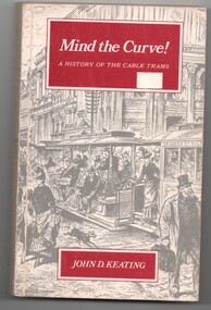
Book, John D Keating, "Mind the Curve", "Hold tight for the Curves", 1970
... Provides location details of the engines houses, tramcars, ticketing, management, politics, the Northcote line and the workers. Has a hand written note written by the daughter of John Caddell, a cable Tammie. ...Provides location details of the engines houses, tramcars, ticketing, management, politics, the Northcote line and the workers. Has a hand written note written by the daughter of John Caddell, a cable Tammie. ....1 - Hard bound book, 172 pages, including end covers, 10 sections, title "Mind the Curve", with subtitle "A history of the Cable Trams", stitch bound to hard red Rexene covers with gold block title on the spine only. Dust cover has the title, author, drawing of Bourke St and details of the book and author on the returns. Written by John D Keating, published by the Melbourne University Press in 1970. Has index, acknowledgements, table of contents, list of illustrations and references Looks at the establishment, construction, operation and demise of the cable tram system in Melbourne. Provides location details of the engines houses, tramcars, ticketing, management, politics, the Northcote line and the workers. Has a hand written note written by the daughter of John Caddell, a cable Tammie. On the page opposite the Acknowledgements is a typed note regarding visiting Mr Twentymen's house. .2 on the inside of the rear cover is a photograph and note regarding John Caddell and information about John's retirement from Preston Depot. .3 - Newspaper cutting, "Hold tight for the curves" - The Herald, 15/10/1970 - written by Laurie Power. reviewing the book. Has been adhered to a sheet of A4 white paper.trams, tramways, melbourne, mmtb, cable trams, mto co, horse trams, preston depot -
 Melbourne Tram Museum
Album - Ron Scholten Slide Collection, Ron Scholten
... Trams on route 88 delayed in Queens Parade Clifton Hill RSC121 Bendigo Birney car in Finn Street near North Bendigo terminus RSC122 SW6 in St Kilda Road at Domain Road at night RSC123 All 3 of Alf Twentyman’s cable cars in his Northcote backyard RSC124 Cable trailer 256 being unloaded into the shed at Bylands RSC125 Cable grip car 1 being removed from the Melbourne Museum RSC126 Alf Twentyman's cable cars in his Northcote Backyard RSC127 Alf Twentyman's cable cars in his Northcote Backyard RSC128 Alf Twentyman's cable cars in his Northcote Backyard RSC129 Alf Twentyman's cable cars in his Northcote Backyard RSC130 W class car in Swanston Street at Collins Street RSC131 Y1 469, L & W3 on the run out of Glenhuntly Depot on a tour RSC132 W7 1024 as an advertising tram for Bank of NSW at Clifton Hill RSC133 W2 496 on a footy special in Simpson Street Siding RSC134 W2 as originally converted to a test car at Preston Workshops RSC135 W3 667 in Brunswick Depot with Ellen Butland at the controls RSC136 W3 669 on its final run at Victoria Parade and Brunswick Street RSC137 W2 571 in Wellington Parade at Clarendon Street with a Footy Final load of Passengers RSC138 Y1 613 shunts at Spencer Street Terminus as X 217 waits on Australia Day Pageant RSC139 PCC 1041 on Route 96 in Bourke Street outside the Southern Cross Hotel RSC140 SW6 890 with accident damage on the outside roads at Preston Workshops, c1978 RSC141 W2 535 on Route 4 at the old St Kilda Junction, c1967 RSC142 PCC 1041 on Route 88 turns from Bourke Street into Spring Street, 1973 RSC143 L 102 on a tour at Albert Park Beach Terminus, Feb 1972 RSC144 W5 class Nos 833, 834 & 835 in Malvern Depot, c1976 RSC145 W2 No 281 in Wellington Parade on a football very crowded special c1974 RSC146 X1 No 464 Ballarat Road 1960 RSC147 T No 181 bound for the Explosives Factory - at Footscray Station - July 1960 RSC148 T No 181 at Williamstown Road, 1960 RSC149 Cable car set in Alf Twentyman’s back yard, c1970 RSC150 X No 217 at Malvern Depot, c1970 RSC151 X1 No 465 and T No181 Footscray Football ground in Barkly Street. c1960 RSC152 Scrubber No 5 at South Melbourne Depot, c1960 RSC153 X1 No 465 Footscray to Russell Street, c1960 RSC154 X1 No 467 Leeds Street Footscray, 1960 RSC155 PMTT No 4 Glenferrie Road, 1910 RSC156 S No 164 at Malvern Depot c1970 RSC157 T No 178 Footscray c1960 RSC158 Cleaner No. 7 at South Melbourne Depot c1960 RSC159 Two Y classes at Princes Bridge and Batman Avenue mid 1950s RSC160 Swanston Street – Nu color vue slide – M142 ...Trams on route 88 delayed in Queens Parade Clifton Hill RSC10 Flinders Street at William Street with Cable Cars RSC11 L 104 on the fan of the new shed at Malvern Depot on a TMSV tour RSC12 Cable Set 1 after it’s restoration at Preston Workshops on the fan near the front gate RSC13 X1 466 at a suburban terminus of the Footscray System RSC14 X2 680 at Point Ormond Terminus RSC15 An ex Launceston Tram at the outside terminus of the Penny Royal Complex Tramway in Launceston RSC16 Q 148 at Preston Workshops awaiting disposal RSC17 Elizabeth Street with Cable Cars RSC18 Elizabeth and Bourke Streets corner outside the GPO with cable cars RSC19 Collins Street with Cable Cars RSC20 A photo taken from the observation deck of the ICI building showing a view of Parliament House with a W class tram in Nicholson Street RSC21 Auburn Horse car with a posed photo of all the tramway men employed RSC22 Cheltenham Double Deck Horsecar with a full load of passengers RSC23 City of Northcote cable trailer No 3 at a terminus RSC24 City of Northcote Cable cars passing in High Street Northcote RSC25 St Kilda Road at Princes Bridge with Cable Cars RSC26 Flinders Street with Cable Cars RSC27 Cable Cars RSC28 Bourke Street looking towards Elizabeth Street from Queen Street RSC29 Cable cars in Bourke Street at Elizabeth Street looking east RSC30 Cable cars in Elizabeth Street at the terminus at Flinders Street RSC31 Cable cars in Bourke Street at Swanston Street looking west RSC32 Cable cars in Swanston Street at Flinders Street looking north RSC33 Cable cars in Collins Street near Russell Street RSC34 Cable cars in Elizabeth Street at Bourke Street RSC35 Cable cars in Collins Street at Elizabeth Street RSC36 Cable Cars in Swanston Street at Flinders Street RSC37 Cable cars in Collins Street RSC38 Cable Cars RSC39 Cable cars in St Kilda Road near Princes Bridge RSC40 Cable cars in Collins Street east of Swanston Street RSC41 Cable cars in Spring Street outside Parliament House RSC42 K class No 92 in M&MTB Chocolate and cream livery but with a P&MTT Destination box on Route 14 RSC43 Thornbury Depot viewed from Miller Street and St Georges Road. ...Photo - see pdf file for further information. Number Brief Description RSC1 PCC 1041 at the gates of Preston Workshops on a test run without its trolley retriever RSC2 PCC 1041 in Glenhuntly Road on Route 67 en-route to Carnegie crossing the Railway Gates at Glenhuntly Station RSC3 W2 482 stored at Malvern Depot with Olympic Park on the Destination RSC4 Cable Car Set 64 in Swanston Street outside Princess Bridge Station in bound with open top Double Deck Bus, Trak Motors ? Departing from Flinders St Station RSC5 W3 669 in St George Road at Sumner Street en-route to Preston Workshops for scrapping RSC6 Cable Car in Lygon Street en-route to Carlton RSC7 PCC 1041 turning from St Georges Road into Miller Street to enter the Preston Workshops RSC8 Flinders Street Station with cable cars RSC9 PCC 1041 in strife on its maiden day in service. Trams on route 88 delayed in Queens Parade Clifton Hill RSC10 Flinders Street at William Street with Cable Cars RSC11 L 104 on the fan of the new shed at Malvern Depot on a TMSV tour RSC12 Cable Set 1 after it’s restoration at Preston Workshops on the fan near the front gate RSC13 X1 466 at a suburban terminus of the Footscray System RSC14 X2 680 at Point Ormond Terminus RSC15 An ex Launceston Tram at the outside terminus of the Penny Royal Complex Tramway in Launceston RSC16 Q 148 at Preston Workshops awaiting disposal RSC17 Elizabeth Street with Cable Cars RSC18 Elizabeth and Bourke Streets corner outside the GPO with cable cars RSC19 Collins Street with Cable Cars RSC20 A photo taken from the observation deck of the ICI building showing a view of Parliament House with a W class tram in Nicholson Street RSC21 Auburn Horse car with a posed photo of all the tramway men employed RSC22 Cheltenham Double Deck Horsecar with a full load of passengers RSC23 City of Northcote cable trailer No 3 at a terminus RSC24 City of Northcote Cable cars passing in High Street Northcote RSC25 St Kilda Road at Princes Bridge with Cable Cars RSC26 Flinders Street with Cable Cars RSC27 Cable Cars RSC28 Bourke Street looking towards Elizabeth Street from Queen Street RSC29 Cable cars in Bourke Street at Elizabeth Street looking east RSC30 Cable cars in Elizabeth Street at the terminus at Flinders Street RSC31 Cable cars in Bourke Street at Swanston Street looking west RSC32 Cable cars in Swanston Street at Flinders Street looking north RSC33 Cable cars in Collins Street near Russell Street RSC34 Cable cars in Elizabeth Street at Bourke Street RSC35 Cable cars in Collins Street at Elizabeth Street RSC36 Cable Cars in Swanston Street at Flinders Street RSC37 Cable cars in Collins Street RSC38 Cable Cars RSC39 Cable cars in St Kilda Road near Princes Bridge RSC40 Cable cars in Collins Street east of Swanston Street RSC41 Cable cars in Spring Street outside Parliament House RSC42 K class No 92 in M&MTB Chocolate and cream livery but with a P&MTT Destination box on Route 14 RSC43 Thornbury Depot viewed from Miller Street and St Georges Road. Two W2 class cars are laying over between the peaks RSC44 Z3 No 201 in Met Livery passes D1 No 3510 in new M/Tram livery. A staff member in uniform stands in the doorway. Dandenong Road RSC45 D1 No 3530 advertising Heinekin Super Golf on Route 55 in Royal Park RSC46 D1 No 3504 in M/Tram livery on the reserved track in Matthews Avenue near Essendon Airport showing Route 81 Travancore. I suspect it is a private enthusiasts charter due to the Malvern W class run number in the rear windscreen RSC47 D1 No 3504 on Route 64 in Dandenong Road in M/Tram Livery RSC48 D1 No 3504 in M/Tram Livery at Airport West Terminus RSC49 D1 No 3504 in M Tram Livery in Union Road outside the Showgrounds RSC50 D1 No 3504 at West Maribyrnong Terminus in M/Tram Livery RSC51 D1 No 3503 in M/Tram Livery in Malvern Depot RSC52 SW6 No 960 and VR No 53 in Harbour Esplanade for the NMEL&T Co Centenary RSC53 Hawthorn Tramways Trust No 32 in Harbour Esplanade for the NMEL&T Co Centenary RSC54 VR 53 & B 2042 in Harbour Esplanade for the NMEL&T Co Centenary RSC55 VR 53 & C 3016 in Harbour Esplanade for the NMEL&T Co Centenary RSC56 NMEL&T Co No 13 (Formerly No 214) in Harbour Esplanade for the NMEL&T Co Centenary RSC57 NMEL&T Co 13 (formerly No 214) at Preston Workshops for the NMEL&T Co Centenary RSC58 Hawthorn Tramways Trust Lettering on HTT No 32 in Harbour Esplanade for the NMEL&T Co Centenary RSC59 Hawthorn Tramways Trust No 32 in Harbour Esplanade for the NMEL&T Co Centenary RSC60 Hawthorn Tramways Trust No 32 in Harbour Esplanade for the NMEL&T Co Centenary RSC61 Hawthorn Tramways Trust No 32 in Harbour Esplanade for the NMEL&T Co Centenary RSC62 NMEL&T Co No 13 (formerly No 214) at Preston Workshops for the NMEL&T Co Centenary RSC63 W2 516 and another on route 59 wait to shunt at Essendon Aerodrome Terminus as W2 571 on route 49 departs. This was the last day of operation. RSC64 Australia’s First Electric Tram at Box Hill with tramway men including H J Hilton who is in the centre RSC65 W2 484 en-route to St Kilda Junction and another wait for passengers after a race meeting at Caulfield Racecourse RSC66 X1 463 on the Footscray system en-route to Russell Street RSC67 Geelong 35 on Chilwell Route, Formerly HTT 13, M&MTB 119, then Bendigo 1 and Ballarat 37 RSC68 P&MTT No 4 on Opening Day of the system in Glenferrie Road RSC69 Bendigo No 6 in McCrae Street near the Depot en-route to North Bendigo RSC70 P&MTT No 4 in Glenferrie Road on opening day of the system RSC71 Scrubber No 3 stripped and awaiting scrapping at Preston Workshops RSC72 Scrubber No 4 at South Melbourne Depot RSC73 Q 191 & 139 at Preston Workshops awaiting scrapping RSC74 Rail Grinder No 3 at Preston Workshops as purchased from Sydney RSC75 Y 469 waits to shunt at Wattle Park Terminus as Y1 613 departs on driver training duties RSC76 VR 53 on the outside roads at Essendon Depot RSC77 W5 796 with three doors and square windows running out of Brunswick Depot in Cameron Street, with a supplementary destination board showing “City via Swanston St” RSC78 W2 258 on the wheel grinder road at Brunswick Depot RSC79 X2 676 on a TMSV tour, W5 817 & 836 & VR 53 on the open roads at Essendon Depot RSC80 PCC 1041 on test, passes W7 1035 in High Street Preston RSC81 D1 class production number 7 as delivered on test in Matthews Avenue RSC82 W2 383 on route 5 turning from the reserved track in Dandenong Road into St Kilda Road at St Kilda Junction RSC83 Z3 204 as advertising tram for Vodaphone Grand Prix running into Malvern Depot new shed RSC84 Z1 No 4 on test in St Georges Road RSC85 PCC 1041 on Route 96 in Bourke Street near Exhibition Street RSC86 Z1 No 3 without numbers on test turning from Miller Street in St Georges Road RSC87 Track components stored in Coldblo Road at Malvern Depot with Z class cars adjacent RSC88 D1 3501 in M/Tram Livery on Route 55 in Peel Street at Franklin Street RSC89 C 3001 in Yarra Trams Livery Porto No 018 & D1 3502 in M/Tram Livery on display in Harbourside Esplanade RSC90 D1 class tram production number 7, in as delivered condition on test in Matthews Avenue RSC91 D1 3503 inside Malvern Depot RSC92 SW6 955 and W6 974 in St Kilda Road at City Road at dusk. RSC93 Freight Car No 19 at Preston Workshops in green Livery RSC94 Rail Grinder No 3 in green Livery at South Melbourne Per Way Yard RSC95 A SW6 class car on route 50 shunting at Elizabeth Street Terminus at night, taken from Flinders Street Station RSC96 W2 588 & 435 in St Kilda Road at Batman Avenue RSC97 Y1 613 in service at Wattle Park Terminus RSC98 W2 588 in Wellington Parade en-route to the City with a Grand Final Load of passengers followed closely by No 384 RSC99 W2 558 on MCG Footy Special entering the Simpson Street siding RSC100 W3 657 & an L Class in the new shed at Malvern Depot RSC101 Y1 613 in St Kilda Road on an enthusiast's tour in St Kilda Road south of St Kilda Junction RSC102 Y1 613 on an enthusiast's tour in Clarendon Street with the two extra tracks on the Railways viaduct under construction RSC103 W6 976 on the fan of the new shed at Malvern Depot RSC104 W7 1024 as an advertising car for Bank of NSW at the route 1 terminus at South Melbourne Beach RSC105 PCC 980 on route 96 in Nicholson Street near North Fitzroy Depot RSC106 SW6 890 with dash canopy lighting in Market Street on the opening day of William Street Services RSC107 W2 444 with big numbers heads a line of footy specials in Simpson Street Siding RSC108 Cable Cars in Elizabeth Street RSC109 NMEL&T co No 2 with a trailer outside the power station in Mount Alexander Road RSC110 Alf Twentyman’s cable car set in his Northcote backyard RSC111 Cable Cars in Queens Parade Clifton Hill RSC112 Cable cars in Collins Street outside the Town Hall RSC113 PCC 1041 at Carnegie terminus RSC114 Cable cars in Elizabeth Street RSC115 Cable cars in Collins St near Swanston St RSC116 HTT 19 turns from Riversdale Road into Camberwell Road at Camberwell Junction RSC117 W1 419 official builders photo of first car of the class RSC118 Cable car with a full load of passengers RSC119 W1 422 illuminated for the visit of T.R.H. The Duke and Duchess of York RSC120 PCC 1041 in strife on it’s maiden day in service. Trams on route 88 delayed in Queens Parade Clifton Hill RSC121 Bendigo Birney car in Finn Street near North Bendigo terminus RSC122 SW6 in St Kilda Road at Domain Road at night RSC123 All 3 of Alf Twentyman’s cable cars in his Northcote backyard RSC124 Cable trailer 256 being unloaded into the shed at Bylands RSC125 Cable grip car 1 being removed from the Melbourne Museum RSC126 Alf Twentyman's cable cars in his Northcote Backyard RSC127 Alf Twentyman's cable cars in his Northcote Backyard RSC128 Alf Twentyman's cable cars in his Northcote Backyard RSC129 Alf Twentyman's cable cars in his Northcote Backyard RSC130 W class car in Swanston Street at Collins Street RSC131 Y1 469, L & W3 on the run out of Glenhuntly Depot on a tour RSC132 W7 1024 as an advertising tram for Bank of NSW at Clifton Hill RSC133 W2 496 on a footy special in Simpson Street Siding RSC134 W2 as originally converted to a test car at Preston Workshops RSC135 W3 667 in Brunswick Depot with Ellen Butland at the controls RSC136 W3 669 on its final run at Victoria Parade and Brunswick Street RSC137 W2 571 in Wellington Parade at Clarendon Street with a Footy Final load of Passengers RSC138 Y1 613 shunts at Spencer Street Terminus as X 217 waits on Australia Day Pageant RSC139 PCC 1041 on Route 96 in Bourke Street outside the Southern Cross Hotel RSC140 SW6 890 with accident damage on the outside roads at Preston Workshops, c1978 RSC141 W2 535 on Route 4 at the old St Kilda Junction, c1967 RSC142 PCC 1041 on Route 88 turns from Bourke Street into Spring Street, 1973 RSC143 L 102 on a tour at Albert Park Beach Terminus, Feb 1972 RSC144 W5 class Nos 833, 834 & 835 in Malvern Depot, c1976 RSC145 W2 No 281 in Wellington Parade on a football very crowded special c1974 RSC146 X1 No 464 Ballarat Road 1960 RSC147 T No 181 bound for the Explosives Factory - at Footscray Station - July 1960 RSC148 T No 181 at Williamstown Road, 1960 RSC149 Cable car set in Alf Twentyman’s back yard, c1970 RSC150 X No 217 at Malvern Depot, c1970 RSC151 X1 No 465 and T No181 Footscray Football ground in Barkly Street. c1960 RSC152 Scrubber No 5 at South Melbourne Depot, c1960 RSC153 X1 No 465 Footscray to Russell Street, c1960 RSC154 X1 No 467 Leeds Street Footscray, 1960 RSC155 PMTT No 4 Glenferrie Road, 1910 RSC156 S No 164 at Malvern Depot c1970 RSC157 T No 178 Footscray c1960 RSC158 Cleaner No. 7 at South Melbourne Depot c1960 RSC159 Two Y classes at Princes Bridge and Batman Avenue mid 1950s RSC160 Swanston Street – Nu color vue slide – M142 Demonstrates the work of Ron Scholten in photography, collection and/or production of duplicate slidesAssembled album in a black presentation folder of 160 colour slides, 8 slide sleeves, collected or produced by Ron Scholten. Many are TMSV or Windsor Publications slides. All photographs have been scanned and placed on the Museum's G drive. A list of all photographs with details has been compiled. melbourne, tramways, trams, cable trams, horse tram, route 67, route 88, route 55, route 64, route 59, route 49, route 50, point ormond, royal park, swanston st, footscray, essendon depot, matthews ave, brunswick depot, glenhuntly depot, malvern depot, st.georges road, preston workshops, pcc class, vr class, w2 class, w3 class, l class, s class, x class, x1 class, k class, z3 class, d1 class, sw6 class, w6 class, w7 class, t class, b1 class, c class, q class, y class, y1 class, w5 class, z1 class, tram 465, tram 181, tram 217, tram 467, tram 164, tram 102, tram 669, tram 667, tram 976, tram 890, tram 558, tram 657, tram 571, tram 484, tram 535, flinders st, tram 980, tram 1041, tram 482, tram 64, tram 104, tram 1, tram 466, tram 680, tram 676, tram 955, tram 92, tram 201, tram 3510, tram 3530, tram 3504, tram 3503, tram 53, tram 588, tram 383, tram 960, tram 32, tram 2042, tram 3016, tram 516, tram 43, tram 463, tram 191, tram 139, tram 469, tram 613, tram 796, tram 258, tram 384 -
Surrey Hills Historical Society Collection
Programme - Ephemera, Chatham Primary School Fathers' Club 'Trial by Jury' programme, 16/11/1929
... Mr Joseph P Braddick (mechanic) lived at 1 Northcote Avenue, Canterbury; now Balwyn (NB/ Name is miss-spelt Braddock in the program). ...Mr Joseph P Braddick (mechanic) lived at 1 Northcote Avenue, Canterbury; now Balwyn (NB/ Name is miss-spelt Braddock in the program). ...The program describes the performance as 'original burlesque' and was written, composed and produced by A E Woffinden and A W Sutton, members of the Chatham Fathers' Club, to raise money for the school. There were 250 programs printed at a cost of one pound fifteen shillings. This performance starred 21 of the fathers with Mr W Crellin as the only female character, Miss Eileen Flapper. The Chatham Fathers' Club became renowned locally for the quality of its performances, repeats being given to other community organisations. In the publication 'Chatham Past & Present: A Patchwork of People' there is also a photo of the cast taken in the quadrangle of the school. The original program and photo were lent to the school at the time of the 70 year reunion in 1997 by Mrs Jean Lacy (nee Walker), whose father took part as a member of the jury. Many of the performers were also in the formal photo of the Father's Club, taken in February 1928 on the front steps of the school. The original hangs in the school entry foyer and is reproduced in 'A Patchwork of People: Chatham Past and Present'. In relation to names, these are better identified and the following identifications have been reached by referencing this and the 1931 electoral roll. The geographic spread of addresses reflects that when Chatham opened in August 1927, surrounding schools were overcrowded and some families chose to relocate their children. Albert Ernest Woffinden (manufacturer) lived at 14 Banool Road, Surrey Hills. Alfred William Sutton (clerk) lived at 528 Whitehorse Road, Surrey Hills. Mr A Davidson - not found in electoral roll. Walter Dallas Kinross (mechanic) lived at 72 Empress Road, Surrey Hills. Gilbert Leslie (Bert) Rae (sales) lived at 63 Empress Road, Surrey Hills. Mr Joseph P Braddick (mechanic) lived at 1 Northcote Avenue, Canterbury; now Balwyn (NB/ Name is miss-spelt Braddock in the program). Norman Patrick Smart (bt opr) lived at 61 Sir Garnet Road, Surrey Hills. Henry Albert Wysham (show card writer) lived at 9 Northcote Avenue, Canterbury. Mr Sidney Bessant (labourer) lived at 191 Mont Albert Road, Canterbury. William Morrison (teacher) lived at 37 Chatham Road, Canterbury. William Charles Crellin (breadcarter) lived at 59 Empress Road, Surrey Hills. Mr F Parsons - taken as Fred Parsons (bricklayer) lived at 2 Kaarumba Grove, Balwyn. Mr MacDougal (incorrectly spelt in program) is Dougall MacDougall (gas collector) lived at 5 Wells Street, Surrey Hills. Mr A V Webb - not found. Mr McKie - not found. Victor Harold Theodore Clow (civil servant) lived at 4 Talbot Avenue, Balwyn; listed as T. Clow. Mr M Walker (donor's father) not found in electoral roll for 1931; thought to have lived in Sir Garnet Road. Mr McLeod - a number listed in the 1931 electoral roll. Richard Frost (carriage builder) lived at 341 Mont Albert Road, Surrey Hills. Mr Allen - a number listed in the 1931 electoral roll. Mr J Tulloch - not found in the 1931 electoral roll. This is an example of 'home-spun' entertainment and creativity of the era when the sense of community was very real. It is an example of the fundraising efforts undertaken by school communities to provide 'extras' that would later be regarded as 'basics'. For many years the sense of community in this part of Surrey Hills revolved around Chatham school, the Benson Street Methodist Church and the football club, located at the Canterbury Recreation Ground.A photocopy of the programme for the Chatham Primary School Fathers' Club "Trial by Jury" performance on 16 November 1929. It includes the words of the song 'Carry me back to dear old Chatham'. It lists the performers by character and some details regarding the Chatham Primary School Fathers' Club.chatham primary school, chatham primary school fathers' club, theatrical productions, entertainment, albert ernest woffinden, fundraising, alfred william sutton, walter dallas kinross, gilbert leslie (bert) rae, joseph p braddick, norman patrick smart, henry albert wysham, sidney bessant, william morrison, william charles crellin, fred parsons, dougall macdougall, mr a v webb, mr mckie, victor harold theodore clow, mr m walker, mr mcleod, richard frost, mr allen, mr j tulloch -
 City of Moorabbin Historical Society (Operating the Box Cottage Museum)
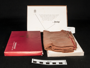
Clothing - Clothing, lady's nylon stockings 'Prestige Wonderfoot'', mid 20thC
... George Gotardo Foletta (1892-1973), hosiery and knitwear manufacturer, was born on 30 January 1892 at Northcote, Melbourne, eldest son of Victorian-born parents Henry Gotardo Foletta, a stonemason of Swiss extraction, and his wife Gertrude, née Bright. ...George Gotardo Foletta (1892-1973), hosiery and knitwear manufacturer, was born on 30 January 1892 at Northcote, Melbourne, eldest son of Victorian-born parents Henry Gotardo Foletta, a stonemason of Swiss extraction, and his wife Gertrude, née Bright. ...Prestige Limited was formed in 1922 by George Foletta to manufacture fine silken hosiery. The company had acquired the Atlas Knitting and Spinning Mills Pty Ltd which had been established in 1920 and produced "Prestige hosiery" from 1921. Prestige Limited merged with Holeproof Hosiery Company (Australia) Pty Ltd in 1964. Both were taken over by Pacific Dunlop in 1968. The Prestige name was dropped in 1978/79. George Gotardo Foletta (1892-1973), hosiery and knitwear manufacturer, was born on 30 January 1892 at Northcote, Melbourne, eldest son of Victorian-born parents Henry Gotardo Foletta, a stonemason of Swiss extraction, and his wife Gertrude, née Bright. Henry repaired the depression-ravaged fortunes of his family by starting a successful fancy goods commission-agency.....George persuaded the demoralized board to restructure around a quality-first marketing policy. By 1924, when George A. Bond & Co. Ltd ( Sydney) was liquidated, Prestige was back in the black. About this time the company became the first Australian knitter to make fully-fashioned silk stockings, outselling the best imported brands and giving Prestige dominance of the local hosiery market. With the arrival of British-trained Leslie Gough in 1926, Prestige entered its period of greatest expansion. By 1933 it was spinning its own silk yarn, had diversified into lingerie and commenced business in New Zealand; three years later it was spinning imported rayon filament into hosiery yarn.A pair of unworn lady's brown nylon 'service weight' stockings made by 'Prestige' Pty Ltd. in the original boxBox Lid: House of / Prestige / ‘monogram’ / WONDERSOFT / SERVICE WEIGHT “FOOT COMFORT’ NYLONS. Box inside lid : ‘monogram’ / You will have day long comfort when your feet are cushioned / with the softness and the smoothness of ‘Prestige “Foot Comfort” nylons. The secret is in the Nylon soles / …and you will find these “ Foot Comfort” / soles in ultra sheer, sheer, service sheer / and service weight nylons. / by Prestigeclothing, stockings, nylons, prestige hosiery pty ltd, melbourne, bentleigh, cheltenham moorabbin -
 Kew Historical Society Inc
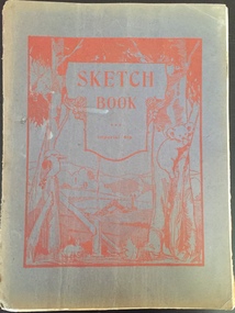
Album, Kenneth Bailey, Art Therapy Sketchbook : Kew Mental Hospital, 1952-1969
... Later he was to live in Clark and Charles Streets in Northcote, in South Caulfield, and finally in Mentone. ...Later he was to live in Clark and Charles Streets in Northcote, in South Caulfield, and finally in Mentone. ...Herbert Joseph Chambers was born in 1912 in Clifton Hill, Victoria. Later he was to live in Clark and Charles Streets in Northcote, in South Caulfield, and finally in Mentone. While he may have worked at the Kew Asylum before 1945, that year was when he was presented with a Certificate issued by the Department of Mental Hygiene (Victoria) declaring that he had completed training and passed the examinations required to work as a 'Mental Attendant’. The document is dated 19th December 1945 and signed by the Director of the Department and by the Co-Examiners. From at least 1945, he was to work as a member of the male staff of the Asylum, mainly in the Refractory Ward. A donor gifted to the Kew Historical Society in February 2019 a number of items collected by Herbert Chambers in his work at the Asylum. These include his Certificate of Registration, a photograph taken of him with two colleagues at Circular Quay in Sydney, a notebook containing ‘SP’ betting records of male asylum staff, and five sketchbooks with artwork created by Kenneth Bailey, a patient of the Asylum. Herbert Chambers’ period of employment at the Kew Asylum coincided with the employment of the English psychiatrist Dr Eric Cunningham Dax (1908-2008) as Chairman of the Mental Hygiene Authority in 1952. Dr Dax introduced an art therapy program into Victorian psychiatric hospitals, including Kew, where it is likely that the five sketchbooks were created. The sketchbooks are believed to have been presented to Chambers by ***** as a “gift for looking after him”. Herbert Chambers retired from the Kew Asylum in c.1970 after working there for almost thirty years.The Kew Historical Society has been the recipient of a number of important collections relating to the Kew Mental Hospital and the Children's Cottages, Kew, including their former incarnations. This is an important donation in this context as it includes five sketchbooks by a patient in an art therapy program at the Hospital. Art therapy programs were introduced by Dr Eric Cunningham Dax to Victorian asylums in the 1950s. The sketchbooks contain incomplete drawings and finished artworks. The donor believes that the patient who created the sketchbooks suffered from Schizophrenia. The sketchbooks are historically significant as representative examples of works created by patients in the program and for what they reveal about how mental illness may be manifested in a patient's artworks. The most significant repository of comparable works is held by the Dax Centre at Melbourne University.One of five sketchbooks with illustrations by Kenneth Bailey, a patient of the Kew Mental Hospital in an art therapy program, during the 1950s or 1960s. No work is dated although a number of the drawings/paintings are signed with the artist's name. art therapy, kew mental hospital, herbert joseph chambers, dr eric cunningham dax -
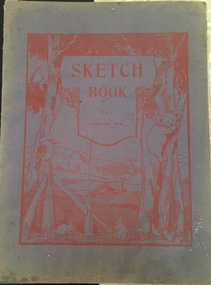 Kew Historical Society Inc
Album - Art therapy sketchbook, Kenneth Bailey, Imperial 4to Sketchbook, Kew Mental Hospital, 1952-1969
... Later he was to live in Clark and Charles Streets in Northcote, in South Caulfield, and finally in Mentone. ...Later he was to live in Clark and Charles Streets in Northcote, in South Caulfield, and finally in Mentone. ...Herbert Joseph Chambers was born in 1912 in Clifton Hill, Victoria. Later he was to live in Clark and Charles Streets in Northcote, in South Caulfield, and finally in Mentone. While he may have worked at the Kew Asylum before 1945, that year was when he was presented with a Certificate issued by the Department of Mental Hygiene (Victoria) declaring that he had completed training and passed the examinations required to work as a 'Mental Attendant’. The document is dated 19th December 1945 and signed by the Director of the Department and by the Co-Examiners. From at least 1945, he was to work as a member of the male staff of the Asylum, mainly in the Refractory Ward. A donor gifted to the Kew Historical Society in February 2019 a number of items collected by Herbert Chambers in his work at the Asylum. These include his Certificate of Registration, a photograph taken of him with two colleagues at Circular Quay in Sydney, a notebook containing ‘SP’ betting records of male asylum staff, and five sketchbooks with artwork created by Kenneth Bailey, a patient of the Asylum. Herbert Chambers’ period of employment at the Kew Asylum coincided with the employment of the English psychiatrist Dr Eric Cunningham Dax (1908-2008) as Chairman of the Mental Hygiene Authority in 1952. Dr Dax introduced an art therapy program into Victorian psychiatric hospitals, including Kew, where it is likely that the five sketchbooks were created. The sketchbooks are believed to have been presented to Chambers by **** as a “gift for looking after him”. Herbert Chambers retired from the Kew Asylum in c.1970 after working there for almost thirty years.The Kew Historical Society has been the recipient of a number of important collections relating to the Kew Mental Hospital and the Children's Cottages, Kew, including their former incarnations. This is an important donation in this context as it includes five sketchbooks by a patient in an art therapy program at the Hospital. Art therapy programs were introduced by Dr Eric Cunningham Dax to Victorian asylums in the 1950s. The sketchbooks contain incomplete drawings and finished artworks. The donor believes that the patient who created the sketchbooks suffered from Schizophrenia. The sketchbooks are historically significant as representative examples of works created by patients in the program and for what they reveal about how mental illness may be manifested in a patient's artworks. The most significant repository of comparable works is held by the Dax Centre at Melbourne University.One of five sketchbooks with illustrations by Kenneth Bailey, a patient of the Kew Mental Hospital in an art therapy program, during the 1950s or 1960s. No work is dated although a number of the drawings/paintings are signed with the artist's name. art therapy, kew mental hospital, herbert joseph chambers, dr eric cunningham dax -
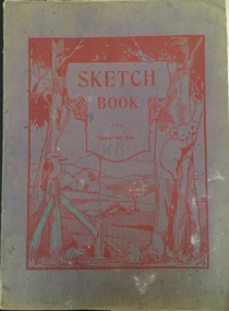 Kew Historical Society Inc
Album - Art therapy sketchbook, Kenneth Bailey, Imperial 4to Sketchbook, Kew Mental Hospital, 1952-1969
... Later he was to live in Clark and Charles Streets in Northcote, in South Caulfield, and finally in Mentone. ...Later he was to live in Clark and Charles Streets in Northcote, in South Caulfield, and finally in Mentone. ...Herbert Joseph Chambers was born in 1912 in Clifton Hill, Victoria. Later he was to live in Clark and Charles Streets in Northcote, in South Caulfield, and finally in Mentone. While he may have worked at the Kew Asylum before 1945, that year was when he was presented with a Certificate issued by the Department of Mental Hygiene (Victoria) declaring that he had completed training and passed the examinations required to work as a 'Mental Attendant’. The document is dated 19th December 1945 and signed by the Director of the Department and by the Co-Examiners. From at least 1945, he was to work as a member of the male staff of the Asylum, mainly in the Refractory Ward. A donor gifted to the Kew Historical Society in February 2019 a number of items collected by Herbert Chambers in his work at the Asylum. These include his Certificate of Registration, a photograph taken of him with two colleagues at Circular Quay in Sydney, a notebook containing ‘SP’ betting records of male asylum staff, and five sketchbooks with artwork created by Kenneth Bailey, a patient of the Asylum. Herbert Chambers’ period of employment at the Kew Asylum coincided with the employment of the English psychiatrist Dr Eric Cunningham Dax (1908-2008) as Chairman of the Mental Hygiene Authority in 1952. Dr Dax introduced an art therapy program into Victorian psychiatric hospitals, including Kew, where it is likely that the five sketchbooks were created. The sketchbooks are believed to have been presented to Chambers by ***** as a “gift for looking after him”. Herbert Chambers retired from the Kew Asylum in c.1970 after working there for almost thirty years.The Kew Historical Society has been the recipient of a number of important collections relating to the Kew Mental Hospital and the Children's Cottages, Kew, including their former incarnations. This is an important donation in this context as it includes five sketchbooks by a patient in an art therapy program at the Hospital. Art therapy programs were introduced by Dr Eric Cunningham Dax to Victorian asylums in the 1950s. The sketchbooks contain incomplete drawings and finished artworks. The donor believes that the patient who created the sketchbooks suffered from Schizophrenia. The sketchbooks are historically significant as representative examples of works created by patients in the program and for what they reveal about how mental illness may be manifested in a patient's artworks. The most significant repository of comparable works is held by the Dax Centre at Melbourne University.One of five sketchbooks with illustrations by Kenneth Bailey, a patient of the Kew Mental Hospital in an art therapy program, during the 1950s or 1960s. No work is dated although a number of the drawings/paintings are signed with the artist's name. art therapy, kew mental hospital, herbert joseph chambers, dr eric cunningham dax -
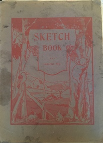 Kew Historical Society Inc
Album - Art therapy sketchbook, Kenneth Bailey, Imperial 4to Sketchbook, Kew Mental Hospital, 1952-1969
... Later he was to live in Clark and Charles Streets in Northcote, in South Caulfield, and finally in Mentone. ...Later he was to live in Clark and Charles Streets in Northcote, in South Caulfield, and finally in Mentone. ...Herbert Joseph Chambers was born in 1912 in Clifton Hill, Victoria. Later he was to live in Clark and Charles Streets in Northcote, in South Caulfield, and finally in Mentone. While he may have worked at the Kew Asylum before 1945, that year was when he was presented with a Certificate issued by the Department of Mental Hygiene (Victoria) declaring that he had completed training and passed the examinations required to work as a 'Mental Attendant’. The document is dated 19th December 1945 and signed by the Director of the Department and by the Co-Examiners. From at least 1945, he was to work as a member of the male staff of the Asylum, mainly in the Refractory Ward. A donor gifted to the Kew Historical Society in February 2019 a number of items collected by Herbert Chambers in his work at the Asylum. These include his Certificate of Registration, a photograph taken of him with two colleagues at Circular Quay in Sydney, a notebook containing ‘SP’ betting records of male asylum staff, and five sketchbooks with artwork created by Kenneth Bailey, a patient of the Asylum. Herbert Chambers’ period of employment at the Kew Asylum coincided with the employment of the English psychiatrist Dr Eric Cunningham Dax (1908-2008) as Chairman of the Mental Hygiene Authority in 1952. Dr Dax introduced an art therapy program into Victorian psychiatric hospitals, including Kew, where it is likely that the five sketchbooks were created. The sketchbooks are believed to have been presented to Chambers by ***** as a “gift for looking after him”. Herbert Chambers retired from the Kew Asylum in c.1970 after working there for almost thirty years.The Kew Historical Society has been the recipient of a number of important collections relating to the Kew Mental Hospital and the Children's Cottages, Kew, including their former incarnations. This is an important donation in this context as it includes five sketchbooks by a patient in an art therapy program at the Hospital. Art therapy programs were introduced by Dr Eric Cunningham Dax to Victorian asylums in the 1950s. The sketchbooks contain incomplete drawings and finished artworks. The donor believes that the patient who created the sketchbooks suffered from Schizophrenia. The sketchbooks are historically significant as representative examples of works created by patients in the program and for what they reveal about how mental illness may be manifested in a patient's artworks. The most significant repository of comparable works is held by the Dax Centre at Melbourne University.One of five sketchbooks with illustrations by Kenneth Bailey, a patient of the Kew Mental Hospital in an art therapy program, during the 1950s or 1960s. No work is dated although a number of the drawings/paintings are signed with the artist's name. art therapy, kew mental hospital, herbert joseph chambers, dr eric cunningham dax -
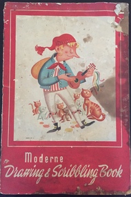 Kew Historical Society Inc
Album - Art therapy sketchbook, Kenneth Bailey, Moderne Drawing & Scribbling Book, Kew Mental Hospital, 1952-1969
... Later he was to live in Clark and Charles Streets in Northcote, in South Caulfield, and finally in Mentone. ...Later he was to live in Clark and Charles Streets in Northcote, in South Caulfield, and finally in Mentone. ...Herbert Joseph Chambers was born in 1912 in Clifton Hill, Victoria. Later he was to live in Clark and Charles Streets in Northcote, in South Caulfield, and finally in Mentone. While he may have worked at the Kew Asylum before 1945, that year was when he was presented with a Certificate issued by the Department of Mental Hygiene (Victoria) declaring that he had completed training and passed the examinations required to work as a 'Mental Attendant’. The document is dated 19th December 1945 and signed by the Director of the Department and by the Co-Examiners. From at least 1945, he was to work as a member of the male staff of the Asylum, mainly in the Refractory Ward. A donor gifted to the Kew Historical Society in February 2019 a number of items collected by Herbert Chambers in his work at the Asylum. These include his Certificate of Registration, a photograph taken of him with two colleagues at Circular Quay in Sydney, a notebook containing ‘SP’ betting records of male asylum staff, and five sketchbooks with artwork created by Kenneth Bailey, a patient of the Asylum. Herbert Chambers’ period of employment at the Kew Asylum coincided with the employment of the English psychiatrist Dr Eric Cunningham Dax (1908-2008) as Chairman of the Mental Hygiene Authority in 1952. Dr Dax introduced an art therapy program into Victorian psychiatric hospitals, including Kew, where it is likely that the five sketchbooks were created. The sketchbooks are believed to have been presented to Chambers by **** as a “gift for looking after him”. Herbert Chambers retired from the Kew Asylum in c.1970 after working there for almost thirty years.The Kew Historical Society has been the recipient of a number of important collections relating to the Kew Mental Hospital and the Children's Cottages, Kew, including their former incarnations. This is an important donation in this context as it includes five sketchbooks by a patient in an art therapy program at the Hospital. Art therapy programs were introduced by Dr Eric Cunningham Dax to Victorian asylums in the 1950s. The sketchbooks contain incomplete drawings and finished artworks. The donor believes that the patient who created the sketchbooks suffered from Schizophrenia. The sketchbooks are historically significant as representative examples of works created by patients in the program and for what they reveal about how mental illness may be manifested in a patient's artworks. The most significant repository of comparable works is held by the Dax Centre at Melbourne University.One of five sketchbooks with illustrations by ******, a patient of the Kew Mental Hospital in an art therapy program, during the 1950s or 1960s. No work is dated although a number of the drawings/paintings are signed with the artist's name. art therapy, kew mental hospital, herbert joseph chambers, dr eric cunningham dax -
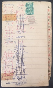 Kew Historical Society Inc
Booklet, Herbert Chambers, SP Bookie's Record Book, pre 1966
... Later he was to live in Clark and Charles Streets in Northcote, in South Caulfield, and finally in Mentone. ...Later he was to live in Clark and Charles Streets in Northcote, in South Caulfield, and finally in Mentone. ...Herbert Joseph Chambers was born in 1912 in Clifton Hill, Victoria. Later he was to live in Clark and Charles Streets in Northcote, in South Caulfield, and finally in Mentone. While he may have worked at the Kew Asylum before 1945, that year was when he was presented with a Certificate issued by the Department of Mental Hygiene (Victoria) declaring that he had completed training and passed the examinations required to work as a 'Mental Attendant’. The document is dated 19th December 1945 and signed by the Director of the Department and by the Co-Examiners. From at least 1945, he was to work as a member of the male staff of the Asylum, mainly in the Refractory Ward. A donor gifted to the Kew Historical Society in February 2019 a number of items collected by Herbert Chambers in his work at the Asylum. These include his Certificate of Registration, a photograph taken of him with two colleagues at Circular Quay in Sydney, a notebook containing ‘SP’ betting records of male asylum staff, and five sketchbooks with artwork created by Kenn’th [sic] Bailey, a patient of the Asylum. Herbert Chambers’ period of employment at the Kew Asylum coincided with the employment of the English psychiatrist Dr Eric Cunningham Dax (1908-2008) as Chairman of the Mental Hygiene Authority in 1952. Dr Dax introduced an art therapy program into Victorian psychiatric hospitals, including Kew, where it is likely that the five sketchbooks were created. The sketchbooks are believed to have been presented to Chambers by Bailey as a “gift for looking after him”. Herbert Chambers retired from the Kew Asylum in c.1970 after working there for almost thirty years.Small notebook, of which the cover is lost, including the names of male and female staff members at the Kew Mental Hospital, the amounts that they gambled and their winnings. It is presumed that the record was kept by Herbert Joseph Chambers, a member of staff between c.1945-70. The names in the book, including some of their aliases are arranged alphabetically. The prices are listed in pre-decimal currency, (i.e. before 1966). From the number of names listed in the book, it must have been a very extensive SP betting ring. herbert joseph chambers, kew mental hospital, gambling - kew (vic) -
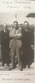 Kew Historical Society Inc
Print, Hebert Joseph Chambers, Sydney, 1962, 1962
... Later he was to live in Clark and Charles Streets in Northcote, in South Caulfield, and finally in Mentone. ...Later he was to live in Clark and Charles Streets in Northcote, in South Caulfield, and finally in Mentone. ...Herbert Joseph Chambers was born in 1912 in Clifton Hill, Victoria. Later he was to live in Clark and Charles Streets in Northcote, in South Caulfield, and finally in Mentone. While he may have worked at the Kew Asylum before 1945, that year was when he was presented with a Certificate issued by the Department of Mental Hygiene (Victoria) declaring that he had completed training and passed the examinations required to work as a 'Mental Attendant’. The document is dated 19th December 1945 and signed by the Director of the Department and by the Co-Examiners. From at least 1945, he was to work as a member of the male staff of the Asylum, mainly in the Refractory Ward. A donor gifted to the Kew Historical Society in February 2019 a number of items collected by Herbert Chambers in his work at the Asylum. These include his Certificate of Registration, a photograph taken of him with two colleagues at Circular Quay in Sydney, a notebook containing ‘SP’ betting records of male asylum staff, and five sketchbooks with artwork created by Kenn’th [sic] Bailey, a patient of the Asylum. Herbert Chambers’ period of employment at the Kew Asylum coincided with the employment of the English psychiatrist Dr Eric Cunningham Dax (1908-2008) as Chairman of the Mental Hygiene Authority in 1952. Dr Dax introduced an art therapy program into Victorian psychiatric hospitals, including Kew, where it is likely that the five sketchbooks were created. The sketchbooks are believed to have been presented to Chambers by Bailey as a “gift for looking after him”. Herbert Chambers retired from the Kew Asylum in c.1970 after working there for almost thirty years.Small copy of an original photograph of Herbert Joseph Chambers, a member of the male staff of the Kew Mental Hospital, standing between two unidentified men at Circular Quay, Sydney. The donor believes his father, Herbery Chambers, was in Sydney attending a conference in 1962."Nursing Conference Sydney 1962 / Unknown | Herbert Chambers | Unknown"herbert joseph chambers, kew mental hospital -
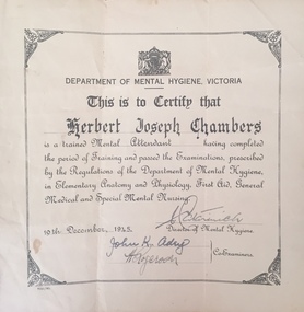 Kew Historical Society Inc
Certificate - Certificate of Completion, Department of Mental Hygeine (Victoria), Certificate of Qualification, Mental Attendant, Department of Mental Hygiene (Victoria), 1945
... Later he was to live in Clark and Charles Streets in Northcote, in South Caulfield, and finally in Mentone. ...Later he was to live in Clark and Charles Streets in Northcote, in South Caulfield, and finally in Mentone. ...Herbert Joseph Chambers was born in 1912 in Clifton Hill, Victoria. Later he was to live in Clark and Charles Streets in Northcote, in South Caulfield, and finally in Mentone. While he may have worked at the Kew Asylum before 1945, that year was when he was presented with a Certificate issued by the Department of Mental Hygiene (Victoria) declaring that he had completed training and passed the examinations required to work as a 'Mental Attendant’. The document is dated 19th December 1945 and signed by the Director of the Department and by the Co-Examiners. From at least 1945, he was to work as a member of the male staff of the Asylum, mainly in the Refractory Ward. A donor gifted to the Kew Historical Society in February 2019 a number of items collected by Herbert Chambers in his work at the Asylum. These include his Certificate of Registration, a photograph taken of him with two colleagues at Circular Quay in Sydney, a notebook containing ‘SP’ betting records of male asylum staff, and five sketchbooks with artwork created by Kenn’th [sic] Bailey, a patient of the Asylum. Herbert Chambers’ period of employment at the Kew Asylum coincided with the employment of the English psychiatrist Dr Eric Cunningham Dax (1908-2008) as Chairman of the Mental Hygiene Authority in 1952. Dr Dax introduced an art therapy program into Victorian psychiatric hospitals, including Kew, where it is likely that the five sketchbooks were created. The sketchbooks are believed to have been presented to Chambers by Bailey as a “gift for looking after him”. Herbert Chambers retired from the Kew Asylum in c.1970 after working there for almost thirty years.Representative example of certification required to work as a Mental Attendant in Victoria.Certificate issued by the Department of Mental Hygiene (Victoria) declaring that Herbert Joseph Chambers has completed training and passed examinations required to work as a 'Mental Attendant. The document, dated 19th December 1945 is signed by the Director of the Department and by the Co-Examiners.Department of Mental Hygiene Victoria This is to certify that HERBERT JOSEPH CHAMBERS is a trained MEDICAL ATTENDANT having completed the period of Training and passed the Examinations, prescribed by the Regulations of The Department of Mental Hygiene, in Elementary Anatomy and Physiology, First Aid, General Medical and Special Mental Hygiene. 19TH DECEMBER, 1945 Signed by the Director of Mental Hygiene and two Co-Examinersherbert joseph chambers, kew mental hospital, department of mental hygeine - victoria