Showing 2119 items
matching eltham house
-
 Eltham District Historical Society Inc
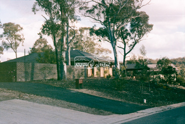
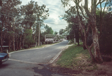
Slide - Photograph, Unidentified residential street, possibly Eltham North, c.Oct. 1989
... melbourne Infrastructure streets Roads Eltham North houses ...35mm colour positive transparency Mount - Black and Whiteinfrastructure, streets, roads, eltham north, houses, residential, streetscape, unidentified -
 Eltham District Historical Society Inc
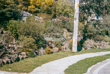
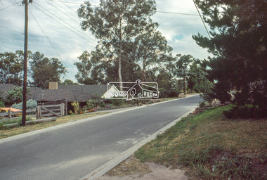
Slide - Photograph, Unidentified location, Eltham district, c.1990
... Eltham District Historical Society Inc 728 Main Rd Eltham ...35mm colour positive transparency Mount - Blank Cardhouses, infrastructure, residential, roads, streets -
 Eltham District Historical Society Inc
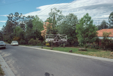
Slide - Photograph, Unidentified location, Eltham district, c.1990
... Eltham District Historical Society Inc 728 Main Rd Eltham ...35mm colour positive transparency Mount - Blank Cardhouses, infrastructure, residential, roads, streets -
 Eltham District Historical Society Inc
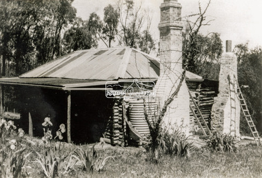
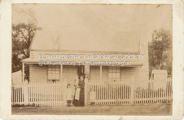
Photograph - Black and White Print, Old settler's cottage, Floods Lane, North Warrandyte, c.1935
An early settler's cottage of 1920s vintage near Floods Rd taken in the 1930s. Was originally Floods Lane and became Floods Road off Kangaroo Ground-Warrandyte Rd near boundary of North WarrandyteInscribed in pencil on reverse "early 20's near Flood Rd taken 30's. 21/1.89" and in pen ".16/1.80"cottage, floods lane, floods road, houses, kangaroo ground-warrandyte road, north warrandyte, pioneers -
 Eltham District Historical Society Inc
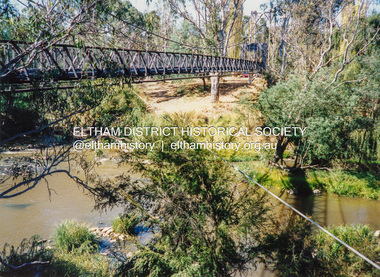
Photograph - Colour Print, Pedestrian suspension bridge over the Yarra River at Lower Plenty, c.1987
blessed sacrament fathers, bonds road, bridge, footbridge, lower plenty, odyssey house, seminary, yarra river -
 Eltham District Historical Society Inc
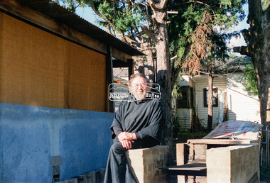
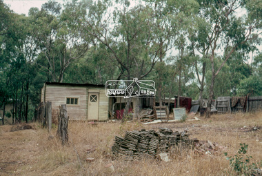
Negative - Photograph, Eltham Shire Council, Possibly a non-compliant house in Simms Road, Kinglake, c.1989
Facebook comments suggested this location may be a cabinetmaker by the name of Cook out the back of Panton Hill. Another comment recalled this man as a visitor to Montsalvat as a friend of the late poet, Geoffrey Egglestone. It is believed his name is Mizza. He is a Bohemium Poet. Also a frequent visitor to the St Andrews market. Photos taken by Eltham Shire Council officers most likely during an inspection of the property for non compliance. Other images on the roll of film are of Council Health officers undergoing food inspections at the shops, maternal health services and housing estate development inspectionsRoll of 35mm colour negative film, 6 strips Frames 3 through 9Fuji 100eltham shire council, shire of eltham, 1989, atlantic ethyl, sheds, signs, unidentified, houses, kinglake, simms road -
 Eltham District Historical Society Inc
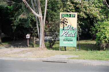
Negative - Photograph, Unidentified property: Real Estate Sign; Sold by Ian Reid Real Estate P/L, 126 Bolton Street, Eltham, 17 Nov 1992
Street with rollover kerbingRoll of 35mm colour negative film, 4 strips Fuji 1001992, houses, ian reid real estate, real estate agent -
 Eltham District Historical Society Inc
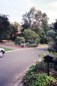
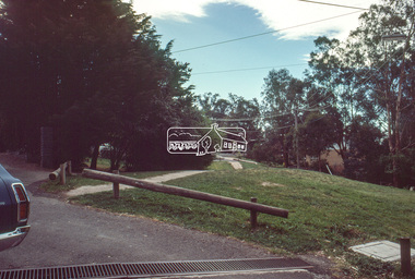
Negative - Photograph, Unidentified residential street, possibly Eltham North, c. Oct. 1989
... Eltham District Historical Society Inc 728 Main Rd Eltham ...View of rollover kerbing and residential streetscape with plantings on the nature strip. Previous frame was Looking north along Ryans Road at intersection with Kerrie Crescent, Eltham. This was the last frame on the roll of film. There are two slide transparencies shot at the same time Cross Ref: 04174 and 04175Roll of 35mm colour negative film, 1 stripsFuji 100eltham north, houses, residential, streets, streetscape, unidentified, infrastructure -
 Eltham District Historical Society Inc
Slide - Photograph, Unidentified house, c.1966
... Eltham District Historical Society Inc 728 Main Rd Eltham ...35mm colour positive transparency blue Agfacolour Service plastic mount1966, houses, unidentified -
 Eltham District Historical Society Inc
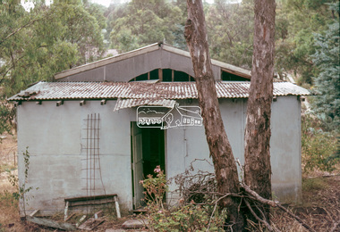
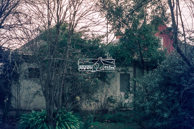
Slide - Photograph, Unidentified derelict house on a bush block possibly Eltham / Research, Vic, c.1966
... melbourne houses Unidentified Eltham Research (Vic.) Bush garden ...35mm colour positive transparency blue Agfacolour Service plastic mounthouses, unidentified, eltham, research (vic.), bush garden -
 Eltham District Historical Society Inc
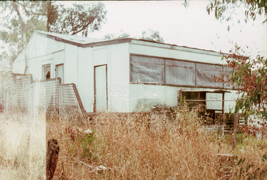
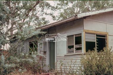
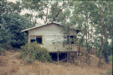
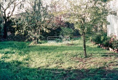
Slide - Photograph, Typical residential backyard, possibly Eltham, c.1968
... melbourne Unidentified Eltham Backyard gardens houses Residential ...35mm colour positive transparency blue Agfacolour Service plastic mountunidentified, eltham, backyard, gardens, houses, residential -
 Eltham District Historical Society Inc
Slide - Photograph, Unidentified property, possibly at Garden Hill Kangaroo Ground, c.1970
... Eltham District Historical Society Inc 728 Main Rd Eltham ...35mm colour positive transparency Mount - Agfacolor Service (Blue)houses, kangaroo ground, unidentified -
 Eltham District Historical Society Inc
Slide - Photograph, Eltham Shire Council, Unidentified street, possibly Montmorency or Eltham North, c.Oct. 1980
... melbourne eltham north houses infrastructure roads Montmorency ...35mm colour positive transparency (1 of 24) Mount - Kodak Kodachrome Cardeltham north, houses, infrastructure, roads, montmorency, unidentified -
 Eltham District Historical Society Inc
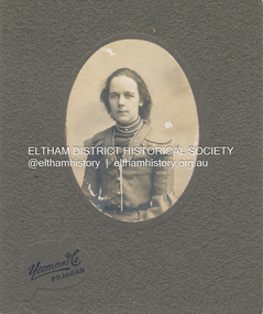
Photograph, Believed to be Sarah Aldous (nee Shillinglaw) with children, Florence, Elizabeth and Percival, c.1888
... Eltham District Historical Society Inc 728 Main Rd Eltham ...House at Diamond Creek Aldous Percival John : SERN DEPOT 160 : POB Melbourne VIC : POE Melbourne VIC : NOK F Aldous Charles https://recordsearch.naa.gov.au/SearchNRetrieve/Interface/DetailsReports/ItemDetail.aspx?Barcode=3024310&isAv=N Percival John Aldous was killed in action 19 Aug 1915 at Gallipoli CABINET 1866-1905 The Cabinet photo was introduced in 1866 in answer to a demand for a larger format photograph which could be mounted for a cabinet or on the wall. They were 4.5 inches by 6.5 inches (11.5 x 16.5 cm), more than twice the size of the cdv. They cost about twice as much as a cdv but eventually displaced them. They were not extensively produced until 1880 and had ceased by 1905. Coloured mounts, especially maroon or green, indicate a date between 1880 and 1890. - Frost, Lenore; Dating Family Photos 1850-1920; Valiant Press Pty. Ltd., Berwick, Victoria 1991marg ball collection, shillinglaw family photo album 2, 1888, cabinet photo, elizabeth annie aldous, florence may aldous, house, percival john aldous, sarah aldous (nee shillinglaw 1854-1925) -
 Eltham District Historical Society Inc
Photograph, Yeoman and Co, Mary Shillinglaw, c.1898
Mary Shillinglaw born November 5, 1880 at Bundoora, Victoria was the sixth child of Phillip Shillinglaw and Sarah Ann (nee Kidd). She commenced school at Eltham State School No. 209 (Register No. 423) in 1885 at age 4 years. Mary did not marry and spent most of her life at Wattle Brae (Shillinglaw Cottage). In his Will, Phillip Shillinglaw provided that any of his unwed sisters would be able to live at Wattle Brae, rent free. When Eltham Shire Council aquired the property in 1963 to build new Shire Offices, both Mary and her sister Lizzie (also unmarried) were still living at the cottage. Council paid for the women to relocate. Mary moved to Elizabeth House, a nursing home in Ivanhoe but found it very hard to adapt to her new surroundings and living consdtions. She died there only a few months after departing Eltham on October 29, 1963 at age 83 years. Lizzie died June 28, 1972 at age 93 years."Mary Shillinglaw"marg ball collection, 1883-1918, 1898, mary ann shillinglaw (1880-1963), yeoman & co photographer prahran -
 Eltham District Historical Society Inc
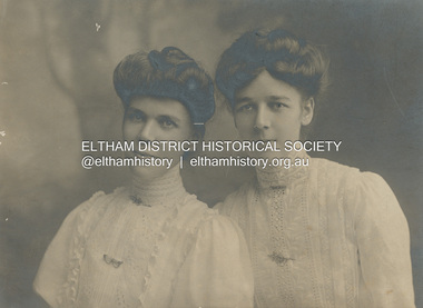
Photograph, Stewart & Co, Elizabeth and Mary Shillinglaw, c.1908
Elizabeth (Lizzie) Ann Shillinglaw born August 15, 1879 at Bundoora, Victoria was the fith child of Phillip Shillinglaw and Sarah Ann (nee Kidd). She commenced school at Eltham State School No. 209 (Register No. 391) in 1883 at age 3 years, her final year being 1892. She was engaged to a local Eltham lad who enslisted in the First World War and presented her with a gold ring with Lizzie inscribed on it. He never returned from war and Lizzie never married. Lizzie was quite involved with the local Methodist church where father Phillip was a Lay Preacher. She also had a dress making business in Smitrh Street, Collingwood. At the time of her father's death in 1914 she was living at 18 Stanley Street, Richmond. She returned to Wattle Brae in Eltham where she and her unmarried sisters, Mary and Ada and brother Ernest Samuel continued to live. Mary Shillinglaw born November 5, 1880 at Bundoora, Victoria was the sixth child of Phillip Shillinglaw and Sarah Ann (nee Kidd). She commenced school at Eltham State School No. 209 (Register No. 423) in 1885 at age 4 years. Mary did not marry and spent most of her life at Wattle Brae (Shillinglaw Cottage). In his Will, Phillip Shillinglaw provided that any of his unwed sisters would be able to live at Wattle Brae, rent free. When Eltham Shire Council aquired the property in 1963 to build new Shire Offices, both Mary and her sister Lizzie (also unmarried) were still living at the cottage. Council paid for the women to relocate. Mary moved to Elizabeth House, a nursing home in Ivanhoe but found it very hard to adapt to her new surroundings and living condtions. She died there only a few months after departing Eltham on October 29, 1963 at age 83 years. Lizzie died June 28, 1972 at age 93 years."Mary Shillinglaw"marg ball collection, 1908, elizabeth (lizzie) ann shillinglaw (1879-1972), mary ann shillinglaw (1880-1963), stewart & co photographers bourke st melbourne -
 Eltham District Historical Society Inc
Document - Photocopy, Diamond Valley News, Newspaper article: Fred looks back by Linley Hartley, Diamond Valley News, c.1985
Fred looks back; Report: Linley Hartley, Picture: Ron Grant Teaching himself German again after 70 years is just one of the many tasks Fred Golgerth, of Greensborough, has undertaken and succeeded in during his lifetime. As the two year old tenth child of a German descendent, Fred learnt to speak German from an Aunt. But World War 1 was raging. Fred’s older brother had gone to Europe with the Australian forces, changing his name … to ….. to sound less German. “I used to get my bottom slapped for speaking German at home,” Fred said. Even his name was changed from Otto to the more anglicised Frederick. Fred claims his involvement with Eltham started two years before he was born! His sister, two years older than him, was a babe in arms when his parents bought a piece of grazing property in Mount Pleasant Rd. “It was about 24 acres on a spur of Mt Pleasant,” Fred said. “My parents bought it from Mr and Mrs Hughes. There was a two-room mud hut in wattle and daub that we lived in from time to time. “My parents had a dairy farm and dairy in West Coburg, and they bought the Mt Pleasant land to put the dry stock on. “At one stage my mother got very ill and my older sister took my younger sister and myself to Eltham for four or five months. I went down to Eltham Primary School then.” That wasn’t the only time Fred stayed in Eltham. His sister, Wilhemina, known as Willa, married Jim Watson who had the Eltham hotel for some years from the end of World War 1. Pillar to post living was the way Fred described his youth, when he stayed with one married sister after another. “After a while Will and Jim lived in the big house at the top of Pitt St, next to the Council depot, and the hotel was managed by Fitzsimmons who had a big place near the river down there on Fitzsimons Lane. There was no bridge in Fitzsimons Lane but we used to cross the river at a ford, rolling up our trouser legs so they wouldn’t get wet, and carrying our shoes. I’d o down to visit some friends I had in Templestowe. And sometimes Jim Watson took his horse drawn lorry across the ford on his way to the brewery, instead of going don through Heidelberg.” “The bridge across the Yarra in Fitzsimons was not built until 1961.” Fred Golgerth, was only a teenager when he was rolled off his pushbike under a car on the bend between Mt Pleasant Rd and the Diamond Creek bridge. He was hospitalised in the little hospital on the east side of Eltham village that served the district in those days. He still carries the scars of the burns he received from the exhaust pipe and recent x-rays have revealed several broken vertebrae. At the time of the accident he was treated for a dislocated neck and was in plaster from his hip to the base of his head for about seven months. But nothing daunted Fred. Bouncing back he began work as an apprentice to a motor mechanic in Bell St, Preston, a man who is still living (at 90) in Queensland and who still communicates with Fred frequently. “He was like a father to me,” Fred declared. He was a marine engineer as well, so I …. that as well as blacksmithing. They taught us properly then.” After finishing his apprenticeship, Fred bought himself a 30 hundredweight Fargo truck and began his own contract carting business, doing most of the work for a firm called Carnegie’s and a subsidiary of that, Howard Radio. It was in the office Fred met his wife. “He taught me to drive the truck giving me lessons in my lunch hours up the Bourke St and Flinders St extension,” she said. “After work I’d have a driving lesson and all the girls from the Howard Radio would pile in the back to get a lift to Richmond Station.” In the 1939 bushfires, the Mt Pleasant Rd property was burnt out and the hut raised. Two years later, Fred and Dorothy were married. Fred paid £7.15.0 ($15.50) for the suit in which he was married. Dorothy had pulled out of the Women’s Air Training Corps to be married. Others with whom she trained went to Darwin and were in a convoy that was bombed. Fred went into the garage business in Brighton and continued his cartage business for a while. His company was employed to do all Brown Gouge’s motor repairs and factory maintenance. Because Fred had a certificate to do steam repair work he often got jobs maintaining industrial boilers. While he was in Brighton, Fred bought an eight-seater 1925 Silver Ghost Rolls Royce from Sir Keith Murdoch. When the couple moved to Rosanna in about 1943, it became a delivery van for the dairy they operated. “I thought I’d like to get back into a dairy business” Fred said. “We used to deliver the milk in the Rolls. “But it was hard work. We couldn’t get the labour and we’d drive to the farm and pick up the milk cans, take them back to the dairy, cool the milk, bottle it and deliver it. The inspectors would come regularly and the walls for bacteria.” Fred was exhausted. The couple gave up the dairy and moved to Eltham to live on the old property where a weatherboard house had now been built. It wasn’t a big house and the glassed in Rolls Royce limousine became the daytime nursery for the Golgerth’s second daughter. We’d put her in there to sleep during the day.” “Dorothy Golgerth was known to drive the Rolls at breakneck speed along Mt Pleasant Rd. Fred took some time off work then began driving a little local bus run by the Lyon Brothers before taking a maintenance job at the Athenaeum Club in the city. He’d ride an old Harley-Davidson to the station and travel into the city by train. Later, when the family moved to Pryor St. (their house stood where McEwans car park is now) Fred could walk to and from the station. “There was no resident doctor in the early days of Eltham,” Fred said. “Dr Cordner used to come from Greensborough to a room in the old house next to the old grocery shop on the corner of York St and Main Rd, Eltham (the grocery shop is now the Eltham Feed and Grain Store). The Golgerths lived in Eltham until “Dollar Day” – the day decimal currency became official. They eventually moved to Greensborough, when they have lived since. Fred has had his share of interesting jobs since then, retiring at 65 seven years ago when he was working in the engineering department at Larundel. Recently, two of his older sisters and a brother died, within a month. They were all in their 80s. They all had a profound influence on Fred, especially during his youth. His sharp wit and amusing anecdotes are the richer for his having been the youngest of a family that made the best of every circumstance. And now, as he enjoys his retirement, he is concentrating on relearning the language of his infancy; teaching himself German from tapes and a ‘teach yourself’ manual. He is fiercely proud of his German ancestry and treasures the diary, written in German in Gothic script, kept by his grandparents during their journey to Australia. On the inside in blue pen: "To Sadie, Wal Margaret & Elizabeth with lots & lots of love & best wishes from Mother"marg ball collection, eltham hotel, herbert james watson, otto (fred) golgerth, wilhemina watson (nee golgerth) -
 Eltham District Historical Society Inc
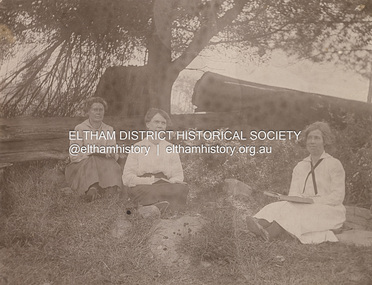
Photograph, Elizabeth Shillinglaw in middle, possibly sister Mary on right, c.1925
Elizabeth (Lizzie) Ann Shillinglaw born August 15, 1879 at Bundoora, Victoria was the fith child of Phillip Shillinglaw and Sarah Ann (nee Kidd). She commenced school at Eltham State School No. 209 (Register No. 391) in 1883 at age 3 years, her final year being 1892. She was engaged to a local Eltham lad who enslisted in the First World War and presented her with a gold ring with Lizzie inscribed on it. He never returned from war and Lizzie never married. Lizzie was quite involved with the local Methodist church where father Phillip was a Lay Preacher. She also had a dress making business in Smitrh Street, Collingwood. At the time of her father's death in 1914 she was living at 18 Stanley Street, Richmond. She returned to Wattle Brae in Eltham where she and her unmarried sisters, Mary and Ada and brother Ernest Samuel continued to live. Mary Shillinglaw born November 5, 1880 at Bundoora, Victoria was the sixth child of Phillip Shillinglaw and Sarah Ann (nee Kidd). She commenced school at Eltham State School No. 209 (Register No. 423) in 1885 at age 4 years. Mary did not marry and spent most of her life at Wattle Brae (Shillinglaw Cottage). In his Will, Phillip Shillinglaw provided that any of his unwed sisters would be able to live at Wattle Brae, rent free. When Eltham Shire Council aquired the property in 1963 to build new Shire Offices, both Mary and her sister Lizzie (also unmarried) were still living at the cottage. Council paid for the women to relocate. Mary moved to Elizabeth House, a nursing home in Ivanhoe but found it very hard to adapt to her new surroundings and living consdtions. She died there only a few months after departing Eltham on October 29, 1963 at age 83 years. Lizzie died June 28, 1972 at age 93 years. Post Card printed on back with photographer's details: W. Mason & Co., 144 Bridge Road, Richmond. W. Mason & Co. operated from this adress from 1903-c.1932 POSTCARD 1905-1940s Like the carte-de-visite, postcards enjoyed a collecting craze by large numbers of people, and were often kept in albums through which the interested visitor could browse. Postcards were posted or exchanged in huge numbers. Postal authorities in Australia only allowed the private printing of postcards from 1898. At this time the back of the card was reserved for the address and postage stamp, and the front was used for the message and a picture. In 1902 British authorities allowed a "divided back", so that the left side could be used for the message, the right side for the address and stamp, and the whole of the front was devoted to the picture. France followed suit in 1904, Germany and Australia in 1905, and the United States in 1907. - Frost, Lenore; Dating Family Photos 1850-1920; Valiant Press Pty. Ltd., Berwick, Victoria 1991marg ball collection, postcard, 1925, elizabeth (lizzie) ann shillinglaw (1879-1972), elizabeth docherty (nee shillinglaw 1861-1942)*, mary ann shillinglaw (1880-1963), reading -
 Eltham District Historical Society Inc
Document, Samantha Westbrooke Pty Ltd et al, 2 Bell Street, Eltham: Cultural Heritage Significance Assessment & Heritage Guidelines for Future Use & Development, 2012
Prepared for Nillumbik Shire Council by Samantha Westbrooke Pty Ltd in association with Peter Mills PhD, Architectural Historian and Roark Muhlen-Schilte, Archaeologist. Covers history of early market gardening in Eltham with the commencement of European settlement in the late 1830s. The site for the village of Eltham was surveyed in 1851 and the Township Plan shows that the property is made up of Lots 7 and 8 which were sold at auction in June 1852 to M. O'Shea. The history of the Bell Street property is closely tied to the West family from the 1860s to 1930s; the earliest rate books for Eltham show William West farming in El;tham in 1864. In the aerly 1930s ownership of the creek side was transferred from the west family to the Fabbro family who shortly afterwards were impaced by the 1934 Diamond Creek flooding. Guido Fabbro relocated the original West home further up the hill and built a new Italianate style modern home in situ. The Fabbro family farmed the property. In 1993/4 Eltham Council acquired the creek-side market garden blocks to the south of 2 Bell Street which was recconceived in 1998 as the Barak Bushland Reserve. The Fabbro house was demolished shortly after and the lots were sold to a developer in 1994. The large steel shed now present on the 2 Bell Street property dates from soon after this sale.26 A4 pages color printcultural heritage significance assessment, peter mills, samantha westbrooke pty ltd, shire of nillumbik, 2 bell street, eltham, market gardening, west family, fabbro family, land use, barak bushland reserve, heritage assessment -
 Eltham District Historical Society Inc
Photograph - Aerial Photograph, Landata, Eltham, Main Road; Henry St to Bellevue Rd, Dec. 1945
Eltham, Main Road; Henry St to Bellevue Rd, and east along Luck St to present day Eltham East School Historic Aerial Imagery Source: Landata.vic.gov.au Aerial Photo Details: Project No :5 Project : MELBOURNE AND METROPOLITAN AREA PROJECT Run : 36 Frame : 60549 Date : 12/1945 Film Type : B/W Camera : EAG4 Flying Height : 10200 Scale : 6000 Film Number : 228 GDA2020 : 37°42'45"S, 145°08'59"E MGA2020 : 336903, 5824465 (55) Melways : 21 K4 (ed. 42)aerial photo, arthur street, bellevue road, bible street, diamond street, dudley street, elsa court, eltham, eltham east primary school, gahan house, henry street, livingstone road, luck street, main road, pryor street, neil webster collection -
 Eltham District Historical Society Inc
Photograph - Aerial Photograph, Landata, Eltham, Main Road; Mt Pleasant Rd to Railway Rd, Dec. 1945
Centred on Main Rd and Henry St, Eltham bounded by Railway Road to north, Mount Pleasant Road at Main Road to south, top of the hill in Arthur Street to east and Karingal Drive at Sherbourne Road to west. Historic Aerial Imagery Source: Landata.vic.gov.au Aerial Photo Details: Project No :65 Project : MELBOURNE AND METROPOLITAN PROJECT NO. 2 Run : 8 Frame : 70 Date : 01/1951 Film Type : B/W Camera : EAG9 Flying Height : 12200 Scale : 12000 Film Number : 1419 GDA2020 : 37°43'06"S, 145°08'45"E MGA2020 : 336589, 5823811 (55) Melways : 21 J6 (ed. 42)aerial photo, eltham, main road, henry street, arthur street, bolton street, eltham-yarra glen road, neil webster collection, 1951-01, dave lyon house, ernie andrew house, karingal road, melway 21j6, mount pleasant road, railway road -
 Eltham District Historical Society Inc
Photograph - Aerial Photograph, Landata, Eltham; Crown Allotment 15, Section 5, Parish of Nillumbik (Stokes Orchard Estate), Dec. 1945
Centred on present day Diosma Rd, Stokes Pl, Nyora Rd and Eucalyptus Rd Historic Aerial Imagery Source: Landata.vic.gov.au Aerial Photo Details: Project No :5 Project : MELBOURNE AND METROPOLITAN AREA PROJECT Run : 36 Frame : 60546 Date : 12/1945 Film Type : B/W Camera : EAG4 Flying Height : 10200 Scale : 6000 Film Number : 195 GDA2020 : 37°42'47"S, 145°09'56"E MGA2020 : 338306, 5824438 (55) Melways : 22 C4 (ed. 42) A History of the Development of Crown Allotment 15, Section 5, Parish of Nillumbik – Stokes Orchard Crown Allotment 15, Section 5, Parish of Nillumbik (CA15) is a square allotment of 158 acres or approximately a quarter of a square mile. It lies just beyond the eastern end of Pitt Street, south of Nyora Road to the northern end of Eucalyptus Road and extends east from Eucalyptus Road to Reynolds Road. The topography of CA15 is generally steep, sloping up to a hill near the centre of the land, the ridgeline passing through the properties along the southern side of Diosma Road. Eucalyptus Road is a straight north-south road with its northern end at the north west corner of CA15. Until the end of the 1970s this road was an un-named Government Road and was largely not open to traffic. With residential development in the 1970s the road was constructed, and the council allocated the name obviously in recognition of the predominant species of the local bushland. CA15 was purchased from the Crown by George D’Arley Boursiquot, a prominent Melbourne printer, on 28th October 1852. On November 23, 1922, former Member for Gippsland and Melbourne Real Estate Agent, Hubert Patrick Keogh purchased the allotment then sold it March 13, 1925, to local farmer, Robert David Taylor, a former Shire of Eltham Councillor (1911-1920) and Shire President (1919). Taylor had extensive land holdings stretching west towards Bible Street and Main Road. The Taylor home was situated at the top of the hill in Bible Street at present day 82 Bible Street. At the time of Taylor’s purchase in 1925, CA15 was subdivided into 48 lots that could be described as small rural properties or large residential lots. A typical lot size was one hectare or 2.5 acres. The subdivision created two roads, Nyora Road, and Diosma Road, each following an irregular alignment between Eucalyptus and Reynolds Roads. However, the lots were not sold off separately nor were the roads constructed. The land effectively remained as one parcel for many further years. Robert David Taylor died November 30, 1934, and probate was granted to his son of the same name, Robert David Taylor of Bible Street, Salesman and William McLelland Vance Taylor of 73 Emmeline Street, Northcote, Clerk, with the transfer of the land into their names on July 8, 1935. Frank Stokes worked as a qualified accountant at Kennons leather factory in Burnley, while living at 1 Thomas Street, Mitcham. He suffered from migraines and wanted to return to working the land (he had previously worked on farms and orchards since coming to Australia from England in 1926, both in WA and Vic.). He first travelled to the district by train in July 1942 to find land with the intention to establish an orchard. By chance he met Arthur Bird of Bird Orchard (bounded by Pitt Street, Eucalyptus Road, and Wattle Grove) and they got talking over their common interest. Arthur put Frank up for the night and pointed out the land, 158 acres- part of the Taylor Estate- £900, Crown Allotment 15, Section 5, Parish of Nillumbik (CA15) somewhat diagonally opposite Bird Orchard. Stokes applied through the Riverina Agency to purchase the land who in turn applied for permission from Canberra to sell as there was a new government regulation introduced during the Second World War banning land sales except for immediate production. Stokes obtained a loan on his Mitcham house of £600 @ 5% and paid £450 deposit with quarterly payments of £15 spread over 5 years. Stokes was assisted and advised by Arthur Bird who farmed the neighbouring orchard. In early 1943 Stokes took possession and would catch the train out to Eltham on Fridays after work and began building a hut on the corner of Nyora Road and the Government Road (Eucalyptus Road) for shelter and to lock up tools. He established an orchard on the central western part of the land through the centre of which ran a natural waterway (part of the present-day linear park) and was able to pay a neighbour (Hawkins) to help with clearing and fencing 25 acres, and with a horse and single furrowed plough, planted approximately 2,500 fruit trees - cherries, peaches, plums, almonds, pears, apricots and lemons as well as a few apples and oranges; a massive task. Aerial photographs from the 1940s through to the 1990s clearly show the orchard with most of the larger CA15 site remaining as natural bushland. A huge problem was hares and rabbits eating all the new buds off the tiny trees. As well as laying poison he painted the trees with a mixture of cow manure and lime, often working by moonlight. Procurement of wire and wire netting was difficult because of the war but after much effort he obtained a permit from the Agricultural Department for supplies in March 1944. In February 1945 Stokes applied for a permit to build a “packing shed” as no house building was allowed. It was to be 33 feet x 21 feet and cost £312. It was constructed mostly from second-hand materials, which were hard to obtain, especially iron for roofing. Stokes finished work at Kennons on October 31, 1945, and in March 1946 he sold the family home at Mitcham for £1,230 plus £170 for furniture. On May 15, 1946, title to the CA15 property was issued to Frank Howard Alfred Stokes, Orchardist and Gladys Ethel Stokes, Married Woman, both of Pitt Street, Eltham. The family of five then moved into the very unfinished “packing shed” at Eltham, which was a struggle to weatherproof. Eventually rooms were divided off and lined with hessian bags and whitewashed. Their income was firewood (cut and sold), selling rockery stones and cut Sweet Bursaria. (It was discovered during the 1940s that Sweet Bursaria contained the sunscreen compound Aesculin. The RAAF utilised this compound from Sweet Bursaria during WW2 for pilots and gunners.) The orchard’s first fruit sale was a half-case of Le Vanq peaches in December 1947 for the price of 8 shillings. In 1956 plans for house were drawn and Glen Iris bricks purchased (1956 Olympic Rings variant). The building of the house commenced in 1957 - 12 feet of original packing shed was removed – and was completed in 1959. Water was connected from newly built pressure storage on the property at the end of 1959 and the electricity connection for the first time at 3pm on April 29, 1960. The house remains to present day (somewhat modified) at 1 Nyora Road, home to Nyora Studio Gallery. On occasions, spare remnants of the 1956 bricks have been known to be unearthed in gardens on the estate as they were utilised by Frank Stokes to fill in rabbit holes. On May 26, 1950, a parcel of land was compulsorily acquired by the Melbourne and Metropolitan Board of Works on the hilltop to establish an easement for a high-level service reservoir to augment Eltham’s water supply. The project also included pipe tracks for the necessary water mains. The reservoir has now been superseded by higher level water tanks east of Reynolds Road and its former site is now a public reserve. On November 27, 1964, the State Electricity Commission served notice to compulsorily acquire a further parcel through the eastern part of the land for a major electricity transmission line that augmented supply from the La Trobe Valley to Melbourne. The easement was registered February 11, 1966. The easement was widened July 18, 1969 for a second transmission line to be constructed. In 1971 Melbourne Metropolitan Planning Scheme amendments adopted Nyora Road as the boundary between a residential zone to the north and a rural zone to the south. This determined the future development of the land. In the mid-1970s the Shire of Eltham divided the orchard into numerous rate-able parcel lots, the 48 lots having been established in 1925 and the subsequent rates assessment proved unsustainable for Stokes. He commenced selling lots outside the boundary of the orchard, north of Diosma and South of Nyora. However shortly later the land between Nyora and Diosma Roads and west of the electricity easement was sold and subdivided into residential lots, a housing development by Macquarie Builders and marketed as the Stokes Orchard Estate. New streets were created, and most were named after trees, although one, Stokes Place, commemorates the former owners. The development was undertaken in two stages; Stage 1 (1975) encompassing Scarlet Ash Court, Ironbark Close and Peppermint Grove bounded by Nyora and Eucalyptus roads and Stage 2 (1978) encompassing Stokes Place, Orchard Way, The Crest and The Lookout bound by Nyora and Diosma roads. The developer, Macquarie Builders went bankrupt shortly after the release of Stage 2 leaving many purchasers to fend for themselves and arrange for their own independent builders. There were also difficulties with sewerage for the land immediately south of Diosma Road and so the conventional residential lots were abandoned in favour of larger lots. The development of Orchard Way, The Crest and The Lookout did not proceed as planned and the proposed lots were incorporated into five-acre parcels instead. These included a low-density group housing development by the Graves family and the award winning Choong House (1983) with Gordon Ford developed garden immediately next door situated on the ridge of the hill nestled amongst the original bush, Eucalypt trees and Sweet Bursaria. In 1994, Nillumbik Shire Council applied Significant Environment and Significant Landscape overlays upon the properties on the south side of Diosma Road to ensure protection of this natural bush garden environment. With the arrival of the sewer along Diosma Road in the 1990s, most of these five-acre parcels have since been subdivided multiple times. The Choong house presently sits on a 2.7-acre property, which in 2022 Nillumbik Council nominated for Cultural Significance Heritage protection and is considered potentially significant at State level. The Stokes family were also associated with the Eltham Christian Church. In the 1970s this church had met in temporary premises in Eltham. Lots of the original 1925 subdivision remained south of Nyora Road and a number of these lots were utilized for the Eltham Christian School, which was established by the Eltham Christian Church in 1981. The school operated on this site until 2000. The premises are now used by The Vine Baptist Church. By the mid-1980s the whole of CA15 had been developed for residential and school purposes, except for the sections north of Diosma Road and between the transmission lines and Reynolds Road. Sewerage issues had been resolved for the section north of Diosma Road and in 1987 it was in the process of being subdivided into residential lots. The development coincided with the discovery of colonies of the rare and endangered Eltham Copper Butterfly on the site. This resulted in a community and political campaign to save the butterfly habitat. With the co-operation of the land developer the subdivision was altered to create two bushland reserves in the critical butterfly habitat areas. In the late 1980s the State Government was investigating options for establishing a metropolitan ring road link between Diamond Creek and Ringwood. The chosen route was adjacent to Reynolds Road and so this created a freeze on development of CA15 between Reynolds Road and the electricity easement. The ring road proposal was eventually abandoned, and this part of the land was subdivided into low density residential lots. Diosma Road has been discontinued at the electricity easement and the eastern part incorporated into View Mount Court with access from Reynolds Road. The whole of CA15 has now been developed for residential or associated purposes, ranging from conventional density to quite low density south of Nyora Road. Some remnants of the orchard remain, a few cherry trees on the Graves property and a lone apple tree in Stokes Place. The butterfly reserves comprise significant areas of remnant bushland. Linear reserves through the estate link with central Eltham via the Woodridge linear reserve and with Research along the electricity easement. CA15 as it exists today has a complicated history of rural use, Government acquisition, urban development, and community action. References: • “Stokes Orchard, an incomplete history”; Russell Yeoman with Doug Orford • Correspondence, Beryl Bradbury (nee Stokes) • Aerial Photographs, 1931-1991, Landata (landata.vic.gov.au) • Certificate of Title, Vol. 4930 Fol. 985900 • Plan Number LP 10859 aerial photo, diosma road, eltham copper butterfly, eucalyptus road, ironbark close, nyora road, peppermint grove, peter & elizabeth pidgeon collection, power transmission lines, reynolds road, scarlet ash court, stokes orchard estate, stokes place, woodridge estate, frank stokes