Historical information
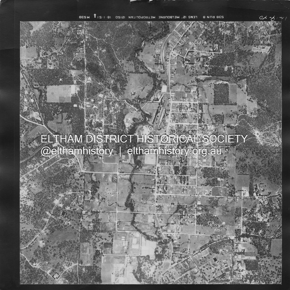
Centred on Main Rd and Henry St, Eltham bounded by Railway Road to north, Mount Pleasant Road at Main Road to south, top of the hill in Arthur Street to east and Karingal Drive at Sherbourne Road to west.
Historic Aerial Imagery
Source: Landata.vic.gov.au
Aerial Photo Details:
Project No :65
Project : MELBOURNE AND METROPOLITAN PROJECT NO. 2
Run : 8
Frame : 70
Date : 01/1951
Film Type : B/W
Camera : EAG9
Flying Height : 12200
Scale : 12000
Film Number : 1419
GDA2020 : 37°43'06"S, 145°08'45"E
MGA2020 : 336589, 5823811 (55)
Melways : 21 J6 (ed. 42)
Physical description
A3 photo print and electronic PDF file