Showing 608 items
matching boundary road
-
 Whitehorse Historical Society Inc.
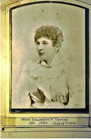
Photograph, Alice Schwerkolt ( nee Schwerkolt)
Alice Tanner nee Schwerkolt was the granddaughter of August & Paulina Schwerkolt. She was the child of Louis Schwerkolt and Francisca (Both) Kruse who was the daughter of August's second wife, Wilhelmina. In 1913 Alice married William Martyn Tanner. Marriage Certificate No. 3604.Sepia photograph of a young woman wiith short curly hair and wearing a frilly blouse. The photograph has a frame within its boundary.Alice Schwerkolt Tanner 1891 - 1954. Child of Cissie.schwerkolt alice bertha, tanner alice bertha -
 Whitehorse Historical Society Inc.
Document, Bloom's Reserve/Simpson's Reserve, 18/11/2022
Information regarding early Bloom's Reservenon-fictionInformation regarding early Bloom's Reservekift elwynne, reserve avenue mitcham no 29 -
 Ballarat and District Irish Association
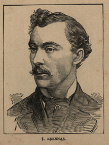
Image, T. Brennan, c1864, 1864
Following the founding meeting of the Mayo Tenants Defence Association in Castlebar, County Mayo on 26 October 1878 the demand for The Land of Ireland for the people of Ireland was reported in the Connaught Telegraph 2 November 1878. The first of many "monster meetings" of tenant farmers was held in Irishtown near Claremorris on 20 April 1879, with an estimated turnout of 15,000 to 20,000 people. This meeting was addressed by James Daly (who presided), John O'Connor Power, John Ferguson, Thomas Brennan, and J. J. Louden. The Connaught Telegraph's report of the meeting in its edition of 26 April 1879 began: Since the days of O'Connell a larger public demonstration has not been witnessed than that of Sunday last. About 1 o'clock the monster procession started from Claremorris, headed by several thousand men on foot – the men of each district wearing a laural leaf or green ribbon in hat or coat to distinguish the several contingents. At 11 o'clock a monster contingent of tenant-farmers on horseback drew up in front of Hughes's hotel, showing discipline and order that a cavalry regiment might feel proud of. They were led on in sections, each having a marshal who kept his troops well in hand. Messrs. P.W. Nally, J.W. Nally, H. French, and M. Griffin, wearing green and gold sashes, led on their different sections, who rode two deep, occupying, at least, over an Irish mile of the road. Next followed a train of carriages, brakes, cares, etc. led on by Mr. Martin Hughes, the spirited hotel proprietor, driving a pair of rare black ponies to a phæton, taking Messrs. J.J. Louden and J. Daly. Next came Messrs. O'Connor, J. Ferguson, and Thomas Brennan in a covered carriage, followed by at least 500 vehicles from the neighbouring towns. On passing through Ballindine the sight was truly imposing, the endless train directing its course to Irishtown – a neat little hamlet on the boundaries of Mayo, Roscommon, and Galway. Evolving out of this a number of local land league organisations were set up to work against the excessive rents being demanded by landlords all over Ireland, but especially in Mayo and surrounding counties. From 1874 agricultural prices in Europe had dropped, followed by some bad harvests due to wet weather during the Long Depression. The effect by 1878 was that many Irish farmers were unable to pay the rents that they had agreed, particularly in the poorer and wetter parts of Connacht. The localised 1879 Famine added to the misery. Unlike other parts of Europe the Irish land tenure system was inflexible in times of hardship. (Wikipedia) The Irish National Land League was founded at the Imperial Hotel in Castlebar, the County town of Mayo, on 21 October 1879. At that meeting Charles Stewart Parnell was elected president of the league. Andrew Kettle, Michael Davitt, and Thomas Brennan were appointed as honorary secretaries. This united practically all the different strands of land agitation and tenant rights movements under a single organisation. Michael Davitt Founder of the Land League The two aims of the Land League, as stated in the resolutions adopted in the meeting, were: ...first, to bring out a reduction of rack-rents; second, to facilitate the obtaining of the ownership of the soil by the occupiers. That the object of the League can be best attained by promoting organisation among the tenant-farmers; by defending those who may be threatened with eviction for refusing to pay unjust rents; by facilitating the working of the Bright clauses of the Irish Land Act during the winter; and by obtaining such reforms in the laws relating to land as will enable every tenant to become owner of his holding by paying a fair rent for a limited number of years. (Wikipedia)Image of a man with a moustache. He is T. Brennan.ballarat irish, brennan, thomas brennan, irish land act, rent -
 Mt Dandenong & District Historical Society Inc.
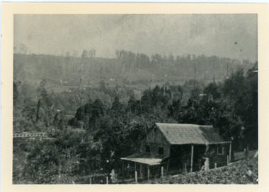
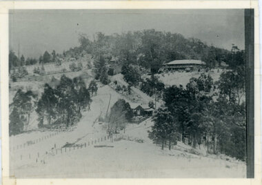
Photograph, Harry Child's Hut, early 1900s
Home of Harry Child in foreground built on the southern boundary of his father's (Francis Matthew Child) allotment. Black and white photograph showing the home of Harry Child. This photograph has a detailed inscription on the back handwritten by John Lundy-Clarke.The eastern face of Mt Dandenong from F.M. Childs selection Cnr allotment D.francis matthew child, mt dandenong, harry child -
 Mt Dandenong & District Historical Society Inc.
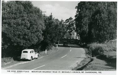
Photograph, Mountain Highway Near St. Michael's Church, Mt. Dandenong, Vic, c1950
... as the Mountain Highway was the Sassafras - Basin Road though it may... Community Hall 42 Falls Road Mt Dandenong yarra-valley ...Rose Series Postcard number 2415Copy of Rose Series post card taken c1950. St. Michael's Foundation Stone laid in 1940. Name 'Mountain Highway" is incorrect as the Mountain Highway was the Sassafras - Basin Road though it may not have received that name by 1950. The correct name is the Mount Dandenong Tourist Road at Mt. Dandenong / Kalorama as Falls Road is the boundary. Note: Heavy roadside vegetation, no white lines at side of road. White car probably pre war Vauxhall.kalorama, mount dandenong, rose series, st. michael's church, mt. dandenong tourist road -
 Mt Dandenong & District Historical Society Inc.
Photograph, Kalorama Gap Under Snow 1921, 1921
View of Kalorama Gap under snow taken in 1921. Mountjoy Guest House is at top right and Beulah Tea Rooms is in the centre. This photograph has a detailed inscription on the back handwritten by John Lundy-Clarke in 1974.Kalorama Gap under snow 1921 The leafless elm trees are low in the centre and the dual nature of the nearer one can be clearly seen, two small suckers of the older farther tree being twisted together in 1898 by Fred Jeeves. The older tree was planted 1880. Mrs Hands shop can be clearly seen, which was the Mount Dandenong North Post Office. The old Main Road runs up the centre of the picture and turns to the right and disappears behind “Mountjoy” the big guest house built by Paynters in 1905 and sold to Ellis Jeeves 1908, whose family ran it till 1943. At the bend of the road behind the big pine tree and the dark blackwood can be seen faintly the gable of Price’s house that contained the first shop on the mount. Above it is H Walker’s cottage on Ridge Road that still exists, his homestead is on the left of the picture on the same level. Below this house and to the left can be seen Ted Prices hay and corn store. The present estate agency lies between these two buildings, on the road which had recently been built. This can be seen winding from the lower left corner of picture to the left of the elms. The CRB had recently fenced the road and this is clearly seen as it circles behind trees in the left centre. Barber’s Road crosses CRB Road to the left of the dray under the leafless elm and the Coach Road dives down to the right just behind the pair of blackwoods to right of the elms. The picture was taken from just above the boundary of Isaac Jeeves’s selection Crown Allotment “C” (Jeeves Saddle) which stretched across the Gap to the other side of Mrs Hand’s shop, monopolising the gap from 1871 to 1879. Price’s house remains partly as the small house – “Mirra Laken”. kalorama gap, fiveways, post office, mountjoy, guest house, snow -
 Southern Sherbrooke Historical Society Inc.
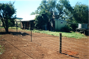
Information folder - Madigan Cottage
... in the area. Its retention in its site close to the road boundary ...The buildings are probably rare remnant examples of their type in the local area and as such are significant to the settlement of Menzies Creek. The dwelling is significant as a longstanding marker of the Madigan family who were original settlers in the area. Its retention in its site close to the road boundary expresses and maintains a connection with early settlement and rural lifestyles in Menzies Creek over the last century. The old shed is of interest as a local example of bush construction, particularly in context with the cottage and farm environs. Without the life of the farm and other elements presumed now gone, its value is lessened.Folder containing information pertaining to the history of Madigan Cottage, Menzies Creek. NB: the shed was demolished in November 2001 and the cottage burned down sometime later. Contents:- Letter, Southern Sherbrooke Historical Society to Shire of Yarra Ranges, dated 9th March 2001, re. sale of property and need for it to be included in shire's Heritage Study. -Letter, shire to society, dated 20th March 2001, reply to above. -Letter, shire to society, dated 15th May 2001, follow-up to above, requesting more information. -Letter, society to shire, dated 30th May 2001, responding to above and including a copy of information previously sent to Chris Johnston, Heritage Study consultant. -Letter, society to shire, undated, noting intention to lodge an objection to proposed application for development on site. -Letter, shire to society, dated 22nd October 2001, advising of consultation meeting. -Yarra Ranges Shire Heritage Study Place Nomination form for Madigan Cottage, prepared by Marian Matta, includes nine colour photos and diagram showing where photos were taken from. -Black and white copies of photos. -A3 copy of real estate advertisement, "Mount Evergreen Estate" dated 21st April 1924. -A3 map showing proposed resubdivision boundary variation, drawn up for Mr. P. Melville, undated but 1990s. -Copy of application for a planning permit, dated 6th August 2001, including letter by Nick Jonkers describing proposed new buildings, site map showing current vegetation, letter re. proposed removal of vegetation, subdivision plan dated March 1998, and larger scale map printed from shire website on 10th August 2001. -5 A3 sheets showing site and house plans drawn up for Mr & Mrs N. Jonkers, dated July 2001.madigan cottage, menzies creek, madigan family, mount evergreen, patrick madigan -
 Ballarat Tramway Museum
Slide - 35mm slide/s - set of 20, Noel Simons, 21/05/1971 12:00:00 AM
Set of 20 transparencies taken on 21/5/1971 on Kodak mounts. 1197.1 - Bendigo No. 5 en route to Eaglehawk at Creeth St Long Gully. Tram has a SEC roof ad and Cinzano roof ad. 1197.2 - No 5 approaching Needle Loop between Long Gully and California Gully. On left hand side is the City of Bendigo sign, indicating city boundary. 1197.3 - As for 1197.2 but actually entering loop. Photo taken after tram has passed photographer. 1197.4 - No. 26 bound for Eaglehawk descending the railway bridge near Eaglehawk, at Jobs Gully. 1197.5 - as for 1197.4, but after crossing bridge, now ascending a hill. Photo taken after tram has passed photographer. 1197.6 - No. 26 climbing High St. hill Eaglehawk, nearing end of Double track, bound for Quarry Hill. Shows centre of the road poles. 1197.7 - As for 1197.6, with tram entering single track section. Photo taken after tram has passed photographer. Has a BP service station in the background. 1197.8 - No. 26 (bound for Quarry Hill) crossing No. 17 (Eaglehawk) at Job's Gully Loop. 1197.9 - No. 17 climbing railway bridge at Job's Gully, en route to Eaglehawk. Photo taken after tram has passed photographer. 1197.10 - No.26 bound for Quarry Hill, leaving Long Gully Loop? Has the Creeth St. church in l197.l in the far background. Photo taken after tram has passed photographer. 1197.11 - Tramway Point work at the northern end of Long Gully Loop. 1197.12 - No. 17 en route for Quarry Hill turning into View St. from Bamard St. Tram has SEC roof ads "Everything fine in my all electric Kitchen' and 'Electric Cooking is Matchless'. 1197.13 - as for 1197.12, but tram has turned into View St and about to enter the double line track. Photo taken after tram has passed photographer. 1197.14 - No. 21 enters Nolan St after turning from MacRae St. en route to Bendigo. Note sign on its own post noting tram turns "Beware Tram Turns" and stop sign on adjacent pole "Trams stop on Request". No. 21 has two SEC roof ads. 1197.15 - No. 21 in Nolan St. after turning from Bridge St. (White Hills Road). Note signal light for Bridge St. loop on pole corner of street. Photo taken after tram has passed photographer. 1197.16 - No. 2 bound for Eaglehawk at unknown location. 1197.17 - Tram stop sign on a pole "CARS STOP BY REQUEST" 1197.18 - No. 5 in Carpenter St.? en route to Quarry Hill. 1197.19 - No. 28 has just arrive at Golden Square terminus, passengers are disembarking and the trolley pole is being turned. Golden Square Hotel in the background. 1197.20 - No. 28 at Golden Square terminus. Has a "Nothing beats Briquettes for hear roof ad. Information written on in black ink and date stamped on purple ink. 1197.1 - "No. 5 at Creeth St. Long Gully" 1197.2 - "No. 5 approaching Needle Loop between Long Gully and California Gully" 1197.3 - "No. 5 at Needle Loop between Long Gully and California Gully" 1197.4 - "No. 26 crossing railway bridge at Job's Gully near Eaglehawk" 1197.5 - "No. 26 just after crossing railway bridge at Job's Gully near Eaglehawk/ 1197.6 - "No. 26 in High St. Eaglehawk" 1197.7 - "No. 26 at end of double track in High St. Eaglehawk" 1197.8 - "Nos. 26 and 17 crossing at Job's Gully Loop" 1197.9 - "No. 17 crossing railway bridge at Job's Gully near Eaglehawk". 1197.10 - "No. 26 at Long Gully" 1197.11 - 'Northern end of points at Long Gully Loop". 1197.12 - "No. 17 turning into View St. from Bamard St. Bendigo". 1197.13 -'No. 17 at beginning of double track in View St. after leaving Bamard St. Bendigo. 1197.14 - "No. 21 enters Nolan St. from MacRae St. Bendigo." 1197.15 - "No. 21 in Nolan St. Bendigo just after leaving White Hills Road." 1197.16 - "No. 2" 1197.18 - "No. 5" 1197.19 - "Birney car No. 28 at Golden Square Terminus" 1197.20 "Birney car No. 28 at Golden Square Terminus" tramways, trams, bendigo, long gully, railway bridge, jobs gully, trackwork, nolan st, quarry hill, tram stops, golden square, tram 2, tram 5, tram 17, tram 21, tram 26, tram 28 -
 Bendigo Historical Society Inc.
Document - Golden City Implements Foundry, Ironbark, Bendigo, 1960-1980s
This foundry had been a landmark in Mt Korong Road for many years. It began with an Osborne and Mitchell. After 1914 when mining declined, it became the Golden City Implement boundary and the name can still be seen painted on on the façade which faces the intersection of Marong Road (Calder highway) and Eaglehawk Road. The interior is a mass of used and un-used machinery scattered amongst modern lathes and more modern apparatus. The yard was a fascinating graveyard of past times, with old mining and agricultural scrap everywhere mixed up with coke and slag from the smelting sheds at the rear. A feature of the foundry was the manufacturer of cast iron lace. National Trust Survey Data Sheet and article from the Bendigo Advertiser November 4th 1981. Osbornes Ironbark Foundryhistory, national trust bendigo collection, bendigo, foundary, iron bark bendigo -
 Bayside Gallery - Bayside City Council Art & Heritage Collection
Map, Department of Crown Lands and Survey et al, Moorabbin, County of Bourke, Government Roads, 1920
The cadastral map of the Parish of Moorabbin in Victoria (L.6104) shows parish boundaries and land ownership 1920 when Sandringham was a Town. The government roads have been coloured in red pencil.moorabbin, county of bourke, map, plan, land subdivision, land titles, foreshores, hampton, beaumaris, highett, cheltenham, department of lands and survey, land owners, cartographic material, brighton, sandringham, town of sandringham, government roads -
 Bayside Gallery - Bayside City Council Art & Heritage Collection
Map - print, Melbourne and Metropolitan Board of Works, Interim development order: Brighton, Moorabbin and Sandringham, 1959
The Melbourne and Metropolitan Board of Works (now Melbourne Water) was established in 1891. From that time, as part of their work laying water and sewerage connections, they created detailed plans of houses and other buildings in the Melbourne metropolitan area. In 1956 it acquired powers to construct and maintain highways and bridges, protect and improve the foreshores and create and maintain parks within the metropolitan region. This Interim development order comprises part of the municipalities of Brighton, Moorabbin and Sandringham and was made on 20 October 1959.brighton, moorabbin, sandringham, melbourne and metropolitan board of works, map, town planning, cartographic material, interim development order, bayside -
 Kew Historical Society Inc
Plan, Melbourne & Metropolitan Board of Works : Borough of Kew : Detail Plan No.1591, 1905
... , that: ‘Park Hill Road, forming the southern boundary of the cemetery..., that: ‘Park Hill Road, forming the southern boundary of the cemetery ...The Melbourne and Metropolitan Board of Works (MMBW) plans were produced from the 1890s to the 1950s. They were crucial to the design and development of Melbourne's sewerage and drainage system. The plans, at a scale of 40 feet to 1 inch (1:480), provide a detailed historical record of Melbourne streetscapes and environmental features. Each plan covers one or two street blocks (roughly six streets), showing details of buildings, including garden layouts and ownership boundaries, and features such as laneways, drains, bridges, parks, municipal boundaries and other prominent landmarks as they existed at the time each plan was produced. (Source: State Library of Victoria)This plan forms part of a large group of MMBW plans and maps that was donated to the Society by the Mr Poulter, City Engineer of the City of Kew in 1989. Within this collection, thirty-five hand-coloured plans, backed with linen, are of statewide significance as they include annotations that provide details of construction materials used in buildings in the first decade of the 20th century as well as additional information about land ownership and usage. The copies in the Public Record Office Victoria and the State Library of Victoria are monochrome versions which do not denote building materials so that the maps in this collection are invaluable and unique tools for researchers and heritage consultants. A number of the plans are not held in the collection of the State Library of Victoria so they have the additional attribute of rarity.Original survey plan, issued by the MMBW to a contractor with responsibility for constructing sewers in the area identified on the plan within the Borough of Kew. The plan was at some stage hand-coloured, possibly by the contractor, but more likely by officers working in the Engineering Department of the Borough and later Town, then City of Kew. The hand-coloured sections of buildings on the plan were used to denote masonry or brick constructions (pink), weatherboard constructions (yellow), and public buildings (grey). That area of Kew bordered by Cotham Road, Park Hill Road, Ermington Lane (now Ermington Place), and Belmont Avenue contained some of the significant homes owned by Kew pioneers. Chief among these was ‘Park Hill’ on an enormous lot facing Park Hill Road. The Jubilee History of 1910 noted, six years after this plan was drawn, that: ‘Park Hill Road, forming the southern boundary of the cemetery, takes its name from Park Hill, the residence of Mr. Thomas Judd, who has resided there since December, 1852.’ Other named houses on the plan include ‘Ferndale’ facing Cotham Road; ‘Ermington’ adjacent to Judd’s Park Hill, facing Park Hill Road; and ‘Gilden’ and ‘Mont Belmont’ facing Belmont Avenue. Mont Belmont was designed by the architectural firm of Reed, Henderson and Smart for William George Lilley in 1887 and was completed in 1888. Lilley was Mayor of Kew in 1887-88, a Justice of the Peace and a member of the first Board of Guardians of Kew’s St. Hilary’s Church of England.melbourne and metropolitan board of works, detail plans, survey plans - borough of kew, mmbw 1591, cartography -
 Kew Historical Society Inc
Plan - Subdivision : Cotham and Glenferrie Roads, J R Mathers & McMillan
The Kew Historical Society's map collection includes a substantial number of real estate subdivision plans, mainly of Kew but also of surrounding suburbs in Melbourne. Most of the subdivision plans date from the 1920s and 1930s when the districts old homes and local farmland were being split up to accommodate residential growth in the postwar period. These early plans were assembled by a local firm, Jas R Mather & McMillan, which had an office in Cotham Road. Many of the plans, and sometimes photos, were annotated by the agents.Subdivision plans are historically important documents used as evidence for the growth of suburbs in Australia. They frequently provide information about when the land was sold as well as evidence relating to surveyors and real estate and financial agents. The numerous subdivision plans in the Kew Historical Society's collection represent working documents, ranging from the initial sketches made in planning a subdivision to printed plans on which auctioneers or agents listed the prices for which individual lots were sold. In a number of cases, the reverse of a subdivision plan in the collection includes a photograph of a house that was also for sale by the agent. These photographs provide significant heritage information relating house design and decoration, fencing and household gardens.The photograph may also be aesthetically significant depending on the importance of the photographic atelier.An undated and untitled hand-drawn and coloured subdivision plan detailing the boundaries of a number of irregular allotments bordering Cotham Road, Glenferrie Road and Stirling Avenue (now Stirling Street). The plan predates the actual subdivision that led to the creation of the eight commercial properties occupying 118-132 Cotham Road. The plan may represent an old subdivision that was further subdivided at a later date, or it may be a subdivision that never eventuated. On MMBW Detail Plan 1575 (1903), the area represented by the proposed subdivision was residential rather than commercial. The irregularity of lots is also apparent in the MMBW Plan. The largest of the unnumbered blocks on the hand-drawn subdivision plan may relate to the boundaries of the nineteenth century mansion identified as ‘Kelso’ on the MMBW Plan.subdivision plans - kew, cotham road - kew,, glenferrie road - kew , stirling avenue street - kew -
 Kew Historical Society Inc
Plan - Subdivision Plan, J R Mathers & McMillan, Plan of Subdivision of Part of Crown Portion 83 at Kew : LP6669, 1923-1939
In 1888, in the section of Park Hill Road between Belmont Avenue and Normanby Road there was only one street running between Park Hill Road and Cotham Road. This was Park Road, later to be named Adeney Avenue. Subsequent 20th century subdivisions created the ‘through roads’ of Cecil Street, Wimba Avenue, Florence Avenue, Marshall Avenue, Uvadale Road, and Barrington Avenue. This subdivision represents an attempt by auctioneers, rather than town planners to create an urban environment from larger residential allotments or in many cases farmland. Existing streets such as Parkhill and Normanby Roads provided a convenient starting point for the surveyors, but the Road named ‘Street Street’ indicates the role of the private surveyor in creating streets. Given that a number of allotments are listed as sold on the plan, the street is presumably Cecil Street. Even those lots that had been sold do not quite match the dimensions of the blocks in this parcel of land today, indicating that either further subdivisions or boundary alterations occurred.Subdivision plans are historically important documents used as evidence for the growth of suburbs in Australia. They frequently provide information about when the land was sold as well as evidence relating to surveyors and real estate and financial agents. The numerous subdivision plans in the Kew Historical Society's collection represent working documents, ranging from the initial sketches made in planning a subdivision to printed plans on which auctioneers or agents listed the prices for which individual lots were sold. In a number of cases, the reverse of a subdivision plan in the collection includes a photograph of a house that was also for sale by the agent. These photographs provide significant heritage information relating house design and decoration, fencing and household gardens.The photograph may also be aesthetically significant depending on the importance of the photographic atelier.Hand-drawn subdivision plan of 19 lots facing Parkhill Road, Normanby Road, and an unnamed street [now Cecil Street] in Kew.Estate Agent notes in ink indicate those lots which had sold.subdivision plans - kew, parkhill road - kew, cecil street - kew, normanby road - kew, cecil street -kew, parkhill road - kew, normanby road - kew, crown portion 83 - kew -
Kew Historical Society Inc
Archive (series) - Subject File, Barkers Road, 1953
Various PartiesReference, Research, InformationKHS OrderSubject file with multiple items of research relating to the history of Barkers Road, previously Barkers Track (sic) including: 2 copies of ‘Barkers Track: Recollections of the Hawthorn Kew Boundary’ (Typescript, Mervyn Chinner, undated, 4pp), ‘The Boroondara Family Hotel’ (Photocopied typescript, 1987, 10pp), ‘Barkers Road (Gwen McWilliam, 1976), a photocopy of an ADB entry on BARKER, Edward (1816-1885). The file also includes a typed letter to Mrs Dickins from Cr WHS Dickinson (1953) relating to the state of Barkers Road and sundry newspaper clippings/articles.barkers road - kew (vic.), barkers track - kew - hawthornbarkers road - kew (vic.), barkers track - kew - hawthorn -
 Kew Historical Society Inc
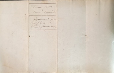
Legal record (Item), Thomas Judd to James Bonwick: Agreement for Sale of Land at Parish of Boroondara, 1853, 28/02/1853
... to the Government Road being the Southern Boundary of Portion Eighty five... to the Government Road being the Southern Boundary of Portion Eighty five ...James Bonwick (1817-1906), the Victorian educator and historian, acquired land in Kew on which to establish a home and school in 1853, not 1854 as more commonly stated. Bonwick returned to England in 1859 for a period, later returning to Melbourne and settling in St Kilda. He was the author of a number of histories and an official transcriber of Government records.This newly acquired document, from a former owner of 'Parkhill' (20 Hillcrest Avenue, Kew), is of statewide importance as it is the original copy of the agreement made between Thomas Judd of Parkhill and James Bonwick in 1853 for the purchase of land in Kew. Both Thomas Judd and James Bonwick were significant pioneers of Victoria.TRANSCRIPT [TITLE] Thomas Judd to James Bonwick Agreement for Sale of Land at Parish of Boroondara [PAGE 1] Articles of agreement made and entered into this the Twentyth eighth day of February One thousand Eight Hundred and fifty three Between Thomas Judd of Melbourne in the Colony of Victoria Gentleman of the one part and James Bonwick of Melbourne in the Colony of Victoria Gentleman of the other part whereby the said Thomas Judd agrees to sell unto the said James Bonwick who hereby agrees to purchase a piece or parcel of land containing two and half acres be the land more or less part of Portion Number Eighty five of the Parish of Boroondara in the County of Bourke commencing at a point on the Northern boundary line of the said Portion Seventeen Chains fifty links East from the North West angle of the same and bounded on the East by other part of said Portion in a line bearing South Eight Hundred and sixty two feet on the South by other part of said Portion Eighty five in a line bearing West one Hundred twenty six and half feet on the West by other part of said Portion Eighty five in a line bearing North Eight Hundred and Sixty two feet on the North by the Northern boundary line of the said Portion Eighty five in a line bearing East one Hundred twenty six and half feet to the commencing point at or for the price or sum of one [PAGE 2] One Hundred Pounds to be paid and payable in the manner hereinafter mentioned that is to say the Sum of Thirty pounds to be paid on the day of the date hereof and the sum of forty pounds by the acceptance of the said James Bonwick for that sum at three months bearing interest thereon after the rate of Eight Pounds per centum per annum and the Sum of Thirty pounds by the acceptance of the said James Bonwick for that sum after Six months with interest thereon after the rate of Eight pounds per centum per annum It is furthermore agreed that the said James Bonwick shall have access by a right of way fifteen feet wide reserved by the said Thomas Judd to the Government Road being the Southern Boundary of Portion Eighty five. That in case default shall be made in the payment of any of any of the Acceptances above mentioned the amount paid shall be actually forfeited to the said Thomas Judd who shall be at liberty to resell the premises. That upon payment of the whole amount of the purchase money the said Thomas Judd shall execute a conveyance of the premises to the said James Bonwick Such conveyance to be prepared by and at the expense of the said James Bonwick who - [PAGE 3] who shall also pay the cost of any attested copies he may require. ---- As witness the hands of the said parties this the twenty first day of February one thousand Eight Hundred and fifty Three. ----- [Signature] T. Judd [Signature] Jas Bonwick Witness [Signature illegible] £ Received Cash on account of the above 30.0.0 Thirty Pounds Bill at three Months with interest 42.4.0 Bill at Six Months with interest 31.4.0 _____ £103.8.0 _____ [Signature] T. Judd [Signature] Jas Bonwick ------------ Transcribed David White 25/08/2020 james bonwick, thomas judd, land titles - kew (vic), pioneers - kew - victoria -
 Kew Historical Society Inc
Plan - Subdivision Plan, Wimba Estate, Kew, c.1925-c.1929, ca. 1925-ca. 1929
Pru Sanderson, in her groundbreaking ‘City of Kew Urban Conservation Study : Volume 2 - Development History’ (1988), summarised the periods of urban development and subdivisions of land in Kew. The periods that she identified included 1845-1880, 1880-1893, 1893-1921, 1921-1933, 1933-1943, and Post-War Development. These periods were selected as they represented periods of rapid growth or decline in urban development. An obvious starting point for Sanderson’s groupings involved population growth and the associated economic cycles. These cycles also highlighted urban expansion onto land that was predominantly rural, although in other cases it represented the decline and breakup of large estates. A number of the plans in the Kew Historical Society’s collection can also be found in other collections, such as those of the State Library of Victoria and the Boroondara Library Service. A number are however unique to the collection.Subdivision plans are historically important documents used as evidence of the growth of suburbs in Australia. They frequently provide information about when the land was sold on which a built structure was subsequently constructed as well as evidence relating to surveyors and real estate and financial agents. The numerous subdivision plans in the Kew Historical Society's collection represent working documents, ranging from the initial sketches made in planning a subdivision to printed plans on which auctioneers or agents listed the prices for which individual lots were sold. In a number of cases, the reverse of a subdivision plan in the collection includes a photograph of a house that was also for sale by the agent. These photographs provide significant heritage information relating house design and decoration, fencing and household gardens.In 1925, the City of Kew called for tenders for the construction of Wimba Avenue, Cadow Street and Lalla Street. Subsequent advertisements for the sale of land in Wimba Avenue continued from 1926 to 1929. The 18 lots (and a further five allotments on the eastern side of the street) offered for sale were unofficially described in the subdivision plan as the ‘Wimba Estate’. These lots began in Park Hill Road and extended almost to Cotham Road. The subdivision took its name from the house ‘Wimba’ in Cotham Road, which may have formed the southern boundary of the subdivision. (Wimba, at 235 Cotham Road was constructed between 1862-70). The Plan highlights the proximity and advantage of ‘electric’ trams in Cotham and Glenferrie Roads, and the Kew and Glenferrie Railway Stations. An oddity in the Plan is the reference to the electric tram terminus at Burke Road, given that the tramline had already been extended to Mont Albert in 1916.wimba estate, subdivision plans - kew, parkhill road – kew (vic.), normanby road – kew (vic.), wimba avenue – kew (vic.) -
 Kew Historical Society Inc
Photograph - Civic event in Stradbroke Park, 1976
Stradbroke Park. Extent: Kilby Road to Harp Road at Burke Road. Historical Documentation: 1851 - Portion 91 purchased by Edward Glynn; 1888 - The Harp of Erin Estate (which included Section 91) offered for sale; 1896 - The area now known as Stradbroke Park was bisected by a creek that flowed from the Yarra via Hay's Paddock (q.v.) and extended through to Burke Road; 1943 - W.D. Birrell, Town Clerk of Kew, proposed that the creek be filled and a reserve created; 1954 - Entire area designated as 'open space' and named 'Stradbroke Park'. The line of the creek that ran through the Park created a further reserve on the north side of High Street, now known as 'Harrison Reserve'. Existing Condition: The park is largely of mown grass that has mature trees set into it It is possible that a number of these are remnant of the original vegetation, while there are also a number of exotic trees introduced, particularly at the northern end of the park. The southern end is dominated by playing fields. (Source: Sanderson, P 1988. Kew Conservation Study)Colour photographic positive (with colour degradation) of sporting teams at a civic event in Stradbroke Park in Kew East in May 1976. The event was officiated by the Mayor of Kew, Cr Alan Hutchinson. Sporting teams in uniform included: footballers, athletes, cricketers, hockey players. Stradbroke Park is situated on the western boundary of Kew at Burke and Harp Roads.stradbroke park, cr alan hutchinson, team sports -- kew (vic.) -
 Kew Historical Society Inc
Photograph - Civic event in Stradbroke Park, 1976
Stradbroke Park. Extent: Kilby Road to Harp Road at Burke Road. Historical Documentation: 1851 - Portion 91 purchased by Edward Glynn; 1888 - The Harp of Erin Estate (which included Section 91) offered for sale; 1896 - The area now known as Stradbroke Park was bisected by a creek that flowed from the Yarra via Hay's Paddock (q.v.) and extended through to Burke Road; 1943 - W.D. Birrell, Town Clerk of Kew, proposed that the creek be filled and a reserve created; 1954 - Entire area designated as 'open space' and named 'Stradbroke Park'. The line of the creek that ran through the Park created a further reserve on the north side of High Street, now known as 'Harrison Reserve'. Existing Condition: The park is largely of mown grass that has mature trees set into it It is possible that a number of these are remnant of the original vegetation, while there are also a number of exotic trees introduced, particularly at the northern end of the park. The southern end is dominated by playing fields. (Source: Sanderson, P 1988. Kew Conservation Study)Colour photographic positive (with colour degradation) of sporting teams at a civic event in Stradbroke Park in Kew East in May 1976. The event was officiated by the Mayor of Kew, Cr Alan Hutchinson. Stradbroke Park is situated on the western boundary of Kew and bordered by Burke and Harp Roads.stradbroke park, cr alan hutchinson, team sports -- kew (vic.) -
 Monbulk Historical Society
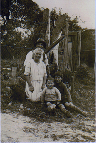
Thomas and Lillian Cavey with sons Tom and George
Thomas William Cavey was born in 1871, he was the youngest of his family and the only child that was born in Australia. He was first employed at the lime kilns in Geelong, before moving to Queensland for 4 years where he worked as a Boundary Rider. Thomas returned to the Lilydale area to be the driver of a buggy and pair for David Mitchell of David Mitchell Quarry in Lilydale. He selected land in Seamer Road in Monbulk in about 1898, but was working for the railways in Melbourne at the time and would come up to Monbulk at weekends to clear and cultivate the land. He met Lillian Eager, probably through relatives of hers, the Wingates, who lived in Monbulk. He and LIllian were married in 1910. They bought a 22 acre property in what is now called Cavey Road. They had two sons Thomas Charles, born in 1918 and George William Born in 1923. Initially the property in Cavey Road was farmed for vegetables, fruit and berries. The land used for this was over a creek on steep land away from the house. Once the produce was harvested it was taken by flying fox, back across the creek to where it could be prepared for sale. It was then taken to the Emerald and Belgrave markets each week. Later 10 cows were purchased, and the main income from the property was the dairy which produced approximately 25 quarts of milk a day, they produced Cream and Butter and together with the milk they were delivered fresh daily in the horse and cart. Deliveries were made to Monbulk, The Patch and to the canvas town at Silvan Dam, where the workers building the Silvan Dam lived. Thomas William Cavey died in 1959 aged 89. Lillian Blanche Cavey died in 1949 aged 68. -
 Surrey Hills Historical Society Collection
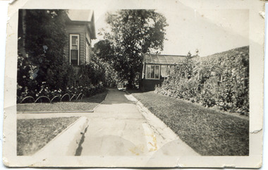
Digital photo, 45 Wandsworth Road, Surrey Hills, 1956
According to the donor, the photo was taken before the driveway was constructed. The house was later extended at the rear and was re-roofed. The donor's grandparents Daniel Patrick Liddy and Beatrice Bridget Tyner (known as 'Beat') were married in at her parents' home in Glencoe, South Australia on 13 December 1908. They lived in the Carlton / North Melbourne area before moving to Surrey Hills. Electoral rolls list them at 92 Curtain Street, North Carlton in 1913. According to the donor, they rented several properties before purchasing 45 Wandsworth Road. They are listed at Albert Crescent in 1914 and 1919, but also lived in Zetland Road. They purchased 45 Wandsworth Road in c1923 and are listed in the electoral rolls there in 1924. The donor's mother Ellen Dorothy Liddy (known as Eileen) was born in 1909; her brother Daniel John Liddy was born in 1911, both in Carlton. Daniel Patrick Liddy died in 1955; his wife Beatrice died in 1959. They are buried in Box Hill Cemetery (RC183-0045). 45 Wandsworth Road was their home for over 30 years.This image is material evidence of a property that has been demolished.A black and white photo taken from the street looking up a path or narrow driveway. On the LHS is part of a weatherboard house, Edwardian in style. On the RHS is the boundary fence against which is a garden border separated from the driveway by a section of grass. In the background is a glasshouse.Rear along top edge in blue biro: "Aunty Eileens house / before she was married" - according to the donor, this is his cousin's writing. Aunty Eileen was Ellen Dorothy Liddy who married Hugh Turnbull in 1936. Along LH edge, perhaps in a different hand " 23-10-1956" Photo laboratory processing stamp in black ink " 2 48", stamped twice.wandsworth road, daniel patrick liddy, beatrice bridget tyner, beatrice bridget liddy, ellen dorothy liddy, daniel john liddy, box hill cemetery, gardens -
 Surrey Hills Historical Society Collection
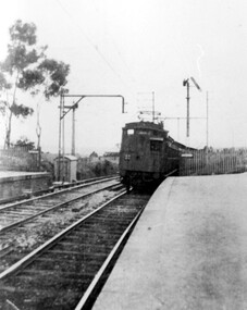
Photograph, Early electric train at Mont Albert Station, c1926, 1926
Date is approximate. Electric trains replaced steam locomotives in 1922. Mr William Holmes of 'Lugano', Mont Albert Road was in charge of the design and introduction of the electrification of the Melbourne rail system.Black and white photo of an early electric train approaching the platform at Mont Albert station. A couple of spindly eucalyptus trees can be seen beyond the picket fence marking the boundary of the platform.Black and white photo mounted on card; measures 16.3 cm x 23.4 cm.mont albert station, railways, trains, norman carter -
 Surrey Hills Historical Society Collection
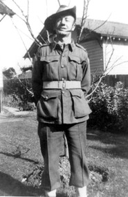
Photograph, Bill Willaton in WW2 army uniform, 1942
Date is approximate. His full name was William John Willaton - Service Number - VX68674 : Date of birth - 20 Mar 1909 : Place of birth - SURREY HILLS VIC : Place of enlistment - CAULFIELD VIC : Next of Kin - MURIEL WILLATON He was the son of Herbert Charles Leopold Willaton and Lily Jenkins and had a sister Lille Louise (Lil) who taught callisthenics and dance in Surrey Hills. Photo references also in this collection. Bill married Muriel Pearl Blake in 1935 and they lived at 18 Grovedale Road. He died Heidelberg in 1972. Bill was a driver (carter) for C E Gray & Son, bakers of Canterbury during the 1930's also recorded in this collection.Black and white photo of Bill Willaton in army uniform including a slouch hat. He is standing with his arms behind his back in front of a fairly young deciduous tree beyond which is a boundary fence and a timber building with a tiled roof. A child's pedal-car can be seen adjacent to the house of the garden. world war, 1939-1945, uniforms, william john willaton, bill willaton, -
 Port Fairy Historical Society Museum and Archives
Book, Melbourne University Press, Untold stories : memories and lives of Victorian Kooris, 1998
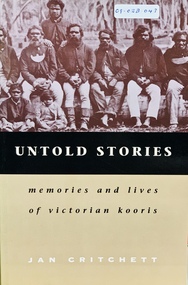
'I'm your half-brother and I'm here to stay. This is my home.' With these words Wilmot Abraham sought refuge with his white relations. 'Did you ever read your history?': Mrs. Mary Clarke remembers p. 1 'An old hand': Jim Cain p. 12 'I'm your half-brother, and I'm here to stay': Wilmot Abraham p. 36 The Three Pompeys The Written Record p. 48 Banjo Clarke's Stories p. 62 'Why did they take them away?': Lizzie and Henry McCrae p. 74 In Defence of Framlingham: Collin Hood p. 79 Double Dispossession: King David p. 107 James Dawson's Informants p. 137 'Why are we kept prisoners here?': Ernest and Maggie Mobourne p. 148 'The old ones, they wouldn't tell us nothing': Mrs. Connie Hart's memories p. 181 'Breaking the cycle is the hard thing to do': Geoff Rose, a stolen child p. 200 Epilogue: James Dawson, Camperdown George and the Obelisk p. 220 The Hood Family p. 238 The Mobourne Letters p. 241 Abbreviations p. 252 Notes p. 252 Bibliography p. 264 Index p. 274xxi, 283 p. : ill., facsims., map, ports. ; 23 cm. Includes index and bibliographical references: p. 264-273.non-fiction'I'm your half-brother and I'm here to stay. This is my home.' With these words Wilmot Abraham sought refuge with his white relations. 'Did you ever read your history?': Mrs. Mary Clarke remembers p. 1 'An old hand': Jim Cain p. 12 'I'm your half-brother, and I'm here to stay': Wilmot Abraham p. 36 The Three Pompeys The Written Record p. 48 Banjo Clarke's Stories p. 62 'Why did they take them away?': Lizzie and Henry McCrae p. 74 In Defence of Framlingham: Collin Hood p. 79 Double Dispossession: King David p. 107 James Dawson's Informants p. 137 'Why are we kept prisoners here?': Ernest and Maggie Mobourne p. 148 'The old ones, they wouldn't tell us nothing': Mrs. Connie Hart's memories p. 181 'Breaking the cycle is the hard thing to do': Geoff Rose, a stolen child p. 200 Epilogue: James Dawson, Camperdown George and the Obelisk p. 220 The Hood Family p. 238 The Mobourne Letters p. 241 Abbreviations p. 252 Notes p. 252 Bibliography p. 264 Index p. 274 western district (vic.) -- colonization., aboriginal australians -- victoria -- western district -- history., aboriginal australians -- victoria -- western district -- interviews, race relations - racial discrimination., child welfare - child / parent separation - stolen generations., history - biographies - indigenous., book -
 City of Greater Bendigo - Civic Collection
Ceremonial object - Rural City of Marong Medal, Blashki & Sons
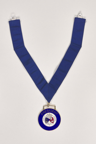
The first local government authority for Marong was the Marong Road District (an early form of single-purpose local government), which was proclaimed on 19 August 1860. Its boundary was altered twice in 1862 and on 12 December 1864 it was re designated as a shire. It absorbed Raywood Borough in 1915, and was proclaimed a Rural City in 1990. On 2 December 1994, with the creation of Greater Bendigo City Council, it was abolished by being amalgamated with Bendigo City, Eaglehawk Borough, Huntly Shire, part of McIvor Shire, part of Metcalfe Shire and Strathfieldsaye Shire to form Greater Bendigo City.Rural City of Marong Stirling silver drop, plated in 22 ct gold with enamel centre piece. Medallion hangs from a royal blue neck ribbon. front; RURAL CITY OF MARONG / verso; FORMED AS / MARONG DISTRICT ROADS BOARD / 27th AUGUST 1861 / PROCLAIMED SHIRE OF MARONG / 23rd DECEMBER 1864 / PROCLAIMED RURAL CITY OF MARONG / 1st OCTOBER 1990shire of marong, city of greater bendigo ceremonial item -
 City of Greater Bendigo - Civic Collection
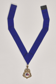
Ceremonial object - Shire of Marong President Medallion, P Blashki & Sons
The first local government authority for Marong was the Marong Road District (an early form of single-purpose local government), which was proclaimed on 19 August 1860. Its boundary was altered twice in 1862 and on 12 December 1864 it was re designated as a shire. It absorbed Raywood Borough in 1915, and was proclaimed a Rural City in 1990. On 2 December 1994, with the creation of Greater Bendigo City Council, it was abolished by being amalgamated with Bendigo City, Eaglehawk Borough, Huntly Shire, part of McIvor Shire, part of Metcalfe Shire and Strathfieldsaye Shire to form Greater Bendigo City.Manufactured by Blashki and Son this circular medal hangs from a royal blue gosgrain ribbon. The medallion has a gold edging with blue enamel outer band. Centre depicts Australia coat of arms and the Shire of Marong coat of arms.PRESIDENT / SHIRE OF MARONG / DIEU ET MON DROIT / INDUSTRIAshire of marong, marong presidents medal, city of greater bendigo ceremonial item -
 City of Greater Bendigo - Civic Collection
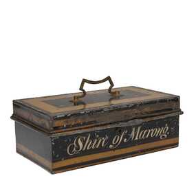
Functional object, Shire of Marong, Unknown
The first local government authority for Marong was the Marong Road District (an early form of single-purpose local government), which was proclaimed on 19 August 1860. Its boundary was altered twice in 1862 and on 12 December 1864 it was re designated as a shire. It absorbed Raywood Borough in 1915, and was proclaimed a Rural City in 1990. On 2 December 1994, with the creation of Greater Bendigo City Council, it was abolished by being amalgamated with Bendigo City, Eaglehawk Borough, Huntly Shire, part of McIvor Shire, part of Metcalfe Shire and Strathfieldsaye Shire to form Greater Bendigo City.Painted metal tin with handle on top. Currently locked closed.Shire of Marongshire of marong -
 City of Greater Bendigo - Civic Collection
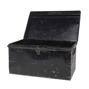
Functional object - Metal Box, Unknown
The first local government authority for Marong was the Marong Road District (an early form of single-purpose local government), which was proclaimed on 19 August 1860. Its boundary was altered twice in 1862 and on 12 December 1864 it was re designated as a Shire. It absorbed Raywood Borough in 1915, and was proclaimed a Rural City in 1990. On 2 December 1994, with the creation of Greater Bendigo City Council, it was abolished by being amalgamated with Bendigo City, Eaglehawk Borough, Huntly Shire, part of McIvor Shire, part of Metcalfe Shire and Strathfieldsaye Shire to form the City of Greater Bendigo. This metal box contained a roll of admission tickets and was possibly used for holding cash at the swimming pool or other municipal facility. Lockable painted metal box. Shire of Marongshire of marong -
 City of Greater Bendigo - Civic Collection
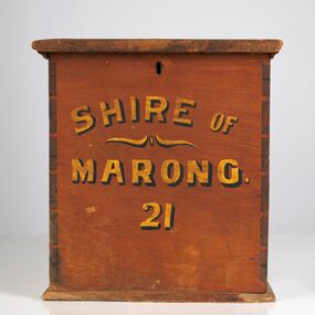
Functional object - Ballot Box, Shire of Marong, Shire of Marong 21, Unknown
The first local government authority for Marong was the Marong Road District (an early form of single-purpose local government), which was proclaimed on 19 August 1860. Its boundary was altered twice in 1862 and on 12 December 1864 it was re designated as a Shire. It absorbed Raywood Borough in 1915, and was proclaimed a Rural City in 1990. On 2 December 1994, with the creation of Greater Bendigo City Council, it was abolished through the amalgamation which took place between Bendigo City, Eaglehawk Borough, Huntly Shire, part of McIvor Shire, part of Metcalfe Shire and Strathfieldsaye Shire to form the City of Greater Bendigo. This box would have been used to collect votes during council elections.Wooden, painted, lidded box with hinged opening lid. Central slit in lid to insert ballot papers. Front face painted in black and gold paint. Hinged at back of box with lock on front. Front of box Shire of / Marong / 21shire of marong