


Historical information
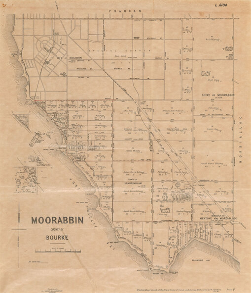
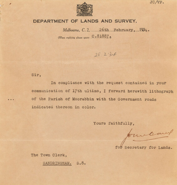
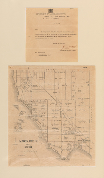
The cadastral map of the Parish of Moorabbin in Victoria (L.6104) shows parish boundaries and land ownership 1920 when Sandringham was a Town. The government roads have been coloured in red pencil.
Physical description
Photolithograph of the Parish of Moorabbin (dated 17/7/1920) accompanied by original typed letter to the Town Clerk Sandringham from the Secretary for Department of Lands and Survey (dated 26/2/1934), notifying of dispatch of the map. The cadastral map of the Parish of Moorabbin in Victoria (L.6104) is photolithographed at the Department of Lands and Survey by W.J. Butson. It is printed in black ink on cream paper and shows street names, subdivision of blocks, sizes of the blocks and the names of the landowners, and the government roads are coloured in red pencil. Port Phillip Bay is on the left, with land extending from Sandringham foreshore through to Cheltenham. The most detail is between Brighton Beach Railway Station (to the north) and just past Rickett's Point (to the south) but the map extends to North Road, Brighton at top. The letter is typed in black ink on cream paper. Both are set on a cream mount with two window openings.