Showing 32628 items
matching goldfields historical society
-
 Marysville & District Historical Society
Photograph (Item) - Black and white photograph, Yarra Track Hotel, c1900
An early black and white photograph of a hotel along the Yarra Track.An early black and white photograph of a hotel along the Yarra Track. The Yarra Track is the former name of the gold fields road from Healesville to the Woods Point and Jordan Goldfields, in Victoria, Australia. A direct route via the Yarra River and the Great Divide was discovered by Rieck in September 1862 and became known as the Yarra Track. Early in 1863, the Victorian Government decided to construct a 193-kilometre (120 mile) road along the route. Its original width varied between 4 and 6 metres (12 and 20 feet), and was designed to accommodate horse-drawn vehicles. The Track involved the climbing of the Black Spur, descent into the Acheron Valley, and then through Marysville to the Cumberland where it followed the existing route. Unable to ascertain both the location and name of hotel.ARMSTRONG COLLECTION 42 STATION STREET/ SANDRINGHAM 3191/ TEL. (03) 9521 5442/ IAN M.L. ARMSTRONG OAMyarra track, healesville, wood's point, jordan goldfields, victoria, yarra river, great divide, reick, black spur, acheron valley, marysville, cumberland creek -
 Marysville & District Historical Society
Photograph (Item) - Black and white photograph, The "Scandinavians' - (Deserted), c1900
An early black and white photograph of The Scandinavian's Hotel and Boarding House along the Yarra Track.An early black and white photograph of The Scandinavian's Hotel and Boarding House along the Yarra Track. The Yarra Track is the former name of the gold fields road from Healesville to the Woods Point and Jordan Goldfields, in Victoria, Australia. A direct route via the Yarra River and the Great Divide was discovered by Rieck in September 1862 and became known as the Yarra Track. Early in 1863, the Victorian Government decided to construct a 193-kilometre (120 mile) road along the route. Its original width varied between 4 and 6 metres (12 and 20 feet), and was designed to accommodate horse-drawn vehicles. The Track involved the climbing of the Black Spur, descent into the Acheron Valley, and then through Marysville to the Cumberland where it followed the existing route.ARMSTRONG COLLECTION 42 STATION STREET/ SANDRINGHAM 3191/ TEL. (03) 9521 5442/ IAN M.L. ARMSTRONG OAMthe scandinavians', yarra track, healesville, wood's point, jordan goldfields, victoria, yarra river, great divide, reick, black spur, acheron valley, marysville, cumberland creek -
 Marysville & District Historical Society
Photograph (Item) - Black and white photograph, Camp Opposite The "Scandinavians', c1900
An early black and white photograph of a camp which was opposite The Scandinavian's Hotel and Boarding House along the Yarra Track.An early black and white photograph of a camp which was opposite The Scandinavian's Hotel and Boarding House along the Yarra Track. The Yarra Track is the former name of the gold fields road from Healesville to the Woods Point and Jordan Goldfields, in Victoria, Australia. A direct route via the Yarra River and the Great Divide was discovered by Rieck in September 1862 and became known as the Yarra Track. Early in 1863, the Victorian Government decided to construct a 193-kilometre (120 mile) road along the route. Its original width varied between 4 and 6 metres (12 and 20 feet), and was designed to accommodate horse-drawn vehicles. The Track involved the climbing of the Black Spur, descent into the Acheron Valley, and then through Marysville to the Cumberland where it followed the existing route.ARMSTRONG COLLECTION 42 STATION STREET/ SANDRINGHAM 3191/ TEL. (03) 9521 5442/ IAN M.L. ARMSTRONG OAMthe scandinavians', yarra track, healesville, wood's point, jordan goldfields, victoria, yarra river, great divide, reick, black spur, acheron valley, marysville, cumberland creek -
 Marysville & District Historical Society
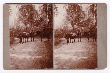
Photograph (Item) - Black and white bi-focal image, Unknown
An early black and white bi-focal image of men and packhorses on the Marysville-Wood's Point Road in Marysville in Victoria.An early black and white bi-focal image of men and packhorses on the Marysville-Wood's Point Road in Marysville in Victoria. This is now known as the Marysville-Wood's Point Road. The Marysville-Woods Point Road was originally part of the Yarra Track, constructed in the early 1860s to provide access between Healesville and the Woods Point Goldfields. Despite the steep terrain and engineering difficulties, the Yarra Track soon became a busy route used by pack horses, horse-drawn drays, and wagons. Today this sealed mountain road is a popular scenic drive between Marysville and Warburton.Packhorses on Wood'spoint Road/ Marysville/ Victoriapackhorses, wood's point road, marysville-wood's point road, marysville, victoria, yarra track, healesville, wood's point goldfields, warburton -
 Marysville & District Historical Society
Document (Item) - Newspaper article, The Argus, New Tourist Road. Marysville to Wood's Point Magnificent Forest Scenery, 02-1924
A newspaper article regarding the opening of the Marysville-Wood's Point Road in February 1924.A newspaper article regarding the opening of the Marysville-Wood's Point Road in February 1924. The Marysville-Woods Point Road was originally part of the Yarra Track, constructed in the early 1860s to provide access between Healesville and the Woods Point Goldfields. Despite the steep terrain and engineering difficulties, the Yarra Track soon became a busy route used by pack horses, horse-drawn drays, and wagons. Today this sealed mountain road is a popular scenic drive between Marysville and Warburton.marysville-wood's point road, yarra track, healesville, wood's point goldfields, warburton, the argus -
 Marysville & District Historical Society
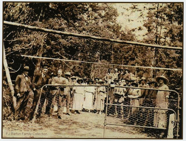
Photograph (Item) - Black and white photograph, 05-02-1924
An early black and white photograph of the ceremonial re-opening of the Marysville-Wood's Point Road in 1924.An early black and white photograph of the ceremonial re-opening of the Marysville-Wood's Point Road in 1924. The Marysville-Woods Point Road was originally part of the Yarra Track, constructed in the early 1860s to provide access between Healesville and the Woods Point Goldfields. Despite the steep terrain and engineering difficulties, the Yarra Track soon became a busy route used by pack horses, horse-drawn drays, and wagons. Today this sealed mountain road is a popular scenic drive between Marysville and Warburton.F.J. Barton Family Collectionmarysville-wood's point road, marysville, wood's point goldfields, healesville, yarra track, warburton -
 Marysville & District Historical Society
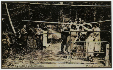
Photograph (Item) - Black and white photograph, 05-02-1924
An early black and white photograph of the ceremonial re-opening of the Marysville-Wood's Point Road in 1924.An early black and white photograph of the ceremonial re-opening of the Marysville-Wood's Point Road in 1924. The Marysville-Woods Point Road was originally part of the Yarra Track, constructed in the early 1860s to provide access between Healesville and the Woods Point Goldfields. Despite the steep terrain and engineering difficulties, the Yarra Track soon became a busy route used by pack horses, horse-drawn drays, and wagons. Today this sealed mountain road is a popular scenic drive between Marysville and Warburton.F.J. Barton Family Collectionmarysville-wood's point road, marysville, wood's point goldfields, healesville, yarra track, warburton -
 Marysville & District Historical Society
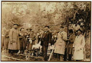
Photograph (Item) - Black and white photograph, 05-02-1924
An early black and white photograph of the ceremonial re-opening of the Marysville-Wood's Point Road in 1924.An early black and white photograph of the ceremonial re-opening of the Marysville-Wood's Point Road in 1924. The Marysville-Woods Point Road was originally part of the Yarra Track, constructed in the early 1860s to provide access between Healesville and the Woods Point Goldfields. Despite the steep terrain and engineering difficulties, the Yarra Track soon became a busy route used by pack horses, horse-drawn drays, and wagons. Today this sealed mountain road is a popular scenic drive between Marysville and Warburton.F.J. Barton Family Collectionmarysville-wood's point road, marysville, wood's point goldfields, healesville, yarra track, warburton -
Marysville & District Historical Society
Document (Item) - Research Document, Judith Vimpani, William Cavanagh Farrell (1844-1901), 04-2020
An account of the life of William Cavanagh Farrell.An account of the life of William Cavanagh Farrell who was important to Marysville as his review in 1863 of the routes to Wood's Point led to the Yarra Track ascending the Black Spur and going on to what became the resort town of Marysville on the Steavenson River. The Yarra Track is the former name of the gold fields road from Healesville to the Woods Point and Jordan Goldfields, in Victoria, Australia. A direct route via the Yarra River and the Great Divide was discovered by Reick in September 1862 and became known as the Yarra Track. Early in 1863, the Victorian Government decided to construct a 193-kilometre (120 mile) road along the route. Its original width varied between 4 and 6 metres (12 and 20 feet), and was designed to accommodate horse-drawn vehicles. The Track involved the climbing of the Black Spur, descent into the Acheron Valley, and then through Marysville to the Cumberland where it followed the existing route.willaim cavanagh farrell, marysville, victoria, wood's point, yarra track, black spur, steavenson's creek, steavenson river, george theodore rieck -
Marysville & District Historical Society
Document (Item) - Research Document, Judith Vimpani, George Theodore Rieck (1833-pos 1884), 04-2020
An account of the life of George Theodore Rieck.An account of the life of George Theodore Rieck. The Yarra Track is the former name of the gold fields road from Healesville to the Woods Point and Jordan Goldfields, in Victoria, Australia. A direct route via the Yarra River and the Great Divide was discovered by Rieck in September 1862 and became known as the Yarra Track. Early in 1863, the Victorian Government decided to construct a 193 kilometre (120 mile) road along the route. Its original width varied between 4 and 6 metres (12 and 20 feet), and was designed to accommodate horse-drawn vehicles. The Track involved the climbing of the Black Spur, descent into the Acheron Valley, and then through Marysville to the Cumberland where it followed the existing route.george theordore rieck, marysville, victoria, james murphy, new chum creek, wood's point, gold mining, matlock, walhalla, yarra track -
 Marysville & District Historical Society
Photograph (Item) - Colour photograph, 20-09-2008
A colour photograph of the entrance to The Big Culvert.A colour photograph of the entrance to The Big Culvert. The Big Culvert is a historic granite and bluestone arch along the Yarra Track, a major route to Melbourne through the 1800s. Built in 1870 and a major piece of infrastructure for its time, the heritage listed culvert allowed water to flow under often-flooded the road. The Yarra Track is the former name of the gold fields road from Healesville to the Woods Point and Jordan Goldfields, in Victoria, Australia. A direct route via the Yarra River and the Great Divide was discovered by Rieck in September 1862 and became known as the Yarra Track. Early in 1863, the Victorian Government decided to construct a 193-kilometre (120 mile) road along the route. Its original width varied between 4 and 6 metres (12 and 20 feet), and was designed to accommodate horse-drawn vehicles. The Track involved the climbing of the Black Spur, descent into the Acheron Valley, and then through Marysville to the Cumberland where it followed the existing route.the big culvert, yarra track, victoria, healesville, wood's point goldfields, jordan goldfields, black spur, acheron valley, cumberland valley -
 Marysville & District Historical Society
Photograph (Item) - Colour photograph, Pre 2009
A colour photograph of the Wilks Creek Bridge near Marysville in Victoria.A colour photograph of the Wilks Creek Bridge near Marysville in Victoria. The Wilks Creek Bridge is a former timber and bluestone road bridge on the Yarra Track, and is located just off the Black Spur route, between Narbethong and Marysville, Victoria, Australia. It was built in 1870 to the design of colonial Public Works Department engineer Clement Wilks as part of the construction of a new road to the Woods Point and Jordan Goldfields. Like many bridges of the period, it had a timber superstructure employing squared beams supported by struts and straining pieces, on cut bluestone abutments. The bridge was remodelled around 1900 by engineer John Monash of the famous bridge-engineering firm of Monash and Anderson. It was last used for heavy vehicular traffic in 1980 following the realignment of Marysville Road, and was left to decay until its demolishment in 2008. All timber traces of the bridge were destroyed in the 2009 Black Saturday fires. The handcrafted bluestone masonry wingwalls and abutments, especially shaped to receive timber struts, rate among the earliest of its kind surviving intact in Victoria.wilks creek bridge, yarra track, narbethong, marysville, victoria, clement wilks, wood's point goldfields, jordan goldfields, john monash, monash and anderson, 2009 black saturday bushfires -
 St Arnaud and District Historical Society
Book. Coonooer Bridge Memorial, Coonooer Bridge Memorial to those who served their Country in Wartime
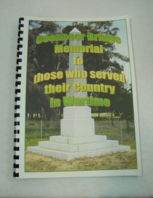
Following the Great War of 1914-18 the people who lived in the general area around Coonooer Bridge , (18 kms from St.Arnaud ) erected a Monument in honour of those men and women who served their country in a time of war. In 1920 the monument was erected across from the hall, situated in a small pine plantation which was also planted by community members. The names of those that served their country during war time were placed on the monument. After the 2nd World War the names of the local men and women who once again were asked to serve their country were added to the memorial to honour and remember the sacrifice that they made.This book was compiled to honour and enable families and future generations to remember those who served.This is the only book listing these servicemen that served from the Coonooer Bridge Area.Spiral plastic bound book.Clear perspex cover. Coloured pages.Includes photographs of servicemen, medals and war service information.Dedicated to the people of Coonooer Bridge. -
 St Arnaud and District Historical Society
Book. Track of the Years, Track Of The Years. The Story of St.Arnaud.By Yvonne S Palmer
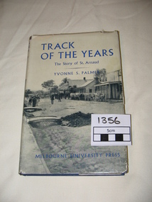
TRACK OF THE YEARS. The Story of St.Arnaud by Yvonne S Palmer had aroused local interest when this book was presented in 1955.The fortunes of this prosperous community, whose origins go back to the excitement of of the New Bendigo gold-rush, gleaned from an unusual wealth of reminiscences,diaries, letters, newspapers and photograph albums, are now placed permanently on record in this fascinating narrative. Contents: The New Bendigo Goldrush, Pastoral Settlement, The Aborigines of the Eastern Wimmera, A Permanent Goldrush, The Township Surveyed, Councils at Work 1861- 1870, Local Government in the District. 1861-1870. Sons of the Antipodes, Diggers in Townsmen, Daughters and Wives, Companies and Miners, Mining Settlements, Increasing Needs, Not by Bread Alone, The beginning of Farming, The Changing Countryside, A New St.Arnaud has Come, Deep Sinking and Dividends, Fewer farmers- Larger farms, Pride but not Complacency.Track of The Years by Yvonne S. Palmer. The Story of St.Arnaud. Hardcover book, blue cover with black and white photograph on the dustcover.Includes photographs and maps.308 pages, 1st Edition.1st Edition Published by Melbourne University Press in 1955. 308 pages. -
 St Arnaud and District Historical Society
Book. A New Bendigo, A New Bendigo.The Story of Gold and Silver Mines in St.Arnaud, First published 2008
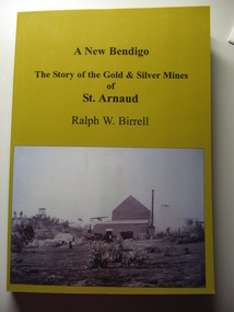
A soft cover book, A New Bendigo The Story of the Gold and Silver Mines of St.Arnaud by Ralph W. Birrell. 257 pages, includes photographs.and map. -
 St Arnaud and District Historical Society
Book.A Pictorial Journey, St.Arnaud A Pictorial Journey
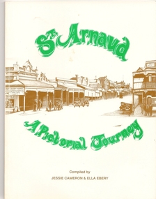
A collection of photographs, some not previously published, produced not in any kind of complete or historical sequence but as a pictorial journey into the past . Produced by members of the St.Arnaud Historical Society and with the help of those that loaned unseen old photographs. Compiled and researched by Jessie Cameron with compilation assistance and editing of the book by Ella Ebery. Published by the St.Arnaud Bi-centenial Committee First Edition 1988.This book has been provided for the citizens of St.Arnaud and district as well as the Australian public generally, as a tribute to past pioneers. The contents of this book will remain invaluable for untold years.Soft cover book St.Arnaud A Pictorial Journey. Compiled by Mrs Jessie Cameron and Mrs Ella Ebery. 88 pages Includes information and numerous black and white photographs relating to St.Arnaud .Published by St.Arnaud Bicentennial Committee.Printed by Creative Rural Printers 16-18 Napier St St.Arnaud 3478. First Edition 1988 Cover design : Napier Street St.Arnaud, 1925 by Leah Berry.book, photographs, st arnaud pictorial journey, jessie cameron, ella ebery, leah berry -
Federation University Historical Collection
Album, Folder containing Information on Henry Sutton
Henry Sutton is a talented world-wide accepted inventor with inventions relating to the telephone, photography, wireless, cars, motorcycles, and bicycles as well as many more inventions. Henry was also one of four brothers that ran the Sutton's Music Store after the death of their Father Richard Sutton. Henry Sutton taught Applied Electricity at the Ballarat School of Mines in 1883 to 1886.Folder containing Information on Henry Sutton including past researchers, dynamo electric motor, vacuum pump, Field and Science Society Ballarat.henry sutton, past researchers, dynamo electric motor, field and science society ballarat, vacuum pump -
 Federation University Historical Collection
Book, The Bulletin of School of Mines Colorado
Book of 92 pagesnon-fictiongolden, colorado, technical and engineering society, coal lands, dakota formation, electric haulage, sunnyside, utah, pahang, malaysia, magnetic seperator, colorado school of mines, schools of mines -
 Federation University Historical Collection
Newspaper - Newspaper - Broadsheet, Ballarat College of Advanced Education; Student Union Newspaper, "Eureka", 1979, 1980, 1981
"Eureka" was a Ballarat College of Advanced Education Student Union Newspaper. Ballarat College of Advanced Education is a predecessor institution of Federation University. The campus was at Mount Helen. Articles in the newspapers include an Editorials, Letters to the Editor, Education items, Clubs and Societies news, Reviews - consumer advice, Union reports. Environment, sports reports "Eureka" printed by Jeff Zilles.eureka, ballarat college of advanced education, editorials, letters to the editor, clubs and societies, reviews, union reports, sports reports, environment, stephen roberts, tony gill, janeen gunn, dawn reading, phillip crowley, judy ellis, neila mccaw, jeff zilles, printer, simon marginson, steve sewell, d j bellingham, steve bromeley, greg giles, wayne king, stephen harris, christopher stevens, philip lynch, peter mcmahon, bruce widdop, robert rook, annie stewart, m a caddie, phil lynch, peter fisher, grahame mcculloch, nina mckay, murray caddie, david fowler, whitlam government, education cuts, the budget, student union, student association, anne e. stweart -
Federation University Historical Collection
Book, Optical Society of America, Journal of the Optical Society of America, Volume 20, No. 6, June 1930, 06/1930
A printed journal contaiining the following contents: * Homochromatic Spectrophotometry in the Extreme Ultra-violet (George R. Harrison and Philip A. Leighton) * Parallax Panoramagrams Made Without Relative Movement of Lens, Grating or Sensitive Plate (Herbert E. Ives) * The Chromoliniscope Revisited (Herbert E. Ives) * Some Experiemtns in Mobile Color (G.A. Snook) Images include L.A. Jones, E.C. Crittenden, L.B. Tuckerman, Adolph Lamb, Paul D. Foote. Irvine C. Gardner, Arthur H. Compton. Paul E. Klopsteg. Edgar D. Tilver, Irwin G. Priest, F.K. Rightmyer, Bell System Telephones non-fictionoptical society of americal, e l.a. jones, e.c. crittenden, l.b. tuckerman, adolph lamb, paul d. foote. irvine c. gardner, arthur h. compton. paul e. klopsteg. edgar d. tilver, irwin g. priest, f.k. rightmyer, bell system telephones -
Federation University Historical Collection
Book, Bulletin of the Massachussetts Institute of Technology Boston, Volume 45, No. 1, December 1909, 1899
466 page Bulletin of the Massachussetts Institute of Technology Boston. Contents include members and committees, historical sketch, Society of Arts, Summer Schools, Admission requirements, Fees, courses of study, laboratories and instructionnon-fictionmassachussetts institute of technology, boston -
Federation University Historical Collection
Document, Zelda Martin, Central Victorian Goldmining towns - Boom Towns or Ghost Towns?, c1996
Zelda Martin was a PhD candidate at the University of Melbourne.[.1] 4th item in light blue display book titled Research Approach/Overview of Chapters/Confirmation of Canditure/Chapters1,2,3&4 of proposed thesis. *Twenty-seven page article on Victorian goldfields towns titled: Central Victorian Goldmining Towns - Boom Towns or Ghost Towns. The article was written during the author's PhD study. It outlines the context methodology, and resources and the chapters of the proposed thesis: (1) Central Victorian Goldmining Towns - The Context (2) Contemporary Views of the Factors Necessary for Town Growth (3) Outward Manifestations of Town Growth (4) The Trappings of Government (5-9) The Main Towns and Their Hinterland. [.2] 5th item in Light Blue display book as above item. *Chapter 1 of proposed thesis titled 'Pick, Shovel and Tin Dish Mining.' Covers in Section A: Central Victoria - Pre 1851: Aborigines in Central Victoria, Squatters, and Government. Section B: The years 1851-1854: The Early Gold Rushes, Government Reaction, Township Surveys, Legislation, Town Development, Local Government and Early Settlement. [.3] 6th item in Light Blue display book as above item. *2A of proposed thesis titled 'Contemporary Views of the Factors Necessary for Town Growth'. Similar information to Chapter 1 plus extra re towns and maps. Sections: Introduction, Context of Place - Geographical Towns Listed, The Context of Time - Pre1851 Aborigines, Governance of Port Phillip, The Squatters, The Villages of Central Victorian Highlands, Conclusion, Condensed Version of Chapter2B. [.4] 7th item in Light Blue display book as above item. *Chapter2B of proposed thesis. Sections: Area of Research, Schools, Banks, Newspapers, Progress Association, Town Development - Sandhurst (Bendigo), Ballarat, Castlemaine,, Maryborough, Ararat and Stawell. [.5] 8th item in Light Blue display book as above item. *Chapter 3 of proposed thesis titled 'Outward Manifestations of Town Growth'. Sections: Introduction, Contemporary Writing, Educationalists, The Bankers, The Townsfolk, Current Theory, General Theories of Urban Development, and Conclusion. [.6] 9th item in Light Blue display book as above item. *Chapter 4 of proposed thesis titled 'Trappings of Government' Sections: Introduction, Early Government Attitudes to Mining and Town Development, Law and Order, Township Surveys, Legislation, Local Government, Transport and Communication, The People and Lobbyists. [.7] 10th item in Light Blue display book as above item. *'The Rise and Fall of Central Victorian Goldmining Towns'. Includes a map showing main Goldfields, a table showing towns and villages at two points in time - 1857 and 1871; a Bibliography of Primary and Secondary Sources. [.8] Resource No1. Black display book titled Local Towns 1 : Alma: *Brief history *Directory *Maps Amphitheatre / Mountain Hut: *Brief History Post Office Directory Ararat: *Brief History *Post Office Directory 1869 - Alphabetical Listing by Occupation *Ararat - Prominent Citizens of 1858 *Langi-Morgala Museum Avoca: *Brief History *Excerpts from 'Avoca The Early Years', Margery and Betty Beavis; pg1 - Beginnings; pg11 - The Midas Touch; pg25 - Local Gold Escorts; pg27 - A Town is Born; pg51- The Administration of Justice; pg53 - The Ways of the Law; pg61 - News of the Day; pg65 - A Time to Play; pg72 - Land Ownership *Post Office Directory (Bailliere's) 1869 *Tourism Map and Information of area *Historic Avoca - A 5.5km Tour *Avoca & the Pyrenees Region - information pamphlet Ballarat: *Early History of Ballarat - Ballarat Historical Society, Publication No.1: origin of the name; Ballaarat - the Beginning; Fabulous Yields from the Ballaarat Goldfield; *Streetscape Lydiard Street. *Hand drawn map showing Leigh River, Old Portland Bay Road, plaque on road to Colac; etc. *Newspaper article re 'The Theatre Royal' ( which stood in the vicinity of the current Owen Williams store) - 'The News'15/04/1998 *Article - 'Ballarat's Mechanics' Institute Lives On' Ballarat Courier, 14/09/1985 *Article - Standing the Test of Time' The News 17/11/1993 re The Mechanics Institute & picture of the Reading Room *'Ballarat a Study of a City, Phyllis Reichl, pub. Nelson, 1968; no.3 place, time and people field studies series *Investigator Vol.33 No.2, 1998 Geelong Historical Society. Article on pg75 describes Ballarat in 1861 *Folded poster - 'Ballarat 100' a history of telegraph communication, pub. Telecom. Beaufort (Fiery Creek): *Brief history *Post Office Directory [.9] Resource No.2 Black Folder Titled Towns cont.No2 Bendigo (Sandhurst): *'Family & Local History at the Bendigo Library - 1851-2001 150 years of gold'. *Bendigo Government Camp in 1853 illustration; key to sketch and names of Government officers stationed there *Excerpts from 'Bendigo and Vicinity' Adolph Haman *The Bendigo Goldfield Registry - pgs 1-7 Introduction *Excerpt: 'Breaking the Grip' *Excerpt: The Most Go-Ahead Place *Excerpts from 'History of Bendigo' - anti license agitation; laying out of town; proposed railway; gold calls and dividends; the Sandhurst Municipality; journalism *Bibliography Blackwood: *Excerpts from 'Aspects of Early Blackwood - The Goldfield, the Landmarks, the Pioneers' Alan J Buckingham and Margaret F Hitchcock, JG Publishing,1980 Buninyong: *A Brief History *Investigator Vol1 No.2 Feb 1966 Geelong Historical Society. Pg3 - Article re gold escort route - Mt Alexander to Adelaide - (see a simple monument on the Western Highway a few miles out of Horsham. Pg 15 - Ballarat Excursion - re the finding of gold. *Three articles published by Buninyong and District Historical Society Inc: (Magpie Exploration; Finding Gold In The Green Hills; Magpie Exploration; Burnt Bridge to Cargarie to Mt Mercer) *Copies of newspaper articles/items *Buninyong Street Directory Carisbrook: *In the Beginning There Was Carisbrook *The History of the Carisbrook Racecourse Carngham / Snake Valley: *Brief History *Directory Castlemaine: *Directory 1865-1866 - Alphabetical and Street *Poster - Castlemaine A Contemporary Guide "The Great Centre" 1866 - A Contemporary Guide to the Fascinating Past *Pamphlet - Castlemaine District Community Hospital *Map - Castlemaine, Maldon & Surrounding Districts *Map and Information - The Dry Diggings Track - a 55kl walk among historic goldfields relics ( Castlemaine Fryerstown Vaughan Mt Franklin Hepburn Daylesford) *Postcard - Former Court House *Directory 1867 - Alphabetical, Trade [.10] Resource No.3 Grey folder Titled Towns 3 Creswick to Maryborough Creswick: *Brief History *Booklet - "Creswick Cemetery Walk" *Booklet - The Buried Rivers of Gold Heritage Trail Creswick *Creswick Historical Museum Information Sheet *Chronological History of Creswick *Alphabetical Directory of the Borough of Creswick *Creswick's Creek Directory 1856 *Historic Creswick Walking Tour *A Brief Account of the Schools of Creswick - Past and Present *100 Years of Railway Travel in Creswick *The Berry Deep Leads *The Spence Home at Jackass Gully in the Creswick State Forest ( William Guthrie Spence - Pioneer) *The New Australian Mine and the 1882 Disaster *Creswick District News, Issue 7, July August 1999 *The Creswick Miners Walk - Information and Map *Maps Chewton: *Brief History *Directory Clunes: *Brief History *Clunes Street Directory Daylesford: *Brief History *Notable Bushfires in Daylesford District Over More Than a Century - "Black Thursday" 1851; 1862; 1899; the Disastrous Hepburn Fire of 1906; 1939; 1944; 1969. *Post Office Directory -Daylesford and Hepburn Dunolly / Inkerman: *Brief History *Directory *Pamphlet - Goldfields Historical Museum *Pamphlet - Historic Dunolly - Victoria's Best Kept Secret *Map of Gold Workings at Dunolly Area - showing where the main gold rushes occurred *Brief History - Inglewood *Directory - Inglewood - Name Occupation, Dwelling Kingower: *Brief History *Directory - Name / Ocupation / Dwelling Linton / Happy Valley / Piggoreet: *Brief History *Directory - Lintons McIvor: *"A History of the Shire and the Township of Heathcote" by J.O. Randell Majorca: *Brief History *Official Post Office Directory 1869 - Name / Occupation/ Address Maldon (Tarrangower): *Brief History Part 1 *Brief History Part 2 *Post Office Directory *List - Alphabetical Order by Names plus Business and Trade (Tarrangower Times Oct/1858) *List - Alphabetical Order by Trade plus Name and Business *Directory - Name / Occupation / Dwelling Maryborough: *Worsley Cottage - built by Arthur Worsley, a contractor in stonework in 1894 [.11] Resource No. 4 Blue Display Book titled Towns 4 Moliagul to Stawell Moliagul: *Brief History *Moligul Legislative Assembly (Voting?) List - Names and Occupations *Moliagul Victorian Post Office Directory 1868 - Name / Ocupation / Address / Comments *"The Welcome Stranger" gold nugget *The Sunday School *The Welcome Stranger Discovery Walk - information and map Moonambel (Mountain Creek) Redbank *Brief History *List of names extracted from advertisments of the Pioneer and Mountain Creek Advertiser 16/02/1861. *Bailliere's Directory 1869 - Alphabetical List of Name / Occupation / Place St Arnaud: *Brief History Sebastapol: *Brief History *Directory 1869 - Alphabetical by Name; plus occupation and address. Browns and Scarsdale: *Brief History *Browns Street Directory - Name and Occupation Smythesdale: *Brief Description *Smythesdale Street Directory -Name and Occupation Stawell (Pleasant Creek) *Brief History *Victorian Official Post Office Directory - Name /Occupation / Dwelling *Chronology - 1841-1920 *Production of gold statistics - 1879 - 1900 *Big Hill *Extracts from "The Golden Years of Stawell". Chapt 1 - Stawell's Coming Out. Capt. 2 - The Gold Rush. Caapt.3 - Cradle of Democracy. Chapt.4 - The Reefs Becomes Stawell. Chapt. 5 - Rushing In. Chapt.6 - The Pioneers. Chapt 7 - The Decade of Optimism. [.12] Resource No. 5: Blue Display Book titled 'Towns Steiglitz to the The Golden Triangle. Steiglitz: Brief History Victorian Post Office Directory 1869 *Map of Steiglitz *List of maps relevant to Steiglitz history *Information 6 tables of data from "Reports of Mining Surveyors Talbot (Back Creek) Brief History Taradale: Post office Directory 1869 - Name/Occupation/Street. Also list in alphabetical order by Occupation Taradale *Chronological Reference to Taradale Mines *Water - The Coliban System of Waterworks *Joseph Brady *The Syphon Tarnagulla (Sandy Creek) *Brief History *Tarnagulla Businessmen Cameos to give depth to advertisments in 'The Tarnagulla Courier' various issues 1864-1871 *Directory - Name/Occupation /Address *List - Name/Business/Trade Wedderburn (Koorong) *Brief History *List - Name/Occupation The Golden Triangle: *The Early Rushes - Wedderburn / Moliagul / Sandy Creek - Tarnagulla / Jones Creek - Waanyarra / Kingower / Dunolly - Goldsborough / Inglweood *Census of 1857 - Population / Occupations *1858-1871 - A Time of Consolidation- Wedderburn / Moliagul / Sandy Creek- Tarnagulla / Arnold *Census 1871 - Population *Information gleaned from the census data - Demographics / Population / Occupations / marital / Birthplace / Religion / Literacy/ Occupation and Housing Cameos *Graphs - Birthplace of settlers /Male-Female Ratio / Married males / Children under 15 as Percentage of Population / Religion *Census 1857 - Statistical data *Maps *Bibliography [.13] Resource No. 6 - Black Display Book Information and Research in Central Victoria including: *Banking - Research from ANZ Bank Archives *Institutions - also includes articles listed from the Ballarat Times Newspaper *Australian mining History Association - A.M.H.A. Bibliography *Australia's Mining History * Bibliography - Land Surveys Victoria - *1853 Administration (Statistics and Other) includes: schools / ministers of religion / police / military / local administration / licences for sale of spirits / distances between various Victorian gold fields. * Victoria Government Gazette (Copy) - N0. 116, 12/12/1854 includes: Gold Felds Commission of Enquiry & No. 85, 15/09/1854 - Addresses presented to the Lieutenant Governor (Sir Charles Hotham) during his tour through the Gold Fields of Victoria,1854. Addresses on behalf of : the people of Bendigo; Members of the Church of England, Bendigo; Members of the Wesleyan Church on the Bendigo Gold Fields; Bendigo Gold District General Hospital; the Bendigo Prospecting Association; Committee of the Bendigo Local Exhibition; Bendigo District Medical Association; Coloured Americans Resident at Bendigo; German Inhabitants of Bendigo; Landowners, Inhabitants, and Miners of Castlemaine; Inhabitants of Forest Creek; Inhabitants of Heathcote and Gold Miners of McIvor; Residents and landholders of the District of Bacchus Marsh; Inhabitants of Kilmore and Vicinity. *Gold Fields Correspondence 1853: letter from Lieutenant Colonel Valiant, (Officer commanding the Troops in Victoria) to the Lieutenant Governor re threatened disturbance at Sandhurst (Bendigo) regarding the Gold License Fee. * Extracts from a book "Victoria" re Gold Fields Commission of Enquiry involving mainly Ballarat and Castlemaine and a chapter titled 'A Tour to the Victorian Gold-Fields' *Lists of central Victorian newspapers - listed by date published 1851to 1874; by first date available to State Library. *A list of cities and towns showing County, population in 1861 &1871, and municipal status. [.14] Resource no.7. Black display book. *Reference: Papers presented to Parliament Victoria - 1859-1860 4 volumes - relevant sections copied. Contains information on Branches of Government. General / Finance / Gold / Gazette / Commission and Warrant / Statistic. *Gold Fields Act. In accordance with the Act the gold fields are divided into six districts - Ballaarat, Castlemaine , Sandhurst, Avoca, Ararat, and Beechworth.. Official staff in each gold district consists of a Resident Warden, Wardens, Wardens' Clerks, Bailiffs, Chinese Protectors, Chinese Interpreters, and Mining Surveyors. *Gold Receiver *Gaols *Police magistrates and Clerks of Petty Sessions, etc. *Field Branch *Immigration and Emigration Overland - Chinese - 1859 *Population on the Goldfields *The Geological Survey - The Government Geologist is assisited by staff from four branches - the office Branch; the Publishing Branch; the Field Branch and the Museum Branch. *Commission to Enquire Into Sludge dated 10/02/1859 (Some sections copied) - Report to the Honorable Chief Commissioner of Public Works, Melbourne re the mode of carrying the sludge from the puddling mills in Sandhurst without interfering with the drainage of the town and the roads in the neighbourhood. [.15] Resource No.8: Camel display book titled Resource No. 8. Aborigines *Lists of book titles - +"Readings in Victorian prehistory" +"The Aborigines of Port Phillip" +Aboriginal languages and clans" +"A History of the Port Phillip District" +"Langi Ghiran 1: Aboriginal Rock...." +"Koorie History: sources for aboriginal studies in the State Library of Victoria", ed. Tom Griffiths, Melb. Friends of the State Library, 1989 +"The Public Lands of Australia Felix"; settlement and land appraisal in Victoria1834-91 with special reference to the Western Plains", J.M.Powell, Melb. Oxford University Press 1970 +*Bibliography of the Victorian Aborigines' from the earliest manuscripts to 31st December 1970, Massoa, Aldo, Melb. Hawthorn Press, 1971 +"Aborigines in Colonial Victoria, 1836-1886", M.F. Christie, Sydney University Press, 1979 +"Urban and Industrial Australia: readings in Human Geography" ed J.M. Powell, Melb. Sorrett Pub. 1974 *Extracts: -Processes of Pioneer Settlement - The Squatting Occupation of Victoria, 1834-60. J.M. Powell -Areal Variations in the Class Structure of the Central-Place Hierarchy. P. Scott - Volume1 and Volume 2: Notes Relating to the Habits of the Natives of Other Parts of Australia and Tasmania. Compiled from various sources for the Government of Victoria by R Brough Smyth. John Curry, O'Neil, Melb. 1st pub. Melb. 1876. p31-45 - Numbers and Distribution of the Aborigines in Victoria -Victorian Aborigines 1835-1901 - A Resource Guide to the Holdings of the Public Record Office, Victoria; published by the Government Information Centre 1984. *History of the Aboriginal Artefacts Displayed in the Daylesford Museum. F. G. Powell (4 page pamphlet) *Letter to Zelda Martin from Peter Lovett, Cultural Officer, Ballarat & District Aboriginal Co- Operative, 05/02/1997 *Map: Ian Clarke Victorian Tribunal Boundary Map - Clans of Central Victoria. *Victorian Rock Art and Mythology - Article about Mount Langhi Ghiran and myths of the Tjapwarong people. *Two Aboriginal myths relating to the Grampians - 'The Monster Emu' / 'The Aquisition of Fire', by the Aborigines in the Grampians Areas *Article titled (chapter 8) Ballarat - information re camping sites in the region. Lake Wendouree / Lake Burrumbeet (includes a myth) / Mt Bunninyong / Lal Lal / Pitfield / Mount Elephant / Mount Egerton / Meredith / Lake Goldsmith / Lake Learmonth / Ercildoune *Notes on the Aborigines of the Wider Ballarat Region plus European names=Aboriginal names. John Morris 26/07/1995 *Role of Aborigines in Town Development in Central Victoria. Mentions Native Police Force est. in Port Phillip 1842 and Central Board for Aborigines est. 1860 *The Grave of King Billy. (Frank Wilson) Pamphlet. *Camping Places in Central and Northern Victoria. Article re Lake Burrumbeet site. *Programme for the Unveiling of Memorial Cairn for Edward Stone Parker 1802-1865. Note portrait not accurate. Accurate portrait is available in the book "A Successful Failure A Trilogy The Aborigines and Early Settlers", Edgar Morrison, Graffiti Publications, 2002. * Large envelope addressed to Mr G Netherway containing newspaper cuttings regarding the life of Edward Stone Parker, the unveiling of the Memorial Cairn as mentioned above, articles titled 'Episodes from Our Early Days' (Edgar Morrison, Yandoit)- The Black's School, A School At Last and The Final years. Also a typed page titled 'Historical Background to E.S.Parker's Career. Includes an interesting tale titled 'When the cat lay doggo' re laying power leads for the unveiling ceremony at the memorial site. [.16] green display folder titled 'Research Aids' *List of references to Commissioners' & W'ardens' Reports (formerly held at La Trobe Library Archives, now at Public Records Office [PRO]). Indicates town referred to / date of report / name of camp if different to town. * Archive information re Anglican Records *Movement around the Goldfields - Miners and Storekeepers - usefulness of newspapers in providing information - areas covered - Castlemaine, Maldon, Ararat, Stawell, Tarnagulla, Dunolly. *Port Phillip /Victoria Directories 1839/1867 - Chronological list of Directories included in this series. *"Notes on the History of Local Government in Victoria" A.W. Greig Melb. University Press 1925 - Photo-copied extract p5-p40. (Source - Deakin University Library) - Introduction by W.Harrison Moore. Section 1 - Development in New South Wales Before Separation. Section 2 - Development in Victoria After Its Separation from New South Wales. Hand written notations: 'roads, markets, and local government 1855 on' ;'opportunity of squatters in parliament' and 'opportunities of matters in parliament p33' * Notes on the Establishment of Surveyor General's Department 1851and Commissioner of Crown Lands and Survey. * Newspaper articles from The Argus, 1849, re the discovery of gold in the Pyrenees region. * Excerpt - a report on schools - A.B.Orlebar, Inspector; re the need for permanent school buildings rather than tents. *Excerpt from - 'Approaches to Urban History', Sean Glynn: The Case for Caution * Except from - 'The Urban Sprinkle', Weston Bate: Country Towns and Australian Regional History *Reference- 'The History of Land Tenure in the Colony of Victoria', John Quick. References the Haines Land Bill, land tenure and Land Leagues. [.17] Light blue envelope folder titled 'Birtchnell's Ballarat, etc. Directory 1862 *Contains various directories for Smythesdale, Buninyong, Clunes, Brown's and Creswick. [.18] Red envelope folder no.2 titled Victorian Gazetteer *Selected pages from 1869 Victorian Gazetteer on A4 paper (with a handwritten note questioning if some pages are from 1868 Victorian Gazetteer as appears to be different sizes - A3 pages.) Information includes locations and descriptions of towns, hotels, banks, communications and populations. (Does not include names, residences and occupations) [.19] Red Envelope folder titled Bailliere's Official Post Office Directory 1868 (or1869 or a mixture of both?) *Preface *Contains a selection of pages of towns highlighted in yellow in the the index *Work on this directory was commenced in 1867. *Information includes: Municipalities - mayors and councilors; lists of towns naming male inhabitants and their occupations. [.20]Yellow manila folder titled Post Grad Seminar Presentation 1996 *Gives some background to Zelda Martin's proposed thesis and why she chose the topic Gold Mining Towns Boom or Bust [.21] A3 display book - No. 1A * A list of 'Relevant Newspapers collected: The Tarrangower Times and Maldon Advertiser (first published 1858) Includes dates 1858-1867. The Mount Alexander Mail. Includes dates 1854-1866 The Tarnagulla Courier. Includes dates from1864-1871 Dunolly and Burnt Creek Express. Includes dates from 1862-1871 * Selection of newspaper pages from The Mount Alexander Mail 1854 to 1856, mostly showing advertisements for businesses and services provided to that community. [.22] A3 display book - No. 1B * Selection of newspaper pages from The Mount Alexander Mail 1857 to 1866, mostly showing advertisements for businesses and services provided to that community. [.23] A3 display book -No. 2 * Selection of newspaper pages from The Tarnagulla Courier 1864 to 1871, mostly showing advertisements for businesses and services provided to that community. [.24] A3 display book - No. 3 *Selection of newspaper pages from The Tarrangower Times (and Maldon and Newstead) Advertiser 1858 to1867, mostly showing advertisements for businesses and services provided to that community. [.25] A3 display book - No.4 * Selection of newspaper pages from The Dunolly and Burnt Creek Express; and The Dunolly and Betbetshire Express 1862 to 1871, mostly showing advertisements for businesses and services provided for that community. [.26] A3 display book - No.5 Includes: * Bryce Ross's Diggings Directory. Includes instructions for using this directory. This directory was used by "all persons having connexion or desiring to communicate with 'working parties, private friends, or Stores at the Diggings." As a directory for each area wwas completed it was published in each month's issue of Bonwick's "Digger's Magazine." Years c1852/1853. This Directory commences first at the head of Forest Creek. Includes a directory for Bendigo and Ballarat. Of interest at the end of the Bendigo and Ballarat directory is a list of the number of storekeepers, butchers, doctors, smiths, eating houses, lemonade sellers and chapels. * The Castlemaine Directory and Book of General Information Comprehending Glass's Model Calendar for the Two Years 1862 and1863. "zelda martin, victorian goldfield towns, bendigo, castlemaine, ballarat, maldon, stawell, ararat, maryborough, creswick, avoca, heathcote, banks, bank of australasia, union bank of australia, government camp, sandhurst, water supply, tarnagulla, talbot, back creek, mountain creek, police court, carisbrook, dunolly, thompson's foundry, charles clacy, anthony trollope, robert cecil, mount alexander, urbanisation, national schools, education, govenrment, industry, railway, transport, settlement, land settlement in central victoria, steiglitz, joseph brady, the new australian mine, berry deep leads, william guthrie spence, creswick state forest, arthur worsley, worsley cottage, the welcome stranger, moliagul, moonambel, redbank, st arnaud, sebastapol, brown's, scarsdale, clunes, chewton, daylesford, bushfires, inkerman, inglewood, kingower, lintons, happy valley, piggoreet, mcivor, majorca, tarrangower, taradale, the coliban system, the syphon, sandy creek, wedderburn, koorong, arnold, jones creek, waanyarra, the golden triangle, census 1857, blackwood, buninyong, durham lead, magpie, carngham, snake valley, alma, amherst, daisy hill, amphitheatre, mountain hut, beaufort, fiery creek, counties, population, gold fields commission of enquiry1854, william westgarth, gold license fee, lieutenant colonel valiant, administration of the victorian gold fields, commission to enquire into sludge 1859, e.s. parker, edward stone parker, edgar morrison, mount franklin protectorate, dja dja wurrung, memorial cairn, franklinford, mt franklin memorial cairn, jajowurrong, dja dja wurung, tjaowarong, wothowurong, assistant protectors, daylesford museum, buluk, rock art - grampians, aboriginal mythology - grampians, aborigines, first nations people, mount franklin, aboriginal artifacts, lake burrumbeet, native police force, central board of aborigines, yandoit, commissioners' reports, wardens' reports, port phillip/victoria directories 1839-1867, local government - victoria 1853/1854, surveyor general's department - 1850's, victorian schools 1850's, a.b.orlebar, haines land bill, william charles haines, wilson gray, land tenure, land leagues, victorian gazetteer, the tarrangower times and maldon advertiser - 1858-1867, the mount alexander mail 1854-1866, the tarnagulla courier 1864, dunolly and burnt creek express 1862-1871, bryce rose's diggings directory, the castlemaine directory 1862-1863 -
 Glen Eira Historical Society
Album - Album page, "Ripponlea", Hotham Street, Circa 1972
This photograph is part of the Caulfield Historical Album 1972. This album was created in approximately 1972 as part of a project by the Caulfield Historical Society to assist in identifying buildings worthy of preservation. The album is related to a Survey the Caulfield Historical Society developed in collaboration with the National Trust of Australia (Victoria) and Caulfield City Council to identify historic buildings within the City of Caulfield that warranted the protection of a National Trust Classification. Principal photographer thought to be Trevor Hart, member of Caulfield Historical Society. Most photographs were taken between 1966-1972 with a small number of photographs being older and from unknown sources. All photographs are black and white except where stated, with 386 photographs over 198 pages.From Victorian Heritage Database citation for Rippon Lea H0614 https://vhd.heritagecouncil.vic.gov.au/places/427(as at 23/10/2020) Rippon Lea was commenced in 1868 by Frederick Sargood, a most successful politician and merchant. He was born in England in 1834 and arrived in Melbourne in 1850. He soon joined his father's wholesale soft goods firm, spending some time as its manager on the goldfields. Sargood entered the Legislative Council in 1874. He was Victoria?s first Minister for Defence in 1883. Sir Frederick Sargood was created CMG. In 1885 and KCMG in 1890 as a reward for his contribution to public life. He died suddenly in 1903. Rippon Lea was designed by the leading firm of architects, Reed and Barnes. Joseph Reed had travelled in Europe in 1863, including northern Italy. When he returned he introduced the use of polychromy. While not the first examples, Rippon Lea and the Independent Church in Collins Street were the best and set a fashion which became a distinctly Melbourne style, particularly used for houses and churches. Its popularity was possible because of the new availability of different coloured bricks. Reed's fine Lombardic Romanesque details soon became debased by others. As Sargood's family grew and his fortunes prospered, Rippon Lea was extended to include 33 rooms - a complete mansion. The cast iron porte cochere and the northern conservatory were added in 1897. The architects were Taylor and Fitts. The ballroom was added in 1882 and remodelled in 1889. Many alterations have changed the interior and exterior during the ownerships of Benjamin Nathan and later his daughter Mrs Louisa Jones in the 1930s and are in their own right of significance. Sir Thomas Bent owned the property from 1903 until 1911 but never lived there. He subdivided much of the land. The original garden dates from about 1868, and it seems that William Guilfoyle of the Botanic Gardens was involved. It was redesigned in a more natural style in the 1880s by Sargood and his head gardener, Adam Anderson. The lake, waterfalls, fernery, hill and grotto are balanced by mighty deciduous trees and conifers. These are interspersed with, but never dominated by Australian species such as eucalyptus and other exotics. The sinuous drive with its carefully prepared approach to the house is notable. The original vegetable gardens, orchard and outer paddocks no longer survive. The shade house is important as the largest known in Australia and possibly the world. Its curved plan and form of construction are particularly notable. It was built about 1884.Page 94 of Photograph Album with four photographs (three landscape and one portrait) of Ripponlea - stables, lookout and neighbouring cottages.Handwritten: "Ripponlea" Hotham Street [top right] / Neg 256 Dec 1972 STABLES [under top left photo] / Neg 248 Dec 1972 LOOKOUT [under top right photo] / Neg 254 Dec 1972 / COTTAGES WILLOW STREET [under bottom left photo] / Neg 259 Dec 1972 STABLES [under bottom right photo] / 94 [bottom right]trevor hart, elsternwick, mansion, hotham street, frederick sargood, reed and barnes, 1860's, 1890's, 1880's, benjamin nathan, nathan, louisa jones, thomas bent, sir thomas bent, william guilfoyle, guilfoyle, adam anderson, ripponlea, victorian, sir frederick sargood, architects, bricks, polychrome bricks, taylor and fitts, stables, lookouts, cottages, outbuildings, rippon lea -
 Glen Eira Historical Society
Album - Album page, Ripponlea, 192 Hotham Street, Circa 1972
This photograph is part of the Caulfield Historical Album 1972. This album was created in approximately 1972 as part of a project by the Caulfield Historical Society to assist in identifying buildings worthy of preservation. The album is related to a Survey the Caulfield Historical Society developed in collaboration with the National Trust of Australia (Victoria) and Caulfield City Council to identify historic buildings within the City of Caulfield that warranted the protection of a National Trust Classification. Principal photographer thought to be Trevor Hart, member of Caulfield Historical Society. Most photographs were taken between 1966-1972 with a small number of photographs being older and from unknown sources. All photographs are black and white except where stated, with 386 photographs over 198 pages.From Victorian Heritage Database citation for Rippon Lea H0614 https://vhd.heritagecouncil.vic.gov.au/places/427(as at 23/10/2020) Rippon Lea was commenced in 1868 by Frederick Sargood, a most successful politician and merchant. He was born in England in 1834 and arrived in Melbourne in 1850. He soon joined his father's wholesale soft goods firm, spending some time as its manager on the goldfields. Sargood entered the Legislative Council in 1874. He was Victoria's first Minister for Defence in 1883. Sir Frederick Sargood was created CMG. In 1885 and KCMG in 1890 as a reward for his contribution to public life. He died suddenly in 1903. Rippon Lea was designed by the leading firm of architects, Reed and Barnes. Joseph Reed had travelled in Europe in 1863, including northern Italy. When he returned he introduced the use of polychromy. While not the first examples, Rippon Lea and the Independent Church in Collins Street were the best and set a fashion which became a distinctly Melbourne style, particularly used for houses and churches. Its popularity was possible because of the new availability of different coloured bricks. Reed's fine Lombardic Romanesque details soon became debased by others. As Sargood's family grew and his fortunes prospered, Rippon Lea was extended to include 33 rooms - a complete mansion. The cast iron porte cochere and the northern conservatory were added in 1897. The architects were Taylor and Fitts. The ballroom was added in 1882 and remodelled in 1889. Many alterations have changed the interior and exterior during the ownerships of Benjamin Nathan and later his daughter Mrs Louisa Jones in the 1930s and are in their own right of significance. Sir Thomas Bent owned the property from 1903 until 1911 but never lived there. He subdivided much of the land. The original garden dates from about 1868, and it seems that William Guilfoyle of the Botanic Gardens was involved. It was redesigned in a more natural style in the 1880s by Sargood and his head gardener, Adam Anderson. The lake, waterfalls, fernery, hill and grotto are balanced by mighty deciduous trees and conifers. These are interspersed with, but never dominated by Australian species such as eucalyptus and other exotics. The sinuous drive with its carefully prepared approach to the house is notable. The original vegetable gardens, orchard and outer paddocks no longer survive. The shade house is important as the largest known in Australia and possibly the world. Its curved plan and form of construction are particularly notable. It was built about 1884.Page 90 of Photograph Album with five photographs (one landscape and 4 portrait) of Ripponlea - two different views of the front entrance to the mansion, one of the front gates and two different views of the main residence.Handwritten: "Ripponlea" 192 Hotham Street [top right] / North [under top left photo] / Neg 255 Dec 1972 MAIN DRIVE [under bottom left photo] / Neg 238 8 OCT 1966 [under middle right photo] / 88 [bottom right]trevor hart, elsternwick, mansion, hotham street, frederick sargood, reed and barnes, cast iron porte cochere, conservatory, 1860's, 1890's, ballroom, 1880's, benjamin nathan, louisa jones, thomas bent, sir thomas bent, william guilfoyle, adam anderson, lake, grotto, shade house, portico, ripponlea, victorian, sir frederick sargood, architects, polychrome bricks, lombardic romanesque architectural style, rippon lea, taylor and fitts, land subdivisions, gardens, drives, vegetable gardens, orchards -
 Glen Eira Historical Society
Album - Album page, Ripponlea, 192 Hotham Street, Circa 1972
This photograph is part of the Caulfield Historical Album 1972. This album was created in approximately 1972 as part of a project by the Caulfield Historical Society to assist in identifying buildings worthy of preservation. The album is related to a Survey the Caulfield Historical Society developed in collaboration with the National Trust of Australia (Victoria) and Caulfield City Council to identify historic buildings within the City of Caulfield that warranted the protection of a National Trust Classification. Principal photographer thought to be Trevor Hart, member of Caulfield Historical Society. Most photographs were taken between 1966-1972 with a small number of photographs being older and from unknown sources. All photographs are black and white except where stated, with 386 photographs over 198 pages.From Victorian Heritage Database citation for Rippon Lea H0614 https://vhd.heritagecouncil.vic.gov.au/places/427(as at 23/10/2020) Rippon Lea was commenced in 1868 by Frederick Sargood, a most successful politician and merchant. He was born in England in 1834 and arrived in Melbourne in 1850. He soon joined his father's wholesale soft goods firm, spending some time as its manager on the goldfields. Sargood entered the Legislative Council in 1874. He was Victoria?s first Minister for Defence in 1883. Sir Frederick Sargood was created CMG. In 1885 and KCMG in 1890 as a reward for his contribution to public life. He died suddenly in 1903. Rippon Lea was designed by the leading firm of architects, Reed and Barnes. Joseph Reed had travelled in Europe in 1863, including northern Italy. When he returned he introduced the use of polychromy. While not the first examples, Rippon Lea and the Independent Church in Collins Street were the best and set a fashion which became a distinctly Melbourne style, particularly used for houses and churches. Its popularity was possible because of the new availability of different coloured bricks. Reed's fine Lombardic Romanesque details soon became debased by others. As Sargood's family grew and his fortunes prospered, Rippon Lea was extended to include 33 rooms - a complete mansion. The cast iron porte cochere and the northern conservatory were added in 1897. The architects were Taylor and Fitts. The ballroom was added in 1882 and remodelled in 1889. Many alterations have changed the interior and exterior during the ownerships of Benjamin Nathan and later his daughter Mrs Louisa Jones in the 1930s and are in their own right of significance. Sir Thomas Bent owned the property from 1903 until 1911 but never lived there. He subdivided much of the land. The original garden dates from about 1868, and it seems that William Guilfoyle of the Botanic Gardens was involved. It was redesigned in a more natural style in the 1880s by Sargood and his head gardener, Adam Anderson. The lake, waterfalls, fernery, hill and grotto are balanced by mighty deciduous trees and conifers. These are interspersed with, but never dominated by Australian species such as eucalyptus and other exotics. The sinuous drive with its carefully prepared approach to the house is notable. The original vegetable gardens, orchard and outer paddocks no longer survive. The shade house is important as the largest known in Australia and possibly the world. Its curved plan and form of construction are particularly notable. It was built about 1884.Page 91 of Photograph Album with four photographs (two portrait and two landscape) of various external views of Ripponlea.Handwritten: SOUTH [under top left photo] / SOUTH [under top right photo] / WEST [under bottom left photo] / 91 [bottom left]trevor hart, elsternwick, mansion, hotham street, frederick sargood, reed and barnes, cast iron porte cochere, conservatory, 1860's, 1890's, ballroom, 1880's, benjamin nathan, louisa jones, thomas bent, sir thomas bent, william guilfoyle, adam anderson, lake, grotto, shade house, portico, ripponlea, victorian, sir frederick sargood, architects, taylor and fitts, rippon lea, polychrome bricks, lombardic romanesque style -
 Glen Eira Historical Society
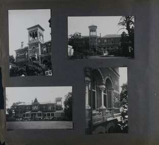
Album - Album page, Ripponlea, Hotham Street, Circa 1972
This photograph is part of the Caulfield Historical Album 1972. This album was created in approximately 1972 as part of a project by the Caulfield Historical Society to assist in identifying buildings worthy of preservation. The album is related to a Survey the Caulfield Historical Society developed in collaboration with the National Trust of Australia (Victoria) and Caulfield City Council to identify historic buildings within the City of Caulfield that warranted the protection of a National Trust Classification. Principal photographer thought to be Trevor Hart, member of Caulfield Historical Society. Most photographs were taken between 1966-1972 with a small number of photographs being older and from unknown sources. All photographs are black and white except where stated, with 386 photographs over 198 pages.From Victorian Heritage Database citation for Rippon Lea H0614 https://vhd.heritagecouncil.vic.gov.au/places/427(as at 23/10/2020) Rippon Lea was commenced in 1868 by Frederick Sargood, a most successful politician and merchant. He was born in England in 1834 and arrived in Melbourne in 1850. He soon joined his father's wholesale soft goods firm, spending some time as its manager on the goldfields. Sargood entered the Legislative Council in 1874. He was Victoria?s first Minister for Defence in 1883. Sir Frederick Sargood was created CMG. In 1885 and KCMG in 1890 as a reward for his contribution to public life. He died suddenly in 1903. Rippon Lea was designed by the leading firm of architects, Reed and Barnes. Joseph Reed had travelled in Europe in 1863, including northern Italy. When he returned he introduced the use of polychromy. While not the first examples, Rippon Lea and the Independent Church in Collins Street were the best and set a fashion which became a distinctly Melbourne style, particularly used for houses and churches. Its popularity was possible because of the new availability of different coloured bricks. Reed's fine Lombardic Romanesque details soon became debased by others. As Sargood's family grew and his fortunes prospered, Rippon Lea was extended to include 33 rooms - a complete mansion. The cast iron porte cochere and the northern conservatory were added in 1897. The architects were Taylor and Fitts. The ballroom was added in 1882 and remodelled in 1889. Many alterations have changed the interior and exterior during the ownerships of Benjamin Nathan and later his daughter Mrs Louisa Jones in the 1930s and are in their own right of significance. Sir Thomas Bent owned the property from 1903 until 1911 but never lived there. He subdivided much of the land. The original garden dates from about 1868, and it seems that William Guilfoyle of the Botanic Gardens was involved. It was redesigned in a more natural style in the 1880s by Sargood and his head gardener, Adam Anderson. The lake, waterfalls, fernery, hill and grotto are balanced by mighty deciduous trees and conifers. These are interspersed with, but never dominated by Australian species such as eucalyptus and other exotics. The sinuous drive with its carefully prepared approach to the house is notable. The original vegetable gardens, orchard and outer paddocks no longer survive. The shade house is important as the largest known in Australia and possibly the world. Its curved plan and form of construction are particularly notable. It was built about 1884.Page 92 of Photograph Album with four photographs (three landscape and one portrait) of Ripponlea - views of entrance and left front of mansion.Handwritten: "Ripponlea" Hotham Street [top right] / Neg 245 Dec 1972 [under top left photo] / Neg 246 Dec 1972 [under bottom left photo] / Neg 247 Dec 1972 [under bottom right photo] / 92 [bottom right]trevor hart, elsternwick, mansion, hotham street, frederick sargood, reed and barnes, lombardic, romanesque, cast iron porte cochere, conservatory, 1860's, 1890's, ballroom, 1880's, benjamin nathan, louisa jones, thomas bent, sir thomas bent, william guilfoyle, adam anderson, lake, grotto, shade house, portico, ripponlea, victorian, sir frederick sargood, architects, polychrome bricks, lombardic romanesque style, rippon lea, entrances -
 Glen Eira Historical Society
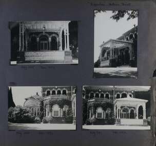
Album - Album page, Ripponlea, Hotham Street, Circa 1972
This photograph is part of the Caulfield Historical Album 1972. This album was created in approximately 1972 as part of a project by the Caulfield Historical Society to assist in identifying buildings worthy of preservation. The album is related to a Survey the Caulfield Historical Society developed in collaboration with the National Trust of Australia (Victoria) and Caulfield City Council to identify historic buildings within the City of Caulfield that warranted the protection of a National Trust Classification. Principal photographer thought to be Trevor Hart, member of Caulfield Historical Society. Most photographs were taken between 1966-1972 with a small number of photographs being older and from unknown sources. All photographs are black and white except where stated, with 386 photographs over 198 pages.From Victorian Heritage Database citation for Rippon Lea H0614 https://vhd.heritagecouncil.vic.gov.au/places/427(as at 23/10/2020) Rippon Lea was commenced in 1868 by Frederick Sargood, a most successful politician and merchant. He was born in England in 1834 and arrived in Melbourne in 1850. He soon joined his father's wholesale soft goods firm, spending some time as its manager on the goldfields. Sargood entered the Legislative Council in 1874. He was Victoria?s first Minister for Defence in 1883. Sir Frederick Sargood was created CMG. In 1885 and KCMG in 1890 as a reward for his contribution to public life. He died suddenly in 1903. Rippon Lea was designed by the leading firm of architects, Reed and Barnes. Joseph Reed had travelled in Europe in 1863, including northern Italy. When he returned he introduced the use of polychromy. While not the first examples, Rippon Lea and the Independent Church in Collins Street were the best and set a fashion which became a distinctly Melbourne style, particularly used for houses and churches. Its popularity was possible because of the new availability of different coloured bricks. Reed's fine Lombardic Romanesque details soon became debased by others. As Sargood's family grew and his fortunes prospered, Rippon Lea was extended to include 33 rooms - a complete mansion. The cast iron porte cochere and the northern conservatory were added in 1897. The architects were Taylor and Fitts. The ballroom was added in 1882 and remodelled in 1889. Many alterations have changed the interior and exterior during the ownerships of Benjamin Nathan and later his daughter Mrs Louisa Jones in the 1930s and are in their own right of significance. Sir Thomas Bent owned the property from 1903 until 1911 but never lived there. He subdivided much of the land. The original garden dates from about 1868, and it seems that William Guilfoyle of the Botanic Gardens was involved. It was redesigned in a more natural style in the 1880s by Sargood and his head gardener, Adam Anderson. The lake, waterfalls, fernery, hill and grotto are balanced by mighty deciduous trees and conifers. These are interspersed with, but never dominated by Australian species such as eucalyptus and other exotics. The sinuous drive with its carefully prepared approach to the house is notable. The original vegetable gardens, orchard and outer paddocks no longer survive. The shade house is important as the largest known in Australia and possibly the world. Its curved plan and form of construction are particularly notable. It was built about 1884.Page 93 of Photograph Album with four photographs (two landscape and two portrait) of Ripponlea - lake and gardens.Handwritten: Neg 239 Dec 1973 LAKE [under top left photo] / Neg 242 Dec 1973 FERN HOUSE [under top right photo] / Neg 243 Dec 1972 FERN HOUSE [under bottom left photo] / Neg 241 Dec 1972 LAKE [under bottom right photo] / 93 [bottom left]trevor hart, elsternwick, mansion, hotham street, frederick sargood, sargood, reed and barnes, 1860's, 1890's, 1880's, benjamin nathan, nathan, louisa jones, thomas bent, sir thomas bent, william guilfoyle, adam anderson, lake, grotto, shade house, portico, ripponlea, victorian, sir frederick sargood, architects, taylor and fitts, rippon lea, gardens, ferns, bridges, walking trails -
 Federation University Historical Collection
Book, Railway Practice: a collection of working plans and practical details of construction in the public works of the most celebrated engineers, 1847 (exact)
A green cloth hard cover book. Title and author's name are engraved in gold on spine. This is the 3rd edition, first series with black and white illustrations. It describes the engineering practices of the early days of British railroads. The book includes (series 1 to 4)and it contains, roads, tramroads and railroads, bridges, aqueducts, viaducts, wharfs, warehouses, roofs, and sheds, canals, locks, sluices, & the various works on rivers, streams, etc., harbours, docks, piers and jetties, tunnels, cuttings and embankments, the several works connected with the drainage of marshes, marine sands, and the irrigation of land, water-works, gas-works, water-wheels, mills, engines.civil engineering, railway practice, rail constructions, s c brees, western railway great britain, public works, railroads, canals, s.c. brees, samuel brees, samuel charles brees -
 Federation University Historical Collection
Book, Prof. Ralph Tate, Papers on Southern Australian Tertiary and Recent Mollusca
An image of contents is available. Ralph Tate (11 March 1840 – 20 September 1901) was a British-born botanist and geologist, who was later active in Australia. In 1875 Tate was appointed Elder Professor of natural science at the University of Adelaide in South Australia, teaching botany, zoology and geology. He became vice-president and then as president (1878–1879) of the Philosophical Society. It changed name to the Royal Society of South Australia in 1880 with Tate as its first president in that year[1] Tate encouraged members to send in original papers, personally contributing nearly 100 papers to its Transactions and Proceedings. (See http://en.wikipedia.org/wiki/Ralph_Tate)Blue half leatherbound book of 422 pages. Includes many black and white illustrations of shells. The book includes a series of articles by Prof. Ralph Tate from transactions of the Royal Society of South Australiasouth australia, ralph tate, royal society, royal society of south australia, gastropods, brachiopods, mollusca, snails, murray river, marine mollusca, brachiopoda