Showing 1624 items matching "river yarra"
-
 Eltham District Historical Society Inc
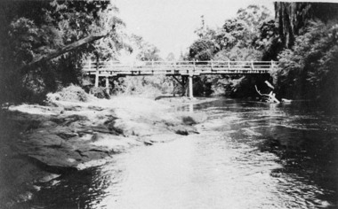
Postcard - Photograph postcard, The Rapids, Devils' Bank, Eltham, 1907
... Yarra River.... It is probably the section along the Yarra River where there are a series.... It is probably the section along the Yarra River where there are a series ...Devils' Bank was situated some two miles from Eltham. It is probably the section along the Yarra River where there are a series of rapids stretching past Petty's Orchard to Griffiths Park and the confluence with the Diamond Creek. Only three properties existed in this area in 1945 aerial maps, Worlingworth and the adjoining property on the bank of the Diamond Creek in Banoon Road and No. 2 Kent Hughes Road. Devils' Bank. The death of Ann Edwards, 77 years, an old resident of the district was reported who lived in an old hut at Devil's Bank who had been found dead in her bed on 13 May 1897 FOUND DEAD IN BED. (1897, May 28). Evelyn Observer, and South and East Bourke Record (Vic. : 1882 - 1902), p. 2 (MORNING.). Retrieved September 3, 2022, from http://nla.gov.au/nla.news-article60696388 A very similar view was published in the Leader paper in January 1908 - Devil's Bank Falls, Eltham VIEWS ON THE UPPER YARRA. (1908, January 11). Leader (Melbourne, Vic. : 1862 - 1918, 1935), p. 28. Retrieved September 3, 2022, from http://nla.gov.au/nla.news-article198106006 On the reverse of the postcard it appears to be postmarked Eltham, Dec 27, 1907 addressed to Mrs Christie Millmoss of Bull Street, Bendigo "Arrived here 10.45 am - ? ? raining cause of ? - ? till evenings it is lovely - but quite fresh after the (rain - crossed out) great ? - I may assume it all go well"Digital file only Postcards scanned from the collection of Michael Aitken on loan to EDHS, 2 Sep. 2022michael aitken collection, devils bank, eltham, postcards, rapids, yarra river -
 University of Melbourne, Burnley Campus Archives
Slide, Alan L. Mitchell, 1934
... Floods in Orchard 1934 from Yarra River.... orchard Floods in Orchard 1934 from Yarra River. Slide Alan L ...Floods in Orchard 1934 from Yarra River.alan l. mitchell, burnley gardens, floods, orchard -
 Eltham District Historical Society Inc
Film - Video (VHS), IMP Productions, The Shire of Etham - The Evergreen Shire (Series 69, Item 4), c.1985
... yarra river... with a population of around 40,000. Scenes include Yarra River, rural... with a population of around 40,000. Scenes include Yarra River, rural ...Shire of Eltham Archives: Series 69, Item 4 This video was produced for the Shire of Eltham by IMP Productions and provides a description of the shire, 277 square km on a north/northeast axis, some 25 km northeast of the centre of Melbourne with a population of around 40,000. Scenes include Yarra River, rural settings and urban settings, housing estates, Shillinglaw Cottage, Pigeon Bank at Kangaroo Ground, the Eltham Railway Trestle Bridge with reference to the fight by locals in the 1970s to save it from replacement, Montsalvat, mudbrick making and its use as a building material, the use of mudbrick in the Eltham Community Centre blending harmoniously with the environment. Emphasises people living in the area due to the qualities of life provided. Also the Living and Learning Centre, St Andrews Markets and other local markets, the Eltham Leisure Centre, cricket and horse riding at Eltham Lower Park, the Infant Welfare Centre (part of the Eltham War Memorial), how residents are mindful of protecting their historical heritage, the CBA bank and Allwood House at Hurstbridge, Tracey Naughton about the Eltham "As we are" Community Banner project and the “River of Life banner”, the Parks and Gardens office in the former Police Residence building (now the Local History Centre), Alistair Knox Park, road planning and types of roads, tree canopy, Peck's Dam, green carparks, road drainage, Gordon Ford's garden and natural landscapes, and Were Street shops in Montmorency. Planning for shopping facilities and carparks with a population of 40,000 growing to 55,000, Arthur Street Mall and carpark, local village feel in the shopping centre. Councillors and Council staff featured include Mary Grant, Bob Manuell, Rodney Roschellor, John Cohen, Alan Baker. Also scenes of Commercial Place, Diamond Valley Railway, Eltham Galley, Riverclay and canoeing on the Yarra intermingled with images of the shire from the Shire of Eltham Pioneers Photograph collection.VHS Video cassette Converted to MP4 file format 00:11:56; 79MBshire of eltham, video recording, shire of eltham archives, alistair knox park, allwood house, arthur street, arthur street mall, bob manuell, canoeing, carparks, cba bank, commercial place, council staff, councillors, cr. mary grant, cricket, diamond valley railway, eltham community banner project, eltham community centre, eltham galley, eltham leisure centre, eltham living and learning centre, eltham lower park, eltham railway trestle bridge, eltham war memorial, gordon ford garden, horse riding, housing estates, hurstbridge, infant welfare centre, john cohen, kangaroo ground, local history centre, montmorency, montsalvat, mudbrick, parks and gardens, peck's dam, pigeon bank, police residence, river of life banner, riverclay, road drainage, road planning, rodney roschellor, shillinglaw cottage, shire of eltham pioneers photograph collection, st andrews market, tracey naughton, tree canopy, were street, yarra river, alan baker -
 Eltham District Historical Society Inc
Film - Video (VHS), Nillumbik Shire Council, The Nillumbik Story, 1996
... Yarra River... the district to its confluence with the Yarra River at Eltham at Eltham... the district to its confluence with the Yarra River at Eltham at Eltham ...PART 1 – NILLUMBIK (00:00-07:17) Opening features various scenes around Nillumbik Shire. For 40,000 years Nillumbik was the home of the Wurundjeri people. Robert Hoddle gave the district its name. Jock Ryan, then president of Nillumbik Historical Society discusses the names Nillumbik and Diamond Creek. In the late 1830s white occupation began with gold found in Warrandyte in 1851 and 12 years later at Diamond Creek -the Diamond Reef which led to the Caledonian gold rush. Jock Ryan discusses the Diamond Creek mine, which was thriving until it burnt out in 1915. Large numbers of workmen moved into area in late 1870s to construct the Maroondah Aqueduct. With growing population of Melbourne, the nearby Yan Yean system had severely disrupted the flow of the Plenty River, forcing the closure of three flour mills there. The aqueduct came to the rescue carrying water 66km from Healesville to Preston. When the Diamond Creek gold mine burnt down the local economy suffered but fruit growing industry had already been established and Diamond Creek became a thriving fruit growing centre. Interview with Jack Powell, a long-time fruiterer at St Andrews market, his family had lived in the area for a hundred years, 3 to 4 generations, “a lot of hard work”. By the time the railway arrived fruit growing was no longer competitive. The railway brought the city closer and day trippers. The Green Wedge separates the shire from the more densely developed neighbours such as Whittlesea, Doncaster, Templestowe, Bulleen and Greensborough. Population at the time (1996) was 19,000 but links to the past remain strong. Mudbrick houses along the Heritage Trail The saving of Shillinglaw Cottage from demolition in 1963 and relocation brick by brick. PART 2 – ENVIRONMENT (07:18-14:44) Peter Brock (with Bev Brock in background) at St Andrews market discusses his childhood growing up in the district and the environment and the values it instilled upon him and his own family. The Brocks have been in the district since the 1860s. Nillumbik Shire responsible for managing three catchment areas; Diamond Creek, Arthurs Creek and Watsons Creek. Follows the course of the Diamond Creek commencing in Kinglake through the district to its confluence with the Yarra River at Eltham at Eltham Lower Park. Highlights Eltham Lower Park community revegetation program and the newly constructed (1996) viewing platform built of new and recycled timbers at the confluence of the Diamond Creek and Yarra River. Also featured are outdoor recreation on the river and at Eltham Lower Park including the Diamond Valley miniature railway. Sugarloaf reservoir and recreational activities and fishing. Aerial view of Memorial Park and Shire of Eltham War Memorial tower at Garden Hill, Kangaroo Ground. Significant tourism opportunities for the shire with 3 million potential day-trippers in metropolitan Melbourne. Council and community working together to find a way to promote the shires natural and artistic assets. At Arthurs Creek, the Brock family and neighbours working together to take care of their waterway. Peter Brock’s uncle, Sandy Brock talks about environmental management and the Arthurs Creek Landcare group and actions to eradicate blackberry problem. Having previously planted Cypress rows they are replacing them with indigenous species to improve the water supply, keeping cattle out of the creek bed to improve the quality downstream flowing into the Yarra. Eltham East Primary School Band playing “All things bright and beautiful” merges into scenes of the bushland sanctuary set aside by the school in 1980 with unidentified teacher discusses the sanctuary and their education program and school children’s comments. Plight of a family of Wedgetail eagles nesting in the path of a developer’s bulldozer at North Warrandyte and actions to save their nesting areas. PART 3 – ARTS (14:45-22:00) Arts and Jazz festival at Montsalvat featuring interviews with Sigmund Jorgensen discussing Montsalvat and its principles. Also Matcham Skipper. Clifton Pugh’s funeral at Montsalvat and his legacy at Dunmoochin near Cottlesbridge with artists in residence, at the time, Chicago artist Charles Reddington who discusses the benefits of the experience. An unidentified female artist also talks about the program and why people are drawn to the area. Unidentified man on street talking about the amount of talent in the area, artists, poets, musicians, authors. Artist Ming Mackay (1918-2009) interviewed talking about the people she mixes with on “the Hill”. Works of local artists are displayed Eltham Library Community Gallery and Wiregrass gallery with a new coffee shop at the Wiregrass making it an even more popular destination. Music at St Andrews Hotel (may be a little bit country) and the Saturday market where likely to hear anything. Sellers and patrons at the market asked about what attracts them to the market and where they came from. Scenes of poets/authors giving readings. CREDITS Music by John Greenfield from the CD Sweet Rain “The Snow Tree”, Uncle Music UNC 2001 Cameras - David Mirabella and Peter Farragher Editor – Olwyn Jones Written and Produced by Jason Cameron A Jason Cameron Proction for Nillumbik ShireProvides a record of the relatively newly created Shire of Nillumbik at the time and the features and attactions of the shire in its people arts, culture and environmentVHS Cassette (five copies) DVD (one copy) Converted to MP4 file format 0:22:00, 1.60GBvideo recording, arthurs creek, arthurs creek landcare group, artists, artists in residence, arts, arts festival, authors, blackberry, brock family, bulldozer, bulleen, bushland sanctuary, caledonian gold rush, charles reddington, clifton pugh, cottlesbridge, cypress rows, developer, diamond creek, diamond creek mine, diamond reef, diamond valley miniature railway, doncaster, dunmoochin, education program, eeps, eltham, eltham east primary school, eltham east primary school band, eltham library community gallery, eltham lower park, environment, fishing, flour mill, fruit growing, fruiterer, garden hill, gold mining, green wedge, greensborough, heritage trail, hurstbridge railway line, jazz festival, jock ryan, kangaroo ground, kangaroo ground tower, kinglake, maroondah aqueduct, matcham skipper, memorial park, ming mackay (1918-2009), montsalvat, mudbrick houses, music, musicians, nesting area, nillumbik historical society, nillumbik shire, north warrandyte, old timer, orchards, peter brock, plenty river, poets, population, recreation, recreational activities, revegetation, robert hoddle, sandy brock, shillinglaw cottage, shire of eltham war memorial, sigmund jorgensen, st andrews hotel, st andrews market, sugarloaf reservoir, templestowe, the hill, tourism, viewing platform, warrandyte, water catchment area, watsons creek, wedgetail eagle, whittlesea, wiregrass gallery, wurundjeri, yarra river, jack powell -
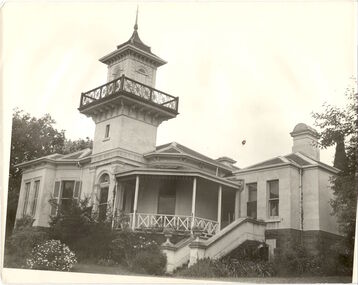 Kew Historical Society Inc
Photograph, J E & B L Rogers, 'Swinton', Swinton Avenue, c.1960
... the Yarra River.... the Yarra River. 'Swinton', Swinton Avenue Photograph Photograph J E ...'The land on which 'Swinton'was later built was first purchased by John Bakewell in 1851 and later sold to Edmund Laskey Splatt in 1858. Splatt was a member of the first provisional committee of the National Bank of Australia in Melbourne and built the first house on the land naming it 'Laskey Villa'. By 1863 the house was occupied by Herbert Henty. The Johnson family connection with the property began with the marriage in 1858 of Annabella Johnson to David Syme, owner of the Áge' newspaper and owner of the adjacent property 'Blytheswood'. Annabella's brother, Francis Johnson, bought the villa in 1876 and renamed it 'Swinton' after his birthplace in Yorkshire. The property was later owned by the artistic Colquhoun family. The house is one of the earliest examples of the Italianate style in Victoria - the outstanding element being the tower with its cantilevered walkway and heavily bracketed pryamidal tower.' Source: Victorian Heritage RegisterThis work forms part of the collection assembled by the historian Dorothy Rogers, that was donated to the Kew Historical Society by her son John Rogers in 2015. The manuscripts, photographs, maps, and documents were sourced by her from both family and local collections or produced as references for her print publications. Many were directly used by Rogers in writing ‘Lovely Old Homes of Kew’ (1961) and 'A History of Kew' (1973), or the numerous articles on local history that she produced for suburban newspapers. Most of the photographs in the collection include detailed annotations in her hand. The Rogers Collection provides a comprehensive insight into the working habits of a historian in the 1960s and 1970s. Together it forms the largest privately-donated collection within the archives of the Kew Historical SocietySwinton in Kew and its tower. This side of the house faces the Yarra River.swinton, laskey villa, swinton avenue, kew, dorothy rogers -
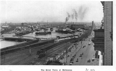 Melbourne Tram Museum
Photograph - Illustration, c1916
... of the river Yarra, Flinders St railway yard, the viaduct, the swing... reproduced in a magazine of the river Yarra, Flinders St railway yard ...Illustration from a photograph reproduced in a magazine of the river Yarra, Flinders St railway yard, the viaduct, the swing basin, the wharves and Queens Bridge. Has a number of cable cars and trains in the view. Taken prior to the construction of the second or duplicate viaduct which was completed during 1915. Construction of the second viaduct on the south side of the original can be seen.in ink in bottom right hand comer "By 1916"trams, tramways, flinders st, railways, shipping, cable trams -
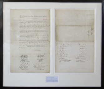 Mission to Seafarers Victoria
Print - Reproduction, Petition, The Photography Department (Jeremy Dillon), Captains' Petition, 2016
... yarra river...' petition to build a Central Institute on the Yarra river...' petition to build a Central Institute on the Yarra river ...This is a reproduction of the original 1897 Captains' petition to build a Central Institute on the Yarra river. "To the Executive Committee of the Victorian Seamen's Mission, Melbourne. "Ladies and Gentleman, "We, the undersigned captains of several ships now lying at the Melbourne wharves think it most desirable that the Victorian Seamen's Mission, being the mission that has for so many years shown a most part their interest in the spiritual, moral, and social well-being of the seamen of all nationalities, shall him on the banks of the Yarra an institute such as that at Port Melbourne, where sailors of every grade could profitably and pleasantly spend their evenings. At almost every other seaport in the world such institutions are being provided for seamen, and we are satisfied from our opinion of the Melbourne public that the matter needs only to be prominently brought under their notice to be accomplished. We are confident that the good work of the mission is being hampered by its not having such a place near the shipping at the Melbourne wharves. Our crews are at present placed at a great dis advantage through not having an institute more convenient to the scene of their labours than that at Port Melbourne, which, on a very wet or a very hot, is not easily reached. If a site could be obtained immediately above the Gasworks but on the other side of Flinders street extension, that is to say, on the lower part of the land on which the Harbour Trust offices are built, it would be most convenient for the shipping on both the north and south side of the river. Trusting that it may be possible to do some thing to meet this long felt want, We suscribe ourselves, Yours respectfully, Geo.H Steven, master ship Dharwar; Thos. Curd, master ship Narcissus; James Horne, master ship Loch Garry; T.Tait, master ship Loch Ryan; T. Nilsen, master ship Hebe; G. Ch Christian, master ship Anna; R.E. Peasley, master ship Seminole; Wm. Martin, master ship Loch Ness; T.C. Martin, master ship Loch Tay; W.H. Bennett, master ship Loch Vennachar; J. Raglan Brodie, master s.s. Warrnambool; James E. Coles, master ship Mermerus; J. H. Walker, master ship Hinemoa; R.J. Johns, master ship Ariel; D. Gorchem (sic. Gerckens), master ship Matador; H. Petersen, master ship Nesaia; Wm. J. Reid, master s.s. Star of New Zealand; A. F. Svhanstrom, master ship Hermes; Alex. Smith, master ship Sophocles; W. Y. Bunn, master ship Carmanian; William Anderson, master ship Loch Katrine."Framed and mounted reproduction of Captains' petitionpetition, seamen's mission, yarra river, captains, victoria, melbourne, ships, australia-wharf, signatures, 717-flinders-street-docklands, maritime welfare services, mission to seafarers, mission to seamen, mermerus, captain coles, sir john coode, loch line, loch ness, loch gary, loch ryan, ss warrnambool, loch tay, loch vennachar, matador, nesaia, d. gerckens, h. petersen, a.f. svhanstrom, hermes, ariel, loch katrine, william anderson, dharwar, narcissus, hebe, anna, hinemoa, sophocles, carmanian, early origins, 2016, exhibitions -
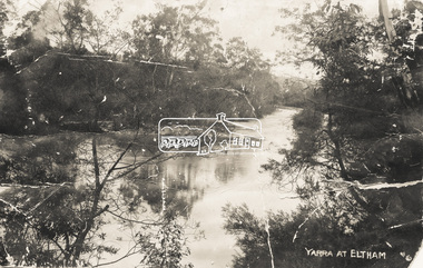 Eltham District Historical Society Inc
Photograph - Photo postcard, J.H. Clark, Yarra at Eltham, c.1910
... yarra river...This card depicts the Yarra River at Eltham circa 1910... melbourne This card depicts the Yarra River at Eltham circa 1910 ...This card depicts the Yarra River at Eltham circa 1910. It was addressed to "Mr J. L. Brown, "Elthamville", Tinning Street, Brunswick" most probably from an extended family member. From the same collection as accession no 00779, (Pond near Eltham Park) and no. 00780 (Eltham, J.H. Clark Photo - dated 20 May 1911). Sending postcards to family and friends including short messages was a common form of communication in the early 20th century. Photographer: J.H. Clark John Henry Clark was the youngest of three boys born to William Henry Clark (1823-1877) and Maria White (1843-1914). He and his brothers, William Charles Clark (1872-1945), Clement Kent Clark (1874-1912) operated a photography business (Clark Bros.) from 25 Thomas Street, Windsor near Prahran during the period c.1894 to 1914. Following death of Clement in September 1912 and their mother in 1914, the Clark Bros business appears to have dissolved, the premises demolished, and a new house was under construction in 1915. John set up business independently in 1914 operating out of 29 Moor Street, Fitzroy where he is registered in the 1914 and 1915 Electoral Rolls. By 1916 John had relocated to Eltham where he continued his practice as a photographer and took many of the early images around the district of Little Eltham. Around 1930 John changed professions and opened a small cobbler's shop in 1931 near the pond opposite Dalton Street adjacent to the Jarrold family cottage. He never married and continued his profession as a bootmaker from this little shop, maintaining a close relationship with Mrs Jarrold for the rest of their lives. His bootmaker shop remains today beside the Whitecloud cottage and is one of only three remaining shops in the area from the early 20th century. There are a couple of images of Eltham taken by Clark Bros. in the Eltham District Historical Society collection, one such example being Hunniford’s Post Office with Miss Anne Hunniford out front (EDHS_00140 - marked on the back of the print, Clark Bros., 25 Thomas St. Windsor), which would date this image between c.1894 and 1914. Other early images of Eltham taken by John Henry Clark are marked on the face “J. H. Clark Photo” and it is assumed these are dated between 1914 and 1930. It is noted that the Grant of Probate for John H Clark of Eltham South dated 5 April !957 (513/387) records his occupation as "X Photographer".Sending postcards to family and friends including short messages was a common form of communication in the early 20th century.Postcard in very poor condition which has been removed from an album. Glue residue and album page adhering preventing information being readFront: Yarra at Elthameltham, yarra river, brown family, j.h. clark photo -
 Eltham District Historical Society Inc
Photograph, Fay Bridge, Old footbridge, 195 Laughing Waters Road, Eltham, n.d
... Yarra River... on Laughing Waters Road. Situated between the Yarra River and Overbank... on Laughing Waters Road. Situated between the Yarra River and Overbank ...This old footbidge is situated close to the shack that Gordon Ford built on the Yarra at Laughing Waters Road. Bernie Bragg also used to live there for a period of time. Gordon Ford and photographer Sue Winslow were married in 1965. They set up home in an old log cabin on the property Gordon had purchased in 1954 on Laughing Waters Road. Situated between the Yarra River and Overbank Road, Gordon had built a small mud-brick shack on the river and a pontoon. Over the decades the shack has been locally referred to as “the love shack”, the “rooting shack” or simply “Gordon’s shack”. Gordon and Sue commissioned local builder Graeme Rose to do a wattle and daub renovation and extension to the old log cabin on the north side of Laughing Waters Road. The work had only just been completed in 1965 when a bushfire swept through the area and destroyed the cabin. Gordon and Sue relocated to his property, Fulling, in Pitt Street, Eltham. In 1970 work started on a new house at the Laughing Waters property. Originally known as the Banana House, it is now known as Boomerang. Designed by Alistair Knox, the mud-brick house includes iron window grilles made by Matcham Skipper that puncture the curved mud walls. The grilles were made from ‘off-pressings’ from the Sidchrome tool works in Heidelberg. Gordon, Sue and family moved into the house in 1972. Their marriage fell apart and Sue moved to Sydney with the children around the same time Gordon commenced building Birrarung just below Boomerang on the Laughing Waters Road block. After the Fords moved out, Boomerang it was rented out to various share households of students, musicians, artists and environmentalists for twenty-four years. Gordon Ford sold Birrarung and Boomerang to Melbourne Water in 1999. The Laughing Waters Artist in Residence Program was developed as a partnership between Parks Victoria and Nillumbik Shire Council. Boomerang was deemed unfit for habitation so was used as a day studio only. By 2001 Boomerang was in a poor state of repair and by 2002 the last artist in residence was to use the house as a studio. Nillumbik Shire Council had been granted funds from the Melbourne Community Fund to restore both Boomerang and Birrarung but it was apparent in early 2003 that the funds would be insufficient to restore both houses. Boomerang was infested with termites which presented a risk to any occupants and so the decision was made to close Boomerang and concentrate funding on Birrarung. Boomerang was fenced off for safety and to prevent intrusion and remains ‘caged’ today (2023). However, it is readily apparent the property has been occupied by squatters over the years. By 2023 it was clear that the squatters had abandoned the property and sections of the roof structure have given away in some areas and collapsed internally. For a more in-depth description and history of the property and that of Gordon and Sue Ford, see Jane Woollard's book, "Laughing Waters Road; Art, Landscape & Memory in Eltham" published 2016.fay bridge collection, bernie's hut, birrarung, footbridge, gordon ford, gordon's shack, laughing waters road, love shack, yarra river -
 Eltham District Historical Society Inc
Photograph, Fay Bridge, The Love Shack, 195 Laughing Waters Road, Eltham, April 2016
... Yarra River... the Yarra River and Overbank Road, Gordon had built a small mud... the Yarra River and Overbank Road, Gordon had built a small mud ...Gordon Ford built this shack on the Yarra at Laughing Waters Road. Bernie Bragg used to live there for a period of time. Gordon Ford and photographer Sue Winslow were married in 1965. They set up home in an old log cabin on the property Gordon had purchased in 1954 on Laughing Waters Road. Situated between the Yarra River and Overbank Road, Gordon had built a small mud-brick shack on the river and a pontoon. Over the decades the shack has been locally referred to as “the love shack”, the “rooting shack” or simply “Gordon’s shack”. Gordon and Sue commissioned local builder Graeme Rose to do a wattle and daub renovation and extension to the old log cabin on the north side of Laughing Waters Road. The work had only just been completed in 1965 when a bushfire swept through the area and destroyed the cabin. Gordon and Sue relocated to his property, Fulling, in Pitt Street, Eltham. In 1970 work started on a new house at the Laughing Waters property. Originally known as the Banana House, it is now known as Boomerang. Designed by Alistair Knox, the mud-brick house includes iron window grilles made by Matcham Skipper that puncture the curved mud walls. The grilles were made from ‘off-pressings’ from the Sidchrome tool works in Heidelberg. Gordon, Sue and family moved into the house in 1972. Their marriage fell apart and Sue moved to Sydney with the children around the same time Gordon commenced building Birrarung just below Boomerang on the Laughing Waters Road block. After the Fords moved out, Boomerang it was rented out to various share households of students, musicians, artists and environmentalists for twenty-four years. Gordon Ford sold Birrarung and Boomerang to Melbourne Water in 1999. The Laughing Waters Artist in Residence Program was developed as a partnership between Parks Victoria and Nillumbik Shire Council. Boomerang was deemed unfit for habitation so was used as a day studio only. By 2001 Boomerang was in a poor state of repair and by 2002 the last artist in residence was to use the house as a studio. Nillumbik Shire Council had been granted funds from the Melbourne Community Fund to restore both Boomerang and Birrarung but it was apparent in early 2003 that the funds would be insufficient to restore both houses. Boomerang was infested with termites which presented a risk to any occupants and so the decision was made to close Boomerang and concentrate funding on Birrarung. Boomerang was fenced off for safety and to prevent intrusion and remains ‘caged’ today (2023). However, it is readily apparent the property has been occupied by squatters over the years. By 2023 it was clear that the squatters had abandoned the property and sections of the roof structure have given away in some areas and collapsed internally. For a more in-depth description and history of the property and that of Gordon and Sue Ford, see Jane Woollard's book, "Laughing Waters Road; Art, Landscape & Memory in Eltham" published 2016.fay bridge collection, 2016-04, bernie's hut, birrarung, gordon ford, gordon's shack, laughing waters road, love shack, yarra river -
 Eltham District Historical Society Inc
Photograph, Fay Bridge, The Love Shack, 195 Laughing Waters Road, Eltham, 22 July 2016
... Yarra River... the Yarra River and Overbank Road, Gordon had built a small mud... the Yarra River and Overbank Road, Gordon had built a small mud ...Gordon Ford built this shack on the Yarra at Laughing Waters Road. Bernie Bragg used to live there for a period of time. Gordon Ford and photographer Sue Winslow were married in 1965. They set up home in an old log cabin on the property Gordon had purchased in 1954 on Laughing Waters Road. Situated between the Yarra River and Overbank Road, Gordon had built a small mud-brick shack on the river and a pontoon. Over the decades the shack has been locally referred to as “the love shack”, the “rooting shack” or simply “Gordon’s shack”. Gordon and Sue commissioned local builder Graeme Rose to do a wattle and daub renovation and extension to the old log cabin on the north side of Laughing Waters Road. The work had only just been completed in 1965 when a bushfire swept through the area and destroyed the cabin. Gordon and Sue relocated to his property, Fulling, in Pitt Street, Eltham. In 1970 work started on a new house at the Laughing Waters property. Originally known as the Banana House, it is now known as Boomerang. Designed by Alistair Knox, the mud-brick house includes iron window grilles made by Matcham Skipper that puncture the curved mud walls. The grilles were made from ‘off-pressings’ from the Sidchrome tool works in Heidelberg. Gordon, Sue and family moved into the house in 1972. Their marriage fell apart and Sue moved to Sydney with the children around the same time Gordon commenced building Birrarung just below Boomerang on the Laughing Waters Road block. After the Fords moved out, Boomerang it was rented out to various share households of students, musicians, artists and environmentalists for twenty-four years. Gordon Ford sold Birrarung and Boomerang to Melbourne Water in 1999. The Laughing Waters Artist in Residence Program was developed as a partnership between Parks Victoria and Nillumbik Shire Council. Boomerang was deemed unfit for habitation so was used as a day studio only. By 2001 Boomerang was in a poor state of repair and by 2002 the last artist in residence was to use the house as a studio. Nillumbik Shire Council had been granted funds from the Melbourne Community Fund to restore both Boomerang and Birrarung but it was apparent in early 2003 that the funds would be insufficient to restore both houses. Boomerang was infested with termites which presented a risk to any occupants and so the decision was made to close Boomerang and concentrate funding on Birrarung. Boomerang was fenced off for safety and to prevent intrusion and remains ‘caged’ today (2023). However, it is readily apparent the property has been occupied by squatters over the years. By 2023 it was clear that the squatters had abandoned the property and sections of the roof structure have given away in some areas and collapsed internally. For a more in-depth description and history of the property and that of Gordon and Sue Ford, see Jane Woollard's book, "Laughing Waters Road; Art, Landscape & Memory in Eltham" published 2016.fay bridge collection, 2016-07-22, bernie's hut, birrarung, gordon ford, gordon's shack, laughing waters, laughing waters road, love shack, yarra river -
 Flagstaff Hill Maritime Museum and Village
Photograph - Vessel, Steam tug "Racer", circa 1920's
... Yarra River... turning in the Yarra River and crashed into the Spencer Street... turning in the Yarra River and crashed into the Spencer Street ...The ocean Steamtug "Racer" was built in 1886 in Sunderland by "Boolds, Sharer and Company" for the "Queenstown Tug and Shipping Company". It is mentioned in several newspapers that soon afterwards it sank in Queenstown Harbour, Ireland and remained submerged for six months before being raised. It was a steel screw boat with a sluice keel, was 185 tons and 420 feet long. It was purchased around 1889 by the "Melbourne Coal, Shipping and Engineering Company Ltd" as it had sufficient power to work with the huge iron clippers that the company were dealing with. It survived several dangerous incidents on its voyage out to Melbourne. On May 28th in the middle of the night in a heavy gale, the tug was swamped by heavy seas and then several hours later was almost run down by a very large ship (the clipper Loch Vennachar) in full sail. The "Racer" (later owned by the "Melbourne Steamship Company") became one of the fastest and best-known tugs in the Port of Melbourne - working in the port until 1935. The "Racer" was involved in many rescues and dangerous incidents during its 45 years including the attempted rescue of the "Craigburn" near Cape Schanck, the rescue of the "Edina" from a reef near Williamstown and the rescue of the "Netherby" from heavy seas near Inverloch. In March 1930 she was caught by a strong wind when turning in the Yarra River and crashed into the Spencer Street Bridge - resulting in some damage to the scaffolding on the bridge and slight damage to the tug. In 1906 the "Racer" created a record for the fastest tow when it towed the 900-ton barque "Elizabeth Graham" from Sydney to Melbourne in 73 hours. In 1934 it was withdrawn from commission with plans for it to be broken up for scrap metal but was bought by a Melbourne businessman to be converted into a three masted schooner trading between Tasmania and Melbourne. George (Joe) Cunningham was born in 1892 in Geelong. His father, Alexander Cunningham was a ship builder and carpenter. George worked on oceangoing ships as a young man but after his marriage, had a twenty-six year career on Tugboats. He worked as a deckhand on the "Racer" and then worked his way up as a mate and then master on the "Maitland" and "Tooronga". Later he was in charge of two larger boats - the "Alvina" and "Helen Moore" and was engaged in salvaging the Union Steamship vessel "Karkariki" near Gellibrand Pile Light at the entrance to Hobsons Bay. George Cunningham died in 1978. This photograph was one of ten photographs donated to Flagstaff Hill Maritime Museum and Village by Fred Trewartha. Frederick John Fox Trewartha (Fred) was a well-known Warrnambool businessman. He was born in Beeac near Geelong in 1920 and came to Warrnambool with his family as a very young child. He was apprenticed to his father John, as a saddler and later opened his own shop on Raglan Parade. He then moved into working with tarpaulins and canvases for the trucking industry. Fred was keenly interested in photography (and was a member of the Warrnambool Cine Club), yachting and boat building. He kept his yacht moored at Port Fairy for many years and participated in sailing events locally and interstate. He also built boats with his sons. He had the opportunity to meet many older sailors and it's thought this photo (and others in the set) may have been given to him by one of these men. Fred Trewartha died in 2016 in Warrnambool.This item is significant as a reminder of the important role tugboats and their crews played in the maritime history of Melbourne and the surrounding seas. This is a close-up view of a tugboat showing a man leaning against the upper deck. Two lifebuoys (with the words S. S. Racer Melbourne) are attached to the side of the deck and a funnel and an airvent are in the background. A handwritten note in pencil saying "Geo Cunningham on board Racer "is on the back of the photograph.Back - "Geo Cunningham on board Racer" Front (on lifebuoys) - S. S. RACER MELBOURNEflagstaff hill maritime museum and village, great ocean road, tugboats, steamtug boats, racer, george cunningham, port of melbourne, melbourne steamship company, rescues, craigburn, steamtug, edina, elizabeth graham, netherby, yarra river, ships, historic maritime photographs, boolds sharer and company, queenstown tug and shipping company, melbourne coal shipping and engineering company limited -
![Photograph - Construction of the F19 [Eastern Freeway], Ron Setford, May 1976](/media/collectors/550653872162f11fb04854aa/items/6815afa28b33318343789e1c/item-media/6815afc88b33318343789fc9/item-fit-380x285.jpg) Kew Historical Society Inc
Kew Historical Society IncPhotograph - Construction of the F19 [Eastern Freeway], Ron Setford, May 1976
... "Main bridges over Yarra River / Kew - Fairfield"... over Yarra River / Kew - Fairfield" Photograph Construction ...Ron Setford and his wife Grace Setford lived in Tanner Avenue, East Kew, from c.1946 to c.1995. A keen photographer, he recorded the changing face of Kew over a 20 year period. Apart from 30 photographs of built structures and places in Kew dating from 1960 and 1961, 145 of his 35mm colour slides chronicle the development of the F19 (later renamed Eastern) Freeway through the Yarra Valley in Kew over a five year period from c.1972 to c.1977. This important collection was donated to the Society by his granddaughter in 2025.This collection of 175 35mm slides is of local and statewide significance, owing to its subject matter, particularly the major development of road transport infrastructure during the 1970s with the construction of the Eastern Freeway. The photographer also took care to annotate and date most of his slides which enable the researcher to pinpoint temporal and spatial locations."Main bridges over Yarra River / Kew - Fairfield"ron setford, eastern freeway, f19 freeway -
 Mission to Seafarers Victoria
Photograph - Digital photograph, Black and white, Charles Daniel Pratt (1892-1968), c. 1927
... Aerial photograph of the Yarra river depicting the Siddeley... photograph of the Yarra river depicting the Siddeley and Flinders ...The tennis court was built in 1924, after a suggestion from seamen. It was used until the 50s when it was too damaged and costly to keep. The Hawthorn branch of the LHLG raised the funds. Aerial photograph of the Yarra river depicting the Siddeley and Flinders buildings with the tennis court.tennis court, sports, charles daniel pratt (1892-1968) -
 Mission to Seafarers Victoria
Photograph - Digital photograph, Black and white, Charles Daniel Pratt (1892-1968), c. 1927
... Aerial photograph of the Yarra river depicting the Siddeley... Aerial photograph of the Yarra river depicting the Siddeley ...The tennis court was built in 1924, after a suggestion from seamen. It was used until the 50s when it was too damaged and costly to keep. The Hawthorn branch of the LHLG raised the funds. Aerial photograph of the Yarra river depicting the Siddeley and Flinders buildings with the tennis court.tennis court, sports, charles daniel pratt (1892-1968), fishmarket, spencer street bridge, sailors' home, siddeley street, flinders street, mission to seafarers, seamen's mission, seamen's institute -
 Victorian Interpretive Projects Inc.
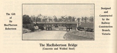
Image, MacRobertson's Bridge, 1934
... A steel bridge over the Yarra River, Melbourne. The bridge... bridge A steel bridge over the Yarra River, Melbourne. The bridge ...Confectionery king MacPherson Robertson personally funded the £19 000 cost of the steel arch MacRobertson or Grange Road Bridge (1934) as a gift to Victoria for its centenary. (http://www.emelbourne.net.au/biogs/EM00234b.htm)A steel bridge over the Yarra River, Melbourne. The bridge was funded by MacPherson Robertson.macrobertson, bridge -
 Port Melbourne Historical & Preservation Society
Photograph - Aerial view of Aeronautical Research Laboratories site from south-west, Early 1970s
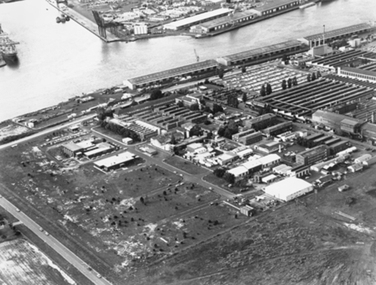
... Laboratories site from Yarra River... of Aeronautical Research Laboratories site from Yarra River Photograph ...Series of aerial views of Aeronautical Research Laboratories site from Yarra Rivertransport - aviation and aerodrome -
 Port Melbourne Historical & Preservation Society
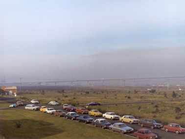
Photograph - Parked cars of Aeronautical Research Laboratories workers, Mid 1970s
... Laboratories site from Yarra River... of Aeronautical Research Laboratories site from Yarra River Photograph ...Series of aerial views of Aeronautical Research Laboratories site from Yarra Rivertransport - aviation and aerodrome -
 Kew Historical Society Inc
Plan - Subdivision Plan, H C Crouch, Old Golf Links Estate, 1930s
... and the River Yarra was released in sections. This release included 80... and the River Yarra was released in sections. This release included 80 ...The land in North Kew between the Outer Circle Railway and the River Yarra was released in sections. This release included 80 lots. Most of this area was released during the Depression years in the early 1930s.Subdivision plans are historically important documents used as evidence of the growth of suburbs in Australia. They frequently provide information about when the land was sold on which a built structure was subsequently constructed as well as evidence relating to surveyors and real estate and financial agents. The numerous subdivision plans in the Kew Historical Society's collection represent working documents, ranging from the initial sketches made in planning a subdivision to printed plans on which auctioneers or agents listed the prices for which individual lots were sold. In a number of cases, the reverse of a subdivision plan in the collection includes a photograph of a house that was also for sale by the agent. These photographs provide significant heritage information relating house design and decoration, fencing and household gardens.One part of a massive subdivision of the Old Golf Links Estate in North Kew of 80 allotments bordering Sutherland Avenue, Ramsay Avenue, Belford Road, Beresford Street and Coleman Avenue. Inset on the plan at the top left, the route of the Outer Circle Railway is clearly marked. The Kew Golf Links is identified in its current location. The land on which Greenacres Golf Club was to be constructed is at this time marked as ‘Recreation Ground’. The ‘new bridge’ over the Yarra at Burke Road is also marked on the inset map. The Plan identifies the surveyor (sic) H.C. Crouch BCE MVIS, 443 Little Collins St., Melbourne. The date of the subdivision auction sale in identified as Saturday September 25th at three o'clock.Annotations: "E" top left. "Golf Links" top right. Lots 73-76 ticked and listed as "6" poundssubdivisions -- kew (vic.), old golf links estate -
 Upper Yarra Museum
Negative Photographic Reproduction, Parbury Bridge Warburton, 14.2.1983
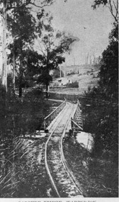
... parbury bridge warburton tramway yarra river... bridge warburton tramway yarra river Parbury Bridge Warburton ...Parbury Bridge Warburton Negative Black white. Scanned at 600 dpi.parbury bridge warburton tramway yarra river -
 Upper Yarra Museum
Negative Photographic Reproduction, Bridge over the Yarra
... bridge over yarra river... over yarra river 03050 Bridge over the Yarra. Upper Yarra Shire ...03050 Bridge over the Yarra. Upper Yarra Shire 1888-1988 Centenary collection. Black & white Negative, scanned at 600 dpibridge over yarra river -
 Eltham District Historical Society Inc
Photograph, Fay Bridge, Griffith Park, Eltham, n.d
... Yarra River... Yarra River 3 images - Scanned from colour prints on loan ...Griffith Park is the former property and home of Cr Fred Griffith in the 1950sfay bridge collection, daffodils, griffith park, yarra river -
 Eltham District Historical Society Inc
Photograph - Aerial Photograph, Landata, Eltham, Feb. 1956
... Yarra River... Orchard Reynolds Road Sweeneys Lane Templestowe Yarra River ...Centred on present day Culla Hill and Petty's Orchard, Eltham bounded by Brougham Street and Mount Pleasant Road to north, Monckton Road, Templestowe to south, Reynolds Road to east and Eltham Lower Park and Hohnes Road to west. Historic Aerial Imagery Source: Landata.vic.gov.au Aerial Photo Details: Project No :250 Project : MELBOURNE OUTER SUBURBS PROJECT Run : 18 Frame : 92 Date : 02/1956 Film Type : B/W Camera : EAG9 Flying Height : 10000 Scale : 12000 Film Number : 1176 GDA2020 : 37°43'35"S, 145°09'31"E MGA2020 : 337735, 5822959 (55) Melways : 22 B8 (ed. 42)aerial photo, 1956-02, neil webster collection, eltham, brougham steet, culla hill, eltham lower park, hohnes road, melway 22b8, monckton road, mount pleasant road, petty's orchard, reynolds road, sweeneys lane, templestowe, yarra river -
 Eltham District Historical Society Inc
Photograph (Item) - Print, Craig Price, Trees, Water And Beer Bottles - River Bank Eltham, 1988
... Yarra River... Series 35 Craig Price Yarra River Front: Entrant No. and name ...Craig Price 1988 Entrant No. 148 Ref: Series 34, Items 37, 38, 109, 110 No negative (or missing) SHIRE OF ELTHAM COMMUNITY PHOTOGRAPHIC SURVEY Photography is an artform which many of us practice, sometimes purely for artistic pursuit, sometimes to record the people and events in our lives. In 1988, as part of a local Bicentennial project, the Shire of Eltham conducted the Eltham Community Photographic Survey. Up to 100 entries were to be selected by a panel of photographers for entry into the Eltham Photographic Survey Exhibition. Entries had to be submitted by May 13, 1988. Entrants whose images were selected for the exhibition were contacted and requested to further submit an entry form providing entrant’s name, area of residence, age, and proposed captions. These details were then used to produce labels for the exhibition mounts. Where negatives had not been supplied, these were requested to support the display of printed enlargements mounted on 10” x 8” cardboard. The mounted prints were made available post exhibition for sale at $8.50 each for colour prints and $7.00 for B&W prints. Residents in the Shire were invited to collect a free roll of film and take a photograph of what they either liked or did not like about the area. A total of 160 entrants submitted multiple entries for the exhibition. Of those selected for exhibition, entrants ranged in age from 9 to 70 years. All custom colour and black and white printing for the exhibition was completed by Wattle Studios of Eltham. The Eltham Photographic Survey was jointly auspiced by the Shire of Eltham and Wattle Studios, of 953 Main Road, Eltham. The project was greatly assisted by: • David McRitchie, Media Studies Lecturer Victoria College, Rusden Campus. • Ian and Annette Toohill of Wattle Studios • Tracy Naughton, Eltham Community Arts Officer • Neville Emerson Pty. Ltd. • Superior Press, Eltham • Kodak Australasia Pty. Ltd. • Agfa Gevaert Ltd. • Townsend Colourtech Pty. Ltd. • The Australian Bicentennial Authority • Eleanor Bowers, Secretary, Eltham Arts Council The exhibition was placed on display in the Woolworths Arcade, Eltham between Monday June 6th and Saturday June 11, 1988. It was also intended to hold the exhibition at a venue in the Shire’s North Riding from Monday, June 20 to Friday June 24. It was then displayed at the Were Street Theatre, Montmorency from Friday, June 24 to Thursday, July 7. Series 34: Eltham Community Photographic Survey 1988 - Prints & Documentation Series consists of 117 photographs of Shire scenes taken by members of the community. Items I - 41 are larger photographs mounted on card, which were exhibited. Items 42 - 117 are unmounted copies, alternative takes and other entries. Corresponding negatives contained in Series 35: Eltham Community Photographic Survey 1988 – Negatives which consists of 267 colour and B&W negatives and one colour slide of Shire scenes taken by members of the community. The negatives are arranged by the entrant number of the photographer. The Eltham Community Photographic Survey collection is significant to the local community as it was curated by the local community - ordinary people of all ages - representing what they liked and did not like in the area where they lived. It represents an unfiltered representation of the Shire of Eltham as it was in 1988. It also represents one of many projects as part of the national programme of events and celebrations to commemorate the bicentenary. It is a time capsule of life in the 1980s of this urban and rural municipality in Melbourne's north. Front: Entrant No. and name on printed label Rear: Entrant No., name and address on printed label; also 'Series 34' and the 'Item No.' in pencilshire of eltham archives, bicentennial project, eltham, eltham community photographic survey, eltham photographic survey exhibition, series 34, series 35, craig price, yarra river -
 Eltham District Historical Society Inc
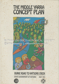
Book, State Government of Victoria, The Middle Yarra Concept Plan: Burke Road to Watsons Creek, July 1991
... Yarra River... melbourne recreation areas regional planning Yarra River Watsons ...A draft concept plan developed for the Middle Yarra River between Burke Road and Watsons Creek which includes planning controls, developed and managed to meet the recreation and landscape objectives whilst protecting the natural resourcesa nd cultural heritage. It established a broad framework for more detailed plans and guidelines. Jointly produced by staff from the Victorian Department of Planning and Housing. July 1991.non-fictionA draft concept plan developed for the Middle Yarra River between Burke Road and Watsons Creek which includes planning controls, developed and managed to meet the recreation and landscape objectives whilst protecting the natural resourcesa nd cultural heritage. It established a broad framework for more detailed plans and guidelines. Jointly produced by staff from the Victorian Department of Planning and Housing. July 1991.recreation areas, regional planning, yarra river, watsons creek -
 Eltham District Historical Society Inc
Document - Folder, McLean, 1984-1999
... Yarra River... Warrandyte Bridge Warrandyte Wingrove park Yarra River EDHS_04789 ...References to McLean family, Hector John McLean and Louisa Frances (nee Green) and six daughters who lived in Eltham during the period 1930 to 1934 inclusive. Lived in the former Evelyn Hotel at the time it was destroyed by fire and being part of the Centenary Parade in 1934 where the family won the Group Section for their entry “Pioneers of Eltham” Reminiscences provided by Edith Jones (nee M1934 flood, ballroom, baptism, barber shop, bittern, boy scouts, bremner's flat, burgoyne's shop, cable tram, cemetery road, centenary celebrations, centenary parade, christening, coach house, collis grocery, dalton street, depression, dole, dorothy jean mclean, edith jones (nee mclean), eltham fire brigade, eltham high school, eltham higher elementary school, eltham lower park, eltham railway station, eltham state school no. 209, evelyn hotel, fire damage - buildings, flinders naval depot, fordham, gladys evelyn mclean, gold mining, gwenneth mae mclean, gwladys evelyn mclean, headmistress, hector john mclean, isherwood house and shop, louisa frances mclean (nee green), metery road, methodist church, miss finnin, miss grant cottage, motor bike races, mrs barrett, mrs bremner, mrs hurley, olive isabel mclean, parade, phoebe lillian mclean, picnic, pioneers of eltham, pitt street, research fire brigade, rev. r.g. arthur, shed, shops, st margarets church hall, st margaret's church, stables, state savings bank of victoria, susso books, todaro, vinnie willet, warrandyte bridge, warrandyte, wingrove park, yarra river -
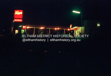 Eltham District Historical Society Inc
Photograph (Item) - Negative, Mathew Wakefield, Eltham Community Photographic Survey Entry, 1988
... Yarra River... Trail Yarra River Beard Street Food Plus Service Station Colour ...Mathew Wakefield 1988 Entrant No. 40 Ref: Series 34, Items 87, 88 The images in this record were not selected for inclusion. SHIRE OF ELTHAM COMMUNITY PHOTOGRAPHIC SURVEY Photography is an artform which many of us practice, sometimes purely for artistic pursuit, sometimes to record the people and events in our lives. In 1988, as part of a local Bicentennial project, the Shire of Eltham conducted the Eltham Community Photographic Survey. Up to 100 entries were to be selected by a panel of photographers for entry into the Eltham Photographic Survey Exhibition. Entries had to be submitted by May 13, 1988. Entrants whose images were selected for the exhibition were contacted and requested to further submit an entry form providing entrant’s name, area of residence, age, and proposed captions. These details were then used to produce labels for the exhibition mounts. Where negatives had not been supplied, these were requested to support the display of printed enlargements mounted on 10” x 8” cardboard. The mounted prints were made available post exhibition for sale at $8.50 each for colour prints and $7.00 for B&W prints. Residents in the Shire were invited to collect a free roll of film and take a photograph of what they either liked or did not like about the area. A total of 160 entrants submitted multiple entries for the exhibition. Of those selected for exhibition, entrants ranged in age from 9 to 70 years. All custom colour and black and white printing for the exhibition was completed by Wattle Studios of Eltham. The Eltham Photographic Survey was jointly auspiced by the Shire of Eltham and Wattle Studios, of 953 Main Road, Eltham. The project was greatly assisted by: • David McRitchie, Media Studies Lecturer Victoria College, Rusden Campus. • Ian and Annette Toohill of Wattle Studios • Tracy Naughton, Eltham Community Arts Officer • Neville Emerson Pty. Ltd. • Superior Press, Eltham • Kodak Australasia Pty. Ltd. • Agfa Gevaert Ltd. • Townsend Colourtech Pty. Ltd. • The Australian Bicentennial Authority • Eleanor Bowers, Secretary, Eltham Arts Council The exhibition was placed on display in the Woolworths Arcade, Eltham between Monday June 6th and Saturday June 11, 1988. It was also intended to hold the exhibition at a venue in the Shire’s North Riding from Monday, June 20 to Friday June 24. It was then displayed at the Were Street Theatre, Montmorency from Friday, June 24 to Thursday, July 7. Series 34: Eltham Community Photographic Survey 1988 - Prints & Documentation Series consists of 117 photographs of Shire scenes taken by members of the community. Items I - 41 are larger photographs mounted on card, which were exhibited. Items 42 - 117 are unmounted copies, alternative takes and other entries. Corresponding negatives contained in Series 35: Eltham Community Photographic Survey 1988 – Negatives which consists of 267 colour and B&W negatives and one colour slide of Shire scenes taken by members of the community. The negatives are arranged by the entrant number of the photographer. The Eltham Community Photographic Survey collection is significant to the local community as it was curated by the local community - ordinary people of all ages - representing what they liked and did not like in the area where they lived. It represents an unfiltered representation of the Shire of Eltham as it was in 1988. It also represents one of many projects as part of the national programme of events and celebrations to commemorate the bicentenary. It is a time capsule of life in the 1980s of this urban and rural municipality in Melbourne's north. shire of eltham archives, bicentennial project, eltham community photographic survey, dalton street, eltham, film - fuji 100, main road, mathew wakefield, scan - 35mm negative, series 35, wiingrove park trail, yarra river, beard street, food plus service station -
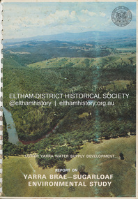 Eltham District Historical Society Inc
Book, Melbourne Metropolitan Board of Works, Lower Yarra Water Supply DeVelopment: Report on Yarra Brae-Sugarloaf Environmental Study, April 1974
... Yarra River Valley... Yarra Brae Dam Yarra River Valley A4 x 3cm Spiral bound 1 v ...environmental study, melbourne metropolitan board of works, report, sugarloaf reservoir, water catchment area, water supply, yarra brae dam, yarra river valley -
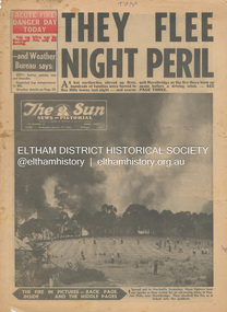 Eltham District Historical Society Inc
Newspaper - Newspaper articles, Sun News-Pictorial, They Flee Night Peril, The Sun News-Pictorial, Wednesday, January 17, p1, 1962
... Yarra River... Hills Yarra River Mitcham Whitehorse Roiad Donvale Park Orchards ...Various news articles pertaining to the January 1962 Victorian bushfires in the Dandenong and Healesville districts which by the third day had encompassed large areas of the State. Specific Eltham Shire districts mentioned include Panton Hill and Hurstbridge on page 1, Warrandyte on page 2, 3, 4 and 5, Hurstbridge, Smith’s Gully, Kinglake on page 3 and 4, Strathewen, Kangaroo Ground, Panton Hill, St. Andrews, Smith’s Gully on page 4 and Pound Bend, Smith’s Gully and Warrandyte on pages 20-21 • They Flee Night Peril, p1 (Illust.) • Their grim picnic; A flash fire strikes, p2 (Illust.) • Night of terror as towns quitted, p3 • Fought till he dropped, p3 (Illust.) • Rain in fire area, p3 • Wye River town goes, p3 • Black Friday Hero Dies In Fire; with wife, grandsons, p4 • Surrounded!, p4 (Illust.) • Main street houses ablaze, p4 • Hurstbridge is evacuated, p4 • Scores jump in river at Warrandyte, p5 • Hills people leave homes, p5 • “Fire” cry at Parlt., p5 • Blind – he’s safe now, p5 (Illust.) • Police Chief Runs Battle, p7 • From Fire Front: Hospital treats 34, p7 • Firms send help, p7 • Tragedy and Ruin: Third Day; Ferntree Gully; Warrandyte; Pound Bend; Smiths Gully; Escape for 18, pp20-21 (Illust.) • Church was a haven for the hurt, weary, p39 (Illust.) • A home is lost, p40 (Illust.) tom fielding collection, victorian bushfires - 1962, victorian bushfires – 1962, panton hill, hurstbridge, five ways crossroads, warrandyte south, dandenongs, upwey, mt. evelyn, monbulk, olinda, sassafras, st. andrews, warrandyte, christmas hills, yarra river, mitcham, whitehorse roiad, donvale, park orchards, metropolitan fire chief, w.t. aldridge, loughnan’s hill, ringwood, woori yallock, leslie ockwell, linda ockwell, kalorama, healesville, daylesford, fire damage – buildings, wye river, portland, eganstown, ballarat, sherbrooke park forest, forest commission headquarters, kallista, r.t. seaton, montrose, yallourn, central gippsland, smith’s creek, black friday, geoffrey ockwell, ronald ockwell, preston town hall, e.j. tenner, strathewen, kangaroo ground, eric farnsworth, adele farnsworth, robin farnsworth, roy cleland, ann cleland, belgrave, sassfras, kaloramalice commissioner porter, mansfield, box hill hospital, pound bend, ferntree gully, ferntree gully state school, w. carew, ann quinton -
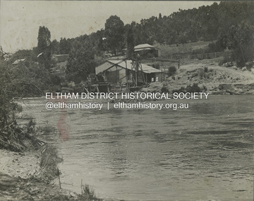 Eltham District Historical Society Inc
Photograph - Black and White Print, J.E. Barnes, The old water wheel, Warrandyte, c.1920
... Yarra River... Yarra River Black & White / Sepia print mounted on card The old ...Josiah Earl BARNES (Australian, 1858–1921) was a noted WW1 photographer who took many photographs of departing troopships and men. The Australian War Memorial holds around 1,436 negatives and prints by J.E. Barnes. His daughter, D. Barnes (married name Smyth) was also a photographer and lived in Diamond Creek from around 1910 to circa 1940.david smyth collection, warrandyte, warrandyte battery, yarra river