Showing 1513 items matching "grant street"
-
 Eltham District Historical Society Inc
Photograph - Aerial Photograph, Landata, Eltham; Crown Allotment 15, Section 5, Parish of Nillumbik (Stokes Orchard Estate), Oct. 1968
Centred on present day Diosma Rd, Stokes Pl, Nyora Rd and Eucalyptus Rd Historic Aerial Imagery Source: Landata.vic.gov.au Aerial Photo Details: Project No :656 Project : MELBOURNE 1968 PROJECT Run : 13A Frame : 64 Date : 10/1968 Film Type : B/W Camera : RC8 Flying Height : 5100 Scale : 9600 Film Number : 2172 GDA2020 : 37°42'46"S, 145°10'01"E MGA2020 : 338430, 5824467 (55) Melways : 22 D4 (ed. 42) A History of the Development of Crown Allotment 15, Section 5, Parish of Nillumbik – Stokes Orchard Crown Allotment 15, Section 5, Parish of Nillumbik (CA15) is a square allotment of 158 acres or approximately a quarter of a square mile. It lies just beyond the eastern end of Pitt Street, south of Nyora Road to the northern end of Eucalyptus Road and extends east from Eucalyptus Road to Reynolds Road. The topography of CA15 is generally steep, sloping up to a hill near the centre of the land, the ridgeline passing through the properties along the southern side of Diosma Road. Eucalyptus Road is a straight north-south road with its northern end at the north west corner of CA15. Until the end of the 1970s this road was an un-named Government Road and was largely not open to traffic. With residential development in the 1970s the road was constructed, and the council allocated the name obviously in recognition of the predominant species of the local bushland. CA15 was purchased from the Crown by George D’Arley Boursiquot, a prominent Melbourne printer, on 28th October 1852. On November 23, 1922, former Member for Gippsland and Melbourne Real Estate Agent, Hubert Patrick Keogh purchased the allotment then sold it March 13, 1925, to local farmer, Robert David Taylor, a former Shire of Eltham Councillor (1911-1920) and Shire President (1919). Taylor had extensive land holdings stretching west towards Bible Street and Main Road. The Taylor home was situated at the top of the hill in Bible Street at present day 82 Bible Street. At the time of Taylor’s purchase in 1925, CA15 was subdivided into 48 lots that could be described as small rural properties or large residential lots. A typical lot size was one hectare or 2.5 acres. The subdivision created two roads, Nyora Road, and Diosma Road, each following an irregular alignment between Eucalyptus and Reynolds Roads. However, the lots were not sold off separately nor were the roads constructed. The land effectively remained as one parcel for many further years. Robert David Taylor died November 30, 1934, and probate was granted to his son of the same name, Robert David Taylor of Bible Street, Salesman and William McLelland Vance Taylor of 73 Emmeline Street, Northcote, Clerk, with the transfer of the land into their names on July 8, 1935. Frank Stokes worked as a qualified accountant at Kennons leather factory in Burnley, while living at 1 Thomas Street, Mitcham. He suffered from migraines and wanted to return to working the land (he had previously worked on farms and orchards since coming to Australia from England in 1926, both in WA and Vic.). He first travelled to the district by train in July 1942 to find land with the intention to establish an orchard. By chance he met Arthur Bird of Bird Orchard (bounded by Pitt Street, Eucalyptus Road, and Wattle Grove) and they got talking over their common interest. Arthur put Frank up for the night and pointed out the land, 158 acres- part of the Taylor Estate- £900, Crown Allotment 15, Section 5, Parish of Nillumbik (CA15) somewhat diagonally opposite Bird Orchard. Stokes applied through the Riverina Agency to purchase the land who in turn applied for permission from Canberra to sell as there was a new government regulation introduced during the Second World War banning land sales except for immediate production. Stokes obtained a loan on his Mitcham house of £600 @ 5% and paid £450 deposit with quarterly payments of £15 spread over 5 years. Stokes was assisted and advised by Arthur Bird who farmed the neighbouring orchard. In early 1943 Stokes took possession and would catch the train out to Eltham on Fridays after work and began building a hut on the corner of Nyora Road and the Government Road (Eucalyptus Road) for shelter and to lock up tools. He established an orchard on the central western part of the land through the centre of which ran a natural waterway (part of the present-day linear park) and was able to pay a neighbour (Hawkins) to help with clearing and fencing 25 acres, and with a horse and single furrowed plough, planted approximately 2,500 fruit trees - cherries, peaches, plums, almonds, pears, apricots and lemons as well as a few apples and oranges; a massive task. Aerial photographs from the 1940s through to the 1990s clearly show the orchard with most of the larger CA15 site remaining as natural bushland. A huge problem was hares and rabbits eating all the new buds off the tiny trees. As well as laying poison he painted the trees with a mixture of cow manure and lime, often working by moonlight. Procurement of wire and wire netting was difficult because of the war but after much effort he obtained a permit from the Agricultural Department for supplies in March 1944. In February 1945 Stokes applied for a permit to build a “packing shed” as no house building was allowed. It was to be 33 feet x 21 feet and cost £312. It was constructed mostly from second-hand materials, which were hard to obtain, especially iron for roofing. Stokes finished work at Kennons on October 31, 1945, and in March 1946 he sold the family home at Mitcham for £1,230 plus £170 for furniture. On May 15, 1946, title to the CA15 property was issued to Frank Howard Alfred Stokes, Orchardist and Gladys Ethel Stokes, Married Woman, both of Pitt Street, Eltham. The family of five then moved into the very unfinished “packing shed” at Eltham, which was a struggle to weatherproof. Eventually rooms were divided off and lined with hessian bags and whitewashed. Their income was firewood (cut and sold), selling rockery stones and cut Sweet Bursaria. (It was discovered during the 1940s that Sweet Bursaria contained the sunscreen compound Aesculin. The RAAF utilised this compound from Sweet Bursaria during WW2 for pilots and gunners.) The orchard’s first fruit sale was a half-case of Le Vanq peaches in December 1947 for the price of 8 shillings. In 1956 plans for house were drawn and Glen Iris bricks purchased (1956 Olympic Rings variant). The building of the house commenced in 1957 - 12 feet of original packing shed was removed – and was completed in 1959. Water was connected from newly built pressure storage on the property at the end of 1959 and the electricity connection for the first time at 3pm on April 29, 1960. The house remains to present day (somewhat modified) at 1 Nyora Road, home to Nyora Studio Gallery. On occasions, spare remnants of the 1956 bricks have been known to be unearthed in gardens on the estate as they were utilised by Frank Stokes to fill in rabbit holes. On May 26, 1950, a parcel of land was compulsorily acquired by the Melbourne and Metropolitan Board of Works on the hilltop to establish an easement for a high-level service reservoir to augment Eltham’s water supply. The project also included pipe tracks for the necessary water mains. The reservoir has now been superseded by higher level water tanks east of Reynolds Road and its former site is now a public reserve. On November 27, 1964, the State Electricity Commission served notice to compulsorily acquire a further parcel through the eastern part of the land for a major electricity transmission line that augmented supply from the La Trobe Valley to Melbourne. The easement was registered February 11, 1966. The easement was widened July 18, 1969 for a second transmission line to be constructed. In 1971 Melbourne Metropolitan Planning Scheme amendments adopted Nyora Road as the boundary between a residential zone to the north and a rural zone to the south. This determined the future development of the land. In the mid-1970s the Shire of Eltham divided the orchard into numerous rate-able parcel lots, the 48 lots having been established in 1925 and the subsequent rates assessment proved unsustainable for Stokes. He commenced selling lots outside the boundary of the orchard, north of Diosma and South of Nyora. However shortly later the land between Nyora and Diosma Roads and west of the electricity easement was sold and subdivided into residential lots, a housing development by Macquarie Builders and marketed as the Stokes Orchard Estate. New streets were created, and most were named after trees, although one, Stokes Place, commemorates the former owners. The development was undertaken in two stages; Stage 1 (1975) encompassing Scarlet Ash Court, Ironbark Close and Peppermint Grove bounded by Nyora and Eucalyptus roads and Stage 2 (1978) encompassing Stokes Place, Orchard Way, The Crest and The Lookout bound by Nyora and Diosma roads. The developer, Macquarie Builders went bankrupt shortly after the release of Stage 2 leaving many purchasers to fend for themselves and arrange for their own independent builders. There were also difficulties with sewerage for the land immediately south of Diosma Road and so the conventional residential lots were abandoned in favour of larger lots. The development of Orchard Way, The Crest and The Lookout did not proceed as planned and the proposed lots were incorporated into five-acre parcels instead. These included a low-density group housing development by the Graves family and the award winning Choong House (1983) with Gordon Ford developed garden immediately next door situated on the ridge of the hill nestled amongst the original bush, Eucalypt trees and Sweet Bursaria. In 1994, Nillumbik Shire Council applied Significant Environment and Significant Landscape overlays upon the properties on the south side of Diosma Road to ensure protection of this natural bush garden environment. With the arrival of the sewer along Diosma Road in the 1990s, most of these five-acre parcels have since been subdivided multiple times. The Choong house presently sits on a 2.7-acre property, which in 2022 Nillumbik Council nominated for Cultural Significance Heritage protection and is considered potentially significant at State level. The Stokes family were also associated with the Eltham Christian Church. In the 1970s this church had met in temporary premises in Eltham. Lots of the original 1925 subdivision remained south of Nyora Road and a number of these lots were utilized for the Eltham Christian School, which was established by the Eltham Christian Church in 1981. The school operated on this site until 2000. The premises are now used by The Vine Baptist Church. By the mid-1980s the whole of CA15 had been developed for residential and school purposes, except for the sections north of Diosma Road and between the transmission lines and Reynolds Road. Sewerage issues had been resolved for the section north of Diosma Road and in 1987 it was in the process of being subdivided into residential lots. The development coincided with the discovery of colonies of the rare and endangered Eltham Copper Butterfly on the site. This resulted in a community and political campaign to save the butterfly habitat. With the co-operation of the land developer the subdivision was altered to create two bushland reserves in the critical butterfly habitat areas. In the late 1980s the State Government was investigating options for establishing a metropolitan ring road link between Diamond Creek and Ringwood. The chosen route was adjacent to Reynolds Road and so this created a freeze on development of CA15 between Reynolds Road and the electricity easement. The ring road proposal was eventually abandoned, and this part of the land was subdivided into low density residential lots. Diosma Road has been discontinued at the electricity easement and the eastern part incorporated into View Mount Court with access from Reynolds Road. The whole of CA15 has now been developed for residential or associated purposes, ranging from conventional density to quite low density south of Nyora Road. Some remnants of the orchard remain, a few cherry trees on the Graves property and a lone apple tree in Stokes Place. The butterfly reserves comprise significant areas of remnant bushland. Linear reserves through the estate link with central Eltham via the Woodridge linear reserve and with Research along the electricity easement. CA15 as it exists today has a complicated history of rural use, Government acquisition, urban development, and community action. References: • “Stokes Orchard, an incomplete history”; Russell Yeoman with Doug Orford • Correspondence, Beryl Bradbury (nee Stokes) • Aerial Photographs, 1931-1991, Landata (landata.vic.gov.au) • Certificate of Title, Vol. 4930 Fol. 985900 • Plan Number LP 10859 aerial photo, diosma road, eltham copper butterfly, eucalyptus road, ironbark close, nyora road, peppermint grove, peter & elizabeth pidgeon collection, power transmission lines, reynolds road, scarlet ash court, stokes orchard estate, stokes place, woodridge estate, frank stokes -
 Eltham District Historical Society Inc
Photograph - Aerial Photograph, Landata, Eltham; Crown Allotment 15, Section 5, Parish of Nillumbik (Stokes Orchard Estate), Oct. 1970
Centred on present day Diosma Rd, Stokes Pl, Nyora Rd and Eucalyptus Rd Historic Aerial Imagery Source: Landata.vic.gov.au Aerial Photo Details: Project No :1148 Project : MELBOURNE 1970 PROJECT Run : 27 Frame : 192 Date : 10/1970 Film Type : B/W Camera : RC8 Flying Height : 5100 Scale : 9600 Film Number : 2366 GDA2020 : 37°42'45"S, 145°10'05"E MGA2020 : 338533, 5824496 (55) Melways : 22 D4 (ed. 42) A History of the Development of Crown Allotment 15, Section 5, Parish of Nillumbik – Stokes Orchard Crown Allotment 15, Section 5, Parish of Nillumbik (CA15) is a square allotment of 158 acres or approximately a quarter of a square mile. It lies just beyond the eastern end of Pitt Street, south of Nyora Road to the northern end of Eucalyptus Road and extends east from Eucalyptus Road to Reynolds Road. The topography of CA15 is generally steep, sloping up to a hill near the centre of the land, the ridgeline passing through the properties along the southern side of Diosma Road. Eucalyptus Road is a straight north-south road with its northern end at the north west corner of CA15. Until the end of the 1970s this road was an un-named Government Road and was largely not open to traffic. With residential development in the 1970s the road was constructed, and the council allocated the name obviously in recognition of the predominant species of the local bushland. CA15 was purchased from the Crown by George D’Arley Boursiquot, a prominent Melbourne printer, on 28th October 1852. On November 23, 1922, former Member for Gippsland and Melbourne Real Estate Agent, Hubert Patrick Keogh purchased the allotment then sold it March 13, 1925, to local farmer, Robert David Taylor, a former Shire of Eltham Councillor (1911-1920) and Shire President (1919). Taylor had extensive land holdings stretching west towards Bible Street and Main Road. The Taylor home was situated at the top of the hill in Bible Street at present day 82 Bible Street. At the time of Taylor’s purchase in 1925, CA15 was subdivided into 48 lots that could be described as small rural properties or large residential lots. A typical lot size was one hectare or 2.5 acres. The subdivision created two roads, Nyora Road, and Diosma Road, each following an irregular alignment between Eucalyptus and Reynolds Roads. However, the lots were not sold off separately nor were the roads constructed. The land effectively remained as one parcel for many further years. Robert David Taylor died November 30, 1934, and probate was granted to his son of the same name, Robert David Taylor of Bible Street, Salesman and William McLelland Vance Taylor of 73 Emmeline Street, Northcote, Clerk, with the transfer of the land into their names on July 8, 1935. Frank Stokes worked as a qualified accountant at Kennons leather factory in Burnley, while living at 1 Thomas Street, Mitcham. He suffered from migraines and wanted to return to working the land (he had previously worked on farms and orchards since coming to Australia from England in 1926, both in WA and Vic.). He first travelled to the district by train in July 1942 to find land with the intention to establish an orchard. By chance he met Arthur Bird of Bird Orchard (bounded by Pitt Street, Eucalyptus Road, and Wattle Grove) and they got talking over their common interest. Arthur put Frank up for the night and pointed out the land, 158 acres- part of the Taylor Estate- £900, Crown Allotment 15, Section 5, Parish of Nillumbik (CA15) somewhat diagonally opposite Bird Orchard. Stokes applied through the Riverina Agency to purchase the land who in turn applied for permission from Canberra to sell as there was a new government regulation introduced during the Second World War banning land sales except for immediate production. Stokes obtained a loan on his Mitcham house of £600 @ 5% and paid £450 deposit with quarterly payments of £15 spread over 5 years. Stokes was assisted and advised by Arthur Bird who farmed the neighbouring orchard. In early 1943 Stokes took possession and would catch the train out to Eltham on Fridays after work and began building a hut on the corner of Nyora Road and the Government Road (Eucalyptus Road) for shelter and to lock up tools. He established an orchard on the central western part of the land through the centre of which ran a natural waterway (part of the present-day linear park) and was able to pay a neighbour (Hawkins) to help with clearing and fencing 25 acres, and with a horse and single furrowed plough, planted approximately 2,500 fruit trees - cherries, peaches, plums, almonds, pears, apricots and lemons as well as a few apples and oranges; a massive task. Aerial photographs from the 1940s through to the 1990s clearly show the orchard with most of the larger CA15 site remaining as natural bushland. A huge problem was hares and rabbits eating all the new buds off the tiny trees. As well as laying poison he painted the trees with a mixture of cow manure and lime, often working by moonlight. Procurement of wire and wire netting was difficult because of the war but after much effort he obtained a permit from the Agricultural Department for supplies in March 1944. In February 1945 Stokes applied for a permit to build a “packing shed” as no house building was allowed. It was to be 33 feet x 21 feet and cost £312. It was constructed mostly from second-hand materials, which were hard to obtain, especially iron for roofing. Stokes finished work at Kennons on October 31, 1945, and in March 1946 he sold the family home at Mitcham for £1,230 plus £170 for furniture. On May 15, 1946, title to the CA15 property was issued to Frank Howard Alfred Stokes, Orchardist and Gladys Ethel Stokes, Married Woman, both of Pitt Street, Eltham. The family of five then moved into the very unfinished “packing shed” at Eltham, which was a struggle to weatherproof. Eventually rooms were divided off and lined with hessian bags and whitewashed. Their income was firewood (cut and sold), selling rockery stones and cut Sweet Bursaria. (It was discovered during the 1940s that Sweet Bursaria contained the sunscreen compound Aesculin. The RAAF utilised this compound from Sweet Bursaria during WW2 for pilots and gunners.) The orchard’s first fruit sale was a half-case of Le Vanq peaches in December 1947 for the price of 8 shillings. In 1956 plans for house were drawn and Glen Iris bricks purchased (1956 Olympic Rings variant). The building of the house commenced in 1957 - 12 feet of original packing shed was removed – and was completed in 1959. Water was connected from newly built pressure storage on the property at the end of 1959 and the electricity connection for the first time at 3pm on April 29, 1960. The house remains to present day (somewhat modified) at 1 Nyora Road, home to Nyora Studio Gallery. On occasions, spare remnants of the 1956 bricks have been known to be unearthed in gardens on the estate as they were utilised by Frank Stokes to fill in rabbit holes. On May 26, 1950, a parcel of land was compulsorily acquired by the Melbourne and Metropolitan Board of Works on the hilltop to establish an easement for a high-level service reservoir to augment Eltham’s water supply. The project also included pipe tracks for the necessary water mains. The reservoir has now been superseded by higher level water tanks east of Reynolds Road and its former site is now a public reserve. On November 27, 1964, the State Electricity Commission served notice to compulsorily acquire a further parcel through the eastern part of the land for a major electricity transmission line that augmented supply from the La Trobe Valley to Melbourne. The easement was registered February 11, 1966. The easement was widened July 18, 1969 for a second transmission line to be constructed. In 1971 Melbourne Metropolitan Planning Scheme amendments adopted Nyora Road as the boundary between a residential zone to the north and a rural zone to the south. This determined the future development of the land. In the mid-1970s the Shire of Eltham divided the orchard into numerous rate-able parcel lots, the 48 lots having been established in 1925 and the subsequent rates assessment proved unsustainable for Stokes. He commenced selling lots outside the boundary of the orchard, north of Diosma and South of Nyora. However shortly later the land between Nyora and Diosma Roads and west of the electricity easement was sold and subdivided into residential lots, a housing development by Macquarie Builders and marketed as the Stokes Orchard Estate. New streets were created, and most were named after trees, although one, Stokes Place, commemorates the former owners. The development was undertaken in two stages; Stage 1 (1975) encompassing Scarlet Ash Court, Ironbark Close and Peppermint Grove bounded by Nyora and Eucalyptus roads and Stage 2 (1978) encompassing Stokes Place, Orchard Way, The Crest and The Lookout bound by Nyora and Diosma roads. The developer, Macquarie Builders went bankrupt shortly after the release of Stage 2 leaving many purchasers to fend for themselves and arrange for their own independent builders. There were also difficulties with sewerage for the land immediately south of Diosma Road and so the conventional residential lots were abandoned in favour of larger lots. The development of Orchard Way, The Crest and The Lookout did not proceed as planned and the proposed lots were incorporated into five-acre parcels instead. These included a low-density group housing development by the Graves family and the award winning Choong House (1983) with Gordon Ford developed garden immediately next door situated on the ridge of the hill nestled amongst the original bush, Eucalypt trees and Sweet Bursaria. In 1994, Nillumbik Shire Council applied Significant Environment and Significant Landscape overlays upon the properties on the south side of Diosma Road to ensure protection of this natural bush garden environment. With the arrival of the sewer along Diosma Road in the 1990s, most of these five-acre parcels have since been subdivided multiple times. The Choong house presently sits on a 2.7-acre property, which in 2022 Nillumbik Council nominated for Cultural Significance Heritage protection and is considered potentially significant at State level. The Stokes family were also associated with the Eltham Christian Church. In the 1970s this church had met in temporary premises in Eltham. Lots of the original 1925 subdivision remained south of Nyora Road and a number of these lots were utilized for the Eltham Christian School, which was established by the Eltham Christian Church in 1981. The school operated on this site until 2000. The premises are now used by The Vine Baptist Church. By the mid-1980s the whole of CA15 had been developed for residential and school purposes, except for the sections north of Diosma Road and between the transmission lines and Reynolds Road. Sewerage issues had been resolved for the section north of Diosma Road and in 1987 it was in the process of being subdivided into residential lots. The development coincided with the discovery of colonies of the rare and endangered Eltham Copper Butterfly on the site. This resulted in a community and political campaign to save the butterfly habitat. With the co-operation of the land developer the subdivision was altered to create two bushland reserves in the critical butterfly habitat areas. In the late 1980s the State Government was investigating options for establishing a metropolitan ring road link between Diamond Creek and Ringwood. The chosen route was adjacent to Reynolds Road and so this created a freeze on development of CA15 between Reynolds Road and the electricity easement. The ring road proposal was eventually abandoned, and this part of the land was subdivided into low density residential lots. Diosma Road has been discontinued at the electricity easement and the eastern part incorporated into View Mount Court with access from Reynolds Road. The whole of CA15 has now been developed for residential or associated purposes, ranging from conventional density to quite low density south of Nyora Road. Some remnants of the orchard remain, a few cherry trees on the Graves property and a lone apple tree in Stokes Place. The butterfly reserves comprise significant areas of remnant bushland. Linear reserves through the estate link with central Eltham via the Woodridge linear reserve and with Research along the electricity easement. CA15 as it exists today has a complicated history of rural use, Government acquisition, urban development, and community action. References: • “Stokes Orchard, an incomplete history”; Russell Yeoman with Doug Orford • Correspondence, Beryl Bradbury (nee Stokes) • Aerial Photographs, 1931-1991, Landata (landata.vic.gov.au) • Certificate of Title, Vol. 4930 Fol. 985900 • Plan Number LP 10859 aerial photo, diosma road, eltham copper butterfly, eucalyptus road, ironbark close, nyora road, peppermint grove, peter & elizabeth pidgeon collection, power transmission lines, reynolds road, scarlet ash court, stokes orchard estate, stokes place, woodridge estate, frank stokes -
 Eltham District Historical Society Inc
Photograph - Aerial Photograph, Landata, Eltham; Crown Allotment 15, Section 5, Parish of Nillumbik (Stokes Orchard Estate), Apr. 1972
Centred on present day Diosma Rd, Stokes Pl, Nyora Rd and Eucalyptus Rd Historic Aerial Imagery Source: Landata.vic.gov.au Aerial Photo Details: Project No :985 Project : MELBOURNE 1972 Run : 27 Frame : 45 Date : 04/1972 Film Type : B/W Camera : RC10 Flying Height : 5700 Scale : 9600 Film Number : 2636 GDA2020 : 37°42'53"S, 145°10'19"E MGA2020 : 338884, 5824261 (55) Melways : 22 E5 (ed. 42) A History of the Development of Crown Allotment 15, Section 5, Parish of Nillumbik – Stokes Orchard Crown Allotment 15, Section 5, Parish of Nillumbik (CA15) is a square allotment of 158 acres or approximately a quarter of a square mile. It lies just beyond the eastern end of Pitt Street, south of Nyora Road to the northern end of Eucalyptus Road and extends east from Eucalyptus Road to Reynolds Road. The topography of CA15 is generally steep, sloping up to a hill near the centre of the land, the ridgeline passing through the properties along the southern side of Diosma Road. Eucalyptus Road is a straight north-south road with its northern end at the north west corner of CA15. Until the end of the 1970s this road was an un-named Government Road and was largely not open to traffic. With residential development in the 1970s the road was constructed, and the council allocated the name obviously in recognition of the predominant species of the local bushland. CA15 was purchased from the Crown by George D’Arley Boursiquot, a prominent Melbourne printer, on 28th October 1852. On November 23, 1922, former Member for Gippsland and Melbourne Real Estate Agent, Hubert Patrick Keogh purchased the allotment then sold it March 13, 1925, to local farmer, Robert David Taylor, a former Shire of Eltham Councillor (1911-1920) and Shire President (1919). Taylor had extensive land holdings stretching west towards Bible Street and Main Road. The Taylor home was situated at the top of the hill in Bible Street at present day 82 Bible Street. At the time of Taylor’s purchase in 1925, CA15 was subdivided into 48 lots that could be described as small rural properties or large residential lots. A typical lot size was one hectare or 2.5 acres. The subdivision created two roads, Nyora Road, and Diosma Road, each following an irregular alignment between Eucalyptus and Reynolds Roads. However, the lots were not sold off separately nor were the roads constructed. The land effectively remained as one parcel for many further years. Robert David Taylor died November 30, 1934, and probate was granted to his son of the same name, Robert David Taylor of Bible Street, Salesman and William McLelland Vance Taylor of 73 Emmeline Street, Northcote, Clerk, with the transfer of the land into their names on July 8, 1935. Frank Stokes worked as a qualified accountant at Kennons leather factory in Burnley, while living at 1 Thomas Street, Mitcham. He suffered from migraines and wanted to return to working the land (he had previously worked on farms and orchards since coming to Australia from England in 1926, both in WA and Vic.). He first travelled to the district by train in July 1942 to find land with the intention to establish an orchard. By chance he met Arthur Bird of Bird Orchard (bounded by Pitt Street, Eucalyptus Road, and Wattle Grove) and they got talking over their common interest. Arthur put Frank up for the night and pointed out the land, 158 acres- part of the Taylor Estate- £900, Crown Allotment 15, Section 5, Parish of Nillumbik (CA15) somewhat diagonally opposite Bird Orchard. Stokes applied through the Riverina Agency to purchase the land who in turn applied for permission from Canberra to sell as there was a new government regulation introduced during the Second World War banning land sales except for immediate production. Stokes obtained a loan on his Mitcham house of £600 @ 5% and paid £450 deposit with quarterly payments of £15 spread over 5 years. Stokes was assisted and advised by Arthur Bird who farmed the neighbouring orchard. In early 1943 Stokes took possession and would catch the train out to Eltham on Fridays after work and began building a hut on the corner of Nyora Road and the Government Road (Eucalyptus Road) for shelter and to lock up tools. He established an orchard on the central western part of the land through the centre of which ran a natural waterway (part of the present-day linear park) and was able to pay a neighbour (Hawkins) to help with clearing and fencing 25 acres, and with a horse and single furrowed plough, planted approximately 2,500 fruit trees - cherries, peaches, plums, almonds, pears, apricots and lemons as well as a few apples and oranges; a massive task. Aerial photographs from the 1940s through to the 1990s clearly show the orchard with most of the larger CA15 site remaining as natural bushland. A huge problem was hares and rabbits eating all the new buds off the tiny trees. As well as laying poison he painted the trees with a mixture of cow manure and lime, often working by moonlight. Procurement of wire and wire netting was difficult because of the war but after much effort he obtained a permit from the Agricultural Department for supplies in March 1944. In February 1945 Stokes applied for a permit to build a “packing shed” as no house building was allowed. It was to be 33 feet x 21 feet and cost £312. It was constructed mostly from second-hand materials, which were hard to obtain, especially iron for roofing. Stokes finished work at Kennons on October 31, 1945, and in March 1946 he sold the family home at Mitcham for £1,230 plus £170 for furniture. On May 15, 1946, title to the CA15 property was issued to Frank Howard Alfred Stokes, Orchardist and Gladys Ethel Stokes, Married Woman, both of Pitt Street, Eltham. The family of five then moved into the very unfinished “packing shed” at Eltham, which was a struggle to weatherproof. Eventually rooms were divided off and lined with hessian bags and whitewashed. Their income was firewood (cut and sold), selling rockery stones and cut Sweet Bursaria. (It was discovered during the 1940s that Sweet Bursaria contained the sunscreen compound Aesculin. The RAAF utilised this compound from Sweet Bursaria during WW2 for pilots and gunners.) The orchard’s first fruit sale was a half-case of Le Vanq peaches in December 1947 for the price of 8 shillings. In 1956 plans for house were drawn and Glen Iris bricks purchased (1956 Olympic Rings variant). The building of the house commenced in 1957 - 12 feet of original packing shed was removed – and was completed in 1959. Water was connected from newly built pressure storage on the property at the end of 1959 and the electricity connection for the first time at 3pm on April 29, 1960. The house remains to present day (somewhat modified) at 1 Nyora Road, home to Nyora Studio Gallery. On occasions, spare remnants of the 1956 bricks have been known to be unearthed in gardens on the estate as they were utilised by Frank Stokes to fill in rabbit holes. On May 26, 1950, a parcel of land was compulsorily acquired by the Melbourne and Metropolitan Board of Works on the hilltop to establish an easement for a high-level service reservoir to augment Eltham’s water supply. The project also included pipe tracks for the necessary water mains. The reservoir has now been superseded by higher level water tanks east of Reynolds Road and its former site is now a public reserve. On November 27, 1964, the State Electricity Commission served notice to compulsorily acquire a further parcel through the eastern part of the land for a major electricity transmission line that augmented supply from the La Trobe Valley to Melbourne. The easement was registered February 11, 1966. The easement was widened July 18, 1969 for a second transmission line to be constructed. In 1971 Melbourne Metropolitan Planning Scheme amendments adopted Nyora Road as the boundary between a residential zone to the north and a rural zone to the south. This determined the future development of the land. In the mid-1970s the Shire of Eltham divided the orchard into numerous rate-able parcel lots, the 48 lots having been established in 1925 and the subsequent rates assessment proved unsustainable for Stokes. He commenced selling lots outside the boundary of the orchard, north of Diosma and South of Nyora. However shortly later the land between Nyora and Diosma Roads and west of the electricity easement was sold and subdivided into residential lots, a housing development by Macquarie Builders and marketed as the Stokes Orchard Estate. New streets were created, and most were named after trees, although one, Stokes Place, commemorates the former owners. The development was undertaken in two stages; Stage 1 (1975) encompassing Scarlet Ash Court, Ironbark Close and Peppermint Grove bounded by Nyora and Eucalyptus roads and Stage 2 (1978) encompassing Stokes Place, Orchard Way, The Crest and The Lookout bound by Nyora and Diosma roads. The developer, Macquarie Builders went bankrupt shortly after the release of Stage 2 leaving many purchasers to fend for themselves and arrange for their own independent builders. There were also difficulties with sewerage for the land immediately south of Diosma Road and so the conventional residential lots were abandoned in favour of larger lots. The development of Orchard Way, The Crest and The Lookout did not proceed as planned and the proposed lots were incorporated into five-acre parcels instead. These included a low-density group housing development by the Graves family and the award winning Choong House (1983) with Gordon Ford developed garden immediately next door situated on the ridge of the hill nestled amongst the original bush, Eucalypt trees and Sweet Bursaria. In 1994, Nillumbik Shire Council applied Significant Environment and Significant Landscape overlays upon the properties on the south side of Diosma Road to ensure protection of this natural bush garden environment. With the arrival of the sewer along Diosma Road in the 1990s, most of these five-acre parcels have since been subdivided multiple times. The Choong house presently sits on a 2.7-acre property, which in 2022 Nillumbik Council nominated for Cultural Significance Heritage protection and is considered potentially significant at State level. The Stokes family were also associated with the Eltham Christian Church. In the 1970s this church had met in temporary premises in Eltham. Lots of the original 1925 subdivision remained south of Nyora Road and a number of these lots were utilized for the Eltham Christian School, which was established by the Eltham Christian Church in 1981. The school operated on this site until 2000. The premises are now used by The Vine Baptist Church. By the mid-1980s the whole of CA15 had been developed for residential and school purposes, except for the sections north of Diosma Road and between the transmission lines and Reynolds Road. Sewerage issues had been resolved for the section north of Diosma Road and in 1987 it was in the process of being subdivided into residential lots. The development coincided with the discovery of colonies of the rare and endangered Eltham Copper Butterfly on the site. This resulted in a community and political campaign to save the butterfly habitat. With the co-operation of the land developer the subdivision was altered to create two bushland reserves in the critical butterfly habitat areas. In the late 1980s the State Government was investigating options for establishing a metropolitan ring road link between Diamond Creek and Ringwood. The chosen route was adjacent to Reynolds Road and so this created a freeze on development of CA15 between Reynolds Road and the electricity easement. The ring road proposal was eventually abandoned, and this part of the land was subdivided into low density residential lots. Diosma Road has been discontinued at the electricity easement and the eastern part incorporated into View Mount Court with access from Reynolds Road. The whole of CA15 has now been developed for residential or associated purposes, ranging from conventional density to quite low density south of Nyora Road. Some remnants of the orchard remain, a few cherry trees on the Graves property and a lone apple tree in Stokes Place. The butterfly reserves comprise significant areas of remnant bushland. Linear reserves through the estate link with central Eltham via the Woodridge linear reserve and with Research along the electricity easement. CA15 as it exists today has a complicated history of rural use, Government acquisition, urban development, and community action. References: • “Stokes Orchard, an incomplete history”; Russell Yeoman with Doug Orford • Correspondence, Beryl Bradbury (nee Stokes) • Aerial Photographs, 1931-1991, Landata (landata.vic.gov.au) • Certificate of Title, Vol. 4930 Fol. 985900 • Plan Number LP 10859 aerial photo, diosma road, eltham copper butterfly, eucalyptus road, ironbark close, nyora road, peppermint grove, peter & elizabeth pidgeon collection, power transmission lines, reynolds road, scarlet ash court, stokes orchard estate, stokes place, woodridge estate, frank stokes -
 Eltham District Historical Society Inc
Photograph - Aerial Photograph, Landata, Eltham; Crown Allotment 15, Section 5, Parish of Nillumbik (Stokes Orchard Estate), Mar. 1975
Centred on present day Diosma Rd, Stokes Pl, Nyora Rd and Eucalyptus Rd Historic Aerial Imagery Source: Landata.vic.gov.au Aerial Photo Details: Project No :1148 Project : MELBOURNE 1974 Run : 27 Frame : 152 Date : 03/1975 Film Type : B/W Camera : RC8 Flying Height : 5200 Scale : 10000 Film Number : 2935 GDA2020 : 37°42'52"S, 145°10'06"E MGA2020 : 338553, 5824293 (55) Melways : 22 D5 (ed. 42) A History of the Development of Crown Allotment 15, Section 5, Parish of Nillumbik – Stokes Orchard Crown Allotment 15, Section 5, Parish of Nillumbik (CA15) is a square allotment of 158 acres or approximately a quarter of a square mile. It lies just beyond the eastern end of Pitt Street, south of Nyora Road to the northern end of Eucalyptus Road and extends east from Eucalyptus Road to Reynolds Road. The topography of CA15 is generally steep, sloping up to a hill near the centre of the land, the ridgeline passing through the properties along the southern side of Diosma Road. Eucalyptus Road is a straight north-south road with its northern end at the north west corner of CA15. Until the end of the 1970s this road was an un-named Government Road and was largely not open to traffic. With residential development in the 1970s the road was constructed, and the council allocated the name obviously in recognition of the predominant species of the local bushland. CA15 was purchased from the Crown by George D’Arley Boursiquot, a prominent Melbourne printer, on 28th October 1852. On November 23, 1922, former Member for Gippsland and Melbourne Real Estate Agent, Hubert Patrick Keogh purchased the allotment then sold it March 13, 1925, to local farmer, Robert David Taylor, a former Shire of Eltham Councillor (1911-1920) and Shire President (1919). Taylor had extensive land holdings stretching west towards Bible Street and Main Road. The Taylor home was situated at the top of the hill in Bible Street at present day 82 Bible Street. At the time of Taylor’s purchase in 1925, CA15 was subdivided into 48 lots that could be described as small rural properties or large residential lots. A typical lot size was one hectare or 2.5 acres. The subdivision created two roads, Nyora Road, and Diosma Road, each following an irregular alignment between Eucalyptus and Reynolds Roads. However, the lots were not sold off separately nor were the roads constructed. The land effectively remained as one parcel for many further years. Robert David Taylor died November 30, 1934, and probate was granted to his son of the same name, Robert David Taylor of Bible Street, Salesman and William McLelland Vance Taylor of 73 Emmeline Street, Northcote, Clerk, with the transfer of the land into their names on July 8, 1935. Frank Stokes worked as a qualified accountant at Kennons leather factory in Burnley, while living at 1 Thomas Street, Mitcham. He suffered from migraines and wanted to return to working the land (he had previously worked on farms and orchards since coming to Australia from England in 1926, both in WA and Vic.). He first travelled to the district by train in July 1942 to find land with the intention to establish an orchard. By chance he met Arthur Bird of Bird Orchard (bounded by Pitt Street, Eucalyptus Road, and Wattle Grove) and they got talking over their common interest. Arthur put Frank up for the night and pointed out the land, 158 acres- part of the Taylor Estate- £900, Crown Allotment 15, Section 5, Parish of Nillumbik (CA15) somewhat diagonally opposite Bird Orchard. Stokes applied through the Riverina Agency to purchase the land who in turn applied for permission from Canberra to sell as there was a new government regulation introduced during the Second World War banning land sales except for immediate production. Stokes obtained a loan on his Mitcham house of £600 @ 5% and paid £450 deposit with quarterly payments of £15 spread over 5 years. Stokes was assisted and advised by Arthur Bird who farmed the neighbouring orchard. In early 1943 Stokes took possession and would catch the train out to Eltham on Fridays after work and began building a hut on the corner of Nyora Road and the Government Road (Eucalyptus Road) for shelter and to lock up tools. He established an orchard on the central western part of the land through the centre of which ran a natural waterway (part of the present-day linear park) and was able to pay a neighbour (Hawkins) to help with clearing and fencing 25 acres, and with a horse and single furrowed plough, planted approximately 2,500 fruit trees - cherries, peaches, plums, almonds, pears, apricots and lemons as well as a few apples and oranges; a massive task. Aerial photographs from the 1940s through to the 1990s clearly show the orchard with most of the larger CA15 site remaining as natural bushland. A huge problem was hares and rabbits eating all the new buds off the tiny trees. As well as laying poison he painted the trees with a mixture of cow manure and lime, often working by moonlight. Procurement of wire and wire netting was difficult because of the war but after much effort he obtained a permit from the Agricultural Department for supplies in March 1944. In February 1945 Stokes applied for a permit to build a “packing shed” as no house building was allowed. It was to be 33 feet x 21 feet and cost £312. It was constructed mostly from second-hand materials, which were hard to obtain, especially iron for roofing. Stokes finished work at Kennons on October 31, 1945, and in March 1946 he sold the family home at Mitcham for £1,230 plus £170 for furniture. On May 15, 1946, title to the CA15 property was issued to Frank Howard Alfred Stokes, Orchardist and Gladys Ethel Stokes, Married Woman, both of Pitt Street, Eltham. The family of five then moved into the very unfinished “packing shed” at Eltham, which was a struggle to weatherproof. Eventually rooms were divided off and lined with hessian bags and whitewashed. Their income was firewood (cut and sold), selling rockery stones and cut Sweet Bursaria. (It was discovered during the 1940s that Sweet Bursaria contained the sunscreen compound Aesculin. The RAAF utilised this compound from Sweet Bursaria during WW2 for pilots and gunners.) The orchard’s first fruit sale was a half-case of Le Vanq peaches in December 1947 for the price of 8 shillings. In 1956 plans for house were drawn and Glen Iris bricks purchased (1956 Olympic Rings variant). The building of the house commenced in 1957 - 12 feet of original packing shed was removed – and was completed in 1959. Water was connected from newly built pressure storage on the property at the end of 1959 and the electricity connection for the first time at 3pm on April 29, 1960. The house remains to present day (somewhat modified) at 1 Nyora Road, home to Nyora Studio Gallery. On occasions, spare remnants of the 1956 bricks have been known to be unearthed in gardens on the estate as they were utilised by Frank Stokes to fill in rabbit holes. On May 26, 1950, a parcel of land was compulsorily acquired by the Melbourne and Metropolitan Board of Works on the hilltop to establish an easement for a high-level service reservoir to augment Eltham’s water supply. The project also included pipe tracks for the necessary water mains. The reservoir has now been superseded by higher level water tanks east of Reynolds Road and its former site is now a public reserve. On November 27, 1964, the State Electricity Commission served notice to compulsorily acquire a further parcel through the eastern part of the land for a major electricity transmission line that augmented supply from the La Trobe Valley to Melbourne. The easement was registered February 11, 1966. The easement was widened July 18, 1969 for a second transmission line to be constructed. In 1971 Melbourne Metropolitan Planning Scheme amendments adopted Nyora Road as the boundary between a residential zone to the north and a rural zone to the south. This determined the future development of the land. In the mid-1970s the Shire of Eltham divided the orchard into numerous rate-able parcel lots, the 48 lots having been established in 1925 and the subsequent rates assessment proved unsustainable for Stokes. He commenced selling lots outside the boundary of the orchard, north of Diosma and South of Nyora. However shortly later the land between Nyora and Diosma Roads and west of the electricity easement was sold and subdivided into residential lots, a housing development by Macquarie Builders and marketed as the Stokes Orchard Estate. New streets were created, and most were named after trees, although one, Stokes Place, commemorates the former owners. The development was undertaken in two stages; Stage 1 (1975) encompassing Scarlet Ash Court, Ironbark Close and Peppermint Grove bounded by Nyora and Eucalyptus roads and Stage 2 (1978) encompassing Stokes Place, Orchard Way, The Crest and The Lookout bound by Nyora and Diosma roads. The developer, Macquarie Builders went bankrupt shortly after the release of Stage 2 leaving many purchasers to fend for themselves and arrange for their own independent builders. There were also difficulties with sewerage for the land immediately south of Diosma Road and so the conventional residential lots were abandoned in favour of larger lots. The development of Orchard Way, The Crest and The Lookout did not proceed as planned and the proposed lots were incorporated into five-acre parcels instead. These included a low-density group housing development by the Graves family and the award winning Choong House (1983) with Gordon Ford developed garden immediately next door situated on the ridge of the hill nestled amongst the original bush, Eucalypt trees and Sweet Bursaria. In 1994, Nillumbik Shire Council applied Significant Environment and Significant Landscape overlays upon the properties on the south side of Diosma Road to ensure protection of this natural bush garden environment. With the arrival of the sewer along Diosma Road in the 1990s, most of these five-acre parcels have since been subdivided multiple times. The Choong house presently sits on a 2.7-acre property, which in 2022 Nillumbik Council nominated for Cultural Significance Heritage protection and is considered potentially significant at State level. The Stokes family were also associated with the Eltham Christian Church. In the 1970s this church had met in temporary premises in Eltham. Lots of the original 1925 subdivision remained south of Nyora Road and a number of these lots were utilized for the Eltham Christian School, which was established by the Eltham Christian Church in 1981. The school operated on this site until 2000. The premises are now used by The Vine Baptist Church. By the mid-1980s the whole of CA15 had been developed for residential and school purposes, except for the sections north of Diosma Road and between the transmission lines and Reynolds Road. Sewerage issues had been resolved for the section north of Diosma Road and in 1987 it was in the process of being subdivided into residential lots. The development coincided with the discovery of colonies of the rare and endangered Eltham Copper Butterfly on the site. This resulted in a community and political campaign to save the butterfly habitat. With the co-operation of the land developer the subdivision was altered to create two bushland reserves in the critical butterfly habitat areas. In the late 1980s the State Government was investigating options for establishing a metropolitan ring road link between Diamond Creek and Ringwood. The chosen route was adjacent to Reynolds Road and so this created a freeze on development of CA15 between Reynolds Road and the electricity easement. The ring road proposal was eventually abandoned, and this part of the land was subdivided into low density residential lots. Diosma Road has been discontinued at the electricity easement and the eastern part incorporated into View Mount Court with access from Reynolds Road. The whole of CA15 has now been developed for residential or associated purposes, ranging from conventional density to quite low density south of Nyora Road. Some remnants of the orchard remain, a few cherry trees on the Graves property and a lone apple tree in Stokes Place. The butterfly reserves comprise significant areas of remnant bushland. Linear reserves through the estate link with central Eltham via the Woodridge linear reserve and with Research along the electricity easement. CA15 as it exists today has a complicated history of rural use, Government acquisition, urban development, and community action. References: • “Stokes Orchard, an incomplete history”; Russell Yeoman with Doug Orford • Correspondence, Beryl Bradbury (nee Stokes) • Aerial Photographs, 1931-1991, Landata (landata.vic.gov.au) • Certificate of Title, Vol. 4930 Fol. 985900 • Plan Number LP 10859 aerial photo, diosma road, eltham copper butterfly, eucalyptus road, ironbark close, nyora road, peppermint grove, peter & elizabeth pidgeon collection, power transmission lines, reynolds road, scarlet ash court, stokes orchard estate, stokes place, woodridge estate, frank stokes -
 Eltham District Historical Society Inc
Photograph - Aerial Photograph, Landata, Eltham; Crown Allotment 15, Section 5, Parish of Nillumbik (Stokes Orchard Estate), Nov. 1975
Centred on present day Diosma Rd, Stokes Pl, Nyora Rd and Eucalyptus Rd Historic Aerial Imagery Source: Landata.vic.gov.au Aerial Photo Details: Project No :1243 Project : (ALSO A.P. 1227) Run : 23 Frame : 86 Date : 11/1975 Film Type : B/W Camera : RC8 Flying Height : 5000 Scale : 10000 Film Number : 3058 GDA2020 : 37°42'46"S, 145°10'06"E MGA2020 : 338546, 5824486 (55) Melways : 22 D4 (ed. 42) A History of the Development of Crown Allotment 15, Section 5, Parish of Nillumbik – Stokes Orchard Crown Allotment 15, Section 5, Parish of Nillumbik (CA15) is a square allotment of 158 acres or approximately a quarter of a square mile. It lies just beyond the eastern end of Pitt Street, south of Nyora Road to the northern end of Eucalyptus Road and extends east from Eucalyptus Road to Reynolds Road. The topography of CA15 is generally steep, sloping up to a hill near the centre of the land, the ridgeline passing through the properties along the southern side of Diosma Road. Eucalyptus Road is a straight north-south road with its northern end at the north west corner of CA15. Until the end of the 1970s this road was an un-named Government Road and was largely not open to traffic. With residential development in the 1970s the road was constructed, and the council allocated the name obviously in recognition of the predominant species of the local bushland. CA15 was purchased from the Crown by George D’Arley Boursiquot, a prominent Melbourne printer, on 28th October 1852. On November 23, 1922, former Member for Gippsland and Melbourne Real Estate Agent, Hubert Patrick Keogh purchased the allotment then sold it March 13, 1925, to local farmer, Robert David Taylor, a former Shire of Eltham Councillor (1911-1920) and Shire President (1919). Taylor had extensive land holdings stretching west towards Bible Street and Main Road. The Taylor home was situated at the top of the hill in Bible Street at present day 82 Bible Street. At the time of Taylor’s purchase in 1925, CA15 was subdivided into 48 lots that could be described as small rural properties or large residential lots. A typical lot size was one hectare or 2.5 acres. The subdivision created two roads, Nyora Road, and Diosma Road, each following an irregular alignment between Eucalyptus and Reynolds Roads. However, the lots were not sold off separately nor were the roads constructed. The land effectively remained as one parcel for many further years. Robert David Taylor died November 30, 1934, and probate was granted to his son of the same name, Robert David Taylor of Bible Street, Salesman and William McLelland Vance Taylor of 73 Emmeline Street, Northcote, Clerk, with the transfer of the land into their names on July 8, 1935. Frank Stokes worked as a qualified accountant at Kennons leather factory in Burnley, while living at 1 Thomas Street, Mitcham. He suffered from migraines and wanted to return to working the land (he had previously worked on farms and orchards since coming to Australia from England in 1926, both in WA and Vic.). He first travelled to the district by train in July 1942 to find land with the intention to establish an orchard. By chance he met Arthur Bird of Bird Orchard (bounded by Pitt Street, Eucalyptus Road, and Wattle Grove) and they got talking over their common interest. Arthur put Frank up for the night and pointed out the land, 158 acres- part of the Taylor Estate- £900, Crown Allotment 15, Section 5, Parish of Nillumbik (CA15) somewhat diagonally opposite Bird Orchard. Stokes applied through the Riverina Agency to purchase the land who in turn applied for permission from Canberra to sell as there was a new government regulation introduced during the Second World War banning land sales except for immediate production. Stokes obtained a loan on his Mitcham house of £600 @ 5% and paid £450 deposit with quarterly payments of £15 spread over 5 years. Stokes was assisted and advised by Arthur Bird who farmed the neighbouring orchard. In early 1943 Stokes took possession and would catch the train out to Eltham on Fridays after work and began building a hut on the corner of Nyora Road and the Government Road (Eucalyptus Road) for shelter and to lock up tools. He established an orchard on the central western part of the land through the centre of which ran a natural waterway (part of the present-day linear park) and was able to pay a neighbour (Hawkins) to help with clearing and fencing 25 acres, and with a horse and single furrowed plough, planted approximately 2,500 fruit trees - cherries, peaches, plums, almonds, pears, apricots and lemons as well as a few apples and oranges; a massive task. Aerial photographs from the 1940s through to the 1990s clearly show the orchard with most of the larger CA15 site remaining as natural bushland. A huge problem was hares and rabbits eating all the new buds off the tiny trees. As well as laying poison he painted the trees with a mixture of cow manure and lime, often working by moonlight. Procurement of wire and wire netting was difficult because of the war but after much effort he obtained a permit from the Agricultural Department for supplies in March 1944. In February 1945 Stokes applied for a permit to build a “packing shed” as no house building was allowed. It was to be 33 feet x 21 feet and cost £312. It was constructed mostly from second-hand materials, which were hard to obtain, especially iron for roofing. Stokes finished work at Kennons on October 31, 1945, and in March 1946 he sold the family home at Mitcham for £1,230 plus £170 for furniture. On May 15, 1946, title to the CA15 property was issued to Frank Howard Alfred Stokes, Orchardist and Gladys Ethel Stokes, Married Woman, both of Pitt Street, Eltham. The family of five then moved into the very unfinished “packing shed” at Eltham, which was a struggle to weatherproof. Eventually rooms were divided off and lined with hessian bags and whitewashed. Their income was firewood (cut and sold), selling rockery stones and cut Sweet Bursaria. (It was discovered during the 1940s that Sweet Bursaria contained the sunscreen compound Aesculin. The RAAF utilised this compound from Sweet Bursaria during WW2 for pilots and gunners.) The orchard’s first fruit sale was a half-case of Le Vanq peaches in December 1947 for the price of 8 shillings. In 1956 plans for house were drawn and Glen Iris bricks purchased (1956 Olympic Rings variant). The building of the house commenced in 1957 - 12 feet of original packing shed was removed – and was completed in 1959. Water was connected from newly built pressure storage on the property at the end of 1959 and the electricity connection for the first time at 3pm on April 29, 1960. The house remains to present day (somewhat modified) at 1 Nyora Road, home to Nyora Studio Gallery. On occasions, spare remnants of the 1956 bricks have been known to be unearthed in gardens on the estate as they were utilised by Frank Stokes to fill in rabbit holes. On May 26, 1950, a parcel of land was compulsorily acquired by the Melbourne and Metropolitan Board of Works on the hilltop to establish an easement for a high-level service reservoir to augment Eltham’s water supply. The project also included pipe tracks for the necessary water mains. The reservoir has now been superseded by higher level water tanks east of Reynolds Road and its former site is now a public reserve. On November 27, 1964, the State Electricity Commission served notice to compulsorily acquire a further parcel through the eastern part of the land for a major electricity transmission line that augmented supply from the La Trobe Valley to Melbourne. The easement was registered February 11, 1966. The easement was widened July 18, 1969 for a second transmission line to be constructed. In 1971 Melbourne Metropolitan Planning Scheme amendments adopted Nyora Road as the boundary between a residential zone to the north and a rural zone to the south. This determined the future development of the land. In the mid-1970s the Shire of Eltham divided the orchard into numerous rate-able parcel lots, the 48 lots having been established in 1925 and the subsequent rates assessment proved unsustainable for Stokes. He commenced selling lots outside the boundary of the orchard, north of Diosma and South of Nyora. However shortly later the land between Nyora and Diosma Roads and west of the electricity easement was sold and subdivided into residential lots, a housing development by Macquarie Builders and marketed as the Stokes Orchard Estate. New streets were created, and most were named after trees, although one, Stokes Place, commemorates the former owners. The development was undertaken in two stages; Stage 1 (1975) encompassing Scarlet Ash Court, Ironbark Close and Peppermint Grove bounded by Nyora and Eucalyptus roads and Stage 2 (1978) encompassing Stokes Place, Orchard Way, The Crest and The Lookout bound by Nyora and Diosma roads. The developer, Macquarie Builders went bankrupt shortly after the release of Stage 2 leaving many purchasers to fend for themselves and arrange for their own independent builders. There were also difficulties with sewerage for the land immediately south of Diosma Road and so the conventional residential lots were abandoned in favour of larger lots. The development of Orchard Way, The Crest and The Lookout did not proceed as planned and the proposed lots were incorporated into five-acre parcels instead. These included a low-density group housing development by the Graves family and the award winning Choong House (1983) with Gordon Ford developed garden immediately next door situated on the ridge of the hill nestled amongst the original bush, Eucalypt trees and Sweet Bursaria. In 1994, Nillumbik Shire Council applied Significant Environment and Significant Landscape overlays upon the properties on the south side of Diosma Road to ensure protection of this natural bush garden environment. With the arrival of the sewer along Diosma Road in the 1990s, most of these five-acre parcels have since been subdivided multiple times. The Choong house presently sits on a 2.7-acre property, which in 2022 Nillumbik Council nominated for Cultural Significance Heritage protection and is considered potentially significant at State level. The Stokes family were also associated with the Eltham Christian Church. In the 1970s this church had met in temporary premises in Eltham. Lots of the original 1925 subdivision remained south of Nyora Road and a number of these lots were utilized for the Eltham Christian School, which was established by the Eltham Christian Church in 1981. The school operated on this site until 2000. The premises are now used by The Vine Baptist Church. By the mid-1980s the whole of CA15 had been developed for residential and school purposes, except for the sections north of Diosma Road and between the transmission lines and Reynolds Road. Sewerage issues had been resolved for the section north of Diosma Road and in 1987 it was in the process of being subdivided into residential lots. The development coincided with the discovery of colonies of the rare and endangered Eltham Copper Butterfly on the site. This resulted in a community and political campaign to save the butterfly habitat. With the co-operation of the land developer the subdivision was altered to create two bushland reserves in the critical butterfly habitat areas. In the late 1980s the State Government was investigating options for establishing a metropolitan ring road link between Diamond Creek and Ringwood. The chosen route was adjacent to Reynolds Road and so this created a freeze on development of CA15 between Reynolds Road and the electricity easement. The ring road proposal was eventually abandoned, and this part of the land was subdivided into low density residential lots. Diosma Road has been discontinued at the electricity easement and the eastern part incorporated into View Mount Court with access from Reynolds Road. The whole of CA15 has now been developed for residential or associated purposes, ranging from conventional density to quite low density south of Nyora Road. Some remnants of the orchard remain, a few cherry trees on the Graves property and a lone apple tree in Stokes Place. The butterfly reserves comprise significant areas of remnant bushland. Linear reserves through the estate link with central Eltham via the Woodridge linear reserve and with Research along the electricity easement. CA15 as it exists today has a complicated history of rural use, Government acquisition, urban development, and community action. References: • “Stokes Orchard, an incomplete history”; Russell Yeoman with Doug Orford • Correspondence, Beryl Bradbury (nee Stokes) • Aerial Photographs, 1931-1991, Landata (landata.vic.gov.au) • Certificate of Title, Vol. 4930 Fol. 985900 • Plan Number LP 10859 aerial photo, diosma road, eltham copper butterfly, eucalyptus road, ironbark close, nyora road, peppermint grove, peter & elizabeth pidgeon collection, power transmission lines, reynolds road, scarlet ash court, stokes orchard estate, stokes place, woodridge estate, frank stokes -
 Eltham District Historical Society Inc
Photograph - Aerial Photograph, Landata, Eltham; Crown Allotment 15, Section 5, Parish of Nillumbik (Stokes Orchard Estate), Apr. 1978
Centred on present day Diosma Rd, Stokes Pl, Nyora Rd and Eucalyptus Rd Historic Aerial Imagery Source: Landata.vic.gov.au Aerial Photo Details: Project No :1368 Project : DIAMOND CREEK Run : 5 Frame : 71 Date : 03/1975 Film Type : B/W Camera : RC8 Flying Height : 2200 Scale : 4000 Film Number : 3279 GDA2020 : 37°42'50"S, 145°09'36"E MGA2020 : 337821, 5824325 (55) Melways : 22 B5 (ed. 42) A History of the Development of Crown Allotment 15, Section 5, Parish of Nillumbik – Stokes Orchard Crown Allotment 15, Section 5, Parish of Nillumbik (CA15) is a square allotment of 158 acres or approximately a quarter of a square mile. It lies just beyond the eastern end of Pitt Street, south of Nyora Road to the northern end of Eucalyptus Road and extends east from Eucalyptus Road to Reynolds Road. The topography of CA15 is generally steep, sloping up to a hill near the centre of the land, the ridgeline passing through the properties along the southern side of Diosma Road. Eucalyptus Road is a straight north-south road with its northern end at the north west corner of CA15. Until the end of the 1970s this road was an un-named Government Road and was largely not open to traffic. With residential development in the 1970s the road was constructed, and the council allocated the name obviously in recognition of the predominant species of the local bushland. CA15 was purchased from the Crown by George D’Arley Boursiquot, a prominent Melbourne printer, on 28th October 1852. On November 23, 1922, former Member for Gippsland and Melbourne Real Estate Agent, Hubert Patrick Keogh purchased the allotment then sold it March 13, 1925, to local farmer, Robert David Taylor, a former Shire of Eltham Councillor (1911-1920) and Shire President (1919). Taylor had extensive land holdings stretching west towards Bible Street and Main Road. The Taylor home was situated at the top of the hill in Bible Street at present day 82 Bible Street. At the time of Taylor’s purchase in 1925, CA15 was subdivided into 48 lots that could be described as small rural properties or large residential lots. A typical lot size was one hectare or 2.5 acres. The subdivision created two roads, Nyora Road, and Diosma Road, each following an irregular alignment between Eucalyptus and Reynolds Roads. However, the lots were not sold off separately nor were the roads constructed. The land effectively remained as one parcel for many further years. Robert David Taylor died November 30, 1934, and probate was granted to his son of the same name, Robert David Taylor of Bible Street, Salesman and William McLelland Vance Taylor of 73 Emmeline Street, Northcote, Clerk, with the transfer of the land into their names on July 8, 1935. Frank Stokes worked as a qualified accountant at Kennons leather factory in Burnley, while living at 1 Thomas Street, Mitcham. He suffered from migraines and wanted to return to working the land (he had previously worked on farms and orchards since coming to Australia from England in 1926, both in WA and Vic.). He first travelled to the district by train in July 1942 to find land with the intention to establish an orchard. By chance he met Arthur Bird of Bird Orchard (bounded by Pitt Street, Eucalyptus Road, and Wattle Grove) and they got talking over their common interest. Arthur put Frank up for the night and pointed out the land, 158 acres- part of the Taylor Estate- £900, Crown Allotment 15, Section 5, Parish of Nillumbik (CA15) somewhat diagonally opposite Bird Orchard. Stokes applied through the Riverina Agency to purchase the land who in turn applied for permission from Canberra to sell as there was a new government regulation introduced during the Second World War banning land sales except for immediate production. Stokes obtained a loan on his Mitcham house of £600 @ 5% and paid £450 deposit with quarterly payments of £15 spread over 5 years. Stokes was assisted and advised by Arthur Bird who farmed the neighbouring orchard. In early 1943 Stokes took possession and would catch the train out to Eltham on Fridays after work and began building a hut on the corner of Nyora Road and the Government Road (Eucalyptus Road) for shelter and to lock up tools. He established an orchard on the central western part of the land through the centre of which ran a natural waterway (part of the present-day linear park) and was able to pay a neighbour (Hawkins) to help with clearing and fencing 25 acres, and with a horse and single furrowed plough, planted approximately 2,500 fruit trees - cherries, peaches, plums, almonds, pears, apricots and lemons as well as a few apples and oranges; a massive task. Aerial photographs from the 1940s through to the 1990s clearly show the orchard with most of the larger CA15 site remaining as natural bushland. A huge problem was hares and rabbits eating all the new buds off the tiny trees. As well as laying poison he painted the trees with a mixture of cow manure and lime, often working by moonlight. Procurement of wire and wire netting was difficult because of the war but after much effort he obtained a permit from the Agricultural Department for supplies in March 1944. In February 1945 Stokes applied for a permit to build a “packing shed” as no house building was allowed. It was to be 33 feet x 21 feet and cost £312. It was constructed mostly from second-hand materials, which were hard to obtain, especially iron for roofing. Stokes finished work at Kennons on October 31, 1945, and in March 1946 he sold the family home at Mitcham for £1,230 plus £170 for furniture. On May 15, 1946, title to the CA15 property was issued to Frank Howard Alfred Stokes, Orchardist and Gladys Ethel Stokes, Married Woman, both of Pitt Street, Eltham. The family of five then moved into the very unfinished “packing shed” at Eltham, which was a struggle to weatherproof. Eventually rooms were divided off and lined with hessian bags and whitewashed. Their income was firewood (cut and sold), selling rockery stones and cut Sweet Bursaria. (It was discovered during the 1940s that Sweet Bursaria contained the sunscreen compound Aesculin. The RAAF utilised this compound from Sweet Bursaria during WW2 for pilots and gunners.) The orchard’s first fruit sale was a half-case of Le Vanq peaches in December 1947 for the price of 8 shillings. In 1956 plans for house were drawn and Glen Iris bricks purchased (1956 Olympic Rings variant). The building of the house commenced in 1957 - 12 feet of original packing shed was removed – and was completed in 1959. Water was connected from newly built pressure storage on the property at the end of 1959 and the electricity connection for the first time at 3pm on April 29, 1960. The house remains to present day (somewhat modified) at 1 Nyora Road, home to Nyora Studio Gallery. On occasions, spare remnants of the 1956 bricks have been known to be unearthed in gardens on the estate as they were utilised by Frank Stokes to fill in rabbit holes. On May 26, 1950, a parcel of land was compulsorily acquired by the Melbourne and Metropolitan Board of Works on the hilltop to establish an easement for a high-level service reservoir to augment Eltham’s water supply. The project also included pipe tracks for the necessary water mains. The reservoir has now been superseded by higher level water tanks east of Reynolds Road and its former site is now a public reserve. On November 27, 1964, the State Electricity Commission served notice to compulsorily acquire a further parcel through the eastern part of the land for a major electricity transmission line that augmented supply from the La Trobe Valley to Melbourne. The easement was registered February 11, 1966. The easement was widened July 18, 1969 for a second transmission line to be constructed. In 1971 Melbourne Metropolitan Planning Scheme amendments adopted Nyora Road as the boundary between a residential zone to the north and a rural zone to the south. This determined the future development of the land. In the mid-1970s the Shire of Eltham divided the orchard into numerous rate-able parcel lots, the 48 lots having been established in 1925 and the subsequent rates assessment proved unsustainable for Stokes. He commenced selling lots outside the boundary of the orchard, north of Diosma and South of Nyora. However shortly later the land between Nyora and Diosma Roads and west of the electricity easement was sold and subdivided into residential lots, a housing development by Macquarie Builders and marketed as the Stokes Orchard Estate. New streets were created, and most were named after trees, although one, Stokes Place, commemorates the former owners. The development was undertaken in two stages; Stage 1 (1975) encompassing Scarlet Ash Court, Ironbark Close and Peppermint Grove bounded by Nyora and Eucalyptus roads and Stage 2 (1978) encompassing Stokes Place, Orchard Way, The Crest and The Lookout bound by Nyora and Diosma roads. The developer, Macquarie Builders went bankrupt shortly after the release of Stage 2 leaving many purchasers to fend for themselves and arrange for their own independent builders. There were also difficulties with sewerage for the land immediately south of Diosma Road and so the conventional residential lots were abandoned in favour of larger lots. The development of Orchard Way, The Crest and The Lookout did not proceed as planned and the proposed lots were incorporated into five-acre parcels instead. These included a low-density group housing development by the Graves family and the award winning Choong House (1983) with Gordon Ford developed garden immediately next door situated on the ridge of the hill nestled amongst the original bush, Eucalypt trees and Sweet Bursaria. In 1994, Nillumbik Shire Council applied Significant Environment and Significant Landscape overlays upon the properties on the south side of Diosma Road to ensure protection of this natural bush garden environment. With the arrival of the sewer along Diosma Road in the 1990s, most of these five-acre parcels have since been subdivided multiple times. The Choong house presently sits on a 2.7-acre property, which in 2022 Nillumbik Council nominated for Cultural Significance Heritage protection and is considered potentially significant at State level. The Stokes family were also associated with the Eltham Christian Church. In the 1970s this church had met in temporary premises in Eltham. Lots of the original 1925 subdivision remained south of Nyora Road and a number of these lots were utilized for the Eltham Christian School, which was established by the Eltham Christian Church in 1981. The school operated on this site until 2000. The premises are now used by The Vine Baptist Church. By the mid-1980s the whole of CA15 had been developed for residential and school purposes, except for the sections north of Diosma Road and between the transmission lines and Reynolds Road. Sewerage issues had been resolved for the section north of Diosma Road and in 1987 it was in the process of being subdivided into residential lots. The development coincided with the discovery of colonies of the rare and endangered Eltham Copper Butterfly on the site. This resulted in a community and political campaign to save the butterfly habitat. With the co-operation of the land developer the subdivision was altered to create two bushland reserves in the critical butterfly habitat areas. In the late 1980s the State Government was investigating options for establishing a metropolitan ring road link between Diamond Creek and Ringwood. The chosen route was adjacent to Reynolds Road and so this created a freeze on development of CA15 between Reynolds Road and the electricity easement. The ring road proposal was eventually abandoned, and this part of the land was subdivided into low density residential lots. Diosma Road has been discontinued at the electricity easement and the eastern part incorporated into View Mount Court with access from Reynolds Road. The whole of CA15 has now been developed for residential or associated purposes, ranging from conventional density to quite low density south of Nyora Road. Some remnants of the orchard remain, a few cherry trees on the Graves property and a lone apple tree in Stokes Place. The butterfly reserves comprise significant areas of remnant bushland. Linear reserves through the estate link with central Eltham via the Woodridge linear reserve and with Research along the electricity easement. CA15 as it exists today has a complicated history of rural use, Government acquisition, urban development, and community action. References: • “Stokes Orchard, an incomplete history”; Russell Yeoman with Doug Orford • Correspondence, Beryl Bradbury (nee Stokes) • Aerial Photographs, 1931-1991, Landata (landata.vic.gov.au) • Certificate of Title, Vol. 4930 Fol. 985900 • Plan Number LP 10859 aerial photo, diosma road, eltham copper butterfly, eucalyptus road, ironbark close, nyora road, peppermint grove, peter & elizabeth pidgeon collection, power transmission lines, reynolds road, scarlet ash court, stokes orchard estate, stokes place, woodridge estate, frank stokes -
 Eltham District Historical Society Inc
Photograph - Aerial Photograph, Landata, Eltham; Crown Allotment 15, Section 5, Parish of Nillumbik (Stokes Orchard Estate), Feb. 1979
Centred on present day Diosma Rd, Stokes Pl, Nyora Rd and Eucalyptus Rd Historic Aerial Imagery Source: Landata.vic.gov.au Aerial Photo Details: Project No :1716 Project : WESTERN PORT FORESHORES Run : 15 Frame : 91 Date : 02/1979 Film Type : B/W Camera : RC8 Flying Height : 5500 Scale : 10000 Film Number : 3286 GDA2020 : 37°42'47"S, 145°09'57"E MGA2020 : 338339, 5824447 (55) Melways : 22 C4 (ed. 42) A History of the Development of Crown Allotment 15, Section 5, Parish of Nillumbik – Stokes Orchard Crown Allotment 15, Section 5, Parish of Nillumbik (CA15) is a square allotment of 158 acres or approximately a quarter of a square mile. It lies just beyond the eastern end of Pitt Street, south of Nyora Road to the northern end of Eucalyptus Road and extends east from Eucalyptus Road to Reynolds Road. The topography of CA15 is generally steep, sloping up to a hill near the centre of the land, the ridgeline passing through the properties along the southern side of Diosma Road. Eucalyptus Road is a straight north-south road with its northern end at the north west corner of CA15. Until the end of the 1970s this road was an un-named Government Road and was largely not open to traffic. With residential development in the 1970s the road was constructed, and the council allocated the name obviously in recognition of the predominant species of the local bushland. CA15 was purchased from the Crown by George D’Arley Boursiquot, a prominent Melbourne printer, on 28th October 1852. On November 23, 1922, former Member for Gippsland and Melbourne Real Estate Agent, Hubert Patrick Keogh purchased the allotment then sold it March 13, 1925, to local farmer, Robert David Taylor, a former Shire of Eltham Councillor (1911-1920) and Shire President (1919). Taylor had extensive land holdings stretching west towards Bible Street and Main Road. The Taylor home was situated at the top of the hill in Bible Street at present day 82 Bible Street. At the time of Taylor’s purchase in 1925, CA15 was subdivided into 48 lots that could be described as small rural properties or large residential lots. A typical lot size was one hectare or 2.5 acres. The subdivision created two roads, Nyora Road, and Diosma Road, each following an irregular alignment between Eucalyptus and Reynolds Roads. However, the lots were not sold off separately nor were the roads constructed. The land effectively remained as one parcel for many further years. Robert David Taylor died November 30, 1934, and probate was granted to his son of the same name, Robert David Taylor of Bible Street, Salesman and William McLelland Vance Taylor of 73 Emmeline Street, Northcote, Clerk, with the transfer of the land into their names on July 8, 1935. Frank Stokes worked as a qualified accountant at Kennons leather factory in Burnley, while living at 1 Thomas Street, Mitcham. He suffered from migraines and wanted to return to working the land (he had previously worked on farms and orchards since coming to Australia from England in 1926, both in WA and Vic.). He first travelled to the district by train in July 1942 to find land with the intention to establish an orchard. By chance he met Arthur Bird of Bird Orchard (bounded by Pitt Street, Eucalyptus Road, and Wattle Grove) and they got talking over their common interest. Arthur put Frank up for the night and pointed out the land, 158 acres- part of the Taylor Estate- £900, Crown Allotment 15, Section 5, Parish of Nillumbik (CA15) somewhat diagonally opposite Bird Orchard. Stokes applied through the Riverina Agency to purchase the land who in turn applied for permission from Canberra to sell as there was a new government regulation introduced during the Second World War banning land sales except for immediate production. Stokes obtained a loan on his Mitcham house of £600 @ 5% and paid £450 deposit with quarterly payments of £15 spread over 5 years. Stokes was assisted and advised by Arthur Bird who farmed the neighbouring orchard. In early 1943 Stokes took possession and would catch the train out to Eltham on Fridays after work and began building a hut on the corner of Nyora Road and the Government Road (Eucalyptus Road) for shelter and to lock up tools. He established an orchard on the central western part of the land through the centre of which ran a natural waterway (part of the present-day linear park) and was able to pay a neighbour (Hawkins) to help with clearing and fencing 25 acres, and with a horse and single furrowed plough, planted approximately 2,500 fruit trees - cherries, peaches, plums, almonds, pears, apricots and lemons as well as a few apples and oranges; a massive task. Aerial photographs from the 1940s through to the 1990s clearly show the orchard with most of the larger CA15 site remaining as natural bushland. A huge problem was hares and rabbits eating all the new buds off the tiny trees. As well as laying poison he painted the trees with a mixture of cow manure and lime, often working by moonlight. Procurement of wire and wire netting was difficult because of the war but after much effort he obtained a permit from the Agricultural Department for supplies in March 1944. In February 1945 Stokes applied for a permit to build a “packing shed” as no house building was allowed. It was to be 33 feet x 21 feet and cost £312. It was constructed mostly from second-hand materials, which were hard to obtain, especially iron for roofing. Stokes finished work at Kennons on October 31, 1945, and in March 1946 he sold the family home at Mitcham for £1,230 plus £170 for furniture. On May 15, 1946, title to the CA15 property was issued to Frank Howard Alfred Stokes, Orchardist and Gladys Ethel Stokes, Married Woman, both of Pitt Street, Eltham. The family of five then moved into the very unfinished “packing shed” at Eltham, which was a struggle to weatherproof. Eventually rooms were divided off and lined with hessian bags and whitewashed. Their income was firewood (cut and sold), selling rockery stones and cut Sweet Bursaria. (It was discovered during the 1940s that Sweet Bursaria contained the sunscreen compound Aesculin. The RAAF utilised this compound from Sweet Bursaria during WW2 for pilots and gunners.) The orchard’s first fruit sale was a half-case of Le Vanq peaches in December 1947 for the price of 8 shillings. In 1956 plans for house were drawn and Glen Iris bricks purchased (1956 Olympic Rings variant). The building of the house commenced in 1957 - 12 feet of original packing shed was removed – and was completed in 1959. Water was connected from newly built pressure storage on the property at the end of 1959 and the electricity connection for the first time at 3pm on April 29, 1960. The house remains to present day (somewhat modified) at 1 Nyora Road, home to Nyora Studio Gallery. On occasions, spare remnants of the 1956 bricks have been known to be unearthed in gardens on the estate as they were utilised by Frank Stokes to fill in rabbit holes. On May 26, 1950, a parcel of land was compulsorily acquired by the Melbourne and Metropolitan Board of Works on the hilltop to establish an easement for a high-level service reservoir to augment Eltham’s water supply. The project also included pipe tracks for the necessary water mains. The reservoir has now been superseded by higher level water tanks east of Reynolds Road and its former site is now a public reserve. On November 27, 1964, the State Electricity Commission served notice to compulsorily acquire a further parcel through the eastern part of the land for a major electricity transmission line that augmented supply from the La Trobe Valley to Melbourne. The easement was registered February 11, 1966. The easement was widened July 18, 1969 for a second transmission line to be constructed. In 1971 Melbourne Metropolitan Planning Scheme amendments adopted Nyora Road as the boundary between a residential zone to the north and a rural zone to the south. This determined the future development of the land. In the mid-1970s the Shire of Eltham divided the orchard into numerous rate-able parcel lots, the 48 lots having been established in 1925 and the subsequent rates assessment proved unsustainable for Stokes. He commenced selling lots outside the boundary of the orchard, north of Diosma and South of Nyora. However shortly later the land between Nyora and Diosma Roads and west of the electricity easement was sold and subdivided into residential lots, a housing development by Macquarie Builders and marketed as the Stokes Orchard Estate. New streets were created, and most were named after trees, although one, Stokes Place, commemorates the former owners. The development was undertaken in two stages; Stage 1 (1975) encompassing Scarlet Ash Court, Ironbark Close and Peppermint Grove bounded by Nyora and Eucalyptus roads and Stage 2 (1978) encompassing Stokes Place, Orchard Way, The Crest and The Lookout bound by Nyora and Diosma roads. The developer, Macquarie Builders went bankrupt shortly after the release of Stage 2 leaving many purchasers to fend for themselves and arrange for their own independent builders. There were also difficulties with sewerage for the land immediately south of Diosma Road and so the conventional residential lots were abandoned in favour of larger lots. The development of Orchard Way, The Crest and The Lookout did not proceed as planned and the proposed lots were incorporated into five-acre parcels instead. These included a low-density group housing development by the Graves family and the award winning Choong House (1983) with Gordon Ford developed garden immediately next door situated on the ridge of the hill nestled amongst the original bush, Eucalypt trees and Sweet Bursaria. In 1994, Nillumbik Shire Council applied Significant Environment and Significant Landscape overlays upon the properties on the south side of Diosma Road to ensure protection of this natural bush garden environment. With the arrival of the sewer along Diosma Road in the 1990s, most of these five-acre parcels have since been subdivided multiple times. The Choong house presently sits on a 2.7-acre property, which in 2022 Nillumbik Council nominated for Cultural Significance Heritage protection and is considered potentially significant at State level. The Stokes family were also associated with the Eltham Christian Church. In the 1970s this church had met in temporary premises in Eltham. Lots of the original 1925 subdivision remained south of Nyora Road and a number of these lots were utilized for the Eltham Christian School, which was established by the Eltham Christian Church in 1981. The school operated on this site until 2000. The premises are now used by The Vine Baptist Church. By the mid-1980s the whole of CA15 had been developed for residential and school purposes, except for the sections north of Diosma Road and between the transmission lines and Reynolds Road. Sewerage issues had been resolved for the section north of Diosma Road and in 1987 it was in the process of being subdivided into residential lots. The development coincided with the discovery of colonies of the rare and endangered Eltham Copper Butterfly on the site. This resulted in a community and political campaign to save the butterfly habitat. With the co-operation of the land developer the subdivision was altered to create two bushland reserves in the critical butterfly habitat areas. In the late 1980s the State Government was investigating options for establishing a metropolitan ring road link between Diamond Creek and Ringwood. The chosen route was adjacent to Reynolds Road and so this created a freeze on development of CA15 between Reynolds Road and the electricity easement. The ring road proposal was eventually abandoned, and this part of the land was subdivided into low density residential lots. Diosma Road has been discontinued at the electricity easement and the eastern part incorporated into View Mount Court with access from Reynolds Road. The whole of CA15 has now been developed for residential or associated purposes, ranging from conventional density to quite low density south of Nyora Road. Some remnants of the orchard remain, a few cherry trees on the Graves property and a lone apple tree in Stokes Place. The butterfly reserves comprise significant areas of remnant bushland. Linear reserves through the estate link with central Eltham via the Woodridge linear reserve and with Research along the electricity easement. CA15 as it exists today has a complicated history of rural use, Government acquisition, urban development, and community action. References: • “Stokes Orchard, an incomplete history”; Russell Yeoman with Doug Orford • Correspondence, Beryl Bradbury (nee Stokes) • Aerial Photographs, 1931-1991, Landata (landata.vic.gov.au) • Certificate of Title, Vol. 4930 Fol. 985900 • Plan Number LP 10859 aerial photo, diosma road, eltham copper butterfly, eucalyptus road, ironbark close, nyora road, peppermint grove, peter & elizabeth pidgeon collection, power transmission lines, reynolds road, scarlet ash court, stokes orchard estate, stokes place, woodridge estate, frank stokes -
 Eltham District Historical Society Inc
Photograph - Aerial Photograph, Landata, Eltham; Crown Allotment 15, Section 5, Parish of Nillumbik (Stokes Orchard Estate), Jan. 1984
Centred on present day Diosma Rd, Stokes Pl, Nyora Rd and Eucalyptus Rd Historic Aerial Imagery Source: Landata.vic.gov.au Aerial Photo Details: Project No :1716 Project : WESTERN PORT FORESHORES Run : 15 Frame : 70 Date : 01/1984 Film Type : B/W Camera : RC8 Flying Height : 5300 Scale : 10000 Film Number : 3833 GDA2020 : 37°42'38"S, 145°10'09"E MGA2020 : 338612, 5824719 (55) Melways : 22 D4 (ed. 42) A History of the Development of Crown Allotment 15, Section 5, Parish of Nillumbik – Stokes Orchard Crown Allotment 15, Section 5, Parish of Nillumbik (CA15) is a square allotment of 158 acres or approximately a quarter of a square mile. It lies just beyond the eastern end of Pitt Street, south of Nyora Road to the northern end of Eucalyptus Road and extends east from Eucalyptus Road to Reynolds Road. The topography of CA15 is generally steep, sloping up to a hill near the centre of the land, the ridgeline passing through the properties along the southern side of Diosma Road. Eucalyptus Road is a straight north-south road with its northern end at the north west corner of CA15. Until the end of the 1970s this road was an un-named Government Road and was largely not open to traffic. With residential development in the 1970s the road was constructed, and the council allocated the name obviously in recognition of the predominant species of the local bushland. CA15 was purchased from the Crown by George D’Arley Boursiquot, a prominent Melbourne printer, on 28th October 1852. On November 23, 1922, former Member for Gippsland and Melbourne Real Estate Agent, Hubert Patrick Keogh purchased the allotment then sold it March 13, 1925, to local farmer, Robert David Taylor, a former Shire of Eltham Councillor (1911-1920) and Shire President (1919). Taylor had extensive land holdings stretching west towards Bible Street and Main Road. The Taylor home was situated at the top of the hill in Bible Street at present day 82 Bible Street. At the time of Taylor’s purchase in 1925, CA15 was subdivided into 48 lots that could be described as small rural properties or large residential lots. A typical lot size was one hectare or 2.5 acres. The subdivision created two roads, Nyora Road, and Diosma Road, each following an irregular alignment between Eucalyptus and Reynolds Roads. However, the lots were not sold off separately nor were the roads constructed. The land effectively remained as one parcel for many further years. Robert David Taylor died November 30, 1934, and probate was granted to his son of the same name, Robert David Taylor of Bible Street, Salesman and William McLelland Vance Taylor of 73 Emmeline Street, Northcote, Clerk, with the transfer of the land into their names on July 8, 1935. Frank Stokes worked as a qualified accountant at Kennons leather factory in Burnley, while living at 1 Thomas Street, Mitcham. He suffered from migraines and wanted to return to working the land (he had previously worked on farms and orchards since coming to Australia from England in 1926, both in WA and Vic.). He first travelled to the district by train in July 1942 to find land with the intention to establish an orchard. By chance he met Arthur Bird of Bird Orchard (bounded by Pitt Street, Eucalyptus Road, and Wattle Grove) and they got talking over their common interest. Arthur put Frank up for the night and pointed out the land, 158 acres- part of the Taylor Estate- £900, Crown Allotment 15, Section 5, Parish of Nillumbik (CA15) somewhat diagonally opposite Bird Orchard. Stokes applied through the Riverina Agency to purchase the land who in turn applied for permission from Canberra to sell as there was a new government regulation introduced during the Second World War banning land sales except for immediate production. Stokes obtained a loan on his Mitcham house of £600 @ 5% and paid £450 deposit with quarterly payments of £15 spread over 5 years. Stokes was assisted and advised by Arthur Bird who farmed the neighbouring orchard. In early 1943 Stokes took possession and would catch the train out to Eltham on Fridays after work and began building a hut on the corner of Nyora Road and the Government Road (Eucalyptus Road) for shelter and to lock up tools. He established an orchard on the central western part of the land through the centre of which ran a natural waterway (part of the present-day linear park) and was able to pay a neighbour (Hawkins) to help with clearing and fencing 25 acres, and with a horse and single furrowed plough, planted approximately 2,500 fruit trees - cherries, peaches, plums, almonds, pears, apricots and lemons as well as a few apples and oranges; a massive task. Aerial photographs from the 1940s through to the 1990s clearly show the orchard with most of the larger CA15 site remaining as natural bushland. A huge problem was hares and rabbits eating all the new buds off the tiny trees. As well as laying poison he painted the trees with a mixture of cow manure and lime, often working by moonlight. Procurement of wire and wire netting was difficult because of the war but after much effort he obtained a permit from the Agricultural Department for supplies in March 1944. In February 1945 Stokes applied for a permit to build a “packing shed” as no house building was allowed. It was to be 33 feet x 21 feet and cost £312. It was constructed mostly from second-hand materials, which were hard to obtain, especially iron for roofing. Stokes finished work at Kennons on October 31, 1945, and in March 1946 he sold the family home at Mitcham for £1,230 plus £170 for furniture. On May 15, 1946, title to the CA15 property was issued to Frank Howard Alfred Stokes, Orchardist and Gladys Ethel Stokes, Married Woman, both of Pitt Street, Eltham. The family of five then moved into the very unfinished “packing shed” at Eltham, which was a struggle to weatherproof. Eventually rooms were divided off and lined with hessian bags and whitewashed. Their income was firewood (cut and sold), selling rockery stones and cut Sweet Bursaria. (It was discovered during the 1940s that Sweet Bursaria contained the sunscreen compound Aesculin. The RAAF utilised this compound from Sweet Bursaria during WW2 for pilots and gunners.) The orchard’s first fruit sale was a half-case of Le Vanq peaches in December 1947 for the price of 8 shillings. In 1956 plans for house were drawn and Glen Iris bricks purchased (1956 Olympic Rings variant). The building of the house commenced in 1957 - 12 feet of original packing shed was removed – and was completed in 1959. Water was connected from newly built pressure storage on the property at the end of 1959 and the electricity connection for the first time at 3pm on April 29, 1960. The house remains to present day (somewhat modified) at 1 Nyora Road, home to Nyora Studio Gallery. On occasions, spare remnants of the 1956 bricks have been known to be unearthed in gardens on the estate as they were utilised by Frank Stokes to fill in rabbit holes. On May 26, 1950, a parcel of land was compulsorily acquired by the Melbourne and Metropolitan Board of Works on the hilltop to establish an easement for a high-level service reservoir to augment Eltham’s water supply. The project also included pipe tracks for the necessary water mains. The reservoir has now been superseded by higher level water tanks east of Reynolds Road and its former site is now a public reserve. On November 27, 1964, the State Electricity Commission served notice to compulsorily acquire a further parcel through the eastern part of the land for a major electricity transmission line that augmented supply from the La Trobe Valley to Melbourne. The easement was registered February 11, 1966. The easement was widened July 18, 1969 for a second transmission line to be constructed. In 1971 Melbourne Metropolitan Planning Scheme amendments adopted Nyora Road as the boundary between a residential zone to the north and a rural zone to the south. This determined the future development of the land. In the mid-1970s the Shire of Eltham divided the orchard into numerous rate-able parcel lots, the 48 lots having been established in 1925 and the subsequent rates assessment proved unsustainable for Stokes. He commenced selling lots outside the boundary of the orchard, north of Diosma and South of Nyora. However shortly later the land between Nyora and Diosma Roads and west of the electricity easement was sold and subdivided into residential lots, a housing development by Macquarie Builders and marketed as the Stokes Orchard Estate. New streets were created, and most were named after trees, although one, Stokes Place, commemorates the former owners. The development was undertaken in two stages; Stage 1 (1975) encompassing Scarlet Ash Court, Ironbark Close and Peppermint Grove bounded by Nyora and Eucalyptus roads and Stage 2 (1978) encompassing Stokes Place, Orchard Way, The Crest and The Lookout bound by Nyora and Diosma roads. The developer, Macquarie Builders went bankrupt shortly after the release of Stage 2 leaving many purchasers to fend for themselves and arrange for their own independent builders. There were also difficulties with sewerage for the land immediately south of Diosma Road and so the conventional residential lots were abandoned in favour of larger lots. The development of Orchard Way, The Crest and The Lookout did not proceed as planned and the proposed lots were incorporated into five-acre parcels instead. These included a low-density group housing development by the Graves family and the award winning Choong House (1983) with Gordon Ford developed garden immediately next door situated on the ridge of the hill nestled amongst the original bush, Eucalypt trees and Sweet Bursaria. In 1994, Nillumbik Shire Council applied Significant Environment and Significant Landscape overlays upon the properties on the south side of Diosma Road to ensure protection of this natural bush garden environment. With the arrival of the sewer along Diosma Road in the 1990s, most of these five-acre parcels have since been subdivided multiple times. The Choong house presently sits on a 2.7-acre property, which in 2022 Nillumbik Council nominated for Cultural Significance Heritage protection and is considered potentially significant at State level. The Stokes family were also associated with the Eltham Christian Church. In the 1970s this church had met in temporary premises in Eltham. Lots of the original 1925 subdivision remained south of Nyora Road and a number of these lots were utilized for the Eltham Christian School, which was established by the Eltham Christian Church in 1981. The school operated on this site until 2000. The premises are now used by The Vine Baptist Church. By the mid-1980s the whole of CA15 had been developed for residential and school purposes, except for the sections north of Diosma Road and between the transmission lines and Reynolds Road. Sewerage issues had been resolved for the section north of Diosma Road and in 1987 it was in the process of being subdivided into residential lots. The development coincided with the discovery of colonies of the rare and endangered Eltham Copper Butterfly on the site. This resulted in a community and political campaign to save the butterfly habitat. With the co-operation of the land developer the subdivision was altered to create two bushland reserves in the critical butterfly habitat areas. In the late 1980s the State Government was investigating options for establishing a metropolitan ring road link between Diamond Creek and Ringwood. The chosen route was adjacent to Reynolds Road and so this created a freeze on development of CA15 between Reynolds Road and the electricity easement. The ring road proposal was eventually abandoned, and this part of the land was subdivided into low density residential lots. Diosma Road has been discontinued at the electricity easement and the eastern part incorporated into View Mount Court with access from Reynolds Road. The whole of CA15 has now been developed for residential or associated purposes, ranging from conventional density to quite low density south of Nyora Road. Some remnants of the orchard remain, a few cherry trees on the Graves property and a lone apple tree in Stokes Place. The butterfly reserves comprise significant areas of remnant bushland. Linear reserves through the estate link with central Eltham via the Woodridge linear reserve and with Research along the electricity easement. CA15 as it exists today has a complicated history of rural use, Government acquisition, urban development, and community action. References: • “Stokes Orchard, an incomplete history”; Russell Yeoman with Doug Orford • Correspondence, Beryl Bradbury (nee Stokes) • Aerial Photographs, 1931-1991, Landata (landata.vic.gov.au) • Certificate of Title, Vol. 4930 Fol. 985900 • Plan Number LP 10859 aerial photo, diosma road, eltham copper butterfly, eucalyptus road, ironbark close, nyora road, peppermint grove, peter & elizabeth pidgeon collection, power transmission lines, reynolds road, scarlet ash court, stokes orchard estate, stokes place, woodridge estate, frank stokes -
 Eltham District Historical Society Inc
Photograph - Aerial Photograph, Landata, Eltham; Crown Allotment 15, Section 5, Parish of Nillumbik (Stokes Orchard Estate), Mar. 1987
Centred on present day Diosma Rd, Stokes Pl, Nyora Rd and Eucalyptus Rd Historic Aerial Imagery Source: Landata.vic.gov.au Aerial Photo Details: Project No :1716 Project : WESTERN PORT FORESHORES Run : 15 Frame : 108 Date : 03/1987 Film Type : B/W Camera : RC10 Flying Height : 5600 Scale : 10000 Film Number : 4102 GDA2020 : 37°43'00"S, 145°10'13"E MGA2020 : 338725, 5824036 (55) Melways : 22 D5 (ed. 42)719 (55) Melways : 22 D4 (ed. 42) A History of the Development of Crown Allotment 15, Section 5, Parish of Nillumbik – Stokes Orchard Crown Allotment 15, Section 5, Parish of Nillumbik (CA15) is a square allotment of 158 acres or approximately a quarter of a square mile. It lies just beyond the eastern end of Pitt Street, south of Nyora Road to the northern end of Eucalyptus Road and extends east from Eucalyptus Road to Reynolds Road. The topography of CA15 is generally steep, sloping up to a hill near the centre of the land, the ridgeline passing through the properties along the southern side of Diosma Road. Eucalyptus Road is a straight north-south road with its northern end at the north west corner of CA15. Until the end of the 1970s this road was an un-named Government Road and was largely not open to traffic. With residential development in the 1970s the road was constructed, and the council allocated the name obviously in recognition of the predominant species of the local bushland. CA15 was purchased from the Crown by George D’Arley Boursiquot, a prominent Melbourne printer, on 28th October 1852. On November 23, 1922, former Member for Gippsland and Melbourne Real Estate Agent, Hubert Patrick Keogh purchased the allotment then sold it March 13, 1925, to local farmer, Robert David Taylor, a former Shire of Eltham Councillor (1911-1920) and Shire President (1919). Taylor had extensive land holdings stretching west towards Bible Street and Main Road. The Taylor home was situated at the top of the hill in Bible Street at present day 82 Bible Street. At the time of Taylor’s purchase in 1925, CA15 was subdivided into 48 lots that could be described as small rural properties or large residential lots. A typical lot size was one hectare or 2.5 acres. The subdivision created two roads, Nyora Road, and Diosma Road, each following an irregular alignment between Eucalyptus and Reynolds Roads. However, the lots were not sold off separately nor were the roads constructed. The land effectively remained as one parcel for many further years. Robert David Taylor died November 30, 1934, and probate was granted to his son of the same name, Robert David Taylor of Bible Street, Salesman and William McLelland Vance Taylor of 73 Emmeline Street, Northcote, Clerk, with the transfer of the land into their names on July 8, 1935. Frank Stokes worked as a qualified accountant at Kennons leather factory in Burnley, while living at 1 Thomas Street, Mitcham. He suffered from migraines and wanted to return to working the land (he had previously worked on farms and orchards since coming to Australia from England in 1926, both in WA and Vic.). He first travelled to the district by train in July 1942 to find land with the intention to establish an orchard. By chance he met Arthur Bird of Bird Orchard (bounded by Pitt Street, Eucalyptus Road, and Wattle Grove) and they got talking over their common interest. Arthur put Frank up for the night and pointed out the land, 158 acres- part of the Taylor Estate- £900, Crown Allotment 15, Section 5, Parish of Nillumbik (CA15) somewhat diagonally opposite Bird Orchard. Stokes applied through the Riverina Agency to purchase the land who in turn applied for permission from Canberra to sell as there was a new government regulation introduced during the Second World War banning land sales except for immediate production. Stokes obtained a loan on his Mitcham house of £600 @ 5% and paid £450 deposit with quarterly payments of £15 spread over 5 years. Stokes was assisted and advised by Arthur Bird who farmed the neighbouring orchard. In early 1943 Stokes took possession and would catch the train out to Eltham on Fridays after work and began building a hut on the corner of Nyora Road and the Government Road (Eucalyptus Road) for shelter and to lock up tools. He established an orchard on the central western part of the land through the centre of which ran a natural waterway (part of the present-day linear park) and was able to pay a neighbour (Hawkins) to help with clearing and fencing 25 acres, and with a horse and single furrowed plough, planted approximately 2,500 fruit trees - cherries, peaches, plums, almonds, pears, apricots and lemons as well as a few apples and oranges; a massive task. Aerial photographs from the 1940s through to the 1990s clearly show the orchard with most of the larger CA15 site remaining as natural bushland. A huge problem was hares and rabbits eating all the new buds off the tiny trees. As well as laying poison he painted the trees with a mixture of cow manure and lime, often working by moonlight. Procurement of wire and wire netting was difficult because of the war but after much effort he obtained a permit from the Agricultural Department for supplies in March 1944. In February 1945 Stokes applied for a permit to build a “packing shed” as no house building was allowed. It was to be 33 feet x 21 feet and cost £312. It was constructed mostly from second-hand materials, which were hard to obtain, especially iron for roofing. Stokes finished work at Kennons on October 31, 1945, and in March 1946 he sold the family home at Mitcham for £1,230 plus £170 for furniture. On May 15, 1946, title to the CA15 property was issued to Frank Howard Alfred Stokes, Orchardist and Gladys Ethel Stokes, Married Woman, both of Pitt Street, Eltham. The family of five then moved into the very unfinished “packing shed” at Eltham, which was a struggle to weatherproof. Eventually rooms were divided off and lined with hessian bags and whitewashed. Their income was firewood (cut and sold), selling rockery stones and cut Sweet Bursaria. (It was discovered during the 1940s that Sweet Bursaria contained the sunscreen compound Aesculin. The RAAF utilised this compound from Sweet Bursaria during WW2 for pilots and gunners.) The orchard’s first fruit sale was a half-case of Le Vanq peaches in December 1947 for the price of 8 shillings. In 1956 plans for house were drawn and Glen Iris bricks purchased (1956 Olympic Rings variant). The building of the house commenced in 1957 - 12 feet of original packing shed was removed – and was completed in 1959. Water was connected from newly built pressure storage on the property at the end of 1959 and the electricity connection for the first time at 3pm on April 29, 1960. The house remains to present day (somewhat modified) at 1 Nyora Road, home to Nyora Studio Gallery. On occasions, spare remnants of the 1956 bricks have been known to be unearthed in gardens on the estate as they were utilised by Frank Stokes to fill in rabbit holes. On May 26, 1950, a parcel of land was compulsorily acquired by the Melbourne and Metropolitan Board of Works on the hilltop to establish an easement for a high-level service reservoir to augment Eltham’s water supply. The project also included pipe tracks for the necessary water mains. The reservoir has now been superseded by higher level water tanks east of Reynolds Road and its former site is now a public reserve. On November 27, 1964, the State Electricity Commission served notice to compulsorily acquire a further parcel through the eastern part of the land for a major electricity transmission line that augmented supply from the La Trobe Valley to Melbourne. The easement was registered February 11, 1966. The easement was widened July 18, 1969 for a second transmission line to be constructed. In 1971 Melbourne Metropolitan Planning Scheme amendments adopted Nyora Road as the boundary between a residential zone to the north and a rural zone to the south. This determined the future development of the land. In the mid-1970s the Shire of Eltham divided the orchard into numerous rate-able parcel lots, the 48 lots having been established in 1925 and the subsequent rates assessment proved unsustainable for Stokes. He commenced selling lots outside the boundary of the orchard, north of Diosma and South of Nyora. However shortly later the land between Nyora and Diosma Roads and west of the electricity easement was sold and subdivided into residential lots, a housing development by Macquarie Builders and marketed as the Stokes Orchard Estate. New streets were created, and most were named after trees, although one, Stokes Place, commemorates the former owners. The development was undertaken in two stages; Stage 1 (1975) encompassing Scarlet Ash Court, Ironbark Close and Peppermint Grove bounded by Nyora and Eucalyptus roads and Stage 2 (1978) encompassing Stokes Place, Orchard Way, The Crest and The Lookout bound by Nyora and Diosma roads. The developer, Macquarie Builders went bankrupt shortly after the release of Stage 2 leaving many purchasers to fend for themselves and arrange for their own independent builders. There were also difficulties with sewerage for the land immediately south of Diosma Road and so the conventional residential lots were abandoned in favour of larger lots. The development of Orchard Way, The Crest and The Lookout did not proceed as planned and the proposed lots were incorporated into five-acre parcels instead. These included a low-density group housing development by the Graves family and the award winning Choong House (1983) with Gordon Ford developed garden immediately next door situated on the ridge of the hill nestled amongst the original bush, Eucalypt trees and Sweet Bursaria. In 1994, Nillumbik Shire Council applied Significant Environment and Significant Landscape overlays upon the properties on the south side of Diosma Road to ensure protection of this natural bush garden environment. With the arrival of the sewer along Diosma Road in the 1990s, most of these five-acre parcels have since been subdivided multiple times. The Choong house presently sits on a 2.7-acre property, which in 2022 Nillumbik Council nominated for Cultural Significance Heritage protection and is considered potentially significant at State level. The Stokes family were also associated with the Eltham Christian Church. In the 1970s this church had met in temporary premises in Eltham. Lots of the original 1925 subdivision remained south of Nyora Road and a number of these lots were utilized for the Eltham Christian School, which was established by the Eltham Christian Church in 1981. The school operated on this site until 2000. The premises are now used by The Vine Baptist Church. By the mid-1980s the whole of CA15 had been developed for residential and school purposes, except for the sections north of Diosma Road and between the transmission lines and Reynolds Road. Sewerage issues had been resolved for the section north of Diosma Road and in 1987 it was in the process of being subdivided into residential lots. The development coincided with the discovery of colonies of the rare and endangered Eltham Copper Butterfly on the site. This resulted in a community and political campaign to save the butterfly habitat. With the co-operation of the land developer the subdivision was altered to create two bushland reserves in the critical butterfly habitat areas. In the late 1980s the State Government was investigating options for establishing a metropolitan ring road link between Diamond Creek and Ringwood. The chosen route was adjacent to Reynolds Road and so this created a freeze on development of CA15 between Reynolds Road and the electricity easement. The ring road proposal was eventually abandoned, and this part of the land was subdivided into low density residential lots. Diosma Road has been discontinued at the electricity easement and the eastern part incorporated into View Mount Court with access from Reynolds Road. The whole of CA15 has now been developed for residential or associated purposes, ranging from conventional density to quite low density south of Nyora Road. Some remnants of the orchard remain, a few cherry trees on the Graves property and a lone apple tree in Stokes Place. The butterfly reserves comprise significant areas of remnant bushland. Linear reserves through the estate link with central Eltham via the Woodridge linear reserve and with Research along the electricity easement. CA15 as it exists today has a complicated history of rural use, Government acquisition, urban development, and community action. References: • “Stokes Orchard, an incomplete history”; Russell Yeoman with Doug Orford • Correspondence, Beryl Bradbury (nee Stokes) • Aerial Photographs, 1931-1991, Landata (landata.vic.gov.au) • Certificate of Title, Vol. 4930 Fol. 985900 • Plan Number LP 10859 aerial photo, diosma road, eltham copper butterfly, eucalyptus road, ironbark close, nyora road, peppermint grove, peter & elizabeth pidgeon collection, power transmission lines, reynolds road, scarlet ash court, stokes orchard estate, stokes place, woodridge estate, frank stokes -
 Eltham District Historical Society Inc
Photograph - Aerial Photograph, Landata, Eltham; Crown Allotment 15, Section 5, Parish of Nillumbik (Stokes Orchard Estate), Sep. 1991
Centred on present day Diosma Rd, Stokes Pl, Nyora Rd and Eucalyptus Rd Historic Aerial Imagery Source: Landata.vic.gov.au Aerial Photo Details: Project No :2072 Project : MELBOURNE PROJECT Run : 13 Frame : 119 Date : 09/1991 Film Type : COL Camera : RC10 Flying Height : 8300 Scale : 15000 Film Number : 4419 GDA2020 : 37°43'07"S, 145°09'35"E MGA2020 : 337812, 5823811 (55) Melways : 22 B6 (ed. 42) A History of the Development of Crown Allotment 15, Section 5, Parish of Nillumbik – Stokes Orchard Crown Allotment 15, Section 5, Parish of Nillumbik (CA15) is a square allotment of 158 acres or approximately a quarter of a square mile. It lies just beyond the eastern end of Pitt Street, south of Nyora Road to the northern end of Eucalyptus Road and extends east from Eucalyptus Road to Reynolds Road. The topography of CA15 is generally steep, sloping up to a hill near the centre of the land, the ridgeline passing through the properties along the southern side of Diosma Road. Eucalyptus Road is a straight north-south road with its northern end at the north west corner of CA15. Until the end of the 1970s this road was an un-named Government Road and was largely not open to traffic. With residential development in the 1970s the road was constructed, and the council allocated the name obviously in recognition of the predominant species of the local bushland. CA15 was purchased from the Crown by George D’Arley Boursiquot, a prominent Melbourne printer, on 28th October 1852. On November 23, 1922, former Member for Gippsland and Melbourne Real Estate Agent, Hubert Patrick Keogh purchased the allotment then sold it March 13, 1925, to local farmer, Robert David Taylor, a former Shire of Eltham Councillor (1911-1920) and Shire President (1919). Taylor had extensive land holdings stretching west towards Bible Street and Main Road. The Taylor home was situated at the top of the hill in Bible Street at present day 82 Bible Street. At the time of Taylor’s purchase in 1925, CA15 was subdivided into 48 lots that could be described as small rural properties or large residential lots. A typical lot size was one hectare or 2.5 acres. The subdivision created two roads, Nyora Road, and Diosma Road, each following an irregular alignment between Eucalyptus and Reynolds Roads. However, the lots were not sold off separately nor were the roads constructed. The land effectively remained as one parcel for many further years. Robert David Taylor died November 30, 1934, and probate was granted to his son of the same name, Robert David Taylor of Bible Street, Salesman and William McLelland Vance Taylor of 73 Emmeline Street, Northcote, Clerk, with the transfer of the land into their names on July 8, 1935. Frank Stokes worked as a qualified accountant at Kennons leather factory in Burnley, while living at 1 Thomas Street, Mitcham. He suffered from migraines and wanted to return to working the land (he had previously worked on farms and orchards since coming to Australia from England in 1926, both in WA and Vic.). He first travelled to the district by train in July 1942 to find land with the intention to establish an orchard. By chance he met Arthur Bird of Bird Orchard (bounded by Pitt Street, Eucalyptus Road, and Wattle Grove) and they got talking over their common interest. Arthur put Frank up for the night and pointed out the land, 158 acres- part of the Taylor Estate- £900, Crown Allotment 15, Section 5, Parish of Nillumbik (CA15) somewhat diagonally opposite Bird Orchard. Stokes applied through the Riverina Agency to purchase the land who in turn applied for permission from Canberra to sell as there was a new government regulation introduced during the Second World War banning land sales except for immediate production. Stokes obtained a loan on his Mitcham house of £600 @ 5% and paid £450 deposit with quarterly payments of £15 spread over 5 years. Stokes was assisted and advised by Arthur Bird who farmed the neighbouring orchard. In early 1943 Stokes took possession and would catch the train out to Eltham on Fridays after work and began building a hut on the corner of Nyora Road and the Government Road (Eucalyptus Road) for shelter and to lock up tools. He established an orchard on the central western part of the land through the centre of which ran a natural waterway (part of the present-day linear park) and was able to pay a neighbour (Hawkins) to help with clearing and fencing 25 acres, and with a horse and single furrowed plough, planted approximately 2,500 fruit trees - cherries, peaches, plums, almonds, pears, apricots and lemons as well as a few apples and oranges; a massive task. Aerial photographs from the 1940s through to the 1990s clearly show the orchard with most of the larger CA15 site remaining as natural bushland. A huge problem was hares and rabbits eating all the new buds off the tiny trees. As well as laying poison he painted the trees with a mixture of cow manure and lime, often working by moonlight. Procurement of wire and wire netting was difficult because of the war but after much effort he obtained a permit from the Agricultural Department for supplies in March 1944. In February 1945 Stokes applied for a permit to build a “packing shed” as no house building was allowed. It was to be 33 feet x 21 feet and cost £312. It was constructed mostly from second-hand materials, which were hard to obtain, especially iron for roofing. Stokes finished work at Kennons on October 31, 1945, and in March 1946 he sold the family home at Mitcham for £1,230 plus £170 for furniture. On May 15, 1946, title to the CA15 property was issued to Frank Howard Alfred Stokes, Orchardist and Gladys Ethel Stokes, Married Woman, both of Pitt Street, Eltham. The family of five then moved into the very unfinished “packing shed” at Eltham, which was a struggle to weatherproof. Eventually rooms were divided off and lined with hessian bags and whitewashed. Their income was firewood (cut and sold), selling rockery stones and cut Sweet Bursaria. (It was discovered during the 1940s that Sweet Bursaria contained the sunscreen compound Aesculin. The RAAF utilised this compound from Sweet Bursaria during WW2 for pilots and gunners.) The orchard’s first fruit sale was a half-case of Le Vanq peaches in December 1947 for the price of 8 shillings. In 1956 plans for house were drawn and Glen Iris bricks purchased (1956 Olympic Rings variant). The building of the house commenced in 1957 - 12 feet of original packing shed was removed – and was completed in 1959. Water was connected from newly built pressure storage on the property at the end of 1959 and the electricity connection for the first time at 3pm on April 29, 1960. The house remains to present day (somewhat modified) at 1 Nyora Road, home to Nyora Studio Gallery. On occasions, spare remnants of the 1956 bricks have been known to be unearthed in gardens on the estate as they were utilised by Frank Stokes to fill in rabbit holes. On May 26, 1950, a parcel of land was compulsorily acquired by the Melbourne and Metropolitan Board of Works on the hilltop to establish an easement for a high-level service reservoir to augment Eltham’s water supply. The project also included pipe tracks for the necessary water mains. The reservoir has now been superseded by higher level water tanks east of Reynolds Road and its former site is now a public reserve. On November 27, 1964, the State Electricity Commission served notice to compulsorily acquire a further parcel through the eastern part of the land for a major electricity transmission line that augmented supply from the La Trobe Valley to Melbourne. The easement was registered February 11, 1966. The easement was widened July 18, 1969 for a second transmission line to be constructed. In 1971 Melbourne Metropolitan Planning Scheme amendments adopted Nyora Road as the boundary between a residential zone to the north and a rural zone to the south. This determined the future development of the land. In the mid-1970s the Shire of Eltham divided the orchard into numerous rate-able parcel lots, the 48 lots having been established in 1925 and the subsequent rates assessment proved unsustainable for Stokes. He commenced selling lots outside the boundary of the orchard, north of Diosma and South of Nyora. However shortly later the land between Nyora and Diosma Roads and west of the electricity easement was sold and subdivided into residential lots, a housing development by Macquarie Builders and marketed as the Stokes Orchard Estate. New streets were created, and most were named after trees, although one, Stokes Place, commemorates the former owners. The development was undertaken in two stages; Stage 1 (1975) encompassing Scarlet Ash Court, Ironbark Close and Peppermint Grove bounded by Nyora and Eucalyptus roads and Stage 2 (1978) encompassing Stokes Place, Orchard Way, The Crest and The Lookout bound by Nyora and Diosma roads. The developer, Macquarie Builders went bankrupt shortly after the release of Stage 2 leaving many purchasers to fend for themselves and arrange for their own independent builders. There were also difficulties with sewerage for the land immediately south of Diosma Road and so the conventional residential lots were abandoned in favour of larger lots. The development of Orchard Way, The Crest and The Lookout did not proceed as planned and the proposed lots were incorporated into five-acre parcels instead. These included a low-density group housing development by the Graves family and the award winning Choong House (1983) with Gordon Ford developed garden immediately next door situated on the ridge of the hill nestled amongst the original bush, Eucalypt trees and Sweet Bursaria. In 1994, Nillumbik Shire Council applied Significant Environment and Significant Landscape overlays upon the properties on the south side of Diosma Road to ensure protection of this natural bush garden environment. With the arrival of the sewer along Diosma Road in the 1990s, most of these five-acre parcels have since been subdivided multiple times. The Choong house presently sits on a 2.7-acre property, which in 2022 Nillumbik Council nominated for Cultural Significance Heritage protection and is considered potentially significant at State level. The Stokes family were also associated with the Eltham Christian Church. In the 1970s this church had met in temporary premises in Eltham. Lots of the original 1925 subdivision remained south of Nyora Road and a number of these lots were utilized for the Eltham Christian School, which was established by the Eltham Christian Church in 1981. The school operated on this site until 2000. The premises are now used by The Vine Baptist Church. By the mid-1980s the whole of CA15 had been developed for residential and school purposes, except for the sections north of Diosma Road and between the transmission lines and Reynolds Road. Sewerage issues had been resolved for the section north of Diosma Road and in 1987 it was in the process of being subdivided into residential lots. The development coincided with the discovery of colonies of the rare and endangered Eltham Copper Butterfly on the site. This resulted in a community and political campaign to save the butterfly habitat. With the co-operation of the land developer the subdivision was altered to create two bushland reserves in the critical butterfly habitat areas. In the late 1980s the State Government was investigating options for establishing a metropolitan ring road link between Diamond Creek and Ringwood. The chosen route was adjacent to Reynolds Road and so this created a freeze on development of CA15 between Reynolds Road and the electricity easement. The ring road proposal was eventually abandoned, and this part of the land was subdivided into low density residential lots. Diosma Road has been discontinued at the electricity easement and the eastern part incorporated into View Mount Court with access from Reynolds Road. The whole of CA15 has now been developed for residential or associated purposes, ranging from conventional density to quite low density south of Nyora Road. Some remnants of the orchard remain, a few cherry trees on the Graves property and a lone apple tree in Stokes Place. The butterfly reserves comprise significant areas of remnant bushland. Linear reserves through the estate link with central Eltham via the Woodridge linear reserve and with Research along the electricity easement. CA15 as it exists today has a complicated history of rural use, Government acquisition, urban development, and community action. References: • “Stokes Orchard, an incomplete history”; Russell Yeoman with Doug Orford • Correspondence, Beryl Bradbury (nee Stokes) • Aerial Photographs, 1931-1991, Landata (landata.vic.gov.au) • Certificate of Title, Vol. 4930 Fol. 985900 • Plan Number LP 10859 aerial photo, diosma road, eltham copper butterfly, eucalyptus road, ironbark close, nyora road, peppermint grove, peter & elizabeth pidgeon collection, power transmission lines, reynolds road, scarlet ash court, stokes orchard estate, stokes place, woodridge estate, frank stokes -
 Eltham District Historical Society Inc
Document - Certificate of Title, Landata, Vol. 4930 Fol. 985900, Crown Portion 15 Section 5, Parish of Nillumbik, County of Evelyn, 1925
(Cancelled) Certificate of Title originally issued for Crown Portion 15, Section 5 to Robert David Taylor, of Eltham, County of Evelyn, Farmer, 13 March 1925. It is with this title that the land allotment was subdivided into 48 lots. The title shows the issuance to Robert David Taylor with encumbrance placed upon it by immediate former owner, Hugh Patrick Keogh, a former member for Gippsland and Melbourne Real Estate Agent. Following Taylor's death in 1934 the title passes to his Executors, sons Robert David Taylor of Bible Street, Eltham and William McLelland Vance Taylor of Northcote. The property is then sold to Frank Stokes who develops the Stokes Orchard. Compulsory acquisitions by the Melbourne Metropolitan Board of Works and State Electricity Commission show provisions of easemenst for town water supply and high voltage power transmission lines. Subsequent lots are then sold off with the development of the Stokes Orchard Estate residential development in the mid to late 1970s. A History of the Development of Crown Allotment 15, Section 5, Parish of Nillumbik – Stokes Orchard Crown Allotment 15, Section 5, Parish of Nillumbik (CA15) is a square allotment of 158 acres or approximately a quarter of a square mile. It lies just beyond the eastern end of Pitt Street, south of Nyora Road to the northern end of Eucalyptus Road and extends east from Eucalyptus Road to Reynolds Road. The topography of CA15 is generally steep, sloping up to a hill near the centre of the land, the ridgeline passing through the properties along the southern side of Diosma Road. Eucalyptus Road is a straight north-south road with its northern end at the north west corner of CA15. Until the end of the 1970s this road was an un-named Government Road and was largely not open to traffic. With residential development in the 1970s the road was constructed, and the council allocated the name obviously in recognition of the predominant species of the local bushland. CA15 was purchased from the Crown by George D’Arley Boursiquot, a prominent Melbourne printer, on 28th October 1852. On November 23, 1922, former Member for Gippsland and Melbourne Real Estate Agent, Hubert Patrick Keogh purchased the allotment then sold it March 13, 1925, to local farmer, Robert David Taylor, a former Shire of Eltham Councillor (1911-1920) and Shire President (1919). Taylor had extensive land holdings stretching west towards Bible Street and Main Road. The Taylor home was situated at the top of the hill in Bible Street at present day 82 Bible Street. At the time of Taylor’s purchase in 1925, CA15 was subdivided into 48 lots that could be described as small rural properties or large residential lots. A typical lot size was one hectare or 2.5 acres. The subdivision created two roads, Nyora Road, and Diosma Road, each following an irregular alignment between Eucalyptus and Reynolds Roads. However, the lots were not sold off separately nor were the roads constructed. The land effectively remained as one parcel for many further years. Robert David Taylor died November 30, 1934, and probate was granted to his son of the same name, Robert David Taylor of Bible Street, Salesman and William McLelland Vance Taylor of 73 Emmeline Street, Northcote, Clerk, with the transfer of the land into their names on July 8, 1935. Frank Stokes worked as a qualified accountant at Kennons leather factory in Burnley, while living at 1 Thomas Street, Mitcham. He suffered from migraines and wanted to return to working the land (he had previously worked on farms and orchards since coming to Australia from England in 1926, both in WA and Vic.). He first travelled to the district by train in July 1942 to find land with the intention to establish an orchard. By chance he met Arthur Bird of Bird Orchard (bounded by Pitt Street, Eucalyptus Road, and Wattle Grove) and they got talking over their common interest. Arthur put Frank up for the night and pointed out the land, 158 acres- part of the Taylor Estate- £900, Crown Allotment 15, Section 5, Parish of Nillumbik (CA15) somewhat diagonally opposite Bird Orchard. Stokes applied through the Riverina Agency to purchase the land who in turn applied for permission from Canberra to sell as there was a new government regulation introduced during the Second World War banning land sales except for immediate production. Stokes obtained a loan on his Mitcham house of £600 @ 5% and paid £450 deposit with quarterly payments of £15 spread over 5 years. Stokes was assisted and advised by Arthur Bird who farmed the neighbouring orchard. In early 1943 Stokes took possession and would catch the train out to Eltham on Fridays after work and began building a hut on the corner of Nyora Road and the Government Road (Eucalyptus Road) for shelter and to lock up tools. He established an orchard on the central western part of the land through the centre of which ran a natural waterway (part of the present-day linear park) and was able to pay a neighbour (Hawkins) to help with clearing and fencing 25 acres, and with a horse and single furrowed plough, planted approximately 2,500 fruit trees - cherries, peaches, plums, almonds, pears, apricots and lemons as well as a few apples and oranges; a massive task. Aerial photographs from the 1940s through to the 1990s clearly show the orchard with most of the larger CA15 site remaining as natural bushland. A huge problem was hares and rabbits eating all the new buds off the tiny trees. As well as laying poison he painted the trees with a mixture of cow manure and lime, often working by moonlight. Procurement of wire and wire netting was difficult because of the war but after much effort he obtained a permit from the Agricultural Department for supplies in March 1944. In February 1945 Stokes applied for a permit to build a “packing shed” as no house building was allowed. It was to be 33 feet x 21 feet and cost £312. It was constructed mostly from second-hand materials, which were hard to obtain, especially iron for roofing. Stokes finished work at Kennons on October 31, 1945, and in March 1946 he sold the family home at Mitcham for £1,230 plus £170 for furniture. On May 15, 1946, title to the CA15 property was issued to Frank Howard Alfred Stokes, Orchardist and Gladys Ethel Stokes, Married Woman, both of Pitt Street, Eltham. The family of five then moved into the very unfinished “packing shed” at Eltham, which was a struggle to weatherproof. Eventually rooms were divided off and lined with hessian bags and whitewashed. Their income was firewood (cut and sold), selling rockery stones and cut Sweet Bursaria. (It was discovered during the 1940s that Sweet Bursaria contained the sunscreen compound Aesculin. The RAAF utilised this compound from Sweet Bursaria during WW2 for pilots and gunners.) The orchard’s first fruit sale was a half-case of Le Vanq peaches in December 1947 for the price of 8 shillings. In 1956 plans for house were drawn and Glen Iris bricks purchased (1956 Olympic Rings variant). The building of the house commenced in 1957 - 12 feet of original packing shed was removed – and was completed in 1959. Water was connected from newly built pressure storage on the property at the end of 1959 and the electricity connection for the first time at 3pm on April 29, 1960. The house remains to present day (somewhat modified) at 1 Nyora Road, home to Nyora Studio Gallery. On occasions, spare remnants of the 1956 bricks have been known to be unearthed in gardens on the estate as they were utilised by Frank Stokes to fill in rabbit holes. On May 26, 1950, a parcel of land was compulsorily acquired by the Melbourne and Metropolitan Board of Works on the hilltop to establish an easement for a high-level service reservoir to augment Eltham’s water supply. The project also included pipe tracks for the necessary water mains. The reservoir has now been superseded by higher level water tanks east of Reynolds Road and its former site is now a public reserve. On November 27, 1964, the State Electricity Commission served notice to compulsorily acquire a further parcel through the eastern part of the land for a major electricity transmission line that augmented supply from the La Trobe Valley to Melbourne. The easement was registered February 11, 1966. The easement was widened July 18, 1969 for a second transmission line to be constructed. In 1971 Melbourne Metropolitan Planning Scheme amendments adopted Nyora Road as the boundary between a residential zone to the north and a rural zone to the south. This determined the future development of the land. In the mid-1970s the Shire of Eltham divided the orchard into numerous rate-able parcel lots, the 48 lots having been established in 1925 and the subsequent rates assessment proved unsustainable for Stokes. He commenced selling lots outside the boundary of the orchard, north of Diosma and South of Nyora. However shortly later the land between Nyora and Diosma Roads and west of the electricity easement was sold and subdivided into residential lots, a housing development by Macquarie Builders and marketed as the Stokes Orchard Estate. New streets were created, and most were named after trees, although one, Stokes Place, commemorates the former owners. The development was undertaken in two stages; Stage 1 (1975) encompassing Scarlet Ash Court, Ironbark Close and Peppermint Grove bounded by Nyora and Eucalyptus roads and Stage 2 (1978) encompassing Stokes Place, Orchard Way, The Crest and The Lookout bound by Nyora and Diosma roads. The developer, Macquarie Builders went bankrupt shortly after the release of Stage 2 leaving many purchasers to fend for themselves and arrange for their own independent builders. There were also difficulties with sewerage for the land immediately south of Diosma Road and so the conventional residential lots were abandoned in favour of larger lots. The development of Orchard Way, The Crest and The Lookout did not proceed as planned and the proposed lots were incorporated into five-acre parcels instead. These included a low-density group housing development by the Graves family and the award winning Choong House (1983) with Gordon Ford developed garden immediately next door situated on the ridge of the hill nestled amongst the original bush, Eucalypt trees and Sweet Bursaria. In 1994, Nillumbik Shire Council applied Significant Environment and Significant Landscape overlays upon the properties on the south side of Diosma Road to ensure protection of this natural bush garden environment. With the arrival of the sewer along Diosma Road in the 1990s, most of these five-acre parcels have since been subdivided multiple times. The Choong house presently sits on a 2.7-acre property, which in 2022 Nillumbik Council nominated for Cultural Significance Heritage protection and is considered potentially significant at State level. The Stokes family were also associated with the Eltham Christian Church. In the 1970s this church had met in temporary premises in Eltham. Lots of the original 1925 subdivision remained south of Nyora Road and a number of these lots were utilized for the Eltham Christian School, which was established by the Eltham Christian Church in 1981. The school operated on this site until 2000. The premises are now used by The Vine Baptist Church. By the mid-1980s the whole of CA15 had been developed for residential and school purposes, except for the sections north of Diosma Road and between the transmission lines and Reynolds Road. Sewerage issues had been resolved for the section north of Diosma Road and in 1987 it was in the process of being subdivided into residential lots. The development coincided with the discovery of colonies of the rare and endangered Eltham Copper Butterfly on the site. This resulted in a community and political campaign to save the butterfly habitat. With the co-operation of the land developer the subdivision was altered to create two bushland reserves in the critical butterfly habitat areas. In the late 1980s the State Government was investigating options for establishing a metropolitan ring road link between Diamond Creek and Ringwood. The chosen route was adjacent to Reynolds Road and so this created a freeze on development of CA15 between Reynolds Road and the electricity easement. The ring road proposal was eventually abandoned, and this part of the land was subdivided into low density residential lots. Diosma Road has been discontinued at the electricity easement and the eastern part incorporated into View Mount Court with access from Reynolds Road. The whole of CA15 has now been developed for residential or associated purposes, ranging from conventional density to quite low density south of Nyora Road. Some remnants of the orchard remain, a few cherry trees on the Graves property and a lone apple tree in Stokes Place. The butterfly reserves comprise significant areas of remnant bushland. Linear reserves through the estate link with central Eltham via the Woodridge linear reserve and with Research along the electricity easement. CA15 as it exists today has a complicated history of rural use, Government acquisition, urban development, and community action. References: • “Stokes Orchard, an incomplete history”; Russell Yeoman with Doug Orford • Correspondence, Beryl Bradbury (nee Stokes) • Aerial Photographs, 1931-1991, Landata (landata.vic.gov.au) • Certificate of Title, Vol. 4930 Fol. 985900 • Plan Number LP 10859 neil webster collection, diosma road, eltham copper butterfly, eucalyptus road, ironbark close, nyora road, peppermint grove, power transmission lines, reynolds road, scarlet ash court, stokes orchard estate, stokes place, woodridge estate, frank stokes, certificate of title -
 Glen Eira Historical Society
Letter - Yeshivah & Beth Rivkah College
This file contains correspondence from the Minister for Community Welfare Services, Walter Jona, dated 10th July 1980 to Mrs Emmy Elbaum in response 6. – a personal visit to the minister by Mrs Elbaum – Written material concerning family policies, child protection and the rights of the handicapped provided by Mrs Elbaum – a submission for funding by the schoolschool, state government, community services, independent school, minister for community welfare, social problems, yeshivah college, jona walter, disabled people, elbaum emmy, minister, grants, saint kilda east, borthwick w.a hon, hotham street 92 -
Eltham District Historical Society Inc
Document - Folder, North, Edley
Joseph Benjamin North was a well-known professional musician in Melbourne in late 1800 to mid 1900s, teaching music and playing in what became the Melbourne Symphony Orchestra. He married Lucinda Matilda and their children were Tralford E and Camille D. With friend Leon Lambert, North purchased 60 acres of land around Karingal Drive and Sherbourne Road and built two houses; they paid for a wooden bridge for access. North eventually sold his house to a family named Green but later the land was sold to the Shire of Eltham, and it is now known as Meruka Park, and the house, Meruka House; Alan Gardner named the park. After Lambert's death, his property was bought by Fred Warne. Edley North was born in 1835, and died 26 March 1923; he married Caroline North, born 1835, died 23 July 1922. Edley's family migrated from England in 1859, settling in Adelaide. He was granted an allotment of 221 acres on Phillip Island 1868-1870. on 7 April 1874 he travelled to Pine Lodge and later moved his wife and five children. He and Caroline later moved to a small farm, Willow Grove in Eltham, purchased between 1905 and 1910 (first mentioned in the rate book in 1908 as being a house and 10 acres on Susan Street, and would also have had frontage on Brougham Street); Their daughter Violet Alice inherited it; she married Walter J Dobson around 1921; he died on 25 March 1948 aged 77 and Violet on 4 January 1947. Willow Grove was later purchased by A George and P Audrey Hester April/May 1947. Edley, Caroline and Violet are all buried in Eltham Cemetery. Marjorie Mary North was born in 1909 ; the family travelled in a horse-drawn waggon from Fitzroy to spend weekends in their little holiday house in Sherbourne Road on 10 acres of land. In 1933, she married Tralford Norman whose parents owned 62 acres of land including Meruka Park. Marjorie and Tralford lived in Looker Road, Montmorency; she died 7 February 2003. Contents Newspaper article: "When life centred on a weekender", Diamond Valley News, 25 September 1984, memories of Montmorency of Marjorie North. Newspaper article: "Worse floods seem likely", Diamond Valley News, 25 September 1984, floods in Eltham Handwritten notes: Information by Marjorie North's about her grandmother, September 1989. Handwritten and typed transcript: "J. B. North", by Marjorie North, history of Joseph Benjamin North. Letter: From Monash University to Marjorie North, 15 November 1989, being unable to assist with her enquiry about the meaning of name [unspecified in the letter but possibly Meruka] Letter: June Stanton (nee Hester) to Eltham District Historical Society, 17 February 1993, seeking information on her great grandfather Edley North and wife Caroline. Christmas card [attached to letter from June Stanton]: Line drawing Eltham Primary School 1856, text history of school Letter: Eltham Historical Society to June Hester, 11 June 1993, providing information held by the Society. Letter: Nancy Chandler (nee Williamson) to Jo McCormick 18 March 2001, providing information about Edley and Carline North, her great grandparents. Email: Patsy Moppett to Eltham District Historical Society October 2010: A photograph of Edley and Caroline North found, wish to return it to family. Family tree: North/Dobson family. Death notice: Marjorie May North, died 7 February 2003.Newspaper clippings, A4 photocopies, etcmarjorie north, tralford norman, sherbourne road montmorency, looker road montmorency, briar hill, montmorency, catholic ladies college, merton hall, melbourne girls grammar school, ivanhoe girls grammar school, wesley college, meruka park, st helena road, st faith's anglican church montmorency, william sapsford, floods in eltham, joseph benjamin north, leon lambert, melbourne symphony orchestra, karingal drive, meruka house, alan gardner, lucinda matilda north, tralford e north, camille d north, montmorency cricket club, diamond creek, eltham railway station, judge book village, fred warne, edley north, caroline north, eltham cemetery., violet alice dobson (nee north), willow farm eltham, edley north family tree, walter john dobson family tree, nancy chandler (nee williamson), pine lodge, elijah north -
Glen Eira Historical Society
Letter - St Peters Church of England, Murrumbeena
This file contains eight items concerning the construction of St Peters Church of England Murrumbeena. Letter dated 25/09/1923 from Harrington Clove, Archbishop of Melbourne to Rev. W.G.A. Green commenting on aspects of the design. Requirements of the Commission of Public Health dated 19/03/1924, includes some sketch plans. Letters of support from Harrington Clove to the congregation dated April 1924. Letter dated 05/04/1924 from Louis R. Williams, architect to St Peters Church. Contains details of two lowest quotes. Letter dated 26/09/1924 from W. Montgomery to rev. W.G.A. Green concerning the cost of stained glass windows. Archbishop’s seal dated 01/111924 granting permission to erect the stained glass windows. Leaflet about the dedication and hallowing of the Church on 19/02/1925 Letter dated 20/03/1925 from W. Montgomery to Rev W. Green concerning the cost of clerestory windows.st peters church of england, murrumbeena, architects, williams louis r., farlie a.j., avon, blackwood street, bishops, architectural drawings, bishops court, building construction, montgomery w., scarfe h., green rev. walter gerard arthur, st agnes, stained glass, religious ceremonies -
Glen Eira Historical Society
Article - Elizabeth Street, 30, Elsternwick, formerly Trengrove
A one page article from the Southern Cross newspaper, dated 09/12/1998, on page 12, for the auction of the mansion at 30 Elizabeth Street. The article includes a brief history of the existence of a 1908 property called "Trengrove", occupancy of the current house built for Mrs SJ Hannon after the demolition of "Trengrove" in 1937, mention of the Edna Walling-designed garden, a description of the property and the interior plan and three colour photographs (168mm x 121mm; 59mm x 78mm; 58mm x 73mm) taken by Maurice Grant-Drew.rippon lea estate, elizabeth street, elsternwick, sargood fredericl sir, bent thomas, hannon s j mrs, georgian revival style, gardens, architectural features, walling edna, flats, house names, talbot birner morley, trengrove, architectural styles, grant-drew maurice -
Glen Eira Historical Society
Document - Ascog (1900), Orrong Road, 10, Elsternwick
A photocopied assessment of Ascog by Andrew Ward as part of the Caulfield Conservation Study in 1994. Assessment includes a description of the house, its condition, integrity, history, including previous owners and a statement of its significance. It includes a poor quality photograph (150mm x 100mm).elsternwick, orrong road, ascog, muir j f, gardenvale estate, hamilton street, riddell parade, plante thomas, grant george, donaldson robert, murdoch thomas, ward andrew, mansions, architectural style, architectural features, victorian style, accountants, produce merchants, land subdivision, residential development -
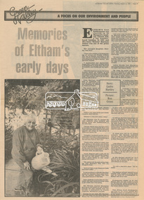 Eltham District Historical Society Inc
Newsclipping, Linley Hartley, Memories of Eltham's early days by Linley Hartley; picture by Ron Grant, Diamond Valley News, 13 August 1985, p37, 13 Aug 1985
Memories of Mrs Irene "Rennie" HarrisonDigital file only - Digitised by EDHS from a scrapbook on loan from Beryl Bradbury (nee Stokes), daughter of Frank Stokes.1939 bushfire, alf isherwood, annie bremmer, arthur munday, beryl bradbury (nee stokes) collection, bible street, bremmer's flat, buses, butcher, cheddar black, clarrie white, collis, dalton street, eltham hotel, eltham kindergaten, eltham lower park, eltham primary school, eltham railway station, eltham south kindergarten, eltham tea rooms, farmer walsh, franklin street, freddie griffiths, greengrocer, grocers, eltham infant welfare centre, irene rennie harrison, jack carrucan, josie shannon, justus jorgensen, len harrison, main road, markets, matcham skipper, metery road, milk bar, montsalvalt, mount pleasant road, shirley harrison, st margaret's church hall, wingrove park, reminscences -
 Eltham District Historical Society Inc
Document, Russell Yeoman, Tour of Historic Buildings and Locations, 1978
Self guided heritage tour information produced by the Shire of Eltham Historical Society for 1978 Eltham Community Festival of 36 locations each numbered on accompanying map. Locations and detail provided current to 1978: 1. ELTHAM SHOPPING CENTRE Whilst very little remains in the centre of historical importance, this area has interest as the "village" which developed over many years following the opening of the railway from Melbourne in 1902. Previously the shopping centre had been spread out over a long length of Main Road to the south. Shops have been continuously demolished or remodelled and the majority of buildings date from the 1950's or later. The recently erected Post Office replaced the "old" Post Office opened on the same site only in 1958. 2. WOOLWORTHS ELTHAM VILLAGE Part of the site of this modern shopping development was occupied by the former Eltham Shire Offices and Hall. The hall was paid for by public subscription whilst the Council raised a loan for the offices. The combined building was opened in 1941. It served as office and Council meeting place until 1965 and as the hall until its demolition in 1970. 3. ELTHAM WAR MEMORIAL The complex of buildings adjoining the present Shire Offices were financed by public subscription as a Memorial following World War II. Their construction and for many years their operation was organised by the now disbanded Eltham War Memorial Committee. The original buildings were the; Infant Welfare Centre, Children’s Library (now War Memorial Hall and Dental Clinic) and Kindergarten. In later years the Elderly Citizens Club was built at the rear. 4. ELTHAM SHIRE OFFICES These offices were opened in 1965 and extended in 1971 to provide additional office accommodation and the Eltham Library. They represent the last of a long line of offices and meeting places of the Eltham Shire Council and its predecessor the Eltham District Road Board. The building occupies the former site of Shillinglaw Cottage. The three tall cypress trees which stood in front of the Cottage have been retained as a feature of the office surrounds. 5. OUR LADY'S CHURCH AND SCHOOL The Catholic Church and School complex opposite the Shires Offices shows a number of stages in the development of Eltham township. The recently constructed church adjoins its predecessor (now the parish centre). Many years ago the Catholic Church was located opposite Wingrove Park and the present central site follows the northerly drift of the township. 6. SHILLINGLAW COTTAGE The Cottage was built in 1859 by George Stebbing, a local builder who was responsible for a number of other prominent buildings in the area. Its removal from the site of the Shire Offices and re-erection on the present site was financed by public subscription. It is built of handmade bricks laid in Flemish Bond with an unusual design featuring burnt "leader" bricks over the whole facade. The Cottage is occupied by Eltham Fleececrafts and will be open during the Festival and at other times during weekends. It is classified by the National Trust. 7. RAILWAY BRIDGE The timber trestle bridge over the Diamond Creek was built in 1901. Whilst all of its timbers have been replaced at various times over the years the only change to its character has been the addition of pylons and wiring for electric trains in 1923. It is one of very few similar bridges remaining in the metropolitan area. In 1976 a proposal to replace the bridge with an earth embankment and large culvert pipes was abandoned following community protests. The bridge, however, remains under threat because of the necessity for future deuplication of the railway line. 8. ELTHAM CENTPAL PARK The area between the railway and the creek has for many years been used as a park which included Eltham' s main football oval. The access road, Panther Place is named after Eltham's team playing in the Diamond Valley League. In recent years a large area extending to Bridge Street and locally known as the Town Park has been landscaped and added to the area. The excellent blending of the park with the natural landscape of the creek valley has earned a National Trust Landscape Classification. 9. OLD BAKERY On the southern corner of York Street and Main Road is an old house with a shop front which was for many years the local baker's shop. The brick bakery at the rear is of somewhat later vintage than the house. 10. BRIDGE STREET CUTTING Before reconstruction of Main Road this intersection had deep cutting embankments on all four corners, forming a distinctive feature of the entrance to Eltham. Roadworks and private development have levelled the land on the low side of the road. A memorial to the Eltham soldiers of World War I which was located at the north-western corner is now situated at the Eltham R.S.L. 11. HILLTOP MILK BAR For many years this was the site of the Eltham Post Office under the control of the Hunniford family and later their descendants the Burgoynes. It was transferred to this site in 1855, although at that time the building apparently fronted Bridge Str e et. The site contained Eltham's first telephone exchange. The post office was relocated in 1954 but the shop was operated until recently by the Burgoyne family who still own the surrounding land. 12. UNITING CHURCH and former C.B.A. BANK The former Methodist Church was built in 1880 by George Stebbing. The Sunday School extension was built in 1929 and there have been more recent extensions. The adjoining opportunity shop was built as a bank in 1874 and purchased by the Methodist Church in 1954. 13. R.S.L. HALL, TELEPHONE EXCHANGE These relatively recent buildings occupy the site of a row of shops forming part of the early ribbon of business development along Main Road. In front of the R.S.L. building is the World War I Memorial relocated from the corner of Bridge Street and Main Road. 14. ELTHAM COMMUNITY CENTRE Australia's first mudbrick "community building" was opened in April this year. Part of the site of the building was purchased in 1856 by Henry Dendy (of Brighton fame). At the rear of the land near the creek was a steam flour mill whilst Dendy's house was at the Main Road frontage of the land. His purchase totalled about 2 Ha (5 acres) and included land on the opposite side of Maria Street (Main Road). Dendy became a prominent member of the Eltham community and served one term as President of the Eltham District Road Board. In 1867 Dendy sold his land and business to William Ford of Malmsbury and shifted to Walhalla. The avenue of trees leading past the Community Centre to the creek may well have bordered the track to the mill. 15. ELTHAM HOTEL The original part of this hotel was built in 1927 following the burning of the former Watson's Eltham Hotel on the same site. The car park on the opposite side of Main Road was also the site of a hotel variously known over the years as; the Fountain of Friendship, the Fountain and the Evelyn Arms. As the Fountain of Friendship it was the first meeting place of the Eltham District Road Board in 1856. 16. ST. MARGARET'S CHURCH, PITT STREET In 1860 Henry Dendy was appointed Chairman of a committee to establish a church of England in Eltham. He donated part of his land in Pitt Street and in 1861 the church was opened. It was built by George Stebbing and remains in a well preserved state today. Th adjoining old vicarage is now named Dendy Hou se. A new mudbrick church hall is under construction on the site. The church and Dendy House are now listed on the Register of Historic Buildings. 17. NO. 86 PITT STREET Cottage built by George Stebbing and believed to be his home for some years in the 1850s. 18. LIVING AND LEARNING CENTRE The house was built in the 1850s with the kitchen at the front being added about 40 years later. By the creek below the house a number of early Eltham industries were located. These included a tannery and a brewery. 19. ELTHAM COURT HOUSE A Court of Petty Sessions was established in Eltham in 1858 and the present building dates from 1860. It is the oldest public building remaining in Eltham. In its early days the building was used as the meeting place and office of the Eltham District Road Board and as an overflow classroom for the local school. The Court House has been classified by the National Trust. The citation states that it is an example of the simple form of early brick Court House with gabled roof and porch. 20. LANDS DEPARTMENT OFFICE This building is the former police station and is probably of about the same age as the Court House. The lockup at the rear has been demolished but the old stables remain as garages. A licence was first granted for a police station at Eltham in 1856. 21. JARROLD COTTAGE The old Cottage opposite Dalton Street was formerly owned by the Jarrold family. Early records indicate that this was the building leased from the Jarrolds as a temporary police station prior to construction of the building on the corner of Brougham Street. The small building on the corner of the property was used as a boot repairer's shop. The elevated studio at the rear is a more recent construction by the present owners. 22. STATE SCHOOL RESIDENCE Erected in 1891 23. WINGROVE COTTAGE This building fills an important place in the history of Eltham and is now used as a medical clinic. It was built in 1858 for Charles S. Wingrove who was Secretary to the Eltham District Road Board and Shire Council from 1858 to 1904. During part of this period he was also Shire Engineer and was Secretary to the Heidelberg Road Board. The house was used as the office of the Board and Council for many years. Wingrove is buried in the cemetery at St. Helena. 24. WINGROVE PARK The parkland opposite Wingrove Cottage has been named after Charles Wingrove. The old Manna Gums are an outstanding feature of the park. 25. ELTHAM FRI.MARY SCHOOL NO. 209 The school first opened in the slab building in 1855 and operated from the present site since 1857. The oldest part of the present school is the stone building erected in 1876. The first school teacher, David Clark remained at the school until 1888. This school is the government township and has always been known as the Eltham School. An earlier school (no.371) known as Little Eltham School operated in Swan Street from 1853 to 1872. 26. "SHOESTRING" This house was built for school teacher David Clark. It has been extensively extended in recent years but the extensions do not detract from the character of the older part of the building. 27. ELTHAM CEMETERY The cemetery contains the graves of many of the district's pioneers . 28. MONTSALVAT This unique complex of buildings was commenced in 1935 by the late Justus Jorgensen and its development has extended over many years. Montsalvat has exerted a significant impact on Eltham The earth and stone construction of many of the buildings has influenced local architecture to a great extent and it has served as a "nerve centre" of the local artistic community. Montsalvat is open to the public for a small charge. 29. MAIN ROAD BRIDGE This location has been the main crossing of Diamond Creek since the earliest days of settlement. The present concrete bridge was erected in 1925 .and was preceded by a number of timber bridges. 30. ELTHAM LOWER PARK This park, being an unusually large flat area for Eltham, was originally the local racecourse. Horse races were held here from 1855 and the area was gazetted as a reserve for a racecourse and recreation reserve in 1857. The park is well known as a venue for school "bird days" and more recently as the site of the Diamond Valley Railway. This miniature railway features scale models of modern and old locomotives and rolling stock and has operated on this site since 1961 . Before that the railway operated at Chelsworth Park, Ivanhoe. 31. FALKINER HOUSE Frederick Falkiner was one of the earliest settlers in the Eltham township area and occupied a substantial leasehold prior to the first land sales. Early records show that Falkiner was the subject of a number of complaints from his neighbours but he has nevertheless been considered a prominent enough citizen to have a street named for him. This house was the home of Evelyn (Ely) Falkiner a member of Frederick's family. 32. WEST HOUSE Behind the large house on the hill is an early house built by the West family. This was relocated from a site near the front of the land by the present owner Mr. Fabbro. 33. FALKINER HOUSE This very old house is believed to have been the home of Frederick and may have been Eltham's first post office. Falkiner was the first post master for a short period. in 1854/55. 34. WITHERS HOUSE This house was the home of famous artist Walter Withers who shifted here from Heidelberg in 1903. 35. ELTHAM HIGH SCHOOL This school celebrated its jubilee this year, having commenced as the Eltham Higher Elementary School 50 years ago. 36. DIAMOND CREEK FOOTWAY If returning from the High School to the town centre the footpath by the bank of the Diamond Creek provides a pleasant route to finish your walk. The creek is a major tributary of the Yarra River. Together with its own major tributaries Arthurs Creek and Running Creek it commences on the southern slopes of the Dividing Range at Kinglake. It gives the name Diamond Valley to an area extending well beyond its actual drainage catchment.Recognition of the significance of various landmarks to the history of the Eltham community as of 1978‘shoestring’, 1978, bridge street cutting, burgoyne store, c.b.a. bank, diamond creek trail, eltham cemetery, eltham central park, eltham community centre, eltham community festival, eltham court house, eltham festival, eltham high school, eltham hotel, eltham lower park, eltham primary school, eltham railway trestle bridge, eltham shire offices, eltham shopping centre, eltham state school no. 209, eltham village, eltham war memorial, falkiner house, heritage trail, hilltop milk bar, jarrold cottage, lands department office, living, living and learning centre, main road bridge, montsalvat, old bakery, our eltham artistic recollections, our lady help of christian’s church, our lady help of christian’s primary school, pitt street, post office, r.s.l. hall, shillinglaw cottage, st margaret’s church, state school residence, stebbing cottage, telephone exchange, uniting church, west house, wingrove cottage, wingrove park, withers house, woolworths -
 Eltham District Historical Society Inc
Document - Grant of Probate, Supreme Court of Victoria et al, In the Will of John Henry Clark, Main Road, Eltham South, 5 Apr 1957
Probate of the Will of John Henry Clark, photographer and bootmaker of Main Road, Eltham South granted to John Francis Carrucan of Dalton Street, Eltham, the Executor of the Will.bootmakers, j.h. clark photo, john francis carrucan, john henry clark, photographer, probate, prov, will -
 Eltham District Historical Society Inc
Film - Video (VHS), IMP Productions, The Shire of Etham - The Evergreen Shire (Series 69, Item 4), c.1985
Shire of Eltham Archives: Series 69, Item 4 This video was produced for the Shire of Eltham by IMP Productions and provides a description of the shire, 277 square km on a north/northeast axis, some 25 km northeast of the centre of Melbourne with a population of around 40,000. Scenes include Yarra River, rural settings and urban settings, housing estates, Shillinglaw Cottage, Pigeon Bank at Kangaroo Ground, the Eltham Railway Trestle Bridge with reference to the fight by locals in the 1970s to save it from replacement, Montsalvat, mudbrick making and its use as a building material, the use of mudbrick in the Eltham Community Centre blending harmoniously with the environment. Emphasises people living in the area due to the qualities of life provided. Also the Living and Learning Centre, St Andrews Markets and other local markets, the Eltham Leisure Centre, cricket and horse riding at Eltham Lower Park, the Infant Welfare Centre (part of the Eltham War Memorial), how residents are mindful of protecting their historical heritage, the CBA bank and Allwood House at Hurstbridge, Tracey Naughton about the Eltham "As we are" Community Banner project and the “River of Life banner”, the Parks and Gardens office in the former Police Residence building (now the Local History Centre), Alistair Knox Park, road planning and types of roads, tree canopy, Peck's Dam, green carparks, road drainage, Gordon Ford's garden and natural landscapes, and Were Street shops in Montmorency. Planning for shopping facilities and carparks with a population of 40,000 growing to 55,000, Arthur Street Mall and carpark, local village feel in the shopping centre. Councillors and Council staff featured include Mary Grant, Bob Manuell, Rodney Roschellor, John Cohen, Alan Baker. Also scenes of Commercial Place, Diamond Valley Railway, Eltham Galley, Riverclay and canoeing on the Yarra intermingled with images of the shire from the Shire of Eltham Pioneers Photograph collection.VHS Video cassette Converted to MP4 file format 00:11:56; 79MBshire of eltham, video recording, shire of eltham archives, alistair knox park, allwood house, arthur street, arthur street mall, bob manuell, canoeing, carparks, cba bank, commercial place, council staff, councillors, cr. mary grant, cricket, diamond valley railway, eltham community banner project, eltham community centre, eltham galley, eltham leisure centre, eltham living and learning centre, eltham lower park, eltham railway trestle bridge, eltham war memorial, gordon ford garden, horse riding, housing estates, hurstbridge, infant welfare centre, john cohen, kangaroo ground, local history centre, montmorency, montsalvat, mudbrick, parks and gardens, peck's dam, pigeon bank, police residence, river of life banner, riverclay, road drainage, road planning, rodney roschellor, shillinglaw cottage, shire of eltham pioneers photograph collection, st andrews market, tracey naughton, tree canopy, were street, yarra river, alan baker -
 Eltham District Historical Society Inc
Film - Video (VHS), VideoCAM, Eltham Woods Children's Resource Centre Opening (Series 69, Item 5), 5 Mar 1988
Shire of Eltham Archives: Series 69, Item 5 Video opens with panning view of completed kinder from Frank Street followed by images of the centre under construction then opening day speeches. Introduction and welcome by Mandy Press (Executive Officer, Shire of Eltham) with speeches by the Hon. Pauline Toner, Member for Eltham and Shire president, Cr. Alan Baker. The Hon. Pauline Toner acknowledged Shire President Alan Baker and her parliamentary colleagues Vin Heffernan, Neil Brown and Bob Halderson and Councillors; three levels of Government which led to the achievement of the kinder, and gave special thanks to the Council and parents for the forward planning to accommodate children from babyhood to school with childcare, kinder and baby health facilities all combined in one facility in the middle of parkland in a residential area. Shire President Cr Alan Baker then followed to formally open the centre. The site had been identified in early 1985 at that stage only as a pre-school but with an opportunity to develop, the additional services were driven by Cr Baker. Though a very long name, its simple message is "Care for Kids." Designed by architect Neil Biggins of Clark, Hopkins and Clark. Cr Baker stated that the theme of "people living in the environment" was very much encapsulated by the facility. Cr Baker informed that the construction of the facility had led to some concerns with a reduction in open space and potential traffic generated to the facility and those users of the facility were asked to ensure their use is sensitive to the local residents. Cr Baker talked about the financial costs and how the Federal grant funding was no longer as plentiful as previous and that the Victorian Government had come to the assistance thanks to Pauline Toner covering some other costs as well as the ongoing running costs of around $40,000. The Federal Government contributed $233,000 out of a childcare component rather than preschool. Cr Baker thanked Mandy Press again as well as Shire Engineer, John Stanton. Cr Baker also acknowledged Ed Latanzio who was in charge of the project, along with his colleague Alan Lansdowne; Gary Bartlett and his team for the exterior surroundings to the facility. He mentioned that Neil Biggins the architect had said not many Shire Councils show the same commitment to the exterior surroundings as the interior which was a credit to the Council and Gary Bartlett. He also thanked Bev Vern, Council's preschool advisor who assisted in developing the programs; Grant Roberts from Federal Office of Childcare for assisting the Cooperative in setting up the funding program; the builders George Takola and George Apted; Michelle Matello who undertook the needs analysis that identified another preschool was required; Cathy King who assisted in the development of the childcare program; Pat Grundy and Susan Forbes, Council officers who assisted with the development of the services and the members of the preschool committee. In addition, local residents and in particular Helen, Peter and Chris who advised Council of their concerns and worked with Council to overcome these issues; members of the Interim Steering Committee and the Directors of the Childcare Co-op. Cr Baker stated that the Co-op nature of the facility and the location of the three services under one roof was unique and the task of the programs was to be led by Annie, Dianne and Lynn Afternoon tea and activities followed the unveiling of the plaque. The video shows some of the children's entertainment and their engagement as well as interior and exterior views.VHS Video cassette Converted to MP4 file format 00:26:02; 302MBshire of eltham, video recording, shire of eltham archives, eltham shire council, alan lansdowne, bev vern, bob halderson, cathy king, clark hopkins and clark, councillors, cr. alan baker, ed latanzio, eltham, eltham woods childcare co-operative, federal government, federal office of childcare, frank street, gary bartlett, george apted, george takola, grant roberts, john stanton, mandy press, michelle matello, neil biggins, neil brown, pat grundy, pauline toner, people living in the environment, susan forbes, victorian government, vin heffernan -
 Eltham District Historical Society Inc
Slide - Photograph, Monument with time capsule, Eltham Community Centre, Main Road, Eltham, c.1997
The monument with time capsule was established by the Shire of Eltham Historical Society to commemorate Victoria’s 150th anniversary and mark the former location of the Eltham Town Centre, which existed along this section of Main Road, then known as Maria Street. The unveiling was conducted 10 November 1985 by Cr. Mary Grant (Shire President). The monument was constructed with a concrete base and the main feature is an old tyring plate or disc. The Time Capsule Ceremony involved lowering the sealed time capsule into place, bolting down its container lid and then concreting over the lid. The capsule contains items relating to present day (1985) Eltham and its people including a video film made by Joh Ebeli and also details of families and organizations who have contributed to construction of the monument. It is to be opened in the year 2035. The Society received an excellent response from local people, firms and organizations by way of assistance with this project. Graham Beyer, who originated the project, arranged many of the donations. He and his firm, Package Handling Equipment, donated the time capsule itself and carried out fabrication of sections of the monument. The design of the monument was adapted by Graham Beyer from drawings by Joh Ebeli. Charmac Industries donated the container for the time capsule and a cast gun metal name plate for the monument. BMG Concrete donated concrete for the base which was constructed by Caridi Construction Company. Northbourne Garden Supplies donated materials for the paving around the monument. Robert Becker from Eltham Apex directed construction of the paving by Society members. Terry Hutchinson donated the use of his crane to lift the tyring disc into place. Financial contributions were also made by the Eltham Chamber of Commerce and the Rotary Club of Eltham. In 1987 in commemoration of the Society’s 20th Anniversary, Joh Ebeli suggested the commissioning of a plaque to be added which explains the functions of the various items used in the Society’s Victorian 150th Anniversary Monument and this was unveiled by its designer, Joh Ebeli, on October 10, 1987. Circa 2010-2012 the monument was damaged through vandalism. The mounts for the ring had been broken. At the time of this photo the ring had been removed by Jim Connor, President of the Eltham District Historical Society and placed in safe storage whilst arrangements were made with Neil Carter of Carter Art, Research to undertake the repairs.Colour printeltham, eltham community centre, monument, public art, time capsule, carter art, neil carter -
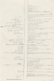 Eltham District Historical Society Inc
Document - Map, Doug Orford, Main Road, Eltham (c..1930s-1970s), c.2010
Map of Main Road with listings of all properties (shops/homes) from Mount Pleasant Road through to Pryor Street from the 1930s on to about the 1970sandrew store, andrews newsagency, arthur street, babe taylor house, bakery, barbers blue gum store, blue gum, boarding house, bootmakers cottage, bottle shop, bradford butcher shop, bradford house, bradley house, brdbury house, bridge street, brooker, brougham steet, brown blacksmith, browne's grocer, bryant, burgoyne post office, burgoyne's shop, capewell butcher shop, catholic church, catholic school, chandlers lolly shop, cheddar black, chiropractor, cockcroft, commercial bank of australia, copelands chemist, copelands dairy, d. hall house, dave lyon house, david lyon house, dr cordner, dr loosli, dr r. bradbury, dudley street, eltham, eltham bakehouse, eltham courthouse, eltham fire brigade, eltham living and learning centre, eltham pre-school, eltham railway station, eltham shire office, eltham station masters house, eltham war memorial, f. collis store, feed store, fountain hotel, franklin street, gadd's blacksmith, gahan house, garnet burges, george bird grocer, gollings, grant house, harry hawker, headmaster's resience, henry street, hepburn house, hills house, isherwood house and shop, jack ryan, jack shallard, james house, jarrold cottage, jim ryan, john lyon house, kilpatrick, le brocq, leather and harness, len parsons, lock-up, lyon bros garage, main road, map, mathews house, mclean's produce store, mechanics institute, methodist church, methodist hall, milkbar, mills bootmaker, miss george, monteith house, mount pleasant road, mrs bradbury, mrs davis house, mrs jewell, mrs mbremner store, mrs morris shop, napoleon street, obelisk, panther place, peter gahan, pitt street, plumber, police residence, poultry and market garden, pryor street, railway house, rains newsagency, real estate agent, reeves general store, s. bradbury, shillinglaw cottage, staffs general store, stones mixed shop, tennis court, timber yard, w. walker, w.b. andrew corn store, warren's general store, water trough, watsons hotel, websters house, whitecloud cottage, whites general store, williams bootmaker, wingrove cottage, wingrove park, woodyard, york street, franco and co -
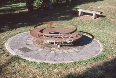 Eltham District Historical Society Inc
Slide - Photograph, Monument with time capsule, Eltham Community Centre, Main Road, Eltham, c.Mar. 1989
The monument with time capsule was established by the Shire of Eltham Historical Society to commemorate Victoria’s 150th anniversary and mark the former location of the Eltham Town Centre, which existed along this section of Main Road, then known as Maria Street. The unveiling was conducted 10 November 1985 by Cr. Mary Grant (Shire President). The monument was constructed with a concrete base and the main feature is an old tyring plate or disc. The Time Capsule Ceremony involved lowering the sealed time capsule into place, bolting down its container lid and then concreting over the lid. The capsule contains items relating to present day (1985) Eltham and its people including a video film made by Joh Ebeli and also details of families and organizations who have contributed to construction of the monument. It is to be opened in the year 2035. The Society received an excellent response from local people, firms and organizations by way of assistance with this project. Graham Beyer, who originated the project, arranged many of the donations. He and his firm, Package Handling Equipment, donated the time capsule itself and carried out fabrication of sections of the monument. The design of the monument was adapted by Graham Beyer from drawings by Joh Ebeli. Charmac Industries donated the container for the time capsule and a cast gun metal name plate for the monument. BMG Concrete donated concrete for the base which was constructed by Caridi Construction Company. Northbourne Garden Supplies donated materials for the paving around the monument. Robert Becker from Eltham Apex directed construction of the paving by Society members. Terry Hutchinson donated the use of his crane to lift the tyring disc into place. Financial contributions were also made by the Eltham Chamber of Commerce and the Rotary Club of Eltham. In 1987 in commemoration of the Society’s 20th Anniversary, Joh Ebeli suggested the commissioning of a plaque to be added which explains the functions of the various items used in the Society’s Victorian 150th Anniversary Monument and this was unveiled by its designer, Joh Ebeli, on October 10, 1987.35mm colour positive transparency (1 of 28) Mount - Kodak KodachromeProcess Date MAR 89Meltham, eltham community centre, monument, time capsule -
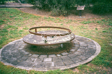 Eltham District Historical Society Inc
Slide - Photograph, Monument with time capsule, Eltham Community Centre, Main Road, Eltham, c.1997
The monument with time capsule was established by the Shire of Eltham Historical Society to commemorate Victoria’s 150th anniversary and mark the former location of the Eltham Town Centre, which existed along this section of Main Road, then known as Maria Street. The unveiling was conducted 10 November 1985 by Cr. Mary Grant (Shire President). The monument was constructed with a concrete base and the main feature is an old tyring plate or disc. The Time Capsule Ceremony involved lowering the sealed time capsule into place, bolting down its container lid and then concreting over the lid. The capsule contains items relating to present day (1985) Eltham and its people including a video film made by Joh Ebeli and also details of families and organizations who have contributed to construction of the monument. It is to be opened in the year 2035. The Society received an excellent response from local people, firms and organizations by way of assistance with this project. Graham Beyer, who originated the project, arranged many of the donations. He and his firm, Package Handling Equipment, donated the time capsule itself and carried out fabrication of sections of the monument. The design of the monument was adapted by Graham Beyer from drawings by Joh Ebeli. Charmac Industries donated the container for the time capsule and a cast gun metal name plate for the monument. BMG Concrete donated concrete for the base which was constructed by Caridi Construction Company. Northbourne Garden Supplies donated materials for the paving around the monument. Robert Becker from Eltham Apex directed construction of the paving by Society members. Terry Hutchinson donated the use of his crane to lift the tyring disc into place. Financial contributions were also made by the Eltham Chamber of Commerce and the Rotary Club of Eltham. In 1987 in commemoration of the Society’s 20th Anniversary, Joh Ebeli suggested the commissioning of a plaque to be added which explains the functions of the various items used in the Society’s Victorian 150th Anniversary Monument and this was unveiled by its designer, Joh Ebeli, on October 10, 1987.35mm colour positive transparency Mount - Black and Whiteeltham, eltham community centre, monument, public art, time capsule -
 Eltham District Historical Society Inc
Binder, Eltham District History, Eltham Road Board, 1856-1871; Research by Keith Chappel, 1971-1974
Eltham District History, Eltham Road Board, 1856-1871Two binders containing 486 A4 pages (photocopied) of mostly handwritten notes from research undertaken of Public Office Records of Victoria various holdings. Some photocopies from source reference books. Includes 20 page subject index (handwritten) at front and 5 pages of notes and sources at rear and a photocopy of short biography of Keith Chappel.a. foley, a. harkness, a. mackie, a. mcintyre, a. von ziegler, a.a. vivian, a.d. kinninmont, a.d. quadri, a.h. grimshaw, a.w. page, aboriginal reserve, aborigines, abraham quarman, abraham rooks, abraham taylor, adam goudie, aenaes harrison, agnes black, agnes charlton, agnes dalrymple, ah chong, ah cock, ah hein, ah lie, ah sing, albert lunson, albert ness, albert parker, albert ramseyor, alert hunt, alex cameron, alex eason, alex mcandrew, alexander crichton, alexander donaldson, alexander falconer, alexander innes, alexander james, alexander mcdonald, alexander miller, alexander thompson, alexander walker, alexander white, alfred armstrong, alfred burgess, alfred davey, alfred deschamp, alfred eddy, alfred hinley, alfred hooper, alfred hubbard, alfred lowman, alfred smith, alfred whelpton, alice power, allen heeps, allwood, amelia neuman, amos taylor, anderson, andersons creek, andrew brown, andrew byrne, andrew harkness, andrew herbert, andrew ross, andrew smith, angus mcdonald, ann emmott, ann mcphee, ann odea, ann plunkett, ann snell, ann tatty, annie ashmore, annie herbert, annie stuart, anthony beale, anthony currie, ants nest, archibald mcphee, arthur connor, arthur lyttle, arthur rooke, arthur young, arthurs creek, arthurs creek school, august ostling, b.o. wallis, barkers creek, barr, belton, benjamin bain, benjamin jenken, benjamin lawford, benjamin rice, benjamin shaw, benjamin smith, benjamin wallis, benjamin walton, berry, bismark hotel, black calf gully, black thursday, boomers gully, bridget bunker, bridget hailes, bridget kearse, bruno hirt, burns, bushranger, c. twiss, c.h. bade, caleb sherar, caledonia, caledonia diggings, campbell hunter, carl euman, caroline davey, catherine kennedy, cathren brock, cecilia farman, chamberlain, chapman, charles caldwell, charles campbell, charles dale, charles draper, charles fowler, charles green, charles hawkins, charles hempel, charles hirt, charles hirtson, charles jefer, charles jesse, charles kerchevell, charles lidgerwood, charles morris, charles peake, charles prince, charles rielly, charles roberts, charles rowand, charles simms, charles souter, charles swan, charles verso, charles wells, charles whelpton, charles williams, charles wingrove, charles woodley, charleys gully, charlotte beltison, charlotte goodwin, ching ah hock, christine brennan, christine mckenzie, christmas hills hotel, christmas hills school, christopher battaila, christopher twiss, chune grove, church of england, church of england school, clarissa milton, cleir hills, colin amos, constable quirke, constable talty, cornelius haley, cornelius stewart, cottles bridge, councillors hotel, cricket, cucksons brewery, d. nicholson, d.w. morrissey, dalry, daniel charleston, daniel harding, daniel jepps, daniel mccarthy, daniel mckenzie, daniel mcloughlin, daniel oloughlin, david boyd, david christian, david clark, david creighton, david rogers, david rolfe, david sharp, david shawcross, david smith, david stevenson, diamond accommodation store, diamond reef mine, dickson, dixon bertram, donald cameron, donald mcmillan, donaldson, dougald mcphee, dr barclay, dugald mcphee, dugald taylor, duncan fraser, duncan smith, dungey, e. hildebrand, e. stichlins, e.f. falkiner, e.j. hughes, e.m. garsed, e.w. morrissey, edith staff, edmund clarke, edmund cuckson, edmund hall, edmund picket, edward bage, edward beltison, edward bunker, edward ford, edward hindley, edward jackson, edward jones, edward kelly, edward qualtrough, edward staff, edward tresain, edward weller, edward whelpton, edward whilpson, edwin biley, edwin cartwright, edwin cohen, edwin deschamp, edwin mcleish, edwin rodda, edwin smith, effie rodda, eliza bellamy, eliza dawson, eliza howell, eliza nield, eliza smith, elizabeth cockshutt, elizabeth eiles, elizabeth fitch, elizabeth gillespie, elizabeth harris, elizabeth herbert, elizabeth hollow, elizabeth le juge, elizabeth plunkett, elizabeth whelpton, ellen hurst, ellen kearse, ellen quarman, ellen sweeney, ellen white, ellis, eltham cemetery, eltham hotel, eltham lower park, eltham market, eltham police station, eltham pound, eltham quarry, eltham racecourse, eltham roads board, eltham school, emile hude, emily anderson, emily blamire, emily coutie, emma smith, emma taylor, ephraim wyett, ernest baillie, ernest henrick, ernest steer, esther porter, ethel baillie, evan jones, evelyn hotel, evelyn observer, ewen cameron, ewen jones, f. chrimes, f. grundel, f.e. falkiner, f.r. howard, fanny benson, fanny white, felix hude, felix noisette, ferdinand ramseyer, flora vale, florence hurst, fogarty, forbes mackenzie, fords creek, frances kearse, francis baker, francis hales, francis raselli, francis steer, frank eiles, frank rogerson, frank tanner, fraser, fred hurst, frederick falkiner, frederick hurst, frederick muller, frederick nink, frederick walker, frederick wharington, friedrich muller, fryers gully, furphy, g. donaldson, g. houghton, g. turnbull, geanetta hude, george assender, george bear, george beare, george benson, george bird, george boston, george brain, george brandt, george burley, george buswell, george coutie, george eiles, george ewings, george ford, george godber, george goodman, george gray, george griffiths, george hall, george herbert, george horn, george kirk, george langhorne, george mann, george mclelland, george mosely, george neumayer, george orchard, george parish, george porter, george purcell, george ralph, george reid, george rocke, george rogers, george rolfe, george stebbing, george stebbings, george stebbins, george switzer, george symons, george thompson, georgina hilton, glenda moriss, glengloy, gold, goulstone, greensborough police station, gulf station, h. jennings, h. mann, h.h. farquason, hannah sunderland, happy valley, harkness, harold scarce, harriet hunt, harriet smith, harry hollow, hazel glen, healesville, heinrich hirt, helena peters, henrietta hill, henry arthur, henry ashmore, henry austin, henry brown, henry dendy, henry dineen, henry fowler, henry gardner, henry green, henry griffin, henry hart, henry hirst, henry hirt, henry hopkinson, henry hude, henry hurst, henry inch, henry jones, henry mills, henry scarce, henry st paul, henry stevens, henry stooke, henry thomson, henry vogt, henry wallace, henry wilson, herbert rodda, herman henrick, hermann lampe, hermann steinmann, hester staff, hitchill, holbert, honoree hude, hotel de france, hugh mccann, humphrey peers, humphrey spicer, hurstbridge, hurstbridge general store, i.h. clarke, ida adelskold, ignatz kinzel, ira pimm, irene donaldson, isaac briggs, isaac hickson, isaac hill, isaac kerr, isaac varby, isaac williams, isabella donaldson, isabelle herbert, j. dungate, j. eccleston, j. harkness, j. hartley, j. hude, j. irvine, j. jones, j. manduell, j. mason, j. mcdonald, j. mcnamara, j. nichenson, j. renahen, j. scott, j. seymour, j.a. goold, j.a. panton, j.c. hughes, j.d. thompson, j.f. hughes, j.f. johnstone, j.g. walter, j.h. taylor, j.p. morris, jack ewart, jacob belsham, jacob goldstein, jacob morast, jam loon, james alexander, james anderson, james andrew, james andrews, james baines, james batchelor, james bond, james bradford, james brennan, james brock, james brown, james brunning, james buchanan, james cockburn, james cowan, james dalrymple, james donaldson, james duckworth, james goodwin, james harding, james harrison, james hartley, james hawkins, james hewish, james holinger, james hughes, james inglis, james jamieson, james johnson, james johnston, james kaye, james kew, james lindsay, james lindsey, james lynan, james macpherson, james mann, james martley, james mayger, james mccutcheon, james mcmahon, james mcpherson, james mess, james miller, james mitton, james morton, james murdoch, james murdock, james nickinson, james orford, james purcell, james qualtrough, james rudall, james simpson, james smith, james spence, james stonachan, james stuart, james suman, james surman, james sutherland, james thompson, james thomson, james walker, james walters, james watts, jane cleave, jane donaldson, jane mess, jane sadler, jane shaw, jane thomson, janefield, jean borelli, jeanette hudi, jeanne hude, johann muller, john ainsworth, john andrew, john baillie, john barr, john beale, john bell, john bellin, john blake, john blyth, john brock, john brown, john byers, john cameron, john candler, john carter, john cobbock, john cockshank, john cockshutt, john coleman, john connell, john crozier, john darroch, john dennis, john donaldson, john elsworthy, john fenton, john fitch, john gardner, john gast, john graham, john grimshaw, john haines, john haley, john harper, john harris, john hassall, john hayes, john heales, john herbert, john holland, john holman, john hood, john horner, john horton, john hughes, john jardine, john johns, john johnston, john jones, john kearse, john kilpatrick, john knell, john lawrey, john macadam, john mandell, john manduell, john marker, john mccoll, john mccolly, john mcdonald, john mcintyre, john mckimmie, john mcnamara, john mitchell, john moore, john morgan, john muller, john murray, john pearson, john peterson, john petty, john pullen, john quinn, john rawlings, john ryder, john sabelberg, john scott, john semar, john serman, john seymour, john shawcross, john smith, john staff, john steer, john stephens, john sweeney, john thompson, john thomson, john trahy, john walker, john weller, john wells, john williams, john williamson, john yates, john yeoman, john young, johnn mcdonnell, joseph bull, joseph burns, joseph caldwell, joseph caudwell, joseph coutie, joseph elliott, joseph emmott, joseph fayver, joseph furphy, joseph hall, joseph hibbert, joseph hilton, joseph johns, joseph lithgow, joseph panton, joseph rodda, joseph sands, joseph sanson, joseph schubert, joseph scott, joseph shaw, joseph smith, joseph spedder, joseph stevenson, joseph verco, joseph wilson, josiah hollis, josiah hullis, josiah thomas, judith furphy, julie williams, junction hotel, kangaroo forest, kangaroo ground, kangaroo ground cemetery, kangaroo ground general store, kangaroo ground hotel, kangaroo ground police station, kangaroo ground post office, kangaroo ground school, kate bolger, kath scarce, katherine kearse, kidd, kinglake, kinglake hotel, kingstown, l. storey, lan quan, lang, latimour, laura henrick, laurence paterson, leon berlioz, levinia henrick, lillian gillan, linton, little eltham, long gully, louis henrick, louis le juge, louis smith, louisa steinmann, louise miller, lower plenty bridge hotel, lucy tidell, lydia qualtrough, m.j. careton, m.s. adams, macrudden, maggs, mail coach, maplestone, margaret graham, margaret hollins, margaret kearse, margaret kennedy, margaret kinrade, margaret lynch, margaret mcbirney, margaret steinmann, marguerite borelli, maria reilly, maria st paul, maria trew, marian trew, marianne miller, marie wright, marion hillier, mark bunker, martha herbert, martin brennan, mary alexander, mary beltison, mary bradford, mary bridgman, mary brock, mary bull, mary eiles, mary hopkinson, mary kearse, mary lean, mary mcinerney, mary miller, mary parmington, mary pearson, mary pickles, mary robertson, mary rodda, mary ross, mary smith, mary surman, mary weller, matilda jordan, matilda mcmillan, matthias watson, mawson, mechanics institute, michael callanan, michael fenton, michael kearse, michael mctyne, michael merritt, michael oday, michael odea, midgley hall, mills, minnie watts, miss bellon, morgans gully, mount joy, mr donnan, mr omeare, mr page, mrs greenaway, mrs havard, mrs hude, mrs morris, muller, murrays bridge, n.d. whyte, ned kelly, new caledonia creek, nicholas rodda, nillumbik, norman mcphee, old caledonia gully, oliver gourlay, one tree hill, owen finnegan, panton hill, panton hill hotel, panton hill post office, panton hill school, parambool, patrick armstrong, patrick bourke, patrick burke, patrick callaghan, patrick green, patrick harrington, patrick kearse, patrick lynch, patrick mcintyre, patrick o'callaghan, patrick rodgers, patrick sheahan, peach grove, perinella bull, perry, peter carrucan, peter flyn, peter ford, peter lawlor, peter patterson, peter snodgrass, peter watson, philip korfman, phillip gakden, phillip kaufman, phillip korfman, pierce brennan, pierce power, poo long, pound bend, pretty hill, queenstown, queenstown cemetery, queenstown police station, queenstown school, r. mackie, r.a. davidson, rebecca noisette, rebecca weller, reefers hotel, research, research gully, research gully hotel, research hotel, research school, rev dobinson, rhoda coutie, richard brook, richard capper, richard dunstan, richard goulding, richard heales, richard lane, richard matthews, richard rodda, richard searle, richard smith, richard wallis, richard warren, richard woolcott, robert alice, robert bourke, robert burke, robert charlton, robert clarke, robert cunningham, robert dugdale, robert grant, robert hall, robert harris, robert hempel, robert hill, robert hurst, robert lowman, robert mcadam, robert mckee, robert nink, robert norman, robert pontessey, robert sharp, robert smith, robert steel, robert stevenson, robert strong, robert surnam, robert wood, robina joyce, rogerson, roman catholic church, rossiter, rudolph muller, ruth mess, ruth sadler, ruth stevenson, s. smith, s. stewart, salters rush, sam deacon, samuel bird, samuel brace, samuel cameron, samuel candler, samuel cole, samuel cracknell, samuel dagley, samuel flier, samuel furphy, samuel merriman, samuel moseley, samuel mosley, samuel smith, sarah howard, sarah moseley, sarah raston, sarah walters, second watery gully school, self, shin hun, simon armstrong, smiths gully, smiths gully mechanics institute, smiths gully school, sophia greenaway, spanish gully, st andrews, st andrews hotel, st helena, stack, stanley smith, stephen gonnet, stephenson turner, stephensons bridge, steven anderson, stevensons corner, sumner, susan dickson, susan street, susan walke, sutherland, t. davidson, t. mclaughlin, t. symons, t.a. aldwell, t.b. drummond, t.b. henderson, t.e. johnston, t.h. subelly, tarrawarra, theis, theodore sabelberg, theresa lynch, thomas anderson, thomas armstrong, thomas baillie, thomas batt, thomas bell, thomas benson, thomas bibbs, thomas boardman, thomas bradford, thomas bull, thomas cattery, thomas cochrane, thomas cook, thomas cottle, thomas cousins, thomas downward, thomas edwards, thomas evans, thomas grierson, thomas haines, thomas harmer, thomas hunniford, thomas huntford, thomas hurry, thomas jardine, thomas jones, thomas kearse, thomas kennedy, thomas marland, thomas martin, thomas mcinerney, thomas morrison, thomas mundy, thomas murphy, thomas murray, thomas peacock, thomas plunkett, thomas postlethwaite, thomas prior, thomas qualtrough, thomas smith, thomas stone, thomas sunderland, thomas swatling, thomas sweeney, thomas symons, thomas walke, thomas wall, thomas wright, thomas young, tim shaw, toll gate, tom collins, tommys hut, true, upper diamond creek, upper diamond creek school, view hill, virtue hall, w. cockayne, w. craig, w. foster, w. marriott, w. ridley, w. trenoweth, w.a. page, w.b. andrew, w.b. burnley, w.b. phillips, w.c. shortt, w.w. herbert, walter barlow, walter hillier, walter joyce, walter knell, walter mckimmie, walter mcnicoll, walter thomson, walter wippell, warburton carr, warrandyte, warrens hotel, watery gully, watsons creek, watsons creek hotel, wattle glen school, wellers hotel, weymss donaldson, whipstick gully, white cloud, wild dog creek, wild dog gully, wiliam albert, william aitken, william albert, william anderson, william andrews, william barr, william barrow, william bell, william bond, william bowden, william bremmer, william brewer, william bridgman, william burnley, william buswell, william cant, william clarke, william cleave, william crozier, william dawson, william dodging, william ellis, william finn, william fitzgibbon, william ford, william foster, william garland, william ghosley, william golding, william goodwin, william graham, william gray, william grimshaw, william hall, william harding, william herbert, william hoilett, william hopkinson, william howitt, william howlett, william hubbard, william hunt, william inglis, william jarrold, william joyce, william kidd, william kilpatrick, william kommer, william lodge, william mclaughlin, william mcmurray, william mitton, william moore, william mosley, william murphy, william nicholson, william normage, william norman, william nuttall, william phillips, william quarman, william ronald, william sadler, william scott, william seaville, william sharp, william smith, william spicer, william taylor, william thomson, william tobin, william underwood, william walsh, william walshe, william walters, william watkins, william west, william wilmot, william wilson, william wolverston, william woods, wolfe, woodley, yarra bank, yow yow creek, a. brewer, a. easson, a. edwards, a. melville, a.m. ross, a.r. larrimour, aborigine reserve, advertisements, agricultural district, alan bernhard horsley, albert frederick charles glover, albert h price, albert h.c. price, albert henry charles price, alex easson, alexander campbell, alexander melville, alexander thomas haley, alexander thomson, alfred j. lowman, alice may peake, alie haley, alistair knox, alistair samuel knox, allandale road, allendale road, allwood run, andrew, andrew mckay, anton william brinkkotter, archibald brown, argus, arthur chichester allen, arthur edwin cracknell, arthur john braid, arthur robert traynor, atlas of australia 1886, b. lawford, b. mess, barry thale houston, basil y hall, basil yaldwyn hall, bell street, benjamin baxter, benjamin bowater, benjamin thomas taylor, benjaomin o. wallis, bible street, billis, bolton street, brewery, brisbane street, buckingham, bushrangers, c. brown, c. carroll, c. hirt, c.s. haley, c.s. wingrove, c.t. harris, caledonia run, cam, cattle, charis meta alexander pelling, charles brown, charles ellis, charles hicks bath, charles newman, clara gonnet, claude bryan gibbs, clifford henry goulding seear, coleraine, colin t. bell, collectors, collingwood, commissioner airey, coplin thomas bell, cornelius john stewart, cornelius sharp haley, cornelius sharpe haley, county of evelyn, culla hill, cutto hill, d. ryan, daily news newspaper, dalton street, daniel jepp, derek cecil o'beirne, diamond creek, diamond creek post office, diamond creek railway station, diamond creek run, diamond creek station, diamond creek township, divisions, doctor, donald alfred neil, donald charles maling, donald ingersole, donald kennedy, douglas anderson, e. cameron, e. falkiner, e. stooke, e.t. peers, edward dumaresq, edward heller, edward james, edward wilson, edwin stooke, elections, electoral districts, electoral roll, electrified railway, eltham, eltham district description, eltham district history, eltham district road board, eltham post office, eltham railway station, eltham road district, eltham road district board, eltham shire council, eltham shire councillors, eltham shire history, eltham town common, eltham village, eltham-hurstbridge railway, ely street, eric dudley butler, eric nichol staff, eric percival harmer, ernest james andrews, eve may edwards, evelyn and mornington division, evelyn division, everard albert hale, ewn hugh cameron, f. stone, f.d. wickham, flour mill, fountain of friendship hotel, francis bradley, francis joseph favier, francis regiereals(?), francis watson rosier, frank haley, frank wayne maas, franklin william nankervis, frederick charles barrett, frederick edward falkiner, frederick eldred griffith, frederick filed durham, frederick gration, frederick kirk gration, frederick vincent squire, fredrick ninck, g. drabble, g. haley, g. hodgkins, g. lee, g. thomas, g. thomson, g.d. boursiquot, g.f. belcher, garden hill, geoffrey charles dreverman, geology, george d'arley boursiquot, george ellis parker, george fletcher, george frederick belcher, george haley, george hirt, george louie cresp, george love, george robertson, george turnbull, george wise, godalmin street, gold mining, goodman, gordon melville, government gazette, graham lindsay bride, grazing, greenhill, greensborough, grierson, gun maker, h. g. james, h. stooke, h. taylor, h.g. jhones, h.t. beams, harold edward bartlett, heatherleigh, heidelberg, helen louise wells, henry creswell, henry gilbert jones, henry holloway, henry peers, herbert eric rundle, herbert hewitt, herbert rutter, hoddle, holiday resort, horace hilton, house of assembly, hugh larimour, hurst, i. barrow, i. rooks, ian g smedley, ian gordon smedley, industry, isaac rooks, isidore t. wilmor, j. alison, j. brown, j. cameron, j. carfrae & co., j. ferguson, j. frank, j. garthwaite, j. greaves, j. greitzner, j. irish, j. lindsay, j. murray, j. o'brien, j. stevenson, j. wilson, j.b. phipps, j.b. rodda, j.f. imley, j.g. foxton, j.g. fraser, j.h.f. hawke, j.k. zahn, j.m. holloway, j.p. imley, jack cato, jack clendinnen gill, jacob belcham, jacob greitzner, jakeb greitzner, james bailey, james cox, james d mealy, james darley mealy, james frank, james frederick mackay, james graham, james johnstone, james kay bryce, james mclaren, james murray, james oliver white, james pearson imley, james pearsons imley, james rosier, james ryan, jane thompson, jersey, johann karl zahn, john a porter, john alexander hampton lewis, john alison, john b. wilson, john barter bennett, john blackmore phipps, john blakemore phipps, john carfrae, john dane, john g. foxton, john gerald searle, john greaves, john green foxton, john greenlaw foxton, john henry sabelberg, john johnstone, john lee smith, john lindsay, john lindsay beale, john mann, john mason, john pape, john porter, john samuel lithgow, john stevenson, john verran mcconnell, john wilson, jonathan scott, joseph anderson panton, joseph bromley shallard, joseph garthwaite, joseph smedley, joseph walter henry bradbury, josiah morris holloway, k.e. dunstan, m kinglake, keelbundora, kenneth chareles crompton, kenneth donald macmillan, kenneth frederick hines, kenyon, kerby street, kinglake school, krelbundora, l. jenyns, l.m. bill, lancefield, land act 1862, land act 1865, land act 1869, land alienation, land settlement, legislative council, leopold kershaw lawry, leslie christopher docksey, leslie edward clarke, little eltham school, m. o'shea, m.h. fitzpatrick, mail run, mail service, main road, map, margaret moody, martin fogarty, mary leak, maxwell alexander spence, medical practitioner, michael o'shea, miss haley, moira, morang, mr. ford, mrs galbraith, n. gillies, n. rodda, name, names, neil stewart roberts, norman ernest charles williams, opening, orchard district, p. ryan, p.a.c o'farrell, p.p. cotter, parish of nillumbik, parish of nillumbik 1856, patrick costello, patrick turnbull, percy downer, peter andrew charles o'farrell, peter fair, peter graham, petr lawlor, phillip cumming, photographer, plenty river, polling place, polling places, porter street, portrait, post office, post office directory 1868, princes bridge, proclamation, r. boston, r. hepburn, r. lane, r. wadeson, r.d. mess, r.s.h. moody, radley (rodney) douglas quin, rag mill, railway lines, raymond clive duncan, registrar, research state school no. 2959, reserve for aborigines, reynolds road, richard jones and co, richard robert woolcott, river plenty, robert alan bell, robert benn (ship), robert cadden, robert cunningham white, robert david taylor, robert hepburn, robert kenneth marshall, robert miller, robert reid, robert stewart hull moody, robinia joyce, rodda family, rosemount, rupert norman maskell, ryans road, s. evans, s. wekey, samuel evans, samuel phillips, samuel ramsden, samuel w. scott, searle, shire of diamond valley, sigismund wekey, sly grog seller, sources, south province, south yarra, st kilda, stanley simpson addison, strathbogie, strippers of bark, stuart alexander donaldson, sweeneys lane, sweeny, sylvia ruth houston, t. archer, t. huntley, t. murray, t. stephens, t. watkins, t.a. stork, t.b. daling, t.b. darling, t.c. darling, t.milthorpe, t.p. cross, tannery, tenders, terence alphonsus collins, the explorers and early colonists of victoria, the story of the camera in australia, thomas bell darling, thomas clarke, thomas darling, thomas foster chuck, thomas grant, thomas henry bowman, thomas herbert power, thomas irvine, thomas maltby, thomas mccombie, thomas scarce, thomas sweeny, thornton street, town of eltham, vaccinations act, victorian government gazette, virtue hall station, virtue hill, w. archer, w. brown, w. gordon, w. inglis, w. jones, w. matthew, w. mcdonald, w. williams, w. wilson, w.r. belcher, w.t. fitzpatrick, walter craig, walter wipple, warringal, water wheel, wattle glen, whittlesea, william acland, william adams, william b. burnley, william buckingham, william c. farrell, william cleve, william craig, william frederick ford, william george gray, william henry hull, william john taylor, william john turner clarke, william johnson, william jones, william lorimer, william morris, william redmond belcher, william thomas cochrane, william vasey houghton, william walker, william wandliss herbert, william white, willie haley, willie stanley dawson, yan yean, yarra flats, yarra river, yielima, york street, yow yow gully, zig zag road, frederick george hurst, grimshaw, mrs s marshall, mrs mcclelland, bushfire -
 Eltham District Historical Society Inc
Booklet, Eltham Network After School Learning Program, Semester II, 1987, 1987
Kim Tarpey was the Co-ordinator of the Eltham Group of Schools After School Learning Program, 1986-1989. The Eltham Group of Schools consisted of Eltham High, Dalton street Primary, Eltham North, Grove Street, Research and Sherbourne Primary. Kim was based at Eltham North and her position was partly funded by a small grant from Eltham Council and a small levy on the fees. The program offered music tuition, hire of instruments, art, pottery, drama, and a variety of other activities. It employed local musicians and artists.12 page booklet, 3 sheets of A4 photocopies double sided on coloured paper (1 orange and 2 cream), folded and stapledeltham east primary school, eltham high school, eltham network after school learning program, eltham north primary school, eltham primary school, research primary school, sherbourne primary school -
 Eltham District Historical Society Inc
Booklet, Eltham Network After School Learning Program, Semester I, 1988, 1988
Kim Tarpey was the Co-ordinator of the Eltham Group of Schools After School Learning Program, 1986-1989. The Eltham Group of Schools consisted of Eltham High, Dalton street Primary, Eltham North, Grove Street, Research and Sherbourne Primary. Kim was based at Eltham North and her position was partly funded by a small grant from Eltham Council and a small levy on the fees. The program offered music tuition, hire of instruments, art, pottery, drama, and a variety of other activities. It employed local musicians and artists.12 page booklet, 3 sheets of A4 photocopies double sided on coloured paper (1 blue and 2 cream), folded and stapledeltham east primary school, eltham high school, eltham network after school learning program, eltham north primary school, eltham primary school, research primary school, sherbourne primary school -
 Eltham District Historical Society Inc
Booklet, Eltham Network After School Learning Program, Semester II, 1989, 1987
Kim Tarpey was the Co-ordinator of the Eltham Group of Schools After School Learning Program, 1986-1989. The Eltham Group of Schools consisted of Eltham High, Dalton street Primary, Eltham North, Grove Street, Research and Sherbourne Primary. Kim was based at Eltham North and her position was partly funded by a small grant from Eltham Council and a small levy on the fees. The program offered music tuition, hire of instruments, art, pottery, drama, and a variety of other activities. It employed local musicians and artists.12 page booklet, 3 sheets of A4 photocopies double sided on coloured paper (1 red and 2 cream), folded and stapledeltham east primary school, eltham high school, eltham network after school learning program, eltham north primary school, eltham primary school, research primary school, sherbourne primary school -
 Eltham District Historical Society Inc
Program, Program of Events, Sixth Eltham Community Festival, October 24, 1980 incorporating the Panton Hill Festival, October 18-19, 1980
Event program, 81 events, Sat-Sun 18-19 Oct, Wed 22 Oct, Fri 24 Oct-Sun 2 Nov, Tue 4 Nov and Sat 8 Nov and local advertisers Alan Marshall (Pioneers and Painters), Aquapilca, Artist Showcase, Bimbadeen Galley Pty Ltd, Bimbi World, Blondies Fashion Boutique, Briar Hill Timber & Trading, Cheepa Toys, Country Art Store, Debonaire Air Conditioning Pty Ltd, Diamond Valley Drapes, Diamond Valley News, Diamond Valley Photographic Services Pty Ltd, Diamond Valley Windscreens, Don Brown, Eccacentre, Economy Timber & Hardware, Edens Hobbycraft & Art Supplies, Eltham Gallery, Eltham Hardware & Plumbing Supplies Pty Ltd, Eltham Jeanery, Eltham Living and Learning Centre, Eltham Produce Store, Grant Taylor, Grimshaw Motor Cycles, Just Looking Furniture, Kenton Footwear, Lamers Construction Pty Ltd, Leisure Centre, Lovittools, Lower Plenty Sports Centre, Montflora, Montmorency Gospel Chapel, Montmorency Pets, Montsalvat, Para Furnishings, Paul's Sports Store, Pegasus Interiors, Pioneers and Painters, Program, R & S Slocum Floorcovering Pty Ltd, R. & S. Trading, R.F. & D.M. Kidd, Sa Boutique, Skybeam Antennas, Studio Papilio, Style Interiors, The Living Water Bookshop, Todaro Coiffure, Valley Tiffany Lighting, W. Hutchison, Were Street Theatre, Zettlock16 pages, stapled, coloured1980, alan marshall, eltham festival, mal harrop, pioneers and painters