Showing 204 items
matching black's spur
-
 Marysville & District Historical Society
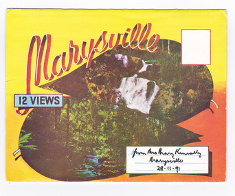
Postcard (item) - Colour photographs, Murray Views, Marysville 12 Views, 1950's
... black spur (image 9)... BLACK SPUR, MARYSVILLE ROAD, MARYSVILLE, VIC. NICHOLL'S LOOKOUT...) black spur (image 9) nicholl's lookout (image 10) tree ferns ...A fold out postcard of 12 colour photographs of scenes and landscapes in and around Marysville in Victoria.A fold out postcard 12 colour photographs of scenes and landscapes in and around Marysville in Victoria. These photographs were produced by Murray Views in Gympie, Queensland as a souvenir of Marysville.Marysville/ 12 VIEWS from Mrs Mary Keneally/ Marysville/ 28.11.91 PRODUCED BY MURRAY VIEWS./ GYMPIE./ Q COPYRIGHT SAMUEL LEE & CO., PRINTERS. STEAVENSON'S FALLS, MARYSVILLE, VIC. TOURISTS AT MARYSVILLE, VIC. "FRUIT SALAD FARM", MARYSVILLE MAIN STREET, MARYSVILLE, VIC. ROAD SCENE, MARYSVILLE, VIC. THE CROSSWAYS, MARYSVILLE, VIC ROAD TO CUMBERLAND VALLEY, MARYSVILLE PANORAMA FROM BLACK SPUR, MARYSVILLE ROAD, MARYSVILLE, VIC. NICHOLL'S LOOKOUT, MARYSVILLE, VIC. TREE FERNS, MARYSVILLE, VIC. THE BRIDGE, MARYSVILLE, VIC.steavenson falls (image 1), tourists in marysville (image 2), taggerty river (image 3), fruit salad farm (image 4), main street marysville (image 5), road scene marysville (image 6), the crossways (image 7), cumberland valley (image 8), black spur (image 9), nicholl's lookout (image 10), tree ferns (image 11), bridge (image 12), marysville, victoria, postcard, souvenir, murray views -
 Kew Historical Society Inc
Photograph - Rural landscape, c.1926
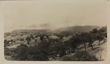
... part of a group of photos preceding images of [Black] Spur, so... preceding images of [Black] Spur, so the photographs may have been ...Henry Beater Christian (1886-1962) , was a descendant of one of the earliest settler families in Kew. Employed at the Kew Asylum as a 'public servant', he was a skilled amateur photographer, photographing numerous scenes in Kew and on his travels around Victoria. The majority of his photographs date from 1916 to 1929. His finest photographs are housed in two photograph albums. Digital copy of a photograph from page 17 of the 47-page photograph album containing 261 gelatinous silver images, loaned by Diane Washfold with permission given to digitise and hold a copy in our collection. This photograph, dating from c.1926, forms part of a group of photos preceding images of [Black] Spur, so the photographs may have been taken as part of that bushwalking trip. John Chapman has written in 'Bushwalking Clubs - A Brief History', about the establishment in Victoria of the first bushwalking club in 1888, and the popularisation of bushwalking during the interwar period. Henry Christian's 'walks' appear to have been undertaken solely or with a companion/s. This photo shows rolling hills interspersed with remnant eucalypts. There appears to be smoke in the distance.Illegible ink inscription on pagehenry beater christian (1886-1962), landscape photography, kew (vic.) — yarra river, christian-washfold collection, photograph albums, bushwalking -- victoria -
 Kew Historical Society Inc
Photograph - Rural landscape, c.1926
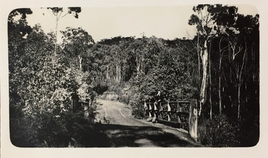
... part of a group of photos preceding images of [Black] Spur, so... preceding images of [Black] Spur, so the photographs may have been ...Henry Beater Christian (1886-1962) , was a descendant of one of the earliest settler families in Kew. Employed at the Kew Asylum as a 'public servant', he was a skilled amateur photographer, photographing numerous scenes in Kew and on his travels around Victoria. The majority of his photographs date from 1916 to 1929. His finest photographs are housed in two photograph albums. Digital copy of a photograph from page 17 of the 47-page photograph album containing 261 gelatinous silver images, loaned by Diane Washfold with permission given to digitise and hold a copy in our collection. This photograph, dating from c.1926, forms part of a group of photos preceding images of [Black] Spur, so the photographs may have been taken as part of that bushwalking trip. John Chapman has written in 'Bushwalking Clubs - A Brief History', about the establishment in Victoria of the first bushwalking club in 1888, and the popularisation of bushwalking during the interwar period. Henry Christian's 'walks' appear to have been undertaken solely or with a companion/s. This photo is a country road with a wooden bridge on which a man is sitting. Illegible ink inscription on pagehenry beater christian (1886-1962), landscape photography, kew (vic.) — yarra river, christian-washfold collection, photograph albums, bushwalking -- victoria -
 Kew Historical Society Inc
Photograph - Rural landscape, c.1926
... part of a group of photos preceding images of [Black] Spur, so... preceding images of [Black] Spur, so the photographs may have been ...Henry Beater Christian (1886-1962) , was a descendant of one of the earliest settler families in Kew. Employed at the Kew Asylum as a 'public servant', he was a skilled amateur photographer, photographing numerous scenes in Kew and on his travels around Victoria. The majority of his photographs date from 1916 to 1929. His finest photographs are housed in two photograph albums. Digital copy of a photograph from page 17 of the 47-page photograph album containing 261 gelatinous silver images, loaned by Diane Washfold with permission given to digitise and hold a copy in our collection. This photograph, dating from c.1926, forms part of a group of photos preceding images of [Black] Spur, so the photographs may have been taken as part of that bushwalking trip. John Chapman has written in 'Bushwalking Clubs - A Brief History', about the establishment in Victoria of the first bushwalking club in 1888, and the popularisation of bushwalking during the interwar period. Henry Christian's 'walks' appear to have been undertaken solely or with a companion/s. This deliberately picturesque photo is a country road stretching into the distance framed by trees.Illegible ink inscription on pagehenry beater christian (1886-1962), landscape photography, kew (vic.) — yarra river, christian-washfold collection, photograph albums, bushwalking -- victoria -
 Kew Historical Society Inc
Photograph - Rural landscape, c.1926
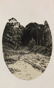
... part of a group of photos preceding images of [Black] Spur, so... preceding images of [Black] Spur, so the photographs may have been ...Henry Beater Christian (1886-1962) , was a descendant of one of the earliest settler families in Kew. Employed at the Kew Asylum as a 'public servant', he was a skilled amateur photographer, photographing numerous scenes in Kew and on his travels around Victoria. The majority of his photographs date from 1916 to 1929. His finest photographs are housed in two photograph albums. Digital copy of a photograph from page 17 of the 47-page photograph album containing 261 gelatinous silver images, loaned by Diane Washfold with permission given to digitise and hold a copy in our collection. This photograph, dating from c.1926, forms part of a group of photos preceding images of [Black] Spur, so the photographs may have been taken as part of that bushwalking trip. John Chapman has written in 'Bushwalking Clubs - A Brief History', about the establishment in Victoria of the first bushwalking club in 1888, and the popularisation of bushwalking during the interwar period. Henry Christian's 'walks' appear to have been undertaken solely or with a companion/s. This snapshot is a muddy track leading into the dense bush. The oval framing device was created by Henry Christian when developing the photo. Illegible ink inscription on pagehenry beater christian (1886-1962), landscape photography, kew (vic.) — yarra river, christian-washfold collection, photograph albums, bushwalking -- victoria -
 Marysville & District Historical Society
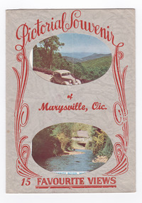
Postcard (item) - Colour and black and white photographs, Murray Views, Pictorial Souvenur of Marysville, Vic. 15 Favourite Views, 1950's
... black spur (image 15).... Panorama from Black Spur, Marysville Road, Marysville, Vic...., Marysville, Vic. Panorama from Black Spur, Marysville Road ...A fold out postcard of 15 colour and black and white photographs of scenes and landscapes in and around Marysville in Victoria.A fold out postcard of 15 colour and black and white photographs of scenes and landscapes in and around Marysville in Victoria. These photographs were produced by Murray Views in Gympie, Queensland as a souvenir of Marysville.Pictorial Souvenir/ of/ Marysville, Vic./ 15 Favourite Views PRODUCED BY MURRAY VIEWS. GYMPIE. Q. COPYRIGHT SAMUEL LEE & CO., PRINTERS Serial No. R 4152 NICHOLL'S LOOKOUT, MARYSVILLE, VIC. TAGGERTY RIVER, MARYSVILLE, VIC ROAD SCENE, MARYSVILLE, VIC. MAIN STREET, MARYSVILLE, VIC. THE CROSSWAYS, MARYSVILLE, VIC. FRUIT SALAD FARM, MARYSVILLE, VIC. ROAD TO CUMBERLAND VALLEY, MARYSVILLE, VIC. CROSSWAYS CABARET, MARYSVILLE, VIC. TREE FERNS, MARYSVILLE, VIC. STEVENSON'S FALLS, MARYSVILLE, VIC. Looking towards Marysville, Vic. Tourists at Marysville, Vic. Taggerty River, Marysville, Vic. On Buxton Road, Marysville, Vic. Panorama from Black Spur, Marysville Road, Marysville, Vic.marysville, victoria, souvenir, postcard, nicholl's lookout (image 1), taggerty river (image 2), road scene (image 3), main street marysville (image 4), crossways hotel (image 5), fruit salad farm (image 6), cumberland valley (image 7), crossways cabaret (image 8), tree ferns (image 9), steavenson falls (image 10), marysville view (image 11), tourists marysville (image 12), taggerty river (image 13), buxton road (image 14), black spur (image 15) -
 Marysville & District Historical Society
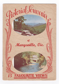
Postcard (item) - Colour and black and white photographs, Pictorial Souvenir of Marysville, Vic. 15 Favourite Views
... black spur (image 15).... Panorama from Black Spur, Marysville Road, Marysville, Vic...., Marysville, Vic. Panorama from Black Spur, Marysville Road ...A fold out postcard of 15 colour and black and white photographs of scenes and landscapes in and around Marysville in Victoria.A fold out postcard of 15 colour and black and white photographs of scenes and landscapes in and around Marysville in Victoria. These photographs were produced by Murray Views in Gympie, Queensland as a souvenir of Marysville.Pictorial Souvenir/ of/ Marysville, Vic./ 15 Favourite Views PRODUCED BY MURRAY VIEWS. GYMPIE. Q. COPYRIGHT SAMUEL LEE & CO., PRINTERS Serial No. R 4152 NICHOLL'S LOOKOUT, MARYSVILLE, VIC. TAGGERTY RIVER, MARYSVILLE, VIC ROAD SCENE, MARYSVILLE, VIC. MAIN STREET, MARYSVILLE, VIC. THE CROSSWAYS, MARYSVILLE, VIC. FRUIT SALAD FARM, MARYSVILLE, VIC. ROAD TO CUMBERLAND VALLEY, MARYSVILLE, VIC. CROSSWAYS CABARET, MARYSVILLE, VIC. TREE FERNS, MARYSVILLE, VIC. STEVENSON'S FALLS, MARYSVILLE, VIC. Looking towards Marysville, Vic. Tourists at Marysville, Vic. Taggerty River, Marysville, Vic. On Buxton Road, Marysville, Vic. Panorama from Black Spur, Marysville Road, Marysville, Vic.marysville, victoria, souvenir, postcard, nicholl's lookout (image 1), taggerty river (image 2), road scene (image 3), main street marysville (image 4), crossways hotel (image 5), fruit salad farm (image 6), cumberland valley (image 7), crossways cabaret (image 8), tree ferns (image 9), steavenson falls (image 10), marysville view (image 11), tourists marysville (image 12), taggerty river (image 13), buxton road (image 14), black spur (image 15) -
![View of the Township of Fernshawe / [by] Nicholas Caire, circa 1876](/media/collectors/550653872162f11fb04854aa/items/57775425d0cdd10a5c17a3fd/item-media/57775483d0cdd10a5c17c7c0/item-fit-380x285.jpg) Kew Historical Society Inc
Kew Historical Society IncPhotograph, Anglo-Australasian Photographic Company, View of the Township of Fernshawe, c. 1876
... of / the Black Spur, and is surrounded by a great many high hills... in the Colony of Victoria. It is situated at the foot of / the Black ...Nicholas Caire was born on Guernsey in the Channel Islands in 1837. He arrived in Adelaide with his parents in about 1860. In 1867, following photographic journeys in Gippsland, he opened a studio in Adelaide. From 1870 to 1876 he lived and worked in Talbot in Central Victoria. In 1876 he purchased T. F. Chuck's studios in the Royal Arcade Melbourne. In 1885, following the introduction of dry plate photography, he began a series of landscape series, which were commercially successful. As a photographer, he travelled extensively through Victoria, photographing places few of his contemporaries had previously seen. He died in 1918. Reference: Jack Cato, 'Caire, Nicholas John (1837–1918)', Australian Dictionary of Biography, National Centre of Biography, Australian National UniversityAn original, rare photograph from the series 'Views of Victoria: General Series' by the photographer, Nicholas Caire (1837-1918). The series of 60 photographs that comprise the series was issued c. 1876 and reinforced a neo-Romantic view of the Australian landscape to which a growing nationalist movement would respond. Nicholas Caire was active as a photographer in Australia from 1858 until his death in 1918. His vision of the Australian bush and pioneer life had a counterpart in the works of Henry Lawson and other nationalist poets, authors and painters.Albumen silver photograph mounted on board. [Note: This is the first of two copies of this photograph in the collection]printed in ink on support l.c.: VIEW OF THE TOWNSHIP OF FERNSHAWE. / COPYRIGHT REGISTERED. printed in ink on support reverse c.: VIEWS OF VICTORIA. / (GENERAL SERIES.) / No. 14. / VIEW OF THE TOWNSHIP OF FERNSHAWE. / Fernshawe may be considered the most romantic town in the Colony of Victoria. It is situated at the foot of / the Black Spur, and is surrounded by a great many high hills, such as Mounts Riddell, Juliet, Munday, and others, / which form the crossing range into Gipps Land. It has, no doubt, derived its name from the fact that it is the / greatest Fern-growing district in the Colony. printed in ink on support reverse l.c.l.: J.W. FORBES, Agent, printed in ink on support reverse l.c.: ANGLO-AUSTRALASIAN PHOTOGRAPHIC COMPANY, MELBOURNE. printed in ink on support reverse l.c.r.: 10 Temple Court, Collins Street West.nicholas caire (1837-1918), landscape photography, fernshawe -
![View of the Township of Fernshawe / [by] Nicholas Caire, circa 1876](/media/collectors/550653872162f11fb04854aa/items/57775578d0cdd10a5c183f96/item-media/577755dfd0cdd10a5c18731c/item-fit-380x285.jpg) Kew Historical Society Inc
Kew Historical Society IncPhotograph, Anglo-Australasian Photographic Company, View of the Township of Fernshawe, c. 1876
... of / the Black Spur, and is surrounded by a great many high hills... in the Colony of Victoria. It is situated at the foot of / the Black ...Nicholas Caire was born on Guernsey in the Channel Islands in 1837. He arrived in Adelaide with his parents in about 1860. In 1867, following photographic journeys in Gippsland, he opened a studio in Adelaide. From 1870 to 1876 he lived and worked in Talbot in Central Victoria. In 1876 he purchased T. F. Chuck's studios in the Royal Arcade Melbourne. In 1885, following the introduction of dry plate photography, he began a series of landscape series, which were commercially successful. As a photographer, he travelled extensively through Victoria, photographing places few of his contemporaries had previously seen. He died in 1918. Reference: Jack Cato, 'Caire, Nicholas John (1837–1918)', Australian Dictionary of Biography,An original, rare photograph from the series 'Views of Victoria: General Series' by the photographer, Nicholas Caire (1837-1918). The series of 60 photographs that comprise the series was issued c. 1876 and reinforced a neo-Romantic view of the Australian landscape to which a growing nationalist movement would respond. Nicholas Caire was active as a photographer in Australia from 1858 until his death in 1918. His vision of the Australian bush and pioneer life had a counterpart in the works of Henry Lawson and other nationalist poets, authors and painters.Albumen silver photograph mounted on board. [Note: This is the second of two copies of this photograph in the collection]printed in ink on support l.c.: VIEW OF THE TOWNSHIP OF FERNSHAWE. / COPYRIGHT REGISTERED. printed in ink on support reverse c.: VIEWS OF VICTORIA. / (GENERAL SERIES.) / No. 14. / VIEW OF THE TOWNSHIP OF FERNSHAWE. / Fernshawe may be considered the most romantic town in the Colony of Victoria. It is situated at the foot of / the Black Spur, and is surrounded by a great many high hills, such as Mounts Riddell, Juliet, Munday, and others, / which form the crossing range into Gipps Land. It has, no doubt, derived its name from the fact that it is the / greatest Fern-growing district in the Colony. printed in ink on support reverse l.c.l.: J.W. FORBES, Agent, printed in ink on support reverse l.c.: ANGLO-AUSTRALASIAN PHOTOGRAPHIC COMPANY, MELBOURNE. printed in ink on support reverse l.c.r.: 10 Temple Court, Collins Street West.nicholas caire (1837-1918), landscape photography, fernshawe -
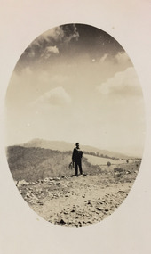 Kew Historical Society Inc
Photograph - Rural landscape, c.1926
... part of a group of photos preceding images of [Black] Spur, so... preceding images of [Black] Spur, so the photographs may have been ...Henry Beater Christian (1886-1962) , was a descendant of one of the earliest settler families in Kew. Employed at the Kew Asylum as a 'public servant', he was a skilled amateur photographer, photographing numerous scenes in Kew and on his travels around Victoria. The majority of his photographs date from 1916 to 1929. His finest photographs are housed in two photograph albums. Digital copy of a photograph from page 17 of the 47-page photograph album containing 261 gelatinous silver images, loaned by Diane Washfold with permission given to digitise and hold a copy in our collection. This photograph, dating from c.1926, forms part of a group of photos preceding images of [Black] Spur, so the photographs may have been taken as part of that bushwalking trip. John Chapman has written in 'Bushwalking Clubs - A Brief History', about the establishment in Victoria of the first bushwalking club in 1888, and the popularisation of bushwalking during the interwar period. Henry Christian's 'walks' appear to have been undertaken solely or with a companion/s. This camera shot invites the viewer to access the landscape through the point-of-view of the man standing with his back to the camera at the edge of the road. The man holds leaves in his left hand [to deter insects], and has a knapsack on his back. The landscape in the distance includes both cleared land for farming and remnant vegetation. The oval framing device was used when Henry Christian developed the photo.Illegible ink inscription on pagehenry beater christian (1886-1962), landscape photography, kew (vic.) — yarra river, christian-washfold collection, photograph albums, bushwalking -- victoria -
![Junction of the Rivers Yarra and Watt, Near Healesville / [by] Nicholas Caire, circa 1876](/media/collectors/550653872162f11fb04854aa/items/577740e5d0cdd10a5c0de011/item-media/57774153d0cdd10a5c0e0662/item-fit-380x285.jpg) Kew Historical Society Inc
Kew Historical Society IncPhotograph, Anglo-Australasian Photographic Company, Junction of the Rivers Yarra and Watt, Near Healesville, c. 1876
... / of the Watt are to be found at the head of the Black Spur, and, being... / of the Watt are to be found at the head of the Black Spur, and, being ...Nicholas Caire was born on Guernsey in the Channel Islands in 1837. He arrived in Adelaide with his parents in about 1860. In 1867, following photographic journeys in Gippsland, he opened a studio in Adelaide. From 1870 to 1876 he lived and worked in Talbot in Central Victoria. In 1876 he purchased T. F. Chuck's studios in the Royal Arcade Melbourne. In 1885, following the introduction of dry plate photography, he began a series of landscape series, which were commercially successful. As a photographer, he travelled extensively through Victoria, photographing places few of his contemporaries had previously seen. He died in 1918. Reference: Jack Cato, 'Caire, Nicholas John (1837–1918)', Australian Dictionary of Biography.An original, rare photograph from the series 'Views of Victoria: General Series' by the photographer, Nicholas Caire (1837-1918). The series of 60 photographs that comprise the series was issued c. 1876 and reinforced a neo-Romantic view of the Australian landscape to which a growing nationalist movement would respond. Nicholas Caire was active as a photographer in Australia from 1858 until his death in 1918. His vision of the Australian bush and pioneer life had a counterpart in the works of Henry Lawson and other nationalist poets, authors and painters.Albumen Silver Photograph, mounted on Board.printed in ink on support l.c.: JUNCTION OF THE RIVERS YARRA AND WATT, NEAR HEALESVILLE. / COPYRIGHT REGISTERED. printed in ink on support reverse c.: VIEWS OF VICTORIA. / (GENERAL SERIES.) / No. 3. / JUNCTION OF THE RIVERS YARRA AND WATT, NEAR HEALESVILLE / The junction is situated about 3 miles from Healesville, and 35 miles from the mouth of the Yarra. The souces / of the Watt are to be found at the head of the Black Spur, and, being fed by a number of creeks and springs, its / waters gain considerable force for several miles before joining those of the Yarra. The "Old Bridge," at the junction, / is the name given to this crossing-place, which has been partly swept away by late floods. The depth of the Yarra here / is from 15 to 20 feet; that of the Watt, about 10 feet. printed in ink on support reverse l.c.l.: J.W. FORBES, Agent, printed in ink on support reverse l.c.: ANGLO-AUSTRALASIAN PHOTOGRAPHIC COMPANY, MELBOURNE. printed in ink on support reverse l.c.r.: 10 Temple Court, Collins Street West.nicholas caire (1837-1918), yarra river, watt river, bridge, wooden bridge, healesville -
 Eltham District Historical Society Inc
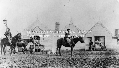
Photograph, William McLaughlin's Kangaroo Ground Hotel, General Store and Post Office, Eltham-Yarra Glen Road, Kangaroo Ground, c.1875
... of the Black Spur, together with the romantic region of the Stephenson... of the Black Spur, together with the romantic region of the Stephenson ...Initially known as the ‘Kangaroo Hotel,’ this photo shows the sign ‘Kangaroo Ground Hotel’ and William McLaughlin as the proprietor, which dates it between 1871 and 1882. The first hotel known as the Kangaroo Hotel was built at the top of the hill by Andrew Ross in 1864 commencing April; a license was obtained, and the bar opened by Edmund Pickett, the tenant, on 11th of July. The hotel was ready for public accommodation by September, 1864. On June 27, 1864, Edmund Pickett, residing at Kangaroo Ground, gave notice to the Bench of Magistrates at Eltham that it was his intention to apply on July 6th for a certificate authorising the issue of a Publican’s Licence for a house rented and occupied by himself, situated at Kangaroo Ground, containing two sitting rooms and five bedrooms exclusive of those required for the use of his family. On February 7, 1866, Edmund Pickett, publican, residing at Kangaroo Ground, applied at the Court of Petty Sessions held at Eltham for a Publican’s License for a house situated at the Kangaroo Ground, containing six bedrooms and two sitting rooms, rented and occupied by himself and licensed under the sign of the 'Kangaroo Hotel.' In 1866, with few boarders at the school and needing to reduce expenses, Ross had the bedroom house removed from the school and placed in contiguity to the hotel, the occupier to have the post office. The house was re-erected with a kitchen addition and was opened as the Post Office & General Store on April 1st. Throughout 1870 Andrew Ross found himself at odds with Pickett - he "felt much dissatisfaction at my having a hotel especially kept by a man of loose principals and low habits" and so served him notice to vacate by December 31st, occupying it himself on January 1, 1871, calling it Rossville House. William McLaughlin and his wife kept the store and post office. As a hotel was now wanted and McLaughlin was desirous to obtain a license, Ross set about making the Store building suitable which was achieved towards the end of 1871. Ross notes in his diary that the Store hotel was finished January 1, 1872. At the Court of Petty Sessions held at Eltham on 5 December 1871, William McLaughlin applied for a license for the Kangaroo Hotel, Kangaroo Ground. He had previously obtained a wine license, March 28. In June 1882, William McLaughlin of Madeline Street, Carlton, (late of Kangaroo Ground, hotelkeeper) was found insolvent due to losses in connection with the Kangaroo Ground Hotel. The license for the hotel was later transferred from Mr John Donaldson to Mrs Sophia Greenaway. It appears during McLaughlin’s tenure the hotel became known as the Kangaroo Ground Hotel. The hotel was replaced with a new wooden building in 1892, constructed by W.Holland and described as being "of a neat appearance, roomy, and fittled up with all modern requirements necessary in a business of this kind." This building was destroyed by fire in 1930. References: Ross, Andrew, 1814-1895 & Woiwod, Mick & Andrew Ross Museum. (2011). The diary of Andrew Ross 1828-1895 & the reminiscences of Andrew Ross 1851-1864 / edited, annotated and introduced by Mick Woiwod for the Andrew Ross Museum, Kangaroo Ground. Kangaroo Ground, [Vic.] : Tarcoola Press in association with the Andrew Ross Museum The Evelyn Observer, (1892, June 24). Evelyn Observer, and South and East Bourke Record (Vic. : 1882 - 1902), p. 2 (MORNING.). Retrieved May 13, 2025, from http://nla.gov.au/nla.news-article60667494 REMINISCENCES. (1893, April 21). Evelyn Observer, and South and East Bourke Record (Vic. : 1882 - 1902), p. 2 (MORNING.). Retrieved May 10, 2025, from http://nla.gov.au/nla.news-article60669116 REMINISCENCES COUNTY EVELYN. BY Andrew Ross. (No. 41) The summer of 1863-4 may be re membered by many colonists as one of the most enjoyable as regards wet weather, and it was one made remarkable by the enterprise and activity apparent throughout Evelyn County. This spirit was fostered and encouraged by the prospect presented from the opening up of the new route to the Jordan and Wood's Point, and the consequent occupation of lands and special localities along the main track. Accommodation for travellers were established at Yarra Flats, the future Healesville, Fernshaw, Marysville, while the beauties and difficulties of the Black Spur, together with the romantic region of the Stephenson Waterfalls mid the mountain forests attracted visitors other than the gold diggers. Before the end of this year 1863, the new route to Wood's Point by the Dividing Range had been so far improved that a track was laid off by the New Chum Creak, Paradise Plains, and the Springs to Emerald Hill, about half way between Jordan and Wood's Point, and the clearing of this track was looked forward to as enabling drays to be employed. The Government had so far yielded to the demands made upon it, that the work was proceeded with early in 1864. In March of that year the writer was favoured by a visit from Mr. Ligne, Surveyor-General, who was enroute to inspect the progress of the undertaking. He was accompanied by Mr. Collins Levey, his son-in-law, who had been a frequent visitor with his friend Mr. Franklin, of the Melbourne Herald newspaper, These parties, and not a few others, were glad to partake of the hospitality of residents on the Ground or, at Yarra Flats when as yet no public accommodation existed. Horsemen and pedestrians became numerous ere winter set in, and there was obviously the want of the hotel which was planned and commenced late in the autumn. The absence of any endeavour on that score by local proprietors induced the writer to undertake the erection of the Kangaroo Ground Hotel, which he did on his own responsibility. The spot best suited for the hotel being held by him on lease, he was permitted by the landlord to devote the required portion of land for the premises to be erected and occupied. Before this was accomplished the imported houses placed near the schoolhouse which had served for bedroom to boarded pupils were rebuilt near the hotel and served for a general store and post office also. Delay was experienced in procuring all the materials for the new building. After the break in the weather the roads on the Ground became very heavy and as timber had to come from town, it was under difficulties that the supply was procured. Bricks for chimneys were made in a small kiln, and hardwood for joists, &c., provided by sawyers employed for the purpose in the bush. The hotel, in consequence, was not ready for public accommodation until the spring, although a license was obtained, and the bar opened by Mr. Pickett, the tenant, on 11th of July. It may be remarked that the house was rather late in being established; a year earlier it would have secured the benefit of the rush to the new diggings, but in another sense it was rather premature for as yet no steps had been taken by the authorities to stop or even discourage the sale of liquor by unlicensed parties, and the holder of a license had to compete with the class in question. As the season (1864) advanced there were parties anxious to be the pioneers in traversing the whole of the route to Wood’s Point, but it was nigh to summer again before the track was available to vehicular traffic. I believe one of the first to effect the whole passage in this way was Mr. Gillies, some time settled at Mortlake. He drove a buggy and called at the Ground on 9th September, stating his intention to drive through to the Point, and we were subsequently informed that he had accomplished the task. (End of Reminiscences No 41)This photo forms part of a collection of photographs gathered by the Shire of Eltham for their centenary project book,"Pioneers and Painters: 100 years of the Shire of Eltham" by Alan Marshall (1971). The collection of over 500 images is held in partnership between Eltham District Historical Society and Yarra Plenty Regional Library (Eltham Library) and is now formally known as the 'The Shire of Eltham Pioneers Photograph Collection.' It is significant in being the first community sourced collection representing the places and people of the Shire's first one hundred years.Digital image (neg copy missing) Print 21 x 26.5 cmeltham-yarra glen road, kangaroo ground, kangaroo ground hotel, post office, shire of eltham pioneers photograph collection, gas lamp, hotels, kangaroo hotel, william mclaughlin, andrew ross, edmund pickett -
 Orbost & District Historical Society
black and white photograph, 1918
Tonghi Creek is 66km north - west of Orbost. Prior to the sealing of the Princes Highway west of Orbost, the road surface was anything but good, even by C1917 when cars started to use the road. From Orbost the old road via Marlo to Sydenham was abandoned for the new location which traversed more rugged country via Cabbage Tree, Bell Bird and Club Terrace to Cann River, and the reason for this diversion was on account of settlements being established at Murrungowar and Club Terrace, at which latter place there was a temporary rush to obtain gold. This road was constructed by the Public Works department and a maximum grade of 1 in 19 was adopted, and as speed was not to be catered for the grade followed in and out round the spurs and gullies, resulting in a maze of turns and twists which required a good deal of skill on the part of the horse driver to negotiate." - Bairnsdale Advertiser, Friday, May 2, 1947. (More information from Newsletter February 2010)This item is a pictorial record of roads in the early 20th century in East Gippsland.A large black / white photograph of a bridge over a small creek, surrounded by bush. The photograph is mounted on a thick cream coloured card.on back - "Bridge at Tonghi Creek 1918"tonghi-creek-bridge country-roads-east-gippsland -
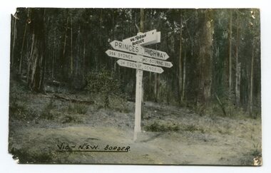 Orbost & District Historical Society
black and white photograph, first half 20th century
Prior to the sealing of the Princes Highway west of Orbost, the road surface was anything but good, even by C1917 when cars started to use the road. From Orbost the old road via Marlo to Sydenham was abandoned for the new location which traversed more rugged country via Cabbage Tree, Bell Bird and Club Terrace to Cann River, and the reason for this diversion was on account of settlements being established at Murrungowar and Club Terrace, at which latter place there was a temporary rush to obtain gold. This road was constructed by the Public Works department and a maximum grade of 1 in 19 was adopted, and as speed was not to be catered for the grade followed in and out round the spurs and gullies, resulting in a maze of turns and twists which required a good deal of skill on the part of the horse driver to negotiate." - Bairnsdale Advertiser, Friday, May 2, 1947. (More information from Newsletter February 2010)This is a pictorial record of an early road distance sign on a major highway through East Gippsland. The distances are indicated in miles, a measurement standard no longer in use.A black / white photograph postcard of the signpost at the Victorian - New South Wales border. It shows distances to Sydney and Eden on one arrow and distances to Melbourne and Genoa on another. on front - Vic - NSW Borderprinces-highway-east-gippsland road-transport road-sign -
 Warrnambool and District Historical Society Inc.
Book, Sabre and spurs, 1926
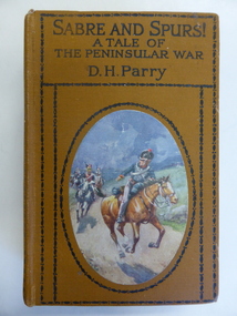
... of 216 pages. It has a brown cover with black lettering ...This book was given in 1928 as a prize by the Dennington Presbyterian Sabbath (Sunday) School to Clive Cust. The Dennington Presbyterian Church was originally established in Drummond Street in 1918. In 1951 it was moved to Lindsay Street and demolished in 1968. The Cust families have been prominent in Warrnambool’s history since its foundation days. Clive Cyril Cust was born in Warrnambool in 1914 to Alex and Annie Cust. This book is of minor interest as an example of the type of book given to a teenage boy as a Sunday School prize in 1928. It is also of interest because of its connection to a member of the Cust family. This is a hard cover book of 216 pages. It has a brown cover with black lettering and ornamental borders on the front cover and spine and a coloured sketch of several military men on horseback on the front cover. The same coloured sketch forms the frontispiece and there are three other black and white sketches scattered throughout the text. The inscriptions are hand-printed and hand-written in black ink. ‘Presbyterian Sabbath School Dennington, Prize Awarded to Clive Cust, January 1928, F. Jones Superintendent’. ‘Presented to Mr Clive Cust of Dennington’ dennington presbyterian church, clive cust -
 Kiewa Valley Historical Society
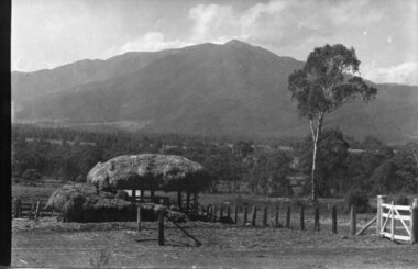
Photograph - Mt Bogong - Tawonga, 06/05/1937
Mount Bogong located in the Alpine National Park and part of the Victorian Alps of the Great Dividing Range, is the highest mountain in Victoria, Australia, at 1,986 metres (6,516 ft) above sea level. The Big River separates the massif of the mountain from the Bogong High Plains to the south. From the nearby town of Mount Beauty to its summit, Mount Bogong rises more than 1,600 metres (5,200 ft), thus making it one of the highest peaks in Australia not only in terms of its elevation above sea level, but also in terms of actual base-to-summit prominence. Mount Bogong is a popular backcountry skiing mountain through winter but only has snow for the mid winter-spring months. It is around 30 kilometres (19 mi) by road and walking track or 12 kilometres (7.5 mi) direct to Mount Beauty. Falls Creek and Mount Hotham ski resorts are also nearby. Camping is relatively safe below the tree line but the summit ridgeline is very exposed. Emergency shelter is also available at Bivouac Hut on the Staircase Spur, and at Cleve Cole, above Camp Creek on the broad ridge to the south of the summit, and Michells Hut on the Eskdale Spur. Mt Bogong is a popular recreational venue in the Kiewa Valley for back country skiing and bush walking and is a favourite with sightseers and popular subject for photographersBlack and white photograph of Mt bogong taken from Tawonga - Thursday May 6th, 1937Handwritten on back of photograph. Thursday May 6th, 1937. Mt Bogong Tawongamt bogong, tawonga, kiewa valley -
 Kiewa Valley Historical Society
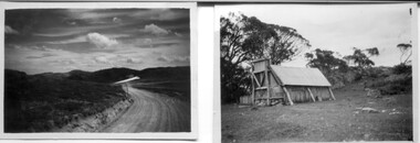
18 small black and white photographs of the Bogong High Plains, 1948
These photos of the Bogong High Plains were all taken by Ronald George Thorn who was a cadet engineer with the State Electricity Commission. He worked on the Kiewa scheme from 1948 to 1950 doing overhead line construction and maintenance plus electrical design and drawing work. They are from his personal collection and a record of his time in the Kiewa area.Pictorial history of personal involvement in the the early days of the Kiewa Scheme.18 small black and white photographs all taken on the Bogong High Plains.Photo 1 Wallace's Hut. Photo 2 Ruined Castle - Looking towards Pretty Valley December 1948. Photo 3 Ruined Castle - Looking towards Pretty Valley December 1948. Photo 4 Ruined Castle - Looking Down Valley December 1948. Photo 5 - Mt. McKay from Ruined Castle October 1948. Photo 6 View from Rocky Valley Camp October 1948. Photo 7 Mt. Feather Top from Ruined Castle October 1948. Photo 8 View from Ruined Castle looking downwards towards Beauty October 1948. Photo 9 Rocky River from gauging station October 1948. Photo 10 Rocky Valley River from main road October 1948. Photo 11 View along little Arthur Fire Track October 1948. Photo 12 View along main road. Looking towards Beauty Valley October 1948. Photo 13 View from Little Arthur Fire Track October 1948. Photo 14 Frying Pan Spur from Rocky Valley Road October 1948. Photo 15 Mt. Bogong from Big Hill Fire Track October 1948. Photo 16 View from Big Hill Fire Track October 1948. Photo 17 Mt. Feathertop from Ruined Castle October 1948. Photo 18 Mt. Fainter from Ruined Castle October 1948. (All of the above is hand written on the back of photos in ink). bogong high plains; r g thorn; secv; kiewa hydro electric scheme; pictorial history -
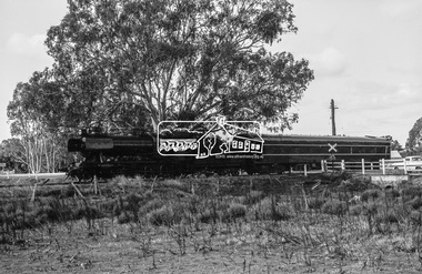 Eltham District Historical Society Inc
Photograph, Steam locomotive J-521 with the Royal Train on the Wharf Spur line during a visit to Echuca by the new Governor of Victoria, His Excellency Sir Rohan Delacombe, c.May 1963
In this picture The Royal Train is passing through a railway crossing along the Wharf Spur line. The train has been shortened comprising steam locomotive J-521 and tender to which is attached the State car. The State car is in the design of the Spirit of Progress. George Coop advised that the occasion is the visit of the Governor of Victoria, Sir Rohan Delacombe to Echuca in 1963. Delacombe had replaced Sir Dallas Brooks in May 1963 who had departed for England on the liner Iberia,11 April 1963 (1963 'SIR DALLAS ON WAY TO U.K.', The Canberra Times (ACT : 1926 - 1995), 9 April, p. 9. , viewed 27 Jan 2020, http://nla.gov.au/nla.news-article104249252) George believes the Governor was doing a considerable formal train ride around the State and Echuca was on the schedule. The ‘platform’ was a special creation for such purposes, located on the wharf spur line that ran behind the Echuca Civic Centre. The large notice board commemorates the Queen’s visit on March 5th, 1954 for which the platform was initially built. From time to time it would get spruced up with pot plants, fresh paint and repaired hand rails for formal functions. George attended the Civic Reception held for the Governor. A picture of His Excellency Sir Rohan Delacombe, Governor of Victoria, and Lady Delacombe about to entrain at Spencer Street for a visit to western Victoria is available on page 4 of VICTORIAN RAILWAYS REPORT OF THE VICTORIAN RAILWAYS COMMISSIONERS FOR THE YEAR ENDED 30th JUNE, 1963. (http://www.victorianrailways.net/vr%20history/annual_reports/vrar1963.pdf) More information about the Victorian Railways Royal Train https://en.wikipedia.org/wiki/Victorian_Railways_Royal_Train State Car No. 5 https://www.pjv101.net/cd/pages/c160v06.htm Digital TIFF file Scan of 35mm Ilford FP3 black and white negative transparencyechuca, george coop collection, governor of victoria, j-521, railway crossing, royal train, sir rohan delacombe, state car no. 5, victorian railways, wharf spur line -
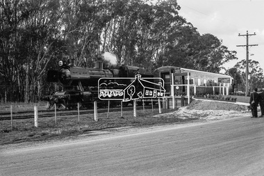 Eltham District Historical Society Inc
Photograph, Steam locomotive J-521 with the Royal Train on the Wharf Spur line during a visit to Echuca by the new Governor of Victoria, His Excellency Sir Rohan Delacombe, c.May 1963
In this picture the Royal Train is pulled up with the State Car at the commemorative platform on the Wharf Spur line. The train has been shortened comprising steam locomotive J-521 and tender to which is attached the State car. The State car is in the design of the Spirit of Progress. The platform is lined with plants in planter boxes. Two men in suits standing to the right, one with a large camera – either press or official photographer. The sign on the platform commemortaes the visit of Her Majesty Queen Elizabeth and His Royal Highness Phillip Duke of Edinburg on March 5th, 1954. George Coop advised that the occasion is the visit of the Governor of Victoria, Sir Rohan Delacombe to Echuca in 1963. Delacombe had replaced Sir Dallas Brooks in May 1963 who had departed for England on the liner Iberia,11 April 1963 (1963 'SIR DALLAS ON WAY TO U.K.', The Canberra Times (ACT : 1926 - 1995), 9 April, p. 9. , viewed 27 Jan 2020, http://nla.gov.au/nla.news-article104249252) George believes the Governor was doing a considerable formal train ride around the State and Echuca was on the schedule. The ‘platform’ was a special creation for such purposes, located on the wharf spur line that ran behind the Echuca Civic Centre. The large notice board commemorates the Queen’s visit on March 5th, 1954 for which the platform was initially built. From time to time it would get spruced up with pot plants, fresh paint and repaired hand rails for formal functions. A picture of His Excellency Sir Rohan Delacombe, Governor of Victoria, and Lady Delacombe about to entrain at Spencer Street for a visit to western Victoria is available on page 4 of VICTORIAN RAILWAYS REPORT OF THE VICTORIAN RAILWAYS COMMISSIONERS FOR THE YEAR ENDED 30th JUNE, 1963. (http://www.victorianrailways.net/vr%20history/annual_reports/vrar1963.pdf) More information about the Victorian Railways Royal Train https://en.wikipedia.org/wiki/Victorian_Railways_Royal_Train State Car No. 5 https://www.pjv101.net/cd/pages/c160v06.htmDigital TIFF file Scan of 35mm Ilford FP3 black and white negative transparencyechuca, george coop collection, governor of victoria, j-521, royal train, sir rohan delacombe, state car no. 5, victorian railways, wharf spur line -
 Marysville & District Historical Society
Book - Hardcover book, J.W. Lindt Master Photographer, 1985
... to purchase land on the North East side of the Black Spur ...A book of photographs taken by John William Lindt of locations and scenery throughout the world.A book of photographs taken by John William Lindt of locations and scenery throughout the world. John William Lindt (1845–1926), was a German-born Australian landscape and ethnographic photographer, early photojournalist, and portraitist. John Lindt was responsible for a folio of photographs of the Fernshaw and Watts River area and he sold over 25,000 images of the Black Spur from his original negatives. In 1895 he was able to purchase land on the North East side of the Black Spur and subsequently built his home and guesthouse "The Hermitage" from where he continued his photographic career. In 1913 he collaborated with Nicholas Caire to produce a tourist booklet on the area. In 1925 the Argus reported that Lindt "continues to produce remarkable and most artistic pictures of the beauties of mountain landscape. He is not a believer in the blurred effects favoured by many ... instead he is a master of detail." Aged 81 Lindt died of heart failure during disastrous bushfires on 19 February 1926 at the Hermitage. He was survived by his wife Catherine who continued to run ‘The Hermitage’ guest house before she retired to the city.Hardcover. Front cover photograph-Log Bridge at the Hermitage c1910photography, artistic, john william lindt, la trobe collection, shar jones -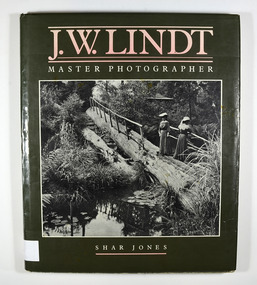
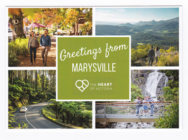 Marysville & District Historical Society
Postcard (item) - Colour postcard, Murrindindi Shire Council, Greetings from Marysville-The HEART OF VICTORIA, Post 2009
... black spur... of Marysville. marysville murchison street keppel lookout black spur ...A postcard with four colour photographs of local attractions in an around Marysville in Victoria.A postcard with four colour photographs of local attractions in an around Marysville in Victoria. This postcard was produced by the Murrindindi Shire Council as a souvenir of Marysville.THE HEART/ OF VICTORIA/ #discoverdindi/ @idscoverdindi www.discoverdindi.com.au Murrindindi/ Shire Councilmarysville, murchison street, keppel lookout, black spur, steavenson falls, victoria, murrindindi shire council, postcard, souvenir -
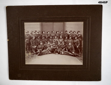 Bendigo Military Museum
Photograph - PHOTOGRAPH OF A GROUP OF SOLDIERS, Australian Army, c1916 - 1918
These are WW1 Australian soldiers, They have leather bandoliers, leather leggings and spurs. Most have slouch hats. Therefore they are probably drivers. The big officer in the middle has red tabs so it is assumed he would be Colonel or above. Seated on the ground, right side is a veteran. He has a colour patch with the letter "A" . There is a Lance Corporal with a colour patch. I would place this as c1916-1918.This is a small group portrait set into a cardboard frame. The photo is black and white. There are 3 ranks of soldiers in front of a timber weatherboard building.On the back written in texta is Mrs O. Pell.photograph, ww1 -
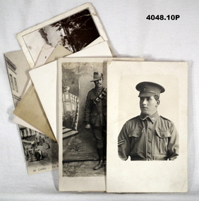 Bendigo Military Museum
Postcard - POSTCARDS, PHOTOGRAPHIC WW1, 2) 1.5.1919
The collection revolves around cards, letters to "Hannah Firth" of Melbourne. .1) & .2) Cards are from William Martindale No. 1188, enlisted 17.7.15 aged 27. D Coy 29th Bn AIF. Embarked 10.11.15, transferred to 13th F.A.B, returned to Australia 23.6.1919. .3) Card from Henry Haines Sutherland No. 3916. Enlisted 22.7.15 aged 21. 12th reinforcements 14th BN AIF. Transferred to 46th Bn, discharged from the AIF on 20.9.19. .4) & .5) from Bill, .5) from Billie. The rest are unknown. Refer to 4049.12P.1) Postcard, photo, black & white, street scene and mosque. On rear, letter in pencil. .2) Postcard, photo, black & white, harbour scene with ships and city in background. Short letter on rear. .3) Photo, black & white, soldier in peak hat, cpl. stripes, background is clear. On rear, brief note. .4) Postcard, photo, black & white, soldier standing, slouch hat, bandolier, crop, studio background. Brief note on rear. .5) Postcard, photo, black & white, harbour scene, ships with statue on the right. On rear letter. .6) Postcard, photo, black & white, portrait, oval shape, soldier, no hat, wearing ribbons. Nothing on rear. .7) Postcard, photo, black & white, soldier standing, hat, riding crop, spurs, studio background. Nothing on rear. .8) Postcard, photo, black & white, portrait of soldier, slouch hat, no rank, background clear. Nothing on rear. .9) Postcard, photo, sepia, soldier standing, one hand on table, studio background. Nothing on rear. .10) Postcard, photo, sepia, group of seven soldiers, four standing, three sitting outside tents. Nothing on rear. post cards, hannah, photographs -
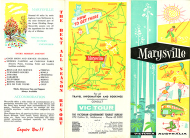 Marysville & District Historical Society
Ephemera (Item) - Tourist brochure, Victorian Government Tourist Bureau, Marysville Victoria Australia, Unknown
... black spur... spur upper yarra dam maroondah highway black spur maroondah dam ...A tourist brochure on Marysville and the surrounding area published by the Victorian Government Tourist Bureau for the Marysville Tourist and Progress Association.A tourist brochure on Marysville and the surrounding area published by the Victorian Government Tourist Bureau for the Marysville Tourist and Progress Association.marysville, victoria, tourist brochure, victorian government tourist bureau, cumberland valley, cumberland falls, cora-lyn falls, robart's lookout, meeting of the waters, warburton, acheron way, healesville, launching place, reefton spur, upper yarra dam, maroondah highway, black spur, maroondah dam, alexandra, mansfield, jamieson, wood's point, eildon weir, snob's creek, rubicon, lake mountain, marysville tourist and progress association, the cumberland, kerami guest house, kooringa guest house, marylands guest house, marylyn guesthouse, marysville hotel, mount kitchener house, barton brothers' store, fruit salad farm, marysville dairy, marysville caravan park, marysville garage, marysville riding school, marysville theatre, mckenzie's tourist services, potters fruit and milk bar, arosa holiday cottages, scenic motel, beauty spot walk, red hill walk, wishing well, taggerty river, mount gordon, steavenson falls, keppel's lookout, keppel's falls -
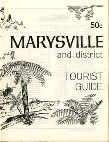 Marysville & District Historical Society
Booklet (Item) - Tourist guide, Ian and Danese Walshe et al, MARYSVILLE and district TOURIST GUIDE, 1982
... black spur motel and caravan park...' store hawthorne's corner shop tudor lodge black spur motel ...A tourist guide outlining services, accommodation, activities and places of interest to visit in and around Marysville and the local district.A tourist guide outlining services, accommodation, activities and places of interest to visit in and around Marysville and the local district.marysville, victoria, australia, tourist guide, marysville hotel, castles' store, hawthorne's corner shop, tudor lodge, black spur motel and caravan park, buxton general store, golden fleece roadhouse, marysville garage, burrengeen park, lake mountain, steavenson falls, nanda binya lodge, alpenglow nursery, black spur inn hotel, silver stream trout farm, mccfarlane's grocery, barton's drapery, marysville newsagency, eildon explorer, beauty spot nursery, crossways, pumpernickel, mckenzie's tourist services, blue hills riding school, mountain view horse hire, pitt's garage, maryton park, j l gould sawmill, eildon deer park, eildon weir, maroondah dam, snob's creek, healesville sanctuary, graceburn park, cathedral range, beauty spot walk, tree fern gully walk, michaeldene track, keppel track, woods lookout track, cumberland scenic reserve, cambarville, the big tree, cora-lyn falls, barton's lookout, cumberland falls, sovereign view, wirreanda festival, scenic motel, tower motel, marylands guest house, kooringa guest house, marylyn guest house, mountain lodge, el kanah, marysville hotel motel, buxton hotel motel, black spur inn, buxton caravan park, marysville caravan park, the cumberland, marysville recreation and fun park -
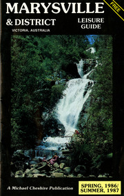 Marysville & District Historical Society
Booklet (Item) - Leisure guide, Michael Chesire & Associates Pty. Ltd, MARYSVILLE & DISTRICT LEISURE GUIDE-SPRING, 1986/SUMMBER, 1987, 1986
... the black spur inn hotel... binya lodge buxton antique and furniture mart the black spur inn ...A free leisure guide to Marysville and the surrounding district published for Spring 1986, and Summer, 1987. This was produced by Michael Cheshire as a free publication to promote tourism in Marysville and the surrounding district. It includes maps of the Big River Valley, Cumberland Valley, Lady Talbot Forest Drive, the Marysville area, and the township of Marysville. It was released in the spring of 1986. A free leisure guide to Marysville and the surrounding district published for Spring 1986, and Summer 1987.Kilmore Historical Society *10/183 *MDL.1.marysville, victoria, australia, leisure guide, michael cheshire & associates pty ltd, marysville golf club, blackwood lodges, sir colin mackenzie fauna park, lake eildon, fraser national park, yarra valley wineries, marysville coach tours, kooringa, marylands guest house, lady talbot forest drive, wishing well, taggerty river recreation area, athols abbey, phantom falls, keppel falls, the beeches walking track, marylyn guest house, kufstein inn motel, the cumberland, marysville tourist & progress association, marysville newsagency & general store, crossways restaurant & motel, beauty spot walk, tree fern gully walk, michaeldene track, keppel track, woods lookout track, marysville hotel motel, lake mountain ski hire, marysville recreation and fun park, mytanta horseback safaris, upper big river valley, the big culvert, marysville mountain view horse hire, maryton park, amber view holiday lodges, cathedral restaurant, the top shop, tower motel, menzes garage, beauty spot nursery, marysville ski hire, lake mountain ski school, faraway forest, scenic motel, buxton trout farm, marysville hardware, timbertop steakhouse, marysville trout farm, healesville sanctuary, buxton hotel motel, nanda binya lodge, buxton antique and furniture mart, the black spur inn hotel, alexandra, lake mountain, j l gould sawmills pty. ltd., geoffrey pope & associates, marysville crafts & gifts, olde yarra track shoppe, cumberland scenic reserve, tudor lodge road house, fruit salad farm, highwayman's retreat -
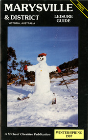 Marysville & District Historical Society
Booklet (Item) - Leisure guide, Michael Chesire & Associates Pty. Ltd, MARYSVILLE & DISTRICT LEISURE GUIDE-WINTER/SPRING 1987, 1987
... the black spur inn hotel... mart the black spur inn hotel alexandra lake mountain j l gould ...A free leisure guide to Marysville and the surrounding district published for Winter and Spring, 1987. This was produced by Michael Cheshire as a free publication to promote tourism in Marysville and the surrounding district. It includes maps of the Big River Valley, Cumberland Valley, Lady Talbot Forest Drive, the Marysville area, and the township of Marysville. It was released in the winter of 1987. A free leisure guide to Marysville and the surrounding district published for Winter and Spring, 1987.marysville, victoria, australia, leisure guide, michael cheshire & associates pty ltd, marysville golf club, blackwood lodges, sir colin mackenzie fauna park, lake eildon, fraser national park, yarra valley wineries, marysville coach tours, kooringa, marylands guest house, lady talbot forest drive, wishing well, taggerty river recreation area, athols abbey, phantom falls, keppel falls, the beeches walking track, marylyn guest house, kufstein inn motel, the cumberland, marysville tourist & progress association, marysville newsagency & general store, crossways restaurant & motel, beauty spot walk, tree fern gully walk, michaeldene track, keppel track, woods lookout track, marysville hotel motel, lake mountain ski hire, marysville recreation and fun park, mytanta horseback safaris, upper big river valley, the big culvert, marysville mountain view horse hire, maryton park, amber view holiday lodges, cathedral restaurant, the top shop, tower motel, menzes garage, marysville ski hire, lake mountain ski school, faraway forest, scenic motel, buxton trout farm, marysville hardware, timbertop steakhouse, marysville trout farm, healesville sanctuary, buxton hotel motel, nanda binya lodge, buxton antique and furniture mart, the black spur inn hotel, alexandra, lake mountain, j l gould sawmills pty. ltd., geoffrey pope & associates, marysville crafts & gifts, olde yarra track shoppe, cumberland scenic reserve, tudor lodge road house, fruit salad farm, highwayman's retreat, beauty spot display gardens & nursery, ski lake mountain cross country ski hire & kitchen, buxton store, valley view marysville, acheron way, mt donna buang road, snow gum woodlands, alpine ash forests, mountain ash forests, stringybark forests, messmate forests, manna gum forests -
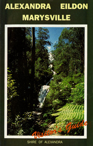 Marysville & District Historical Society
Ephemera (Item) - Visitor's Guide, Shire of Alexandra, ALEXANDRA EILDON MARYSVILLE Visitor's Guide, Unknown
... black spur roadhouse... green galleries marysville black spur roadhouse black spur motel ...A tourist guide for Alexandra, Eildon and Marysville produced by the Shire of Alexandra.A tourist guide for Alexandra, Eildon and Marysville produced by the Shire of Alexandra.alexandra, eildon, marysville, victoria, australia, tourist guide, steavenson falls, blackwood lodges, marysville hotel motel, the cumberland, gallery restaurant marysville, marysville gallery, cross country ski hire, marylyn guest house, marylands guest house, marysville crafts & gifts, hearts of oak antiques, geoffrey pope & associates, cedron house marysville, amber view holiday lodges marysville, marysville ski hire, lake mountain ski school, fruit salad farm, taggerty general store, arbor green galleries marysville, black spur roadhouse, black spur motel & caravan park, marysville caravan park, the hermitage narbethong, danish coffee garden, maryton park, buxton trout farm, lake mountain outdoor centre marysville, australian bush pioneer's farm, the camel farm and zoo buxton, marysville mountain view horse hire, marysville golf and bowls club, yarrolyn holiday park taggerty, riverland lodge taggerty, beauty spot walk, tree fern gully walk, michaeldene track, keppel track, woods lookout track