Historical information
Mount Bogong located in the Alpine National Park and part of the Victorian Alps of the Great Dividing Range, is the highest mountain in Victoria, Australia, at 1,986 metres (6,516 ft) above sea level. The Big River separates the massif of the mountain from the Bogong High Plains to the south. From the nearby town of Mount Beauty to its summit, Mount Bogong rises more than 1,600 metres (5,200 ft), thus making it one of the highest peaks in Australia not only in terms of its elevation above sea level, but also in terms of actual base-to-summit prominence. Mount Bogong is a popular backcountry skiing mountain through winter but only has snow for the mid winter-spring months. It is around 30 kilometres (19 mi) by road and walking track or 12 kilometres (7.5 mi) direct to Mount Beauty. Falls Creek and Mount Hotham ski resorts are also nearby. Camping is relatively safe below the tree line but the summit ridgeline is very exposed. Emergency shelter is also available at Bivouac Hut on the Staircase Spur, and at Cleve Cole, above Camp Creek on the broad ridge to the south of the summit, and Michells Hut on the Eskdale Spur.
Significance
Mt Bogong is a popular recreational venue in the Kiewa Valley for back country skiing and bush walking and is a favourite with sightseers and popular subject for photographers
Physical description
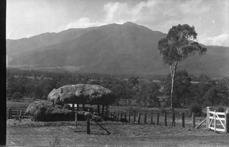
Black and white photograph of Mt bogong taken from Tawonga - Thursday May 6th, 1937
Inscriptions & markings
Handwritten on back of photograph. Thursday May 6th, 1937. Mt Bogong Tawonga