Showing 695 items
matching forest creek
-
 Bendigo Historical Society Inc.
Document - BARBARA MAMOUNEY COLLECTION: COPY OF PRINTED PAGE
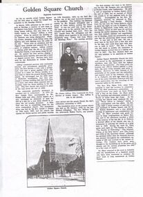
... to the district was Reverend Mr Symonds who was stationed at Forest Creek... to the district was Reverend Mr Symonds who was stationed at Forest Creek ...Photocopy of a published page, marked as Eightieth Anniversary, relating to records as showing Golden Square as the first place in the Bendigo area at which the gospel was preached. On arriving from South Australia in 1852, attracted by the news of gold in the area James Jeffrey widely known later as Jimmy Jeffrey, a preacher who noticed that the sanctity of the Sabbath was being ignored, with normal chores and entertainment being the order of everyday. In short, little regard was shown for religion and there were no ministers. With a tree stump as his pulpit Jimmy began service by singing a Methodist hymn heartily, attracting a band of diggers to listen, with continuous services in Golden Square taking place ever since. Jeffrey continued with similar activities with increasing interest and attendances. Beginning with a tent surrounded by a fence a disused shed was bought and relocated to the site and was the finest building in the district. Late in 1852 the first real Church was erected in place of the shed and the tent. Enthusiasm and numbers of attendees swelled and in 1859 Reverend Joseph Dare and Robert Lisle and other church leaders purchased land (for 30 pounds) and had the foundation stone for a new Church building was laid by Reverend Daniel J.Draper on19th of April 1859 with Divine Service and Public Worship conducted from 11th December that year by Reverend Mr Draper. A collection on the day raised 262 pounds. The foundation stone for the present Church was financed by Richard Allingham laid on 5th January 1870. The first minister who went to the district was Reverend Mr Symonds who was stationed at Forest Creek near Castlemaine. Reverend Richard Hart was the first minister stationed at Golden Square. Embedded in the article is an image of Jimmy and Mrs Jeffrey. On the reverse of the article is a copy of a drawing by Reverend Aswel Aptel circa 1853.fra margolden square methodist church, wesleyan church, mamouney, church, richard allingham reverends jimmy jeffrey, william robert lisle robert draper, william taylor, symonds, j dare, chapman, hilson t raston, richard hart, wm shaw. g a pethard, robert saunders. reverse side a sketch of the church circa 1853 by aswel aptel. james cox (sec) mrs foot (teacher). -
 Federation University Historical Collection
Image, Robert Malachy Serjeant
... made his way to Forest Creek (near Castlemaine) and he and his... made his way to Forest Creek (near Castlemaine) and he and his ...ROBERT MALACHY SERJEANT (1828-1902) Robert Malachy Serjeant was born on 21 December 1828 at Callington, Cornwall. He was the son of Philip Davey Serjeant, a surgeon in the Royal Marines, and Eliza Malachy. Philip Serjeant died in 1834. His mother, Eliza, remarried John Burgh in 1836. He died in 1837. In September 1848 Eliza, Robert and his two sisters, Caroline and Susan, departed Plymouth on the William Moneya for Port Adelaide and arrived in January 1849. Once gold was discovered in Victoria, Serjeant made his way to Forest Creek (near Castlemaine) and he and his mate Mr Victor, were the first party to sink through the basalt in search of a deep lead. In 1854 he moved to Ballarat to work as a miner and enjoyed some success. In 1855 he was with a group that discovered a 500 ounce nugget. With his share of the sale he set himself up with the latest mining equipment, as well as beginning a lifelong interest in the share market. He became the Manager of the Chryseis, Isis and Garibaldi claims and then the Manager of the Band and Albion Consol Company. He held the position for thirty years and only resigned when the company amalgamated with the Sir Henry Loch Mine. Robert Malachy Serjeant became interested in Politics. The first election for Parliament Representatives for Ballarat was in 1855. Robert stood for election for the first time in 1859, representing Ballarat West. He was also elected to represent Ballarat West in 1874 and 1880. Robert Serjeant’s community involvement extended to Education. Years of discussion eventually saw the development of the Ballarat School of Mines, the first school of mines in Australia. The inaugural School Council was formed in 1870 with Sir Redmond Barry, the Chief Justice, as President and Robert Malachy Serjeant as a member of the council. He held a position on the council until illness forced him to retire in 1889. He was elected a Life Governor in 1889. He was also a Life Governor of the Ballarat Hospital. Robert Serjeant showed Prince Albert and Prince George (later King George V) around the Band and Albion Mine. At the age of 42, Robert enrolled as a student at the School of Mines in 1871. He obtained a Certificate of Competency in Assaying (including Metallurgy) in 1875. The first certificate in “Geology as Applied to Mining” was awarded to Robert Serjeant in 1876. Robert Serjeant was an active and generous supporter of the School of Mines. As well as being a financial contributor, he lectured and examined in the Principles and Practice of Mining. He was regarded as an authority on alluvial and quartz mining and was a member of the Ballarat Local Court and mining board. In 1977 Robert, Joseph Flude and Henry Caselli donated the patent rights of a novel Pyrites furnace to the school. The R.M. Serjeant Scholarship at the Ballarat School of Mines resulted after a reward was offered for the first to produce the best method of treating auriferous ores – other than the smelting method. The offer was open for two years but not awarded. The money for this was donated by Robert Serjeant to the amount of 256 Pounds. It was then used to fund the School of Mines Scholarship in Engineering (1889). It was first awarded in 1922. Robert Malachy Serjeant died on 25 October 1902 and was buried at the Ballaarat Old Cemetery. (Sometimes Malachy is incorrectly written as Malachi)Two photographic portraits of mine manager Robert Malachy Serjeant. Both portraits were purchased by the donor from the State Library of Victoria. robert malachy serjeant, r.m. sergeant, robert malachi serjeant, band of hope and albion consols -
Federation University Historical Collection
Photograph - Image, Yarrowee Hall, Redan, c1883
... to Forest Creek (near Castlemaine) and he and his mate Mr Victor... in Victoria, Serjeant made his way to Forest Creek (near Castlemaine ...ROBERT MALACHY SERJEANT (1828-1902) Robert Malachy Serjeant was born on 21 December 1828 at Callington, Cornwall. He was the son of Philip Davey Serjeant, a surgeon in the Royal Marines, and Eliza Malachy. Philip Serjeant died in 1834. His mother, Eliza, remarried John Burgh in 1836. He died in 1837. In September 1848 Eliza, Robert and his two sisters, Caroline and Susan, departed Plymouth on the William Moneya for Port Adelaide and arrived in January 1849. Once gold was discovered in Victoria, Serjeant made his way to Forest Creek (near Castlemaine) and he and his mate Mr Victor, were the first party to sink through the basalt in search of a deep lead. In 1854 he moved to Ballarat to work as a miner and enjoyed some success. In 1855 he was with a group that discovered a 500 ounce nugget. With his share of the sale he set himself up with the latest mining equipment, as well as beginning a lifelong interest in the share market. He became the Manager of the Chryseis, Isis and Garibaldi claims and then the Manager of the Band and Albion Consol Company. He held the position for thirty years and only resigned when the company amalgamated with the Sir Henry Loch Mine. Robert Malachy Serjeant became interested in Politics. The first election for Parliament Representatives for Ballarat was in 1855. Robert stood for election for the first time in 1859, representing Ballarat West. He was also elected to represent Ballarat West in 1874 and 1880. Robert Serjeant’s community involvement extended to Education. Years of discussion eventually saw the development of the Ballarat School of Mines, the first school of mines in Australia. The inaugural School Council was formed in 1870 with Sir Redmond Barry, the Chief Justice, as President and Robert Malachy Serjeant as a member of the council. He held a position on the council until illness forced him to retire in 1889. He was elected a Life Governor in 1889. He was also a Life Governor of the Ballarat Hospital. Robert Serjeant showed Prince Albert and Prince George (later King George V) around the Band and Albion Mine. At the age of 42, Robert enrolled as a student at the School of Mines in 1871. He obtained a Certificate of Competency in Assaying (including Metallurgy) in 1875. The first certificate in “Geology as Applied to Mining” was awarded to Robert Serjeant in 1876. Robert Serjeant was an active and generous supporter of the School of Mines. As well as being a financial contributor, he lectured and examined in the Principles and Practice of Mining. He was regarded as an authority on alluvial and quartz mining and was a member of the Ballarat Local Court and mining board. In 1977 Robert, Joseph Flude and Henry Caselli donated the patent rights of a novel Pyrites furnace to the school. The R.M. Serjeant Scholarship at the Ballarat School of Mines resulted after a reward was offered for the first to produce the best method of treating auriferous ores – other than the smelting method. The offer was open for two years but not awarded. The money for this was donated by Robert Serjeant to the amount of 256 Pounds. It was then used to fund the School of Mines Scholarship in Engineering (1889). It was first awarded in 1922. Robert Malachy Serjeant died on 25 October 1902 and was buried at the Ballaarat Old Cemetery. (Sometimes Malachy is incorrectly written as Malachi)An copy of a photo of Yarrowee Hall, the home of of mine manager Robert Malachy Serjeant. robert malachy serjeant, r.m. sergeant, robert malachi serjeant, band of hope and albion consols, yarrowee hall, redan -
 Department of Energy, Environment and Climate Action
Washington Winch - identification Plate
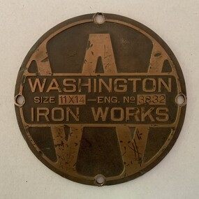
... The Washington Winch sits deep in the forest east of Swifts...The Washington Winch sits deep in the forest east of Swifts ...The Washington Winch sits deep in the forest east of Swifts Creek and is the last one of its particular type left in Australia. It was made by the Washington Iron Works company in Seattle. This unique winch was one of two machines imported in 1920 to operate in the Karri forests of WA. Both machines were later purchased by the Forests Commission after the 1939 bushfires for salvage logging at Toorongo to drive elaborate "high lead" cable systems. This particular machine was later sold to Jack Ezard from Swifts Creek in 1959 where it operated on its current site until about 1961. The fate of the second machine is unknown. It was possibly cannibalised for parts. The Ezards were innovative sawmillers who introduced high lead logging into Victoria. They had owned and operated sawmills in the Warburton area from 1907, before shifting to Erica in Gippsland in 1932. Bulldozers and powerful logging trucks eventually made steam and the Washington Winch redundant. The winch is listed on the State Heritage Register. Only one of its kindBrass identification plate recovered from the Washington Winch near Swifts Creek 21 cm in diameter11 x 14 refers to the double drums The serial number is assumed to be 3832forest harvesting -
Southern Sherbrooke Historical Society Inc.
Typescript|Photograph - copy
... Ground Belgrave c. 1934 shows a forest scene, a creek... Belgrave c. 1934 shows a forest scene, a creek with a large tree ...Single page typescript composed by Jill A'Vard, and single page with four copies of photographs. -Micawber Park Picnic Ground Belgrave c. 1934 shows a forest scene, a creek with a large tree fallen across it, a wooden footbridge, and a man in a hat standing on the bridge. Black and white photo. -Micawber Tea Rooms Belgrave shows a group of two men and two women standing on the verandah of a building which bears the signs "Refreshments", "Hot water" and "Micawber Tea Rooms". Black and white photo. -Ted & Lil A'Vard sitting in their lounge room at Micawber Park c. 1935 shows a middle-aged couple in armchairs in front of a brick fireplace. The mantelpiece holds several items including a clock. Behind the woman, on the right side, is a wooden stand with a green vase holding an arrangement of autumn-coloured flowers and foliage. The man is holding a book and there is possibly a dark dog at the woman's feet. Black and white photo which has been coloured in the top right corner (flower vase and edge of mantelpiece). -Alf & Maggie A'Vard's "The Valley" is a Rose Series postcard P. 1488, showing a house in a forest setting with a group of people on the verandah.albert a'vard, a'vard family, micawber park, alf a'vard, the valley -
Federation University Historical Collection
Document, Zelda Martin, Central Victorian Goldmining towns - Boom Towns or Ghost Towns?, c1996
... , Inhabitants, and Miners of Castlemaine; Inhabitants of Forest Creek..., and Miners of Castlemaine; Inhabitants of Forest Creek; Inhabitants ...Zelda Martin was a PhD candidate at the University of Melbourne.[.1] 4th item in light blue display book titled Research Approach/Overview of Chapters/Confirmation of Canditure/Chapters1,2,3&4 of proposed thesis. *Twenty-seven page article on Victorian goldfields towns titled: Central Victorian Goldmining Towns - Boom Towns or Ghost Towns. The article was written during the author's PhD study. It outlines the context methodology, and resources and the chapters of the proposed thesis: (1) Central Victorian Goldmining Towns - The Context (2) Contemporary Views of the Factors Necessary for Town Growth (3) Outward Manifestations of Town Growth (4) The Trappings of Government (5-9) The Main Towns and Their Hinterland. [.2] 5th item in Light Blue display book as above item. *Chapter 1 of proposed thesis titled 'Pick, Shovel and Tin Dish Mining.' Covers in Section A: Central Victoria - Pre 1851: Aborigines in Central Victoria, Squatters, and Government. Section B: The years 1851-1854: The Early Gold Rushes, Government Reaction, Township Surveys, Legislation, Town Development, Local Government and Early Settlement. [.3] 6th item in Light Blue display book as above item. *2A of proposed thesis titled 'Contemporary Views of the Factors Necessary for Town Growth'. Similar information to Chapter 1 plus extra re towns and maps. Sections: Introduction, Context of Place - Geographical Towns Listed, The Context of Time - Pre1851 Aborigines, Governance of Port Phillip, The Squatters, The Villages of Central Victorian Highlands, Conclusion, Condensed Version of Chapter2B. [.4] 7th item in Light Blue display book as above item. *Chapter2B of proposed thesis. Sections: Area of Research, Schools, Banks, Newspapers, Progress Association, Town Development - Sandhurst (Bendigo), Ballarat, Castlemaine,, Maryborough, Ararat and Stawell. [.5] 8th item in Light Blue display book as above item. *Chapter 3 of proposed thesis titled 'Outward Manifestations of Town Growth'. Sections: Introduction, Contemporary Writing, Educationalists, The Bankers, The Townsfolk, Current Theory, General Theories of Urban Development, and Conclusion. [.6] 9th item in Light Blue display book as above item. *Chapter 4 of proposed thesis titled 'Trappings of Government' Sections: Introduction, Early Government Attitudes to Mining and Town Development, Law and Order, Township Surveys, Legislation, Local Government, Transport and Communication, The People and Lobbyists. [.7] 10th item in Light Blue display book as above item. *'The Rise and Fall of Central Victorian Goldmining Towns'. Includes a map showing main Goldfields, a table showing towns and villages at two points in time - 1857 and 1871; a Bibliography of Primary and Secondary Sources. [.8] Resource No1. Black display book titled Local Towns 1 : Alma: *Brief history *Directory *Maps Amphitheatre / Mountain Hut: *Brief History Post Office Directory Ararat: *Brief History *Post Office Directory 1869 - Alphabetical Listing by Occupation *Ararat - Prominent Citizens of 1858 *Langi-Morgala Museum Avoca: *Brief History *Excerpts from 'Avoca The Early Years', Margery and Betty Beavis; pg1 - Beginnings; pg11 - The Midas Touch; pg25 - Local Gold Escorts; pg27 - A Town is Born; pg51- The Administration of Justice; pg53 - The Ways of the Law; pg61 - News of the Day; pg65 - A Time to Play; pg72 - Land Ownership *Post Office Directory (Bailliere's) 1869 *Tourism Map and Information of area *Historic Avoca - A 5.5km Tour *Avoca & the Pyrenees Region - information pamphlet Ballarat: *Early History of Ballarat - Ballarat Historical Society, Publication No.1: origin of the name; Ballaarat - the Beginning; Fabulous Yields from the Ballaarat Goldfield; *Streetscape Lydiard Street. *Hand drawn map showing Leigh River, Old Portland Bay Road, plaque on road to Colac; etc. *Newspaper article re 'The Theatre Royal' ( which stood in the vicinity of the current Owen Williams store) - 'The News'15/04/1998 *Article - 'Ballarat's Mechanics' Institute Lives On' Ballarat Courier, 14/09/1985 *Article - Standing the Test of Time' The News 17/11/1993 re The Mechanics Institute & picture of the Reading Room *'Ballarat a Study of a City, Phyllis Reichl, pub. Nelson, 1968; no.3 place, time and people field studies series *Investigator Vol.33 No.2, 1998 Geelong Historical Society. Article on pg75 describes Ballarat in 1861 *Folded poster - 'Ballarat 100' a history of telegraph communication, pub. Telecom. Beaufort (Fiery Creek): *Brief history *Post Office Directory [.9] Resource No.2 Black Folder Titled Towns cont.No2 Bendigo (Sandhurst): *'Family & Local History at the Bendigo Library - 1851-2001 150 years of gold'. *Bendigo Government Camp in 1853 illustration; key to sketch and names of Government officers stationed there *Excerpts from 'Bendigo and Vicinity' Adolph Haman *The Bendigo Goldfield Registry - pgs 1-7 Introduction *Excerpt: 'Breaking the Grip' *Excerpt: The Most Go-Ahead Place *Excerpts from 'History of Bendigo' - anti license agitation; laying out of town; proposed railway; gold calls and dividends; the Sandhurst Municipality; journalism *Bibliography Blackwood: *Excerpts from 'Aspects of Early Blackwood - The Goldfield, the Landmarks, the Pioneers' Alan J Buckingham and Margaret F Hitchcock, JG Publishing,1980 Buninyong: *A Brief History *Investigator Vol1 No.2 Feb 1966 Geelong Historical Society. Pg3 - Article re gold escort route - Mt Alexander to Adelaide - (see a simple monument on the Western Highway a few miles out of Horsham. Pg 15 - Ballarat Excursion - re the finding of gold. *Three articles published by Buninyong and District Historical Society Inc: (Magpie Exploration; Finding Gold In The Green Hills; Magpie Exploration; Burnt Bridge to Cargarie to Mt Mercer) *Copies of newspaper articles/items *Buninyong Street Directory Carisbrook: *In the Beginning There Was Carisbrook *The History of the Carisbrook Racecourse Carngham / Snake Valley: *Brief History *Directory Castlemaine: *Directory 1865-1866 - Alphabetical and Street *Poster - Castlemaine A Contemporary Guide "The Great Centre" 1866 - A Contemporary Guide to the Fascinating Past *Pamphlet - Castlemaine District Community Hospital *Map - Castlemaine, Maldon & Surrounding Districts *Map and Information - The Dry Diggings Track - a 55kl walk among historic goldfields relics ( Castlemaine Fryerstown Vaughan Mt Franklin Hepburn Daylesford) *Postcard - Former Court House *Directory 1867 - Alphabetical, Trade [.10] Resource No.3 Grey folder Titled Towns 3 Creswick to Maryborough Creswick: *Brief History *Booklet - "Creswick Cemetery Walk" *Booklet - The Buried Rivers of Gold Heritage Trail Creswick *Creswick Historical Museum Information Sheet *Chronological History of Creswick *Alphabetical Directory of the Borough of Creswick *Creswick's Creek Directory 1856 *Historic Creswick Walking Tour *A Brief Account of the Schools of Creswick - Past and Present *100 Years of Railway Travel in Creswick *The Berry Deep Leads *The Spence Home at Jackass Gully in the Creswick State Forest ( William Guthrie Spence - Pioneer) *The New Australian Mine and the 1882 Disaster *Creswick District News, Issue 7, July August 1999 *The Creswick Miners Walk - Information and Map *Maps Chewton: *Brief History *Directory Clunes: *Brief History *Clunes Street Directory Daylesford: *Brief History *Notable Bushfires in Daylesford District Over More Than a Century - "Black Thursday" 1851; 1862; 1899; the Disastrous Hepburn Fire of 1906; 1939; 1944; 1969. *Post Office Directory -Daylesford and Hepburn Dunolly / Inkerman: *Brief History *Directory *Pamphlet - Goldfields Historical Museum *Pamphlet - Historic Dunolly - Victoria's Best Kept Secret *Map of Gold Workings at Dunolly Area - showing where the main gold rushes occurred *Brief History - Inglewood *Directory - Inglewood - Name Occupation, Dwelling Kingower: *Brief History *Directory - Name / Ocupation / Dwelling Linton / Happy Valley / Piggoreet: *Brief History *Directory - Lintons McIvor: *"A History of the Shire and the Township of Heathcote" by J.O. Randell Majorca: *Brief History *Official Post Office Directory 1869 - Name / Occupation/ Address Maldon (Tarrangower): *Brief History Part 1 *Brief History Part 2 *Post Office Directory *List - Alphabetical Order by Names plus Business and Trade (Tarrangower Times Oct/1858) *List - Alphabetical Order by Trade plus Name and Business *Directory - Name / Occupation / Dwelling Maryborough: *Worsley Cottage - built by Arthur Worsley, a contractor in stonework in 1894 [.11] Resource No. 4 Blue Display Book titled Towns 4 Moliagul to Stawell Moliagul: *Brief History *Moligul Legislative Assembly (Voting?) List - Names and Occupations *Moliagul Victorian Post Office Directory 1868 - Name / Ocupation / Address / Comments *"The Welcome Stranger" gold nugget *The Sunday School *The Welcome Stranger Discovery Walk - information and map Moonambel (Mountain Creek) Redbank *Brief History *List of names extracted from advertisments of the Pioneer and Mountain Creek Advertiser 16/02/1861. *Bailliere's Directory 1869 - Alphabetical List of Name / Occupation / Place St Arnaud: *Brief History Sebastapol: *Brief History *Directory 1869 - Alphabetical by Name; plus occupation and address. Browns and Scarsdale: *Brief History *Browns Street Directory - Name and Occupation Smythesdale: *Brief Description *Smythesdale Street Directory -Name and Occupation Stawell (Pleasant Creek) *Brief History *Victorian Official Post Office Directory - Name /Occupation / Dwelling *Chronology - 1841-1920 *Production of gold statistics - 1879 - 1900 *Big Hill *Extracts from "The Golden Years of Stawell". Chapt 1 - Stawell's Coming Out. Capt. 2 - The Gold Rush. Caapt.3 - Cradle of Democracy. Chapt.4 - The Reefs Becomes Stawell. Chapt. 5 - Rushing In. Chapt.6 - The Pioneers. Chapt 7 - The Decade of Optimism. [.12] Resource No. 5: Blue Display Book titled 'Towns Steiglitz to the The Golden Triangle. Steiglitz: Brief History Victorian Post Office Directory 1869 *Map of Steiglitz *List of maps relevant to Steiglitz history *Information 6 tables of data from "Reports of Mining Surveyors Talbot (Back Creek) Brief History Taradale: Post office Directory 1869 - Name/Occupation/Street. Also list in alphabetical order by Occupation Taradale *Chronological Reference to Taradale Mines *Water - The Coliban System of Waterworks *Joseph Brady *The Syphon Tarnagulla (Sandy Creek) *Brief History *Tarnagulla Businessmen Cameos to give depth to advertisments in 'The Tarnagulla Courier' various issues 1864-1871 *Directory - Name/Occupation /Address *List - Name/Business/Trade Wedderburn (Koorong) *Brief History *List - Name/Occupation The Golden Triangle: *The Early Rushes - Wedderburn / Moliagul / Sandy Creek - Tarnagulla / Jones Creek - Waanyarra / Kingower / Dunolly - Goldsborough / Inglweood *Census of 1857 - Population / Occupations *1858-1871 - A Time of Consolidation- Wedderburn / Moliagul / Sandy Creek- Tarnagulla / Arnold *Census 1871 - Population *Information gleaned from the census data - Demographics / Population / Occupations / marital / Birthplace / Religion / Literacy/ Occupation and Housing Cameos *Graphs - Birthplace of settlers /Male-Female Ratio / Married males / Children under 15 as Percentage of Population / Religion *Census 1857 - Statistical data *Maps *Bibliography [.13] Resource No. 6 - Black Display Book Information and Research in Central Victoria including: *Banking - Research from ANZ Bank Archives *Institutions - also includes articles listed from the Ballarat Times Newspaper *Australian mining History Association - A.M.H.A. Bibliography *Australia's Mining History * Bibliography - Land Surveys Victoria - *1853 Administration (Statistics and Other) includes: schools / ministers of religion / police / military / local administration / licences for sale of spirits / distances between various Victorian gold fields. * Victoria Government Gazette (Copy) - N0. 116, 12/12/1854 includes: Gold Felds Commission of Enquiry & No. 85, 15/09/1854 - Addresses presented to the Lieutenant Governor (Sir Charles Hotham) during his tour through the Gold Fields of Victoria,1854. Addresses on behalf of : the people of Bendigo; Members of the Church of England, Bendigo; Members of the Wesleyan Church on the Bendigo Gold Fields; Bendigo Gold District General Hospital; the Bendigo Prospecting Association; Committee of the Bendigo Local Exhibition; Bendigo District Medical Association; Coloured Americans Resident at Bendigo; German Inhabitants of Bendigo; Landowners, Inhabitants, and Miners of Castlemaine; Inhabitants of Forest Creek; Inhabitants of Heathcote and Gold Miners of McIvor; Residents and landholders of the District of Bacchus Marsh; Inhabitants of Kilmore and Vicinity. *Gold Fields Correspondence 1853: letter from Lieutenant Colonel Valiant, (Officer commanding the Troops in Victoria) to the Lieutenant Governor re threatened disturbance at Sandhurst (Bendigo) regarding the Gold License Fee. * Extracts from a book "Victoria" re Gold Fields Commission of Enquiry involving mainly Ballarat and Castlemaine and a chapter titled 'A Tour to the Victorian Gold-Fields' *Lists of central Victorian newspapers - listed by date published 1851to 1874; by first date available to State Library. *A list of cities and towns showing County, population in 1861 &1871, and municipal status. [.14] Resource no.7. Black display book. *Reference: Papers presented to Parliament Victoria - 1859-1860 4 volumes - relevant sections copied. Contains information on Branches of Government. General / Finance / Gold / Gazette / Commission and Warrant / Statistic. *Gold Fields Act. In accordance with the Act the gold fields are divided into six districts - Ballaarat, Castlemaine , Sandhurst, Avoca, Ararat, and Beechworth.. Official staff in each gold district consists of a Resident Warden, Wardens, Wardens' Clerks, Bailiffs, Chinese Protectors, Chinese Interpreters, and Mining Surveyors. *Gold Receiver *Gaols *Police magistrates and Clerks of Petty Sessions, etc. *Field Branch *Immigration and Emigration Overland - Chinese - 1859 *Population on the Goldfields *The Geological Survey - The Government Geologist is assisited by staff from four branches - the office Branch; the Publishing Branch; the Field Branch and the Museum Branch. *Commission to Enquire Into Sludge dated 10/02/1859 (Some sections copied) - Report to the Honorable Chief Commissioner of Public Works, Melbourne re the mode of carrying the sludge from the puddling mills in Sandhurst without interfering with the drainage of the town and the roads in the neighbourhood. [.15] Resource No.8: Camel display book titled Resource No. 8. Aborigines *Lists of book titles - +"Readings in Victorian prehistory" +"The Aborigines of Port Phillip" +Aboriginal languages and clans" +"A History of the Port Phillip District" +"Langi Ghiran 1: Aboriginal Rock...." +"Koorie History: sources for aboriginal studies in the State Library of Victoria", ed. Tom Griffiths, Melb. Friends of the State Library, 1989 +"The Public Lands of Australia Felix"; settlement and land appraisal in Victoria1834-91 with special reference to the Western Plains", J.M.Powell, Melb. Oxford University Press 1970 +*Bibliography of the Victorian Aborigines' from the earliest manuscripts to 31st December 1970, Massoa, Aldo, Melb. Hawthorn Press, 1971 +"Aborigines in Colonial Victoria, 1836-1886", M.F. Christie, Sydney University Press, 1979 +"Urban and Industrial Australia: readings in Human Geography" ed J.M. Powell, Melb. Sorrett Pub. 1974 *Extracts: -Processes of Pioneer Settlement - The Squatting Occupation of Victoria, 1834-60. J.M. Powell -Areal Variations in the Class Structure of the Central-Place Hierarchy. P. Scott - Volume1 and Volume 2: Notes Relating to the Habits of the Natives of Other Parts of Australia and Tasmania. Compiled from various sources for the Government of Victoria by R Brough Smyth. John Curry, O'Neil, Melb. 1st pub. Melb. 1876. p31-45 - Numbers and Distribution of the Aborigines in Victoria -Victorian Aborigines 1835-1901 - A Resource Guide to the Holdings of the Public Record Office, Victoria; published by the Government Information Centre 1984. *History of the Aboriginal Artefacts Displayed in the Daylesford Museum. F. G. Powell (4 page pamphlet) *Letter to Zelda Martin from Peter Lovett, Cultural Officer, Ballarat & District Aboriginal Co- Operative, 05/02/1997 *Map: Ian Clarke Victorian Tribunal Boundary Map - Clans of Central Victoria. *Victorian Rock Art and Mythology - Article about Mount Langhi Ghiran and myths of the Tjapwarong people. *Two Aboriginal myths relating to the Grampians - 'The Monster Emu' / 'The Aquisition of Fire', by the Aborigines in the Grampians Areas *Article titled (chapter 8) Ballarat - information re camping sites in the region. Lake Wendouree / Lake Burrumbeet (includes a myth) / Mt Bunninyong / Lal Lal / Pitfield / Mount Elephant / Mount Egerton / Meredith / Lake Goldsmith / Lake Learmonth / Ercildoune *Notes on the Aborigines of the Wider Ballarat Region plus European names=Aboriginal names. John Morris 26/07/1995 *Role of Aborigines in Town Development in Central Victoria. Mentions Native Police Force est. in Port Phillip 1842 and Central Board for Aborigines est. 1860 *The Grave of King Billy. (Frank Wilson) Pamphlet. *Camping Places in Central and Northern Victoria. Article re Lake Burrumbeet site. *Programme for the Unveiling of Memorial Cairn for Edward Stone Parker 1802-1865. Note portrait not accurate. Accurate portrait is available in the book "A Successful Failure A Trilogy The Aborigines and Early Settlers", Edgar Morrison, Graffiti Publications, 2002. * Large envelope addressed to Mr G Netherway containing newspaper cuttings regarding the life of Edward Stone Parker, the unveiling of the Memorial Cairn as mentioned above, articles titled 'Episodes from Our Early Days' (Edgar Morrison, Yandoit)- The Black's School, A School At Last and The Final years. Also a typed page titled 'Historical Background to E.S.Parker's Career. Includes an interesting tale titled 'When the cat lay doggo' re laying power leads for the unveiling ceremony at the memorial site. [.16] green display folder titled 'Research Aids' *List of references to Commissioners' & W'ardens' Reports (formerly held at La Trobe Library Archives, now at Public Records Office [PRO]). Indicates town referred to / date of report / name of camp if different to town. * Archive information re Anglican Records *Movement around the Goldfields - Miners and Storekeepers - usefulness of newspapers in providing information - areas covered - Castlemaine, Maldon, Ararat, Stawell, Tarnagulla, Dunolly. *Port Phillip /Victoria Directories 1839/1867 - Chronological list of Directories included in this series. *"Notes on the History of Local Government in Victoria" A.W. Greig Melb. University Press 1925 - Photo-copied extract p5-p40. (Source - Deakin University Library) - Introduction by W.Harrison Moore. Section 1 - Development in New South Wales Before Separation. Section 2 - Development in Victoria After Its Separation from New South Wales. Hand written notations: 'roads, markets, and local government 1855 on' ;'opportunity of squatters in parliament' and 'opportunities of matters in parliament p33' * Notes on the Establishment of Surveyor General's Department 1851and Commissioner of Crown Lands and Survey. * Newspaper articles from The Argus, 1849, re the discovery of gold in the Pyrenees region. * Excerpt - a report on schools - A.B.Orlebar, Inspector; re the need for permanent school buildings rather than tents. *Excerpt from - 'Approaches to Urban History', Sean Glynn: The Case for Caution * Except from - 'The Urban Sprinkle', Weston Bate: Country Towns and Australian Regional History *Reference- 'The History of Land Tenure in the Colony of Victoria', John Quick. References the Haines Land Bill, land tenure and Land Leagues. [.17] Light blue envelope folder titled 'Birtchnell's Ballarat, etc. Directory 1862 *Contains various directories for Smythesdale, Buninyong, Clunes, Brown's and Creswick. [.18] Red envelope folder no.2 titled Victorian Gazetteer *Selected pages from 1869 Victorian Gazetteer on A4 paper (with a handwritten note questioning if some pages are from 1868 Victorian Gazetteer as appears to be different sizes - A3 pages.) Information includes locations and descriptions of towns, hotels, banks, communications and populations. (Does not include names, residences and occupations) [.19] Red Envelope folder titled Bailliere's Official Post Office Directory 1868 (or1869 or a mixture of both?) *Preface *Contains a selection of pages of towns highlighted in yellow in the the index *Work on this directory was commenced in 1867. *Information includes: Municipalities - mayors and councilors; lists of towns naming male inhabitants and their occupations. [.20]Yellow manila folder titled Post Grad Seminar Presentation 1996 *Gives some background to Zelda Martin's proposed thesis and why she chose the topic Gold Mining Towns Boom or Bust [.21] A3 display book - No. 1A * A list of 'Relevant Newspapers collected: The Tarrangower Times and Maldon Advertiser (first published 1858) Includes dates 1858-1867. The Mount Alexander Mail. Includes dates 1854-1866 The Tarnagulla Courier. Includes dates from1864-1871 Dunolly and Burnt Creek Express. Includes dates from 1862-1871 * Selection of newspaper pages from The Mount Alexander Mail 1854 to 1856, mostly showing advertisements for businesses and services provided to that community. [.22] A3 display book - No. 1B * Selection of newspaper pages from The Mount Alexander Mail 1857 to 1866, mostly showing advertisements for businesses and services provided to that community. [.23] A3 display book -No. 2 * Selection of newspaper pages from The Tarnagulla Courier 1864 to 1871, mostly showing advertisements for businesses and services provided to that community. [.24] A3 display book - No. 3 *Selection of newspaper pages from The Tarrangower Times (and Maldon and Newstead) Advertiser 1858 to1867, mostly showing advertisements for businesses and services provided to that community. [.25] A3 display book - No.4 * Selection of newspaper pages from The Dunolly and Burnt Creek Express; and The Dunolly and Betbetshire Express 1862 to 1871, mostly showing advertisements for businesses and services provided for that community. [.26] A3 display book - No.5 Includes: * Bryce Ross's Diggings Directory. Includes instructions for using this directory. This directory was used by "all persons having connexion or desiring to communicate with 'working parties, private friends, or Stores at the Diggings." As a directory for each area wwas completed it was published in each month's issue of Bonwick's "Digger's Magazine." Years c1852/1853. This Directory commences first at the head of Forest Creek. Includes a directory for Bendigo and Ballarat. Of interest at the end of the Bendigo and Ballarat directory is a list of the number of storekeepers, butchers, doctors, smiths, eating houses, lemonade sellers and chapels. * The Castlemaine Directory and Book of General Information Comprehending Glass's Model Calendar for the Two Years 1862 and1863. "zelda martin, victorian goldfield towns, bendigo, castlemaine, ballarat, maldon, stawell, ararat, maryborough, creswick, avoca, heathcote, banks, bank of australasia, union bank of australia, government camp, sandhurst, water supply, tarnagulla, talbot, back creek, mountain creek, police court, carisbrook, dunolly, thompson's foundry, charles clacy, anthony trollope, robert cecil, mount alexander, urbanisation, national schools, education, govenrment, industry, railway, transport, settlement, land settlement in central victoria, steiglitz, joseph brady, the new australian mine, berry deep leads, william guthrie spence, creswick state forest, arthur worsley, worsley cottage, the welcome stranger, moliagul, moonambel, redbank, st arnaud, sebastapol, brown's, scarsdale, clunes, chewton, daylesford, bushfires, inkerman, inglewood, kingower, lintons, happy valley, piggoreet, mcivor, majorca, tarrangower, taradale, the coliban system, the syphon, sandy creek, wedderburn, koorong, arnold, jones creek, waanyarra, the golden triangle, census 1857, blackwood, buninyong, durham lead, magpie, carngham, snake valley, alma, amherst, daisy hill, amphitheatre, mountain hut, beaufort, fiery creek, counties, population, gold fields commission of enquiry1854, william westgarth, gold license fee, lieutenant colonel valiant, administration of the victorian gold fields, commission to enquire into sludge 1859, e.s. parker, edward stone parker, edgar morrison, mount franklin protectorate, dja dja wurrung, memorial cairn, franklinford, mt franklin memorial cairn, jajowurrong, dja dja wurung, tjaowarong, wothowurong, assistant protectors, daylesford museum, buluk, rock art - grampians, aboriginal mythology - grampians, aborigines, first nations people, mount franklin, aboriginal artifacts, lake burrumbeet, native police force, central board of aborigines, yandoit, commissioners' reports, wardens' reports, port phillip/victoria directories 1839-1867, local government - victoria 1853/1854, surveyor general's department - 1850's, victorian schools 1850's, a.b.orlebar, haines land bill, william charles haines, wilson gray, land tenure, land leagues, victorian gazetteer, the tarrangower times and maldon advertiser - 1858-1867, the mount alexander mail 1854-1866, the tarnagulla courier 1864, dunolly and burnt creek express 1862-1871, bryce rose's diggings directory, the castlemaine directory 1862-1863 -
 The Beechworth Burke Museum
Animal specimen - Spotted Pardalote, Trustees of the Australian Museum, 1860-1880
The spotted pardalote is the smallest of all Australian birds. It has a tendency to nest in a long horizontal tunnel, often dug into the soil of creek banks, the embankments of railway cuttings, and quarries. Its call is characterised by a very clear and repetitive double "ding". The spotted pardalote is common in woodlands and eucalypt forest areas in Australia. This specimen is part of a collection of almost 200 animal specimens that were originally acquired as skins from various institutions across Australia, including the Australian Museum in Sydney and the National Museum of Victoria (known as Museums Victoria since 1983), as well as individuals such as amateur anthropologist Reynell Eveleigh Johns between 1860-1880. These skins were then mounted by members of the Burke Museum Committee and put-on display in the formal space of the Museum’s original exhibition hall where they continue to be on display. This display of taxidermy mounts initially served to instruct visitors to the Burke Museum of the natural world around them, today it serves as an insight into the collecting habits of the 19th century.This specimen is part of a significant and rare taxidermy mount collection in the Burke Museum. This collection is scientifically and culturally important for reminding us of how science continues to shape our understanding of the modern world. They demonstrate a capacity to hold evidence of how Australia’s fauna history existed in the past and are potentially important for future environmental research. This collection continues to be on display in the Museum and has become a key part to interpreting the collecting habits of the 19th century. One of Australia's smallest native birds, the male spotted pardalotte is covered with small, distinct white spots. Males have a pale eyebrow, a yellow throat and a red rump. Females are similar but have less-distinct markings. 10060 comprises of one male and one female. This specimen stands upon a wooden platform and has an identification tag tied around its legLabel: 14a. / Spotted Diamond Bird / See Catalogue, page 9. /taxidermy mount, cancel, taxidermy, burke museum, beechworth, australian museum, bird, spotted pardalote -
The Beechworth Burke Museum
Audio - Oral History, Jennifer Williams, Mrs Vanessa McDonald, 9 November 2000
Mrs. Vanessa McDonald was born in Beechworth in 1917. Christened, Agnes Bertha Collins, Vanessa changed her name in 1960. Mrs. McDonald's family's connection with gold mining in the district reach back to the first of Beechworth's gold rushes, when her great grandfather, a Dutchman who adopted the name Charles Collins, arrived in 1851-1852. Mrs. McDonald spent her childhood in the isolated hamlet of Stanley, in the area known as 'Little Scotland', where she recalls helping her mother to raise younger siblings, picking apples and walnuts on the family farm, and roaming the hills for wildflowers. As a young woman Mrs. McDonald attended religious and social gatherings in the local community. In 1940 she went to Melbourne to work as a mothercraft nurse during the Second World War. She met her husband at a Beechworth football match and was married at the Stanley Methodist Church in 1941. The gold diggings known as the 'Nine Mile' became the hamlet of Stanley, after the British Prime Minister, Lord Stanley, in 1858. By the late 1850s, Stanley boasted schools, an athenaeum, a church, a weekly newspaper and several hotels and other civic infrastructure to cater for a growing population. The area attracted large numbers of Chinese miners, whose presence was frequently resisted. Like other early Victorian mining settlements, Stanley was a hotbed of political and racial tensions during the gold rush. One side of the Nine Mile Creek was known as 'Little Scotland’, the other, 'Little Ireland'. A number of Christian denominations built congregations and churches in Stanley, including the Church of England, Methodist Church, the Catholic Church, and Presbyterian Church. Stanley became part of the United Shire of Beechworth in 1871. By 1880 timber was being cut and two sawmills were established by 1887. River-dredged gold mining consumed vast amounts of timber from the forests in the area, and in 1931 the first of several softwood plantations began. This oral history recording was part of a project conducted by Jennifer Williams in the year 2000 to capture the everyday life and struggles in Beechworth during the twentieth century. This project involved recording seventy oral histories on cassette tapes of local Beechworth residents which were then published in a book titled: 'Listen to what they say: voices of twentieth century Beechworth'. These cassette tapes were digitised in July 2021 with funds made available by the Friends of the Burke.Following the decline in the mining and associated industries during the early-mid-twentieth century, the Beechworth district experienced a period of general economic decline. On the east side of the Dingle Range, Mrs. McDonald's father, William Henry Collins, felled timber and the family were pioneer apple orchardists. The establishment of apple orchards in Stanley reflects changes to how land was used and contributes to our understanding of the historical development of rural communities following the gold rush. Mrs. McDonald's recollections are significant for understanding family and social life in a small rural town in years leading up to the Great Depression and prior to the Second World War. This oral history recording may be compared with other oral histories and items in the Burke Museum's collection. This oral history account is socially and historically significant as it is a part of a broader collection of interviews conducted by Jennifer Williams which were published in the book 'Listen to what they say: voices of twentieth-century Beechworth.' While the township of Beechworth is known for its history as a gold rush town, these accounts provide a unique insight into the day-to-day life of the town's residents during the 20th century, many of which will have now been lost if they had not been preserved.This is a digital copy of a recording that was originally captured on a cassette tape. The cassette tape is black with a horizontal white strip and is currently stored in a clear flat plastic rectangular container. It holds up 40 minutes of recordings on each side.Mrs Vanessa McDonald /listen to what they say, beechworth, oral history, burke museum, emigration, gold rush immigration, victorian gold rush, mining families, apple orchard, forestry, forest plantation, little scotland, stanley, twentieth century history, regional australia, rural australia, farming, harvest festival, great depression, dingle range, the nine mile, australian wildflowers, high country wildflowers, mothercraft nurse, rural and regional women, social history, collins, mrs. vanessa mcdonald, building community life, shaping cultural and creative life, fruit growers, family history, changes to land use in regional victoria -
 Orbost & District Historical Society
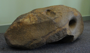
Aboriginal grinding stone, Aboriginal people have shaped this rock through usage, pre-European Australia
This large and very heavy stone was donated by Albert Emphield. Where he found it is unknown, but he worked in the Orbost forest areas and lived at Cabbage Tree Creek.Aboriginal usage, tool manufacture.A large rock of generally oval shape and with a number of flatish surfaces and hole indentations which were identified by archaeologist Dr Joanna Freslov 2.6.2008 as being used by Aboriginal people as a grinding or tool-sharpening stone.aboriginal-grinding-stone -
 The Beechworth Burke Museum
Photograph, 1907-8
The photo from 1907-8 is a sepia print, depicting a small valley with building at base. There are flumes visible above areas of water, trees on hills and a few small cottages on the hillside. Cock's Pioneer Gold & Tin Sluicing Co NZ No 2 Site. The photo was taken of Matthews Gully looking west. Sluicing was undertaken in the area from 1900 to 1942 with some short breaks between these periods. The image depicts a location mined by Cocks Pioneer Gold and Tin Sluicing Company (as recorded on the annotation on the card mount) The Cocks Pioneer Gold and Tin Mines N.L was one of El Dorado's two largest open cut sluicing mines of the 20th Century. The other was named the Cocks El Dorado Gold Dredging Company. The Cocks Pioneer Mines operated from 1901 until 1941 and found a total of 117,378 ounces of Gold and 1,673 tones of tin concentrates over these years. The Cocks company was formed in 1898 and operated until 1941. Open cut sluicing involved the use of high-powered hoses which used the centrifugal sand pump system (known as hydraulic sluicing) which broke down the soil which was then processed for gold and other precious metals. From 1914 , four years after this image was captured, the company reformed to Cocks Pioneer Gold and Tin Mines NL (previously it was known as Cocks Pioneer Sluicing Co) and undertook large scale sluicing operations until 1929 and then 1934-1941. El Dorado is located on Reedy Creek and is surrounded by forested country to the north and east. It is 20 km east of Wangaratta in Victoria's regional north-east. John Cock was the son of a Cornish minor who arrived in El Dorado in 1858. Cock founded his gold and tin mining company which ran successfully for many years in the El Dorado region. It was an open cut sluicing company because of the abandonment of underground mining after this was deemed too dangerous. In 1935 Cock's El Dorado Company commissioned the floating dredge which is still visible in El Dorado today. The dredge was built by the Thompson engineering works, Castlemaine, and weighed over 2,000 tones and today has a place on the Victorian Registers of historic buildings. Interestingly, the name El Dorado does not derive from the gold in the region, but from the Barambogie pastoral run completed by William Baker in 1840-1841. Gold was discovered in El Dorado 1854 but the gold was too deep for individual prospectors to find, it required the use of heavy machinery.The search for gold is ingrained into the history of Victoria and therefore, images like this one which portray an open cut sluicing site can reveal important information for society and technology for the date when the photograph was taken. This image is of important historical significance for its ability to convey information about sluicing and the methods used to find gold in 1910. It also shows a location where sluicing was undertook which provides insight into the impact of sluicing on the environment at a time when it was done. This image is important for current research into the history of El Dorado, a small regional location near Wangaratta in Victoria's North East. Therefore, this image has the capacity to be beneficial for research into society and the motivations of those living and working in this region during this period and therefore, has social significance. The Beechworth Burke Museum has additional images relating to gold sluicing and El Dorado which can be analysed and studied alongside images like this one.Sepia coloured rectangle photograph printed on gloss photographic paper Reverse: 1997. 2613/ A02613/ No2 site/ Matthews Gully/ Cocks Pioneer G&T. ?? Co NZ/ No2 Site looking West/ 1907-8/ (7)sluicing, hydraulic sluicing, 1907, 1908, mining, cock's pioneer gold & tin sluicing co nz, nz, site no 2, matthews gully, west, valley, building, cottages, hillside, trees, water, gold and tin mine -
 The Beechworth Burke Museum
Photograph, 1910 - 1911
This photograph depicts Cock's Pioneer G & T Sluicing site No. 4 in El Dorado. Looking eastwards, the photo captures a wooden and tin building with various mining equipment strewn in the foreground. Underneath the verandah, figures can be seen. These are believed to be a Mr. Hollister (left), Mrs. Breustedt (4th from left), children Min and Chris Breustedt, and Kate Timmons holding a girl's hand. The Cocks Pioneer Gold and Tin Mines N.L was one of El Dorado's two largest open-cut sluicing mines of the 20th Century. The other was named the Cocks El Dorado Gold Dredging Company. The Cocks Pioneer Mines operated from 1901 until 1941 and found a total of 117,378 ounces of Gold and 1,673 tones of tin concentrates over these years. The Cocks company was formed in 1898 and operated until 1941. Open cut sluicing involved the use of high-powered hoses which used the centrifugal sand pump system (known as hydraulic sluicing) which broke down the soil which was then processed for gold and other precious metals. From 1914, four years after this image was captured, the company reformed to Cocks Pioneer Gold and Tin Mines NL (previously it was known as Cocks Pioneer Sluicing Co) and undertook large-scale sluicing operations until 1929 and then 1934-1941. The Cocks Pioneer was an extremely successful mining company during the 20th century. In the Annual Report of the Secretary for Mines for the year 1915, the Cocks Pioneer was the largest producer of gold and tin collecting 5,535 ozs. of gold and £7,500 of tin. Twenty years later in 1935, Cocks Pioneer was still one of the most profitable mines in Victoria, ranking as the second-highest dividend paying mine. The company produced a total of 3,650 kg of gold. El Dorado is located on Reedy Creek and is surrounded by forested country to the north and east. It is 20 km east of Wangaratta in Victoria's regional northeast. John Cock was the son of a Cornish miner who arrived in El Dorado in 1858. Cock founded his gold and tin mining company which ran successfully for many years in the El Dorado region. It was an open-cut sluicing company because of the abandonment of underground mining after this was deemed too dangerous. In 1935 Cock's El Dorado Company commissioned the floating dredge which is still visible in El Dorado today. The dredge was built by the Thompson engineering works, Castlemaine, and weighed over 2,000 tones and today has a place on the Victorian Registers of historic buildings. Interestingly, the name El Dorado does not derive from the gold in the region, but from the Barambogie pastoral run completed by William Baker in 1840-1841. Gold was discovered in El Dorado in 1854 but the gold was too deep for individual prospectors to find, it required the use of heavy machinery.The search for gold is ingrained into the history of Victoria and therefore, images like this one which portray an open cut sluicing site can reveal important information for society and technology for the date when the photograph was taken. This image is of important historical significance for its ability to convey information about sluicing and the methods used to find gold in 1910. It also shows a location where sluicing was undertook which provides insight into the impact of sluicing on the environment at a time when it was done. This image is important for current research into the history of El Dorado, a small regional location near Wangaratta in Victoria's North East. Therefore, this image has the capacity to be beneficial for research into society and the motivations of those living and working in this region during this period and therefore, has social significance. The Beechworth Burke Museum has additional images relating to gold sluicing and El Dorado which can be analysed and studied alongside images like this one.A black and white copy of a sepia coloured rectangular photograph printed on matte photographic paper mounted on boardObverse: COCKS PIONEER G + T SL CO, N.L. / 1910 - 11 / NO 4 SITE LOOKING EAST / 4 Reverse: 1997.2508 / AUG 29 1909cocks pioneer gold and tin sluicing company, el dorado, mining, sluicing, hydraulic mining, hollister, breustedt, timmons, gold, tin, gold rush, victoria -
 The Beechworth Burke Museum
Photograph, 1910
This photograph dating to 1910 depicts an open cut sluicing site located in El Dorado captured looking east up the open cut from the number 3 Barge site. Sluicing was undertaken in the area from 1900 to 1942 with some short breaks between these periods. The image depicts a location mined by Cocks Pioneer Gold and Tin Sluicing Company (as recorded on the annotation on the card mount). It portrays open cut rocks with a crevice in the center of the image where the sluicing was being undertaken. There is a small timber structure on the right of the image which could be an entrance to a mine or supports made of wood to prevent a cave in at the open cut site and above the cut rock there is bush. The timber structure has rail tracks on top of the bridge which could suggest the identification of this structure as a mine entrance. The rail tracks were used for little carts which hauled soil from the mine. The Cocks Pioneer Gold and Tin Mines N.L was one of El Dorado's two largest open cut sluicing mines of the 20th Century. The other was named the Cocks El Dorado Gold Dredging Company. The Cocks Pioneer Mines operated from 1901 until 1941 and found a total of 117,378 ounces of Gold and 1,673 tones of tin concentrates over these years. The Cocks company was formed in 1898 and operated until 1941. Open cut sluicing involved the use of high-powered hoses which used the centrifugal sand pump system (known as hydraulic sluicing) which broke down the soil which was then processed for gold and other precious metals. From 1914 , four years after this image was captured, the company reformed to Cocks Pioneer Gold and Tin Mines NL (previously it was known as Cocks Pioneer Sluicing Co) and undertook large scale sluicing operations until 1929 and then 1934-1941. El Dorado is located on Reedy Creek and is surrounded by forested country to the north and east. It is 20 km east of Wangaratta in Victoria's regional north-east. John Cock was the son of a Cornish minor who arrived in El Dorado in 1858. Cock founded his gold and tin mining company which ran successfully for many years in the El Dorado region. It was an open cut sluicing company because of the abandonment of underground mining after this was deemed too dangerous. In 1935 Cock's El Dorado Company commissioned the floating dredge which is still visible in El Dorado today. The dredge was built by the Thompson engineering works, Castlemaine, and weighed over 2,000 tones and today has a place on the Victorian Registers of historic buildings. Interestingly, the name El Dorado does not derive from the gold in the region, but from the Barambogie pastoral run completed by William Baker in 1840-1841. Gold was discovered in El Dorado 1854 but the gold was too deep for individual prospectors to find, it required the use of heavy machinery.The search for gold is ingrained into the history of Victoria and therefore, images like this one which portray an open cut sluicing site can reveal important information for society and technology for the date when the photograph was taken. This image is of important historical significance for its ability to convey information about sluicing and the methods used to find gold in 1910. It also shows a location where sluicing was undertook which provides insight into the impact of sluicing on the environment at a time when it was done. This image is important for current research into the history of El Dorado, a small regional location near Wangaratta in Victoria's North East. Therefore, this image has the capacity to be beneficial for research into society and the motivations of those living and working in this region during this period and therefore, has social significance. The Beechworth Burke Museum has additional images relating to gold sluicing and El Dorado which can be analysed and studied alongside images like this one.Sepia coloured rectangular photograph printed on gloss photographic paper mounted on board.Obverse: COCKS PIONEER Q + T SL CO, N.L. / 1910 / LOOKING EAST UP OPEN CUT / FROM NO3 BARGE SITE / Reverse: 1997 . 2611 / A02611el dorado, north east gold, sluicing, gold sluicing, hydraulic sluicing, 1910, gold and tin mine, open cut mining, mining, gold mining, north-east victoria, beechworth, burke museum -
 Eltham District Historical Society Inc
Film - Video (VHS), Diamond Creek Fire Brigade, c.1955-1987
Combination of three movie films. Movie One (1950s): 00:00 – 13:14 Black and white footage of Diamond Creek firemen practising in Diamond Street in the 1950s for forthcoming demonstrations of abilities. Mentions of Gordon Brandy and Joe Hislop Running out hoses from old hose reels along Diamond Street, Diamond Creek Displays from various brigades running out and connecting hoses. Also scenes from the 1950s of Diamond Creek Fire Brigade competing in various locations around Victoria and Tasmania. Mentions of Brigade members Dave Kidd, Bruce Hackett, Ron Kirkbride, Jack Marks, Graham Upton who are prominent in these events. Members of Kyneton Fire Brigade also present. Members competing in running out hose reels, connecting hoses togethers and to hydrants then climbing towers to direct water from hose or at a target hanging above the road. Diamond Creek members identified wearing a diamond on their chest and back. Includes scenes of Scottish pipe bands at the events and significant crowds of spectators. Footage of Mel Stone and Beryl Marks, Stan Redpath and Ron Kirkbride, then Ron Kirkbride and Eric Holt viewing flower displays. Film changes to colour at Diamond Creek oval for practice with fire engine entering oval. Members depicted include Bill May, Jack Sinclair, Jim Cox, Bob Beale, Dave Kidd, Bruce Hackett and Captain Clarrie Stone. Reverts to black and white in the 1950s where the Brigade joins forces with the Diamond Valley Community Hospital for a Gala Day on the Diamond Creek Oval. Changes to colour again, possibly same event and scenes of children on bikes and scooters or with prams and carts racing around the oval. Mention of young lad Brian Laurie who has his own fire truck. Dart throwing, pony rides. Scenes with Dr Don Cordner, Gus Lyons, Vic Cohn (?) and spinning wheel and Diamond Creek School children entertain a large crowd with Maypole dancing. Movie Two (1950s): 13:25 – 19:00 This black and white film was taken by a TV film crew in the 1950s depicts a typical call out for the Diamond Creek Fire Brigade. In this case the careless action of a member of the public throwing a lighted match from a car, which can cause extensive damage. Footage features the Shire of Eltham War Memorial tower at Kangaroo Ground before it was modified with a fire spotter’s cabin. Discusses fire spotting operations from the tower. Shows a fire spotter walking around the top of the tower. A fire is detected, and the information is relayed to the nearest fire station, in this case, Diamond Creek. The telephone call is received, and the alarm sounded. Captain Clarrie Stone and firemen May and Shaw leave their workplaces and prepare for action. Scenes of running across the Main Hurstbridge road showing the shops (Shell service station and Chemist prominent). Scenes entering the fire station which has a pictorial warning covering the entire door “Only you can prevent forest fires – If you’re careless – we’re homeless!” Eric Holt pinpoints the location of the fire while Captain Clarrie Stone and Fireman Shaw take note. The advance vehicle (an FE Holden ute, rego GTE-696) leaves to assess the extent of the fire. Having assessed the fire, Fireman Shaw communicates with base showing radio with call sign VL3JZ. Eric Holt takes the call. In the meantime, Captain Clarrie Stone and Fireman Shaw undertake some limited action to address the fire. Firemen Bill May, Jim Bates and Hugh Bar (?) man the tanker. A photo portrait of Queen Elizabeth is visible hanging on the wall. They are later joined by Firemen Jim Cox, Eric DeBuse (?) and Jack Marks. The tanker is seen departing the station and diverging off before the bridge. Captain Clarrie Stone and Fireman Shaw are seen pumping water on the flames with hand pumps when the tanker arrives. The hose is unreeled, and water turned on the flames. Jack Sinclair joins the action. Jim Cox directs water to the high stuff. The fire put out, Jack Marks and Eric DeBuse wind in the hoses and the team head back to town. It’s peaceful again at the memorial tower. Movie Three (1969-1987): 19:14 – 34:34 Colour film “Fired with Dedication”, Country Fire Authority Victoria, produced by I.L. Wadeson, Commentary by A.M. Hem. Credits with CFA Victoria emblem and then placed over a view of an old-style ladder engine. Opens with the scene of a fire engine outside the Diamond Creek Fire Station then various trophies reflecting the competition success of the brigade in various track and disciplined events. Two trophies shown of particular pride to the brigade were for first place in the Torchlight Procession at the State Championships in Mildura in 1986 and also at Swan Hill in 1981. Still photo scenes of ex Captain Clarrie Stone, Brigade Captain for 21 years; ex Captain Jack Marks, 10 years; ex Captain Ian Douglas, 10 years. Cuts to scene of radio control room, January 1969, and news of a fire on the northern side of the township of Diamond Creek. With scenes of flames in bush, the narration explains that until the early 1960s the area was an orchard district which protected the town against the savagery of bushfires. But due to competition from other areas more suitable for orcharding and easier transport to Melbourne the district could no longer remain competitive, and orchards were replaced by grassed areas, which together with the bush areas were a feeding ground for fire. On 8th January 1969, high temperatures and strong north winds, were, with the carelessness of some individual all that was necessary to produce the worst fire the district had seen. Cuts to scene of blackened fields and cattle - Hundreds of hectares of grass land were blackened, and cattle had to be transported to other areas for agistment. Scene of destroyed buildings in the township – 13 houses and the public hall in the town were destroyed as was the theatre equipment which was owned by the fire brigade. The Church of England Hall and bell tower were badly damaged. The whole town could have been burnt out but for the determination, skill, and courage of the Diamond Creek Fire Brigade. Scenes of all that was left of the home on the hill on the west side of the Church of England. Also, the remains of the old Pisy (?) home on the top of the same hill near Lambert Street, and the ruined Crocker home. Cuts to a scene in the mid-1970s to mid-1980s of a house fire in Haley Street attended by the Diamond Creek Fire Brigade. Although the house was severely damaged, it was saved. Mentions that whilst assistance is appreciated, in some circumstances, those doing so are not properly dressed for fighting fires. Breathing apparatus is a must in structure fire attack. Next scene (either on Mangarook or Coventry oval) showing off four Diamond Creek Fire Brigade efficient and very expensive firefighting units. Features a forward control vehicle Toyota 4WD used for conveying task force personnel to the required areas; a Hino Model 3.2 tanker, diesel powered and carries 3,000 litres of water and has a 16 HP petrol driven pump which delivers 900 litres of water per minute; an International tanker (registration TCM-418) which carries 3,000 litres of water with pumping capacity of 600 litres per minute. The Ford diesel powered pumper (registration MXE-754) is a well-equipped vehicle with a water capacity of 1,000 litres and capable of pumping 1,900 litres of water per minute from the main pump, has many lockers which hose equipment such as breathing apparatus and various types of hose nozzles and foam making equipment. The vehicle carries 360m of 64mm diameter hose which can be laid out from the rear lockers and a portable lighting plant, an Oxy Viva resuscitator to revive smoke inhalation victims and forcible entry tools to gain access to structure fires. Views of the main pump and control panel on the vehicle. As well as the main pump, the vehicle is equipped with an auxiliary pump which allows the facility to pump whilst moving. Fire fighters must undergo constant training and hone their skills, Scenes of a training exercise using the pumper to pump from static water. First, the short lengths of suction hose are coupled, a strainer fitted to ensure debris does not foul the pump. Gauges must be constantly monitored to ensure manageable water pressures are maintained. Pressures are normally controlled to allow two fire fighters to work at each nozzle outlet. Two nozzles are tested, one adjustable jet fog type which is used on flammable gasses or within a structure fire to absorb heat. A straight jet nozzle to project water long distances to protect exposed surfaces close to a fire radiated heat. The pumper is quite a versatile vehicle in handling structure fires, but it also carries specialist equipment needed in containing hazardous chemical incidents. Cuts to scene of parade – the Diamond Creek Fire Brigade has with other neighbouring brigades participated in most town fairs and earns the respect of the watching public. It can be seen why this brigade has been so successful at disciplined contests. Views of Plenty Fire Brigade Road Rescue unit which is equipped with the “Jaws of Life” Scenes of athletic competitions – many neighbouring brigades indulge in friendly but keen competition at the Diamond Creek Town Fair. The young are also encouraged to participate in all aspects of Junior Fire Brigade activities and become tomorrow’s generation of volunteer fire fighters. Scene of the 1986 Diamond Creek Town Fair which was the last time veteran Captain Clarrie Stone BEM marched with the brigade. Clarrie was awarded the British Empire Medal for his service to the Country Fire Authority. Also, scenes of vehicles in the parade. Cuts to scene of brigade members in drill formation for inspection by Acting Chief Harry Rothsay (?) on the occasion of the opening of the new fire station extensions on August 29, 1987. Rudy Libel (?) Captain at the time. Scenes of crowds including many dignitaries of neighbouring brigades present including Lieutenant Gordon Grandy (who came down from Queensland for the occasion) and ex-Secretary David Kidd and wife Betty, also ex Captain Clarrie Stone and Mrs Nel Stone, a life member of the Ladies Auxiliary, the Reverend Jock Ryan, son of J.L Ryan, founder of the Diamond Creek Fire Brigade, Foundation Captain of the fire brigade, Keith Bradbury and Mrs Bradbury. Pauline Dick accepts a community service award for services to the CFA. Recognising over 47 and a half years of service, a presentation is made by Mr Neil Marshall, Acting Chairman of the CFA to ex Captain Clarrie Stone with response by Clarrie. Other members of the official party include Cr. Martin Wright, Shire President Wayne Phillips and local Member of Parliament, Mrs Pauline Toner. Ex foreman John Bennett is presented with a life member’s awards by Captain Rudy Libel. The camera also catches Gwen Cox, Jean Ryan and Bessie Layton (?) Provides historic footage of people, places and equipment and a record of the worst fires expoerienced in Diamond Creek in 1969BASF Standard Quality SQ E-180 VHS dubbing (poor quality) of three films Converted to MP4 file format 0:34:38, 1.85GBOn label: "Donation - August 2000 Diamond Creek Unit Old films made up from Fire Brigade shows at competitions - also Kangaroo Ground Tower being used"video recording, diamond creek fire brigade, 1986 diamond creek town fair, a.m. hem, acting chief harry rothsay, athletic competitions, beryl marks, bessie layton, betty kidd, bill may, bob beale, brian laurie, bruce hackett, captain clarrie stone, chemist, church of england hall, clarrie stone, clarrie stone bem, country fire authority victoria, coventry oval, cr. martin wright, crocker home, dart throwing, dave kidd, david kidd, diamond creek, diamond creek fire station, diamond creek oval, diamond creek school, diamond creek town fair, diamond street, diamond valley community hospital, dr don cordner, eric debuse, eric holt, fe holden ute, fire damage – buildings, fire spotter, fire spotter’s cabin, fire station extension, fired with dedication (film), firefighting units, fireman shaw, firemen jim cox, ford pumper, foundation captain, gala day, gordon brandy, gordon grandy, graham upton, gus lyons, gwen cox, haley street, hino model 3.2 tanker, house fire, i.l. wadeson, ian douglas, international tanker, j.l ryan, jack marks, jack sinclair, january 1969, jaws of life, jean ryan, jim bates and hugh bar, jim cox, joe hislop, john bennett, kangaroo ground, kangaroo ground tower, keith bradbury, kyneton fire brigade, lambert street, main hurstbridge road, mangarook oval, maypole dancing, mel stone, mildura 1986, mrs bradbury, mxe754 vic registration, neil marshall, nel stone, orchard district, oxy viva resuscitator, pauline dick, pauline toner mp, pisy home, plenty fire brigade road rescue unit, pony rides, radio control room, reverend jock ryan, ron kirkbride, rudy libel, shell service station, shire of eltham war memorial, shire president wayne phillips, spinning wheel, stan redpath, state championships, swan hill 1981, tcm418 vic registration, torchlight procession, toyota 4wd, trophies, vic cohn, victorian bushfires - 1969, vl3jz -
 Eltham District Historical Society Inc
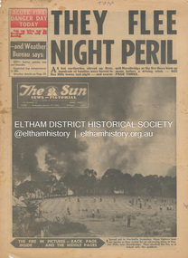
Newspaper - Newspaper articles, Sun News-Pictorial, They Flee Night Peril, The Sun News-Pictorial, Wednesday, January 17, p1, 1962
Various news articles pertaining to the January 1962 Victorian bushfires in the Dandenong and Healesville districts which by the third day had encompassed large areas of the State. Specific Eltham Shire districts mentioned include Panton Hill and Hurstbridge on page 1, Warrandyte on page 2, 3, 4 and 5, Hurstbridge, Smith’s Gully, Kinglake on page 3 and 4, Strathewen, Kangaroo Ground, Panton Hill, St. Andrews, Smith’s Gully on page 4 and Pound Bend, Smith’s Gully and Warrandyte on pages 20-21 • They Flee Night Peril, p1 (Illust.) • Their grim picnic; A flash fire strikes, p2 (Illust.) • Night of terror as towns quitted, p3 • Fought till he dropped, p3 (Illust.) • Rain in fire area, p3 • Wye River town goes, p3 • Black Friday Hero Dies In Fire; with wife, grandsons, p4 • Surrounded!, p4 (Illust.) • Main street houses ablaze, p4 • Hurstbridge is evacuated, p4 • Scores jump in river at Warrandyte, p5 • Hills people leave homes, p5 • “Fire” cry at Parlt., p5 • Blind – he’s safe now, p5 (Illust.) • Police Chief Runs Battle, p7 • From Fire Front: Hospital treats 34, p7 • Firms send help, p7 • Tragedy and Ruin: Third Day; Ferntree Gully; Warrandyte; Pound Bend; Smiths Gully; Escape for 18, pp20-21 (Illust.) • Church was a haven for the hurt, weary, p39 (Illust.) • A home is lost, p40 (Illust.) tom fielding collection, victorian bushfires - 1962, victorian bushfires – 1962, panton hill, hurstbridge, five ways crossroads, warrandyte south, dandenongs, upwey, mt. evelyn, monbulk, olinda, sassafras, st. andrews, warrandyte, christmas hills, yarra river, mitcham, whitehorse roiad, donvale, park orchards, metropolitan fire chief, w.t. aldridge, loughnan’s hill, ringwood, woori yallock, leslie ockwell, linda ockwell, kalorama, healesville, daylesford, fire damage – buildings, wye river, portland, eganstown, ballarat, sherbrooke park forest, forest commission headquarters, kallista, r.t. seaton, montrose, yallourn, central gippsland, smith’s creek, black friday, geoffrey ockwell, ronald ockwell, preston town hall, e.j. tenner, strathewen, kangaroo ground, eric farnsworth, adele farnsworth, robin farnsworth, roy cleland, ann cleland, belgrave, sassfras, kaloramalice commissioner porter, mansfield, box hill hospital, pound bend, ferntree gully, ferntree gully state school, w. carew, ann quinton -
 Eltham District Historical Society Inc
Journal, Peter Doughtery, ArtStreams: News in arts and cultural heritage; Vol. 1, No. 1, November 1996, 1996
Vol. 1, No. 1 November 1996 CONTENTS REFORMIST?: Barbara Kruger comes to the Museum of Modern Art at Heide 3 FESTIVALS Nillumbik festival celebrates our lifestyle in food, wine, music and art 5 WRITERS WEEK Barry Dickens and Judy Jacques on Ruckers Hill present the "word" in all its possibilities 8 EMERGING ARTISTS Nillumbik presents a new wave of visual artists 11 SHORT STORY Extract from a novel in progress by Jon Weaving 12 POETRY Tribute to Myra Skipper 16 HERITAGE TRAIL Youth of Eltham research local history 1 8 SCULPTURE Akira Takizawa's search for harmony 22 WRITER'S JOURNEY A writer overcomes a nightmare 24 SCIENCE AND ART Pamela Conder analyses nature 26 ARTS BALL Jazz greats come to town 27 HISTORY IN PRINTS Australia's forgotten war artist 28 "Peter Dougherty has been involved in the local art scene for many years. As publisher and editor of the arts magazine Artstreams, his comments on the various branches of the arts are widely respected. His "The Arts" column in the Diamond Valley Leader presents a brief summary for a much wider cross section of the local community. Peter also operates his own gallery and the Artstreams Cafe at the St Andrews market. Peter has a wealth of knowledge about present day and historical aspects of local art and artists." - Eltham District Historical Society Newsletter No. 161, March 2005Colour front and back cover with feature articles and literary pieces with photographs and advertisements printed in black and white. 36 pages, 30 cm. Vol. 1, no. 1 (Nov. 1996) - Vol. 10, no. 5 (summer ed. 2005/06) 1996, adam simmons, akira takizawa, alison cassidy, alistair knox park, allwood house, alvaro castagnet, angels of soul, anita hustas, anna kelly, anne curry, arts ball, avenue of honour, barbara kruger, barry dickens, batacuda, belli, belly dance and drumming group, betty rowland, bike paths, bits & pieces, blair fraser, blue tongue, bridge street, bulleen art & garden centre, bulleen nursery, bux, caffe poco, cal martin, carla cordeiro, cate bailey, charles morris, charlie dowley, chris hooke, chris kandis, chute street, circus in a suitcase, crucial kick, deirdre o'reilly, diamond creek, diamond valley big band, edna kenny, ellis cottage, eltham arts council, eltham cemetery, eltham courthouse, eltham festival, eltham high school stage and jazz band, eltham high school, eltham library, eltham people's choir, eltham symphonica band, eltham war memorial building, eltham wiregrass gallery, eucalypso, fay alexander jenkins, fiona furphy, firefly, food for all seasons, friends of the earth forest action fund, gavan gray, gene strode, geoff braithwaite, geoff kluke, george kirov, gil askey, golden cascades, graeme barker and the cats, greg o'leary, harry gilham, helen o'grady children's drama academy, heritage trail, hurstbridge goldworks gallery, italian women's choir, jackie gaudion, jackie stojznova, jacqueline gawler, janine james, jarrold cottage, jay atwill, jazz band ball, jerry hughes, jock ryan, john rasmussen, jon weaving, joseph zbukvic, joy ness, judy jacques, judy racz, jules burns, june cugola, kate jones, kavisha mazzella, kevin spearey, les gyori, lisa walker, lothlorian, louise jade, magwal, margie allan, margie lou dyer, margo barrett, mary burns, masquerade ball, melody james and friends, mermaid in the well, michael eames, michael murray, michele lonsdale, monique di mattina, montsalvat, myra skipper, nell frysteen, nerida kirov, nicole o'connor, nillumbik emerging artists exhibition, nillumbik festival, nola spence, ona henderson, opportunity shop, our lady of help christians church, pamela conder, parafinallen, patrick mccauley, peter burns, peter dougherty, pond, road, robbie greig, roger shuttleworth, ron hanson, rory cole, ross hannaford, ross needham, ruckers hill, sanctuary, scott griffiths, shep huntly, shillinglaw cottage, shire of nillumbik, shoestring, sigmund jorgensen, silvio apponyi, spindrift, st margarets anglican church, stebbing cottage, steve sedergreen, susan street, sweeney, syd tunn, tennis-courts, terry cole, the great gizmo, the picture, theo scharf, thermal skunkrust, untitled scraper board, victorian artists supplies, war artist, warrandyte, westgarth writers' week, wingrove cottage, wolfgangs palace theatre troupe, women's circus, yarra plenty rock gospel choir, you did alright kid, art streams -
 Marysville & District Historical Society
Book - Paperback book, Donnelly's Creek-From rush to ruin of a Gippsland Mountain Goldfield, 1990
A history of the Donnelly's Creek gold mine in VictoriaPaperback. Front cover has a drawing depicting two horses carrying packs followed by a man mounted on a horse. There is also two men on foot following with packs and walking poles. They are walking along a forest track that has some tree stumps alongside it.The back cover has two colour photographs. The top one is of an old wooden building with what appears to be an attached lean to. Both of the buildings have stone chimneys. There is a group of people sitting and standing outside the main building. The bottom photograph appears to be the ruins of a building and a fence. There are three people viewing the ruins.The captions accompanying the photographs are: History revisited - O'Sullivans Old Toombon Hotel Recreated and Remnants of a Bygone Mining Era.Stamp of the Marysville & District Historical Society Inc / P O Box 22 / Marysville 3779gold, gold miner, gold mining, gold field, gippsland, victoria, australia, history, fulton's creek, seaton, walhalla, aberfeldy, jericho, wood's point -
 Marysville & District Historical Society
Book, The Wild Heart of the Yarra Valley
... Paperback. Front cover has a main photograph of a creek... Paperback. Front cover has a main photograph of a creek running ...A pictorial book of the flora, fauna, rivers, waterfalls and rainforest in the Upper Yarra ValleyPaperback. Front cover has a main photograph of a creek running through a forest. There is also four smaller photographs. They are of a Red Coral Fungi, a Superb Lyrebird, a night time view looking upwards in a grove of trees and a view of a Soft tree fern. The back cover has a photograph of a Superb Lyrebird.yarra valley, upper yarra valley, flora, fauna, photography, rivers, waterfalls, rainforest, nature, donovan wilson -
 Marysville & District Historical Society
Postcard (item) - Black and white postcard, Rose Stereograph Company, Cumberland Creek Valley, Marysville, Vic, 1913-1967
A postcard in a series produced by the Rose Stereograph Company in Victoria, Australia as a souvenir of Marysville.A black and white photograph of a heavily forested valley leading up to a forested hill. The Cumberland Valley is near Cambarville which was a timber town near Marysville. Cambarville is notable for its giant mountain ash (Eucalyptus regnans) trees within the Cumberland Memorial Scenic Reserve, and relics from former sawmills and gold mining. The Big Culvert is located nearby on the Marysville - Woods Point Road, which was historically part of the Yarra Track. Cambarville was established as a timber mill town in the 1940s. Timber mill owners A Cameron and FJ Barton named Cambarville. They established the mill to salvage timber from trees destroyed in the 1939 bushfires. Cambarville was impacted by the 2009 Black Saturday bushfires and any remaining structures were destroyed.POST CARD The "Rose" Series/ De Luxe A Real Photograph/ Produced in Australia Published by the Rose Stereograph Co.,/ Armadale, Victoria.cumberland valley, marysville, victoria, p. 2330, cumberland creek, rose series postcard, postcard, souvenir, mountain ash, timber mill, mining, a cameron, fj barton, cambarville, big culvert, yarra track, black saturday bushfires, 1939 bushfires -
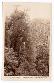 Marysville & District Historical Society
Postcard (item) - Black and white postcard, Rose Stereograph Company, Cumberland Creek Valley, Marysville, Vic, 1913-1967
A postcard in a series produced by the Rose Stereograph Company in Victoria, Australia as a souvenir of Marysville.A sepia photograph of a heavily forested valley leading up to a forested hill. The Cumberland Valley is near Cambarville which was a timber town near Marysville. Cambarville is notable for its giant mountain ash (Eucalyptus regnans) trees within the Cumberland Memorial Scenic Reserve, and relics from former sawmills and gold mining. The Big Culvert is located nearby on the Marysville - Woods Point Road, which was historically part of the Yarra Track. Cambarville was established as a timber mill town in the 1940s. Timber mill owners A Cameron and FJ Barton named Cambarville. They established the mill to salvage timber from trees destroyed in the 1939 bushfires. Cambarville was impacted by the 2009 Black Saturday bushfires and any remaining structures were destroyed.POST CARD THE "ROSE"SERIES/ DE LUXE/ REAL PHOTOS PRODUCED IN/ AUSTRALIA Published by the Rose Stereographs/ Armadale, Victoriacumberland valley, marysville, victoria, p. 2330, cumberland creek, rose series postcard, postcard, souvenir, cambarville, mountain ash, mining, timber mills, big culvert, yarra track, a cameron, fj barton, black saturday bushfires, 1939 bushfires -
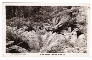 Marysville & District Historical Society
Postcard (item) - Black and white postcard, Rose Stereograph Company, By the Wolfram Track, Marysville, Vic, 1913-1967
A postcard in a series produced by the Rose Stereograph Company in Victoria, Australia as a souvenir of Marysville.A black and white photograph of a part of the forest that the Wolfram Track, which is part of the Wilks Creek Walking Track, runs through. The Wilks Creek Walking Track is in Marysville in Victoria. The Wolfram Track is named after the Wilks Creek Wolfram Mine which opened in around 1894. Wolframite is one of the principle ores of tungsten. The discovery was made in Wolfram Creek by a Mr Robinson who was probably a local of the district. Four creeks eventually proved to carry alluvial deposits of the ore; Wolfram Creek, Opas Creek, Quartz Creek and Main Creek. These creeks run south-east into Deep Creek, a tributary of the O'Shannassy River which, in turn, runs into the Yarra River.POST CARD The "Rose" Series/ De Luxe A Real Photograph/ Produced in Australia Published by the Rose Stereograph Co.,/ Armadale, Victoria.wolfram track, wilks creek walking track, walking track, marysville, victoria, p. 2334, rose series postcard, postcard, souvenir, p. 2332, wolframite, wolfram creek, opas creek, quartz creek, main creek, deep creek, o'shannassy river, yarra river, mining -
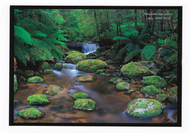 Marysville & District Historical Society
Postcard (item) - Colour postcard, Donovan Wilson, Temperate Rainforest Lady Talbot Drive, Pre 2009
A colour photograph taken of the rainforest along Lady Talbot Drive near Marysville in Victoria.A colour photograph taken of the rainforest along Lady Talbot Drive near Marysville in Victoria.Lady Talbot Drive is a 24 kilometer scenic rainforest car journey which passes a number of walks and waterfalls in the Yarra Ranges National Park. Lady Talbot Drive is named after Lady Sarah Elizabeth, the wife of Sir Reginald Talbot, who was the Governor of Victoria from 25th April, 1904 to 6th July 1908.Temperate Rainforest/ surrounding Marysville/ Koala Creektalbot drive, marysville, victoria, postcard, souvenir, sir reginald talbot, lady sarah elizabeth talbot, lady talbot drive, lady talbot forest drive -
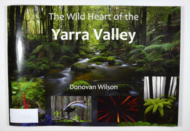 Marysville & District Historical Society
Book, The Wild Heart of the Yarra Valley
... Paperback. Front cover has a main photograph of a creek... Paperback. Front cover has a main photograph of a creek running ...A pictorial book of the flora, fauna, rivers, waterfalls and rainforest in the Upper Yarra ValleyPaperback. Front cover has a main photograph of a creek running through a forest. There is also four smaller photographs. They are of a Red Coral Fungi, a Superb Lyrebird, a night time view looking upwards in a grove of trees and a view of a Soft tree fern. The back cover has a photograph of a Superb Lyrebird.yarra valley, upper yarra valley, flora, fauna, photography, rivers, waterfalls, rainforest, nature, donovan wilson -
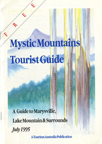 Marysville & District Historical Society
Ephemera (Item) - Tourist Guide, Graeme Haycraft, Mystic Mountains Tourist Guide July 1995, 07-1995
A tourist guide outlining services, accommodation, activities and places of interest to visit in and around Marysville, Lake Mountain and the local district.A tourist guide outlining services, accommodation, activities and places of interest to visit in and around Marysville, Lake Mountain and the local district.Acknowledgements/ Mystic Mountains Tourism Association, Marysville Office of the Dept. of Conser/ vation & Natural Resources, Mrs Elaine Postlethwaite, Ms Sue Henry & every/ advertiser without whose support this Guide would not have been possible.marysville, victoria, australia, tourist guide, mystic mountains, lake mountain, tourism australia, graeme haycraft, magic creek nursery, missing links miniature golf, phelps bakery, blackwood cottages, marysville hotel motel, tower motel, kerami house, marylands guest house, lomatia lodge, willowbank at taggerty, barree mud brick cottages, scenic motel, somerled mountain retreat, dalrymples guest cottages, nanda binya lodge, mathilde's of marysville country guest house, the birches resort, mystic mountains tourist information, marysville caravan park, the cumberland, igloo roadhouse, top shop pancake parlour, the silver birch restaurant, steavenson's restaurant, olde yarra track shoppe, danish coffee gardens, oscars take-away, country touch pottery studio & gallery, cumberland memorial scenic reserve, cathedral range state park, lady talbot forest drive, wishing well, taggerty river picnic area, taggerty river, phantom falls, keppels falls, the beeches walking track, mount sugarloaf, maryton park holiday cottages, snowviews, esa camping & conference centre, wirreanda festival, marysville post shop, hidden talent craft gallery, marysville automotive repairs, geoffrey pope & associates, beauty spot walk, tree fern gully walk, michaeldene track, marysville riding school, gerraty's ski centre, marysville holiday cottages, marysville triangle taxi service, fruit salad farm, lake mountain alpine resort, marysville ski hire, lake mountain ski school, cross country ski hire, lake mountain ski hire, marysville country club -
 Halls Gap & Grampians Historical Society
Map - Coloured
Background on Bridle Path up Stony Creek Gorge Pre 1840 C. B. Hall, squatter on Mokepilly Run 1841-1842, first European to discover the Fyans Creek valley, the entrance of which became known as Hall's Gap. He later recorded that he followed a number of tracks which he assumed had been made by the Aboriginies and described one as "leading up a wild romantic glen and over on to the source of the Glenelg River". This could well have been the route taken up Stony Creek gorge by the first timber-cutters in this part of the Grampians to the saddle between the Wonderland and Mt. Difficult ranges known as Valley Gap 1850s/60s Timber cutters and shingle splitters were reported to be moving into the eastern side of the Grampians and by the mid 1860s there were a number of families connected to the supplying of timber to Pleasant Creek living in the "Hall's Gap ranges". John Wakeham, the first store owner in Pleasant Creek in 1854, established a timer-mill in upper Stony Creek Gorge in the late 1850s. Wakeham is credited for the clearing and levelling of the first bridle-path up the gorge. 1870s By the mid 1870s the track had been extended over Valley Gap to the Victoria Forest (the upper region of the Victoria Valley). McKeon's bullock team was known to have hauled red gum from the Valley to Stawell in the late 1870s and the 1880s. 1880s In 1887 an article in the Pleasant Creek news describes the Stony Creek Gorge track as "being a ledge alongside the mountain range, formed in the early days with the aid of earth and timber, along which the bullock teams used to travel to Horsham and plains of the Wimmera beyond." 1890s Gold was discovered in the catchment area of Stony Creek and by the end of the 1890s a new track was built from "near the junction of Fyan's and Stony Creeks, up the gorge to the diggings settlement. The mining Department had paid L300 for its construction and, when completed, the track was "three miles and 30 chains in length, the side cuttings at the narrowest part being 10 feet between" and "the watercourses which cross the track at various points" having been "filled up with rocks rolled down the sides of the hills, and consequently there can be no damage caused by bushfires which destroyed the former wooden bridges erected on the old track to Wakeham's saw-mill, the remains of which are still to be seen at the side of the diggings" The article goes on to further describe the track as one which "can with ease travel with a two horse conveyance either up or down" and that the workmen engaged in the construction of the track would be attending "a ball that night at McKeon's farm near the mouth of the gap to celebrate the successful completion of the undertaking". 1900s At what time the bridle path was extended beyond Valley Gap to the Wartook basin on the Mt. Difficult Range has not yet been determined. However, it is known that, by the turn of the century, people were travelling between Halls Gap and the caretakers' residence at Wartook Reservoir along what was now known as the "Bluff Road. Wartook's embankment had been constructed in 1887 and at that time there was already a track from Rosebrook Station homestead (near the present day Wartook Pottery) to the reservoir. Philip Rose owned both Rosebrook and Wartook Stations from the mid 1840s to the late 1850s and had regularly leased the Wartook basin to Cobb & Co. to rest horses there. 1920s Following the war of 1914-1918, tourism really took off in the Grampians, and Halls Gap rapidly grew. People would travel as far as they could on the many tracks then hike to the many lookouts being discovered by local tour guides. This led to the need for access across the range so that horse riders and the increasing number of vehicles could travel between Horsham and Halls Gap. To this end, the Bluff Road was improved and extended on 1929 and at its opening in March, 1930, by Lady Somers it was renamed the Mt. Victory Road.Map of Mt Victory Road and othersaccess routes, mt victory rd, bridle path, roads -
 Halls Gap & Grampians Historical Society
Photograph
Photo depicts Fyans Valley. The road is The Grampians/ Dunkeld Road, leading to Dunkeld towards the right or Halls Gap travelling towards the left. Fyans Creek is visible in parts at the foot of the range (middle of Photo). Photo appears to have been taken from Bellfield Pk area. Photo is typical of those taken by Forests Commission of Victoria in the 1960sPhoto shows a mountain range in the background with a valley. The Valley has a band of a mostly cleared grassy section (middle of photo) with a fairly dense treed area in the foreground. A road and some buildings can be seen where the cleared land meets the treed area.scenery, fyans valley -
 Eltham District Historical Society Inc
Negative - Photograph, Log bridge over Pheasant Creek, Kinglake, c.1920
... supported by timber rails over Johnstone's Creek amidst the Kinglake... supported by timber rails over Johnstone's Creek amidst the Kinglake ...Horse and cart with driver Mr. F. Thomson and passenger cross a wooden bridge with log tree trunk base construction supported by timber rails over Johnstone's Creek amidst the Kinglake forest. The bridge was built for the timber tramline. There was also a logging district in the Pheasant Creek area just outside the Shire of Eltham. Note dog also sitting on bridge.This photo forms part of a collection of photographs gathered by the Shire of Eltham for their centenary project book,"Pioneers and Painters: 100 years of the Shire of Eltham" by Alan Marshall (1971). The collection of over 500 images is held in partnership between Eltham District Historical Society and Yarra Plenty Regional Library (Eltham Library) and is now formally known as 'The Shire of Eltham Pioneers Photograph Collection.' It is significant in being the first community sourced collection representing the places and people of the Shire's first one hundred years.Digital image 4 x 5 inch B&W Neg 120 format B&W negative (spare) 2 x printsbridge, f. thomson, kinglake, log bridge, mr. munro, pheasant creek, pioneers and painters, shire of eltham pioneers photograph collection, timber tramway -
 Kiewa Valley Historical Society
Photo: Memorial on the Staircase Spur Track, Mt Bogong
... . The Staircase Spur track to its top starts at Mountain Creek Road going... starts at Mountain Creek Road going through forest and continuing ...Mt Bogong is the highest mountain in Victoria. The Staircase Spur track to its top starts at Mountain Creek Road going through forest and continuing above the snow line to grass land. The weather can change very quickly with cloud and snow making conditions dangerous. Large sepia photo of the Memorial in snow on the Staircase Spur Track on Mt Bogong. The Memorial has a plaque attached: Sacred to the Memory / of Georgine Gadsden / Edward Neave Welch / John McRae / who perished here during a blizzard / about August 2nd 1943staircase spur memorial, mt bogong -
 Kiewa Valley Historical Society
Book - Non Fiction History, The Kiewa Story, circa 1993
This book provides in chronological order the development of the Kiewa Hydro-electricity scheme from the first concept (1911) to final construction work (1961). It covers the first attempt to utilise the power of the Victorian Alps water system. It started from a private syndicate and developed to the current State Electricity Commission of Victoria. The incentive for the Hydro scheme was to make money and not as an alternative to the carbon producing coal fired power plants. These coal fired power plants were increasing in numbers to service an ever increasing demand made by population expansion, especially in cities and large rural settlements. This demand spiraled up after World War II when there was a tremendous spike in immigration numbers due to refugees and displaced persons in Europe. The ability to utilise the untapped water provided by the winter snow fields, for a higher yield in electricity, was a powerful incentive to overcome the physical hardships in this remote Alpine region. Future power requirements may initiate the re-installation of the other two power stations(Pretty Valley and Big Hill) covered in original Scheme. This publication not only covers the development of the Kiewa Valley region with respect to population (within a socio-economical framework) but also the subtle but yet strong physical changes of a relatively pristine alpine region. The demands that an ever growing regional population places on the environment is clearly documented in print and black and white photographs. The working and living conditions of those who constructed and gave life to this hydro scheme is well documented in this book. It may be viewed as spartan now but was relevantly good at that moment in time, especially for those workers fleeing a devastated European environment. The successful planning and consideration to minimising any intrusion upon the natural alpine forests and high plains can viewed as an example (compared to the Tasmanian Hydro schemes) of how future hydro schemes (an inevitable requirement) will proceed. Most rural towns (in the early 1900s) were built by unencumbered rural based citizens, with the exception of Mount Beauty and Falls Creek. These two settlements were brought into life by a State (Victorian) Authority for a specific function and program. They were a gated community, that is, only open to construction workers involved with the hydro scheme. All facilities within these communities were provided by the State Electricity Commission of Victoria. The impact on the social, financial and individual independency of the community, by the transition from the S.E.C .environment to one of local government (Shire of Bright), had in some cases a severe impact.This hard covered book has a green cover with pictures on the front and back covers. The front cover has a coloured picture of a snow covered Mount Bogong taken from the opposite mountain range. The valley between both ranges has a whisk of mist over it. At the bottom of this picture are three black and white photographs covering the construction of the Kiewa Hydro - Electricity Scheme. On the back cover is a photograph, (black and white) detailing the Bogong village and Junction dam containing lake Guy. The inside front cover is a black and white photograph which details the construction of the West Kiewa tailrace tunnel during April 1951. The inside back cover is a black and white photograph of the concrete pour at the Clover Dam circa 1952. All photographs and sketches are in black and white. The pages are approximately 160 g/m2 and those which have photographs are on gloss paper.Book spine: "The Kiewa Story Graham Napier Geoff Easdown" alongside this is a white framed circle with white spokes radiating out and underneath in white lettering SECkiewa valley, hydro scheme, victorian alpine region, electricity generators, graham napier, geoff easdown -
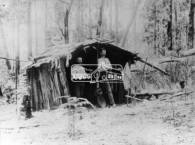 Eltham District Historical Society Inc
Negative - Photograph, Prospecting No. 1 Creek, Kinglake District
Two men stand in front of a forest hut. Photo appears on page 8 of book: "Kinglake: a collected history of the Kinglake district 1861 - 2011" with the caption: Harry Thomson and Maurice Power in their goldfield accommodation. They met at Caledonian goldfields and later both selected land at Kinglake.This photo forms part of a collection of photographs gathered by the Shire of Eltham for their centenary project book,"Pioneers and Painters: 100 years of the Shire of Eltham" by Alan Marshall (1971). The collection of over 500 images is held in partnership between Eltham District Historical Society and Yarra Plenty Regional Library (Eltham Library) and is now formally known as the 'The Shire of Eltham Pioneers Photograph Collection.' It is significant in being the first community sourced collection representing the places and people of the Shire's first one hundred years.Digital image 4 x 5 inch B&W Neg B&W Print 19 x 25 cmsepp, shire of eltham pioneers photograph collection, kinglake, gold miners, no. 1 creek, harry thomson, maurice power, hut, forest, propsecting -
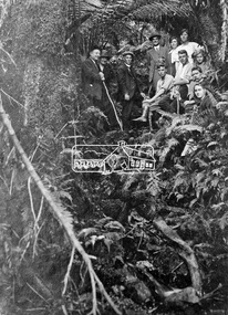 Eltham District Historical Society Inc
Photograph, Kinglake National Park, Tangle Creek
Bushwalkers and hikers pose for a photograph in the heavily forested area of Kinglake National Park near the little known Tangle Creek, circa 1925. The Kinglake National Park was established on 11,300 acres in the Shire of Eltham in 1928.This photo forms part of a collection of photographs gathered by the Shire of Eltham for their centenary project book, "Pioneers and Painters: 100 years of the Shire of Eltham" by Alan Marshall (1971). The collection of over 500 images is held in partnership between Eltham District Historical Society and Yarra Plenty Regional Library (Eltham Library) and is now formally known as 'The Shire of Eltham Pioneers Photograph Collection.' It is significant in being the first community sourced collection representing the places and people of the Shire's first one hundred years.Digital imagesepp, shire of eltham pioneers photograph collection, kinglake, kinglake national park, tangle creek, walking, hiking, bushwalk, ferns