Showing 2406 items
matching maps of goldfields
-
 Bendigo Military Museum
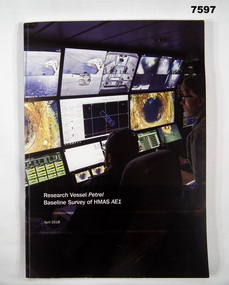
Book, Find AE1 Ltd & Australian National Maritime Museum, "RESEARCH VESSEL PETREL BASELINE SURVEY OF HMAS AE1", 2018
"Research Vessel Petrel - Baseline Survey of HMAS AE1" This book is a report of a comprehensive photographic survey completed on a c.1938 submarine wreck off the coast of PNG.Soft cover book. Cover - cardboard with white print on black and dark blue background on front and spine. Illustrated with colour photographs. Front cover - "RV Petrel control room during the survey". Back cover - "AE1 bow torpedo tube". 179 pages, cut, plain, white paper. Illustrated in black and white and colour photographs, maps and technical drawings.books, ww2, submarine, png, photographic -
 Bendigo Military Museum
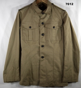
Uniform - JACKET, SERVICE DRESS, SUMMER, ARMY, cWW2
Jacket - Khaki colour cotton twill fabric, brown colour Bakelite shank buttons with raised map of Australia and lettering with metal cotton pins. Collar, shoulder epaulettes with attached "AUSTRALIA" badge, two front pockets with button down flap. Inside jacket two brass belt keepers. Manufacturers stamp inside front right side.Manufacturers information - purple ink stamp "^/C.P."uniform, army, cww2 -
 Bendigo Military Museum
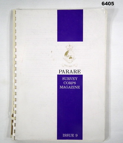
Magazine - "Parare" Survey Corps Magazine Issue 9, Royal Australian Survey Corps, 1993
An annual magazine published for release on RASvy Corps birthday 1st July. All units with RASvy Corps are invited / expected to submit an article depicting their activities over the preceding years 1991 to 1993. 4Fd Svy Sqn Adventure training list pages 7, 8. Army Map Depot - Unit Ski Day, pages 20, 21. The William Patton Expedition - Locating his grave as part of the " Burke and Wills " expedition, list of personnel involved - page 43. 8 Fd Svy Sqn - names mentioned and photo - page 50. 4 Fd Svy Sqn (1992) names mentioned page 69. The G Res manning list on page 70. Names mentioned in "Unit sports pages 73, 74. Exercise Kokoda Cartographer July 1992 list of participants on Page 78. Iraq - The Gulf War, Topographic Support page 52. Adelaide (4 Fd Svy Sqn) 1992 page 65. 8 Fd Svy Sqn manning wind down list pages 89-90. Military Geographic Information Pilot Project page 92. Royal Australian Survey Corps Aerial photography Team personnel list page 95. Operation Belama 92 Team list page 96. Long term Schooling attendees and promotions, page 105. Litho Sqn Postings in and out pages 116-117. Special awards SGT Durrant page 113, SSGT SR Hill page 114. RASvy completes 1:50,000 scale mapping of the Pilbara Region page 121. 1st Topo Svy Sqn personnel mentioned on page 122. A4 sized booklet with soft glossy card covers, paper pages held together with a plastic spiral binder.army survey regiment, army survey regt, fortuna, royal australian survey corps, rasvy, asr -
 Bendigo Military Museum
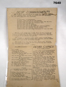
Document - BCOF COMMANDMENTS, C1945 - 1950
Item in the BCOF Association Collection, refer Cat No 7625This is a single page document printed both sides. It has been laminated. Side one - typed wording in black ink. Headlines are:- "BCOF COMMANDMENTS", "THE GENERAL'S PRAYER" and "REHAB CORNER" Side Two - A map showing Japan at the top, Australia at the bottom. It shows the course the ship HMAS MANOORA took to come home. Numbers along the way show 1800 hrs and the day/date at that time.japan, japan occupational forces, hmas manoora -
 Bendigo Military Museum
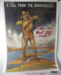
Poster - ENLISTMENT POSTER, St. Leigh & Co. Ltd, Original WW1
A commemorative poster facsimile of an original WW1 Recruitment Poster issued in 1915 by Defence Department - Issued by Australian Geographic.Large hard paper poster. Symbolic image of Australian Soldier standing on a 3D image of the Dardenelles in Turkey. In colour showing map of that part of Turkey. Poster laminated with layer of clear plastic to protect it.On top says "A CALL FROM THE DARDENELLES" On bottom "ENLIST NOW" In middle "COO-EE - WON'T YOU COME"ww1, recruitment poster -
 Bendigo Military Museum
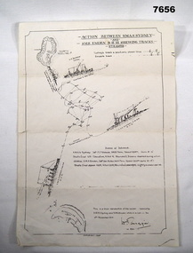
Map - BATTLE MAP - SYDNEY EMDEN, Possibly 1928
This is a medium size poster. It is drawn in black ink. It shows an image of HMAS SYDNEY, SS BURESK (Collier) and SMS EMDEN. It shows the tracks the two ships took through the battle. It shows dotting lines throughout the drawing - possibly indicating when shots were exchanged. It shows a list in the centre, showing basic specs of the two warships and their battle casualties. It also shows relative positions of Keeling Island and Direction Island.ww1, sms emden, hmas sydney -
 Bendigo Military Museum
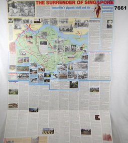
Poster - POSTER RE THE FALL OF SINGAPORE AND MALAYA
See Cat 7656This is a very large poster with coloured printing in red, blue and black ink. One side is titled "The surrender of Singapore". Both sides have maps and photos.ww2, poster, fall of malaya, fall of singapore -
 Bendigo Military Museum
Map - MAPS, EAST TIMOR, US Govt et al, 1975 - 1976
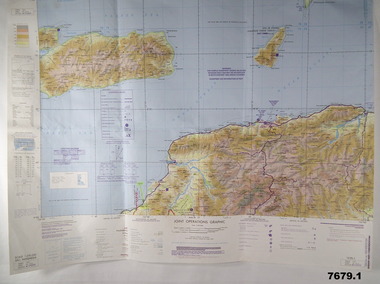
... goldfields East Timor Maps Interfet 1. Has highlighted "7 BSG ...1. This is a coloured map. It's scale is 1.250,000 - called a jpoint operations graphic. It covers the North side of East Timor. Dili is in the centre. Its shows 4 Islands to the north of Timor. It shows Savu Fea, Ombai Strait, Wetar Strait. On bottom left of map it shows Batheade and the start of the New Border. Map - Series 159. Sheet 5C- 51-4. Edition 3-GSGS. 2. This is a coloured map. Its scale is 1.250,000 called a joint Operations Graphic. It manly covers West Timor. It shows Savu Sea in North and Timor Sea on south side. Series 1501. Sheet SC 51.7. Edition 3-GSGS. 3. This a coloured map. It's scale is 1.250,000. Joint operations graphic. This map shows the south side of East Timor and the Timor Sea. This map shows a highlighted New border. The major towns on South coast are KAMFNASA, BETANO. Map series 1501. Sheet SC 51-8. Edition 3 GSGS.1. Has highlighted "7 BSG" on coast. All maps show East Timor border highlighted in pink.east timor, maps, interfet -
 Bendigo Military Museum
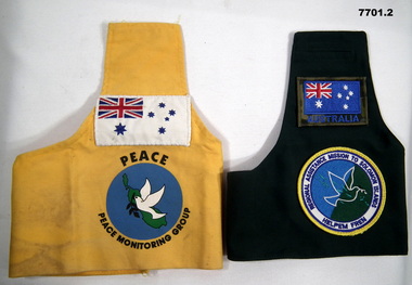
Uniform - BRASSARDS, PEACEKEEPER
Brassards were worn by Peacekeeping Forces to identify their identity. Belonged to Gary Clift R.127835 M8073771. For RAMSI was deployed as ship's company HMAS BRUNEI. For PNG was deployed from HMAS TARAKAN & BRUNEI.1. PNG Peace Keeping Mission Brassard. Bright yellow brassard. Stitched on white Australian ensign on arm picture of dove carrying a twig overlaid over a map of Bougainville in green. Blue background. 2. RAMSI brassard for Solomon Island Peace Keeping Mission. Dark green with Australian Flag sewn onto sleeve. As is RAMSI emblem (yellow border, white dove over map os islands).1. Embroidered "Peace" & "Peace Monitorial Group". 2. Embroidered patch "Regional Assistance Mission to Solomon Islands" and "Helpen Frew".peace keepers, uniform, brassards, ramsi -
 Bendigo Military Museum
Photograph - Photographic Technicians operating the KLIMSCH Camera at the Army Survey Regiment, Fortuna, Bendigo, c1988
These nine photographs were most likely taken in c1988 in Lithographic Squadron at the Army Survey Regiment, Fortuna, Bendigo. The equipment operated by the technicians is the KLIMCH camera. The main tasks undertaken by the technicians were most likely enlargements and reductions of map reproduction material. The KLIMSCH Commodore camera was introduced in 1953 and was the largest in the Southern Hemisphere. It was replaced with a new model of the same size in 1979. The new model with its computer-based interface provided productivity gains with improved speed and its consistent results led to less wastage in time and materials. Its variomat lens system provided improved retention of map feature linear weights during the camera reduction process. The camera which was specially made for the Army in Germany was fully automatic and power operated. It was claimed to be one of the biggest automatic cameras of its type in the world. It was made to the specifications of the Royal Australian Army Survey Corps to assist in the production of the very high standard maps for the Army. There are several more photos catalogued in the Victorian Collections database of RA Svy personnel operating the KLIMSCH camera.This is a set of four photographs of technicians operating the KLIMSCH Camera at the Army Headquarters Survey Regiment, Bendigo c1988. The photographs are on 35mm colour slides scanned at 96 dpi. They are part of the Army Survey Regiment’s Collection. .1) - Photo, colour, c1988, KLIMSCH Camera. .2) - Photo, colour, c1988, KLIMSCH Camera, unidentified technician. .3) - Photo, colour, c1988, KLIMSCH Camera. .4) - Photo, colour, c1988, KLIMSCH Camera, L to R: SPR Shona Hastie, CPL Paul Baker. .5) - Photo, colour, c1988, KLIMSCH Camera. .6) & .7) - Photo, colour, c1988, KLIMSCH Camera, SPR Shona Hastie. .8) & .9) - Photo, colour, c1988, KLIMSCH Camera, SPR Russell Pajank.35mm colour slides are in good condition.rasvy, royal australian survey corps, army survey regiment, army svy regt, fortuna, asr, litho sqn -
 Bendigo Military Museum
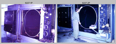
Photograph - Orthorectification Equipment - Army Survey Regiment, Fortuna, Bendigo, c1975, c1988
Orthophoto mapping provided the Survey Corps with the capability to produce map products quickly in the event of a crisis. These are four photographs of equipment used by the Army Survey Regiment to produce orthophotomaps. The Wild GZ1 orthophoto projector shown in photo.1P was introduced in 1973 and was the first equipment used to orthorectify colour and monochrome film aerial photography. Height profiles were originally produced on a PEB8 Stereo profiler and later were software generated. Photos of the PEB8 are available in Victorian Collections item 6222.17P, photos .5P and .6P. In the same era the IBM 1130 computer; OMI/Nistri AP/C-3 analytical plotter with coordinatograph, OP/C orthophoto projector and Zeiss Planimat D2 stereoplotters were introduced. Orthorectification is the process of removing geometric distortions and scale errors/variations from images. Images have tilt and relief distortions that make it difficult to compare accurately a map and an image of the same geographic area. Once an image is orthorectified, features on the image are shown in their planimetric locations. The WILD OR1 orthophoto projector and workstation shown in photos .2P to.4P was introduced in the mid-1980s. It was the second-generation equipment used to orthorectify colour and monochrome film aerial photography, replacing the system introduced in 1973. See items 6124.5P and 6133.4P for more photographs of orthorectification equipment.These four photographs of orthorectification equipment were taken at the Army Survey Regiment at Fortuna, Bendigo, c1975 and c1988. The photos are on 35mm colour slides and scanned at 96 dpi. They are part of the Army Survey Regiment’s Collection. .1) - Photo, colour, c1975, Wild GZ1 orthophoto projector. .2) - Photo, colour, c1988, WILD OR-1 unrectified colour photo in carrier, orthorectified and re-scaled colour image. .3) & .4) - Photo, colour, c1988, WILD OR-1 Orthorectification Workstation.1P to .4P – Some of the equipment is annotated on the frame of the 35mm slides.royal australian survey corps, rasvy, army survey regiment, asr, army svy regt, fortuna -
 Bendigo Military Museum
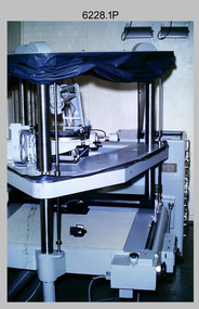
Photograph - Photo Troop Equipment, Lithographic Squadron – Army Survey Regiment, Fortuna, Bendigo, c1970s
This collection of five photos was most likely taken at Lithographic Squadron, Army Survey Regiment, Fortuna, Bendigo in c1970s. The main tasks undertaken by technicians in Photo Troop were most likely enlargements, reductions and duplication of map reproduction material, and processing of aerial photography.This is a set of five photographs of Photo Troop equipment was taken in Lithographic Squadron, at the Army Survey Regiment, Fortuna, Bendigo, c1970s. The photographs are on 35mm colour slides and were scanned at 96 dpi. They are part of the Army Survey Regiment’s Collection. .1) - Photo, colour, c1970s, WILD U4A Diapositive Camera. .2) - Photo, colour, c1970s, Hass-Labortechnik Film and Paper Roller Transport Processor. .3) - Photo, colour, c1970s, Hass-Labortechnik Film and Paper Roller Transport Processor, SGT Christopher Wardley. .4) - Photo, colour, c1970s, Hass-Labortechnik Film and Paper Roller Transport Processor, unidentified technician. .5) - Photo, colour, c1970s, Pako Film Processor..1P to .5P – Some of the equipment is annotated on the frame of the 35mm slides.royal australian survey corps, rasvy, army survey regiment, army svy regt, asr, fortuna, litho -
 Bendigo Military Museum
Photograph - Retouching Reproduction Material at the Army Survey Regiment, Fortuna, Bendigo, c1975
This is a set of seven photographs of technicians retouching orthophoto reproduction material at the Army Survey Regiment, Bendigo, c1975. Retouching mainly entailed the application of liquid opaque (Plumtree), commonly known as “duff” to cover blemishes such as scratches and spots on film negatives before photographic exposure. Retouching technicians also used specialised techniques such as “needling” to repair faults on the emulsion of map reproduction material. The technicians in this set of photos were probably working on the retouching and registration of orthophotomap colour film separations in preparation for publication by Print Troop. Peter Dew featuring in photos .1P to .5P was a serving member of RA Svy, who died in a tragic accident at home. He was fondly remembered as one of Lithographic Squadron’s colourful personalities. The "Super Animal of the Year" Peter Dew Memorial Award was an award presented to a member of the squadron for a crude act. To view a photo of this award, refer to item 6230 of the Victorian Collections.This is a set of seven photographs of technicians retouching and assembling orthophoto reproduction material at the Army Survey Regiment, Fortuna, Bendigo. c1975. The photographs are on 35mm colour slides and were scanned at 96 dpi. They are part of the Army Survey Regiment’s Collection. .1) to .3) - Photo, colour, c1975. Retouching reproduction material. L to R: SPR Ralph Chant, PTE Laurie Tedford, SGT Peter Dew. .4) to .5) - Photo, colour, c1975. Retouching reproduction material. SGT Peter Dew. .6) - Photo, colour, c1975. Assembly of orthophoto colour film separations. .7) - Photo, colour, c1975. Assembly of orthophoto colour film separations, CPL Garran Hill..1P to .7P - There are no annotations stored with the 35mm slides.royal australian survey corps, rasvy, army survey regiment, army svy regt, fortuna, asr, litho -
 Bendigo Military Museum
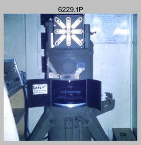
Photograph - Print Troop Equipment and Personnel, Lithographic Squadron – Army Survey Regiment, Fortuna, Bendigo, c1970s to 1980s
This collection of nine photos was most likely taken in Lithographic Squadron, Army Survey Regiment, Fortuna, Bendigo, c1970s to 1980s. The two Ultra-MAN-III Printing Presses were made in Germany at a standard map size format and introduced in June 1962 as a two-colour offset press with improved safety features. With an upgrade to a third colour deck in 1968, productivity greatly improved as the two presses could print a five-colour standard topographic map in two passes, rather than the three passes before their upgrade. They were replaced with a single Heidelberg Speedmaster 102 five colour Printing Press in 1990. There is more information on the Ultra-MAN-III, Printing Press on page 71 of Valerie Lovejoy’s book 'Mapmakers of Fortuna – A history of the Army Survey Regiment’ ISBN: 0-646-42120-4. For additional photos, refer to item 6065.10P for Ultra-MAN-III presses. The Krause Wohlenberg in photo .5P was a heavy-duty guillotine to trim bulk printed map stock in the c1970s and c1980s. See item 6069.6P for more information and photos of guillotine equipment. Densitometer readings as shown in photo .6P were essential to the quality control of film and printing processes, reductions in time taken and material wastage.This is a set of nine photographs of Print Troop personnel and equipment from Lithographic Squadron at the Army Survey Regiment, Fortuna, Bendigo, c1970s to 1980s. The photographs are on 35mm colour slides and were scanned at 96 dpi. They are part of the Army Survey Regiment’s Collection. .1) - Photo, colour, c1970s, Ultra-MAN-III Printing Presses, L to R: unidentified technician, Laurie Sutton, SGT Jim Cook, unidentified technician. .2) - Photo, colour, c1970s, Ultra-MAN-III Printing Presses, unidentified technicians (x2). George Mann Fast Five Quad Demi Printing Press in background. .3) - Photo, colour, c1970s, Ultra-MAN-III Printing Presses, unidentified technicians (x2), George Austen in background and George Mann Fast Five Quad Demi Printing Press next to back wall. .4) - Photo, colour, c1970s, Ultra-MAN-III Printing Press, unidentified technicians (x2) operating George Mann Fast Five Quad Demi Printing Press in background. .5) - Photo, colour, c1970s, Krause Wohlenberg heavy-duty paper guillotine, unidentified technician. .6) - Photo, colour, c1970s, Densitometer reading taken by unidentified technician. .7) - Photo, colour, c1980s, Ultra-MAN-III Printing Presses, L to R: Janet Murray, Lance Strudwick, Terry Winzar, Komori Newkoni and Planeta Polygraph Printing Press in background. .8) to .9) - Photo, colour, c1980s, Ultra-MAN-III Printing Presses, Janet Murray, Komori Newkoni and Planeta Polygraph Printing Presses in background..1P to .9P - There are no annotations stored with the 35mm slides.royal australian survey corps, rasvy, army survey regiment, army svy regt, fortuna, asr, printing, litho -
 Bendigo Military Museum
Photograph - Print Troop Equipment, Lithographic Squadron – Army Survey Regiment, Fortuna, Bendigo, c1990s
This is a set of 25 photograph of Print Troop Equipment in Lithographic Squadron, Army Survey Regiment at Fortuna, Bendigo, 1990. Photo .1P features the new Howson Algraphy Autoneg printing plate processor. It improved quality control and efficiency and allowed the conversion of printing plates for positive or negative use. The Heidelberg Speedmaster 102 shown in photos .2P to .4P was a computer-controlled five colour lithographic offset printing press. It provided the Royal Australian Survey Corps a vastly improved printing capability, as the five colours for a standard topographic map was printed in a single pass. The print room housing the Speedmaster printing press was named Wayzgoose Hall after a medieval printing house festival. Wayzgoose Hall and the Speedmaster printing capability was commissioned by the Commander of the 3rd Military District BRIG P. Davies AM, ADC on Wednesday 27th June 1990. This occasion is covered in more detail in page 145 of Valerie Lovejoy’s book 'Mapmakers of Fortuna – A history of the Army Survey Regiment’ ISBN: 0-646-42120-4. For additional photos, refer to item 6062.4P for more photos of the Heidelberg Speedmaster printing press. The Print Room’s Map Assessment and Colour Evaluation Stations in photos .5P to .12P provided the Printer Technician suitable viewing environments to perform quality assessments of map samples. See item 6151.34P for more information and photos of technicians using the equipment. The Print Room’s Map Handling Station in photo .15P to .20P provided ergonomic benefits to the Printer Technician and improved despatching productivity. See Item 6070.9P for more information and photos. The Wohlenberg MCS-2 guillotine seen in photos .21P & .22P was a heavy-duty guillotine integrated component of the Map Handling Station, to trim bulk printed map stock. See item 6069.6P for more information and photos of earlier types of guillotine equipment. This is a set of 25 photograph of Print Troop Equipment in Lithographic Squadron, Army Survey Regiment at Fortuna, Bendigo, 1990. The photographs are on 35mm colour slides and were scanned at 96 dpi. They are part of the Army Survey Regiment’s Collection. .1) - Photo, colour, c1990s, Howson Algraphy Autoneg printing plate processor .2) to .4) - Photo, colour, 1990. Heidelberg Speedmaster 102 computer-controlled five colour lithographic offset printing press .3) to .10) - Photo, colour, c1990s, Heidelberg Speedmaster CPC 1-04 control unit. .11) to .12) - Photo, colour, c1990s, Map Colour Evaluation Work Station. .13) to .14) - Photo, colour, c1990s, Linear printing plate registration punch. .15) to .20) - Photo, colour, c1990s, Print Room’s Map Handling Station. .21) to .22) - Photo, colour, c1990s, Wohlenberg MCS-2 guillotine. .23) - Photo, colour, c1990s, Print Room Power supply equipment. .24) to .25P - Photo, colour, c1990s, Print Room Crown Fork Lift..1P to .25P - There are no annotations stored with the 35mm slides.royal australian survey corps, rasvy, army survey regiment, army svy regt, fortuna, asr, printing, litho -
 Bendigo Military Museum
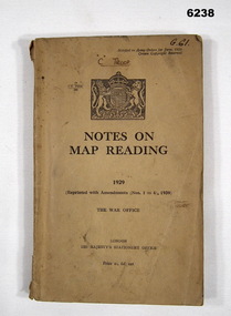
Manual - Notes on Map Reading 1929 - The War Office, 30.06.1939
... goldfields Instruction in Map reading. The object of map - reading ...Instruction in Map reading. The object of map - reading is to tender possible the clear and accurate visualization of the ground from a map productBrown Cardboard book, A5 Size, Several insets. Reprinted with Amendments 1-4 1939, 95 pages.royal australian survey corps, rasvy, fortuna, army survey regiment, army svy regt, asr -
 Bendigo Military Museum
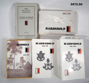
Booklet - BOOKLET, BATTALION ASSOCIATION, "HARD - N - BOLD", 1960 - 2010
Collection of 50 "HARD N BOLD" 57/60 ASSOCIATION BOOKLETS. Original owner of items; FRANK TRACEY JOHNSON UNIT 57/60 AREA OF SERVICE PNG SEE ALSO 5973 & 5974Soft cover booklets. Cover - cardboard, black print on cover. Illustrated with the red and black battalion colour patch. Date on front cover. Published annually. 1. - 9. Cover grey textured cardboard. 16-32 pages 1960-1969 - 1964 booklet missing, 10. - 19. Cover - glossy white, blue or cream cardboard. Illustrated with maps and black and white photographs. 24 - 40 pages, 1970 - 1979. 20. - 29. Cover glossy white, cream, yellow and bronze colour cardboard. Illustrated sepia, black and white and black, red and blue, photographs and maps 1980 to 1989 - 24 to 40 pages. 30. - 39. Cover - glossy white cardboard. illustrated with 57 & 60th colour patches and unit badges. 1990 to 1999. 44 - 60 pages. 40. - 50. Cover - glossy white cardboard. illustrated with 57 & 60th colour patches and unit badges on "Cobbers" bronze 1998. 44 o 68 pages. All booklet pages - cut, plain, white paper. Booklets illustrated with black and white photographs.booklets, 57/60 battalion association, ww2 -
 Bendigo Military Museum
Photograph - Army Survey Regiment - Regimental Training Field Phase, 1995
This is a set of twenty photographs of the Army Survey Regiment undertaking regimental training in state forest north of Costerfield, Victoria, 1995. The state forest is now part of the Heathcote-Graytown National Park. The aim of the training was to provide personnel practical revision of infantry and minor tactics at the section level, navigation and map reading, RATEL and Survival in the Field. This was the Army Survey Regiment’s last military skills field training exercise before disbandment of RA Svy and the weather on the last day was wet and cold. It provided soldiers who decided to continue their military service essential military skills revision and for those who chose to discharge from the Army, it reinforced their decision to leave. LTCOL Duncan Burns was the last CO of the Army Survey Regiment from 1994 to 1996 and WO1 Ken Johnston OAM MM from RA Inf was the RSM for one year in 1995.This is a set of twenty photographs of the Army Survey Regiment undertaking regimental training in state forest north of Costerfield, Victoria, 1995. The photographs were printed on photographic paper and are part of the Army Survey Regiment’s Collection. The photographs were scanned at 300 dpi. .1) - Photo, colour, 1995, unidentified personnel. .2) - Photo, colour, 1995, L to R: Derek Percival, Damien Cole, unidentified. .3) - Photo, colour, 1995, L to R: unidentified, Chris ‘Charlie’ Brown, unidentified (x2). .4) - Photo, colour, 1995, unidentified personnel. .5) - Photo, colour, 1995, unidentified. .6) - Photo, colour, 1995, unidentified personnel. .7) - Photo, colour, 1995, unidentified personnel. .8) - Photo, colour, 1995, L to R: Jim Ash, Syd Anstee, unidentified, Rob Bogumil. .9) & 10) - Photo, colour, 1995, L to R: Steve Hill OAM CSM, Rob Bogumil, Brian Paul, Jim Ash, Syd Anstee, Colin Davidson. .11) - Photo, colour, 1995, L to R: Paul ‘Hutch’ Hunter, Stu Ridge, Chris ‘Charlie’ Brown. .12) - Photo, colour, 1995, RSM WO1 Ken Johnston OAM MM. .13) - Photo, colour, 1995, Peter Imeson. .14) - Photo, colour, 1995, L to R: Stu Ridge, Alan Virtue. .15) - Photo, colour, 1995, CO LTCOL Duncan Burns. .16) - Photo, colour, 1995, unidentified personnel. .17) - Photo, colour, 1995, L to R: Tony Harder, CAPT Sutiman (Indonesian Exchange Officer), Kasey ‘Tiges’ Northausen, unidentified (x2), Mick Duggan. .18) - Photo, colour, 1995, CAPT Sutiman (Indonesian Exchange Officer). .19) & 20) - Photo, colour, 1995, unidentified personnel..1P to .20P – No personnel are identified.royal australian survey corps, rasvy, army survey regiment, army svy regt, fortuna, asr -
 Bendigo Military Museum
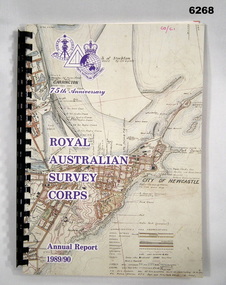
Administrative record - 75th Anniversary of the Royal Australian Survey Corps - Annual Report 1989/90, Royal Australian Survey Corps, 1990
Royal Australian Survey Corps Annual Report 1989/90 of all mapping and charting carried out during that periodAn A4 booklet, glossy pages, map index of all mapping scales, 17 pages and Annexes, plastic ring bindingroyal australian survey corps, rasvy, fortuna, army survey regiment, army svy regt, asr -
 Bendigo Military Museum
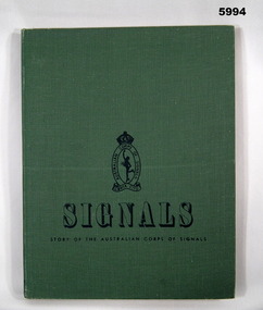
Book - BOOK, WW2, Australian Corps of Signals, "SIGNALS", 1953
"SIGNALS" "STORY OF THE AUSTRALIAN CORPS OF SIGNALS"Hard cover book. Cover - cardboard with green buckram covering. Black print on front and spine. Illustrated in black print small Corps of Signals badge. 196 pages, cut, plain, off white paper. Illustrated - black and white and colour photographs, portraits, maps and cartoons. End paper - front and back - Illustrated in pale green tones - montage of photographs.book, military history -
 Bendigo Military Museum
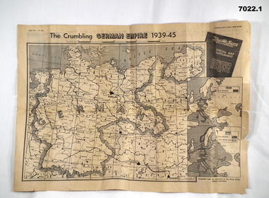
Newspaper - NEWSPAPER EXTRACTS
... goldfields The various map extract showed the position of the German ...The various map extract showed the position of the German Control of Europe at the point of time in 1944 and April 1945 near the end. Was for general issue at a time when Allied Forces were on top moving towards German lines.Yellow faded paper, black writing and b & W photos. 1. Four page extract from Newspaper "The Sun" with centre pages having a detailed map of the European Theatre of War dated 11 April 1945. front and Back pages covering normal news items. 2. Four page extract from "The Sun" newspaper giving a phasing of German control of Europe over period of War and a detailed map of position as at 5th August 1944. Final page lists key dates in the history of the War.1. Map headed "The Crumbling German Empire 1939-45". 2. Maps headed "The War Map".ww2, europe, maps, newspapers -
 Bendigo Military Museum
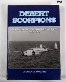
Book - Book - WW2, Leon KANE-MAGUIRE, "Desert Scorpions"", 2007
"Desert Scorpions - A History of 459 Squadron RAAF/ 1942-1945".Hard cover book. Cover - cardboard with adhered glossy finish paper cover. Light blue and white print on front, spine and back. Illustrated - front, back and white photographs of an aircraft and landing beacon with operator. 528 pages - cut, plain, white. Illustrated black and white photographs of aircraft, personnel and maps. non-fiction"Desert Scorpions - A History of 459 Squadron RAAF/ 1942-1945".book, raaf, ww2 -
 Bendigo Military Museum
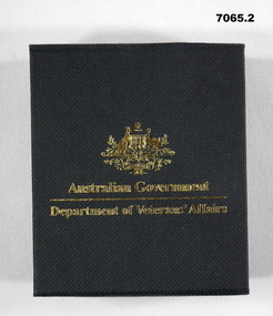
Medal - MEDAL, SERVICE to AUSTRALIA & BOX, Royal Australian Mint
Medallion was produced by the Royal Australian Mint and given to members who served with Australian Forces or her Allies between 1939 - 1945. This was on the 60th Anniversary of the end of WW2. Given to Tony Cork who was in the Merchant Navy, England 1939-45.1. Gold coloured coin medallion produced by Royal Mint. On one side of the coin is the Commonwealth Coat of Arms with the reverse side symbolising the Navy, Army and AirForce through the depiction of sea, land and air over a stylized map of Australia. 2. Contained in a hard cardboard black box inscribed with gold writing and Commonwealth emblem and medal lays in a felt recess within the box. 1. One side inscribed "World War 2", "60 years""1945 - 2005". and stylized map of Australia. Other side inscribed around Rim "World War 2"and "Service to Australia" with Commonwealth of Australia emblem in centre. 2. Box on top has Commonwealth Emblem and "Australian Govt", "Dept of Veteran Affairs". Inside "60th Ann of WW2".medal, 60th anniversary ww2 -
 Bendigo Military Museum
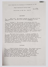
Administrative record - Joint Committee for the exchange of Information on ADP within the RASvy Corps, Activities Jun- Dec 1985, Army Survey Regiment, December 1985
Automated Computer Processing (ADP) was instrumental to the successful operation of the Royal Australian Survey Corps Mapping capability and production. This paper describes elements of the ADP with a comprehensive description of each. They Include, PDP 11/70 Memory, Map Stock Control System, Digital Terrain Elevation Data, Digital Terrain Model Package, ASMAPS, ASTIS, Reflectance Hill Shading, Aerial Triangulation and Terrain Analysis.Two page paper report about Automated Data Processing, unstapledHand annotated "Folio 74" in top right hand cornerroyal australian survey corps, rasvy, fortuna, army survey regiment, army svy regt, asr -
 Bendigo Military Museum
Map - Map Extract - Charterhouse of Mendip, John James Raisbeck, Unknown
... goldfields Map extract showing the towns of Cheddar, Rodney Stoke ...Map extract showing the towns of Cheddar, Rodney Stoke, Westbury and a smaller town of Easton. The area depicted is part of Somerset, England. Map is hand drawn by J.J. Raisbeck date unknown. John James RAISBECK was born on 4 July 1880 at Christchurch New Zealand. He served 4 years (Citizen Military Force - CMF) in 9th Australian Light Horse Regiment in Central VIC with the rank 2nd Lieutenant. He was the first Australian appointed to the Survey Section RAE, on 16 April 1910, as a draughtsman which was his civilian profession, with the rank Warrant Officer, honorary 2nd Lieutenant. He was required to resign his commission in the CMF. He supervised the draughting work of the Section in Melbourne and was largely responsible for the mapping standards and specifications set in the production of the Cowes one-inch-to-one-mile military map, which became the enduring Australian standard. He was also responsible for supervising the printing of the maps by the Victorian Government Printer. He was appointed 2nd Lieutenant in the AIF Survey Corps draft on 6 December 1917 (from Melbourne) embarking for England on 22 December 17. He was attached to the Australian Corps Topographic Section in France from 21 April 1918 to 5 March 1919 serving as Second-in-Command and as Officer Commanding. He was promoted Lieutenant 15 October 1918, attending the AIF Survey School, Southampton in 1919, returning to Australia 23 June 1919, before his AIF appointment was terminated 17 July 1919. He went on to serve the Survey Section RAE and Australian Survey Corps, including in the Second World War, having been promoted Captain then Major and Officer Commanding Army Headquarters Cartographic Section until February 1940. He retired after 33 years of service to military survey, and after serving the Corps in two world wars, on 4 July 1943 with the retired rank Lieutenant-Colonel. He was the author of the article ‘A Short History of the Military Survey of Australia, 1907-1936’, published in The Australian Surveyor, Sept 1, 1937Map extract slightly larger than A4. Scale: One Inch to One and a half Mile. 1:31680, 9 x copiesSignature of "J.J. Raisbeck" bottom right-hand cornerroyal australian survey corps, rasvy, fortuna, army survey regiment, army svy regt, asr -
 Bendigo Military Museum
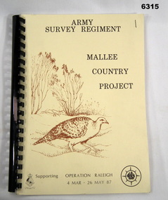
Administrative record - Army Survey Regiment - Mallee Country Project, Army Survey Regiment, 30.01.1987
This is a reconnaissance report for the Mallee Country Project supporting Operation Raleigh 4 Mar - 26 May 1987. Operation Raleigh is a scheme for International Venturers (Scouts) to develop leadership, self-reliance, initiative and team work while studying Mallee Fowl, Mammal Trapping and Cross Country Trekking. Four Annexes containing sketch maps, personnel lists, photographs and stores lists.A4 Report, soft covers front and back. Plastic ring bindingroyal australian survey corps, rasvy, fortuna, army survey regiment, army svy regt, asr -
 Bendigo Military Museum
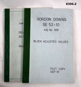
Administrative record - Report on the Block Adjustment of the Gordon Downs and Delemere 1:250,000 Maps, Army Survey Regiment, 1 Sep 1991, .2 Jan 1988
All mapping produced at this time were produced using Aerial Photography. These booklets contain the adjusted mathematical solution to joining this group of photographs together..1 Blue covered booklet with green tape binding. Block adjusted values for Gordon Downs SE 52-10 1:250 000 map Adjustment number 309 Sep 1991 .2 Blue covered booklet with green tape binding. Block adjusted values for Delamere SD 52-16 1:250 000 map Adjustment number 272 Jan 1988royal australian survey corps, rasvy, fortuna, army survey regiment, army svy regt, asr -
 Bendigo Military Museum
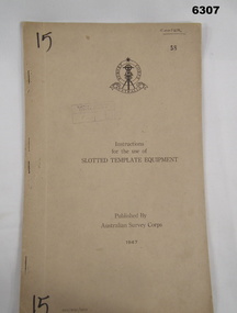
Manual - Australian Survey Corps 1947 - Instructions for the use of Slotted Template Equipment, Australian Survey Corps, 1947
This is an instruction manual describing in detail the construction of the templates used for producing map compilation sheets from aerial photographs, and how the system works.Foolscap size, soft carboard covers, 9 x numbered pages, 3 x fold out pages containing two photos on each. Australian Survey Corps Badge on cover. Stapled and re-stapled on Left hand edge.Front Cover, "15" Top Left and Bottom Left corner, "COOPER" and stamped "58" in Top Right, "AHQ/Misc/0015" Bottom Left Corner, Stamped "Eastern Command Survey Service copy 5"royal australian survey corps, rasvy, fortuna, army survey regiment, army svy regt, asr -
 Bendigo Military Museum
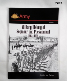
Book - BOOK, MILITARY HISTORY, Captain David Adams - Royals Australian Armoured Corps, "MILITARY HISTORY OF SEYMOUR AND PUCKAPUNYAL 1903-1969", June 2021
Soft cover book. Cover - cardboard; black, red and white print on front and back. Illustrated - front, black and white photographs of a troop inspection parade with army camp in background. Rising Sun Badge. Book - Colour map of Seymour area. 65 pages - cut, plain, white paper. Illustrated black and white and colour photographs and maps. End papers - printed with "Foreword" and information. books, military history, seymour, puckapunyal -
 Bendigo Military Museum
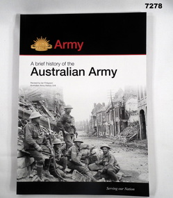
Book - BOOK, ARMY, Australian Army History Unit, The Australian Army - A Brief History, Edition one (1987) This edition - edition five (2017)
Soft cover book. Cover - cardboard with adhered paper cover. Black, white and red print on front, spine and back. Illustrated - front - black and white photograph of 5 soldiers seated within a bomb and battle damaged buildings in a streetscape. Back - colour photograph of troops on patrol at sunrise in Southern Afghanistan. Gold Rising Sun badge on front cover. 166 pages - cut, plain, beige paper, Illustrated in black and white and colour photographs, paintings, maps, Corp badges and Badges of Rank.books, history, australian army