


Physical description
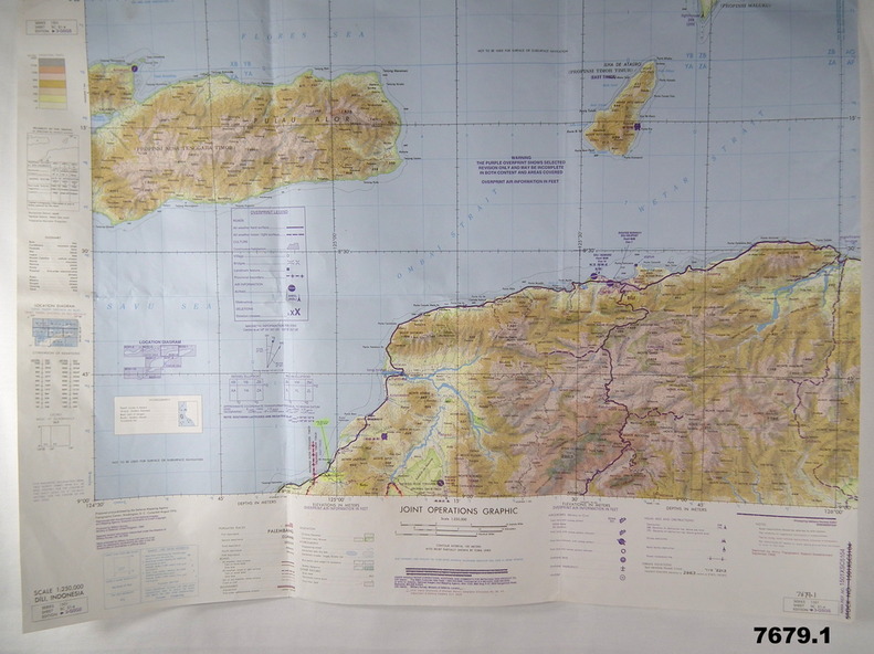
1. This is a coloured map. It's scale is 1.250,000 - called a jpoint operations graphic. It covers the North side of East Timor. Dili is in the centre. Its shows 4 Islands to the north of Timor. It shows Savu Fea, Ombai Strait, Wetar Strait. On bottom left of map it shows Batheade and the start of the New Border. Map - Series 159. Sheet 5C- 51-4. Edition 3-GSGS.
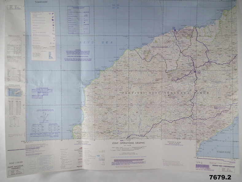
2. This is a coloured map. Its scale is 1.250,000 called a joint Operations Graphic. It manly covers West Timor. It shows Savu Sea in North and Timor Sea on south side. Series 1501. Sheet SC 51.7. Edition 3-GSGS.
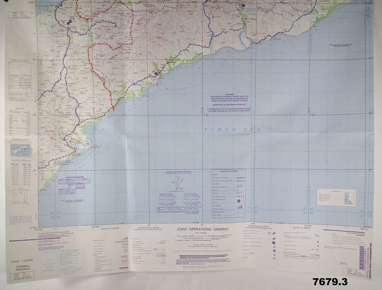
3. This a coloured map. It's scale is 1.250,000. Joint operations graphic. This map shows the south side of East Timor and the Timor Sea. This map shows a highlighted New border. The major towns on South coast are KAMFNASA, BETANO. Map series 1501. Sheet SC 51-8. Edition 3 GSGS.
Inscriptions & markings
1. Has highlighted "7 BSG" on coast. All maps show East Timor border highlighted in pink.