Showing 854 items
matching surveyors-terrestrial
-
 Bendigo Military Museum
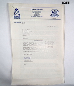
Document - CENOTAPH RESTORATION BENDIGO, City of Bendigo, C.1984
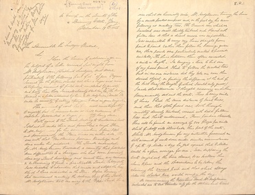
This Document is the first in several plus photos and an article following the restoration of the Bendigo Cenotaph (Replica of the Cenotaph in Whitehall London). The letter is from the City of Bendigo Municipal Offices Lyttleton Terrace Bendigo is dated 13th April 1984 from the Building Surveyor Mr P.W. Phillips to Mr J.K. Barnes Secretary Bendigo RSL Sub Branch P.O.Box 449 Bendigo. Letter states that the Surveyors Report was adopted by Council on 21st November 1983 and would then be considered at Estimates later in the year. The Surveyors Report pages 2/3 gives a background report back to 1976 re its condition by the Building Surveyor at the time Mr R.H. Chellow and that an offer to fund at no cost was offered. Unfortunately this did not proceed. Council had approved funds for Stone work etc in the 1976/77 Estimates. The report is under several headings “Restoration of Cenotaph” being the history to this point. “Nature of Repairs Neccessary” - in brief, Extensive repairs, Granite structure is good, Sandstone needs 90% replacement, brick core in good order. “Estimate of Cost” A price of $30,000 for Budget purposes but could be as low as $25,000. “Recommendation” That Restoration be referred to the 1984/85 Estimates for consideration, copies to Bendigo RSL and State President RSL.Document 3 pages stapled together, front page is A4 and the pages 2/3 is Foolscap.Front page has a top section in blue, on the left is a depiction of a Mine Poppet Head, on the right is a Coat of Arms. The letter section is in black type, signed at the bottom in blue pen. Pages 2/3 are all black print.Page 1 points, Coat of Arms, “City of Bendigo - Progress”. “1968/84” - PWP:LT 32.7.1”. Page 2/3, “Building Surveyors Report - 21st November 1983 - B42/83 - (32.7.1)”brsl, smirsl, cenotaph, restoration -
 Bendigo Historical Society Inc.
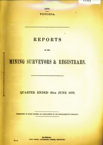
Book - REPORT OF THE MINING REGISTRAR AND SURVEYORS JUNE 1879, 1879
REPORT OF THE MINING REGISTRAR AND SURVEYORS JUNE 1879gold mining, miners' safety cage, mining surveyors and registrars, gold, gold mining, mining registrars, mining surveyors -
 Bendigo Historical Society Inc.
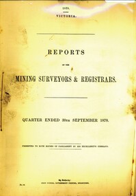
Book - REPORT OF THE MINING SURVEYORS AND REGISTRARS SEPT. 1878, 1878
REPORT OF THE MINING SURVEYORS AND REGISTRARS SEPT. 1878gold mining, miners' safety cage, registrars and surveyors report, gold, gold mining, registrars and surveyors report -
 Bendigo Historical Society Inc.
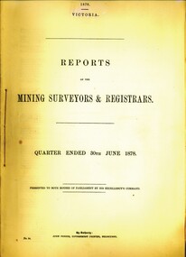
Book - REPORT OF THE MINING SURVEYORS AND REGISTRAR - JUNE 1878, 1878
REPORT OF THE MINING SURVEYORS AND REGISTRAR - JUNE 1878gold mining, miners' safety cage, registrars and surveyors report, gold, gold mining, registrars and surveyors report -
 Bendigo Historical Society Inc.
Book - REPORT OF THE MINING SURVEYORS AND REGISTRARS DEC. 1877, 1877-8
REPORT OF THE MINING SURVEYORS AND REGISTRARS DEC. 1877gold mining, miners' safety cage, registrars and surveyors report, gold, gold mining, registrars report, surveyors report -
 Bendigo Historical Society Inc.
Book - REPORT OF THE MINING SURVEYORS AND REGISTRARS SEPT. 1876, 1876
REPORT OF THE MINING SURVEYORS AND REGISTRARS - Sept. 1876gold mining, miners' safety cage, registrars and surveyors report, gold, gold mining, registrars and surveyors report. -
 Bendigo Historical Society Inc.
Book - REPORT OF THE MINING SURVEYORS AND REGISTRARS JUNE 1876, 1876
REPORT OF THE MINING SURVEYORS AND REGISTRARS JUNE 1876gold mining, miners' safety cage, registrars and surveyors report, gold, gold mining, registrars, surveyors report -
 Bendigo Historical Society Inc.
Book - REPORTS OF THE MINING SURVEYORS AND REGISTRAR, 1873
REPORTS OF THE MINING SURVEYORS AND REGISTRAR - June 1873gold mining, miners' safety cage, mining surveyors and registrars rep, gold, gold mining, suvveyors and registrars -
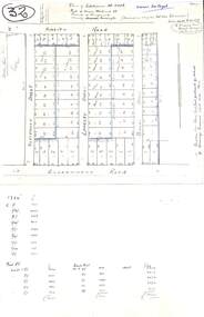 Ringwood and District Historical Society
Plan, Plan of Subdivision No.11498 with handwritten costing notations - East Ringwood Central Estate c.1948
Two handwritten pages showing layout of Subdivision no 11498 with surveyor notations including property sizes and road construction cost calculations. Drainage easement 6 feet wide shaded blue.Plan of Subdivision No. 11498, Part of Crown Allotment 27, Parish of Ringwood, County of Mornington, (Certificate of Title Vol 5120 Fol 1023945). Owner Mr Vogel. Subdivision includes Knaith Road, Northwood Street, Langley Street, Bondi Street, and Government Road (later Alexandra Road), Ringwood East. G. Parsons & Sons, Licensed Surveyors, 389 Flinders Lane (Melbourne). -
 Bendigo Military Museum
Photograph - Royal Australian Survey Corps Field Survey Vehicles, c1950s
This is a set of five photographs of vehicles used by field survey parties. c1950s. The first two photos show unidentified surveyors and field survey vehicles departing the Army Survey Regiment’s transport compound. The third photo of LTCOL Lindsay Lockwood and CAPT Jim Stedman was taken at a field survey camp at Camooweal, QLD. LTCOL Lindsay Lockwood was the CO of the Army Survey Regiment from 1951 to 1962. As the longest serving commanding officer of the unit, there was many changes implemented. LTCOL Lindsay Lockwood’s period as CO is covered in more detail in pages 48-49 of Valerie Lovejoy’s book 'Mapmakers of Fortuna – A history of the Army Survey Regiment’ ISBN: 0-646-42120-4. CAPT Jim Stedman later reached the rank of Colonel, was Director of Military Survey from 1975 to 1978 and was appointed as Colonel Commandant (honorary appointment, Retd) of the Royal Australian Survey Corps from 1978 to 1983. The truck and semi-trailer loaded on a flatbed Photo .4P was probably towing RA Svy’s field deployable printing press, the MANN Double Crown. See pages 44 -45 of Valerie Lovejoy’s book for more information on how this trailer mounted printing press was used in a recruitment drive in 1948.This is a set of five photographs of vehicles used by field survey parties. c1950s – 1960s. The photographs were printed on photographic paper and are part of the Army Survey Regiment’s Collection. The photographs were scanned at 300 dpi. .1) - Photo, black & white, c1950s, unidentified surveyors in a field survey vehicle departing the Army Survey Regiment’s transport compound. .2) - Photo, black & white, c1950s, unidentified surveyors in a Humber 1 ton survey vehicle departing the Army Survey Regiment’s transport compound. .3) - Photo, black & white, 1958, L to R: LTCOL Lindsay Lockwood and CAPT Jim Stedman at Camooweal, QLD., .4) - Photo, black & white, c1950s, unidentified surveyor, field survey truck and trailer. .5) – Photo black & white, c1950s. Unidentified surveyor undertaking vehicle recovery..3P on back – Lindsay Lockwood (LT COL) Jim Stedman (Capt) 1958 Camooweal .4P on back – Early vehicles for field trips. .5P with card strip annotation’ Survey field parties often strike difficult terrain when driving’.royal australian survey corps, rasvy, army survey regiment, army svy regt, fortuna, asr, surveying -
 Federation University Historical Collection
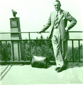
Photograph - black and white, Frank Wright at a viewing spot, mid 1900s
Frank Wright was a renoun resident of Smeaton, where he was born on 2 August 1901. He lived at Laura Villa, and attended Smeaton State School. His father William was a gold miner and his mother's name was Sarah. Their family won many singing and instrumental awards. Frank was tutored by Percy Code and was awarded a gold medal for the highest marks in the ALCM examinations in the British Colonies at the age of seventeen years. He became the Australian Open Cornet Champion by the age of eighteen. A year later, Frank conducted the City of Ballarat Band, and later the Ballarat Soldiers’ Memorial Band. He formed the Frank Wright Frisco Band and Frank Wright and his Coliseum Orchestra. These bands won many South Street awards, and Frank as conductor won many awards in the Australian Band Championship contest. In 1933 Frank Wright sailed to England to conduct the famous St Hilda’s Band and was later appointed Musical Director of the London County Council, where he organized many amazing concerts in parks, in and around the London district. He was made Professor of Brass and Military Band Scoring and conducted at the Guildhall of Music and Drama. Frank was often invited to adjudicate Brass Band Championships around Europe, in Australia, including South Street and in New Zealand. The Frank Wright Medal at the Royal South Street competition is awarded to an individual recognized as making an outstanding contribution to brass music in Australia. He died on 16 November 1970.Black and white photograph of a man standing against a railing near a terrestrial telescope at a viewing spot overlooking a pine tree clad terrain. The man who is dressed i a suit, with a briefcase beside him is Frank Wright. frank wright, terrestrial telescope, composer, musician, adjudicator -
 Kew Historical Society Inc
Plan, Survey Plan, Park Hill Road, Kew, 1880-1890
The streets identified on the survey plan - Cotham Road, Park Hill Road East, Park Hill Road West in Kew were each gazetted by the Victorian Government in 1865. The hand-coloured survey plan was completed by Holland Loxton, Town Clerk and Surveyor of the Borough of Kew from 1866. The unnamed survey plan includes names of land owners in addition to measurements (2 chains to 1 inch) and streets. Named owners include Webster, Payne and Francom which will enable us to narrow down the creation date of the survey.Handdrawn survey plan by a former surveyor and town clerk of KewHand drawn and coloured survey plan created by Holland Loxton, Surveyor and Town Clerk of Kew, showing land owned by Payne in Park Hill Road, Kew. The plan includes street names, land measurements and land owners.surveys - kew, maps - kew, holland loxton, park hill road - kew, holland loxton -- surveyor, survey plans -- parkhill road -- kew (vic.) -
 Bendigo Historical Society Inc.
Book - REPORT OF THE MINING REGISTRARS AND SURVEYORS REPORT - SEPT. 1878, 1878
... surveyors ...REPORT OF THE MINING REGISTRARS AND SURVEYORS REPORT - SEPT. 1878gold mining, miners' safety cage, mining registrar and surveyors repo, gold, gold mining, mining registrar, surveyors -
 Bendigo Historical Society Inc.
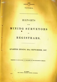
Book - REPORTS OF THE MINING SURVEYORS AND REGISTRARS 30TH. SEPT. 1867, 1867
REPORTS OF THE MINING SURVEYORS AND REGISTRARS 30TH. SEPT. 1867gold mining, miners' safety cage, surveyors reports, gold, gold mining, mining registrars report, mining surveyor -
 Whitehorse Historical Society Inc.
Magazine - Periodical, Health and Building
Periodical of the Institute of Health Surveyors, AustraliaPeriodical of the Institute of Health Surveyors, Australia. New series.Periodical of the Institute of Health Surveyors, Australiahealth inspectors, institute of health surveyors. australia -
Bendigo Historical Society Inc.
Map - WESTON, 21/10/1876
Map: Re-Survey of part of the parish of Weston, County of Rodney. Parish plan (number 309 in map cupboard 1)Murray and Hargreave, Authorised surveyorsmap, rodney, parish plan, parish of weston, murray and hargreave -
 Bendigo Historical Society Inc.
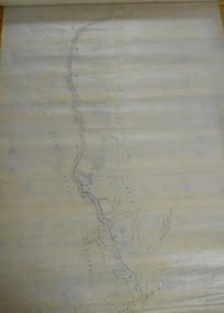
Map - PLAN OF BENDIGO CREEK, 12th March 1873
Map: Hand drafted plan of the Bendigo Creek, covering from Scott St. White Hills to Alder St. Kangaroo Flat. Scale 2 chains to 1 inchGeorge R------- ? City Surveyormap, bendigo, bendigo creek -
 Bendigo Military Museum
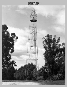
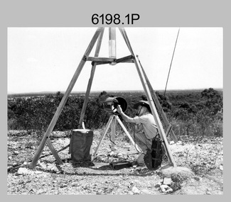
Photograph - Royal Australian Survey Corps Survey Observation Towers, c1950s
This is a set of seven photographs of Royal Australian Survey Corps surveyors setting up observation towers in the field and undertaking survey observations during mapping and geodetic control operations. c1950s. Survey observation towers were used mainly to take angular measurements in flat or heavily forested terrain, where height was necessary to achieve observer’s line-of-sight between field survey station. The Bilby Tower seen in photo .5P was erected to a height of 75 feet (23m) above ground level. The use of the Bilby Tower in Topographic Squadron’s field survey operations from 1955 to 1966 is described in page 54 of Valerie Lovejoy’s book 'Mapmakers of Fortuna – A history of the Army Survey Regiment’ ISBN: 0-646-42120-4. CAPT George Ricketts’ period of service was from 1942 to 1976 reaching the rank of LTCOL. It is noted in page 35 of Valerie Lovejoy’s book that then SGT Ricketts hand lettering skills came to the fore from his contribution to the draughting of one of the Japan’s Instruments of Surrender in 1945.This is a set of seven photographs of Royal Australian Survey Corps surveyors setting up observation towers in the field and undertaking survey observations during mapping and geodetic control operations. c1950s. The photographs were printed on photographic paper and are part of the Army Survey Regiment’s Collection. The photographs were scanned at 300 dpi. .1) - Photo, black & white, c1950s, ‘Bilby’ survey observation tower. .2) - Photo, black & white, c1950s, CAPT George Ricketts climbing ‘Bilby’ survey observation tower. .3) - Photo, black & white, c1950s, geodetic survey equipment on ‘Bilby’ survey observation tower. .4) - Photo, black & white, c1950s, two unidentified field surveyors on ‘Bilby’ survey observation tower. .5) - Photo, black & white, c1950s, two unidentified field surveyors, with CAPT Ricketts climbing ‘Bilby’ survey observation tower. .6) - Photo, black & white, c1950s, two unidentified field surveyors undertaking observations on survey observation tower. .7) - Photo, black & white, c1950, two unidentified field surveyors erecting or dismantling a survey observation tower..1P with paper tag annotated ‘Bilby Tower’ .4P on back – ‘Bilby Tower’. .5P on back – ‘Survey Observing Tower. Observing tower used for angular measurement in flat country. 75’ high – CAPT Ricketts climbing. .6P, .7P on back. ‘1960s?’royal australian survey corps, rasvy, army survey regiment, army svy regt, fortuna, asr, surveying -
 Wodonga & District Historical Society Inc
Map - Tulloch & Brown's Map of the Colony of Victoria, Tulloch & Brown, 1856
The map was created by Tulloch and Brown. David Tulloch was one of the earliest engravers and lithographers in the state of Victoria. He arrived in Melbourne from Greenock, Scotland, on 3 January 1849. Following the discovery of gold Tulloch went to the Victorian goldfields in 1851, commissioned to make sketches of the diggers and the diggings for Ham’s Illustrated Australian Magazine. In November 1852 Tulloch set up in business as engraver, draughtsman, copperplate printer and lithographer. Tulloch took a map engraver, James Davie Brown, into partnership in March 1853; the several maps and specimens of commercial engraving they showed at the 1854 Melbourne Exhibition were awarded a bronze medal. That year Tulloch and Brown also received a silver medal at the Victorian Industrial Exhibition. The partnership was dissolved towards the end of 1856.This is a very early map of the Colony of Victoria including Belvoir (now know as Wodonga).A foldable map mounted on linen and with a board cover. It records the Colony of Victoria according to Surveyor's Records revised in 1857. Areas of the map are shaded to highlight different counties.At bottom right hand section of map: Tulloch & Brown's map of the Colony of Victoria : comprising part of New South Wales, the boundaries, counties, also seaport & inland townships, the gold fields with the latest discoveries, roads, tracks, &c. &c. / compiled from drawings in the Survey Office and correctly revised till 1857. Respectfully dedicated by Permission, to the Honorable Captain Andrew Clarke R.E. Surveyor General of Victoria by His Obediant Servants Tulloch & Brown, Engravers & Publishers, Melbourne". At bottom right below border : Published as the Act directs by the Proprietors, Melbourne, 1st Feb. 1856. tulloch and brown maps, rare maps victoria, victorian cartography -
Clunes Museum
Map - SURVEYERS MAP OF CLUNES, J. FINNIE, 1883
A SURVEYORS MAP OF CLUNES. GEOLOGICALLY AND TOPOGRAPHICALLY SURVEYED BY R.A.F. MURRAY.LITHOGRAPHED BY R. SHEPHERD AND PRINTED BY J. FINNIE MINING DEPARTMENT, MELBOURNE,1883document, surveyers map of clunes, map of clunes -
 Whitehorse Historical Society Inc.
Photograph - Photograph Album, Tanglewood
The album was given to the owner who was selling the property by the Estate Agent.Photo album with photos of the property for sale..Doolan and Goodchild Surveyorstanglewood, property for sale, blackburn, the avenue -
 Stawell Historical Society Inc
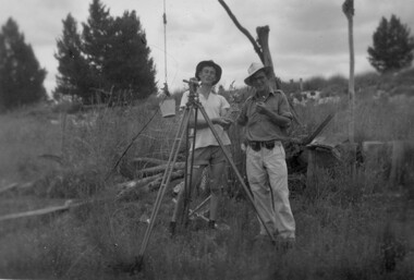
Photograph, Stawell Geodetic Survey at work. c1940's
Taken while surveying western half of Victoria to South Australian Border.Theodolite in foreground. Behind Surveyor in hat, shirt, long pants. Directly behind is Survey technician in hat, Tee shirt and shorts. Surveyor unknown. Assistant Alan Edward Tangey of Stawell. Reverse 4 2 2 6 -
 Bendigo Military Museum
Photograph - Royal Australian Survey Corps Electronic Distance Measuring Equipment Demonstration, c1960s
This is a set of five photographs of CAPT James ‘Jim’ Leslie Stedman in the field demonstrating the setup of prisms used as electric distance measurement (EDM) receiver reflectors for tellurometer equipment and the sighting of a large surveyor’s light. This equipment was deployed in establishing mapping and geodetic control operations. The photos were most likely taken in the late 1950s or early 1960s. The tellurometers of this era were man-portable systems that improved geodetic survey efficiencies for rapid network extension and densification replacing triangulation with EDM and theodolite traverse sometimes using Bilby Towers to extend line lengths. Jim Stedman later reached the rank of Colonel, was Director of Military Survey from 1975 to 1978 and was appointed as Colonel Commandant (honorary appointment, Retd) of the Royal Australian Survey Corps from 1978 to 1983. Jim Stedman is demonstrating EDM equipment. See item 6180.16P, photos .14) to .16) for more information and photos of Jim Stedman’s EDM demonstration. This is a set of five photographs of a surveyor in the field demonstrating electric distance measurement (EDM) equipment. c1950s – 1960s. The photographs were printed on photographic paper and are part of the Army Survey Regiment’s Collection. The photographs were scanned at 300 dpi. .1) to .2) - Photo, black & white, c1960s, CAPT Jim Stedman demonstrating the sighting of a large surveyor’s light. .3) to .5) – Photo, black & white, c1960s, CAPT Jim Stedman demonstrating EDM prism equipment. .1P to .5P on back – CAPT Stedman EDM Eqpt.royal australian survey corps, rasvy, army survey regiment, army svy regt, fortuna, asr, surveying -
 Whitehorse Historical Society Inc.
Document - Correspondence, Anderson's Creek, 19/12/1874
Letter of resignation, 19 December 1854, from W. Bennett Hull to the Surveyor General regarding complaints about the supervision of Mr Hodgkinson, District Surveyor during survey of road to Anderson's Creek.hull, w. bennett, hodgkinson, clement, andersons creek, land surveys, roads and streets -
Eltham District Historical Society Inc
Folder, R. Brazill, 1860s
Folder of information on R Brazill, mining surveyor, Caledonia Diggings, 1860sr brazill -
 Bendigo Historical Society Inc.
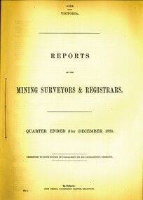
Book - REPORT OF THE MINING SURVEYORS AND REGISTRARS, 31ST. DECEMBER 1881, 1881
REPORT OF THE MINING SURVEYORS AND REGISTRARS, 31st. December 1881. 44 pagesVic. Govt.gold mining, miners' safety cage, mining surveyors and registrars rep, gold mining, bendigo, goldfields, mining surveyor, mining registrar's reports -
 Bendigo Historical Society Inc.
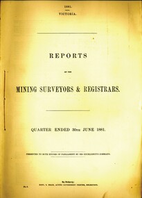
Book - REPORT OF THE MINING SURVEYORS AND REGISTRARS, 30TH. JUNE 1881, 1881
REPORT OF THE MINING SURVEYORS AND REGISTRARS, 30TH. JUNE 1881. 40 pagesVic. Govt.gold mining, miners' safety cage, mining surveyors and registrars rep, bendigo, gold mining, goldfields, registrars, mining surveyors report -
 Bendigo Historical Society Inc.
Book - REPORT OF THE MINING SURVEYORS AND REGISTRARS 30TH. JUNE 1877, 1877
... surveyors ...Report of the mining surveyors and registrars, quarter ended 30th June 1877.gold mining, miners' safety cage, registrars and surveyors report, gold, gold mining, registrars, surveyors -
 Bendigo Historical Society Inc.
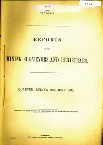
Book - REPORTS OF THE MINING SURVEYORS AND REGISTRARS, 1872
... surveyors ...REPORTS OF THE MINING SURVEYORS AND REGISTRARS. Quarter ending 30th June 1872.gold mining, miners' safety cage, registrars report, gold, gold mining, surveyors, registrars report. -
 University of Melbourne, Burnley Campus Archives
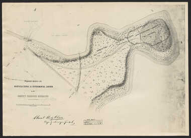
Photograph, Clement Hodgkinson, Proposed Reserve for Horticultural & Experimental Garden in the Survey Paddock, Richmond, 1862-1948
Photograph dated 7.12.48 of plan by Clement Hodgkinson, Deputy Surveyor General. Gazetted 1/8/62, handwritten on it in pencil.clement hodgkinson