


Historical information
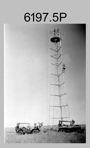
This is a set of seven photographs of Royal Australian Survey Corps surveyors setting up observation towers in the field and undertaking survey observations during mapping and geodetic control operations. c1950s. Survey observation towers were used mainly to take angular measurements in flat or heavily forested terrain, where height was necessary to achieve observer’s line-of-sight between field survey station. The Bilby Tower seen in photo .5P was erected to a height of 75 feet (23m) above ground level. The use of the Bilby Tower in Topographic Squadron’s field survey operations from 1955 to 1966 is described in page 54 of Valerie Lovejoy’s book 'Mapmakers of Fortuna – A history of the Army Survey Regiment’ ISBN: 0-646-42120-4. CAPT George Ricketts’ period of service was from 1942 to 1976 reaching the rank of LTCOL. It is noted in page 35 of Valerie Lovejoy’s book that then SGT Ricketts hand lettering skills came to the fore from his contribution to the draughting of one of the Japan’s Instruments of Surrender in 1945.
Physical description
This is a set of seven photographs of Royal Australian Survey Corps surveyors setting up observation towers in the field and undertaking survey observations during mapping and geodetic control operations. c1950s.
The photographs were printed on photographic paper and are part of the Army Survey Regiment’s Collection. The photographs were scanned at 300 dpi.
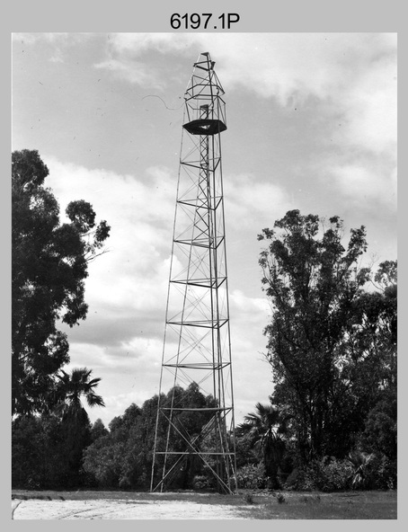
.1) - Photo, black & white, c1950s, ‘Bilby’ survey observation tower.
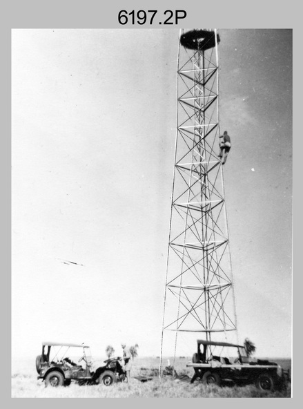
.2) - Photo, black & white, c1950s, CAPT George Ricketts climbing ‘Bilby’ survey observation tower.
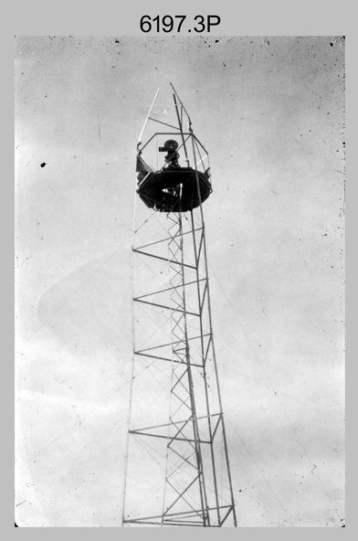
.3) - Photo, black & white, c1950s, geodetic survey equipment on ‘Bilby’ survey observation tower.
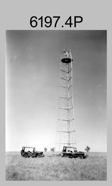
.4) - Photo, black & white, c1950s, two unidentified field surveyors on ‘Bilby’ survey observation tower.
.5) - Photo, black & white, c1950s, two unidentified field surveyors, with CAPT Ricketts climbing ‘Bilby’ survey observation tower.
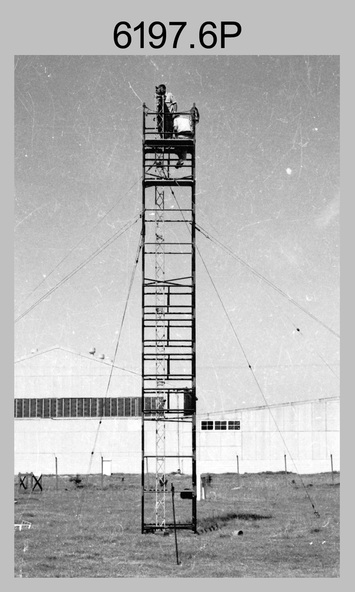
.6) - Photo, black & white, c1950s, two unidentified field surveyors undertaking observations on survey observation tower.
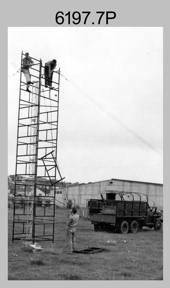
.7) - Photo, black & white, c1950, two unidentified field surveyors erecting or dismantling a survey observation tower.
Inscriptions & markings
.1P with paper tag annotated ‘Bilby Tower’
.4P on back – ‘Bilby Tower’.
.5P on back – ‘Survey Observing Tower. Observing tower used for angular measurement in flat country. 75’ high – CAPT Ricketts climbing.
.6P, .7P on back. ‘1960s?’