Showing 115 items matching "the geography of victoria"
-
 Bendigo Historical Society Inc.
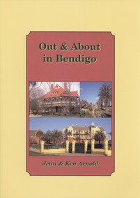
Book - OUT & ABOUT IN BENDIGO, 2007
... headstones poppet heads Fortuna geographical centre of Victoria ...Out & About in Bendigo. History of Bendigo and District. Plaques, monuments and head stones. Photographs. ISBN:978 1 875 342 69 3. Inscriptions: Ken Arnold December 2007.Ken & Jean Arnoldbendigo, history, bendigo, bendigo and district, plaques monuments headstones poppet heads fortuna geographical centre of victoria memorials -
 Bendigo Historical Society Inc.
Map - VICTORIA, Circa 1926
... Victoria counties Counties of Victoria Geographic features Map: Map ...Map: Map showing Counties, including Railway lines and Geographic features. Compiled and engraved at the Department of Lands and Survey Melbourne, Revised October 1926 ( number 184 in Map Cupboard 1)map, victoria, counties, counties of victoria, geographic features -
 Bendigo Historical Society Inc.
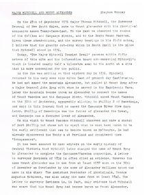
Document - MAJOR MITCHELL AND MOUNT ALEXANDER
Typed notes mentioning the naming of Mount Alexander, Coliban, Campaspe and who named them. Also the origins of the names.document, major mitchell and mount alexander, tommy-came-last, the major mitchell tourist trail, major general john byng, phillip of macedonia, alexander the great, henty s, surveyor davidson, alexander mollison, george augustus robinson, william morton, mr charles hotson ebden, john randell, public library of melbourne, les blake, governor burke, phillip parker king, crown solicitor henry field gurner, arthur phillip, hume, australia felix expedition, l blake, place names of victoria, g brenmer, booklet for secondary schools, m cannon, historical records of victoria vol 1, j h l cumpston, thomas mitchell surveyor general and explorer, h f gurner, chronicle of port phillip, t l mitchell, three expeditions into the interior of eastern australia, a f mollison, an overlanding diary, w l morton, adventures of a pioneer, m s 5188, itinerary from the journal of the exploring expedition returning from portland bay, m s 5189, mitchell's 1837 map, j o randell, pastoral settlement in northern victoria vol 1, pastoral settlement in northern victoria vol 2, records of the victorian archaeological survey number 5, journals of george augustus robinson, t c sargent, some peninsular names in australia felix, w h wells, a geographical dictionary or gazetteer of the australian colonies -
Clunes Museum
Book, Jan D Clark, MONASH UNIVERSITY NUMBER 37 ABORIGINAL LANGUAGES AND CLANS
HISTORICAL ATLAS OF WESTERN AND CENTRAL VICTORIA, AUSTRALIA 1800-1900 ON PAGE ONE: TO THE CLUNSES MUSEUM WITH BEST WISHES "JAN CLARK" 5 OCTOBER 2003aboriginal languages - of western and central victoria, aboriginal clans -
 Robin Boyd Foundation
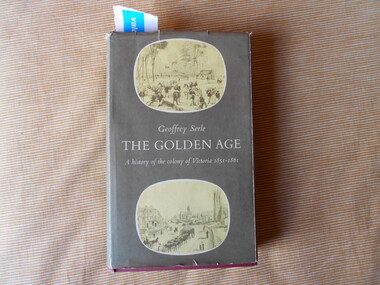
Book, Geoffrey Serle, The Golden Age, 1963
... melbourne victoria history geography geoffrey serle Walsh St library ...Hardcover w/ Dust JacketTorn paper bookmark @ p.85victoria history, geography, geoffrey serle, walsh st library -
Victorian Aboriginal Corporation for Languages
Map, Geographic Data Victoria, Vicmap topographic map index as at June 2000, 2000
... by the earlier bodies, Survey &? Mapping Victoria, etc. Also indexes ...Index to Vicmap topographic mapping, including 1:25 000 and 1:50 000 topographic maps, and Outdoor leisure series, compiled by the earlier bodies, Survey &? Mapping Victoria, etc. Also indexes Royal Australian Survey Corps' 1:50 000 topographic mapping.mapsvictorian maps, topographic maps -
 Victorian Aboriginal Corporation for Languages
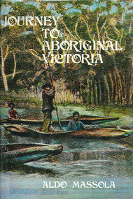
Book, Aldo Massola, Journey to Aboriginal Victoria, 1969
... and detailed description of sites and geographical features. Journey ...Looks at the Aboriginal community from the time of white contact, across many parts of Victoria. Chap.1; Melbourne - early missions, camp of Native Police, corroboree trees, canoe trees, grave &? headstone of Derrimut; quarries at Keilor, excavation sites at Green Gully &? Keilor; quarry at Mt. William, notes on inheritance of quarries Coranderrk settlement - Barraks grave, notes on his life; Chap.2; Geelong - Yawangi group of the Wothowurong tribe, camping grounds in area quarries; Notes on William Buckley, Gellibrand (a notable Aboriginal), graves in the Western Cemetery; Chap.3; Colac - war between Colac &? Geelong tribes; Mission at Birregurra, reason for failure of Buntingdale Mission; brass plate to Coc-coc-coine; reserve at Elliminyt, native ovens, camp sites, initiation site &? ritual; quarry sites, axegrinding factory, rock pecking &? engraving; dried hand &? 3 Aboriginal skulls found; Chap.4; The south-west coast - middens, camp sites notes on Framlingham Stn., fish traps at Tyrendarra; Chap.5; The far west - massacres of Aborigines near Casterton; camp sites, oven mounds; the first cricket team formed; Aboriginal cemetery; Chap.6; Hamilton - camps; Mount Rouse Station, axegrinding grooves at Nareeb Nareeb, shelters described, fish traps, massacre at Lake Condah; mission; canoes; Chap.7; Camperdown - legend about Lake Bullen Merri; obelisk erected in memory of Aborigines of district especially chief Wombeetch Puyuun; Jarcoort tribe; fish weirs, camps, intertribal fights between Booluc-burrers, Jarcoorts &? Ellengermote groups; bartering place at Mount Noorat; articles traded, legend of Flat-Top Hill; Chap.8; Ballarat - camp at Lake Wendouree; White Stone Lagoon; legends concerning Mt. Buninyong &? waterfalls at Lal-lal; camp sites; pygmy-type implements near Meredith, quarry at Glue Pot Rocks near Durdidwarrah; brass plate of King Billy; Chap.9; Ararat - Tjapwurong territory; camp sites, quarries, shield &? canoe trees; Bunyip belief at Lake Buninjon of Muk-jarawaint &? Pirtkopen-noot tribes, gives legend; stone implements; mill stones; fish weirs; stone arrangement near Lake Wongan; ground drawing of a bunyip, paintings in rock shelter near Mt. Langi Ghiran; Chap.10; Maryborough - camps, oven mounds, rock wells, stone arrangement at Carisbrook; camp sites at Mt. Franklin; Chap.11; Charlton - belief in Mindye (snake); canoe trees, ovens, camp sites, water holes, rock wells, stone implements; method of rainmaking; Chap.12; Horsham-Stawell, The Wimmera - Wotjobaluk land; camps, fish traps at Toolondo; Black Range cave paintings, Flat Rock shelters (detailed account of these paintings); Bunjils Cave; Chap.13; Horsham-Stawell, The Mallee - camp sites, implements; Ebenezer Mission, Willie Wimmera taken to England by Rev. Chase to become a missionary, died in England; Chap.14; The Murray River, Mildura Swan Hill - Battle of the Rufus; ceremonial ground, Lake Gol Gol, canoe &? shield trees; stone implements; camp sites, fire place arrangements; fish traps; oven mounds; Chap.15; The Murray River, Swan Hill-Echuca - legend about Lake Boga; camps, oven mounds, the Cohuna skull, Kow Swamp, method of burial; Chap.16; Shepparton ovens; brass plates of King Paddy of Kotupna &? King Tattambo of Mulka Stn., native well, camps; Chap.17; Wangaratta -camps, quarry, rock holes, the Faithful massacre; grinding rocks at Earlston; Chap.18; The High Plains - Ya-itma-thang; camps, Bogong moth feasts, native paths for trade &? intertribal fights, articles traded; painted shelters; Koetong Ck. Valley, near Mt. Pilot &? near Barwidgee Ck.; Chap.19; Dandenong - water holes, list of 8 holes in Beaumaris - Black Rock area; camps, middens, stone implements (microliths), legend of Angels Cave, stone axes, Native Police Force, Narre Narre Warren Station, legend about rocks on Bald Hill, kangaroo totemic site; Chap.20; Wonthaggi- Yarram - natives visit Phillip Is., murder of William Cook and Yankee by five Tasmanians (listed as Bon Small Boy, Jack Napoleon Timninaparewa, Fanny Waterpoordeyer, Matilda Nattopolenimma and Truganini) near Cape Patterson, men; camp sites, middens, legend of White Rock; Chap.21; Sale - Bairnsdale, The Lakes Country middens, camps; legend at Wulrunjeri; story of a white woman supposedly living with with the Tutangolung tribe, efforts made to prove story; canoe trees; Chap.22; Sale-Bairnsdale, The Inland Braiakolung tribe, camps, implements, canoe &? shield trees; Ramahyuck Mission, grinding rocks, fights with Omeo tribe; native tracks, death through enemy magic - procedure, belief in ghosts; Chap.23; Lakes Entrance and the Country to the east - Kroatungolung people, legend of Kalimna Valley; camps, stones of Nargun, bunyip, devils at Lake Tyers, excavation at Buchan, carbon dates; middens, ochre at Cape Conrad, stone fish-hook file at Thurra River; note on Bidwel tribe; Each chapter gives historical details, early contacts, relationships with settlers; Aboriginal place names and detailed description of sites and geographical features.b&w photographs, b&w illustrations, colour illustrationsgeelong, colac, hamilton, camperdown, ballarat, ararat, maryborough, charlton, horsham, stawell, murray river, shepparton, wangaratta, dandenong, wonthaggi, yarram, sale, bairnsdale, lakes entrance -
 Victorian Aboriginal Corporation for Languages
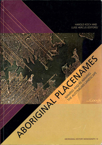
Book, Harold Koch, Aboriginal placenames : naming and re-naming the Australian landscape, 2009
"Aboriginal approaches to the naming of places across Australia differ radically from the official introduced Anglo-Australian system. However, many of these earlier names have been incorporated into contemporary nomenclature, with considerable reinterpretations of their function and form. Recently, state jurisdictions have encouraged the adoption of a greater number of Indigenous names, sometimes alongside the accepted Anglo-Australian terms, around Sydney Harbour, for example. In some cases, the use of an introduced name, such as Gove, has been contested by local Indigenous people." "The 19 studies brought together in this book present an overview of current issues involving Indigenous placenames across the whole of Australia, drawing on the disciplines of geography, linguistics, history, and anthropology. They include meticulous studies of historical records, and perspectives stemming from contemporary Indigenous communities. The book includes a wealth of documentary information on some 400 specific placenames, including those of Sydney Harbour, the Blue Mountains, Canberra, western Victoria, the Lake Eyre district, the Victoria River District, and southwestern Cape York Peninsula." -- Publisher description. Contents: Introduction: Old and new aspects of Indigenous place-naming /? Harold Koch and Luise Hercus NSW &? ACT: 1. Aboriginal placenames around Port Jackson and Botany Bay, New South Wales, Australia: sources and uncertainties /? Val Attenbrow 2. Reinstating Aboriginal placenames around Port Jackson and Botany Bay /? Jakelin Troy and Michael Walsh 3. The recognition of Aboriginal placenames in New South Wales /? Greg Windsor 4. New insights into Gundungurra place naming /? Jim Smith 5. The methodology of reconstructing Indigenous placenames: Australian Capital Territory and south-eastern New South Wales /? Harold Koch Victoria: 6. Toponymic books and the representation of Indigenous identities /? Laura Kostanski 7. Reviving old Indigenous names for new purposes /? Laura Kostanski and Ian D. Clark 8. Reconstruction of Aboriginal microtoponymy in western and central Victoria: case studies from Tower Hill, the Hopkins River, and Lake Boga /? Ian Clark South Australia &? Central Australia: 'Aboriginal names of places in southern South Australia': placenames in the Norman B.Tindale collection of papers /? Paul Monaghan 10. Why Mulligan is not just another Irish name: Lake Callabonna, South Australia /? J.C. McEntee 11. Murkarra, a landscape nearly forgotten: the Arabana country of the noxious insects, north and northwest of Lake Eyre /? Luise Hercus 12. Some area names in the far north-east of South Australia /? Luise Hercus 13. Placenames of central Australia: European records and recent experience /? Richard Kimber Northern Australia: 14. Naming Bardi places /? Claire Bowern 15. Dog-people: the meaning of a north Kimberley story /? Mark Clendon 16. 'Where the spear sticks up': the variety of locatives in placenames in the Victoria River District, Northern Territory /? Patrick McConvell 17. 'This place already has a name' /? Melanie Wilkinson, Dr R. Marika and Nancy M. Williams 18. Manankurra: what's in a name? placenames and emotional geographies /? John J. Bradley and Amanda Kearney 19. Kurtjar placenames /? Paul Black.Maps, b&w photographs, tables, word listsaustralian placenames, sociolinguistics, linguistics, anthropology, sydney harbour placenames, blue mountains placenames, canberra placenames, western victoria placenames, lake eyre placenames, victoria river district placenames, cape york peninsula placenames -
 Victorian Aboriginal Corporation for Languages
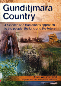
Book, Theo Watson Read et al, Gunditjmara country : a science and humanities approach to the people, the land and the future, 2007
... Street Brunswick melbourne Gunditjmara Western Victoria education ...Gunditjmara Country is an integrated unit which looks at the lives, traditions and culture of the Gunditjmara People of Western Victoria. Developed as part of the Kormilda Science Project and targeted at all Australian students, this work recognises the need for Western and Indigenous cultures to contribute to the comprehensive education of Australia's youth. The introduction provides a guide to implementing this program of study in schools and includes feedback from teachers involved in trialling the material.gunditjmara, western victoria, education, curriculum development, geography, science, history, secondary school education -
 Victorian Aboriginal Corporation for Languages
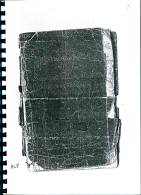
Book, An alphabetical list of loose bags, parishes, shires, stations, butter factories, hamlets, state schools, streets, village settlements, and places not being post towns in the colony of Victoria
Photocopy of the original document of c. 1895-1897 listing all places not a Post Town in Victoria.listing of place and street namesvictorian geographical names, street names -
 Victorian Aboriginal Corporation for Languages
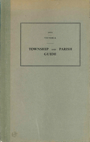
Book, Department of Crown Lands and Survey Victoria, Township and parish guide : Victoria, 1955
A alphabetical list of townships proclaimed under the Land Acts of Victoria. Shows the parish, land district and the municipality in which each is situated, and the particulars of Gazettal of Proclamation.victorian geographical names, victorian administration -
Clunes Museum
Book, IAN D. CLARK. 1990, ABORIGINAL LANGUAGES AND CLANS, 1990
Full bibliographic detail on Dhauwurd wurrung, Djab wurrung, Djadja wurrung, Djargurd wurrung; Gadubanud; Girai wurrung; Gulidjan Jardwadjarli; Wada wurrung, Wergaia; East Kulin, Woi wurrung, Daung wurrung, Bun wurrung, Ngurai-illam wurrung, Barababaraba, Wadiwadi; Wembawemba; history of contact and settlement; effects on tradition; disruption of lifestyle; clan/subsection information; research based solely on archival sources.A MONASH UNIVERSITY PUBLICATION IN GEOGRAPHYnon-fictionFull bibliographic detail on Dhauwurd wurrung, Djab wurrung, Djadja wurrung, Djargurd wurrung; Gadubanud; Girai wurrung; Gulidjan Jardwadjarli; Wada wurrung, Wergaia; East Kulin, Woi wurrung, Daung wurrung, Bun wurrung, Ngurai-illam wurrung, Barababaraba, Wadiwadi; Wembawemba; history of contact and settlement; effects on tradition; disruption of lifestyle; clan/subsection information; research based solely on archival sources.book, aboriginal languages and clans -
Melbourne Athenaeum Archives
internet printout, Royal Historical Society Victoria - Invitation to Third Triennial meeting to mark Columbus' Discovery of America, 1492 held at Melbourne Athenaeum, October 12 1892 Royal Geographical Society of Australasia, Victorian Branch: Album
-
Koorie Heritage Trust
Book, Bader, Frances, Naming St. Kilda, 2007
... Federation Square, Melbourne melbourne Names Geographical -- Victoria ...Mentions the indigenous inhabitants of the area.i - vi; 214 P.; ports,; facs.; refs.; bib.; Mentions the indigenous inhabitants of the area. names, geographical -- victoria -- st. kilda. | st. kilda (vic.) -- name -- history. -
Koorie Heritage Trust
Book, Bulmer, John, Victorian Aborigines John Bulmer's Recollections 1855-1908, 1994
Blurb: " John Bulmer began his missionary work in 1855, commencing a life dedicated to the Christianising of Victorian Aboriginal people at Yelta on the Murray, in the Wimmera and Monaro and at Lake Tyers in Gippsland. ...he recorded many of his recollections in thirteen papers, in correspondence with R. Brough Smyth and A. W. Howitt and in ... Royal Geographical Society of Australia."`xv, 98 p. : ill., map. figs.; tables; notes, word list; bib.;; 25 cm.Blurb: " John Bulmer began his missionary work in 1855, commencing a life dedicated to the Christianising of Victorian Aboriginal people at Yelta on the Murray, in the Wimmera and Monaro and at Lake Tyers in Gippsland. ...he recorded many of his recollections in thirteen papers, in correspondence with R. Brough Smyth and A. W. Howitt and in ... Royal Geographical Society of Australia."`bulmer, john, 1833-1913. | aboriginal australians -- missions -- victoria. | aboriginal australians -- victoria -- social life and customs. | aboriginal australians -- victoria -- social conditions. -
Koorie Heritage Trust
Article - Paper, Bryant, Jennifer J, The Robinvale Aboriginal and Islander community : transition to independence, 1981
An in-depth study of this community to be used as part of a major thesis on Aboriginal housing in Victoria. Survey of Aboriginal housing in Robinvale and surrounding area; includes history of European settlement and consequent demographic upheaval for Aborigines; contemporary data on employment, incomes and expenditure, seasonal work, education, health and Murray Valley Aboriginal Co-operative; housing survey looks at structures, rents, number and duration of occupancy, maintenance and suitability of design.113 p. : maps ; tables; footnotes; 30 cm. -- (Working paper ; no. 13.)An in-depth study of this community to be used as part of a major thesis on Aboriginal housing in Victoria. Survey of Aboriginal housing in Robinvale and surrounding area; includes history of European settlement and consequent demographic upheaval for Aborigines; contemporary data on employment, incomes and expenditure, seasonal work, education, health and Murray Valley Aboriginal Co-operative; housing survey looks at structures, rents, number and duration of occupancy, maintenance and suitability of design.robinvale-aboriginal community. | housing-aborignal, victoria.| statistics- robinvale-aboriginal community | cooperatives-aboriginal-robinvale | latje latje tribe. i. monash university. dept. of geography. -
 Old School House Museum
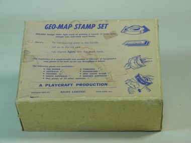
Rubber Stamp Set
Used by teachers for teaching geography, they would take the plate and attach to the handle, stamp it into ink and would make multiple copies for the students to either identify capital and countries or to learn the shape and localities of each locationIt was an early way of making multiple copies for teaching students.Geography stamp set in box which include 4 plates and handle. Plates include, Asia,Africa,Victoria,The world Geo-Map Stamp Setfrankston primary school, rubber stamps, education, geo-map, victoria, asia, the world, africa, playcraft production -
 Numurkah & District Historical Society
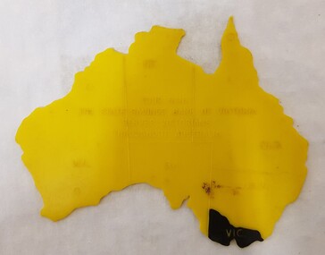
Equipment - Plastic stencil map/shape of Austalia
Yellow plastic stencil in the shape of Australia, states marked on the map, Victoria painted in blackState Savings Bank of Victoraeducation, school, geography, australia, stencil, drawing -
 Bendigo Historical Society Inc.
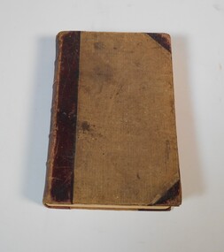
Book - Geographical dictionary
... and schools. Geographic dictionary Colony of Victoria Unreadable name ...The Gazetteer presents an extensive a to z list of Victorian towns and villages, lakes, rivers and creeks, islands, bays, hills and mountains, runs and other localities and features. Entries include latitude and longitude, populations, proximity to other towns, local industries, coach and mail runs, hotels, churches and schools.Bailliere's Victorian Gazetteer and road guide containing the most recent and accurate information as to every place in the colony. Brown hardcover book, on the spine: Victorian Gazetteer with map 1865. The first and last pages are advertisements. The book has 442 pages listing every place in the colony. The map is not included. Compiled by Robert P. Whitworth. Published by Bailliere, Regent Street Unreadable name on first page and the name of F. Houston in blue pen on first page geographic dictionary, colony of victoria -
 Bendigo Historical Society Inc.
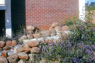
Slide - Bendigo College of Advanced Education - Landscaping, about 1986
Bendigo TAFE is a regional provider of vocational education, training and assessment services, located in northern and central Victoria, Australia. The institute has been in operation in various guises since 1854. The institute was known as the Loddon Campaspe Institute of TAFE from 1987 to 1990, Bendigo Regional Institute of TAFE (BRIT) from 1990 to 2009, before becoming Bendigo TAFE in 2009. Bendigo TAFE services a significant geographical area of approximately 25,000 square kilometres in central and northern Victoria, with a local population of 220,000. In May 2014, Bendigo TAFE announced that it would merge with the Melbourne-based Kangan Institute to form Bendigo Kangan Institute, however both institutes retain their existing branding.Bendigo College of Advanced Education (BCAE) early years - 24 slides of Landscaping at the new premises in Nolan Street Bendigo (Now the Bendigo Tertiary and Further Education (TAFE). history, bendigo, bendigo college of advanced education, bcae, landscaping, bendigo tafe -
 8th/13th Victorian Mounted Rifles Regimental Collection
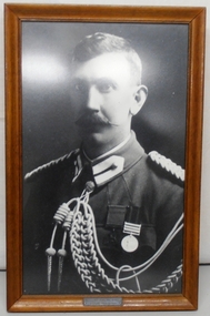
Photograph - Photograph Maygar, 1902 circa
Lieutenant Leslie Maygar served with the 5th Contingent Victorian Mounted Rifles in south Africa during the Boer War (1899-1902). He was awarded the Victoria cross for heroism . Maygar served with the 15th Light Horse (CMF) in the period 1902-1914 and at the outbreak of WWI (1914-1918) he was promoted to Major and appointed as a Squadron Commander with 4th Light Horse (AIF). He served at Gallipoli then was promoted Lieutenant Colonel and appointed Commanding Officer 8th Light Horse. He was serving in this capacity at Beersheba in October 1917 when the regiment was attacked by enemy aircraft. Maygar died of wounds sustained in the attack. Fine photograph of officer of the Victorian Mounted Rifles in the period immediately following the Boer War. Leslie Maygar was a native of the Euroa district and a geographic feature and a winery have been named in his honour.Framed black and white photograph of Lieutenant Leslie Maygar VC in Victorian Mounted Rifles uniform following his return from South Africa 1902. He is wearing his Victoria Cross and Queen's South African medal with three bars: Transvaal, Orange Free State, Cape Colony..Engraved panel at lower centre frame "Lt L C Maygar VC 5VMR / Date of Award 23-11.01"maygar leslie c lieutenant vc, victoria cross, vmr 5th contingent, 8th light horse regiment -
 Kew Historical Society Inc
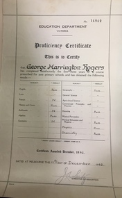
Certificate, Education Department (Victoria), Proficiency Certificate: George Harrington Rogers, 11/12/1942
This document was donated to the Kew Historical Society by John Rogers in 2015. Primary source for understanding the requirements of educational standards in Victoria in the 1940sEducation Department Victoria. Proficiency Certificate No.14942 This is to Certify that George Harrington Rogers has completed satisfactorily the first three years of a course prescribed for post primary school, and had obtained the following results. Pass - English, History and Civics, Algebra, Geography, Drawing, Physical Education and Hygiene, Physics, Chemistry. Certificate awarded 1942. Dated at Melbourne this 11th Day of December 1942. Signed Director of Education.certificates - education department victoria, proficiency certificates, george harrington rogers -
 Stawell Historical Society Inc
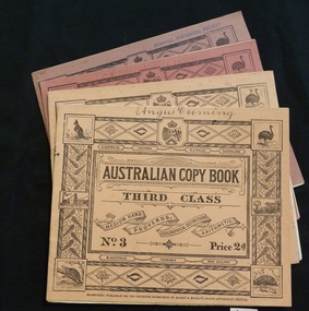
Booklet, Education Department, Australian Copy book
Books used in teaching writing0682-6: Fawn cardboard cover, with complex border artwork. 0682-7: Blue cardboard cover, with complex border artwork. 0682-8: Pink cardboard cover, with complex border artwork. 0682-6: S. Australia. Victoria. N.S. Wales. Queensland. Australian Copy Book Third Class. Medium Hand. Proverbs. Geographical Definitions. Arithmetic. No. 3 Price 2d. W. Australia Tasmania. New Zealand. Melbourne: Published for the Education Department by J. Kemp. Government Printer. 0682-7: Christina (Handwritten) S. Australia. Victoria. N.S. Wales. Queensland. Australian Copy Book Fourth Class. Small Hand. Proverbs. Geography. Commercial Terms. No.4 Price 2d. W. Australia Tasmania. New Zealand. Melbourne: Published for the Education Department by J. Kemp. Government Printer. 0682-8: Angus Cumming (Handwritten) S. Australia. Victoria. N.S. Wales. Queensland. Australian Copy Book Fifth and Sixth Class. Quotations, Poetry & Prose. Commercial. Letters & Forms. No.5 Price 2d. W. Australia Tasmania. New Zealand. Melbourne: Published for the Education Department by J. Kemp. Government Printer.stawell education -
 Port Fairy Historical Society Museum and Archives
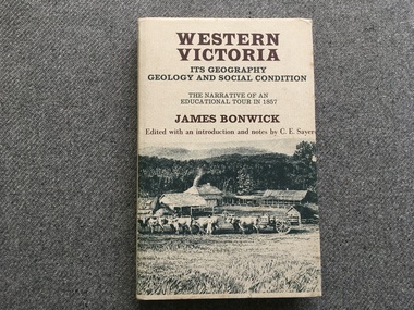
Book, James Bonwick, Western Victoria It’s geography geology and social condition. The Narrative of an Educational Tour in 1857
... Western Victoria It’s geography geology and social... and Yambuk. Les Robertson Western Victoria It’s geography geology ...1857 tour of Western Victoria including Tower Hill, Belfast and Yambuk.non-fiction1857 tour of Western Victoria including Tower Hill, Belfast and Yambuk.colonial education, belfast, victoria 1857, book -
 Parks Victoria - Wilsons Promontory Lightstation
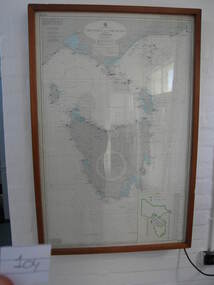
Nautical chart
Used as display in AMSA workshop foyer, Moorabbin, Vic. Nautical charts x 2 , The framed and glazed chart identifies strategic points in the notorious Bass Strait passage, which in the nineteenth century was known as the ‘Eye of the Needle’. It covers the whole of Tasmania, Bass Strait and the islands, and the lower part of Victoria with its coastline between Cape Otway and Gabo Island. The chart has an electric cord connecting it to a wall switch which enables a series of small lights to flash on strategic geographical locations.. While it is not known if it is original to Wilsons Promontory, it certainly elates to its location. A similar chart at Cape Otway shows less of Tasmania and is not electrified. Gabo Island Lightstation has two large framed charts; one is the same as the Wilsons Promontory example but without the lights and the other is entirely different, focussing on the east coast between Point Hicks and Montague Island. The Wilsons Promontory chart is unique as an illuminated version of the other charts and has first level significance if its provenance to the lightstation can be confirmed.The framed and glazed chart has an electric cord connecting it to a wall switch which enables a series of small lights to flash on strategic geographical locations.Yes -
 Bacchus Marsh & District Historical Society
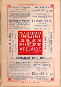
Book, Railway guide book and time table for Melbourne, Ballarat, Adelaide and all intermediate stations, also gazette for Bacchus Marsh, Ballan, Melton, &c., and almanac for 1891
Publication details: 'Railway guide book and time table for Melbourne, Ballarat, Adelaide and all intermediate stations, also gazette for Bacchus Marsh, Ballan, Melton, &c., and almanac for 1891', compiled by Christopher Crisp. Printed and published by Crisp and Lane, Bacchus Marsh, Vic., 1891. SUMMARY OF CONTENT: Includes detailed timetables and schedule of fares, descriptions of stations and refreshment facilities pp.6-26; overviews of Shires of Bacchus Marsh, Ballan and Melton, pp.27-30; historical, geographic, and economic background notes about places on the Melbourne to Adelaide route, pages 31-64, including descriptions of Bacchus Marsh, pp.34-42 and briefer notes on Ballan, pp.42-43 and Melton, pp.32-33. Almanac section is pp.65-95 (not numbered), containing common information in nineteenth century almanacs such as a calendar of the days, weeks, and months of the year; a record of various astronomical phenomena, climate information and seasonal suggestions for farmers, the rising and setting times of the Sun and Moon, dates of eclipses, hours of high and low tides, and religious festivals. A brief history of Irrigation in Mildura is on pages 1 and 112 (first and last pages). Advertisements, mostly for Bacchus Marsh businesses are on pp.96-111. The Almanac section is illustrated with drawings of scenic views of various places in Australia, but none of the Bacchus Marsh region. Online access is available on Trove at: http://nla.gov.au/nla.obj-392504046Printed book. 112 pages in total. Pages 13 -64 numbered.non-fictionPublication details: 'Railway guide book and time table for Melbourne, Ballarat, Adelaide and all intermediate stations, also gazette for Bacchus Marsh, Ballan, Melton, &c., and almanac for 1891', compiled by Christopher Crisp. Printed and published by Crisp and Lane, Bacchus Marsh, Vic., 1891. SUMMARY OF CONTENT: Includes detailed timetables and schedule of fares, descriptions of stations and refreshment facilities pp.6-26; overviews of Shires of Bacchus Marsh, Ballan and Melton, pp.27-30; historical, geographic, and economic background notes about places on the Melbourne to Adelaide route, pages 31-64, including descriptions of Bacchus Marsh, pp.34-42 and briefer notes on Ballan, pp.42-43 and Melton, pp.32-33. Almanac section is pp.65-95 (not numbered), containing common information in nineteenth century almanacs such as a calendar of the days, weeks, and months of the year; a record of various astronomical phenomena, climate information and seasonal suggestions for farmers, the rising and setting times of the Sun and Moon, dates of eclipses, hours of high and low tides, and religious festivals. A brief history of Irrigation in Mildura is on pages 1 and 112 (first and last pages). Advertisements, mostly for Bacchus Marsh businesses are on pp.96-111. The Almanac section is illustrated with drawings of scenic views of various places in Australia, but none of the Bacchus Marsh region. Online access is available on Trove at: http://nla.gov.au/nla.obj-392504046railways, railway lines, almanacs, railway lines timetables -
Friends of St Brigids Association
Book - Western Victoria, Its Geography, Geology, and Social Condition; the Narrative of an Educational Tour in 1857, Bonwick, James, and Charles Edward Sayers. 1970. Western Victoria, Its Geography, Geology, and Social Condition; the Narrative of an Educational Tour in 1857. Melbourne: Heinemann
... Western Victoria, Its Geography, Geology, and Social... Victoria, Its Geography, Geology, and Social Condition; the.... 1970. Western Victoria, Its Geography, Geology, and Social ... -
 Mont De Lancey
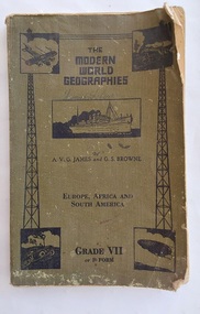
Book, The Specialty Press Pty. Ltd. et al, The Modern World Geographies Grade VII or F Form, c 1938
... Yallock, Victoria. Children's books Readers Geography Textbooks ...The Modern World Geographies: Europe, Africa and South America Grade VII or Form F is part of a series of six little books of geographical information for children between the ages of eight and fourteen written by very experienced teachers and educationalists. They are readers rather than textbooks with the object of stimulating interest and to leave to the teacher the filling in of the course by appropriate lessons.A faded khaki green softcover reader or textbook with black lettering on the front cover at the top for the title The Modern World Geographies, Europe, Africa and South America Grade VII or Form F. A black and white illustration of a steamship and four other pictures are printed on the damaged front cover. Throughout are black and white charts, maps, diagrams, photographs and illustrations. In red ink writing inside on the front endpaper is Lance Sebire. Dog eared pages with a damaged worn cover and stains. Lance Sebire is written again on the back cover.226p.non-fictionThe Modern World Geographies: Europe, Africa and South America Grade VII or Form F is part of a series of six little books of geographical information for children between the ages of eight and fourteen written by very experienced teachers and educationalists. They are readers rather than textbooks with the object of stimulating interest and to leave to the teacher the filling in of the course by appropriate lessons.children's books, readers, geography, textbooks -
 Kilmore Historical Society
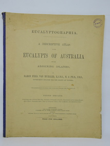
Book, Baron Ferdinand von Mueller et al, EUCALYPTOGRAPHIA. Tenth Decade, 1884
A descriptive atlas of the Eucalypts of Australia and adjoining islands. This last part of the series also contains a Synopsis of the Species, Geographic Index, Index of Vernacular Names, Index of Decades and Alphabetical Index.Light card cover with blue cloth backstrip to spine, torn at upper extremity. Some staining and marks on cover, discoloration from light exposure. Some foxing through out. Binding intact. Fair condition.non-fictionA descriptive atlas of the Eucalypts of Australia and adjoining islands. This last part of the series also contains a Synopsis of the Species, Geographic Index, Index of Vernacular Names, Index of Decades and Alphabetical Index.botany, eucalypts, australia -
 Mordialloc College Alumni Association Inc (MCAA)
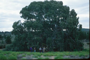
Photograph, 1979 Wyperfeld Old Be-al River Red Gum Tree, 1979
1979 - Mordialloc-Chelsea High School students standing in front of “Old Be-al” in Victoria’s Wyperfeld National Park, near Outlet Creek. It has been described as one of the most magnificent River Red Gums in the land. This glorious tree with foliage hanging to the ground escaped the fire of 1959 but not the fire of 1982 that damaged it badly. It lives on but has also suffered from lack of water and is now inaccessible to the public in a reference area. The MCAA has provided this image to the Friends of Wyperfeld National Park. Mordialloc-Chelsea High School students visited the Wyperfeld National park annually for the biology and geography Year 11 school camp.Example of a River Red Gum at Wyperfeld National Park.Digital image reproduced from colour slide.big desert fire 1959, mordialloc-chelsea high school camp, wyperfeld national park, fire 1982, old be-al river red gum