Showing 686 items matching "new south building"
-
 Kew Historical Society Inc
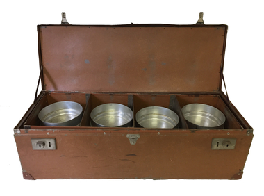
Container - Meals on Wheels delivery case
... The service in Kew began three years after in 1956 and originally operated out of the Council-owned South Esk in Cotham Road. With the building of a new Senior Citizens Centre, the service moved to Childers Street....The service in Kew began three years after in 1956 and originally operated out of the Council-owned South Esk in Cotham Road. With the building of a new Senior Citizens Centre, the service moved to Childers Street. meals on wheels (kew) south esk - kew elder citizens dorothy fox Leather case containing 12 aluminium containers, stacked in groups of three which was used to deliver meals to elderly residents by the Kew Meals on Wheels group. ...The Meals on Wheels Service in Victoria began in 1953 in South Melbourne. The service in Kew began three years after in 1956 and originally operated out of the Council-owned South Esk in Cotham Road. With the building of a new Senior Citizens Centre, the service moved to Childers Street.Leather case containing 12 aluminium containers, stacked in groups of three which was used to deliver meals to elderly residents by the Kew Meals on Wheels group. The program was initiated in 1956. The items were presented to the Society in 2008 by Dorothy Fox, President of the Kew Seniors Association.meals on wheels (kew), south esk - kew elder citizens, dorothy fox -
 Kew Historical Society Inc
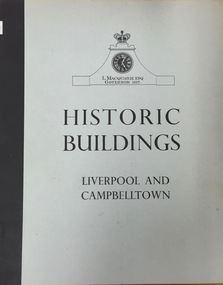
Book, Cumberland County Council, Historic Buildings: Liverpool and Campbelltown, 1963
... The Dorothy Rogers Collection, held the Kew Historical Society includes her professional library, her working and finished manuscripts, as well as an extensive collection of photographs and ephemera that she either inherited or collected. historic buildings -- new south wales -- liverpool. historic buildings -- new south wales -- campbelltown. ...[Liverpool, N.S.W.] : Cumberland County Council, 1963 54 p. : ill., maps ; 26 cm. non-fictionhistoric buildings -- new south wales -- liverpool., historic buildings -- new south wales -- campbelltown. -
 Kew Historical Society Inc
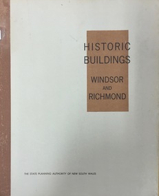
Book, Helen Baker, Historic Buildings: Windsor and Richmond, 1967
... Historic Buildings: Windsor and Richmond Book State Planning Authority of New South Wales Helen Baker ...[Sydney], 1967 67 p. : illus., facsims., maps, plans ; 26 cm. non-fictionhistoric buildings - windsor (nsw), historic buildings - richmond (nsw) -
 Queen Victoria Women's Centre
Photograph, August 1996
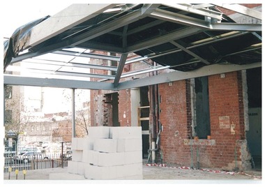
... buildings cultural structures and establishments Colour photograph. Ground floor acing south west into QVWC tower in what was to be the cafe. Entrances show access corridors to ormer towers. New ...Colour photograph. Ground floor acing south west into QVWC tower in what was to be the cafe. Entrances show access corridors to ormer towers. New structure for roof seen with black tarp. Taken during restoration inspectionbuilding construction, historic buildings, cultural structures and establishments -
 Queen Victoria Women's Centre
Photograph, August 1996
... buildings Cultural structures and establishments Colour photograph. Ground floor facing south towards Lonsdale street in what was to be the cafe and in 2015 is the Breacan office. Entrances show access corridors to former towers. White besser blocks in foreground. New ...Colour photograph. Ground floor facing south towards Lonsdale street in what was to be the cafe and in 2015 is the Breacan office. Entrances show access corridors to former towers. White besser blocks in foreground. New structure for roof seen with tarp. Taken during restoration inspection.building construction, historic buildings, cultural structures and establishments -
 Kew Historical Society Inc
Slide - Architectural Drawing, Kew Public Offices, 1887
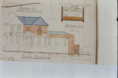
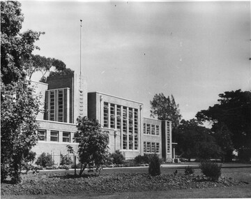
... They are historically and architecturally significant to the State Of Victoria because Watson and Harvey's designs exhibit diversity in integrating civil offices, they accommodate the apex of road junctions, and they demonstrate a departure from the contemporaneously favoured High Victorian Classical to the Queen Anne style in the design of civic buildings. kew court house kew police station kew post office architectural drawings khs - slides new public offices -- kew (vic.) architecture — queen anne style SOUTH ELEVATION / SECTION L-L / SECTION G-G 35mm colour transparency of an original plan by George Watson and John Henry Harvey, architects of the Department of Public Works (Victoria), in 1887 for New Public Offices at Kew. ...A civic campaign for new public offices developed in Kew in the 1880s. After much deliberation, the location chosen was the junction of Bulleen and Cotham Roads. The buildings were designed by George Watson and John Henry Harvey, architects within the Department of Public Works (Victoria). Building was commenced in 1887, and after one year, the buildings were opened. The Post Office was transferred to the new Commonwealth Government in 1901. The Police Station and Court House, sold by the Victorian Government to the City of Boroondara in 2007, are now a community cultural centre and performing arts venue.The buildings were listed on the Victorian Heritage Register Register (HO885) in 1991. They are historically and architecturally significant to the State Of Victoria because Watson and Harvey's designs exhibit diversity in integrating civil offices, they accommodate the apex of road junctions, and they demonstrate a departure from the contemporaneously favoured High Victorian Classical to the Queen Anne style in the design of civic buildings. 35mm colour transparency of an original plan by George Watson and John Henry Harvey, architects of the Department of Public Works (Victoria), in 1887 for New Public Offices at Kew. This plan was copied by the donor from an original held at the Commonwealth Archives in Brighton (Vic). The copy was made to illustrate a report that the donor made on ‘The functional planning design, building materials and construction methods of the Kew Post Office’ as part of course work at RMIT.SOUTH ELEVATION / SECTION L-L / SECTION G-Gkew court house, kew police station, kew post office, architectural drawings, khs - slides, new public offices -- kew (vic.), architecture — queen anne style -
 Kew Historical Society Inc
Photograph - Aerial photograph of Cotham Road and Highbury Grove, Kew, c.1970
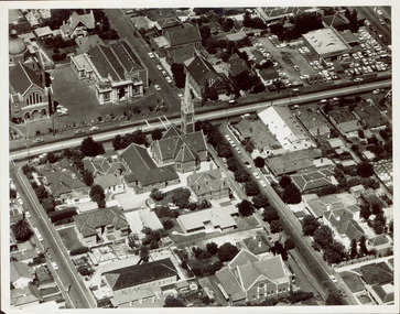
... south. This historically important photo shows major churches and schools in the vicinity, including a number that have since been demolished. Bordering St John''s Parade at the top of the photo are, on the left Sacred Heart Church and Primary School, while on the right are the original buildings of the Kew Baptist Church, beside which is Bib Stilwell's caryard and the remains of Alice Anderson's garage. In the foreground is the new...south. This historically important photo shows major churches and schools in the vicinity, including a number that have since been demolished. Bordering St John''s Parade at the top of the photo are, on the left Sacred Heart Church and Primary School, while on the right are the original buildings of the Kew Baptist Church, beside which is Bib Stilwell's caryard and the remains of Alice Anderson's garage. In the foreground is the new ...This aerial photo was used by John O'Neill in The Church on the Hill, published 1974, so the photo predates that. The photographer is unknown.Black and white aerial photograph of the intersection of Cotham Road and Highbury Grove in Kew, looking south. This historically important photo shows major churches and schools in the vicinity, including a number that have since been demolished. Bordering St John''s Parade at the top of the photo are, on the left Sacred Heart Church and Primary School, while on the right are the original buildings of the Kew Baptist Church, beside which is Bib Stilwell's caryard and the remains of Alice Anderson's garage. In the foreground is the new Baptist Church and on Cotham Road, the Kew Presbyterian Church.Nilcotham. road -- kew, highbury grove -- kew, mary street -- kew, st john's parade -- kew, alice anderson, bib stilwell, kew baptist church, kew presbyterian church, sacred heart church – kew (vic.), sacred heart primary school – kew (vic.) -
 University of Melbourne, Burnley Campus Archives
Plan, Department of Public Works, Burnley School of Horticulture, c.1952
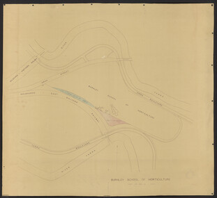
... south. Additional areas coloured. Position of new buildings and new house shown....University of Melbourne, Burnley Campus Archives 500 Yarra Boulevard Richmond melbourne burnley school of horticulture extensions railway Yarra River Yarra Boulevard college buildings Department of Public Works, Melbourne, Victoria plan No. 51/66 of extension of grounds. Area bounded by Yarra River to north and south. Additional areas coloured. Position of new ...Department of Public Works, Melbourne, Victoria plan No. 51/66 of extension of grounds. Area bounded by Yarra River to north and south. Additional areas coloured. Position of new buildings and new house shown.burnley school of horticulture, extensions, railway, yarra river, yarra boulevard, college buildings -
 University of Melbourne, Burnley Campus Archives
Photograph - Black and white print, Administration Building, c. 1950
... 2 copies black and white photograph of the Administration Building taken from the south eastern aspect, new garden bed mainly unplanted. ...University of Melbourne, Burnley Campus Archives 500 Yarra Boulevard Richmond melbourne administration building garden beds emily gibson beds new planting 2 copies black and white photograph of the Administration Building taken from the south eastern aspect, new garden bed mainly unplanted. ...2 copies black and white photograph of the Administration Building taken from the south eastern aspect, new garden bed mainly unplanted. One is taken slightly to the left of the other one.administration building, garden beds, emily gibson beds, new planting -
 MYLI My Community Library
Photograph - Pakenham Consolidated School Grade Two Class Photo, 1953
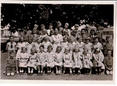
... The schools that formed the Consolidated School were Pakenham Upper No. 2155 (closed January 1952), Pakenham South No. 3755 (closed September 1951), Toomuc Valley No. 3034 (closed September 1951), Army Road No. 3847 (closed April 1947), Mount Burnett No. 4506 (closed October 1949), Tynong No. 2854 (closed April 1951), Tynong North No.4464 (closed December 1951), Nar Nar Goon North No. 2914 (closed October 1951), Nar Nar Goon South No. 4554 (closed May 1951), Rythdale No. 4231 (closed September 1951), Officedale No. 4242 (closed May 1951), Cora Lynn No. 3502 (closed May 1951) and Koo-Wee-Rup North (Five Mile) No. 3198 (closed November 1959). The School consisted of new buildings...The schools that formed the Consolidated School were Pakenham Upper No. 2155 (closed January 1952), Pakenham South No. 3755 (closed September 1951), Toomuc Valley No. 3034 (closed September 1951), Army Road No. 3847 (closed April 1947), Mount Burnett No. 4506 (closed October 1949), Tynong No. 2854 (closed April 1951), Tynong North No.4464 (closed December 1951), Nar Nar Goon North No. 2914 (closed October 1951), Nar Nar Goon South No. 4554 (closed May 1951), Rythdale No. 4231 (closed September 1951), Officedale No. 4242 (closed May 1951), Cora Lynn No. 3502 (closed May 1951) and Koo-Wee-Rup North (Five Mile) No. 3198 (closed November 1959). The School consisted of new buildings ...Grade 2 of Pakenham Consolidated School in 1953 with their teacher Mrs Joyce Hosking. Back row L to R: Paul Manestar or Bill Vallender, Bernie Carter, (?), Norman Whitelaw, Richard Shelton, Rodney Shallard, Ian Reid (Reidy?) or Duncan Beard (Reidy), Ken Jarred, Glen Jolly. 2nd back row L to R: Keith Crofts, Peter Johnstone, Kevin Lewis, Robert Tulloch (Bones), Nipper Reid, Duncan Beard(?), Bruce Weatherhead, Peter Hobson (Hobbo). 2nd row from front L to R: David Langley, Kath Mauger, Jill Peck, Rosamund Hunt, Beth Schilling, Roslyn Smith, Lynne Tuena, Pat Stone, Joy Higgins, Lynette Wheeler, Grif Fearon or Kevin McInnis. Front row L to R: Ken McCaffrey, Marion Butcher, Helen Stephens, Mary Lou Walsh, Glenis Tuena, Dawn Hillderbrick/ Hillbrick(?), Marion Hansford, Kaye Wollard, Beverley Payne (Payney), Edna Sinclair(?), Paul Braemar. In the 1940s and 1950s there was a movement to consolidate small rural schools into one larger school. This was partly a response to a shortage of teachers, due to many male teachers enlisting during the Second World War. The War also caused a shortage of materials and labour and many Schools fell into disrepair. The Education Department decided that Pakenham would be one of the first six Consolidated Schools to be established and that all schools within 8 kms or 5 miles would be closed. The Pakenham Consolidated School was officially opened on May 29, 1951, on the site of the Pakenham State School, No.1359, in Main Street. The original Pakenham School had opened on a site near the Toomuc Creek in January 1875 and it moved to the Main Street site in 1891. The first Head Master was Charles Hicks. The School offered classes up to Year 10 (Form 4). The schools that formed the Consolidated School were Pakenham Upper No. 2155 (closed January 1952), Pakenham South No. 3755 (closed September 1951), Toomuc Valley No. 3034 (closed September 1951), Army Road No. 3847 (closed April 1947), Mount Burnett No. 4506 (closed October 1949), Tynong No. 2854 (closed April 1951), Tynong North No.4464 (closed December 1951), Nar Nar Goon North No. 2914 (closed October 1951), Nar Nar Goon South No. 4554 (closed May 1951), Rythdale No. 4231 (closed September 1951), Officedale No. 4242 (closed May 1951), Cora Lynn No. 3502 (closed May 1951) and Koo-Wee-Rup North (Five Mile) No. 3198 (closed November 1959). The School consisted of new buildings, which at the time cost one hundred thousand pounds, and many of the old School buildings. Some towns did not realise that their School buildings would be removed from the sites and transferred to Pakenham. The Pakenham Consolidated School moved from its original location in Main Street to its current location in Rundell, Way in 1997.This photograph is of historic and social significance. Pakenham Consolidated School was one of the first six Consolidated Schools established by the Education Department, and was born out of shortages of teachers, labour, and materials during World War II. The school can be used more broadly to reflect on the evolution of education in the state of Victoria, as the school can trace its origins all the way back to 1875, when the original Pakenham School was opened near Toomuc Creek. The photograph is also of social significance to many community groups, including Cardinia Shire, past and current students and teachers, allowing various groups to reflect on and share intangible memories of times spent at Pakenham Consolidated School.Copy of a rectangular black and white photograph on matte photographic paperpakenham consolidated school, primary school, class photo, grade two, grade 2, pakenham, school, photo -
 Port Fairy Historical Society Museum and Archives
Photograph
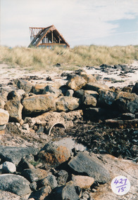
... Port Fairy Historical Society Museum and Archives 30 Gipps Street Port Fairy great-ocean-road South Beach Development looking toward Mal Dorea’s new house from the beach south beach development mal dorea house building bluestone beach Coloured photograph of rocks and drain on beach looking at unfinished A framed house in backgroun Photograph Photograph ...South Beach Development looking toward Mal Dorea’s new house from the beach Coloured photograph of rocks and drain on beach looking at unfinished A framed house in backgrounsouth beach, development, mal dorea, house, building, bluestone, beach -
 Ballarat Heritage Services
Ceramic, Small bottle by Ray Molony
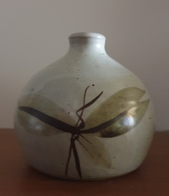
... New South Wales "Notes for Raymond Walter Molony: Raymond Walter Molony grew up in the Dandenongs, and Maffra where he went to school. He attenended Sale Technical School, before studying at R.M.I.T. from where he gained a diploma of pottery and technical teaching qualifications. He taught at Shepparton Technical College leaving there in 1977 to become a full time potter. Ray Molony established the Mud Factory Pottery in Shepparton in 1977 after purchasing, renovating and extending the old Kialla Methodist church, and building...New South Wales "Notes for Raymond Walter Molony: Raymond Walter Molony grew up in the Dandenongs, and Maffra where he went to school. He attenended Sale Technical School, before studying at R.M.I.T. from where he gained a diploma of pottery and technical teaching qualifications. He taught at Shepparton Technical College leaving there in 1977 to become a full time potter. Ray Molony established the Mud Factory Pottery in Shepparton in 1977 after purchasing, renovating and extending the old Kialla Methodist church, and building ...Ray MOLONY Born Albury, New South Wales "Notes for Raymond Walter Molony: Raymond Walter Molony grew up in the Dandenongs, and Maffra where he went to school. He attenended Sale Technical School, before studying at R.M.I.T. from where he gained a diploma of pottery and technical teaching qualifications. He taught at Shepparton Technical College leaving there in 1977 to become a full time potter. Ray Molony established the Mud Factory Pottery in Shepparton in 1977 after purchasing, renovating and extending the old Kialla Methodist church, and building a two storey mud brick pottery. Two of Ray and Deirdre Molony's sons, Kevin and Russell, were employed during the 1980s and 1990s. Kevin Molony left due in the early 1990s due to the recession at that time, and Russell Molony followed soon after. Both competent throwers, with Russell making some creative slab work while Ray continuing to decorate the works. Ray Molony continued to produce studio ceramics at the kialla studion until selling the property in 2000, and semi retiring to Miepoll. In 2005 he moved to Pottsville New South Wales." studio potterySmall ceramic bottle with leaf designs in brown glaze made at the Mud Factory Pottery by Ray Molony.ceramics, studio pottery, ray molony, mud factory pottery -
 Rutherglen Historical Society
Image, c1890
... Photo taken during building of 2nd John Foord Bridge, between Wahgunyah Victoria and Corowa New South Wales. ...Rutherglen Historical Society Murray Street Rutherglen high-country Photo taken during building of 2nd John Foord Bridge, between Wahgunyah Victoria and Corowa New South Wales. ...Photo taken during building of 2nd John Foord Bridge, between Wahgunyah Victoria and Corowa New South Wales. Extracts from the entry for the bridge in the Victorian Heritage Database: "The bridge is of also of historical significance for its association with the prominent local identity and pioneer businessman John Foord, who was involved in the company that erected the 1862 timber bridge on the site. ... When the new bridge was built as a replacement, it took the same name." This second bridge (the current one) was opened in January 1893, Black and white photograph, mounted on cardboard, of four men, one in old style diving suit. diving, wahgunyah, corowa, john foord, bridge construction -
 Rutherglen Historical Society
Postcard - Post card, c1920
... building at the center of the photograph is the Victoria Hotel. The men near the front of the hotel, in white robes, are members of the Druid lodge. The firetruck is from the New South...building at the center of the photograph is the Victoria Hotel. The men near the front of the hotel, in white robes, are members of the Druid lodge. The firetruck is from the New South ...Believed to have been taken sometime in the 1920s. An enthusiast could probably date the photo by the fire engine.Black and white photographic postcard showing a parade in Main Street, Rutherglen. The building at the center of the photograph is the Victoria Hotel. The men near the front of the hotel, in white robes, are members of the Druid lodge. The firetruck is from the New South Wales Fire Brigade.main street rutherglen, parades, victoria hotel, druids -
 Southern Sherbrooke Historical Society Inc.
Information folder - Belgrave South State School - history
... South", compiled by P. Phillips, Principal, March 1969, 2 sheets & front cover, (2 copies) -photocopy of hand-written notes for above, including an interview with Miss Sophie Giles, dated 18 June 1966 -photocopies of school photos - G2 1966, G1B 1963, G1 1964, G4&5 1960, G6 1969 (2 copies), unidentified grade photo, original school building, unidentified man and girl -program for "Opening of New and Refurbished Facilities, May 11th, 2001", Belgrave Sth SS...South", compiled by P. Phillips, Principal, March 1969, 2 sheets & front cover, (2 copies) -photocopy of hand-written notes for above, including an interview with Miss Sophie Giles, dated 18 June 1966 -photocopies of school photos - G2 1966, G1B 1963, G1 1964, G4&5 1960, G6 1969 (2 copies), unidentified grade photo, original school building, unidentified man and girl -program for "Opening of New and Refurbished Facilities, May 11th, 2001", Belgrave Sth SS Information folder - Belgrave South State School - history ...Folder containing items pertaining to the history of Belgrave South State School. Contents: -typescript, prepared for display at Staxafun Fete 2005 -hand-written notes from school records, prepared for above -copy of Belgrave South shop and post office flyer -excerpts from oral history by Ray Tremain -excerpts from oral history by Peg Roberts and Edna Bastion -typescript, "History of State School No. 3551, Hallam Road, Belgrave South", compiled by P. Phillips, Principal, March 1969, 2 sheets & front cover, (2 copies) -photocopy of hand-written notes for above, including an interview with Miss Sophie Giles, dated 18 June 1966 -photocopies of school photos - G2 1966, G1B 1963, G1 1964, G4&5 1960, G6 1969 (2 copies), unidentified grade photo, original school building, unidentified man and girl -program for "Opening of New and Refurbished Facilities, May 11th, 2001", Belgrave Sth SSbelgrave south state school, miss sophie giles, giles family -
 Ballarat Heritage Services
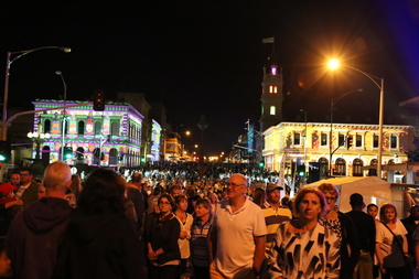
Photograph - Colour, Clare Gervasoni, White Night Ballarat, 2017, 04/03/2017
... Ballarat Heritage Services PO Box 2209 Bakery Hill Post Office goldfields white night white night ballarat projection lydiard street Post Office Gallery, Ballarat Ballarat Mining Exchange Craig's Royal Hotel, Ballarat Lydiard Street, Ballarat Sturt Street, Ballarat Former Bank of New South Wales, Ballarat Images of White Night Ballarat which lit up buildings in Lydiard Street Ballarat. ...Images of White Night Ballarat which lit up buildings in Lydiard Street Ballarat.white night, white night ballarat, projection, lydiard street, post office gallery, ballarat, ballarat mining exchange, craig's royal hotel, ballarat, lydiard street, ballarat, sturt street, ballarat, former bank of new south wales, ballarat -
 Whitehorse Historical Society Inc.
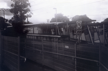
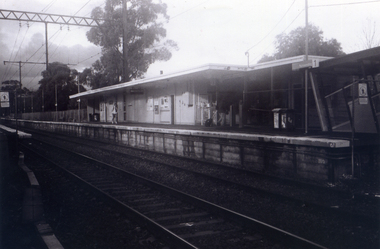
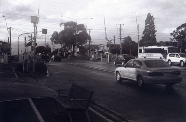
Photograph, Railway Platform from south side, 1/06/2009
... Whitehorse Historical Society Inc. 2-10 Deep Creek Road Mitcham melbourne One of a collection of photographs taken of the Nunawading Railway Station prior to the lowering of the railway line and building of the new railway station on the western side of Springvale Road so that the Springvale Road Rail Crossing can be eliminated. nunawading railway station springvale road nunawading redevelopment of railway line/springvale road. Black & white photograph of the precinct surrounding the Nunawading Station and the Springvale Road Railway crossing. This photograph is railway station looking from north side of station. See NP 3545 to NP3567 for the complete set of photographs Railway Platform from south ...One of a collection of photographs taken of the Nunawading Railway Station prior to the lowering of the railway line and building of the new railway station on the western side of Springvale Road so that the Springvale Road Rail Crossing can be eliminated.Black & white photograph of the precinct surrounding the Nunawading Station and the Springvale Road Railway crossing. This photograph is railway station looking from north side of station. See NP 3545 to NP3567 for the complete set of photographsnunawading railway station, springvale road nunawading, redevelopment of railway line/springvale road. -
 Whitehorse Historical Society Inc.
Photograph, Station seen from north side-Platform, 1/06/2009
... Whitehorse Historical Society Inc. 2-10 Deep Creek Road Mitcham melbourne One of a collection of photographs taken of the Nunawading Railway Station prior to the lowering of the railway line and building of the new railway station on the western side of Springvale Road so that the Springvale Road Rail Crossing can be eliminated. nunawading railway station springvale road nunawading redevelopment of railway line/springvale road. Black & white photograph of he precinct surrounding the Nunawading Station and the Springvale Road Railway crossing. This photograph is a close up view of the south ...One of a collection of photographs taken of the Nunawading Railway Station prior to the lowering of the railway line and building of the new railway station on the western side of Springvale Road so that the Springvale Road Rail Crossing can be eliminated.Black & white photograph of he precinct surrounding the Nunawading Station and the Springvale Road Railway crossing. This photograph is a close up view of the south platform at Nunawading from the north side.|See NP 3545 to NP3567for the complete set of photographsnunawading railway station, springvale road nunawading, redevelopment of railway line/springvale road. -
 Whitehorse Historical Society Inc.
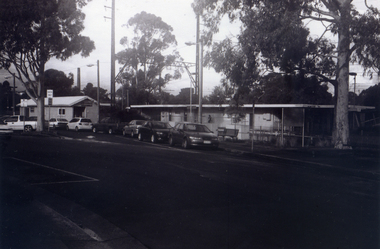
Photograph, General View of Nunawading Station, 1/06/2009
... Whitehorse Historical Society Inc. 2-10 Deep Creek Road Mitcham melbourne One of a collection of photographs taken of the Nunawading Railway Station prior to the lowering of the railway line and building of the new railway station on the western side of Springvale Road so that the Springvale Road Rail Crossing can be eliminated. nunawading railway station springvale road nunawading redevelopment of railway line/springvale road. walkers road nunawading Black & white photograph of he precinct surrounding the Nunawading Station and the Springvale Road Railway crossing. This photograph is view of the Nunawading Railway Station from Walker Road, showing the North an South ...One of a collection of photographs taken of the Nunawading Railway Station prior to the lowering of the railway line and building of the new railway station on the western side of Springvale Road so that the Springvale Road Rail Crossing can be eliminated.Black & white photograph of he precinct surrounding the Nunawading Station and the Springvale Road Railway crossing. This photograph is view of the Nunawading Railway Station from Walker Road, showing the North an South Platforms. See NP 3545 to NP3567 for the complete set of photographsnunawading railway station, springvale road nunawading, redevelopment of railway line/springvale road., walkers road nunawading -
 Whitehorse Historical Society Inc.
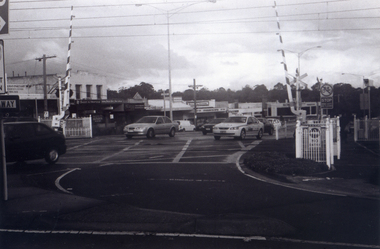
Photograph, Railway Crossing from the north, 1/06/2009
... Whitehorse Historical Society Inc. 2-10 Deep Creek Road Mitcham melbourne One of a collection of photographs taken of the Nunawading Railway Station prior to the lowering of the railway line and building of the new railway station on the western side of Springvale Road so that the Springvale Road Rail Crossing can be eliminated. nunawading railway station springvale road nunawading redevelopment of railway line/springvale road. Black & white photograph of the precinct surrounding the Nunawading Station and the Springvale Road Railway crossing. This photograph is of the railway crossing of Springvale Road, Nunawading, looking to the south ...One of a collection of photographs taken of the Nunawading Railway Station prior to the lowering of the railway line and building of the new railway station on the western side of Springvale Road so that the Springvale Road Rail Crossing can be eliminated.Black & white photograph of the precinct surrounding the Nunawading Station and the Springvale Road Railway crossing. This photograph is of the railway crossing of Springvale Road, Nunawading, looking to the south of the shops. See NP 3545 to NP3567 for the complete set of photographsnunawading railway station, springvale road nunawading, redevelopment of railway line/springvale road. -
 Whitehorse Historical Society Inc.
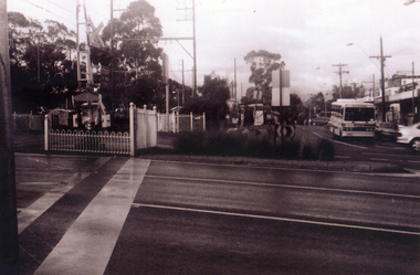
Photograph, Pedestrian Crossing & Nunawading Railway Station, 1/06/2009
... Whitehorse Historical Society Inc. 2-10 Deep Creek Road Mitcham melbourne One of a collection of photographs taken of the Nunawading Railway Station prior to the lowering of the railway line and building of the new railway station on the western side of Springvale Road so that the Springvale Road Rail Crossing can be eliminated. nunawading railway station springvale road nunawading redevelopment of railway line/springvale road. Black & white photograph of the precinct surrounding the Nunawading Station and the Springvale Road Railway crossing. This photograph is looking over the south ...One of a collection of photographs taken of the Nunawading Railway Station prior to the lowering of the railway line and building of the new railway station on the western side of Springvale Road so that the Springvale Road Rail Crossing can be eliminated.Black & white photograph of the precinct surrounding the Nunawading Station and the Springvale Road Railway crossing. This photograph is looking over the south side of the intersection in Springvale, to the pedestrian crossing and the Railway Station. The shopping centre is on the right hand side. See NP 3545 to NP3567 for the complete set of photographsnunawading railway station, springvale road nunawading, redevelopment of railway line/springvale road. -
 Whitehorse Historical Society Inc.
Photograph, Railway Crossing from the south, 1/06/2009
... Whitehorse Historical Society Inc. 2-10 Deep Creek Road Mitcham melbourne One of a collection of photographs taken of the Nunawading Railway Station prior to the lowering of the railway line and building of the new railway station on the western side of Springvale Road so that the Springvale Road Rail Crossing can be eliminated. nunawading railway station springvale road nunawading redevelopment of railway line/springvale road. Black & white photograph of the precinct surrounding the Nunawading Station and the Springvale Road Railway crossing. This photograph is south ...One of a collection of photographs taken of the Nunawading Railway Station prior to the lowering of the railway line and building of the new railway station on the western side of Springvale Road so that the Springvale Road Rail Crossing can be eliminated.Black & white photograph of the precinct surrounding the Nunawading Station and the Springvale Road Railway crossing. This photograph is south side of the crossing looking north. See NP 3545 to NP3567 for the complete set of photographsnunawading railway station, springvale road nunawading, redevelopment of railway line/springvale road. -
 Ballarat Heritage Services
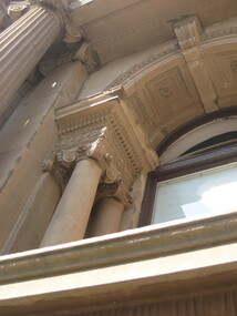
Photograph - Colour, Clare Gervasoni, University of Melbourne Old Commerce Building, 2010, 29/09/2010
... Colour photograph of The Old Commerce Building, later part of Architecture. An 1856 Reed designed Bank of New South Wales faced was incorporated into the original 1940 building. ...It later house the Univesity's Centre for Indigenous Education and a conference centre (2010). university of melbourne old law building eight hour day stonemasons tasmanian freestone cloisters edward stevens wilson trust wildred brookes Colour photograph of The Old Commerce Building, later part of Architecture. An 1856 Reed designed Bank of New South Wales faced was incorporated into the original 1940 building. ...Melbourne University Old Physics Building (1889) was designed by Reed, Henderson and Smart. It later house the Univesity's Centre for Indigenous Education and a conference centre (2010).Colour photograph of The Old Commerce Building, later part of Architecture. An 1856 Reed designed Bank of New South Wales faced was incorporated into the original 1940 building. university of melbourne, old law building, eight hour day, stonemasons, tasmanian freestone, cloisters, edward stevens, wilson trust, wildred brookes -
 Loreto Australia and South-East Asia
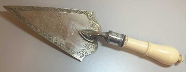
Commemorative Trowel, Joseph Sleep, c.1881
... South-East Asia 1600 Sturt Street Ballarat goldfields Presented to the Bishop of Ballarat, Dr. James Moore, when he laid the foundation stone for the new schoolroom/residential wing at Loreto Mary's Mount. A decorative artefact manufactured by an early Ballarat jeweller. Records the early building ...Presented to the Bishop of Ballarat, Dr. James Moore, when he laid the foundation stone for the new schoolroom/residential wing at Loreto Mary's Mount. A decorative artefact manufactured by an early Ballarat jeweller. Records the early building and expansion of Mary's Mount.Silver engraved commemorative trowel with ivory handle.Presented by the Architect to The Very Rev'd J. Moore D.D.V.G. on the occasion of his laying the foundation stone fo the Loretto Convent Ballarat 8th Dec'r 1881 -
 Ballarat Heritage Services
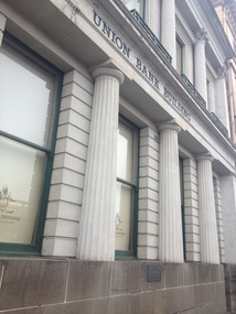
Photograph, Former Union Bank, Lydiard Street South, Ballarat, 2013, 15/02/2020
... The Union Bank disposed of the building in 1951 when it merged with the Bank of Australasia. Union Bank of Australasia Lydiard Street South Ballarat Australa and New Zealand Bank Limited ANZ Ballarat Branch of the Union Banl of Australasia plaque: 1857-1957 This tablet commemorates the opening on 1st July 1857 of the Ballarat Branch of the Union Bank of Australia Limited. ...This former bank building was contructed for the Union Bank of Australia in 1863-64 to the design of architect Leonard Terry. It replaced an earlier building that operated from 1857. The Union Bank disposed of the building in 1951 when it merged with the Bank of Australasia.Double storey bank building. The ground floor facade is designed as a five bay colonnade of engaged Doric columns, a motif repeated above using Corinthian columns to support the balustraded parapet. plaque: 1857-1957 This tablet commemorates the opening on 1st July 1857 of the Ballarat Branch of the Union Bank of Australia Limited. These premises housed the branch until 30th September 1951 when the Union Bank of Australia Limited was merged with the Bank of Australasia to form Australia and New Zealand Bank Limited. union bank of australasia, lydiard street south, ballarat, australa and new zealand bank limited, anz, ballarat branch of the union banl of australasia -
 Ballarat Heritage Services
Photograph, Clare Gervasoni, 2 Lyons Street South, Ballarat, 28/05/2023
... The building was returned to the R.S.L in the later part of 1945. In 2013, 2 Lyons Street South was given new life as Ballarat Premier Apartments after extensive renovations and began operating as luxury accommodation....The building was returned to the R.S.L in the later part of 1945. In 2013, 2 Lyons Street South was given new life as Ballarat Premier Apartments after extensive renovations and began operating as luxury accommodation. 2 Lyons Street South RSL Ballarat Premier Apartments Ballarat War Memorial Building The Comforts Fund William Cussen surgeon Double storey residence in Lyons Street South, Ballarat. 2 Lyons Street South, Ballarat Photograph Clare Gervasoni ...This building was constructed in 1901 by surgeon Dr. William Cussen, a surgeon. His name is still visible in the leadlight above the front door. In 1998 Dr Cussens was an Honorary Medical Office with of the Ballarat Orphanage. In July 1920, the building was gifted to the citizens of Ballarat for the ongoing welfare of returned servicemen and women. Sir John Monash officially opened the building as the Ballarat War Memorial Building. In 1942 a voluntary organisation called The Comforts Fund took up residence in the building with the permission of the R.S.L to transform it into a hostel, providing beds, food and support for many service men and women during World War II. It is estimated that by the end of the war in 1945, one million meals had been served. The building was returned to the R.S.L in the later part of 1945. In 2013, 2 Lyons Street South was given new life as Ballarat Premier Apartments after extensive renovations and began operating as luxury accommodation.Double storey residence in Lyons Street South, Ballarat. 2 lyons street south, rsl, ballarat premier apartments, ballarat war memorial building, the comforts fund, william cussen, surgeon -
 Melton City Libraries
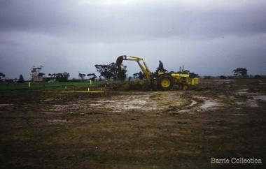
Photograph, Building a new school, 1974
... South and Toolern Vale State Schools went by bus to Bacchus Marsh High School. In 1975, Melton High School opened its doors. Coburn Road named after Coburns, early settlers family and George Coburn Councillor and 1935 Shire President Education Earth works undertaken for the development of Melton High School, Coburns Road, Melton West Building a new school Photograph Barrie Collection ...There were no high schools in the area pre 1975, and students from Melton, Melton South and Toolern Vale State Schools went by bus to Bacchus Marsh High School. In 1975, Melton High School opened its doors. Coburn Road named after Coburns, early settlers family and George Coburn Councillor and 1935 Shire PresidentEarth works undertaken for the development of Melton High School, Coburns Road, Melton Westeducation -
 Melton City Libraries
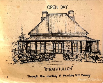
Drawing, Open Day at Strathtulloh, Unknown
... new semi-detached rear extension was added in the early years of the 21st century. The former kitchen building has also undergone minor repairs and alterations". Local Architecture Strathtulloh Homestead at 1402-1600 Greigs Road, Melton South ..."Strathtulloh, 1402-1600 Greigs Road, Melton South, is significant as an early property in Victoria, retaining different eras of pioneering dwellings, ranging from a ruin to a fine Colonial style homestead. The property has close historical association with the early settlement of the Melton district, and was owned by the Henty family in the 1840s. The Strathtulloh property was alienated by the Crown in 1840 to Charles James Garrard, who sold it in 1848 to Charles and Stephen Henty, whose sister Jane and her husband Samuel Bryan lived there in the late 1840s. In 1853 the property then passed to William Tulloh, after whom the homestead was named. A primitive bluestone ruin of near the Toolern Creek, built of vesicular bluestone and mud mortar, is of unknown origin. It has commonly been assumed to pre-date 1840, and to have belonged to the original holder of the Exford lease, Dr Watton or Port Phillip Association member Dr Cotterill. This is unlikely, as the 1841 census records Dr Watton, and everyone else in the district, as living in a ‘wood’ dwelling. It may instead have been the residence of Garrard, and the Bryans, in the 1840s and an early map names a site near here as ‘Bryan’s outstation’. It is assumed that the two-level stone building that became the kitchen is the earliest intact building on the site, and was the first homestead; it is likely to date to the 1840s or 1850s. The main homestead is a substantial villa constructed of random coursed bluestone, with a verandah facing three sides, attic bedrooms with dormer windows, a fan light over the front door, a hipped roof originally clad in slate, and a large cellar. Although demonstrating characteristics of pioneering construction, such as unworked log beams, pit sawn beams, hand-sawn lintels and colonial door locks, documentary evidence shows that it was built c.1869. The homestead has now been structurally repaired and decoratively restored; a sympathetic new semi-detached rear extension was added in the early years of the 21st century. The former kitchen building has also undergone minor repairs and alterations". Strathtulloh Homestead at 1402-1600 Greigs Road, Melton Southlocal architecture -
 Melton City Libraries
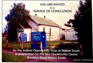
Flyer, Melton South Uniting Church Opportunity Centre, 2016
... new building containing a Pastoral Office, a meeting room and a furniture and homeware section. It was dedicated by Rev Ian Hickingbotham at 11am Sunday 5th June 1994. Churches Local Identities Invites to the service of conclusion of the original Uniting Church Opportunity Centre and official opening to the new shop in Melton South Melton South Uniting Church Opportunity Centre Flyer Barrie Collection ...The Opportunity Shop – Established 1975 by Edna Barrie 1992 In 1985 the need for more shop space became apparent. Les [Bone] had plans drawn up (Surv 12/8/84) and approved by the Melton shire Council for a storeroom extension (17.800 x 9500) 1986 the small ancillary rooms at the rear of the timber church were demolished allowing the concrete slab to be laid. The building was completed in 1987. By the early 1900s the old timber Church had deteriorated, this lead to it being demolished in 2/11/1993. It was replaced with a new building containing a Pastoral Office, a meeting room and a furniture and homeware section. It was dedicated by Rev Ian Hickingbotham at 11am Sunday 5th June 1994. Invites to the service of conclusion of the original Uniting Church Opportunity Centre and official opening to the new shop in Melton Southchurches, local identities -
 Melton City Libraries
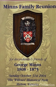
Document, Minns Family Reunion, 2004
... new addition became the front of the building. Six buttresses were attached to the east and west walls of the old building, two to the south wall and the whole rendered with mortar to give the appearance of dressed stonework around the windows. ...new addition became the front of the building. Six buttresses were attached to the east and west walls of the old building, two to the south wall and the whole rendered with mortar to give the appearance of dressed stonework around the windows. ..."A perpetual spring in the adjacent creek provided a steady supply of fresh water to the site on which the homestead is built. Although we can not be certain of the identity of the builder, the first stage of ‘The Willows’ homestead appears to have been constructed in the mid 1850s. The house is situated on Crown Allotment No.1 (No Section), Parish of Kororoit, an allotment of 5 acres 3 roods 4 perches. Although it had surveyed the land, the Crown did not offer it for sale until 22nd November 1861, at which time it was purchased by Charles March Williams. (Although the property is directly opposite and immediately adjacent to the Township of Melton, and was sold as ‘Suburban Allotment 33’, it was situated within the Shire of Braybrook rather than the Shire of Melton until 1917.) Considerable improvements had taken place on the land prior to the Crown sale. When CM Williams purchased the allotment in November 1861 he paid £23.5.0 for the land itself, and valued the improvements at £400. Even allowing for some exaggeration by Williams, this is an extremely high valuation for improvements, and must have included a house. Some local research has claimed that in 1858 Williams had taken over the interest of a Mr Parkinson in the property, and that Parkinson built the house upon taking possession of the land c.1855. It was definitely built by 1861, when a map shows a square building on the site marked as ‘House’. The property is important in the district for its association with the establishment of the pound. The district pound had been established in 1854, when George Scarborough of Mount Cottrell (Mt Cottrell Road, south of Greigs Road) was appointed pound-keeper. Scarborough resigned in 1857. The pound was moved to Melton following agitation from local farmers and Charles March Williams appointed pound-keeper on 26th April 1858. Williams, the son of a doctor, had been born in London. Reminiscences of local residents of the time, as recorded in the Express newspaper, note Williams’ success in breeding horses on the property. Sales of up to 60 guineas were noted. Whether this was from Williams’s own stock or from unclaimed pound stock is not made clear. Williams appeared before a government inquiry in 1860 and advocated registration of all stock brands in the State. Williams died in 1862 leaving a widow, Catherine, and five living children aged 15 years to five months. At the time of his death Williams had entered negotiations with one Matthew Devenish and had a mortgage of £100 on allotments 1 and 2, Parish of Kororoit. Catherine Williams was appointed pound-keeper on 2 September 1863, with her eldest son Charles as her assistant. Her tenure was short for on 22nd March 1864 George Minns senior paid Matthew Devenish £135 for allotments 1 and 2 Parish of Kororoit (considerably less than Williams had claimed the property was worth in 1861) and on the same day paid William Tullidge £45 for the adjoining allotments 3 and 4. In April 1867, James Ebden Minns, the newly married son of George senior became the owner of The Willows property having entered into a mortgage arrangement with his father to the extent of £200. At the time George Minns was residing in Kaarimba having left Melton in 1867 for a short trip to England and upon his return having taken up a selection in the Kaarimba district with his son Frederick who had a hotel licence there. James paid out the mortgage on 2-1-1873. James Minns was appointed pound-keeper in 1872; in 1885 the pound was moved elsewhere and Minns purchased the old pound site and added it to his farm. The Willows residence underwent a major change about this time. A two room extension, similar in style but with a lower elevation was added to the original rear of the house with a chimney matching the distinctive originals. Window arrangements did not match the original but became a feature of the façade when the new addition became the front of the building. Six buttresses were attached to the east and west walls of the old building, two to the south wall and the whole rendered with mortar to give the appearance of dressed stonework around the windows. Galvanized iron was placed over the shingles and a verandah added on three sides. By 1876 The Willows was the homestead for a thriving mixed farm of 340 acres of which 156 was rented from a H. Ruck. In October of that year the Australasian travelling reporter visited and reported on the property. In common with the nearly every other property in the district the farm had ‘recently’ (generally within the last two years) abandoned cultivation of crops, and turned over completely to cattle pasture. Butter making was the principal occupation of the farm, which had about 50 head of cattle, a large proportion of which were milking cows. The reporter also noted that a ‘large number of pigs are kept upon this farm and are found to be very profitable stock’. Their manure was used in an orchard and garden in which ‘large quantities of lucerne and prairie grass are grown for the use of stock when ordinary feed is scarce’. Two bores attached to deep brick lined wells supplied water for the house in addition to the farm. A commodious timber barn and necessary sheds had also been constructed. Access to the property was improved following the construction of the bluestone ford across the creek c.1887, when the recreation ground came into use. Prior to this date it may have been that the crossing referred to as ‘Mr Minns bridge’ was used. This appears to have been a flimsy structure and has but two references in Council reports in the Melton Express in the 1880’s. It is believed that in the late 1890’s a timber building was added near the rear of the building to house a kitchen, ablutions and laundry rooms and rooms for seasonal workers. This was attached to the house by means of a trellised walkway using the original front entry to the house (long since the back door). A photograph of this building appears in a local history of Melton. This was demolished in recent decades during the period when the house was tenanted (after the Minns family had left). James Minns son, George, took over the property following his marriage to Alice Walsh in 1903. James and Caroline moved into a house on the former JH Games property at the eastern end of Henry Street. George held the position of Shire Secretary for Melton for 40 years. He was a most prominent member of the community being Secretary to, among others, the Melton Coursing Club, the Shooting Club and the Cemetery Trust. He also rode with the hunting parties who sported across the Plains and were entertained at Mount Kororoit. George and Alice had one son, Norman who followed his father into local government and became Secretary of the Shire of Werribee completing a record term in this position. George retired to Werribee in 1951, where he died in 1965. The National Trust records note that James Ebden Minns and his sons were ‘leading men of the district, Justices of the Peace, and Shire Councillors’. It claims that Sir Thomas Bent was a frequent visitor. The Willows passed into the hands of George’s grandson, Bruce Minns and the property was let for a number of years. In the 1960s it became vacant and was subject to vandalism. Major structural problems arose with the part demolition of the roof, the loss of windows and doors and holes dug into and under the floorboards. The outbuildings were particularly targeted. Following widespread public support, the Shire of Melton purchased the house, with 3.75 acres of land, in 1972. In 1975 the Shire of Melton and the Melton and District Historical Society were successful in nominating the building for National Trust classification, and then the Australian Heritage Commission’s Register of the National Estate. The AHC particularly noted its ‘townscape importance’. It was envisaged that the farmhouse would form ‘a picturesque centrepiece to Melton’s planned … historical park, along with Dunvegan bluestone cottage … and similar structures as they become available.’ In a time of great Melton’s ‘satellite city’ development the Council spelt out its broader vision in its submission to the AHC: ‘Melton is destined to become, by the end of the present century, a city of between 75,000 and 100,000 people. Significant relics of the past, such as ‘The Willows’, regrettably will be rare in that situation. It is essential that sufficient tangible links with Melton’s pioneering days remain to promote in the new community a sense of history and continuity’. Under the direction of ‘The Willows’ Restoration Committee and consultant architect John Hitch, all outbuildings, with the exception of the garage and toilet, were demolished and the dwelling house restored. Finances were provided by the Shire of Melton and the National Estate Grants Program, and considerable amount of voluntary labour was provided by the local community. The orchard was removed, and remaining wooden buildings were relocated to provide an open vista for visitors to the Park. The property was furnished with donations from district families keen to preserve this example of pioneer life in the area. The Willows became the headquarters of the Melton and District Historical Society". Invitation to the family reunion at the Willowslocal identities, pioneer families