Showing 10966 items
matching maps
-
 Warrnambool and District Historical Society Inc.
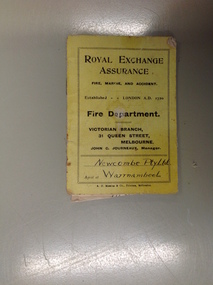
Booklet, Pay Newcombe Pty Ltd
A small booklet relating to fire insurance offered by Royal Exchange Assurance. The schedule relates to the area as outlined on the map in red. Newcombe PTY Ltd operated a timber mill in Warrnambool.A small item with a local social interest.Small yellow covered booklet. Black text. 9 pages with fold out map.Newcombe Pty Ltd on front cover. BCE Warrnambool Vic inside front cover.newcombe pty ltd, warrnambool -
 Victorian Aboriginal Corporation for Languages
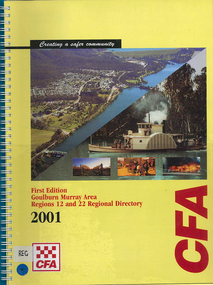
Map, Country Fire Authority, Goulburn Murray Area regions 12 and 22 regional directory, 2001
mapsgoulburn river, fire protection districts, northern victoria -
 Victorian Aboriginal Corporation for Languages
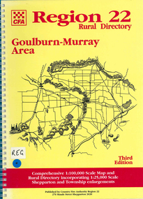
Map, Country Fire Authority, Region 22 rural directory Goulburn-Murray area, 1997
mapsgoulburn region, fire protection, emergency services, victorian maps, directories -
 Victorian Aboriginal Corporation for Languages
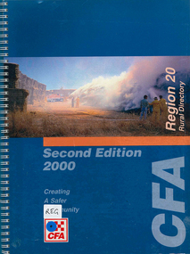
Map, Country Fire Authority, Region 20 rural directory, 2000
mapskerang, regional maps, atlas, fire protection -
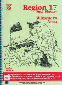 Victorian Aboriginal Corporation for Languages
Map, Country Fire Authority, Region 17 rural directory : Wimmera area, 1997
mapshorsham, wimmera, west wimmera, hindmarsh, yarramback, grampians, fire protection, emergency services, victorian regional maps -
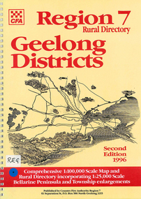 Victorian Aboriginal Corporation for Languages
Map, Country Fire Authority, Region 7 rural directory Geelong districts, 1996
Shows roads, railway, power lines, buildings and emergency locations. Lists property owners.mapsgeelong, regional victoria, fire protection -
 Victorian Aboriginal Corporation for Languages
Book, Wilfrid Prest, The Wakefield companion to South Australian history, 2001
A one volume guide to events, people, places themes and topics in South Australian history.mapssouth australia, history, encyclopedias -
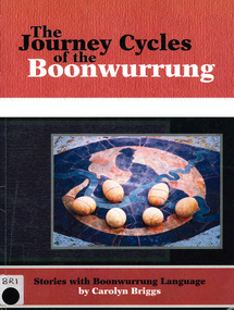 Victorian Aboriginal Corporation for Languages
Book, Carolyn Briggs, The journey cycles of the Boonwurrung: stories with Boonwurrung language, 2008
mapsboonwurrung, stories, word lists -
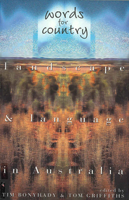 Victorian Aboriginal Corporation for Languages
Book, Tim Bonyhady, Words for country : landscape &? language in Australia, 2002
Landscape and Language -- Lubra Creek -- The River Runs Backwards -- These Blarsted Hills -- Scarcely Any Water on Its Surface -- Everyone Who Has Ever Done A Tree Sit Always Says That The Tree Talks To You -- The Spirit of the Plains Kangaroo -- The Graveyard of a Century -- So Much for a Name -- Blackfellow Oven Roads -- The Ends of the Earth -- Natural Beauty, Man-Made -- Uluru -- The Outside Country -- It's Only Words.Mapslanguage and landscape, language essays, writing, storytelling -
 Victorian Aboriginal Corporation for Languages
Book, RMW Dixon, Grammatical categories in Australian languages, 1976
Various authors, technical linguistic studies of the encoding of particular syntactic functions across many Australian languages. Discussion of ?having? suffix, suffix -ku, syntactic ergativity, and verbal auxiliaries.Mapslinguistics, case relations in languages, pama-nyungan languages -
 Victorian Aboriginal Corporation for Languages
Book, W J Oates, A revised linguistic survey of Australia, 1970
Lists languages under areas and language classification; records location, previous research, degree of urgency of research and assessment of total linguistic knowledge; index of variant language names.Mapslinguistics -
 Victorian Aboriginal Corporation for Languages
Book, Mari Rhydwen, Writing on the backs of the blacks, 1996
The author has set out to study the effects of newly developing literacy on a predominantly oral society. She persuasively argues for an awareness of the dangers of denying a voice to the very people who are the objects of such linguistics research.Mapsbilingual education, kriol, ethics and research -
 Victorian Aboriginal Corporation for Languages
Book, Ian D Clark, Aboriginal language areas in Victoria : a report to the Victorian Aboriginal Corporation for Languages, 1996
This book consists of a series of feasibility plans for language retrieval for Daungwurrung, Woiwurring, Yorta Yorta, Way Wurru, Dhudhuroa, Wadiwadi, Wembawemba and Wathawurrung.mapslanguage resources, language revival, daungwurrung, taungurung, woiwurrung, yorta yorta, way wurru, waywurru, dhudhuroa, wadiwadi, wadi wadi, wembawemba, wemba wemba, wathawurrung, wadawurrung -
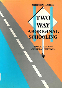 Victorian Aboriginal Corporation for Languages
Book, Stephen Harris, Two-way Aboriginal schooling : education and cultural survival, 1990
In a time where more communities are moving towards control of their children?s education, the author explores the theoretical concept of bicultural schooling and its practical implications in the classroom.mapsbilingual education, multicultural education, biculturalism -
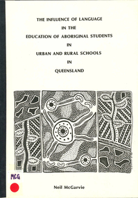 Victorian Aboriginal Corporation for Languages
Book, Neil McGarvie, The influence of language in the education of Aboriginal students in urban and rural schools in Queensland, 1986
mapssecondary school education, aboriginal english, queensland education system, language and education -
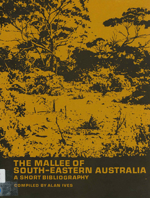 Victorian Aboriginal Corporation for Languages
Book, The Mallee of south-eastern Australia : a short bibliography, 1973
mapsmallee region, south-eastern australia, geography, geology, climatology, water, agriculture, soils, botany, zoology, national parks, historical geography, australian literature, anthropology, sociology -
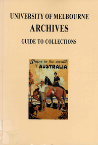 Victorian Aboriginal Corporation for Languages
Book, University of Melbourne Archives, University of Melbourne Archives : guide to collections, 1983
mapsuniversity of melbourne archives, archive guides, victorian history -
 Victorian Aboriginal Corporation for Languages
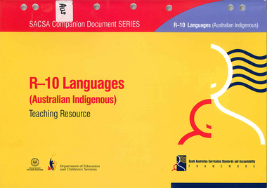
Book, South Australia Department of Education and Children's Services, R-10 languages (Australian Indigenous) teaching resource, 2005
Looks at an outline of learning and teaching of Indigenous Languages across the primary and secondary school years.mapslanguage learning, primary school education, secondary school education -
 Tatura Irrigation & Wartime Camps Museum
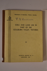
Book, Department of Agriculture Victori, Soil and Land Use in Part of the Goulburn Valley Victoria Technical Bulletin No 14, 1962
Mid sized book with soft cover, brown spine with off white cover. Black writing on back and front. Contains maps. Tech Bulletin No 14.non-fictiongoulburn valley, soil studies victoria, victorian maps -
Whitehorse Historical Society Inc.
Pamphlet, Neighbourhood activity in Nunawading, 1977
An attempt by the E.R.E.C. / ACCESS Community Education Project to increase the awareness of community activity and involvement in the municipality.An attempt by the E.R.E.C. / ACCESS Community Education Project to increase the awareness of community activity and involvement in the municipality. Includes maps of region showing community centres etc.An attempt by the E.R.E.C. / ACCESS Community Education Project to increase the awareness of community activity and involvement in the municipality. city of nunawading, east burwood recreation association, north blackburn community action group, vermont south community association, libraries, social services, emergency services -
 Ballan Shire Historical Society
Map - Map. Kerrit Bareet, Department of Lands and Survey, Kerrit Bareet. County of Grant, 08/1944
A map of the Kerrit Bareet area within the County of Grant showing properties and names of owners in 1944.Significant to people researching land usage and ownership. Also those researching families in the area at that time.A map of Kerrit Bareet in the County of Grant. Black printing on buff coloured paper. Details roads, rivers, railways, property boundaries and names of property owners and towns and villages. The map is easily readable although there is some physical damage and that and the borders have been reinforced with sellotape. Shows a Scale in Chains and Price 2/.gordon, bungal, kerrit bareet, lal lal, moorarbool river, warrenheip, bungaree, wallace, moorarbool west -
Canterbury History Group
Map - Map of Canterbury, Surrey Hills, Mont Albert and Camberwell, c1930s
... Maps ...Map produced and distributed by White & Clarke Real Estate Agents in Canterbury c 1930canterbury, canterbury road, surrey hills, mont albert, camberwell, maps, real estate agents -
Canterbury History Group
Document - The Grange, 1905
... Maps ...MMBW detailed map of "The Grange" 1905. Includes a short history of the house by Don Gibbcanterbury, the grange, fintona junior school, st. duthies, mont albert road, maps, gibb> don -
 Buninyong Visitor Information Centre
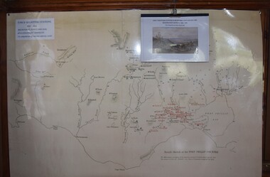
Map, et al, Early Squatters Stations 1837-1838, This map was created in 2016 by a group of U3A Ballarat students under the Tutor, John Olsen
The map shows rivers and pastoral holdings from 1837 to 1838. Stations occupied around Geelong in 1837 are shown in red and those occupied in 1838 are shown in black. Reproduction of a coloured map shows pastoral stations around the Geelong area from 1837-1940. pastoralism, stations, farming, settlement, squatters -
Hume City Civic Collection
Book - Street Directory, Gregory"s Melbourne Street Directory
... Maps ...This 1972 Gregory's Melbourne Street Directory published by Gregory's Guides & Maps Pty Ltd was used by the donor, her husband and family.A black leather removable cover with gold embossed vintage car on the front enclosing a Gregory's Melbourne Street Directory.Gold embossed vintage car on front cover.joan houston, maps, street directory, roads, suburbs -
 Warrnambool and District Historical Society Inc.
Documents Maps (3) - Warrnambool Town Allotments, City of W'bool Parish of Wangoom Country of Villiers, 1948
These maps were produced in 1948 and they contain maps of allotments within the city of Warrnambool, including the Central Business District, up to 1948. The details given on each allotment show the allotment and section numbers, the measurement in acres, the name of the original purchaser of the lot and the date of the first sale. The Warrnambool and District Historical Society owns several copies of these maps but these ones are originals.These three maps are of great significance because they give the names of land purchasers in Warrnambool from the date of the first land sales in 1847. They are a most valuable research tool and can be scanned and photocopied etc.These are three sheets of cream paper pasted on to linen. The sheets have black and white printing and map work. Some of the edges are a little frayed and there is some staining, particularly on the backs of the sheets.‘City of Warrnambool Parish of Wangoom County of Villiers Sheet 1’ ‘City of Warrnambool Parish of Wangoom County of Villiers Sheet 2’ ‘City of Warrnambool Parish of Wangoom County of Villiers Sheet 3’city of warrnambool, warrnambool maps, warrnambool town allotments 1948, land purchases -
 Stawell Historical Society Inc
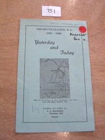
Book, N.A. McLennan, Yesterday and Today - Ord River Station WA 1895 - 1896 by N A McLennan, 1965
John McLennan's Period as Manager of the Ord River Station. W.A. adjoining Negri Station N.T., was 1895-6. The whole area consisted of 3,365,000 areas under a number of leasesand the then owner was Mr W.H. Osmand, who lived at "The Sycamores" four miles east of Stawell in Victoria. The Distance to Ord W.A. is 4,000 Miles.LIght green card cover with border, inside print and picture of a map Ord River Station W.A. 1895-1896 Yesterday and Today Map of North-East of W.A. Kimberly Ord River area Negri Station N.T. Complied and written by N.A. McLennan December 1965 1965 Victoriastawell, mclennan family -
 National Vietnam Veterans Museum (NVVM)
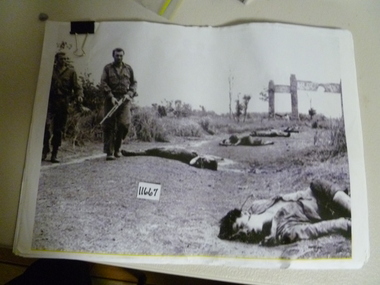
Photograph, Soldiers At War
... Maps ...Thirteen copies of photos - Soldiers At War, fifty-six pages of maps and data. Phuoc Tuy Border, shots of casualty, analysis for 1AFT. Twenty-five pages all 1ATF ambushes. Graph cicilian casualities. July 1966 - December 1971.photograph, 1atf, maps -
Clunes Museum
Map - DOCUMENTS/MAP, 3 1887. .4 1891
MINING, CLUNES GOLD MINES, MAPS, SECTIONS.1 AERIAL VIEW OF CLUNES AND DISTRICT. COLOUR PHOTOGRAPH LAMINATED. .2 MAP OF MINING AREAS SHOWING EXCISED AREA. No. 9104. MINING DISTRICT OF BALLARAT. PARISH OF CLUNES. COUNTY OF TALBOT. SCALE 4 CHAINS TO AN INCH. .3 MAP OF GOLD MINING LEASE BLOCKS AT CLUNES .4 DRAWINGS OF SECTIONS, CLUNES GOLD MINES. SCALE 400 FEET TO AN NCH. ALL MOUNTED WITH PLASTIC HANGING STRIPS..1 ON BACK. CLUNES 1:25000 .2 ASSORTED HANDWITTEN NOTATIONS. .3 ASSORTED HANDWITTEN NOTATIONS. REPLACE IN DEPT. OF MINING REGISTRARS QUARTER ENDED 30TH JUNE 1887. P. 12.clunes, gold mining, leases, aerial photograph, mine sections -
 Queenscliffe Maritime Museum
Book - Royal Atlas 1861, Keith Johnston, The Royal Atlas of Modern Geography, 1861
Atlas of the word in 1861105 page leather bound atlas containing some coloured illustrations of maps of the countries of the world up to 1861. Published by William Blackwood & Sons, 1861. Folio [51x34cm] size with 9 pages of introductory text followed by 48 double-page spread and part coloured maps.non-fictionAtlas of the word in 1861geography, world atlas, keith johnstone