Historical information
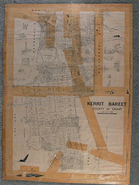
A map of the Kerrit Bareet area within the County of Grant showing properties and names of owners in 1944.
Significance
Significant to people researching land usage and ownership. Also those researching families in the area at that time.
Physical description
A map of Kerrit Bareet in the County of Grant. Black printing on buff coloured paper. Details roads, rivers, railways, property boundaries and names of property owners and towns and villages. The map is easily readable although there is some physical damage and that and the borders have been reinforced with sellotape. Shows a Scale in Chains and Price 2/.