Showing 1643 items
matching fill
-
 Bendigo Historical Society Inc.
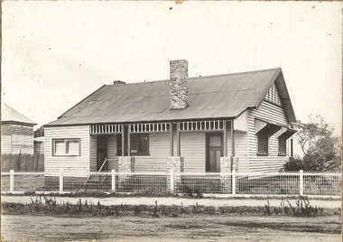
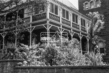
Photograph - T C WATTS & SON COLLECTION: HARGREAVES STREET, CORNER OF LANSELL STREET, BENDIGO, 1927
Black and white photograph mounted on rectangular brown board. House, with wire fence, weatherboard, corrugated iron roof, 2 chimneys, decorative wood frieze across verandah, verandah filled in at LH end to form room with door and window. Brick and timber verandah pillars. Canopies over 2 windows on RHS. On back of photo ' Miss Haw, Hargreaves St., cnr. Lansell St., £750 sewered, freehold., 9 Dec, 1927, T.C. Watts & Son.Frank A. Jeffree, Bendigoplace, photo of house prepared for sale, residential, stamped on back in rectangle ''t.c. watts and son'' stamped on back in circle ''royal historical society of victoria, bendigo branch'' -
 Bendigo Historical Society Inc.
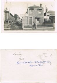
Photograph - PITTOCK COLLECTION: FIVE PITTOCK FAMILY PHOTOGRAPHS, PITTOCK GRANDFATHER'S SLATE YARD AND J.E. PITTOCK LODGE MEMORIAL
Five family photographs: Three repeated photographs of Pittock Grandfather's Slate Yard, Ryrie Street, Geelong. Two photographs detailing Lodge Mmorial of J.E. Pittock, as follows: coloured photograph of Bro. J.E. Pittock P.M.W.P. Member initiated Sept. 19th 1865 - Died Oct. 8th 1915 During his fifty year membership he filled almost every office in connection with the Order, and at his death, occupied the positions of a N.D. Trustee, and Treasurer of the Corio Division. -
 Bendigo Historical Society Inc.
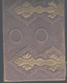
Book - ABBOTT COLLECTION: BOOK OF POETRY, 1884
Leather bound album with metal clasps filled with poems, some are hand written but most have been cut out of books or magazines. On the inside front cover are details of a wedding at the residence of Mr. James Smart, Castlemaine, between Mr. Lewellin and Eliza Beaumont, also article 'token of esteem' a poem written by William Pascoe to Mr. H. Lewis, loco foreman, Railway employee of Sandhurst on the occasion of his removal from Sandhurst to Ballarat. One article dated 1871.poetry, poetry, poems, james smart, castlemaine, rev, jesse carey, llewelyn, william lewellin, bridge, glamorgan, william beaumont, picola, sutton grange -
 Anglesea and District Historical Society
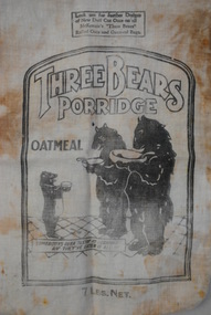
Three Bears Porridge Bag, Jas. F. McKenzie & Co, 1936
Calico bag originally containing porridge and sold in Australia during 1930's. Patent is dated 1936.Front top: THREE BEARS PORRIDGE / OATMEAL / picture of three bears / SOMEBODY'S BEEN TASTING MY PORRIDGE AND THEY'VE EATEN IT ALL UP / 7 LBS.NET Back of bag: Cut-out pattern of Brere Rabbit. Directions - cut around outline of design, place both patterns face to face, stitch around the outline leaving open down the side of the trousers for filling; cut notches, turn right side out, then fill with suitable filling. Sew down side of trousers when filled. Copyrights and Patents Applied for. In order to complete this doll it will be necessary to obtain the Back Design from another Bag of "Three Bears" Rolled Oats or Oat-meals. LOOKOUT FOR FURTHER DESIGNS OF NEW DOLL CUT OUTS ON ALL MCKENZIE'S "THREE BEARS" ROLLED OATS AND OATMEAL BAGS.porridge. oatmeal, mckenzies -
 Kiewa Valley Historical Society
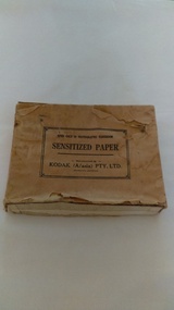
Photographs of small box originally used to contain sensitized photographic paper
The Junction Dam and Clover Dam Power Station, stages of the Kiewa Hydro-Electric Scheme, were needed to meet the increased power demands of the wartime industry in Victoria. Clover added 26 megawatts to the grid. Junction Dam was completed and ready to hold water by September 1943, but was emptied in December 1943 and not filled again until May 1944. Construction of Clover Power Station commenced in July 1941 and both turbines were in service by May 1945.Clover Power Station and Junction Dam were part of the Kiewa Hydro Electric Scheme constructed by the State Electricity Commission of Victoria. SECV official photographers took photographs of most stages of construction of the Hydro Electric Scheme and referenced each photo with a number and dating system as an historical record and for reference for other projects. This provided a thorough history of the construction of the Hydro Electric Scheme, some of the workers involved in its construction and the infrastructure supporting its construction, such a Bogong Village.Small light brown cardboard box originally containing sensitized photographic paper, now containing a range of black and white photographs of the Kiewa Hydro Electric System taken by the official SECV photographer Box has some damage – Front panel on lid is missing. Top has a puncture in top right corner and some peeling of paper along sides and at edges. Printed on the top of the box in black ink: OPEN ONLY IN PHOTOGRAPHIC DARK ROOM SENSITIZED PAPER Manufactured by – KODAK (A/asia) PTY. LTD. Melbourne Australia Green and white sticker on right side of lid and bottom right side of box, torn at join 1. 1B1 Single Weight Soft. Available in Soft (1) Medium (2) Contrast (3) Extra Contrast (4) Single and Double Weight Stamped at bottom of sticker in grey ink G8087 CK photographic paper box; state electricity commission of victoria; official photographer; kiewa hydro electric scheme; clover power station; junction dam; bogong village -
 Kiewa Valley Historical Society
Photographs – SECV – Clover Power Station
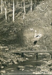
The Junction Dam and Clover Dam Power Station, stages of the Kiewa Hydro-Electric Scheme, were needed to meet the increased power demands of the wartime industry in Victoria. Clover added 26 megawatts to the grid. Junction Dam was completed and ready to hold water by September 1943, but was emptied in December 1943 and not filled again until May 1944. Construction of Clover Power Station commenced in July 1941 and both turbines were in service by May 1945.Clover Power Station and Junction Dam were part of the Kiewa Hydro Electric Scheme constructed by the State Electricity Commission of Victoria.Set of 22 black and white photographs taken by the official SECV photographer who gave each photo a number prefixed by K (for Kiewa) K60 -no date- A bridge and entrance to tunnel K519 -no date- Welding steel lining in the tunnel K531 –no date- Construction on the Kiewa Scheme (tunnel in background K821 – no date- Bogong Village, early days K928 -15 Oct 1942- Construction Clover Power Station K947 -26 Oct 1942- Construction Clover Power Station K948 -26 Oct 1942- Construction Clover Power Station K949- 26 Oct 1942- Clover Camp in background K950 -26 Oct 1942- Construction Clover Power Station K955 -27 Oct 1942- Constructing the bridge at Clover K1102 -7 April 1943- Inlet pipe to power station K1179 –no date- Clover Power Station K1187 – no date- Clover Power Station K1189 -24 June 1943- Part of the spiral casing 1199 -7 July 1943- Clover Power Station K1201 -7 July 1943- Clover Power Station K1231 -26 July 1943- Gantry crane for Clover Power Station K1308 -6 Sept 1943- Spiral casing K1334 -6 Oct 1943- Lake Guy. Bogong Village in background K1342 -29 Oct 1943- Power station under construction K1365 -19 Nov 1943- Power station under construction K1366 -19 Nov 1943- Gantry crane for Clover Power Station On the back- each photograph has a handwritten reference number starting with K and the date stamped or written (see above)secv; kiewa hydro electric scheme; official photographer; junction dam; clover power station; bogong; -
 Kiewa Valley Historical Society
Photographs – SECV – Clover Power Station
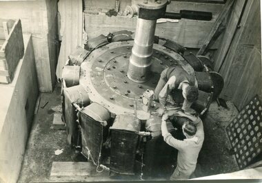
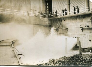
The Junction Dam and Clover Dam Power Station, stages of the Kiewa Hydro-Electric Scheme, were needed to meet the increased power demands of the wartime industry in Victoria. Clover added 26 megawatts to the grid. Junction Dam was completed and ready to hold water by September 1943, but was emptied in December 1943 and not filled again until May 1944. Construction of Clover Power Station commenced in July 1941 and both turbines were in service by May 1945.Clover Power Station and Junction Dam were part of the Kiewa Hydro Electric Scheme constructed by the State Electricity Commission of Victoria.Set of 21 black and white photographs taken by the official SECV photographer who gave each photo a number prefixed by K (for Kiewa) K1367- 19 Nov 1943 The rotor for the generator K1368- 19 Nov 1943 Base of the generator K1377- 2 Dec 1943 Generator under construction K1380- 2 Dec 1943 Power Station under construction K1381- 2 Dec 1943 Generator being assembled K1386- 3 Dec 1943 Part of the generator K1389- 30 Dec 1943 Inlet pipe work K1391- 30 Dec 1943 Inside the power station K1392- 30 Dec 1943 Inlet pipe work K1396- 27 Jan 1944 Equipment in the power station K1410- 4 FGeb 1944 Unpacking equipment for the power station K1422- 16 Feb 1944 Generator being assembled K1425- 22 Feb 1944 Water way – power station K1433- no date Generator being assembled K1434- 3 Mar 1944 Constr5ucting the power station K1448- no date Generator inside the power station K1450- 17 Mar 1944 Clover Power station K1452- 17 Mar 1944 Looking down on the valve-water release from the power station K1456- 22 Mar 1944 ‘half Travel Opening- No 1 Relief Valve’ Overflow from the power station K1458- 22 Mar 1944 Outlet from the power station K1462- 22 Mar 1944 Inside the power station On the back- each photograph has a handwritten reference number starting with K and the date stamped or writtensecv; kiewa hydro electric scheme; clover power station; junction dam; bogong -
 Kiewa Valley Historical Society
Photographs – SECV – Clover Power Station
The Junction Dam and Clover Dam Power Station, stages of the Kiewa Hydro-Electric Scheme, were needed to meet the increased power demands of the wartime industry in Victoria. Clover added 26 megawatts to the grid. Junction Dam was completed and ready to hold water by September 1943, but was emptied in December 1943 and not filled again until May 1944. Construction of Clover Power Station commenced in July 1941 and both turbines were in service by May 1945Clover Power Station and Junction Dam were part of the Kiewa Hydro Electric Scheme constructed by the State Electricity Commission of VictoriaSet of 21 black and white photographs taken by the official SECV photographer who gave each photo a number prefixed by K (for Kiewa) K1463- 22 Mar 1944 Inside Clover Power Station K1464- 23 Mar 1944 Valve K1466- 23 Mar 1944 Fittings for the power station K1467- 23 Mar 1944 Valve K1472- 30 Mar 1944 Equipment being installed in Clover Power Station K1474- 31 Mar 1944 Equipment for the power station K1493- 19 April 1944 Transformer K1495- 28 April 1944 Part of the generator being installed K1514- 11 May 1944 Equipment in the power station K1563- 9 June 1944 Turbine under construction K1565- 22 June 1944 Shaft between turbine and generator K1567- 22 June 1944 Turbine in the power station K1568- 22 June 1944 Transformers K1570- 5 June 1944 Guide vane actuators K1574- 22 June 1944 Equipment in the power station K1567- 22 June 1944 Clover Power Station K1607- 14 Aug 1944 Equipment in the power station K1620- 27 Aug 1944 ‘Charles Tavare (?) Equipment in the power station K1626- 23 Aug 1944 Clover Power Station K1628- 23 Aug 1944 Clover Power Station K1629- 23 Aug 1944 Clover Power Station On the back- each photograph has a handwritten reference number starting with K and the date stamped or writtensecv; kiewa hydro electric scheme; clover power station; junction dam; bogong -
 Kiewa Valley Historical Society
Photographs – SECV – Clover Power Station
The Junction Dam and Clover Dam Power Station, stages of the Kiewa Hydro-Electric Scheme, were needed to meet the increased power demands of the wartime industry in Victoria. Clover added 26 megawatts to the grid. Junction Dam was completed and ready to hold water by September 1943, but was emptied in December 1943 and not filled again until May 1944. Construction of Clover Power Station commenced in July 1941 and both turbines were in service by May 1945.Clover Power Station and Junction Dam were part of the Kiewa Hydro Electric Scheme constructed by the State Electricity Commission of VictoriaSet of black and white photographs taken by the official SECV photographer who gave each photo a number prefixed by K (for Kiewa) K1630- 23 Aug 1944 Clover Power Station K1633- no date Clover Power Station K1683- 10 Oct 1944 Weir K1700- no date Tail boy for Clover Power Station K1710- 11 Oct 1944 Part of aqueduct – Clover K1767- 6 Jan 1945 Switchboard in the power station K1769- 6 Jan 1945 Turbine and shaft K1770- 10 Jan 1945 Houses under construction at Bogong Village K1897- 22 Feb 1945 Equipment in the power station K1808- 22 Feb 1945 Equipment in the power station K1910- 31 May 1945 Top of the turbine and the shaft K1964- 16 Jul 1945 Equipment in the power station K1970- 17 Jul 1945 Bogong Village K1983- 30 Jul 1945 Turbine in power station K1984- 30 Jul 1945 Bogong Village K1989- 2 Aug 1945 Turbines in power station K1990- 2 Aug 1945 Equipment in power station K1991- 2 Aug 1945 Bogong village K2011- 28 Aug 1945 Equipment in power station K2015- 28 Aug 1945 Generators in power station K2016- 28 Aug 1945 Top of the turbine and the shaft K2018- 30 Aug 1945 Spiral casing, the turbine and the shaft On the back- each photograph has a handwritten reference number starting with K and the date stamped or writtensecv; kiewa hydro electric scheme; junction dam; clover power station; bogong -
 Kiewa Valley Historical Society
Photographs – SECV– Clover Power Station
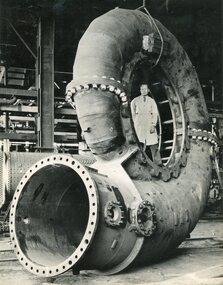
The Junction Dam and Clover Dam Power Station, stages of the Kiewa Hydro-Electric Scheme, were needed to meet the increased power demands of the wartime industry in Victoria. Clover added 26 megawatts to the grid. Junction Dam was completed and ready to hold water by September 1943, but was emptied in December 1943 and not filled again until May 1944. Construction of Clover Power Station commenced in July 1941 and both turbines were in service by May 1945.Clover Power Station and Junction Dam were part of the Kiewa Hydro Electric Scheme constructed by the State Electricity Commission of Victoria.Set of 2 large black and white photographs of spiral casing for a turbine being transported to a power station on the Kiewa Scheme. Gentleman in lab coat standing inside casing in photograph 1 On the back – dark grey ink stamp “Photographed by / E.B. Studios / 309 George St., / Tel. SW 7373 Sydney” clover power station, secv -
 Ballarat RSL Sub-Branch Inc.
Duffle bag, C. 1940
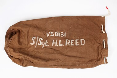
This gear bag was issued to Sergent Harold Loraine Reed, who was born in 14 Aug 1889 in Portland, Victoria. Reed enlisted in the army in 1940 in Ballarat to serve in WWI, and was discharged from 8 Battalion in 1943. Gear bags such as this were standard issue to servicemen. Soldiers would fill their gear bags with essential equipment (mess tins, clothes, etc.) and carry them with them from post to post, or ship them to their destination ahead of time.Khaki coloured canvas bag that is cylindrical in shape with the owner's rank, name, and service number written on the front of the bag in white paint. The base of the bag is rounded, while the top is open with 11 eyelets (one missing) through which a cotton cord has been threaded. Each end of the cord has been wrapped with red tape.V58131 / S/Sgt. H.L. REEDmilitary equipment, duffle bag, barracks bag, kit bag, wwii, second world war (ww2) -
 Kew Historical Society Inc
Functional object - The Mecca Foot Warmer, 1900-1914
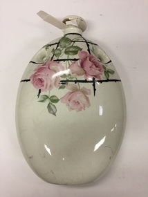
Ceramic hot water bottles were common in the 19th and early 20th centuries. As well as filling hot water containers to warm your bed, you could buy earthenware bottles to use as foot warmers or hand warmers too. Earlier foot warmers used to hold hot coals, or glowing wood, not warm water. In the same way, traditional bed warmers filled with embers were once more usual than hot water bottles.Ceramic foot warmer glazed in cream with a decoration of lattice and pink roses.Maker stamp on base: "The Mecca Foot Warmer / Made in finest English Ivory Ware / Reg. No. 571373 / No sharp corners / Warming Pan / Stone-Trent Englandfoot warmer, household item, bedroom item -
 Eltham District Historical Society Inc
Negative - Photograph, J.A. McDonald, Eltham, Susan Street, Jan. 1961
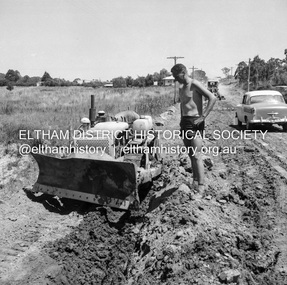
January 1961 Looking south Brown excavating Brougham to Dalton (present-day Withers Way) F. Woods Consolidating showing soft fill over culvert after 9 months Just south of Brougham Street. To the immediate left is the present-day car park for the Elham Leisure Centre. The house on the left is immediately opposite Cromwell street and adjacent to the southwest corner of the Leisure Centre buiding (where the Williams house sits hidden from view)Record of various Shire of Eltham infrastructure works undertaken during the period of 1952-1962 involving bridge and road reconstruction projects, sometimes with Eltham Shire Council Project Reference numbers quoted. It was during this period that a number of significant improvements were made to roads and new bridges constructed within the shire that remain in place as of present day (2022). In many situations, the photos provide a tangible visible record of infrastructure that existed throughout the early days of the Shire. The album was put together by or under the direction of the Shire Engineer, J.A. McDonald.shire of eltham, infrastructure, 1961-01, cromwell street, eltham leisure centre, road construction, susan street -
 Waverley RSL Sub Branch
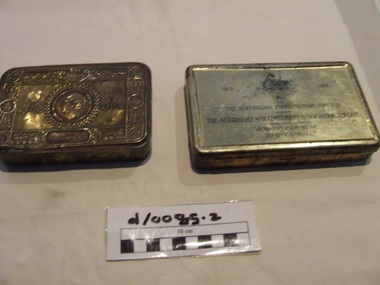
Gift tobacco tins
Gift to troops in France 1914-15. Decorative brass tin sent by Princess Mary to members of the British, Colonial and Indian Armed Forces for Christmas 1914. Over 426,000 of these tins were distributed to those serving on Christmas Day 1914. The tins were filled with various items including tobacco, confectionary, spices, pencils, a Christmas card and a picture of the princess. http://museumvictoria.com.au/collections/items/1329146/tin-princess-mary-s-christmas-gift-19142Gift to the troops tobacco tins Christmas 1914 Brass hinged lidded tin New Year 1915 Brass hinged lidded tin containing tobacco in "plugs"Christmas 1914 Imperium Brittanicum France Russia (embossed) Australian coat of arms To the Australian Expeditionary Forces From the Australian Contingent Association Happy New Year 1915 christmas gift, tobacco, princess mary -
 Melbourne Legacy
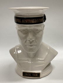
Sculpture - Sculpture, ceramic, Ceramic Innovations Pty Ltd, Jack Tar
A sculpture of an Australian navy man that was produced as a commemorative piece by a Melbourne firm called Ceramic Innovations. It is filled with Tawny Port and is part of a wider set of bar pieces. The three pieces held at Melbourne Legacy are tributes to the three armed forces and are called 'Digger', 'RAAFIE' and 'Jack Tar'. They were once in the comradeship room and now stored in the archive. An advertising flyer for 'Digger' found shows the RRP was $110 with $5 of each 'Digger' being donated to Legacy Australia.A record that the items were souvenirs as tributes to the three armed forces.Ceramic sculpture of the head of a naval person with a separate hat that is made as a bottle and contains Tawny PortGold inscription under the hat says 'Bullocks Tawny Port. Bar Piece No 17. Produced by Ceramic Innovations Pty Ltd.'souvenir, bottle, sculpture -
 Melbourne Legacy
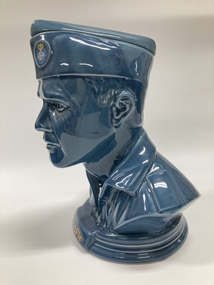
Sculpture - Sculpture, ceramic, Ceramic Innovations Pty Ltd, RAAFie
A sculpture of an Australian air force man that was produced as a commemorative piece by a Melbourne firm called Ceramic Innovations. It is filled with Tawny Port and is part of a wider set of bar pieces. The three pieces held at Melbourne Legacy are tributes to the three armed forces and are called 'Digger', 'RAAFie' and 'Jack Tar'. They were once in the comradeship room and now stored in the archive. An advertising flyer for 'Digger' shows the RRP was $110 with $5 of each 'Digger' being donated to Legacy Australia.A record that the items were souvenirs as tributes to the three armed forces.Ceramic sculpture of the head of a airforce person that is made as a bottle, with a separate hat, and contains Tawny PortGold inscription under the hat says 'Bullocks Tawny Port. Bar Piece No 14. Produced by Ceramic Innovations Pty Ltd.'souvenir, bottle, sculpture -
 Glen Eira Historical Society
Document - Depression – Caulfield
This file contains two items: 1/The Lonsdale Unemployment Relief Stamp Duty Book. The book has been completely filled with entries starting from 08/07/1930 through to 11/07/1932. 2/A handwritten memo from W. Hatcher from the Caulfield Sustenance Office to a Mr. Marshall listing the men whose cards need to be renewed. The memo is dated 10/03/1933 and has been written on the back of an application for sustenance.marshall mr., caulfield, brockley h. j., carroll p., clarke t. e., close r., crawley c., ellis h. s., forbes b., gruben a. j., hopkinson wm, hopkkinson william, hughes t. e., jennings a., jones j., morgans t. j., mcintosh wm l., mcintosh william l., quirk j., romerill f., sears c., thompson a., warden wm, warden william, williams j. s., hatcher w., finnie e., rowe f., harlock c., martin i. l., richards e., unemployment relief, depression, 1929 – 1939, economic depression, relief workers, sustenance, government policies -
 Flagstaff Hill Maritime Museum and Village
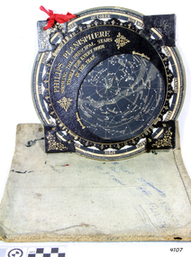
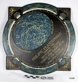
Planisphere, Early 20th Century
The word Planisphere (Latin planisphaerium) was originally used in the second century by Claudius Ptolemy to describe the representation of a spherical Earth by a map drawn in the plane. This usage continued into the Renaissance: for example Gerardus Mercator described his 1569 world map as a Planisphere. The word describes the representation of the star-filled celestial sphere on the plane. The first star chart to have the name "Planisphere" was made in 1624 by Jacob Bartsch. Bartsch was the son-in-law of Johannes Kepler, discoverer of Kepler's laws of planetary motion. A significant item of celestial mapping used by marine navigators This particular item was made and used in the first quarter to half of the 20th centuryPlanisphere of northern hemisphere, with canvas bag. Planisphere consists of a circular star chart attached at its centre to an opaque circular overlay that has a clear elliptical window or hole so that only a portion of the sky map will be visible in the window or hole area at any given time. The chart and overlay are mounted so that they are free to rotate about a common pivot point at their centres. The star chart contains the brightest stars, constellations and (possibly) deep-sky objects visible from a particular latitude on Earth. The night sky that one sees from the Earth depends on whether the observer is in the northern or southern hemispheres and the latitude. A Planisphere window is designed for a particular latitude and will be accurate enough for a certain band either side of that. Planisphere makers will usually offer them in a number of versions for different latitudes. Planispheres only show the stars visible from the observer's latitude; stars below the horizon are not included. A complete twenty-four-hour time cycle is marked on the rim of the overlay. A full twelve months of calendar dates are marked on the rim of the starchart. The window is marked to show the direction of the eastern and western horizons. The disk and overlay are adjusted so that the observer's local time of day on the overlay corresponds to that day's date on the star chart disc. The portion of the star chart visible in the window then represents (with a distortion because it is a flat surface representing a spherical volume) the distribution of stars in the sky at that moment for the Planispheres designed location. Users hold the Planisphere above their head with the eastern and western horizons correctly aligned to match the chart to actual star positions. "Made in Germany for GEORGE PHILIP & SONS Ltd. Geographical and Educational Depot, 32 Fleet Street, London" Canvas bag has "Capt. H (Howard) Tyler from Captain H. F. Woolf" "Tyler 22 ? St East Brighton" also "13 Halls St Flinders"flagstaff hill, warrnambool, shipwrecked-coast, flagstaff-hill, flagstaff-hill-maritime-museum, maritime-museum, shipwreck-coast, flagstaff-hill-maritime-village, planisphere, star map, marine navigation, maps, george philip & sons -
 Flagstaff Hill Maritime Museum and Village
Planisphere, Early 20th Century
The word Planisphere (Latin planisphaerium) was originally used in the second century by Claudius Ptolemy to describe the representation of a spherical Earth by a map drawn in the plane. This usage continued into the Renaissance: for example Gerardus Mercator described his 1569 world map as a Planisphere. The word describes the representation of the star-filled celestial sphere on the plane. The first star chart to have the name "Planisphere" was made in 1624 by Jacob Bartsch. Bartsch was the son-in-law of Johannes Kepler, discoverer of Kepler's laws of planetary motionA significant item of celestial mapping used by marine navigators This particular item was made and used in the first quarter to half of the 20th century.Planisphere consists of a circular star chart attached at its centre to an opaque circular overlay that has a clear elliptical window or hole so that only a portion of the sky map will be visible in the window or hole area at any given time. The chart and overlay are mounted so that they are free to rotate about a common pivot point at their centers. The star chart contains the brightest stars, constellations and (possibly) deep-sky objects visible from a particular latitude on Earth. The night sky that one sees from the Earth depends on whether the observer is in the northern or southern hemispheres and the latitude. A Planisphere window is designed for a particular latitude and will be accurate enough for a certain band either side of that. Planisphere makers will usually offer them in a number of versions for different latitudes. Planispheres only show the stars visible from the observer's latitude; stars below the horizon are not included. A complete twenty-four-hour time cycle is marked on the rim of the overlay. A full twelve months of calendar dates are marked on the rim of the star chart. The window is marked to show the direction of the eastern and western horizons. The disk and overlay are adjusted so that the observer's local time of day on the overlay corresponds to that day's date on the star chart disc. The portion of the star chart visible in the window then represents (with a distortion because it is a flat surface representing a spherical volume) the distribution of stars in the sky at that moment for the Planispheres designed location. Users hold the Planisphere above their head with the eastern and western horizons correctly aligned to match the chart to actual star positions. "Sold by J DONNE & SON, Booksellers & Stationers, 349 Post Office Place Melbourne 349. Admiralty Chart Agents" and " Made in Germany for George Philip & Son Ltd" England . Signature "Capt E. B. ?..id, 22 Baund St"flagstaff hill, warrnambool, shipwrecked-coast, flagstaff-hill, flagstaff-hill-maritime-museum, maritime-museum, shipwreck-coast, flagstaff-hill-maritime-village, star map, marine navigation, maps, george philip & sons -
 Eltham District Historical Society Inc
Photograph, C.S. Wingrove, Secretary, Eltham District Road Board 1858-1871; Shire Secretary, Shire of Eltham 1871-1904, 1858-1871
Charles Symons Wingrove (1829-1905) was Secretary, Eltham District Road Board 1858-1871 and Secretary for the Shire of Eltham 1871-1904. Nearly 50 years service to the local community. For about twelve years he also filled the position of shire engineer for Heidelberg council. Reproduced Page 137 "Pioneers & Painters" Copied from original at Eltham Shire Council offices presented to Mr. Ivor Hammet, 32 Waterdale Road, Ivanhoe, owner of Wingrove's house, Eltham (1971)This photo forms part of a collection of photographs gathered by the Shire of Eltham for their centenary project book,"Pioneers and Painters: 100 years of the Shire of Eltham" by Alan Marshall (1971). The collection of over 500 images is held in partnership between Eltham District Historical Society and Yarra Plenty Regional Library (Eltham Library) and is now formally known as the 'The Shire of Eltham Pioneers Photograph Collection.' It is significant in being the first community sourced collection representing the places and people of the Shire's first one hundred years.Digital image Print 25 x 20 cmc.s.wingrove, charles symons wingrove, eltham district road board, sepp, shire of eltham pioneers photograph collection, shire secretary, wingrove cottage, pioneers and painters, shire of eltham, councilor, municipal officer -
 Eltham District Historical Society Inc
Photograph, George Coop, A day in Melbourne, corner of Cathedral Place and Lansdowne Street, November 1962
Adjacent to Albert Street, St. Patrick’s Cathedral College School occupied this site 1854-1968 when it was controversially demolished to make way for development of the greater Cathedral area. The preserved tower is all that remains. This is a close view of St. Patrick’s College taken from the corner of Cathedral Place and Lansdowne Street. It appears the veranda is an early addition to the main building. In time, even it appears to have had its own modifications with window ‘fill-ins’ to create more enclosed spaces.Digital TIFF file Scan of 35mm Ilford FP3 black and white transparencycathedral place, lansdowne street, melbourne, st. patrick’s cathedral college school -
 Warrnambool and District Historical Society Inc.
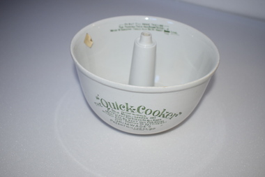
Cooking Bowl, Quick Cooker, Early 20th century
This item is an early type of cooker and would have been used to cook meat and puddings in the first two or three decades of the 20th century. It has no known local provenance but may have been a display item from the old Warrnambool Museum which was established in 1883 and was dismantled in the 1960s. This item, although incomplete, is of interest as a cooking bowl from the past and is retained for display purposes. This is a circular-shaped white china bowl. The base has a hollow tube protruding up through the centre of the bowl. There is printing on the outside of the bowl and on the top inside section. The lid of the bowl is missing. The ‘Quick Cooker’ Patent No 12161/11 Gold Medal London 1911 Excellent for stews of all kind Meat can be kept hot for hours without over-cooking or getting dry Grimwade’s Patent Nos 12835/09, 15043/09 Do not fill above this line – The pudding then has room to expand Water in saucepan should also be about this level ----- vintage culinary items, history of warrnambool, quick cooker -
 Warrnambool and District Historical Society Inc.
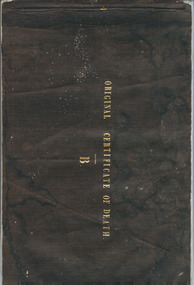
Booklet, Original Certificate of death 1853-1854, Mid 19th century
These certificates of death are original and give details of 47 deaths from July 1853 to February 1855 with the deaths mostly from the Villiers district in the Parish or Township of Warrnambool. The deaths have been registered by John Martin Ardlie and the doctors’ signatures include those of Isaac Corney and Berkeley Hutchinson. This booklet is of high significance as many of the deaths recorded herein are not registered anywhere else and some were buried in the Warrnambool Cemetery before official records began. The Warrnambool Cemetery was gazetted in June 1854. The certificates were found in a private house in Warrnambool.This is a bound booklet with a black linen cover and containing 40 pages. The pages are designed to have the information written twice with one section called the Counterpart and the second called the Original Certificate of Death (Schedule B). The counterpart section was meant to be kept in the booklet and the second section was to be cut out and sent or put elsewhere. The first seven pages have the one Counterpart section and the rest are complete with the two sections. The pages are blue with printed headings for the Registrar of Deaths to fill in. The information on 12 of the pages are incomplete and the entries are handwritten in ink. Front cover: Original Certificate of Death, Bwarrnambool cemetery, early warrnambool death records 1853-1854, john martin ardlie, warrnambool history, isaac corney, berkeley hutchinson -
 Warrnambool and District Historical Society Inc.
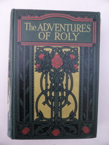
Book, The adventures of Rolly, Early 1930s
This book was given by the Warrnambool State School as a school prize to Ruddy Holland in 1933. He went from the primary school to the Warrnambool Technical School and was well-known for is sporting prowess, especially as a footballer. The Warrnambool State School in Jamieson Street, Warrnambool was opened in 1876, replacing the four Common Schools on the town. This book is of interest as a memento of the Warrnambool State School in the 1930s and of Ruddy Holland, a well-known sportsperson in Warrnambool in the mid 20th century. This is a hard cover book of 206 pages. The cover is dark green with yellow, pink, black and green floral designs on the front cover and spine. The lettering is yellow. The book has several full-page black and white illustrations, with the one at the front detached from the binding. The cover is partly detached from the binding and has been mended with adhesive tape. The book plate on the first page is printed with an ornamental red, blue and gold border. The book plate has been filled in with hand-printing in black ink. ‘Warrnambool 1743, presented to Ruddy Holland, Leadership in Sport, Head Teacher’s Prize, Dec. 1933’. ruddy holland, warrnambool state school -
Port Melbourne Historical & Preservation Society
Photograph - COR/BP tank farm clean-up, Alison Kelly, Aug 1990
Shot when Alision Kelly was caretaker at the nearby 'Mission Art Centre' and displayed there and at the Port Melbourne LibraryFour colour photos of bulldozer working on clean up process on site of former COR/BP tank farm - view to south. Archivally mounted on vertical strip of white card and enclosed in mylar. Photos all looking south; views of equipment scooping out hydro-carbons, soil from pit filled with ground water; top to bottom: Williamstown and Webb Dock in background; white Toyota EAY-921 right foreground; close up; close up; Princes Pier in left backgroundInk on back: 'A. Kelly 645 2324'town planning - proposals shelved - bayside, environment, alison kelly -
 Kew Historical Society Inc
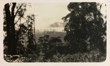
Photograph - Valleys and mountains, c.1927
Henry Beater Christian (1886-1962) , was a descendant of one of the earliest settler families in Kew. Employed at the Kew Asylum as a 'public servant', he was a skilled amateur photographer, photographing numerous scenes in Kew and on his travels around Victoria. The majority of his photographs date from 1916 to 1929. His finest photographs are housed in two photograph albums. Digital copy of a photograph from page 26 of the 47-page photograph album containing 261 gelatinous silver images, loaned by Diane Washfold with permission given to digitise and hold a copy in our collection. John Chapman has written in 'Bushwalking Clubs - A Brief History', about the establishment in Victoria of the first bushwalking club in 1888, and the popularisation of bushwalking during the interwar period. Henry Christian's 'walks' appear to have been undertaken solely or with a companion/s. Here the focus of the photograph is of distant mountains and mist-filled valleys.Inscription on page illegiblehenry beater christian (1886-1962), landscape photography, christian-washfold collection, photograph albums, bushwalking -
 Whitehorse Historical Society Inc.
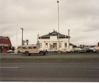
Photograph, Mitcham R.S.L. Memorial Hall, 13/06/1986 12:00:00 AM
2 Coloured photos of Mitcham R.S.L. Memorial Hall, north eastern corner Whitehorse Road and McDowall Street. The Hall is comprehensively documented in the society's archives. See also NP1068. War Memorial in foreground Buildings shown to left of hall occupy a vacant block that reached almost to Mitcham Road. Barrie Gracie's Milk Bar and Mr. Holly's shoe repairs filled the remaining space. The large vacant space was used for impromptu cricket and football games and was akso the location for the circuses the regularly visited Mitcham.mitcham memorial hall, war memorials, soldiers memorial, mitcham -
 Surrey Hills Historical Society Collection
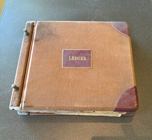
Administrative record - Mitton's Pharmacy Ledger, c 1928
Charles Leslie Mitton (1905-1968) was a pharmacist at 131 Union Road, Surrey Hills from 1933-1968. DOD 30/04/1968. Prior to coming to Surrey Hills, he was a pharmacist in Newmarket (Ref: 1931 electoral roll). He and his wife, Ethel Sylvia Elizabeth Mitton (nee Stevenson) lived at 65 Union Road. They were married in 1933 and had 2 sons and a daughter. He was followed in the business by his son John and daughter Rosalind. See also SHP0015 - Charles Mitton outside his pharmacy; SHP1100 - head and shoulders portrait of Charles Mitton.A ledger with a brown cloth cover, partly stained, with tooled leather corners and a label on the centre of the front cover, both in burgundy leather. The pages are pre-ruled and there is an index at the front. The index includes the account number and the account holder's name. The entries are in blue and occasionally black ink, in a consistent hand. There are a lot of blank pages. The entries include accounts for local doctors for supplies for their practices. Both the front and back covers and the edges of the pages are dirty. There are a handful of blank and filled in accounts loosely held within the ledger.charles leslie mitton, mitton's pharmacy, ledger, 131 union road, pharmacies -
 Ballarat Tramway Museum
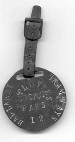
Badge - ESCo employee pass, Electric Supply Co. of Vic (ESCo)
Used by ESCo to enable identification of depot employees when travelling on the trams. Date made and when used unknown. Has hammer marks on rear of badge. See item 9038 for another example.Demonstrates a employee's free pass for travelling on Ballarat's trams.Handmade metal badge from brass sheet about 52 in diameter with a slot (long oval shape) about 23 long x 5 deep through which a leather strap about 100 long x 10 wide with a steel buckle is fitted. Stamped in capital letters on the badge are "BALLARAT TRAMWAYS" on the outside, "EMPLOYEES DEPOT PASS", in the centre of the badge, with the word "Employees" in a semi-circle. Near the bottom of the badge is the number "12", the one formed using an "I". The letters have been filled with a white paint.tramways, trams, esco, depot, employees pass, badges -
 Bendigo Historical Society Inc.
Document - FORTUNA COLLECTION: VILLA FORTUNA ACTION GROUP
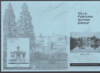
Blue tri-fold pamphlet titled 'Villa Fortuna Action Group' which has a photo of Fortuna and the lake on the front with Fortuna 1908 under the photo and Working for Community Use of Fortuna. On the inside is a brief history of Fortuna, What the Action Group plans to do and Potential Activities. There is also a photo of the Billiard Room, criteria 1908 and another of the exterior of the building. There is also a space to fill in for a Joining Fee and Annual Membership Fee of $10 each. On a lighter photo on the back page is a proposed drawing of the Entrance Hall.bendigo, clubs, villa fortuna action group, fortuna, army survey regiment, theodore ballerstedt, vahland, getzschmann, 180 mine, george lansell, roman bath, pompeii fountain, department of defence, the villa fortuna action group, bendigo historical society inc.