Showing 110514 items matching " roads"
-
 Eltham District Historical Society Inc
Slide, Norman Road, Research, May 1983
... roads ...One of a series of images of roads and infrastructure taken by Eltham Shire Council Planning and Engineering officers, May 1983 specifically looking at road conditions and drainage in Research (Vic.) around Thompson Crescent.35 mm colour positive transparency (1 of 11) Mount - Kodak Kodachrome Cardroads, infrastructure, research (vic.), norman road -
 Eltham District Historical Society Inc
Slide, Thompson Crescent, Research, May 1983
... roads ...One of a series of images of roads and infrastructure taken by Eltham Shire Council Planning and Engineering officers, May 1983 specifically looking at road conditions and drainage in Research (Vic.) around Thompson Crescent.35 mm colour positive transparency (1 of 21) Mount - Kodak Kodachrome Cardroads, infrastructure, research (vic.), thompson crescent -
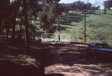
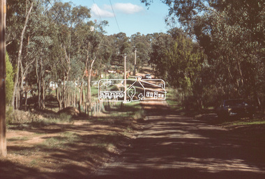
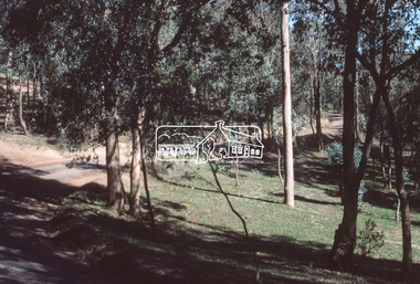
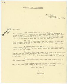 Ringwood and District Historical Society
Letter, Borough of Ringwood engineer stating that a road between Warrandyte Road and Adelaide St has been completed in 1931
1929 saw the establishment of the Ringwood Bowls Club initially located on the land now occupied by the Eastland Shopping Centre. It moved to its current location in Loughnan Road, Ringwood in 1997.Borough of Ringwood engineer stating that a road between Warrandyte Road and Adelaide St has been completed in 1931. The proposed name of Bamford Grove.city of ringwood bowls club, ringwood bowling club, ringwood bowls club, lawn bowls, bowling -
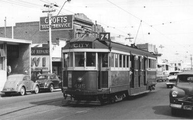 Melbourne Tram Museum
Photograph - W2 495 at Burwood terminus Toorak Road, Doug Colquhoun, 18-3-1959
Photo shows W2 495 (Route 74, City) arriving at the Burwood terminus in Toorak Road, just before Warragul Road. The tram line was extended to Burwood East in July 1978. In the background is a Crofts Self Service store. Photo by Doug Colquhoun, 18.3.59Yield information about the Burwood tram terminus in 1959.Black and white photograph of W2 495 at Burwood terminus Toorak RoadHas details and dates on rear in ink.trams, tramways, w2 class, toorak road, tram 495, burwood, route 74 -
 Eltham District Historical Society Inc
Slide, Riverhill Drive, Lower Plenty, Jun. 1981
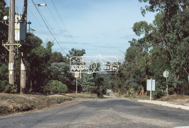
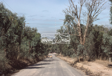
... roads ...Roll of film taken by Eltham Shire Council officers specifically focussed on road infrastructure and maintenance. Many roads of the shire were only relatively recently sealed towards the late 1980s/early 1990s.35 mm colour positive transparency (1 of 8) Mount - Kodak Kodachrome CardProcessed July 1981infrastructure, roads, lower plenty, riverhill drive -
 Eltham District Historical Society Inc
Slide, Riverhill Drive, Lower Plenty, Jun. 1981
... roads ...Roll of film taken by Eltham Shire Council officers specifically focussed on road infrastructure and maintenance. Many roads of the shire were only relatively recently sealed towards the late 1980s/early 1990s.35 mm colour positive transparency (1 of 8) Mount - Kodak Kodachrome CardProcessed July 1981infrastructure, roads, lower plenty, riverhill drive -
 Marysville & District Historical Society
Photograph (Item) - Colour photograph, Unknown
A colour photograph taken looking across Pack Road in Marysville in Victoria.A colour photograph taken looking across Pack Road in Marysville in Victoria.pack road, marysville, victoria, photograph -
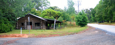 Marysville & District Historical Society
Photograph (Item) - Colour photograph, Travel Victoria, Unknown
A colour photograph of the Log Cabin that was situated on Pack Road in Marysville in Victoria.A colour photograph of the Log Cabin that was situated on Pack Road in Marysville in Victoria. This was a well known business in Marysville that sold tourist related items until it was destroyed in the 2009 Black Saturday bushfires.log cabin, marysville, pack road, victoria, 2009 black saturday bushfires, photograph -
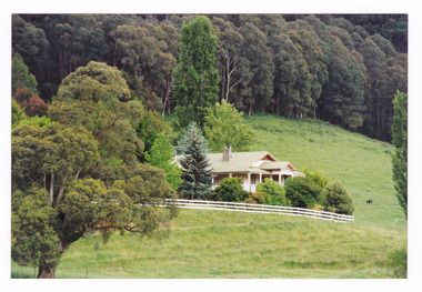 Marysville & District Historical Society
Photograph (Item) - Colour photograph, Unknown
A colour photograph of a house on the Marysville-Buxton Road near Marysville in Victoria.A colour photograph of a house on the Marysville-Buxton Road near Marysville in Victoria.marysville-buxton road, marysville, buxton, victoria, photograph -
 Marysville & District Historical Society
Photograph (Item) - Colour photograph, Unknown
A digital copy of a colour photograph taken in Racecourse Road in Marysville in Victoria.A digital copy of a colour photograph taken in Racecourse Road in Marysville in Victoria.racecourse road, marysville, victoria, photograph -
 Whitehorse Historical Society Inc.
Article, Crash Capital of Australia, 2017
Springvale Road is the nation's worst for insurance claims for the fifth year in a row.Springvale Road is the nation's worst for insurance claims for the fifth year in a row.Springvale Road is the nation's worst for insurance claims for the fifth year in a row.whitehorse road, traffic, accidents, maroondah highway -
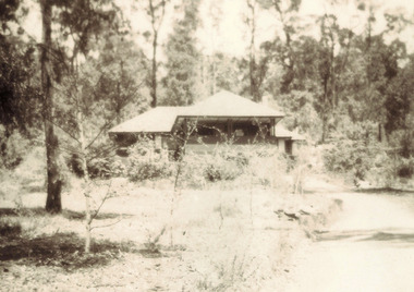 Marysville & District Historical Society
Photograph (item) - Black and white photograph, 1957
A black and white photograph of Somerled Road House in Marysville that was taken in 1957.A black and white photograph of Somerled Road House in Marysville that was taken in 1957.marysville, victoria, australia, somerled holiday home, j.c. greatorex, r. greatorex, mrs d. ivey, photograph -
 Eltham District Historical Society Inc
Slide, Looking south along Bonds Road towards intersection of Montpelier Drive, Lower Plenty, 18 July 1972, 1972
Water drainage work undertaken by Eltham Shire Council in Bonds Road, Lower Plenty outside the Martin property opposite Montpelier Drive, July 1972 Note blocked table drains.35 mm colour positive transparency Mount - Agfacolor Service (Blue)Bonds Road (Martin property) 12.10 pm 18.7.72bonds road, drainage works, eltham shire council, infrastructure, lower plenty, martin property, montpelier drive -
 City of Kingston
Photograph - Black and white, c. 1950
This image shows a sealed road running along South Road, although with a wide gravel shoulder. The railway crossing gates were hand operated. This image is one of many in the collections that focuses on the railway. The development of the railway was crucial to the ongoing development of the area. Community life often sprang up along and beside the railway.Black and white photograph of the railway crossing at South Road, Moorabbin, viewed from Nepean Highway. Handwritten in blue ink on reverse: 217 Handwritten in red ink on reverse: 80%moorabbin, railway, railway crossing -
 Eltham District Historical Society Inc
Slide, Bonds Road, Lower Plenty, Mar. 1981
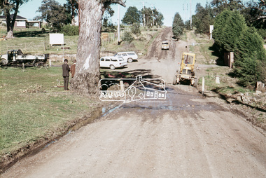
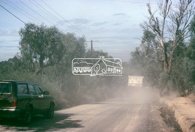
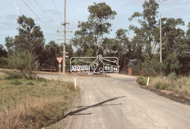
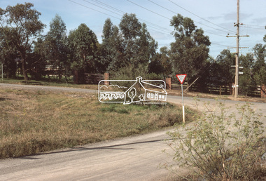
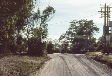
... roads ...One of a series of images of road infrastructure focussed on Bonds Road, Lower Plenty, the section connecting Old Eltham Road with Rosehill Road, taken by Eltham Shire Council Planning and Engineering officers. They provide perspective of the changes in housing styles and road development that began sweeping in from the mid 1970s with increasing urbanisation of what was once more outlying suburbs and regions. All images have been identified with GPS35 mm colour positive transparency (1 of 13) Mount - Kodak Kodachrome CardProcessed Mar 1981infrastructure, roads, bonds road, lower plenty, old eltham road -
 Eltham District Historical Society Inc
Slide, Bonds Road, Lower Plenty, Mar. 1981
... roads ...One of a series of images of road infrastructure focussed on Bonds Road, Lower Plenty, the section connecting Old Eltham Road with Rosehill Road, taken by Eltham Shire Council Planning and Engineering officers. They provide perspective of the changes in housing styles and road development that began sweeping in from the mid 1970s with increasing urbanisation of what was once more outlying suburbs and regions. All images have been identified with GPS35 mm colour positive transparency (1 of 13) Mount - Kodak Kodachrome CardProcessed Mar 1981infrastructure, roads, bonds road, lower plenty, rosehill road -
 Eltham District Historical Society Inc
Slide, Bonds Road, Lower Plenty, Mar. 1981
... roads ...One of a series of images of road infrastructure focussed on Bonds Road, Lower Plenty, the section connecting Old Eltham Road with Rosehill Road, taken by Eltham Shire Council Planning and Engineering officers. They provide perspective of the changes in housing styles and road development that began sweeping in from the mid 1970s with increasing urbanisation of what was once more outlying suburbs and regions. All images have been identified with GPS35 mm colour positive transparency (1 of 13) Mount - Kodak Kodachrome CardProcessed Mar 1981infrastructure, roads, bonds road, lower plenty, old eltham road -
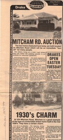 Whitehorse Historical Society Inc.
Newspaper, Mitcham Road auction, 01/04/1984,Nunawading
Advertisement for the sale of two homesAdvertisement for the sale of two homes, 265 Mitcham Road, Mitcham and 534 Mitcham road, Mitcham a 1930s timber home. Agent, drakes real estate. Photographs. Cutting from Nunawading Gazette, 18th April, 1984.Advertisement for the sale of two homesmitcham road, mitcham, no. 534, mitcham road, mitcham, no. 265, houses, drake & co. -
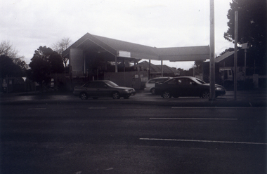 Whitehorse Historical Society Inc.
Photograph, The Railway Crossing from Corner of Springvale Road & Station, 1/06/2009
One of a collection of photographs taken of the Nunawading Railway Station prior to the lowering of the railway line and building of the new railway station on the western side of Springvale Road so that the Springvale Road Rail Crossing can be eliminated.Black & white photograph of he precinct surrounding the Nunawading Station and the Springvale Road Railway crossing. This photograph is of the Railway Crossing from corner of Springvale Road & Station. See NP 3545 to NP3567for the complete set of photographsnunawading railway station, springvale road, nunawading, redevelopment of railway line/springvale road., station street nunawading -
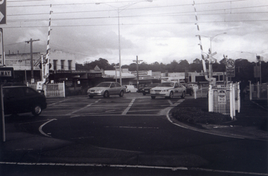 Whitehorse Historical Society Inc.
Photograph, Railway Crossing from the north, 1/06/2009
One of a collection of photographs taken of the Nunawading Railway Station prior to the lowering of the railway line and building of the new railway station on the western side of Springvale Road so that the Springvale Road Rail Crossing can be eliminated.Black & white photograph of the precinct surrounding the Nunawading Station and the Springvale Road Railway crossing. This photograph is of the railway crossing of Springvale Road, Nunawading, looking to the south of the shops. See NP 3545 to NP3567 for the complete set of photographsnunawading railway station, springvale road nunawading, redevelopment of railway line/springvale road. -
 Geelong Cycling Club
Trophy
The summer aggregate road races have been conducted from the 1930s at the Geelong Cycling Club. The award is made up from points accumulated for road races during the summer season.This award provides an incentive for cyclists to perform at their best on club race days. It is interesting to note that over time awards have changed with the fashion of the time. Cycling trophies have ranged from badges in the early 1900s, to sashes in the mid 1900s, then to shields and to individual trophies.Trophy with a square base and rectangular background in grey coloured imitation marble. A figure of a cyclist in gold colour is placed on the base and there is a plaque at the front of the base."Geelong Cycling Club/Summer Series - 2007-08/Road Aggregate/John Burtt"geelong cycling club; summer series - 2007/08; road aggregate; john burtt; -
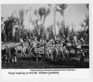 Halls Gap & Grampians Historical Society
Photograph - Sepia, C 1900s
... Roads ...Photo depicts "road-making" approaching the Mount William gold fields. Because of the heavy traffic in the area during the very wet winter of 1900, low sections of the track became quagmires and road building was essential.Photo shows men with horses, carts, shovels etc. There are six horses in photo, three of them hitched up to carts. There are twenty-two men in total, some holding shovels etc.Photo has been laminated. "Title" appears at bottom of photo together with previous holder of photoaccess routes, roads, access routes, road building -
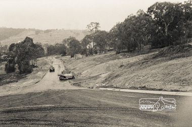
 Melton City Libraries
Photograph, Western Highway, 1983
Construction of service road in front of the former Ann Dowling (Miers) 1866 Crown Grant, Title dated October 1870. She married Henri Miers in 1867.Their house was located on the site near the Myers Gully part of Ryans Creek. Built in 1867 and later named “Burnbank” by Martha Myers after the Street in Ballarat were she lived before arriving in Melton in 1907. She married Frederick Myers in 1908. He died in 1963, and Martha moved to a new home at 5 McKenzie Street Melton in 1968. Attempts made by the family to retain the historic cottage were unsuccessful. A demolition order imposed by the Housing Commission and it was pulled down by the family. It was the home of the family and stood for over 100 years.East of Reserve Road towards Ferris Roadlandscapes of significance, misc. -
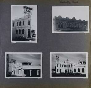 Glen Eira Historical Society
Album - Album page, Glen Huntly Road, Circa 1972
This photograph is part of the Caulfield Historical Album 1972. This album was created in approximately 1972 as part of a project by the Caulfield Historical Society to assist in identifying buildings worthy of preservation. The album is related to a Survey the Caulfield Historical Society developed in collaboration with the National Trust of Australia (Victoria) and Caulfield City Council to identify historic buildings within the City of Caulfield that warranted the protection of a National Trust Classification. Principal photographer thought to be Trevor Hart, member of Caulfield Historical Society. Most photographs were taken between 1966-1972 with a small number of photographs being older and from unknown sources. All photographs are black and white except where stated, with 386 photographs over 198 pages.Page 62 of Photograph Album with three photographs (one landscape and two portrait) of the Elsternwick Hotel exterior (front, rear and side); plus one of the first floor exteriors for 5 adjacent shops on Glen Huntly Road.Hand written: Glen Huntly Road [top right] / 62 [bottom right] trevor hart, caulfield north, glen huntly road, elsternwick, hotels, elsternwick hotel, shops, glenhuntly road -
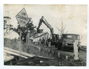 Orbost & District Historical Society
black and white photographs, 1976 - 1977
These photographs are of the demolition of the road bridge across the Snowy River at Orbost. This bridge over the Snowy River was opened on July 4 1922. It was constructed in 1922 alongside the previous suspension bridge. Its building was a combined effort of the Victorian Railways and the Country Roads Board at a cost of 35,000 pounds. It was replaced in 1976 by the present bridge after several major floods.This bridge was replaced in 1976 after several major floods. These photographs are pictorial records of its demolition.Four black / white photographs of the demolition of a road bridge across a river. In them can be seen trucks, excavators and workmen. In 3246.1 there is a triangular road sign - "LOW CLEARANCE 3.9m"bridge-demolition orbost-snwoy-river-bridge -
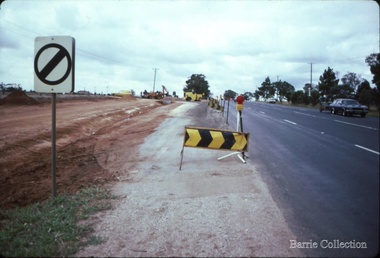
 Eltham District Historical Society Inc
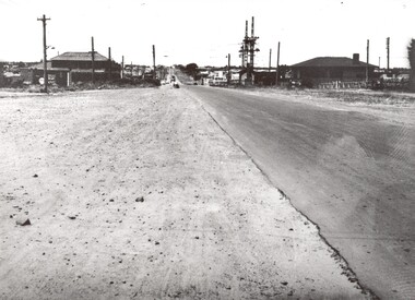
Photograph, Road construction
... roads ...Unidentified local view of road construction, no date.Photographroads, streets, shire of eltham, road construction