Showing 1296 items
matching victorian maps
-
 Canterbury History Group
Map - Victorian Railways East Camberwell to Laburnum. Diagram No.3' 58, 1/05/1958 12:00:00 AM
... melbourne Canterbury Canterbury Station Victorian Railways Railway ...Diagram showing proposed signal and interlocking arrangements for the East Camberwell to Laburnam line 1958canterbury, canterbury station, victorian railways, railway lines -
 Kilmore Historical Society
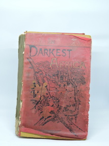
In Darkest Africa, In Darkest Africa or the Quest Rescue and Retreat of EMIN Governor of Equatoria, 1890
Late Victorian travels, skirmishes and adventures in Africa. Colonial edition not for sale in Great Britain.Brown cardboard covered book with printed red paper overlay. Poor condition. Spine missing, splitting of volume. Paper detached from front cover. Front cover partially detached, back cover detached. 38 Full Plate illustrations. Other woodcut illustrations. 4 maps. 635pp. Indexed.P.2 Mechanics Institute Kilmore stamp, '79'.kilmore mechanics institute library. -
Canterbury History Group
Document - Planning for our future, City of Boroondara, 1/07/2014 12:00:00 AM
City of Boroondara paper describing the approval of the Victorian Government to approve new Residential Zones in some areas of Boroondara. Includes a map of the areas affectedboroondara, city of boroondara, amendment c199, residential development, victorian government, local laws, ross> coral -
 Parks Victoria - Mount Buffalo Chalet
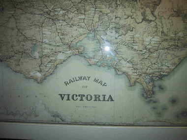
Map, "Railway Map of Victoria"
Large framed map of Victoria, showing Victorias extensive rail network. Printed by Victorian Railways and is one of a number of 'framed pictures, particularly photographs of scenery, which have always been a feature of the Chalet.' (Pg 83. Historica, 2011) This map has been a permanent fixture situated in the hallway alongside the ballroom leading to the ski hire area since the 1950's and most likely earlier. Listed in Draft Inventory of Significant Collection ItemsLarge railway map of Victoria, Melbourne & Ballarat framed in white painted wood. Scale eight miles to one inch. Areas of the map have been whited out.Yes -
 Parks Victoria - Mount Buffalo Chalet
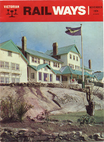
Magazine, "Victorian Railways November 1974"
'Over the years the VR Advertising Division published a number of booklets promoting Mount Buffalo's sports and restorative powers of its scenery in summer and winter...The collection (MBCC) comprises a good range of tourist writing published as promotional booklets, guidebooks, brochures, walking trails, maps and newspaper articles.' (Pg. 119. Historica) This Victorian Railways monthly publication and also the VR Newsletter, published by the Victorian Railways Printing Works in North Melbourne, is one of a number which featured iconic photos of the Chalet of the plateau on its cover, as an identifiable flagship for The Victorian Railways and it's employees from the Railways Refreshment and Services Branch. These publications also have stories regarding upgrades and on long serving staff of the Chalet.Listed in Draft Inventory of Significant Collection Items . Appendix A.3. Promotional material.. (Pg 168. Historica).Railways magazine featuring an image of the chalet on the front cover and an article about the Chalet.Yes -
 Kilmore Historical Society
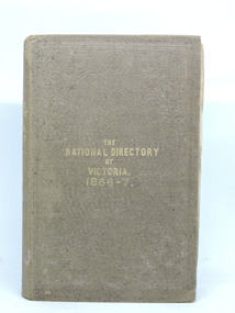
The National Directory of Victoria, The National Directory of Victoria. 1866-7, 1866
Butler & Brooke's National Directory of Victoria for 1866-7. Correct and complete map of the Colony, and The Victorian Yearly Advertiser.Brown cloth-bound hardcover book. Embossed border decoration front and back covers. Mildew spotting to front cover and page edges. Front cover partially separated from body. Binding loose. Pull-out page of advertisments before title page. 405 pp. plus advertisements front and back plus Squatting Directory and Towns' Directories. Fair condition.Inside front cover. 'Nesta McKellar'.victorian directory -
 The Celtic Club
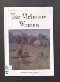
Book, Bronwyn Fensham, Ten Victorian women, 1999
... the information that can be found. Plates, ill, map, p.51. Ten Victorian ...This book summarises various sources available in the PROV used to build a picture of the lives of ten women whose records are available. it highlights the information that can be found.Plates, ill, map, p.51.non-fictionThis book summarises various sources available in the PROV used to build a picture of the lives of ten women whose records are available. it highlights the information that can be found.women - victoria - history - sources, women pioneers - victoria - history -
 Phillip Island Conservation Society Inc.
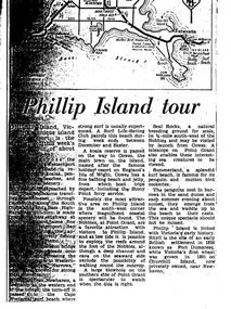
Work on paper - Photocopy of newspaper cutting, "Phillip Island tour", circa 1950s?
The article relates the journalist's visit to Phillip Island, starting from Melbourne and describing features along the way, then at San Remo on mainland side of Phillip Island bridge, then Newhaven on the other. Other places visited include the main town of Cowes, the jetty and beach there, and the Nobbies (Point Grant), with views of the Seal Rocks offshore through telescope at the Nobbies. The writer also visited Summerland beach, described as a surf beach, with penguin and mutton bird rookeries. While not specifically referring to the Penguin Parade, the writer says the spectacle of seeing the penguins coming ashore is not to be missed. The brief military colony at Rhyll and the first Victorian 'garden' planted at Churchill Island in 1801 are also mentionedArticle is significant because it is an early (1950s?) tourist guide to Phillip Island's most popular tourist destinations. 3 column text under map of Phillip Island. Black print on white paper. phillip island, newhaven, , westernport, surf beaches phillip island, summerland beach, penguins, mutton birds, the nobbies, point grant, seal rocks, cowes, nobbies blowhole, rhyll, churchill island, nobbies telescope -
 Wodonga & District Historical Society Inc
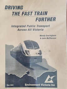
Booklet - Driving the Fast Train Further, Wendy Everingham and John McPherson, May 2001
This document is a response by Environment Victoria to the Fast Train Report. It advocates the establishment of an integrated transport approach in Victoria including the need for a Rural and Regional Planning Strategy to be developed in conjunction with the Metropolitan StrategyA publication of 34 pages produced by Environment Victoria Inc. It has brown cover featuring an image of a locomotive superimposed over an outline map of Victoria. It consists of 36 pages including appendices, references, a map of an Environment Victoria Enhanced Victorian Passenger Rail Network and a map of the Victoria's Regional and Rural Bus service.fiction This document is a response by Environment Victoria to the Fast Train Report. It advocates the establishment of an integrated transport approach in Victoria including the need for a Rural and Regional Planning Strategy to be developed in conjunction with the Metropolitan Strategyrailways environmental impact, victorian railways, environment victoria -
 Wodonga & District Historical Society Inc
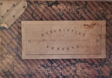
Booklet - Descriptive Surveys - Wodonga - Tallangatta Line
The first section of the Wodonga to Tallangatta line opened in 1889 and was further extended in 1891. It was a vital community link until the passenger service closed in September 1961. The last regular goods train on the line ran on 21st April 1978. These maps give detail of the surveying and building of the line.A collection of replicas of survey maps acquired to build the Wodonga to Tallangatta Railway line. Each survey includes a diagram of a portion of the line showing survey measurements and details of the land which that portion of the line will run through. It also includes the name of the landowner from whom the necessary land was acquired.The first section of the Wodonga to Tallangatta line opened in 1889 and was further extended in 1891. It was a vital community link until the passenger service closed in September 1961. The last regular goods train on the line ran on 21st April 1978. These maps give detail of the surveying and building of the line.victorian railways, wodonga to tallangatta rail service -
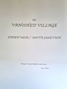 Wodonga & District Historical Society Inc
Booklet - The Vanished Village - Ebden Weir / Mitta Junction, Lyn Larkin, 2004
This publication tells the story of the village of Mitta Junction which was established in about 1920 on the Victorian side of the Hume Dam construction site. The town was built to house workers and their families during the construction of the Hume Weir. It included houses, a shop, hall and school as well as tennis courts. After the completion of the weir the village and all its contents was sold at auction in June 1936 for £7000. The Mitta Junction school continued to operate until the mid 1980s. The book also documents aspects of the history of the Clark family of Bonegilla.A small publication by a local author. A4 size including photographs and a map.This publication tells the story of the village of Mitta Junction which was established in about 1920 on the Victorian side of the Hume Dam construction site. The town was built to house workers and their families during the construction of the Hume Weir. It included houses, a shop, hall and school as well as tennis courts. After the completion of the weir the village and all its contents was sold at auction in June 1936 for £7000. The Mitta Junction school continued to operate until the mid 1980s. The book also documents aspects of the history of the Clark family of Bonegilla.mitta junction township, hume weir construction, clark family bonegilla -
 Wodonga & District Historical Society Inc
Uniform - Hamilton-Smith Collection - Red Cross Uniform
The Hamilton-Smith collection was donated by the children of Grace Mary Hamilton-Smith nee Ellwood (1911-2004) and John Hamilton-Smith (1909-1984) who settled in Wodonga in the 1940s. The Ellwood family had lived in north-east Victoria since the late 1800s. Grace’s mother, Rosina Ellwood nee Smale, was the first teacher at Baranduda in 1888, and a foundation member of the C.W.A. Rosina and her husband Mark retired to Wodonga in 1934. The collection contains significant items which reflect the local history of Wodonga, including handmade needlework, books, photographs, a wedding dress, maps, and material relating to the world wars. Grace and John married at St. David’s Church, Albury in 1941. John was a grazier, and actively involved in Agricultural Societies and the Belvoir Wodonga Rotary Club. Grace was an active member of several organisations including the CWA, Red Cross, the Wodonga Show Ladies' Auxiliary and the Victorian Agricultural Societies Association. This uniform was owned by Grace Hamilton-Smith. She achieved recognition for more 20 years of service to the Red Cross.This item has well documented provenance and a known owner. It is part of a significant collection from the Hamilton-Smith family of Wodonga and reflects important aspects of social history including the roles of women and their contribution to the community. A tan coloured Red Cross uniform and badges worn C1940sred cross australia, hamilton-smith collection, wodonga red cross -
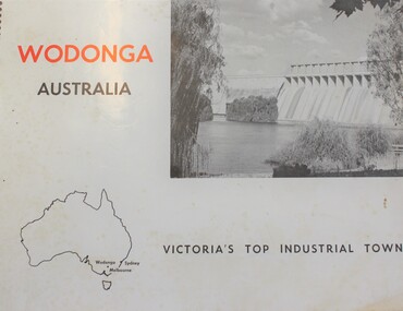 Wodonga & District Historical Society Inc
Book - Wodonga Australia - Victoria's Top Industrial Town, Wodonga Promotions Committee, 1966
Winning the top award for "Industrial Development" in the Victorian Premier Town Contest 1964, Wodonga was recognised and declared the chief industrially developing town outside the Melbourne metropolitan area. This publication outlines the key features of Wodonga supplemented with photos and maps.non-fictionWinning the top award for "Industrial Development" in the Victorian Premier Town Contest 1964, Wodonga was recognised and declared the chief industrially developing town outside the Melbourne metropolitan area. This publication outlines the key features of Wodonga supplemented with photos and maps.wodonga description and travel, wodonga development -
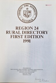 Wodonga & District Historical Society Inc
Booklet - CFA Region 24 Rural Directory, Country Fire Authority Mapping Association, 1991
This publication was been prepared to meet the need in the rural community for a "Rural Directory". Its primary purpose was to decrease the time taken by fire brigades and other services responding to emergency calls. It provides maps of the whole region as well as selected towns. It also includes a localities index, map legends and a road index.An A4 sized directory of 119 pages including an index and maps. The volume has black plastic spiral binding and laminate cover.This publication was been prepared to meet the need in the rural community for a "Rural Directory". Its primary purpose was to decrease the time taken by fire brigades and other services responding to emergency calls. It provides maps of the whole region as well as selected towns. It also includes a localities index, map legends and a road index.victorian country fire authority, fire protection regions, cfa region 24 -
 Wodonga & District Historical Society Inc
Map - Tulloch & Brown's Map of the Colony of Victoria, Tulloch & Brown, 1856
... maps Rare maps Victoria Victorian cartography At bottom right ...The map was created by Tulloch and Brown. David Tulloch was one of the earliest engravers and lithographers in the state of Victoria. He arrived in Melbourne from Greenock, Scotland, on 3 January 1849. Following the discovery of gold Tulloch went to the Victorian goldfields in 1851, commissioned to make sketches of the diggers and the diggings for Ham’s Illustrated Australian Magazine. In November 1852 Tulloch set up in business as engraver, draughtsman, copperplate printer and lithographer. Tulloch took a map engraver, James Davie Brown, into partnership in March 1853; the several maps and specimens of commercial engraving they showed at the 1854 Melbourne Exhibition were awarded a bronze medal. That year Tulloch and Brown also received a silver medal at the Victorian Industrial Exhibition. The partnership was dissolved towards the end of 1856.This is a very early map of the Colony of Victoria including Belvoir (now know as Wodonga).A foldable map mounted on linen and with a board cover. It records the Colony of Victoria according to Surveyor's Records revised in 1857. Areas of the map are shaded to highlight different counties.At bottom right hand section of map: Tulloch & Brown's map of the Colony of Victoria : comprising part of New South Wales, the boundaries, counties, also seaport & inland townships, the gold fields with the latest discoveries, roads, tracks, &c. &c. / compiled from drawings in the Survey Office and correctly revised till 1857. Respectfully dedicated by Permission, to the Honorable Captain Andrew Clarke R.E. Surveyor General of Victoria by His Obediant Servants Tulloch & Brown, Engravers & Publishers, Melbourne". At bottom right below border : Published as the Act directs by the Proprietors, Melbourne, 1st Feb. 1856. tulloch and brown maps, rare maps victoria, victorian cartography -
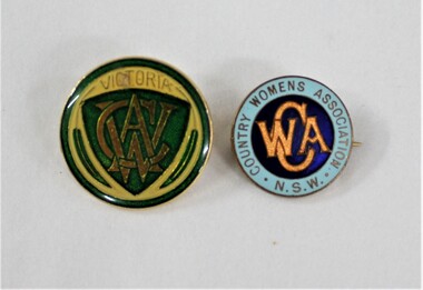 Wodonga & District Historical Society Inc
Badge - Hamilton-Smith Collection Country Women's Association
The Hamilton-Smith collection was donated by the children of Grace Mary Hamilton-Smith nee Ellwood (1911-2004) and John Hamilton-Smith (1909-1984) who settled in Wodonga in the 1940s. The Ellwood family had lived in north-east Victoria since the late 1800s. Grace’s mother, Rosina Ellwood nee Smale, was the first teacher at Baranduda in 1888, and a foundation member of the C.W.A. Rosina and her husband Mark retired to Wodonga in 1934. Grace and John married at St. David’s Church, Albury in 1941. John was a grazier, and actively involved in Agricultural Societies. The collection contains significant items which reflect the local history of Wodonga, including handmade needlework, books, photographs, a wedding dress, maps, and material relating to the world wars. This item has well documented provenance and a known owner. It forms part of a significant and representative historical collection which reflects the local history of Wodonga. It contributes to our understanding of social and family life in early twentieth century Wodonga, as well as providing interpretative capacity for themes including local history and social history. Two small round badges. The NSW CWA badge has a light and dark blue design with orange. The Victorian badge has a yellow, green and gold design.On Victorian badge: "VICTORIA/CWA". On NSW Badge: "COUNTRY WOMENS ASSOCIATION N.S.W./CWA".hamilton-smith collection, hamilton-smith, ellwood, charity, volunteer, voluntering, cwa, country women's association, rural, women, women's history, domestic, cooking, food, community -
 Wodonga & District Historical Society Inc
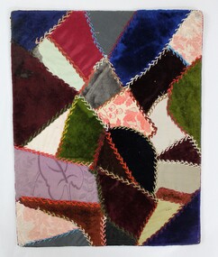
Textile - Hamilton-Smith Collection Victorian-era Crazy Quilt Sampler
The Hamilton-Smith collection was donated by the children of Grace Mary Hamilton-Smith nee Ellwood (1911-2004) and John Hamilton-Smith (1909-1984) who settled in Wodonga in the 1940s. The Ellwood family had lived in north-east Victoria since the late 1800s. Grace’s mother, Rosina Ellwood nee Smale, was the first teacher at Baranduda in 1888, and a foundation member of the C.W.A. Rosina and her husband Mark retired to Wodonga in 1934. Grace and John married at St. David’s Church, Albury in 1941. John was a grazier, and actively involved in Agricultural Societies. The collection contains significant items which reflect the local history of Wodonga, including handmade needlework, books, photographs, a wedding dress, maps, and material relating to the world wars. This quilt sampler was made before 1900 by Rosina Ellwood. Crazy quilts were fashionable in the late Victorian era. The rise of the trend is attributed to the display of Japanese art and ceramics at the 1876 Philadelphia Centennial Exposition (U.S.A.) that featured asymmetrical designs. Inspired, quilters began sewing pieces of fabric of different sizes and textures together into abstract, asymmetrical patterns. The craze spread from America around the world. Embroidery, ribbon and silk embellishments, and hand stitched applique birds and flowers were popular additions. One magazine estimated that a detailed crazy quilt could take over 1,500 hours to complete. Crazy quilts remained in fashion in metropolitan cities until about 1910, though the style endured for longer in rural areas. This item is unique, handmade and has a known owner. It forms part of a significant and representative historical collection which reflects the local history of Wodonga. It contributes to our understanding of domestic and family life in early twentieth century Wodonga, as well as providing interpretative capacity for themes including local history, social history and women’s history.A colourful patchwork quilt sampler using mixed fabric types including velvet, cotton, brocade and satin, backed on cardboard.hamilton-smith collection, hamilton-smith, stiching, needlework, sewing, handmade, domestic, quilt, quilts, crazy quilt, crazy quilts, women's history -
 Wodonga & District Historical Society Inc
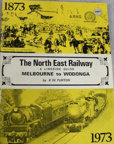
Book - The NORTH EAST RAILWAY Melbourne to Wodonga- A Lineside Guide, Keith W. Turton, 1973
A detailed history and description of the North East Rail Line, including information about each station and siding and relevant maps.non-fictionA detailed history and description of the North East Rail Line, including information about each station and siding and relevant maps.railway transport victoria, north east railway victoria, victoria railways, lineside rail guide -
 Wodonga & District Historical Society Inc
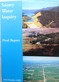
Book - Snowy Water Inquiry Final Report 23rd October 1998, Robert Webster et al, 1998
The Snowy Water Inquiry was commissioned in 1998 with a brief to recommend environmental water release options to the Commonwealth, Victorian, and NSW Governments so that corporatisation of the Snowy Mountains Scheme could proceed. This book contains the findings of the Inquiry into water allocation and uses of the Snowy River.A book of 160 pp - Snowy River Inquiry Final report 23rd October 1998. Submitted to the Governments of New South Wales and Victoria / Commissioner: The Hon. Robert Webster. On the front cover are three aerial photographs of the Snowy River and Snowy Hydro Scheme. The book contains maps and photographs.non-fictionThe Snowy Water Inquiry was commissioned in 1998 with a brief to recommend environmental water release options to the Commonwealth, Victorian, and NSW Governments so that corporatisation of the Snowy Mountains Scheme could proceed. This book contains the findings of the Inquiry into water allocation and uses of the Snowy River.snowy river hydro, snowy river government inquiry, water allocations, water resources developmen -
 Falls Creek Historical Society
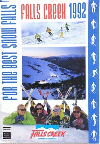
Magazine - Falls Creek 1992 For The Best Snow Falls
A part of a yearly marketing magazine program promoting Falls Creek ski region for the winter holidays. It includes 28 pages of comprehensive information and maps describing resort facilities, different runs and access to the snow. Available accommodation is explained with the inclusion of tariffs for 25 different venues in both lodges and apartments for 1992. Transport, ski hire, other village services and insurance and booking agents are also explained. This issue was published for the Falls Creek Chamber of Commerce and supported by the Victorian Tourism Commission.This item is important as it documents seasonal activities at Falls Creek Alpine ResortMagazine titled "Falls Creek 1992 For The Best Snow Falls". It is a comprehensive guide to activities, accommodation and services in Falls Creek.falls creek marketing, accommodation falls creek, facilities falls creek, falls creek chamber of commerce -
 Falls Creek Historical Society
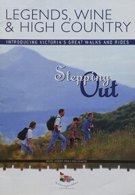
Booklet - Legends, Wine & High Country - Stepping Out
This is one of several booklets published to promote tourism throughout Victoria. It contains detailed information to promote tourism in the region of Northeast Victoria. It was published by the Victorian Tourism Information Service in April 1999.This item is important as it documents how the region of Northeast Victoria has been promoted by the Victorian government. An A4 sized marketing booklet, including images, maps and detailed information about walks, trails and activities in .Northeast Victoria published by the Victorian Tourism Information Board'tourism victoria, falls creek tourism, legends wine and high country, victorian tourism information service -
 Mrs Aeneas Gunn Memorial Library
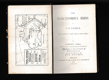
Book, Robert Hall, The insectivorous birds of Victoria : with chapters on birds more or less useful, 1900
... on Victorian birds Index, ill, maps, p.257 The insectivorous birds ...An ornithological book on Victorian birdsIndex, ill, maps, p.257non-fictionAn ornithological book on Victorian birdsbirds - victoria, birds - australia - guidebook -
 Warrnambool and District Historical Society Inc.
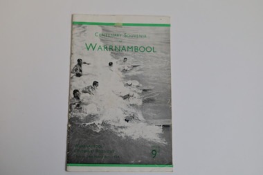
Booklet - Centenary Souvenir of Warrnambool, H. J. Paynter, 1934
In 1934, Victoria and Melbourne celebrated their centenaries. Realising how impossible it would be for the majority of Warrnambool residents to participate in the Victorian celebrations, the organising committee of the Warrnambool Centenary celebrations devised a week long comprehensive programme of activities including exhibitions, a pageant re-enactment at the breakwater and a mass children's display at the showgrounds. Sir Harold Gengoult Smith officially opened the Warrnambool Centenary Exhibition of Arts, Crafts, Antiques and Historical Relics. This booklet was designed and written in 1934 for the Warrnambool Centenary festivities by Frank H. Ford, Lava Street, Warrnambool. The souvenir booklet contains a brief history of Warrnambool, a map and description of Warrnambool and its facilities in 1934.The last three pages include a business directory which would be useful for research.A twenty page booklet printed on shiny paper. The front cover has a black and white photo of nine swimmers in the water (five male & four female) some with surfboards. There is a 4mm green line printed 12mm from the upper edge and a 3mm green line printed 6mm from the lower edge of the cover. There is green printing over the photograph on the front cover. On the rear cover there are two small black and white photographs of an aerial view of the city of Warrnambool and the Hopkins Falls in flood. The green line extend across the rear cover and are intersected by a perpendicular 4mm green line running from the upper to the lower edge 18mm to the left of the spine. Words are printed in black on the rear cover and the printer details are printed in green at the bottom edge.Front cover: Centenary Souvenir of Warrnambool Warrnambool Centenary Festivities 13th to 24th November 1934 Price 9d Rear Cover: Beautiful Warrnambool "City of the West" Victoria Australiawarrnambool, frank h. ford, foyle photos, a. wilkins photos, warrnambool centenary festivities 1934, warrnambool souvenir, warrnambool business directory -
 Eltham District Historical Society Inc
Archive Box, Shire of Eltham War Memorial
Material relating to the Shire of Eltham War Memorial located at Garden Hill, Kangaroo Ground. Also known as The Eltham Shire War Memorial Tower, Shire of Eltham Soldiers' Memorial and Kangaroo Ground War Memorial Park. Includes photocopies, newspaper clippings, correspondence and more beginning from early history 1919-2009. Contents: Archive Box 1 Folder 1 (Publication Proofs) The Tower of Remembrance and War Memorial Park On Garden Hill at Kangaroo Ground, Victoria 1919-2010 Folder 2 (Up to 1960) 1. Binder with plastic pockets. Photocopies. Minutes of the Kangaroo Ground War Memorial Bazaar Committee, 1922-1926 EDHS Newsletter No. 123 November 1998 PRESIDENT'S REPORT ACQUISITION FROM NILLUMBIK SHIRE'S MEMORABILIA Recently found in a storage box of old Shire of Eltham items was a school size, blue lined black covered writing book. It is recognized as the minute book and cash receipt book of the period 1922-1926 when the Memorial Park Committee, who it seems were part of the Shire of Eltham Soldier's Memorial League, was requested to raise funds for building the Shire of Eltham War Memorial Tower at Kangaroo Ground. History tells us that the tower, which is currently being refurbished, was officially opened by the Governor General of Australia, Lord Stonehaven on 11.11.26. The ladies invited to the first meeting at the Shire Hall did so on 21st September 1922. The minutes book reads: Present: Mesdames Bell, Bourchier, McMahon, Gosling, Cockcroft, Wraight, E Coutie, R Rogers, A Jones, AH White, Davies, Everitt and the Misses Lacey, Harris, N Weller, Gosling, Bell and D and G J Bourchier. These people became the Kangaroo Ground Memorial Bazaar Committee along with others named at further meetings. They conditionally accepted the role of raising funds, their condition being that the Bazaar Committee be given representation on any committee empowered to deal with the memorial in proportion to the amount of money raised by the bazaar'. The Andrew Ross Museum has the original book. We at Eltham District Historical Society have two photocopies for public perusal. 2. Transcriptions of newspaper articles 1919-1920. 6 pages. 3. Photocopy of program for thanksgiving service July 6th, 1919 held at Public Hall, Panton Hill. 4. Photocopies: a. Kangaroo Ground, The Advertiser, 17 Oct 1919 (working bee) b. The Advertiser August 1920 – advertisement for coach between Eltham and KG. c. Anzac Memorial Service, The Eltham & Whittlesea Shires Advertiser & Diamond Creek Advertiser, April 14, 1922 and April 28, 1922 d. Anzac Day services. April 27, 1923 e. Photocopy Anzac Commemoration, local newspaper, May 2, 1924 f. Shire of Eltham Memorial Service, The Advertiser April 23, 1926 g. Eltham Shire War Memorial Advertiser August 13,1926 h. Eltham Shire War Memorial The Advertiser October 26, 1926 i. Eltham The Advertiser, December 17, 1926 j. Kangaroo Ground April 26, 1929 5. Photocopy. Eltham War Memorial Tower article, The Advertiser, November 19, 1926 6. Typed transcription of parts of newspaper articles for three titles, November 1926 7. Transcription. Public Notice, October 16, 1926 8. Photocopy Kangaroo Ground Armistice Day local newspaper, November 25, 1927 9. Photocopy Kangaroo Ground Armistice Day local newspaper, November 16, 1928 10. Photocopy Kangaroo Ground, local newspaper, April 26 1929 11. 3 Original Copies. One Hardback. Dedication of memorial official brochure, 1951 original but damaged 12. Photocopy with notes from G.G. relating to the land transfer/acquisition/contract via White and Gepp. Folder 3 (1961-1970) 1. Original newspaper article: Place with a view at Kangaroo Ground, The Age, May 11, 1963, p18 Folder 4 (1981-1990) 1. Newspaper article, Memorial a fire watch. Diamond Valley News, March 16, 1982, 2 original copies. 2. Newspaper article. An Obvious Monument by Russell Yeoman article with photo: Network Nov/Dec 1984, p14. Folder 5 (1991-2000) 1. Original newspaper article: “Kangaroo Ground Tower is top spot”. Thought to be from a tourist information free newspaper, Mountain Country, Summer [1993] p39. 2. Newspaper article with reference to quoins – a contrasting edging or corner stone on the façade of a stone or brick house. Age August 2000 3. Program. Service program for Remembrance Day commemoration ceremony, 1996. 4. Speech by Harry Gilham for Remembrance Day commemoration ceremony, 1996 5. Newspaper article: Remembrance, Diamond Valley News, 20 November 1996 6. Word Document. A Tower of Strength by Dean Stewart April 1997 7. Newspaper articles: Tower group needed, Diamond Valley News, September 17, 1997, p3 and advertisement “Nillumbik, Nominations for Kangaroo Ground Memorial Tower and Grounds Advisory Committee”, Diamond Valley News, September 17, 1997 8. Newspaper article: Council apology; scaling new heights, 1997 about Aboriginal Reconciliation. Probably Diamond Valley News ca 1997. 9. Photocopy / Newspaper Article: Two newspaper clippings, “Memorial with a view” 30 April 1997 and “Funds boost to restore tower to its former glory”, Diamond Valley News, 3 December 1997. 10. Newspaper article: Kangaroo Ground Tower of Remembrance Nillumbik Mail, 9th August 2000 and Research notes (July 2000) by Harry Gilham pertaining to photo in August 2000 newspaper article. 11. Photocopy. Newspaper article: New lease of life for tower (Concept plan) Nillumbik Mail, September 27, 2000 12. Photocopy: 4 pages, War Memorials of Victoria; a pictorial record, c.1994 Folder 6 (2001-2010) 1. Newspaper article: $10,000 to start refurbishment, Nillumbik Mail, Feb 21, 2001 2. Circular. KG War Memorial Advisory committee circular August 2001 3. Newspaper article: Tower group retained 4. Program for re-dedication of the Kangaroo Ground War Memorial Tower 8th November 2001 with copies of pages 65-70 of from The Tower of Remembrance and War Memorial Park 1919-2001 (see Folder 1) - Speaking notes from the day from Nillumbik Shire Mayor, Cr. Sigmund Jorgensen and Harry Gilham and Speech by John Landy, Governor of Victoria 5. 2 pages of Harry Gilham notes – Draft of ‘book’ notes ‘Thank you’ for rededication ceremony to be held Thursday, Nov 8, 2001 - list of invitations, notifications and acknowledgements. 6. Proposed running sheet. Re-dedication of KGT. November 8, 2001 7. Newspaper article (2 copies) Century of war service, DVL November 14, 2001 page 6 8. Letter. Gov. John Landy to Harry Gilham. Thank you for visit. [2001] 9. Newsletter Clipping: Governor of Victoria re-dedicates KG War memorial Tower, Nillumbik News (NSC) Christmas 2001 10. Newspaper article: War Memorial to be restored: DVL November 19, 2003 11. Newspaper article: Memorial Facelift Sept 29 2004. 12. Folder. Collection of maps and context Yarra Water proposal to build water tanks 13. Newspaper clipping. Pressure on with new tank. Re installation of water tank near site. DVL March 2, 2005 14. Folder of emails and designs from Dennis Ward re poppies and prostrate rosemary for formal garden around base of tower April 2005 15. Folder. Letters and paperwork re the Victorian Government “Community Cabinet” and invitation for community groups to speak directly with a government minister. Actual submission not included in folder. 16. Newspaper clipping. Time to remember among the poppies, Diamond Valley Leader, 9 November 2005, p1 and 17. Newspaper clipping. Lone pine company for souls. DVL 9 November 2005 18. Folder. Restoring Community War Memorials Grants Program. Application and associated paperwork 2005/2006 January 2006 19. Newspaper article. Shared views. Valley Weekly, June 21 2006 20. Newspaper article: Kangaroo Ground, Restoration on schedule, DVL October 2006? 21. Newspaper article. Towering over the terrain. The Age August 8, 2009 22. Photocopy. Nillumbik Shire Council. Policy and service report re lease of land to Victoria Police for police radio communications and re-building of radio tower. December 9, 2009 23. Schematics: A3 photocopies, Kangaroo Ground memorial Tower, front and rear view, Tom Manley, 17 Apr 2001 Folder 7 (2011 on) 1. Magazine article and cover. Cover story – The Kangaroo Ground Memorial Tower, The Genealogist, March 2010 2. Newspaper article. (2 copies) Photo and caption. Diamond Valley Leader, July 14, 2010 3. Newspaper notice: Notice of application for a planning permit to construct radio communications tower, DVL, October 10, 2012 4. Copy. Reference enquiry to National Film and Sound Archive. 10 September 2012 5. Copy letter. Quotation/estimate for Shire of Nillumbik on renovation and underpinning of old care takers cottage, KG. 30 September, 2012 6. Story. The Kangaroo Ground Tower of Remembrance by Amy Shaw. Yarrambat Primary School Year 6 History speech, 2014. 7. Program: Remembrance Day service, 11th November 2014 8. Newspaper article. Tribute to bravery DVL, November 19, 2014. 9. Minutes. MAC meeting. 2 September 2016. Folder 8 (Interpretative Signs Grant 2000-2001) 1. Folder. Various including Letters. EDHS Grant project: Kangaroo Ground Park and Tower of Remembrance interpretative signage from Parks Victoria 2000-2001. Folder 9 (Miscellaneous) 1. Folder Gilham collection. Google earth images of Tower, Extract describing history of Tower, including honour roll for WW1 and WW2, 8 pages, Extract describing history of Tower, including honour roll for WW1 and WW2, 3 pages, 2002 and 2004; Kangaroo Ground Tower; Southwell-Keely M.; WAR MEMORIALS IN AUSTRALIA; 8 pages, https://web.archive.org/web/20080722161554/http://www.skp.com.au/memorials2/pages/30054.htm) 2. Letter. Undated, unsigned re application to council to proposed work to police radio masts behind caretaker’s cottage. 3. Brochure: Heritage Nillumbik. Includes cover photo and other information about site. Published by Nillumbik Shire Council. About 2006. 4. Folder of notes and photocopies of various Certificates of Title for property 5. Inward loan documents. Two. Andrew Ross Museum inward loan for collection items from “War Memorial Tower” 2003 6. Photocopies of postcards of Soldiers War Memorial: One taken c.1926 before completion around base, on colour print on paper (enlarged) of Soldiers War Memorial postcard c.1930s prior to gun placements with typed text pasted on and additional detail version mounted on card with handwritten explanatory notes by Harry Gilham. 7. Photocopy of photo of tower 1944 with guns in place from Gordon and explanatory notes plus A4 photo paper print of image (photoshopped cleaned up). 8. Miscellaneous photocopies of photos taken by Harry Gilham of Memorial Park entrance, model tower in font of tower entrance, caretaker’s cottage, spiral staircase, Menin Gate sign and possibly planting of Lone Pine. Folder 10 (Fire Spotting Operations) 1. Biographical notes on Herman Motschall 1969-1981 2. Newspaper article, Memorial Tower top site for fire spotter, Diamond Valley News, May 15, 1973. 3. Proper Officer's report on an addition to the Kangaroo Ground Memorial Tower for Fire Spotting purposes: "This report covers the history of the tower, its uses, and reasons why it should be put to greater use, benefiting the Shire Council and ratepayers" Includes detailed commentary around the proposal to use the Shire of Eltham War Memorial at Kangaroo Ground for fire spotting. From Shire of Eltham archives. H. J. Masefield Property Officer. 4. Eltham Shire Council meetings 14 and 24 September 1973 references to fire watching facilities. Summary of end of season reports from spotters 1965-1973. 5. Newspaper clipping; Memorial a fire watch by Marguerite Marshall Diamond Valley News 16 March 1982 6. Letter: Cover letter from Dennis Ward 20 Feb 2006 architect for CFA Cabin design and Proposal to upgrade the fire spotting cabin, 2007 including a cost and concept plan dated 7 February 2009. 7. Newspaper article. From that first puff of smoke – horror. Diamond Valley Leader, Feb 25, 2009, p. 7 8. Invitation: State Government announcement of refurbishment of KGWM Fire spotting tower 19 October 2009 9. Newspaper article. Tower– up, Black Saturday watch. Cover and page. Diamond Valley Leader, October 28, 2009 10. Invitation. Opening of newly upgraded fire spotting tower, 11 April 2010 11. Newspaper article. Incredible luxury at fire spotting tower, Diamond Valley Leader, April 21, 2010, p, 5 12. Printout of plan of base of tower including comms cabinet and ladder to CFA cabin. Dated 17/6/2010 Archive Box 2 Folder 11 (Moor-rul Viewing Platform) 1. Agenda. Planning and building committee 12 March 2003 Application for construction of a viewing platform and road entry refurbishment and coach parking bay. 2. Envelope. Letters, paperwork and emails, mainly from Dennis Ward re roof design for the viewing platform and order for poppy seeds. 2005 3. Newspaper article (enlarged and laminated). Stolen Red gum seats sap new project’s momentum. (Local paper), April 3, 2007 4. Convenor’s Notes – Opening of the Viewing Platform at Kangaroo Ground, Shire of Nillumbik 5. Folder. Nillumbik Reconciliation Charter. Opening of the Moor-rul viewing platform 17.4.2008. Compiled by Harry Gilham. Includes newspaper clipping, speech, photocopy of photos with captions. 6. Newspaper article. View from the hill is a thrill. Heidelberg and Diamond Valley Weekly, April 22, 2008 7. Newspaper article. A platform towards reconciliation. Diamond Valley Leader, 23 April 2008. 8. Newspaper article: 6 reasons to visit Hurstbridge, The Age, Jun 6 2012 9. Article: Aboriginal cultural values and heritage management issues 10. Folder: Material relating to design and construction of viewing platform Folder 12 - Shire of Nillumbik Advisory Committee 1. 2011 Diary, Harry Gilham, Kangaroo Ground Advisory Committee 2. Photocopy. Newspaper clipping. Nillumbik Council seeking nominations for new Kangaroo Ground Memorial Tower and grounds advisory committee. DVN 17 Sept 1997 3. Letter. From NSC to Dean Stewart re heritage listing status. 12 July 1998. 4. Business paper for NSC Council meeting: KG Memorial Tower and Grounds advisory committee, 12 March 2002. Includes Terms of Reference Folder 13 - Friends of Kangaroo Ground War Memorial Park Inc. 1. KG Tower and land occupational health & Safety (guidelines) for volunteers 2. Supplementary notes (not related to fire spotting) from Friends group or advisory group of Kangaroo Ground War Memorial Park including design of seating, proposed budget for works, hand written notes from meeting by H.G. about 1999. Folder 14 - Soldiers. 1. Folder of material pertaining to men from the Shire of Eltham who enlisted in WW1 and for whom the Shire of Eltham War Memorial was dedicated. 2. Folder on residents from Shire of Eltham who died in WW2 1939-1945 with listings of each from Commonwealth War Graves Commission, WW2 Nominal Roll for Eltham 3. Newspaper article: Mates join to recall past, Diamond Valley News, November 16, 1994 4. Newspaper article: Board replaced, Diamond Valley News, September 2, 1998 about Hurstbridge RSL Honour Roll Board 5. Newspaper article: Keeping the memories alive; VP Day honoured, Valley Weekly, August 17, 2005 6. Newspaper article: In our hearts; Tributes for war heroes, Diamond Valley Leader, November 9, 2005, p1 7. Newspaper article: Service honoured, Diamond Valley News, Leader, April 23, 2008 8. Newspaper article: Salute to last men standing, Diamond Valley Leader, April 20, 2011, p1 and Last of the world warriors, pp8-9 9. Newspaper article: We will remember, Diamond Valley Leader, April 25, 2012, p3 10. Newspaper article: Family legacy builds whole town, Diamond Valley Leader, Oct, 2013, p15 11. Photos and details of Honour Boards in the shire 12. Miscellaneous notes by Harry Gilham Folder 15 – Welcome Home Committee Meeting Minutes. 1. Extracts from Welcome Home Committee Meeting Minutes 18 August 1917 to 14 August 1919. Folder 16 – World War One Local Enlistments. 1. Lever arch binder containing records of local enlistments by name from the Diamond Valley including extracts from Commonwealth War Graves Commission records. Includes Newspaper article clipping "Digger's marker of respect: Temporary cross a poignant find after eight decades in dusty garage"; Sunday Herald Sun, November 10, 2024, p33 concerning Private Harry Conway who died April 1918 and whose tempory grave marker cros now housed at Montmorency-Eltham RSL. Archive Box with documentsharry gilham collection, fire spotting, kangaroo ground, shire of eltham war memorial, masefield h. j., cfa, kangaroo ground war memorial park, shire of eltham soldiers' memorial, eltham shire war memorial tower, harry conway, montmorency-eltham rsl sub-branch -
 Whitehorse Historical Society Inc.
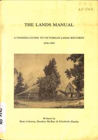
Manual - Government (Lands Dept), Royal Historical Society of Victoria, The Lands Manual - A Finding Guide to Victorian Land Records 1836 - 1983, March 1989
The manual documents the archives of the Department of Crown Lands and Survey (Lands Department) between 1836 to 1983 and explains how they can be used for historical research.The manual documents the archives of the Department of Crown Lands and Survey (Lands Department) and explains how they can be used for historical research.The manual documents the archives of the Department of Crown Lands and Survey (Lands Department) between 1836 to 1983 and explains how they can be used for historical research.crown lands, victoria. department of crown lands and survey -
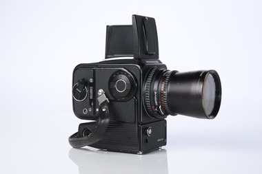 Department of Energy, Environment and Climate Action
Hasselblad aerial camera
Aerial photos were used to make maps of forest types, timber resources, to survey logging areas and regeneration, to mark boundaries of public land and new plantations, to identify new roads and tracks, as well as for fire suppression. Infrared film was sometimes used to monitor insect and disease attack. The images needed to sharp, with high contrast, and in a large format (most were printed in B&W on 9-inch by 9-inch glossy photographic paper) with at least a 60% overlap to enable stereoscopic viewing and with a 20-30% side lap to allow for aircraft drift. Preferably, the photo scale was close to the final map scale avoid to problems when enlarging and to reduce distortion. Something was needed to supplement the very expensive and infrequent large-area photography programs. From the mid-1960s Victorian foresters began experimenting with small format 70mm and 35mm cameras which proved simple, practical, cheap and flexible. It was found that any SLR camera could be used provided it had a good quality lens and fast shutter speed (preferably down to 1/1000 second). Motorised cameras with a large film capacity had obvious advantages and were essential when access to the camera was not possible during flight. It is also essential for the shutter to operate at low temperatures and those lubricated with silicones were recommended. Components of a typical FCV Divisional Office system included – A Hasselblad or Vinten 70 mm format aerial camera with a focal plane shutter which could be electrically operated. Interchangeable lenses to allow for different photo scales and flying heights. Several large film magazines, which were loaded in a darkroom, each with a capacity of 100 feet or approximately 500 frames. A remote control for the camera in single-shot mode or automatic firing at selected intervals of 2 to 50 seconds. It also needed a frame counter. A light aircraft was modified with an internal mounting for the camera to keep it level and steady. Often a hole was cut through the floor for the lens. The aircraft also needed an inbuilt 12 Volt DC battery to operate the motorised camera shutter. The front passenger seat was generally removed to improve access to the camera. An Aldis drift sight was also fitted. This might be likened to an inverted periscope and is used to determine drift, to facilitate accurate navigation along flight lines and to determine the exposure interval for stereoscopic overlap. This item is kept at Traralgon.Hasselblad 500 ELM camera with 70mm lens, film pack, motor drive and battery In 1964 Hasselblad started production of a motorized camera, the 500 EL The EL/M is a modified version of the EL, "M" means modified, "EL" electric. Perhaps the most famous use of the Hasselblad camera was during the Apollo program missions when man first landed on the Moon. Almost all of the still photographs taken during these missions used modified Hasselblad cameras. forests commission victoria (fcv), forest measurement, surveying, mapping -
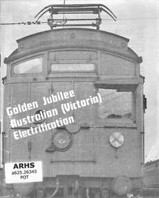 Victorian Railway History Library
Booklet, Potts, Don, Golden Jubilee Australian (Victoria) Electrification, 1969
A brief history of the electrification of the railways in Metropolitan Melbourne to celebrate the Golden Jubilee (50 years) of the opening of the first electrification from Sandringham to Essendon.ill, maps, p.15.non-fictionA brief history of the electrification of the railways in Metropolitan Melbourne to celebrate the Golden Jubilee (50 years) of the opening of the first electrification from Sandringham to Essendon.railroad construction - victoria - history, railroad electrification - victoria - history -
 Bacchus Marsh & District Historical Society
Map, Coimadai Parish Map, County of Bourke. Circa 1890s-1900s
The cadastral Parish of Coimadai, a subdivision of the County of Bourke, lies directly north of the township of Bacchus Marsh. The date of this map is uncertain. T.F. McGauran the person who made a photo-lithographic copy of the map was in charge of photo-lithography at the Victorian Department of Lands and Survey in the late 19th century until about 1910.A single page paper map showing the map for the Parish of Coimadai in the County of Bourke. A cadastral map showing parish boundaries and land ownership. A rectangle shaped area is missing from the centre of the map due to a tear or deliberate excision. The map is pasted into a bound volume containing 76 maps or plans in total. High resolution digital image stored on BMDHS computer network. Photo-lithographed at the Department of Lands and Survey, Melbourne by T.F. McGauran 26.8.[??] NOTE. Photo litho from L.P showing temporary surveys and occupation of land prepared for departmental use onlybacchus marsh region parish plans, coimadai parish maps, coimadai parish plan -
![Map, Late the Property of Robert Lawson Esq. [Landsberg Estate Blackwood]](/media/collectors/5e461d8021ea67224c82f2a1/items/67763722eb6d2cbd24dff14f/item-media/677637b7eb6d2cbd24dff29d/item-fit-380x285.jpg) Bacchus Marsh & District Historical Society
Bacchus Marsh & District Historical SocietyMap, Late the Property of Robert Lawson Esq. [Landsberg Estate Blackwood]
The date this map was created has not been identified. It was possibly created at the time the Landsberg Estate near Blackwood was subdivided and sold into smaller lots in December 1886. This land once belonged to Robert Lawson who died in 1869. Lawson was a well known school teacher who founded Scotch College in Melbourne before setting up a school near Blackwood. This map is similar to another map in the BMDHS collection titled 'Landsberg Estate Blackwood' Victorian Collections record 459 and was possibly produced at the same time.Single page map showing land allotments which made up the Landsberg Estate near Blackwood. Scale 20 chains to 1 inch. The map is pasted into a bound volume containing 76 maps or plans in total. High resolution digital image stored on BMDHS computer network. At the top of the map: 'Late the Property of Robert Lawson Esq.'bacchus marsh victoria maps, landsberg estate blackwood -
Lakes Entrance Historical Society
Book, Land Conservation Council Victoria, Final Recommendations Gippsland Lakes hinterland Area, 1983
1980 report and recommendations of the Victorian Land Conservation Council, for the balanced use of public land in teh gippsland Lakes Hinterland includes reserves schools forests rivers foreshores and other public sites. Map and diagrams added.topography, parks, waterways