Showing 19637 items matching " east "
-
 Robin Boyd Foundation
Functional object - Cushion
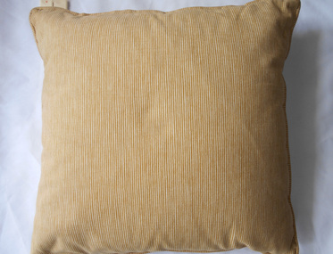
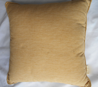
This set of mustard and honeycomb coloured cushions (items F088-F092 and F099-F103) are located on Penleigh and Suzy's beds in the east facing back rooms of the Children's Pavilion.Mustard and white stripe cotton with a concealed zip and piping. Matches bed cover (item F087).walsh st furnishings, robin boyd -
 Robin Boyd Foundation
Functional object - Cushion
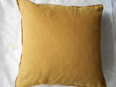
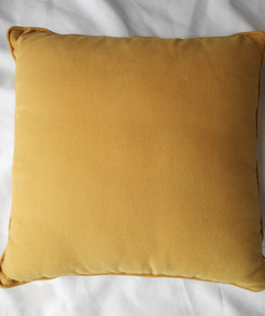
This set of mustard and honeycomb coloured cushions (items F088-F092 and F099-F103) are located on Penleigh and Suzy's beds in the east facing back rooms of the Children's Pavilion.Solid mustard cotton fabric with concealed zip and pipingwalsh st furnishings, robin boyd -
 Robin Boyd Foundation
Functional object - Cushion
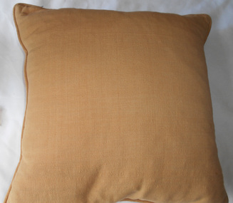
This set of mustard and honeycomb coloured cushions (items F088-F092 and F099-F103) are located on Penleigh and Suzy's beds in the east facing back rooms of the Children's Pavilion.Honeycomb cotton fabric with concealed zip and pipingwalsh st furnishings, robin boyd -
 Robin Boyd Foundation
Functional object - Cushion
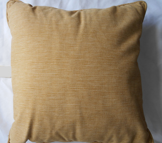
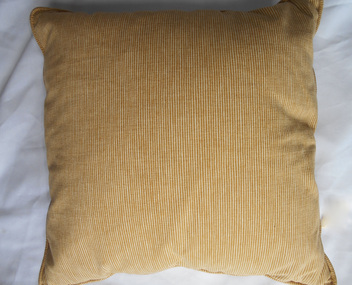
This set of mustard and honeycomb coloured cushions (items F088-F092 and F099-F103) are located on Penleigh and Suzy's beds in the back east facing rooms of the Children's Pavilion.Mustard and white stripe cotton with a concealed zip and piping. Matches bed cover (item F104).walsh st furnishings, robin boyd -
 Robin Boyd Foundation
Functional object - Cushion
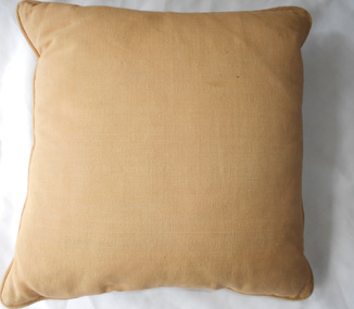
This set of mustard and honeycomb coloured cushions (items F088-F092 and F099-F103) are located on Penleigh and Suzy's beds in the back east facing rooms of the Children's Pavilion.Solid mustard cotton fabric with concealed zip and pipingwalsh st furnishings, robin boyd -
 Robin Boyd Foundation
Functional object - Cushion
This set of mustard and honeycomb coloured cushions (items F088-F092 and F099-F103) are located on Penleigh and Suzy's beds in the back east facing rooms of the Children's Pavilion.Honeycomb cotton fabric with concealed zip and pipingwalsh st furnishings, robin boyd -
 Robin Boyd Foundation
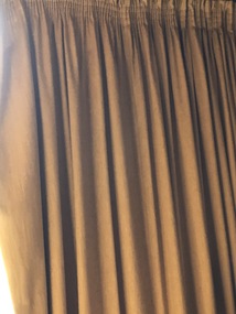
Functional object - Curtains
The curtains are same fabric as the daybed cover (item F104) and some of the cushions (items F088-F092 and F099-F103) located on the Suzy's bed. The windows are east facing.Mustard and white stripe cotton to match bedslip (item 26). Drawstring gathers to south wallwalsh st furnishings, robin boyd -
 Clunes Museum
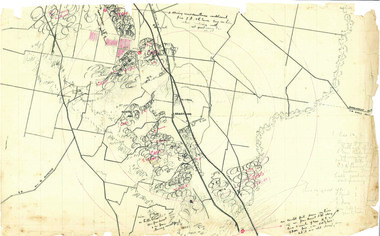
Plan, 23RD SEPTEMBER,1854
GEOLOGICAL SKETCH PLAN AND LETTER FOR TWO RIGHTS CLAIMED BY DONALD CAMERON AT "CLUNES" - 320 ACRES IN THE WEST SIDE OF "CRESWICK CREEK" AND 160 ACRES IN EAST SIDE.1 .2 HANDWRITTEN GEOLOGICAL SKETCH/PLAN COMBINED WITH CORRESPONDENCE DATED 23 SEPTEMBER 1854 - FROM THOMAS BURR, SURVEYOR, 1854 AND PROVIDED TO THE SURVEYOR GENERAL. IT RELATED TO TWO RIGHTS CLAIMS BY PRESCRIPTION OF DONALD CAMERON ESQ.local history, plan, donald cameron, thomas burr, gold mining -
 City of Ballarat Libraries
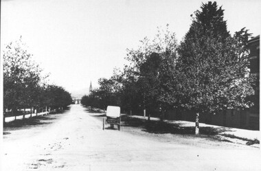
Photograph, Corner of Mair and Drummond Street, Ballarat Central circa 1919
View down Mair Street from the south east corner of Mair Street and Drummond Street North. St Andrew's Church Spire can be seen in the background.mair street, drummond street north, st andrew's church, ballarat, street view -
 8th/13th Victorian Mounted Rifles Regimental Collection
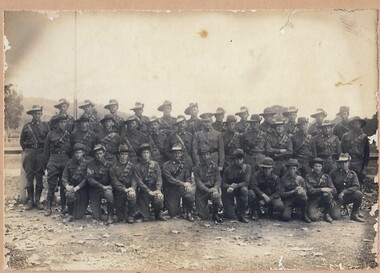
Photograph
Photo taken by Beecdhworth photographer, Between 1911 and 1914. 16th Light Horse was the Citizens Military Force ( CMF ) located in North East Victoria with Headquarters at Wangaratta.Black and white photograph of one officer and 36 soldiers posed in 3 rows. Photo mounted on card." B Troop C Sqdrn 16th L Horse 5. 8. 14" -
 Australian Army Museum of Western Australia
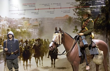
Diorama, 2015
This diorama is the central feature in the World War 1 Gallery - Middle East Campaigns sequence and shows typical uniforms and accoutrements of the Australian Light Horse and Ottoman infantry.This diorama attempts to convey the conditions experienced and the country traversed during "The Great Ride"1:1 scale diorama showing mounted trooper of 10th Australian Light Horse Regiment in Palestine 1918 and dismounted Ottoman soldiergaza, beersheba, light horse -
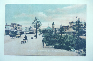 Ballarat Tramway Museum
Postcard - Copy photograph - horse tram, Sturt Street Ballarat, c1900
Photograph of a postcard showing a horse tram travelling east in Sturt Street, taken from the median strip. Has the Harry Davies store and the Town Hall in the view.Demonstrates copy photographs of a coloured postcard and shows a horse tram in Sturt Street.Copy print or photograph of a coloured postcard showing a horse tram in Sturt Street Ballarat.ballarat, horse trams, tramways, sturt street, postcard -
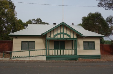 Kew Historical Society Inc
Photograph - Digital Photograph, Robert Baker, Harriers' Pavilion, Victoria Park (Kew), 2014, 2014
While initially a pavilion at Victoria Park used by the Kew Harriers Club, the building was subsequently used by a range of community groups, including the East Kew Women's Club.Born digital image of the exterior of the renovated Harriers' Pavilion at Victoria Park (Kew)kew - sport pavilions, victoria park - kew (vic), kew harriers club -
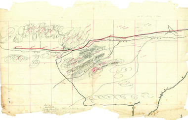
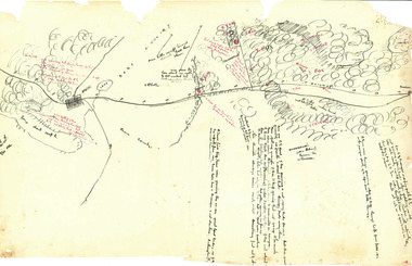
![Hand-Drawn Map Centred on Myrtleford by Frank Lebbell Frost [ca 1915-1918]](/media/collectors/51d110e42162ef12e06aa06b/items/51fb0bb72162ef156c79aeee/item-media/52a11c442162ef1f0c9c052b/item-fit-380x285.jpg) Beechworth Honey Archive
Beechworth Honey ArchiveHand-Drawn Map Centred on Myrtleford by Frank Lebbell Frost [ca 1915-1918]
This is one of the maps drawn by Frank L. Frost while he was beekeeping in North-East Victoria. This particular map may be reference in the "Wooden" Diary on page 8.Hand-drawn map centred on Myrtleford, Palmerston, Gapstead Road, the Ovens River and the Myrtleford-Wangaratta Road. Shows locations of flowering eucalypts. Scale is 1 mile to 1 inch. Drawn with black pen and grey lead on paper. Names of towns are marked in red pen. hand drawn, hand-drawn, map, myrtleford, palmerston, gapstead, ovens, beekeeping, frost, beechworth honey -
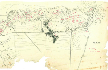
 Beechworth Honey Archive
Hand-Drawn Map Centred on Worouly by Frank Lebbell Frost December 1916
This is one of the maps drawn by Frank L. Frost while he was beekeeping in North-East Victoria. This particular map may be reference in the "Wooden" Diary on page 10.Hand-drawn map centred on Whorouly and showing other towns, including Oxley, Byrne, Edi and Whitfield. Details the local flowering eucalypts. Scale is each red square equals three miles. Drawn with black pen and grey lead on paper. Grid and other features are marked in red.hand drawn, hand-drawn, map, oxley, byrne, whitfield, edi, frost, beekeeping, beechworth honey -
 Beechworth Honey Archive
Hand-Drawn Map Centred on Buckland Gap Road by Frank Lebbell Frost July 1916
This is one of the maps drawn by Frank L. Frost while he was beekeeping in North-East Victoria. This particular map may be reference in the "Wooden" Diary on page 8.Hand-drawn map centred on Buckland Gap road (near Murmungee). Details the quantity and quality of flowering timber in the nearby State Forest. Scale is 1/2 mile to 1 inch. Map was drawn on the 16th July, 1916. Drawn with black pen and grey lead on paper. Features are marked in red.hand drawn, hand-drawn, map, buckland gap, frost, beekeeper, beechworth honey -
 Beechworth Honey Archive
Hand-Drawn Map Centred on Armstrong by Frank Lebbell Frost Dec 1916
This is one of the maps drawn by Frank L. Frost while he was beekeeping in North-East Victoria. This particular map may be reference in the "Wooden" Diary on page 11.Hand-drawn map centred on Armstrong, a town 6 miles from Ararat. Details vegetation along Great Western Highway. Drawn with black pen and grey lead on paper. Features are marked in red.hand drawn, hand-drawn, map, armstrong, ararat, frost, beekeeper, beechworth honey -
 Beechworth Honey Archive
Hand-Drawn Map Centred on Ararat by Frank Lebbell Frost December 1916
This is one of the maps drawn by Frank L. Frost while he was beekeeping in North-East Victoria. This particular map may be reference in the "Wooden" Diary on page 11. Front Side: Hand-drawn map centred on Ararat, central Victoria. Details road and railway and vegetation with comments on flowering. Back Side: Comments in grey lead [ca 1923]hand drawn, hand-drawn, map, ararat, frost, beekeeper, beechworth honey -
 The Beechworth Burke Museum Research Collection
Photograph (Series) - Index Card, George Tibbits, High St, Beechworth, 1976
George Tibbits, University of Melbourne. Faculty of Architecture, Building and Town & Regional PlanningIndex system that support the research for Beechworth : historical reconstruction / [by] George Tibbits ... [et al]Arranged by street names of BeechworthEach index card includes: street name and number of property, image of property, allotment and section number, property owners and dates of ownership, description of the property according to rate records, property floor plan with dimensions.beechworth, george tibbitsbeechworth, george tibbits -
 Buninyong & District Historical Society
Photograph - Colour photograph, A school building in the grounds of the former Yendon Primary School
Yendon Primary School operated as a State School from 1877 and ceased operating in 1993. The School initially operated as the Buninyong East Common School from 1864.The children of railway workers from the Ballarat- Geelong railway would have formed much of the opening enrolment of the school.Colour photograph of single story building located in the grounds of the former Yendon Primary School painted cream and showing evidence of its use in 1994 as a private home including curtains and new wooden doors at the rear of the building.Yendon Primary School 1994education, yendon, state schools -
 Buninyong & District Historical Society
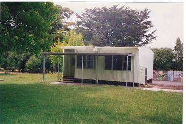
Photograph - Colour photograph, Coloured photograph of a portable school building at Yendon taken in 1994
Yendon Primary School operated as a State School from 1877 and ceased operating in 1993. The School initially operated as the Buninyong East Common School from 1864.The children of railway workers from the Ballarat- Geelong railway would have formed much of the opening enrolment of the school.Colour photograph of a portable school building in the grounds of the former Yendon Primary SchoolPre Fab - Yendon Primary School 1994education, yendon, state schools -
 Buninyong & District Historical Society
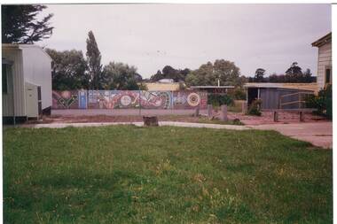
Photograph - Colour photograph, Colour photograph of the rear Yendon Primary School 1994 featuring the playground area and mural
Yendon Primary School operated as a State School from 1877 and ceased operating in 1993. The School initially operated as the Buninyong East Common School from 1864.The children of railway workers from the Ballarat- Geelong railway would have formed much of the opening enrolment of the school.Colour photograph showing the rear of the former of Yendon Primary featuring the playground and mural on the boundary fence.Yendon Primary School 1994education, yendon, state schools -
 Buninyong & District Historical Society
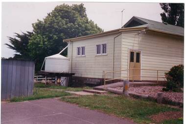
Photograph - Colour photograph, Colour photograph of the rear of the main building of Yendon Primary School 1994
Yendon Primary School operated as a State School from 1877 and ceased operating in 1993. The School initially operated as the Buninyong East Common School from 1864.The children of railway workers from the Ballarat- Geelong railway would have formed much of the opening enrolment of the school.Colour photograph showing the rear of the former main school building of Yendon Primary and part of the playground.Yendon Primary School 1994education, yendon, state schools -
 Wangaratta RSL Sub Branch
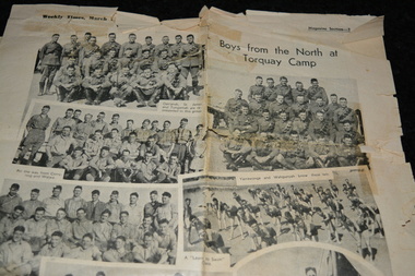
Newspaper, March 16 1940
Group photographs of soliders from North East towns in Victoria - St James/Tungamah, Corryong/Walwa,Wodonga,Myrtleford/Moyhu, Wangaratta,Yarrawonga/Wahgunyah and Tallangatta Photographs depicting soldiers who enlisted from towns in Victoria's north east whilst at training camp in Torquay prior to deployment during World War Two.Large black and white original newspaper containing full page of ten photographs of solidersWeekly Times March 16 1940 Magazine Section -7 Boys from the North at Torquay Campst james/tungamah, corryong/walwa,wodonga,myrtleford/moyhu, wangaratta,yarrawonga/wahgunyah and tallangatta, torquay, training camp -
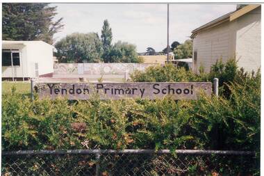 Buninyong & District Historical Society
Photograph - Colour photograph, Part of the former grounds and buildings of the former Yendon Primary School featuring the school sign
Yendon Primary School operated as a State School from 1877 and ceased operating in 1993. The School initially operated as the Buninyong East Common School from 1864.The children of railway workers from the Ballarat- Geelong railway would have formed much of the opening enrolment of the school.Colour photograph of part of two school buildings and the grounds of the school featuring the sign "Yendon Primary School" on the school fence.Yendon Primary School 1994education, yendon, state schools -
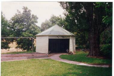 Buninyong & District Historical Society
Photograph - Colour photograph, Six sided shelter shed of the former Yendon Primary School 1994
Yendon Primary School operated as a State School from 1877 and ceased operating in 1993. The School initially operated as the Buninyong East Common School from 1864.The children of railway workers from the Ballarat- Geelong railway would have formed much of the opening enrolment of the school.Colour photograph of a six sided shelter shed in the grounds of the former Yendon Primary School 1994Shelter shed Yendon Primary School 1994 6 sidededucation, yendon, state schools