Historical information
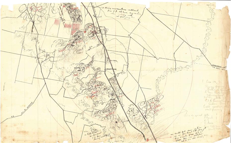
This is one of the maps drawn by Frank L. Frost while he was beekeeping in North-East Victoria. This particular map may be reference in the "Wooden" Diary on page 11.
Physical description
Hand-drawn map centred on Armstrong, a town 6 miles from Ararat. Details vegetation along Great Western Highway. Drawn with black pen and grey lead on paper. Features are marked in red.