Showing 1056 items matching "trailes"
-
 Eltham District Historical Society Inc
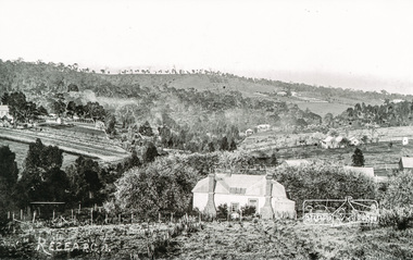
Photograph, Tom Prior, Research
Taken from the back of the Research Hotel around Ingrams Road.The Reynolds family were early settlers in Research. The Reynolds/ Prior collection of photographs were taken by Tom Prior, the maternal uncle of Ivy Reynolds, around 1900 and the 60 photos in the album give a fine overview of many of the landmarks of Research and Eltham over 100 years ago. lvy lived in the family home for many years at 106 Thompson Cres Research. Ivy's father, Ernst Richard Reynolds and grandfather, Richard Reynolds, lived at the same address. Ivy's father Richard worked for Mr. Trail on his property in Research. Reynolds Road is named after the family. Mr Tom Prior (wife Eva) worked at the Melbourne zoo. He was very innovative and made his own camera, using the black cloth hood to exclude the light. The photographs are a reminder of the rural nature of Research and Eltham and its rich heritage. Black and white photograph mounted in an album, the Reynolds/Prior Photograph Collection, this being one of 53 reproduced black and white images of early Eltham.The Reynolds/Prior Photograph Collection, Presented to the Eltham District Historical Society, 14 June 2006 by Ross McDonald. A second copy was also presented to the Andrew Ross Museum, Kangaroo Groundingrams road, research (vic.), research hotel, reynolds prior collection -
 Eltham District Historical Society Inc
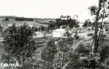
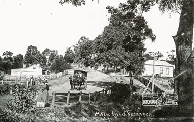
Photograph, Tom Prior, View looking down Ingrams Road, Research towards the rear of Doney's store
The small building at left of photo housed the school for a short period of time but it was too hot in summer and the community lobbied for a more substantial school.The Reynolds family were early settlers in Research. The Reynolds/ Prior collection of photographs were taken by Tom Prior, the maternal uncle of Ivy Reynolds, around 1900 and the 60 photos in the album give a fine overview of many of the landmarks of Research and Eltham over 100 years ago. lvy lived in the family home for many years at 106 Thompson Cres Research. Ivy's father, Ernst Richard Reynolds and grandfather, Richard Reynolds, lived at the same address. Ivy's father Richard worked for Mr. Trail on his property in Research. Reynolds Road is named after the family. Mr Tom Prior (wife Eva) worked at the Melbourne zoo. He was very innovative and made his own camera, using the black cloth hood to exclude the light. The photographs are a reminder of the rural nature of Research and Eltham and its rich heritage. Black and white photograph mounted in an album, the Reynolds/Prior Photograph Collection, this being one of 53 reproduced black and white images of early Eltham.The Reynolds/Prior Photograph Collection, Presented to the Eltham District Historical Society, 14 June 2006 by Ross McDonald. A second copy was also presented to the Andrew Ross Museum, Kangaroo Grounddoney property, general store, ingrams road, main road, research (vic.), research hotel, research primary school, reynolds prior collection, sepp, shire of eltham pioneers photograph collection -
 Eltham District Historical Society Inc
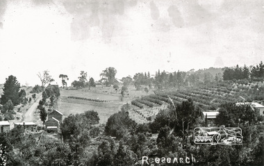
Photograph, Tom Prior, Research
Taken north along Ingrams Road after turning the bend, the area was known for its orchards.The Reynolds family were early settlers in Research. The Reynolds/ Prior collection of photographs were taken by Tom Prior, the maternal uncle of Ivy Reynolds, around 1900 and the 60 photos in the album give a fine overview of many of the landmarks of Research and Eltham over 100 years ago. lvy lived in the family home for many years at 106 Thompson Cres Research. Ivy's father, Ernst Richard Reynolds and grandfather, Richard Reynolds, lived at the same address. Ivy's father Richard worked for Mr. Trail on his property in Research. Reynolds Road is named after the family. Mr Tom Prior (wife Eva) worked at the Melbourne zoo. He was very innovative and made his own camera, using the black cloth hood to exclude the light. The photographs are a reminder of the rural nature of Research and Eltham and its rich heritage. Black and white photograph mounted in an album, the Reynolds/Prior Photograph Collection, this being one of 53 reproduced black and white images of early Eltham.The Reynolds/Prior Photograph Collection, Presented to the Eltham District Historical Society, 14 June 2006 by Ross McDonald. A second copy was also presented to the Andrew Ross Museum, Kangaroo Groundingrams road, orchards, research (vic.), reynolds prior collection -
 Eltham District Historical Society Inc
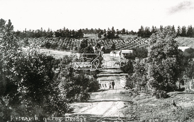
Photograph, Tom Prior, Research Gully Bridge, Research Gully Road, Research, c.1895
Research Gully Bridge. At time of collection (1970) Ingrams Road was formerly Research Gully Road. The Maroondah Aqueduct runs along the base of the pine trees.The Reynolds family were early settlers in Research. The Reynolds/ Prior collection of photographs were taken by Tom Prior, the maternal uncle of Ivy Reynolds, around 1900 and the 60 photos in the album give a fine overview of many of the landmarks of Research and Eltham over 100 years ago. lvy lived in the family home for many years at 106 Thompson Cres Research. Ivy's father, Ernst Richard Reynolds and grandfather, Richard Reynolds, lived at the same address. Ivy's father Richard worked for Mr. Trail on his property in Research. Reynolds Road is named after the family. Mr Tom Prior (wife Eva) worked at the Melbourne zoo. He was very innovative and made his own camera, using the black cloth hood to exclude the light. The photographs are a reminder of the rural nature of Research and Eltham and its rich heritage. Black and white photograph mounted in an album, the Reynolds/Prior Photograph Collection, this being one of 53 reproduced black and white images of early Eltham. (Duplicated on p38 also)The Reynolds/Prior Photograph Collection, Presented to the Eltham District Historical Society, 14 June 2006 by Ross McDonald. A second copy was also presented to the Andrew Ross Museum, Kangaroo Groundaqueduct, ingrams road, research (vic.), research gully bridge, research gully road, reynolds prior collection, shire of eltham pioneers photograph collection, bridge -
 Eltham District Historical Society Inc
Photograph, Tom Prior, Waiting for the taxi-bus, Main Road, Research
Mr West's bus line. Dyson's taxi-bus came once a day to take people shopping in Eltham. The lady is waving the bus to stop.The Reynolds family were early settlers in Research. The Reynolds/ Prior collection of photographs were taken by Tom Prior, the maternal uncle of Ivy Reynolds, around 1900 and the 60 photos in the album give a fine overview of many of the landmarks of Research and Eltham over 100 years ago. lvy lived in the family home for many years at 106 Thompson Cres Research. Ivy's father, Ernst Richard Reynolds and grandfather, Richard Reynolds, lived at the same address. Ivy's father Richard worked for Mr. Trail on his property in Research. Reynolds Road is named after the family. Mr Tom Prior (wife Eva) worked at the Melbourne zoo. He was very innovative and made his own camera, using the black cloth hood to exclude the light. The photographs are a reminder of the rural nature of Research and Eltham and its rich heritage. Black and white photograph mounted in an album, the Reynolds/Prior Photograph Collection, this being one of 53 reproduced black and white images of early Eltham.The Reynolds/Prior Photograph Collection, Presented to the Eltham District Historical Society, 14 June 2006 by Ross McDonald. A second copy was also presented to the Andrew Ross Museum, Kangaroo Groundmain road, research (vic.), reynolds prior collection, taxi-bus -
 Eltham District Historical Society Inc
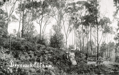
Photograph, Tom Prior, Dry Creek, Eltham
At the south of Research, the creek that starts at Geoff Joslyn's and follows Mount Pleasant Road and it eventually flows into the Yarra. Possibly Ivy Reynolds' aunty shown.The Reynolds family were early settlers in Research. The Reynolds/ Prior collection of photographs were taken by Tom Prior, the maternal uncle of Ivy Reynolds, around 1900 and the 60 photos in the album give a fine overview of many of the landmarks of Research and Eltham over 100 years ago. lvy lived in the family home for many years at 106 Thompson Cres Research. Ivy's father, Ernst Richard Reynolds and grandfather, Richard Reynolds, lived at the same address. Ivy's father Richard worked for Mr. Trail on his property in Research. Reynolds Road is named after the family. Mr Tom Prior (wife Eva) worked at the Melbourne zoo. He was very innovative and made his own camera, using the black cloth hood to exclude the light. The photographs are a reminder of the rural nature of Research and Eltham and its rich heritage. Black and white photograph mounted in an album, the Reynolds/Prior Photograph Collection, this being one of 53 reproduced black and white images of early Eltham.The Reynolds/Prior Photograph Collection, Presented to the Eltham District Historical Society, 14 June 2006 by Ross McDonald. A second copy was also presented to the Andrew Ross Museum, Kangaroo Groundreynolds prior collection, creek, eltham -
 Eltham District Historical Society Inc
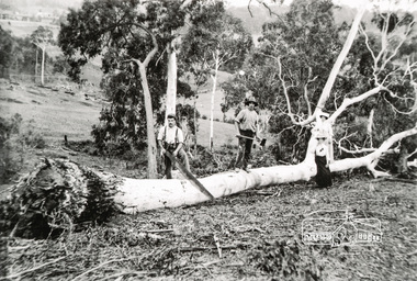
Photograph, Tom Prior, Cutting trees
Cutting trees with a large cross cut saw and axe. Shown is Tom Prior (Ivy Reynolds' uncle) and his wife Eva Prior (or Ivy's mother)The Reynolds family were early settlers in Research. The Reynolds/ Prior collection of photographs were taken by Tom Prior, the maternal uncle of Ivy Reynolds, around 1900 and the 60 photos in the album give a fine overview of many of the landmarks of Research and Eltham over 100 years ago. lvy lived in the family home for many years at 106 Thompson Cres Research. Ivy's father, Ernst Richard Reynolds and grandfather, Richard Reynolds, lived at the same address. Ivy's father Richard worked for Mr. Trail on his property in Research. Reynolds Road is named after the family. Mr Tom Prior (wife Eva) worked at the Melbourne zoo. He was very innovative and made his own camera, using the black cloth hood to exclude the light. The photographs are a reminder of the rural nature of Research and Eltham and its rich heritage. Black and white photograph mounted in an album, the Reynolds/Prior Photograph Collection, this being one of 53 reproduced black and white images of early Eltham.The Reynolds/Prior Photograph Collection, Presented to the Eltham District Historical Society, 14 June 2006 by Ross McDonald. A second copy was also presented to the Andrew Ross Museum, Kangaroo Groundreynolds prior collection, trees -
 Eltham District Historical Society Inc
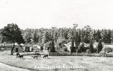
Photograph, Tom Prior, A Homestead, Research
Near the aqueduct on Ingrams Road looking northwards.The Reynolds family were early settlers in Research. The Reynolds/ Prior collection of photographs were taken by Tom Prior, the maternal uncle of Ivy Reynolds, around 1900 and the 60 photos in the album give a fine overview of many of the landmarks of Research and Eltham over 100 years ago. lvy lived in the family home for many years at 106 Thompson Cres Research. Ivy's father, Ernst Richard Reynolds and grandfather, Richard Reynolds, lived at the same address. Ivy's father Richard worked for Mr. Trail on his property in Research. Reynolds Road is named after the family. Mr Tom Prior (wife Eva) worked at the Melbourne zoo. He was very innovative and made his own camera, using the black cloth hood to exclude the light. The photographs are a reminder of the rural nature of Research and Eltham and its rich heritage. Black and white photograph mounted in an album, the Reynolds/Prior Photograph Collection, this being one of 53 reproduced black and white images of early Eltham.The Reynolds/Prior Photograph Collection, Presented to the Eltham District Historical Society, 14 June 2006 by Ross McDonald. A second copy was also presented to the Andrew Ross Museum, Kangaroo Groundhouses, ingrams road, research (vic.), reynolds prior collection -
 Eltham District Historical Society Inc
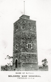
Photograph, Tom Prior, Shire of Eltham, Soldiers' War Memorial, unveiled 11-11-26
Note the unfinished state-stones at base. Honour Roll not yet erected. Before the memorial was erected there was a cairn of rocks to commemorate Armistice Day. All travel was mostly by walking and school children walked to town each November 11 Memorial Service.The Reynolds family were early settlers in Research. The Reynolds/ Prior collection of photographs were taken by Tom Prior, the maternal uncle of Ivy Reynolds, around 1900 and the 60 photos in the album give a fine overview of many of the landmarks of Research and Eltham over 100 years ago. lvy lived in the family home for many years at 106 Thompson Cres Research. Ivy's father, Ernst Richard Reynolds and grandfather, Richard Reynolds, lived at the same address. Ivy's father Richard worked for Mr. Trail on his property in Research. Reynolds Road is named after the family. Mr Tom Prior (wife Eva) worked at the Melbourne zoo. He was very innovative and made his own camera, using the black cloth hood to exclude the light. The photographs are a reminder of the rural nature of Research and Eltham and its rich heritage. Black and white photograph mounted in an album, the Reynolds/Prior Photograph Collection, this being one of 53 reproduced black and white images of early Eltham.The Reynolds/Prior Photograph Collection, Presented to the Eltham District Historical Society, 14 June 2006 by Ross McDonald. A second copy was also presented to the Andrew Ross Museum, Kangaroo Groundreynolds prior collection, kangaroo ground, war memorial -
 Eltham District Historical Society Inc
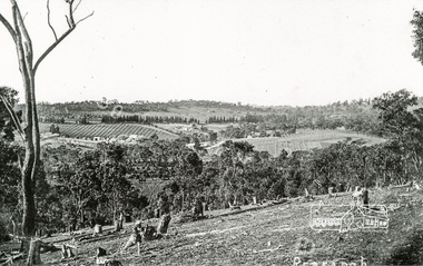
Photograph, Tom Prior, Clearing land at Research
Main Road is in the distance with the aqueduct following the pine trees at top of photo. Doney's store is visible near the road.The Reynolds family were early settlers in Research. The Reynolds/ Prior collection of photographs were taken by Tom Prior, the maternal uncle of Ivy Reynolds, around 1900 and the 60 photos in the album give a fine overview of many of the landmarks of Research and Eltham over 100 years ago. lvy lived in the family home for many years at 106 Thompson Cres Research. Ivy's father, Ernst Richard Reynolds and grandfather, Richard Reynolds, lived at the same address. Ivy's father Richard worked for Mr. Trail on his property in Research. Reynolds Road is named after the family. Mr Tom Prior (wife Eva) worked at the Melbourne zoo. He was very innovative and made his own camera, using the black cloth hood to exclude the light. The photographs are a reminder of the rural nature of Research and Eltham and its rich heritage. Black and white photograph mounted in an album, the Reynolds/Prior Photograph Collection, this being one of 53 reproduced black and white images of early Eltham.The Reynolds/Prior Photograph Collection, Presented to the Eltham District Historical Society, 14 June 2006 by Ross McDonald. A second copy was also presented to the Andrew Ross Museum, Kangaroo Groundreynolds prior collection, research (vic.) -
 Eltham District Historical Society Inc
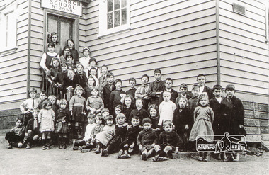
Photograph, Class of 1922, Research State School No. 2959
The Children of Research State School in 1922 Photo and list of children provided by Ivy Reynolds to Ross McDonald. Ross has supplemented and filled in some blanks, from the children names in Andrew Lemons book 'Return to Research. A centenary of Research Primary School, 1989 ' page 103. Additional commentary provided by Ivy Reynolds in 2006. 1. Winnie La Frenz - a great friend of the Reynolds 2. Ruth Thompson - Wally Buttwell's niece 3. Bertha Wiltshire 4. Ivy Dickson (who grew up to be a good-looking woman) 5. May Norman - a cousin to the Reynolds through Ernest Reynolds 6. Elsie Shaw 7. Veenie Turner (Ivy was not 100% sure of her surname, but said she was not related to Hazel Turner) 8 Lil La Frenz (Lilian) - a bright spark and a lively tennis player 9 Lily Wilson (looks like a boy) - had red hair 10 Hazel Turner - a cousin of the Reynolds who lost her mother very early in life. Her father remarried and the family then became Roman Catholics, which in those days, caused them to become distant with the Anglican Reynolds family 11 Lila Dickson (Lyla) 12. Jack Wilson - a red-head like his sister 13. Len Blashick 14. Marjory Palmer 15 ? Burgoyne 16 Lance Doney and 17 Bill Doney. Cleaver boys who went to Ivanhoe Grammar. Both caught TB from their mother and died young. 17. Bill Doney - The Doneys were clever boys. They went to Ivanhoe Grammar after Research Primary and this educational advantage caused them to grow apart from the local boys. Both caught tuberculosis from their mother and didn't live long. Lance died first, but Bill survived long enough to join the Merchant Navy. He eventually entered the Mont Park Sanatorium where Ernest Reynolds used to visit him every Sunday. The Doney boys were keen on Margaret and Ivy Reynolds at one stage (probably before they became seriously ill) and Bill gave Ivy a macrame belt he'd made. 18 ? Burgoyne 19 ? Messen (Frank or Alex Masson) 20 Neville West 21 ? Shaw 22 ? Shaw 23 Neil Palmer 24 George Shaw or his brother Bertie 25 George Shaw or his brother Bertie 26 Eva Kilson 27 Lorna Turner 28 ? Henry Fox (or possibly Eric?) 29 Nancy Storey (adopted) 30 Mona Fox 31. Nell Storey (also adopted) She married Sam Howard and they had 2 daughters. One went to Queensland, the other lived locally and helped at the Research Anglican Church. 32 Victor Davey 33 Margaret Reynolds 34 Ethel Davey - cousin of the Reynolds through Ernest Reynolds 35 ? Randall (Freddie) 36 ? Randall (Kitty) -Their father was a builder who made toys for every child at the school one Christmas 37 Ronnie Turner 38 ? Ivy couldn't remember his name, but thought he lived at the Research Hotel 39 John Reynolds 40 Jim Davey 41 Unknown 42 Ivy Reynolds 43. Unknown - one of the unknown boys is Jimmy Storey 44. Unknown 45. Unknown 46. Dorothy La Frenz 47. Eric Fox 48. Unknown 49. Possibly Bert Shaw One of the boys in the photograph is Jimmy Storey The Reynolds family were early settlers in Research. The Reynolds/ Prior collection of photographs were taken by Tom Prior, the maternal uncle of Ivy Reynolds, around 1900 and the 60 photos in the album give a fine overview of many of the landmarks of Research and Eltham over 100 years ago. lvy lived in the family home for many years at 106 Thompson Cres Research. Ivy's father, Ernst Richard Reynolds and grandfather, Richard Reynolds, lived at the same address. Ivy's father Richard worked for Mr. Trail on his property in Research. Reynolds Road is named after the family. Mr Tom Prior (wife Eva) worked at the Melbourne zoo. He was very innovative and made his own camera, using the black cloth hood to exclude the light. The photographs are a reminder of the rural nature of Research and Eltham and its rich heritage. Black and white photograph mounted in an album, the Reynolds/Prior Photograph Collection, this being one of 53 reproduced black and white images of early Eltham.The Reynolds/Prior Photograph Collection, Presented to the Eltham District Historical Society, 14 June 2006 by Ross McDonald. A second copy was also presented to the Andrew Ross Museum, Kangaroo Groundreynolds prior collection, research (vic.), research school, schools, school children, state school no. 2959, winnie la frenz, ruth thompson, bertha wilshire, ivy dickson, may norman, elsie shaw, veenie, lil la frenz (lilian), lily wilson, hazel turner, lila dickson (lyla), jack wilson, len blashick, margery palmer, burgoyne, lance doney, bill doney, frank messen, alex masson, neville west, shaw, neil palmer, george shaw, bertie shaw, eva kilson, lorna turner, henry fox, eric fox, nancy storey, mona fox, nell storey, victor davey, margaret reynolds, ethel davey, freddie randall, kitty randall, ronnie turner, john reynolds, jim davey, ivy reynolds, dorothy la frenz, bert shaw, jimmy storey -
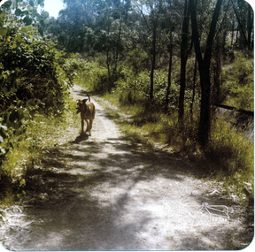
 Eltham District Historical Society Inc
Photograph, Richard Pinn, Jah on Maroondah Aqueduct trail south of Allendale Road, c.1991, 1991c
Colour photographmaroondah aqueduct -
 Eltham District Historical Society Inc
Photograph, Richard Pinn, Jah on Maroondah Aqueduct trail west of Afton Street, early 1980s, 1980s
Colour photographmaroondah aqueduct -
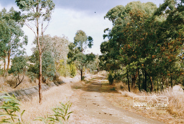 Eltham District Historical Society Inc
Photograph, Maroondah Aqueduct trail west of Parsons Road, Eltham, 1991, 1991
Colour photographmaroondah aqueduct, parsons road -
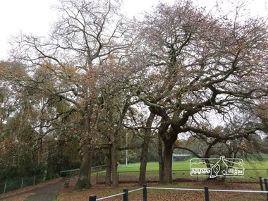 Eltham District Historical Society Inc
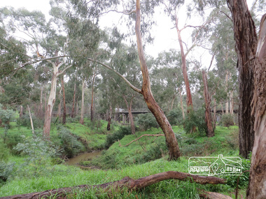
Photograph, Oak Trees and Eltham Rugby Football Club oval, Diamond Creek Trail, 21 June 2017, 21 June 2017
A walk around Little Eltham, 21 June 2017. Eltham’s first industrial area at the end of present day Pitt Street near the Diamond Creek. Just upstream a bit, near these oak trees was the flour mill. The most significant owner of that was Henry Dendy. Better known for founding Brighton but he lived in Eltham longer than he lived in Brighton, during the 1860s. There was also the brewery and slightly downsteam from here was the tannery. The brewery needed fresh clean water so it was upstream from the tannery. The Oak trees were most likely planted during Henry Dendy's time. (Source: Local historian commentary, Eltham Hidden Creek heritage excursion 7 March 2020) Born Digitaleltham community centre, diamond creek trail, eltham rugby football club, oak trees, henry dendy -
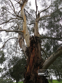 Eltham District Historical Society Inc
Photograph, Liz Pidgeon, Diamond Creek Trail, 21 June 2017, 21 June 2017
A walk around Little Eltham, 21 June 2017Born Digitaleltham community centre, diamond creek trail -
 Eltham District Historical Society Inc
Photograph, Liz Pidgeon, Diamond Creek Trail, 21 June 2017, 21 June 2017
A walk around Little Eltham, 21 June 2017Born Digitaleltham community centre, diamond creek trail -
 Eltham District Historical Society Inc
Photograph, Liz Pidgeon, Diamond Creek Trail and Railway Trestle bridge, 21 June 2017, 21 June 2017
A walk around Little Eltham, 21 June 2017Born Digitaleltham community centre, diamond creek trail, trestle bridge -
 Eltham District Historical Society Inc
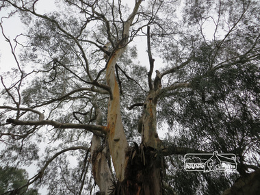
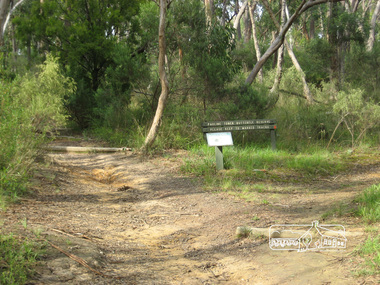
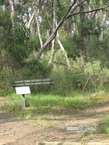
Photograph, Liz Pidgeon, Pauline Toner Butterfly Reserve, Eltham, 18 February 2011, 18 February 2011
Signage in the Pauline Toner Butterfly Reserve asking visitors to keep to marked tracks. The Reserve at the corner of Pitt Street and Eucalyptus Road, Eltham is managed by Parks Victoria. It is named for Pauline Toner M.P. who after the re-discovery of the rare Eltham copper Butterfly in large numbers in Eltham in 1987 worked to preserve its habitat.Born Digitalpauline toner reserve, eucalyptus road, copper butterfly, nature reserve, walking trail, sign, erosion -
 Eltham District Historical Society Inc
Photograph, Liz Pidgeon, Pauline Toner Butterfly Reserve, Eltham, 18 February 2011, 18 February 2011
Signage in the Pauline Toner Butterfly Reserve asking visitors to keep to marked tracks. The Reserve at the corner of Pitt Street and Eucalyptus Road, Eltham is managed by Parks Victoria. It is named for Pauline Toner M.P. who after the re-discovery of the rare Eltham copper Butterfly in large numbers in Eltham in 1987 worked to preserve its habitat. Born Digitalpauline toner reserve, eucalyptus road, copper butterfly, walking trail, sign, nature reserve -
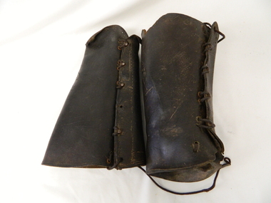 Kiewa Valley Historical Society
Gaiters Riding, Late 19th Century
These gaiters where used circa 1800's to mid 1900's, by horse riders "cattle men" to protect their shins and long trousers against wear and tear. They were used rather than having expensive boots damaged. Gaiters were a lot easier to fasten and clean than boots. They were used in the Kiewa Valley and the High Plains grazing areas.These gaiters were part of a cattleman's "out fit". The Gaiters were easily cleaned and did away with expensive riding boots. They were used throughout the valley and high plains areas both by horse riders herding cattle and the recreational rider of both sexes. After the 1950s more recreational riders from Melbourne ventured onto the high plains and not so rugged mountain slopes. Small settlements such as Mount Beauty, Bogong village and Falls Creek provided a secure backdrop for short term horse back adventures. The increasing pressure of city life provided a greater flow of stressed out city dweller to find the peace and quiet that city life does not have. Horse riding preceded the modern trail bikes and other recreational vehicles of the late 1900s. Thick leather tapered gaiters with six metal Hooks and Leather lacing through metal eyelets. All bar two eyelets have a metal reinforced punch holes. Left gaiter missing most of lacing.horse, country, leather, gaiters, high, grazing, cattlemen, laces, studs -
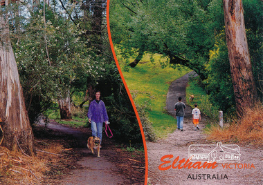 Eltham District Historical Society Inc
Postcard, Alistair Knox Park, Eltham, Victoria, Australia, 2015c
Postcard showing two views of people walking dogs through the park. Mel: 21 J6eltham, alistair-knox-park, walking, trail, postcard -
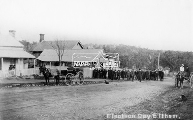 Eltham District Historical Society Inc
Negative - Photograph, Tom Prior, Election Day, Eltham, 4 June 1907
Election Day, Legislative Council Elections, Tuesday, 4 June 1907, Maria Street (Main Road), Eltham. Group of men standing outside George Knapman’s forge on Election Day (4 June 1907) for the Legislative Council. Voting was conducted in the Eltham Courthouse next door, visible behind the forge. At that time women did not have the right to vote; two women wait on the horse and buggy and two others are looking on from the verandah of the house next door. A dog also sits patiently on the road. The Police Station and residence are just visible on the corner of Brougham Street. Reproduced on p62 of 'Pioneers & Painters' Cross Ref: 0629This photo forms part of a collection of photographs gathered by the Shire of Eltham for their centenary project book,"Pioneers and Painters: 100 years of the Shire of Eltham" by Alan Marshall (1971). The collection of over 500 images is held in partnership between Eltham District Historical Society and Yarra Plenty Regional Library (Eltham Library) and is now formally known as the 'The Shire of Eltham Pioneers Photograph Collection.' It is significant in being the first community sourced collection representing the places and people of the Shire's first one hundred years. The Reynolds family were early settlers in Research. The Reynolds/ Prior collection of photographs were taken by Tom Prior, the maternal uncle of Ivy Reynolds, around 1900 and the 60 photos in the album give a fine overview of many of the landmarks of Research and Eltham over 100 years ago. lvy lived in the family home for many years at 106 Thompson Cres Research. Ivy's father, Ernst Richard Reynolds and grandfather, Richard Reynolds, lived at the same address. Ivy's father Richard worked for Mr. Trail on his property in Research. Reynolds Road is named after the family. Mr Tom Prior (wife Eva) worked at the Melbourne zoo. He was very innovative and made his own camera, using the black cloth hood to exclude the light. The photographs are a reminder of the rural nature of Research and Eltham and its rich heritage.Digital image 4 x 5 inch B&W Negshire of eltham pioneers photograph collection, eltham, main road, knapman's forge, election day, elections, eltham courthouse, forge, george knapman, knapmans forge, maria street, pioneers and painters, reynolds prior collection, court house, courthouse, g. knapman, sepp -
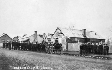 Eltham District Historical Society Inc
Negative - Photograph, Tom Prior, Election Day, Eltham, 4 June 1907
Election Day, Legislative Council Elections, Tuesday, 4 June 1907, Maria Street (Main Road), Eltham. Group of men standing outside George Knapman’s forge on Election Day (4 June 1907) for the Legislative Council. Voting was conducted in the Eltham Courthouse next door, to the right of photo. At that time women did not have the right to vote. At the far left can be see William B. Andrew’s Corn Store on the corner of Franklin Street. The weatherboard house in between at one stage the home of Miss George.This photo forms part of a collection of photographs gathered by the Shire of Eltham for their centenary project book,"Pioneers and Painters: 100 years of the Shire of Eltham" by Alan Marshall (1971). The collection of over 500 images is held in partnership between Eltham District Historical Society and Yarra Plenty Regional Library (Eltham Library) and is now formally known as the 'The Shire of Eltham Pioneers Photograph Collection.' It is significant in being the first community sourced collection representing the places and people of the Shire's first one hundred years. The Reynolds family were early settlers in Research. The Reynolds/ Prior collection of photographs were taken by Tom Prior, the maternal uncle of Ivy Reynolds, around 1900 and the 60 photos in the album give a fine overview of many of the landmarks of Research and Eltham over 100 years ago. lvy lived in the family home for many years at 106 Thompson Cres Research. Ivy's father, Ernst Richard Reynolds and grandfather, Richard Reynolds, lived at the same address. Ivy's father Richard worked for Mr. Trail on his property in Research. Reynolds Road is named after the family. Mr Tom Prior (wife Eva) worked at the Melbourne zoo. He was very innovative and made his own camera, using the black cloth hood to exclude the light. The photographs are a reminder of the rural nature of Research and Eltham and its rich heritage.Digital image 4 x 5 inch B&W Negelection day, elections, eltham, eltham courthouse, forge, george knapman, knapmans forge, main road, maria street, miss george, reynolds prior collection, shire of eltham pioneers photograph collection, w.b. andrew corn store -
 Eltham District Historical Society Inc
Photograph, Tom Prior, Police Station and Residence, Maria Street, Eltham, c.1900
Situated near the top of what was known as 'Policeman's Hill' according to Miss Ivy Reynolds, neice of the photographer, Tom Prior. From the left, Eltham Court House, Police Residence and Police station on Main Road and corner of Brougham Street. These buildings formed part of Little Eltham and still stand (without the front fence) today though the Police Station was demolished in 1986 due to termite damage. A replica was built circa 1989. The institutions of law and order in Colonial Victoria included the police, courts and prisons. The 1852 report of the Snodgrass Select Committee appointed to "identify the policing needs of the colony” noted there existed seven independent police forces that did not co-operate or regularly communicate. Following the committee's report all these police entities were merged into the Victoria Police, founded on 8 January 1853, to implement law and order responsibilities throughout the Colony of Victoria. The Eltham Courthouse (1860) and adjacent Police Residence (1859) formed a justice precinct established in the immediate aftermath of the 1852 police inquiry and the effects of the gold rush. The physical presence of these buildings, in the centre of the early Eltham township, defined centralised control over law and order. In the early days the Police Constable in charge would conduct his duties travelling around the district by horse; a stable was located at the rear of the residence. At times the horse would be grazed on the paddocks across the road. Horseshoes were forged by the blacksmith beside the Courthouse on the high side of “Policeman’s Hill”. Along with the stable, there was a two-cell bluestone lockup where prisoners were held awaiting trial in the adjacent Courthouse. Their meals were usually provided by the policeman’s wife or from the hotel just up the road. With the arrival of the railway in 1902 the town centre gradually shifted towards the railway station. The Police Station and operations were moved into the town centre in 1961 to a renovated house in Pryor Street, which was later replaced by the current Police Station. From 1961-1981 the residence was occupied by the Vermin and Noxious Weeds Destruction Section of the Department of Crown Lands and Survey. Prior to August 1967 the former Police Station was dragged to the rear of Police Residence to make way for the construction of a driveway and access from Main Road. The building was placed on the site of a former Scullery and modified for Lands Department use. In 1981 the Shire of Eltham took over management of the former Police Residence in Eltham. It remained unoccupied for a period whilst its future was discussed in Council. It was then used for a community job creation scheme until 1985. In 1985 the Shire of Eltham Parks and Environment occupied the residence. Council improved the driveway but later added a second rear access from Brougham Street due to the dangerous nature of the Main Road entrance. Additionally, a rear toilet facility between the Police Residence and the relocated former Police Station, which was doubling up as a lunchroom. Council also commenced discussions to re-establish a replica Police Station. Around November 1986 the former Police Station was demolished; believed to have been suffering termite damage. About 1989, after some years of discussion, a replica Police Station was built, based on photographs, to act as a lunchroom and meeting room for the Parks and Environment staff and volunteers doing community service. In 1996 Eltham District Historical Society held discussions with Nillumbik Shire Council commissioners throughout the year regarding a home for the Society. A proposal was put forward by the Society in October to occupy the former Police Residence. In March 1997 Eltham District Historical Society gained access to former Police Residence and on July 12, 1998, moved into its Local History Centre. In July 2018, Eltham District Historical Society gained access to the replica Police Station (which had been used as a music library and storage for the Eltham Concert Band) for use as part of regular heritage tours for schools and community-based groups.This photo forms part of a collection of photographs gathered by the Shire of Eltham for their centenary project book,"Pioneers and Painters: 100 years of the Shire of Eltham" by Alan Marshall (1971). The collection of over 500 images is held in partnership between Eltham District Historical Society and Yarra Plenty Regional Library (Eltham Library) and is now formally known as 'The Shire of Eltham Pioneers Photograph Collection.' It is significant in being the first community sourced collection representing the places and people of the Shire's first one hundred years. The Reynolds family were early settlers in Research. The Reynolds/ Prior collection of photographs were taken by Tom Prior, the maternal uncle of Ivy Reynolds, around 1900 and the 60 photos in the album give a fine overview of many of the landmarks of Research and Eltham over 100 years ago. lvy lived in the family home for many years at 106 Thompson Cres Research. Ivy's father, Ernst Richard Reynolds and grandfather, Richard Reynolds, lived at the same address. Ivy's father Richard worked for Mr. Trail on his property in Research. Reynolds Road is named after the family. Mr Tom Prior (wife Eva) worked at the Melbourne zoo. He was very innovative and made his own camera, using the black cloth hood to exclude the light. The photographs are a reminder of the rural nature of Research and Eltham and its rich heritage.Digital imagechildren, court house, courthouse, eltham, eltham district historical society, eltham justice precinct, little eltham, local history centre, main road, police residence, police station, reynolds prior collection, sepp, shadow, shire of eltham pioneers photograph collection -
 Eltham District Historical Society Inc
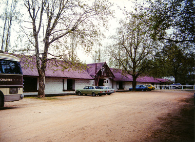
Photograph, Chateau Tahbilk Winery; 9 Oct 1994, 09/10/1994
Colour photographactivities, 1994, whroo historic reserve, chateau tahbilk winery, major mitchell trail -
 Eltham District Historical Society Inc
Photograph, Brighton and Bayside Artists' Trail Excursion, 11 April 1999, 11/04/1999
Colour photographactivities, brighton (vic.) -
 Eltham District Historical Society Inc
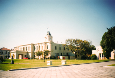
Photograph, Old Brighton Town Hall, Brighton and Bayside Artists' Trail Excursion, 11 April 1999, 11/04/1999
Colour photographactivities, brighton (vic.) -
 Eltham District Historical Society Inc
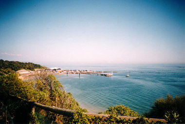
Photograph, Black Rock, Brighton and Bayside Artists' Trail Excursion, 11 April 1999, 11/04/1999
Colour photographactivities, brighton (vic.) -
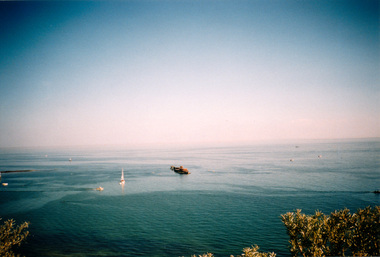 Eltham District Historical Society Inc
Photograph, Cerberus, Brighton and Bayside Artists' Trail Excursion, 11 April 1999, 11/04/1999
Colour photographactivities, brighton (vic.)