Showing 738 items
matching charts
-
 Victorian Aboriginal Corporation for Languages
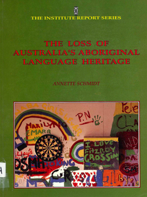
Book, Annette Schmidt, The loss of Australia?s Aboriginal Language heritage, 1993
Overviews Aboriginal language situation; examines attitudes to language; analyses language maintenance and revival programs, bilingual education, effectiveness of funding and National Aboriginal Languages Program; availability of linguistic training, characteristics of language loss and the place of creoles in language programs.Maps, chartslanguage loss, language maintenance, reports -
 Victorian Aboriginal Corporation for Languages
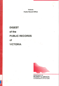
Book, Public Record Office Victoria, Digest of the public records of Victoria, 1990
charts, tablespublic records, victorian history, local history -
 Victorian Aboriginal Corporation for Languages
Book, South Australia Department of Education and Children's Services, Languages : Australian Indigenous languages, 2003
wall chartslanguage teaching south australia, curriculum development, curriculum standards, secondary education -
 Surrey Hills Historical Society Collection
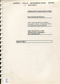
Report, Camberwell conservation study: environmental history 1989 : Draft only, 10/12/1989
Full title on cover: Camberwell Conservation Study: environmental history. Draft report submitted to Advisory Committee, 12 December 1989 at Camberwell Council Chambers An environmental history draft report prepared for City of Camberwell as part of the City of Camberwell Conservation Study. Presented in 2 volumes. Charts the development of the suburb of Camberwell. Beginning late 1880s.An environmental history draft report prepared for City of Camberwell as part of the City of Camberwell Conservation Study. Presented in 2 volumes. Charts the development of the suburb of Camberwell. Beginning late 1880s.camberwell, land places and structures, buildings - conservation and restoration, buildings, structures and establishments, social history, public housing, camberwell estate, st john's wood (wanganella) -
Port Melbourne Historical & Preservation Society
Map - Navigation Charts, Port Melbourne, Williamstown and River Yarra, 1994
.01 - Navigation chart of Port Melbourne, Williamstown and River Yarra channels 1994. Chart No Aust 154 .02 - Navigation Chart of approaches to Melbourne. Chart No Aust 155 c1986sport - yachting, maritime, beacons -
 Flagstaff Hill Maritime Museum and Village
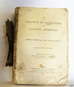
Book - Technical Reference, Henry Raper, Lieut. R.N, The Practice of Navigation and Nautical Astronomy, 1891
This technical textbook is the nineteenth edition of the book by Henry Raper, Lieutenant in the Royal Navy with awards that include F.R.A.S. (Fellow of the Royal Astronomical Society) and F.R.G.S. (Friend of the Royal Geographical Society). The book is dedicated in honour of Rear-Admiral Sir Francis Beaufort K.C.B., Hydrographer to the Admiralty. He was awarded the title K.C.B. (King's Commander) as a Member of the Order of Bath, an order of British Chivalry, The book was first published in 1840 and soon became a resource for navigation students. It includes topics on nautical navigation, astronomy, navigation charts, calculations and mathematical tables, time, tides, ships, longitude, and position at sea. Thomas A. Hull, who revised and expanded this edition, was a Commander in the Royal Navy and had previously been Superintendent of Admiralty Charts used for navigation worldwide by seamen from many walks of life. The publisher, J D Potter of London, was at that time the sole agent for the Admiralty Charts produced by the Royal Navy. Printer Spottswoode and Co.,. was established by William Strachan in 1738. In 1819 his nephews A and R Spottswoode took over the business and bought premises in New-Street Square and Shoe Lane. In 1850 over 200 workers were employed by the firm. and five years later the business became Spottswoode & Co. Andrew Spottswoode invented the Spottswoode Press.This technical book was very popular as a textbook for students of maritime navigation, written and updated by members of the British Royal Navy and relied upon for accurate advice and information. The first edition was published in 1840, this edition was updated, expanded and published in 1891 when ports around the world were filling with travellers, merchants and business people. Title: The Practice of Navigation and Nautical Astronomy Author: Henry Raper, Lieut, R.N., F.R.A.S., F.R.G.S. Nineteenth Edition, revised and enlarged by Commander Thomas A. Hull, R.N., Late Superintendant of Admiralty Charts Dedication: To Rear-Admiral Sir Francis Beaufort K.C.B. Publisher: J D Potter, London, sole agent for the sale of Admiralty Charts Printer: Spottswoode and Co. New-Street Square, London Date: 1891 Small leather hardcover book with gold embossed text and lines on the spine. The Dedication in the book is as follows: - "To Rear-Admiral Sir Francis Beaufort K.C.B. Hydrographer to the Admiralty. Sir, The eminent station which you occupy in the naval scientific world renders it highly gratifying to me to dedicate the following Work to you as a testimony of my regard and esteem; while the general accordance of my views on the subject with those of your more experienced judgement, gives me the greater confidence in laying my labours before the Public. I have the honour to be, Sir, Your obedient servant, HENRY RAPER"flagstaff hill maritime museum, maritime museum, shipwreck coast, flagstaff hill, warrnambool, flagstaff hill maritime village, book, navigation, nautical astronomy, hydrography, nautical charts, nautical navigation, astronomical navigation, admiralty charts, henry raper, thomas a. hull, royal navy, j d potter, royal astronomical society, royal geographical society, calculations, mathematical tables, longitude, latitude, nautical time, location at sea, position at sea, maritime, practical navigation, spottswoode and co., sir francis beaufort, k.c.b., rear-admiral sir francis beaufort, hydrographer to the admiralty, scientific book, naval science -
 Bay Steamers Maritime Museum
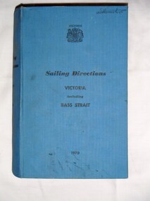
Book, Ports and Harbours Division, Sailing Directions Victoria including Bass Strait, 1970
... charts ...Blue hard cover book of 745 pagesInside front cover, white sticker with red printing "JOHN DONNE & SON / CHARTS, MAPS & MARINE BOOKS / 372 LITTLE BOURKE ST. / MELBOURNE" non-fiction, sailing, victoria, bass strait, communications, fuel, maps, charts, weather, navigation -
Lakes Entrance Historical Society
Book, Howse, Derek and Sanderson, Michael, The Sea Chart, 1973
A sample collection of maps and charts showing the development of the sea chart from 1420 to a metric Admiralty chart of 1971. The sixty reproductions are of sea charts preserved in the National Maritime Museum, Greenwich.maritime history -
 Ringwood and District Historical Society
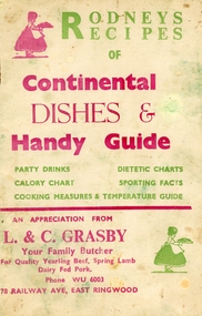
Booklet, Grasby, L. and C, Rodney's Recipes of Continental dishes and Handy Guide. From Your local Butcher (L & C Grasby, 78 Railway Avenue, East Ringwood, WU 6003) c1960, c1960
Given to customers of L. and C. Grasby, Your Family Butcher, 78, Railway Avenue, East Ringwood.Roney's Recipes of Continental Dishes and handy Guide of party drinks, calorie chart, dietetic charts, sporting facts, cooking measures and temperature guide.10 page booklet plus cream coloured covers with red and green printing on both sides. Contains recipes for various occasions, drinks, charts, cooking measures and temperature guide. Given to customers of the butcher. Covering letter from Mrs. Ives +Additional Keywords: Grasby / Ives, Mrs. Norma. All the Ives family lived at 2 Lois Street, East Ringwood until moved away, except for the eldest Ted and his daughter Lynda who lived at 4 Lois Street. -
 Victorian Aboriginal Corporation for Languages
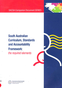
Book, Department of Education and Children's Services, South Australian curriculum, standards and accountability framework : the required elements, 2005
South Australian Education Department Curriculum planning document.tables, wall chartseducation, south australia, curriculum development, early childhood education, primary school education, secondary school education, curriculum policy, curriculum planning -
 Victorian Aboriginal Corporation for Languages
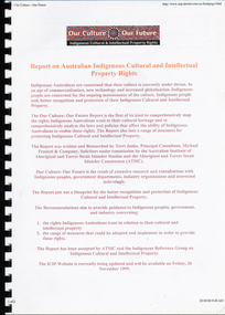
Book, Terri Janke, Our culture : our future : report on Australian Indigenous cultural and intellectual property rights, 1998
In 1997, ATSIC released the discussion paper Our Culture: Our Future: Proposals for the Protection and Recognition of Indigenous Cultural and Intellectual Property, and invited public comment on the need for protecting and recognising Indigenous Cultural and Intellectual Property Rights. The report extracted here was developed in the light of over 70 submissions received on this discussion paper, and also in consultation with a National Indigenous Reference Group and other relevant individuals, communities and organisations. The Report details the types of rights Indigenous people seek in relation to their cultures and considers the application of current laws. It also makes recommendations for a comprehensive range of measures for improving the level of protection, including legal and non-legal reforms.colour illustrations, chartsindigenous cultural and intellectual property, intellectual property, copyright, native title -
 Bendigo Military Museum
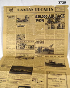
Newspaper - CHART, Qantas Recalls
Item relates to Arthur Thomas MANLY No 431130 RAAF. Refer Cat No 3710 for his service details.Brown cartridge paper folded 4 ways. Articles & photos of the history of Qantas 1920 - 1970. Rear has an assortment of articles of Australian history 1770 - 1970. Top front of chart: QANTAS RECALLS Top rear of chart: AUSTRALIAN GAZETTEnewspaper, history of qantas -
 Federation University Historical Collection
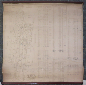
Document - Chart, Port Jackson, Reference to City Properties, 1930s
This chart was compiled using information compiled by Gray & Co Auctioneers of 135 Pitt Street, Sydney and contains information relating to the streets of Port Jackson with the property numbers and dates of sale until 1930, the dimensions of the properties and the purchase prices. It was most likely part of the School of Mines Ballarat collection.This dirty cream chart is of the streets of Port Jackson with the property numbers and dates of sale until 1930, the dimensions of the properties and the purchase prices. Some property numbers have been added by hand. It has timber ends, top and bottom.Some information has been added by handport jackson, reference to city properties, chart, gray & co auctioneers, sydney, kenneth craigie sydney, property information -
 Sunbury Family History and Heritage Society Inc.
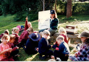
Photograph, 31st March 1996
The students from Bulla Primary School were taken on a nature excursion to a nearby nature park as part of their scientific and environmental studies. They were studying the number and types of insects that could be found in the plants and water in the area. The park ranger then asked them to identify any insects on the chart that they found. Nature and environmental studies give the students of the importance of caring for the environment and are included in their science work.A non-digital coloured photograph of a group of children sitting on the ground in front of a teacher who is holding up a chart featuring common insects. One child has her hand up while others are looking down onto the grass.bulla, bulla primary school, nature studies, school excursion -
 Melbourne Tram Museum
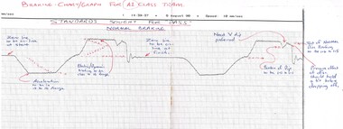
Document - Report, Public Transport Corporation (PTC), "Braking Chart - Graph", c1998
Set of documents, charts, notes and other papers about Braking chart / graphs for A and Z3 class trams - produced c1998 - has notes on charts etc.trams, tramways, tramcars, preston workshops, maintenance, a class, z class -
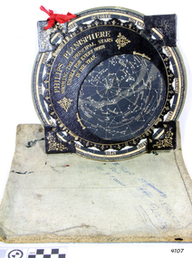 Flagstaff Hill Maritime Museum and Village
Planisphere, Early 20th Century
The word Planisphere (Latin planisphaerium) was originally used in the second century by Claudius Ptolemy to describe the representation of a spherical Earth by a map drawn in the plane. This usage continued into the Renaissance: for example Gerardus Mercator described his 1569 world map as a Planisphere. The word describes the representation of the star-filled celestial sphere on the plane. The first star chart to have the name "Planisphere" was made in 1624 by Jacob Bartsch. Bartsch was the son-in-law of Johannes Kepler, discoverer of Kepler's laws of planetary motion. A significant item of celestial mapping used by marine navigators This particular item was made and used in the first quarter to half of the 20th centuryPlanisphere of northern hemisphere, with canvas bag. Planisphere consists of a circular star chart attached at its centre to an opaque circular overlay that has a clear elliptical window or hole so that only a portion of the sky map will be visible in the window or hole area at any given time. The chart and overlay are mounted so that they are free to rotate about a common pivot point at their centres. The star chart contains the brightest stars, constellations and (possibly) deep-sky objects visible from a particular latitude on Earth. The night sky that one sees from the Earth depends on whether the observer is in the northern or southern hemispheres and the latitude. A Planisphere window is designed for a particular latitude and will be accurate enough for a certain band either side of that. Planisphere makers will usually offer them in a number of versions for different latitudes. Planispheres only show the stars visible from the observer's latitude; stars below the horizon are not included. A complete twenty-four-hour time cycle is marked on the rim of the overlay. A full twelve months of calendar dates are marked on the rim of the starchart. The window is marked to show the direction of the eastern and western horizons. The disc and overlay are adjusted so that the observer's local time of day on the overlay corresponds to that day's date on the star chart disc. The portion of the star chart visible in the window then represents (with a distortion because it is a flat surface representing a spherical volume) the distribution of stars in the sky at that moment for the Planispheres designed location. Users hold the Planisphere above their head with the eastern and western horizons correctly aligned to match the chart to actual star positions. "Made in Germany for GEORGE PHILIP & SONS Ltd. Geographical and Educational Depot, 32 Fleet Street, London" Canvas bag has "Capt. H (Howard) Tyler from Captain H. F. Woolf" "Tyler 22 ? St East Brighton" also "13 Halls St Flinders"flagstaff hill, warrnambool, shipwrecked-coast, flagstaff-hill, flagstaff-hill-maritime-museum, maritime-museum, shipwreck-coast, flagstaff-hill-maritime-village, planisphere, star map, marine navigation, maps, george philip & sons -
 Victorian Aboriginal Corporation for Languages
Periodical, La Trobe University Department of Linguistics, La Trobe working papers in linguistics, 1994
maps, word lists, chartslinguistics -
 Victorian Aboriginal Corporation for Languages
Periodical, La Trobe University Department of Linguistics, La Trobe working papers in linguistics, 1995
Features 'Classifying Victorian languages' by Barry Blake and Julie Reidmaps, word lists, chartslinguistics -
 Victorian Aboriginal Corporation for Languages
Thesis, Cathrine Koukmenides, Pronouns as evidence for genetic relationships in Victorian languages, 1997
Thesis on language in Victoria, includes historical notes.Maps, charts, word listspama-nyungan, warnman, gundungurra, dyirringan, wathaurong, wathawurrung, tyattyalla, wudjubaluk, wuttyabullak, woiwurrung, kulin, madhi-madhi, wadi-wadi, wamba-wamba, wemba wemba, bereba-bereba, barababaraba, colac, warrnambool, bunganditj, kulin, yorta yorta, yabula yabula, jabulajabula, dhudhuroa, pallanganmidda, gippsland, ganai, gunai kurnai -
 Victorian Aboriginal Corporation for Languages
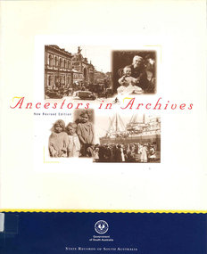
Book, State Records of South Australia, Ancestors in archives : a guide for family historians to South Australia's government archives, 2000
A user friendly reference tool for historians - particularly family historians. Over 750 different series of records are described in a straightforward manner to guide users through this extensive collection.charts, b&w photographsgenealogy, state records of south australia, family history, south australian history -
 Victorian Aboriginal Corporation for Languages
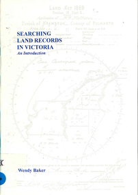
Book, Wendy Baker, Searching land records in Victoria : an introduction, 1996
maps, charts, photocopies of recordsgenealogy, victorian history, land tenure, land grants -
 Greensborough Historical Society
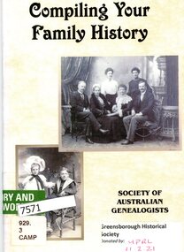
Booklet, Society of Australian Genealogists, Compiling your family history, 2008
44p., text and chartsnon-fictionfamily history, genealogy -
Gippsland Vehicle Collection
Chart, Nissan Model Chart
Nissan Model Chartnissan, model, chart -
 Running Rabbits Military Museum operated by the Upwey Belgrave RSL Sub Branch
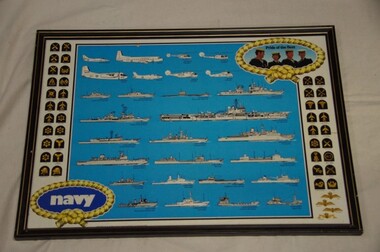
Recognition Chart
RAN Fleet chartposter, 1970, ran -
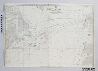 Flagstaff Hill Maritime Museum and Village
Document - Navigation Chart, North Atlantic : Route Chart showing Lane Routes North of Ireland
British Admiralty Navigation Chart - North Atlantic : Route Chart showing Lane Routes North of Irelandwarrnambool, shipwrecked-coast, flagstaff-hill, flagstaff-hill-maritime-museum, maritime-museum, shipwreck-coast, flagstaff-hill-maritime-village, shipwrecked-artefact, navigation chart, british admiralty navigation chart, british admiralty, north atlantic, route chart -
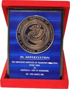 Seaworks Maritime Museum
Port of Melbourne Appreciation Plaque, Moses Sport, c. March 1991
The plaque is dedicated in appreciation to the Port of Melbourne from the Chartered Institute of Transport (Malaysia). The plaque is made of dark blue metal sheeting, engraved with white writing. At the top centre of the plaque is the large gold-plated seal of the Charted Institute of Transport, Malaysia which is dominated by a Pegasus. The plaque is backed by a wooden board painted back, which is hinged onto a red felt case. The hinging allows the plaque to stand up when the case is opened.THE CHARTERED INSTITUTE OF TRANSPORT MALAYSIA SECTION/ IN APPRECIATION/ THE CHARTED INSTITUTE OF TRANSPORT (MALAYSIA)/ STUDY TOUR/ TO/ AUSTRALIA - PORT OF MELBOURNE/ 1ST - 6TH MARCH 1991 -
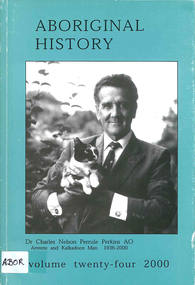 Victorian Aboriginal Corporation for Languages
Periodical, Australian National University Department of Pacific and Southeast Asian History, Aboriginal history, 2000
maps, charts, b&w photographs -
Victorian Aboriginal Corporation for Languages
Book, Pat Dodson et al, Recognising Aboriginal and Torres Strait Islander Peoples in the Constitution : report of the expert panel, 2012
Current multiparty support has created a historic opportunity to recognise Aboriginal and Torres Strait Islander peoples as the first peoples of Australia, to affirm their full and equal citizenship, and to remove the last vestiges of racial discrimination from the Constitution. The Expert Panel was tasked to report to the Government on possible options for constitutional change to give effect to Indigenous constitutional recognition, including advice as to the level of support from Indigenous people and the broader community for these options. This executive summary sets out the Panel's conclusions and recommendations" [taken from executive summary]. Report contains draft Bill for an Act to alter the Constitution to recognise Aboriginal and Torres Strait Islander peoples and their cultures, languages and heritage, to replace racially discriminatory provisions and to include a prohibition of racial discrimination. Letter to the Prime Minister Foreword from the co-chairs Executive summary Introduction: Expert panel and its methodology 1. Historical background 2. Comparative and international recognition 3. The national conversation: themes from the consultation program 4. Forms of recognition 5. The 'race' provisions 6. Racial non-discrimination 7. Governance and political participation 8. Agreement-making 9. The question of sovereignty 10. Approaches to the referendum 11. Draft bill Appendixes Bibliography.maps, tables, colour photographs, chartsconstitutional history, legislation, australian constitution, constitutional law, closing the gap, 1967 referendum, white australia policy, sovereignty -
Victorian Aboriginal Corporation for Languages
Book, Peter Cabena et al, The lands manual : a finding guide to Victorian lands records 1836-1983, 1992
charts, extracts from original documentsvictorian history, archives, local history, crown lands, public lands, land tenure -
Hand Tool Preservation Association of Australia Inc
Chasers
This item is part of the Thomas Caine Tool Collection, owned by The National Trust of Australia (Victoria) and curated by the Hand Tools Preservation Association of Australia.Chasers for thread selection chart